Snow Observations List
200 cm snow depth. Soft on top moving to firm, cohesive layers through the pack. Some weak snow near ground.
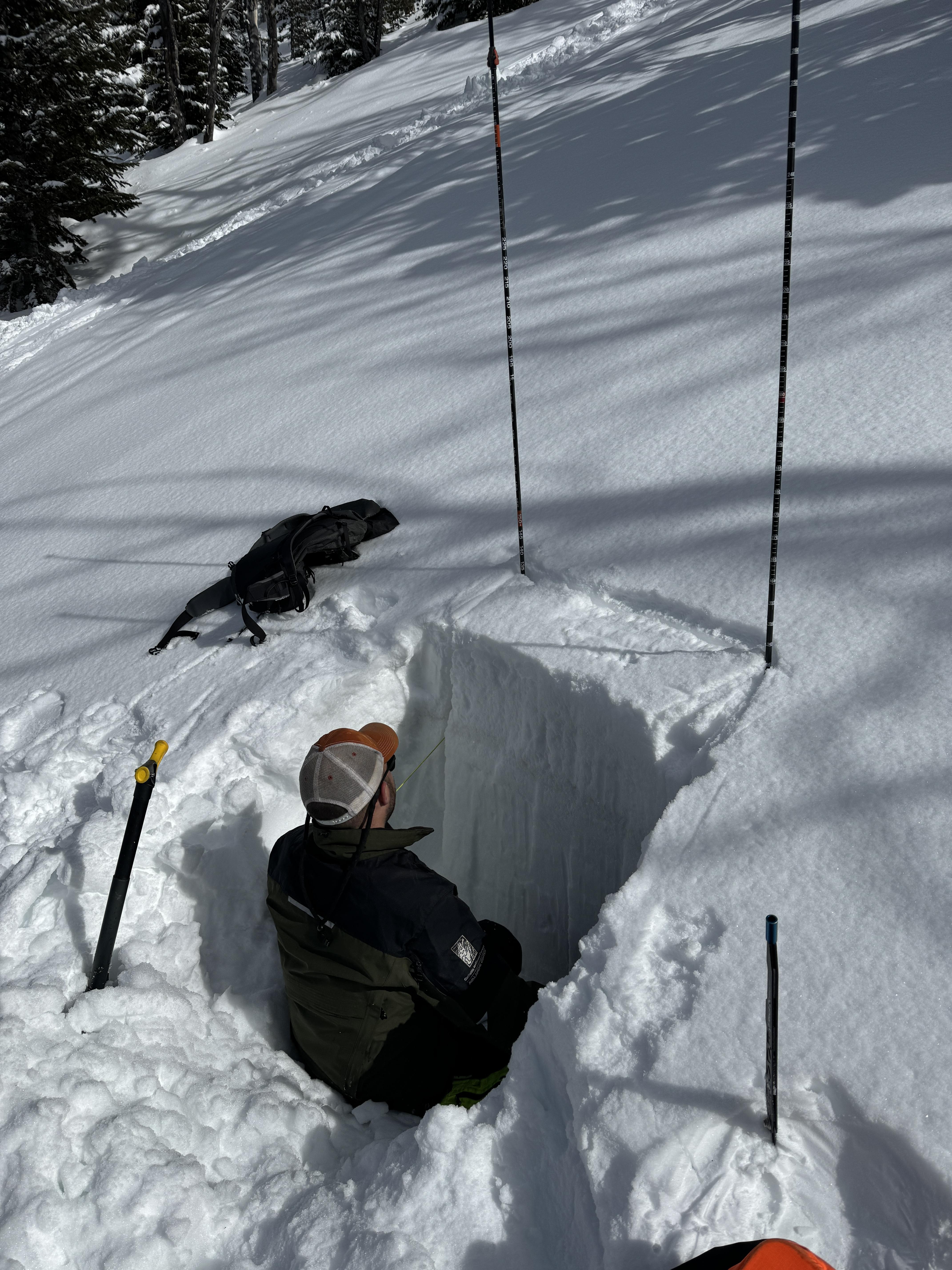
Full Snow Observation ReportOur group conducted an East facing snow pit on the top of the East Beehive Ridge at around 9100’, at 1 pm. Sky was OVC, wind from W at 5 mph. Snow pit was on a 15° slope. The total snow depth was 135 cm. Our results were an ECTN 22 at 35 cm down, a PST 34/100 End and 85 cm down, and a DT 21 PC at 100 cm down. No observed wind slabs on ridge south of Prayer Flag Trees. No signs of wet loose such as rollerballs at 4 pm.
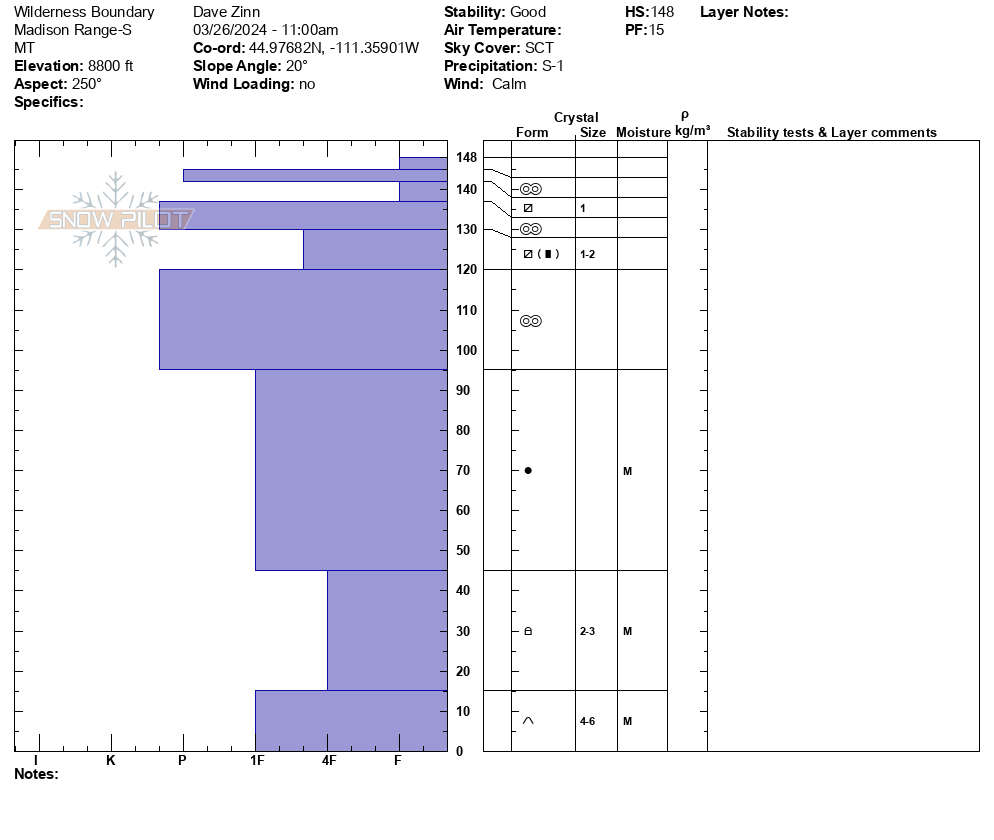
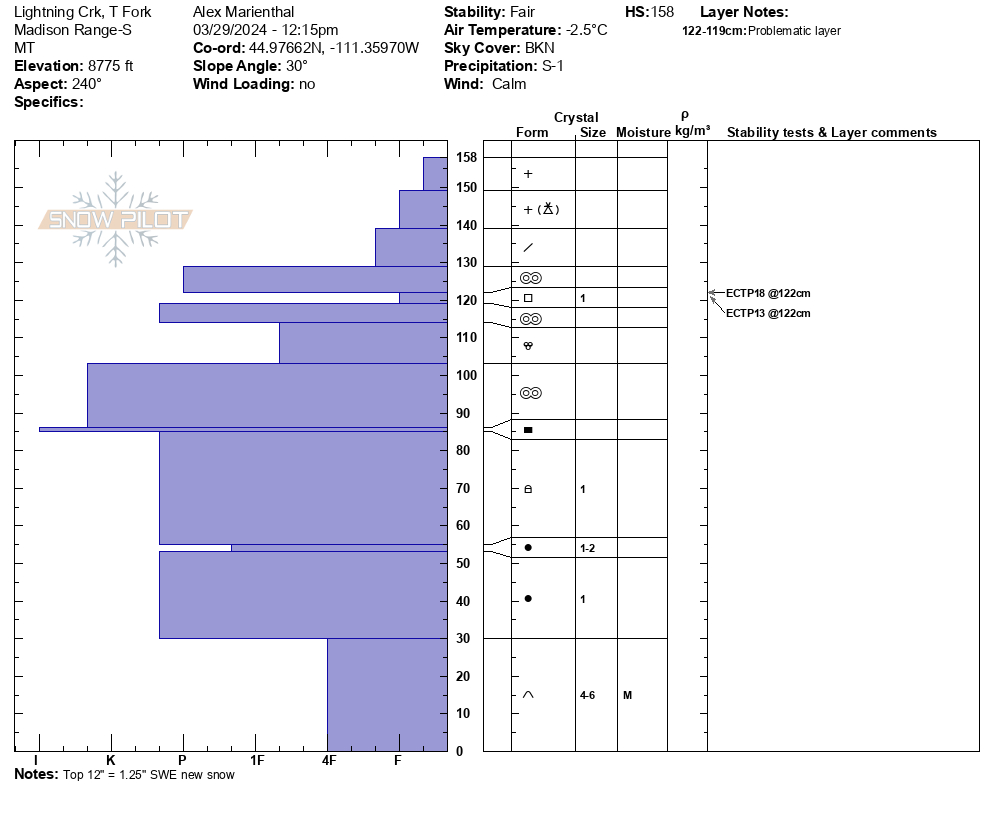
Full Snow Observation ReportWe rode into Taylor Fork, to the ridge at sunlight basin, through Carrot basin to the wilderness boundary, and back along the ridge to Beaver slide. There was 12" of new snow equal to 1.25" SWE.
Wind was calm, and skies were partly sunny with clouds obscuring Sage Peak, Skyline and areas to the south. The recent snow had not been affected by wind anywhere. The ridge near the weather station that is normally scoured still had 8"+ of light new snow on it. Sunny slopes got moist in the afternoon.
The only new avalanche I saw was one slope with small debris from a loose snow slide/ or new snow/wind slab on Kirkwood Ridge.
We dug a pit near the wilderness boundary where Ian and Dave dug earlier in the week. We had ECTP13 and ECTP18 on the recently buried layer of small facets below a 2" crust under the 12" of new snow.
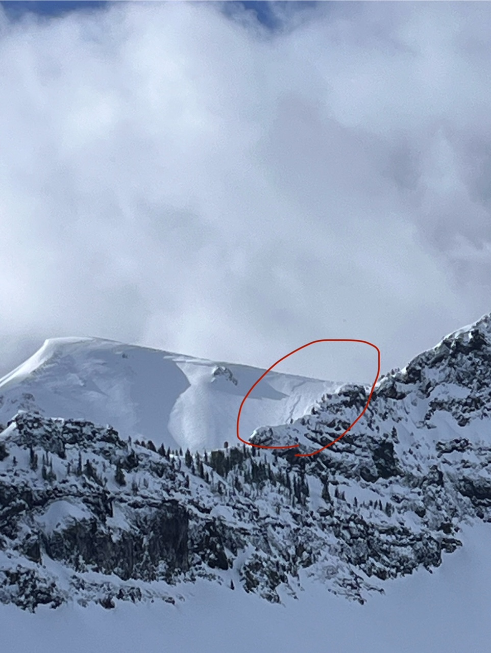
Full Snow Observation ReportI mentioned to Ian on the phone I saw a deeper PWL avalanche near Woodward peak, but after looking at my photos I think it was actually a rock band... Not totally sure one way or the other, but I'm leaning towards not an avalanche.
My movie wont save in the new software I use for the vertical format, so that probably won't get published, but maybe in the morning.

Skied Hyalite and Divide peak today. Snow conditions were extremely variable, ranging from undisturbed powder, to wind slabs and sun crusts. No bullseye signs of instability outside of the new snow (i.e. on the deep slab layer).
In the recent snow there was some localized cracking in dispersed windslabs, rollerballs coming off steep solar aspects, and two old windslab releases in the summer trail bowl off Hyalite. These slides probably released either before or during the most recent wind/storm event, as the start zones were both partially refilled. The larger of the two was noticeably older than the other, with the start zone and debris deeply covered. Both were R1/D1, naturally triggers, with crowns no deeper than half a meter directly under the cornice. No cornice fall seemed evident near either crown.
New snow that was sheltered from the wind and sun showed no signs of instability, and the weather consisted of light winds with periods of interspersed graupel and sun. Weather and obvious wind affects looked similar across the range.
Full Snow Observation Report
ECTP 11 30cm down on melt freeze layer.
PST 28/100 End
location: meadow below the ramp above Bradley’s meadow.
Full Snow Observation Report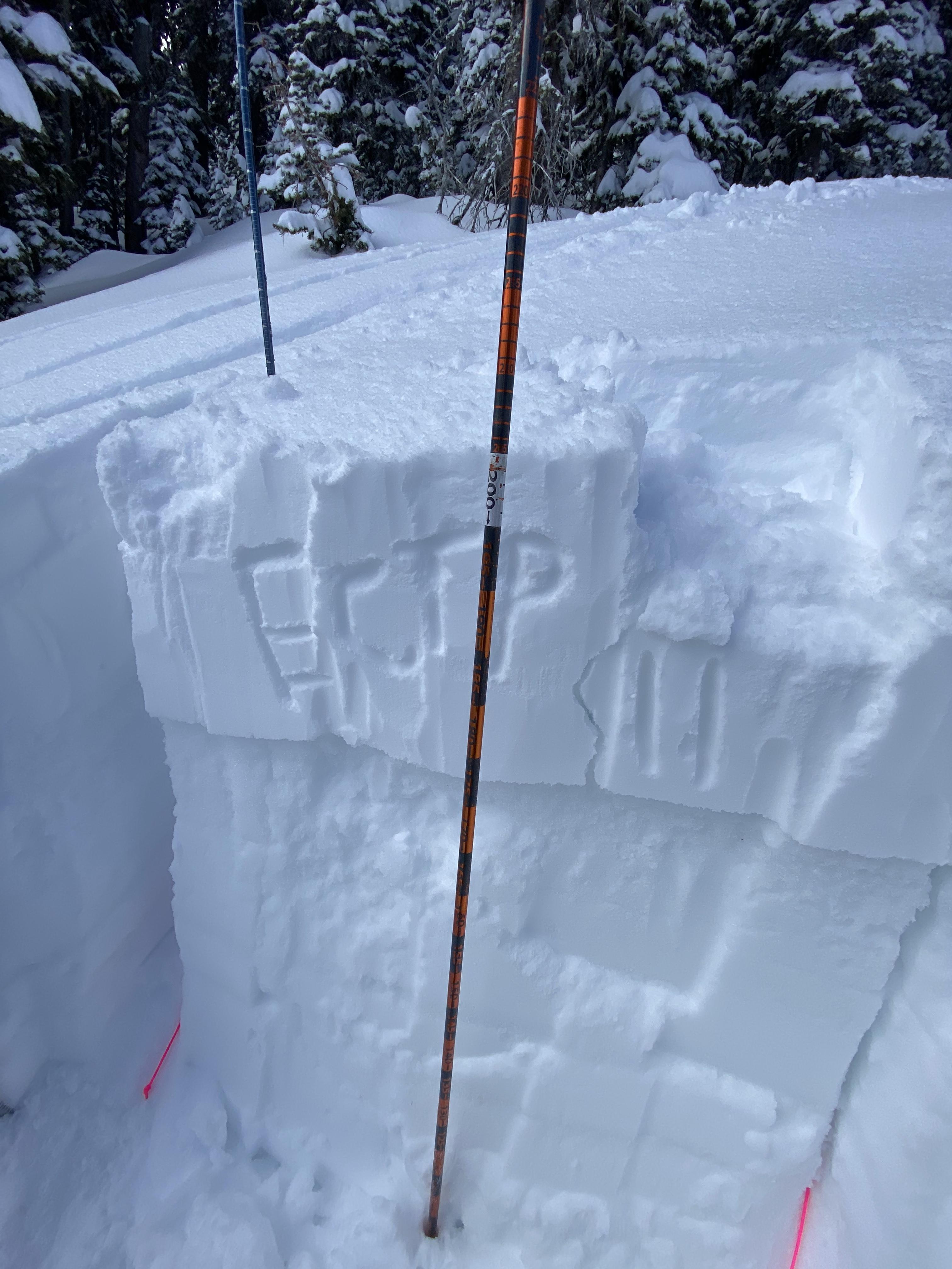
Dug a pit near the top of bacon rind on an east facing slope. ECT-P 14 on the new snow slab breaking 12” deep
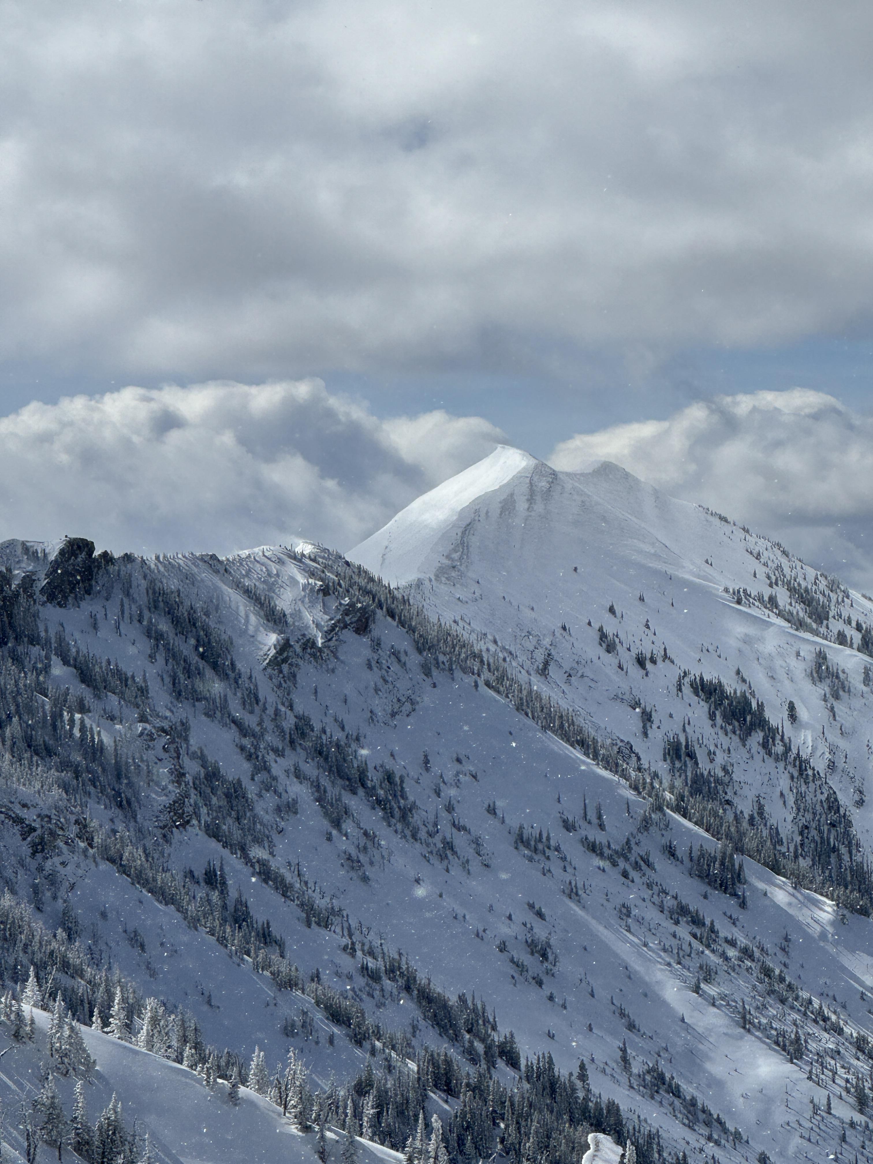
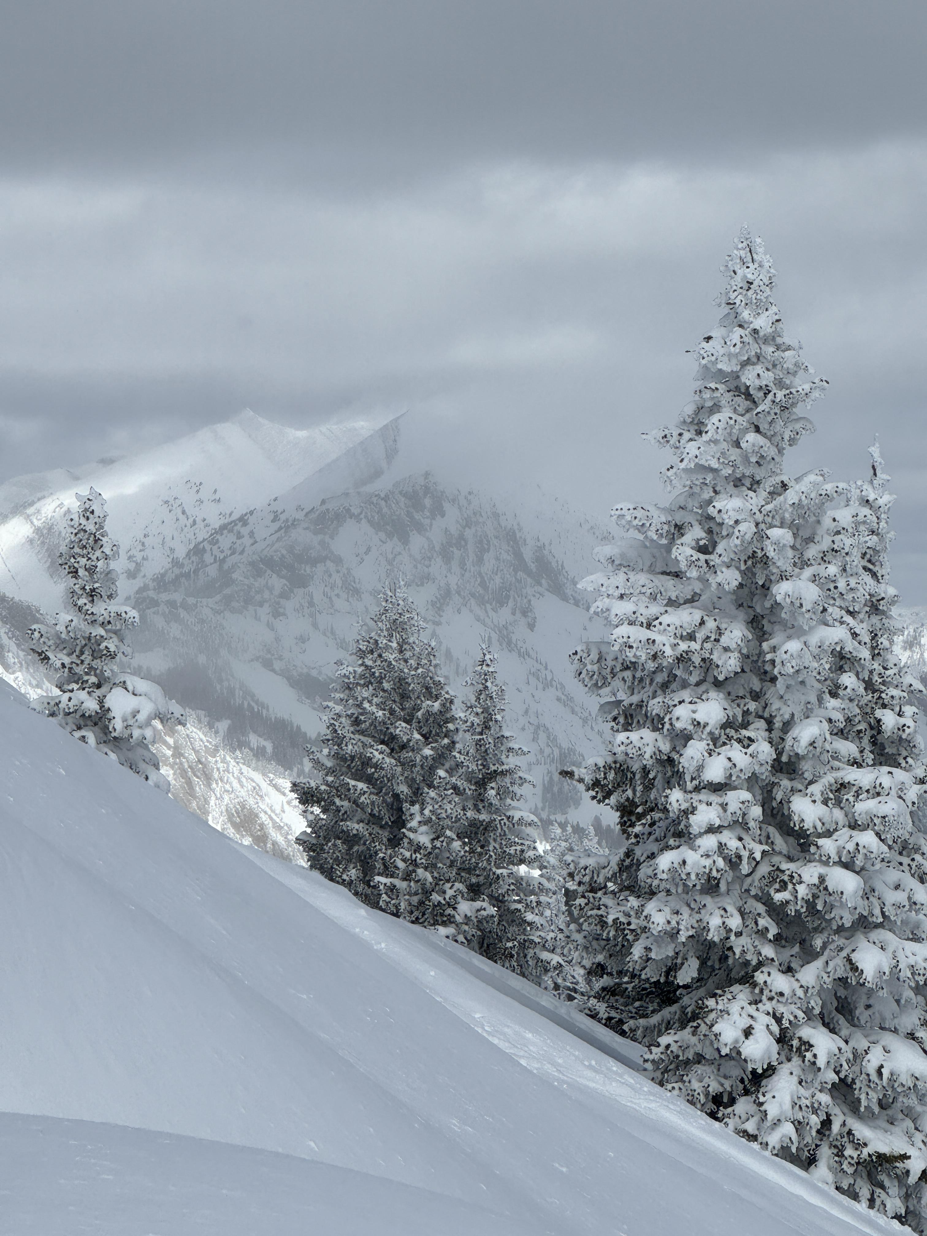
Full Snow Observation ReportSkied Divide Peak this morning. Snowfall totals in the main fork were around 3", while the Shower falls area experienced 6-8". Inconsistent snow depths within divide cirque highlight heavy snow transport yesterday and overnight. Varying levels of sun crust below the most recent snow were widespread.
One hand shear on a solar ESE aspect demonstrated cohesiveness, which seemed to be due to moist snow, on a thick crust. Sheer quality created a pretty smooth bed surface.
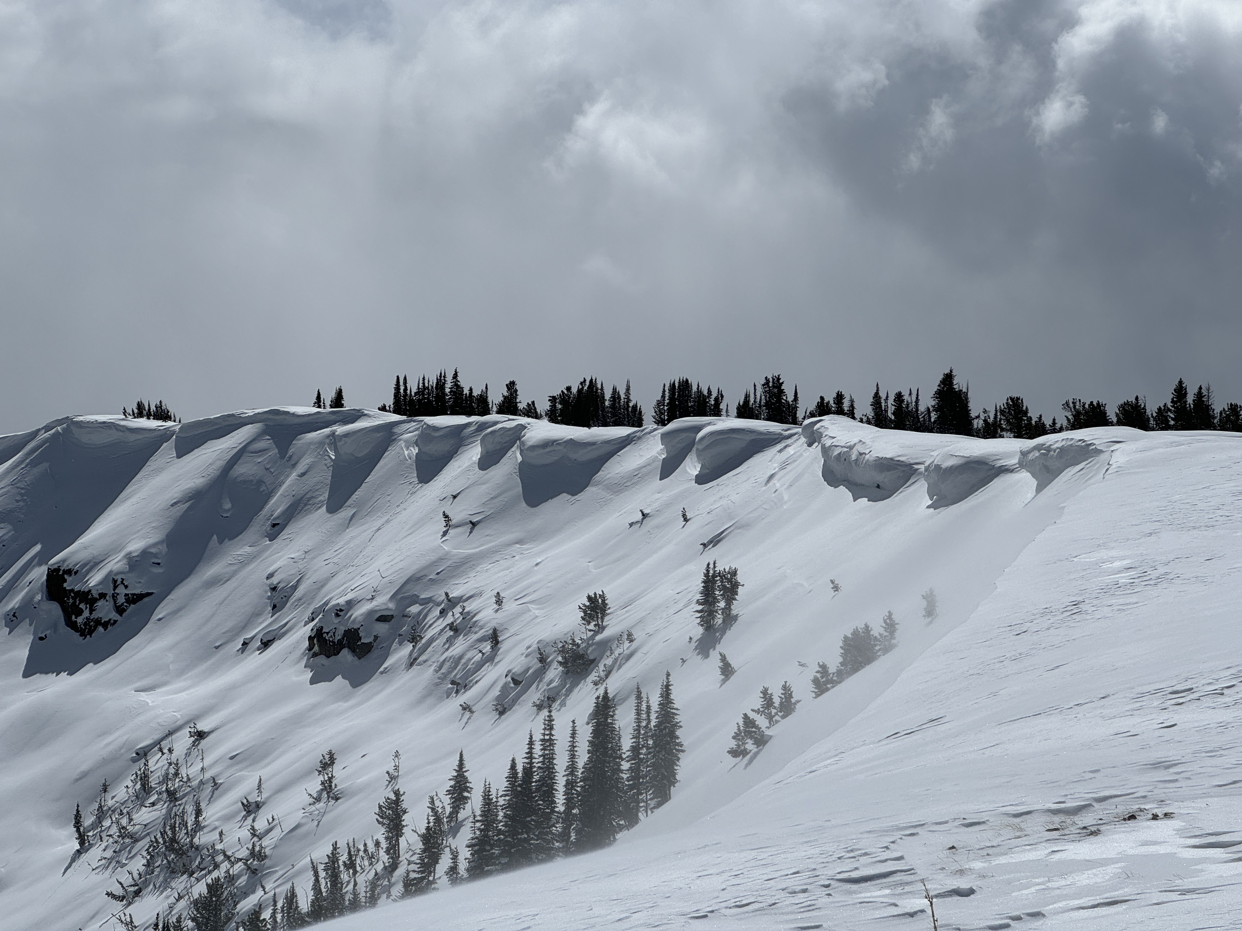
Today's tour provided many views of undulating wind effect- cornices on west-east ridges formed on south and north sides. Plenty of large cornices were present and could be quite destructive.
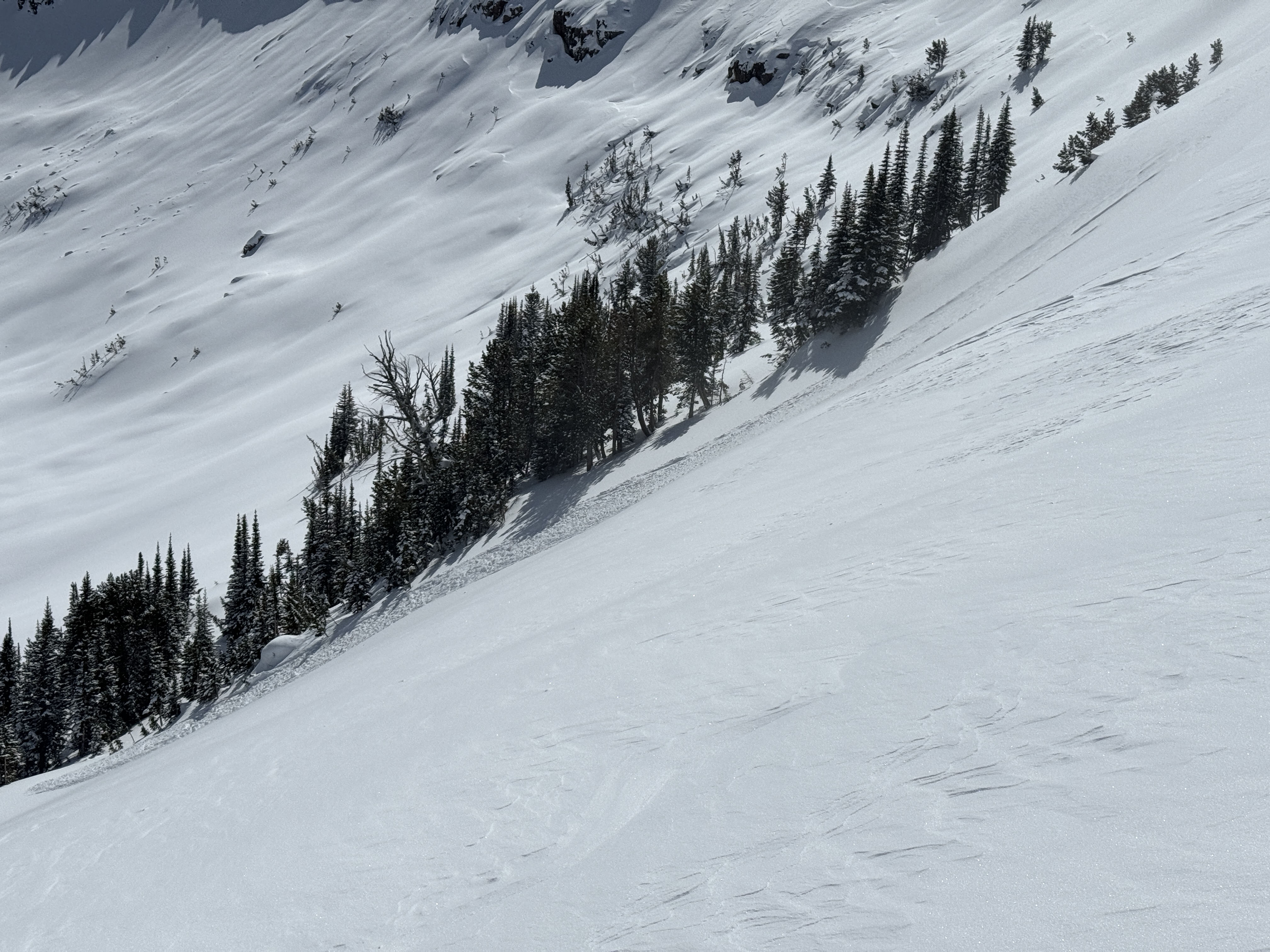
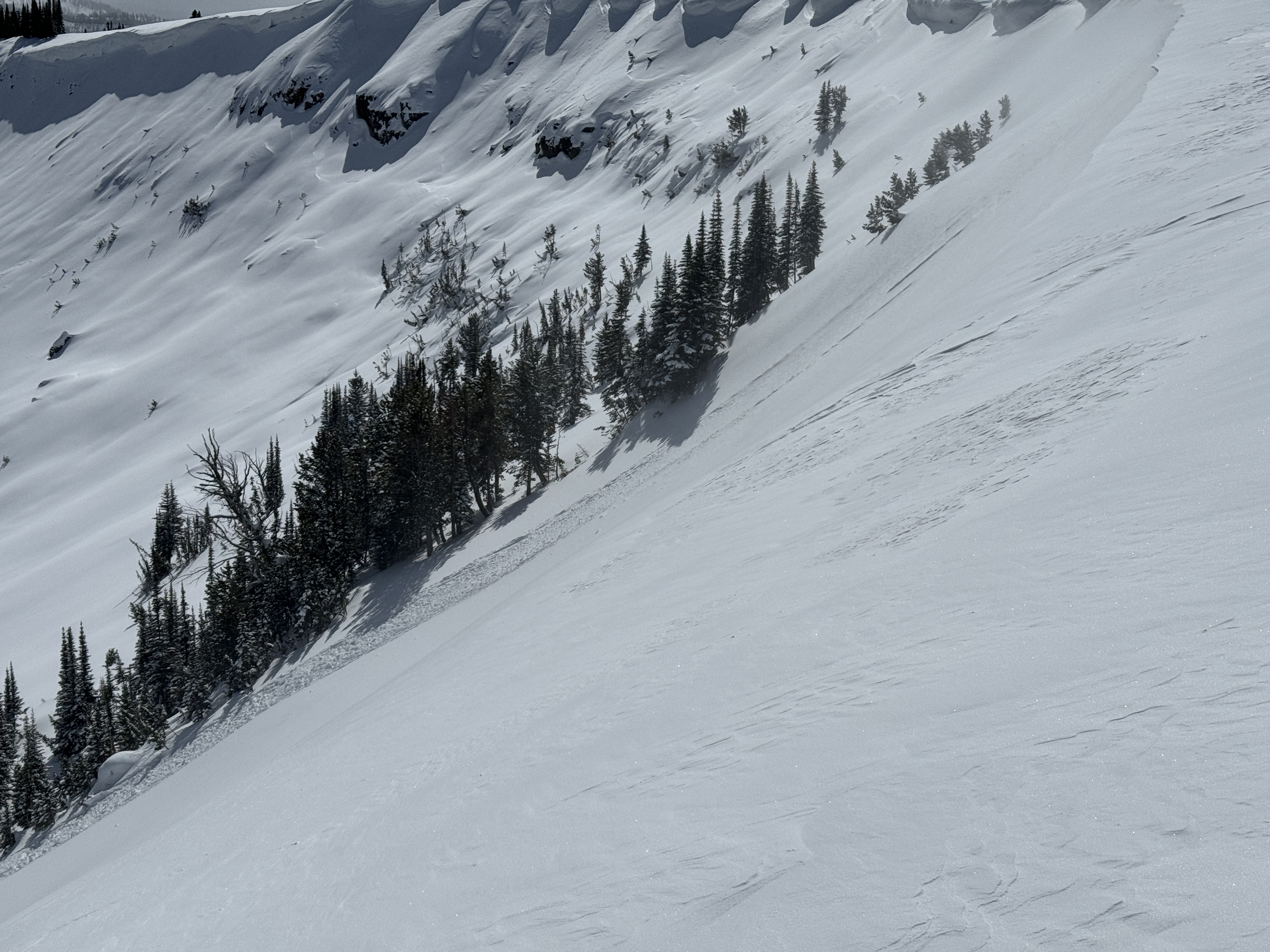
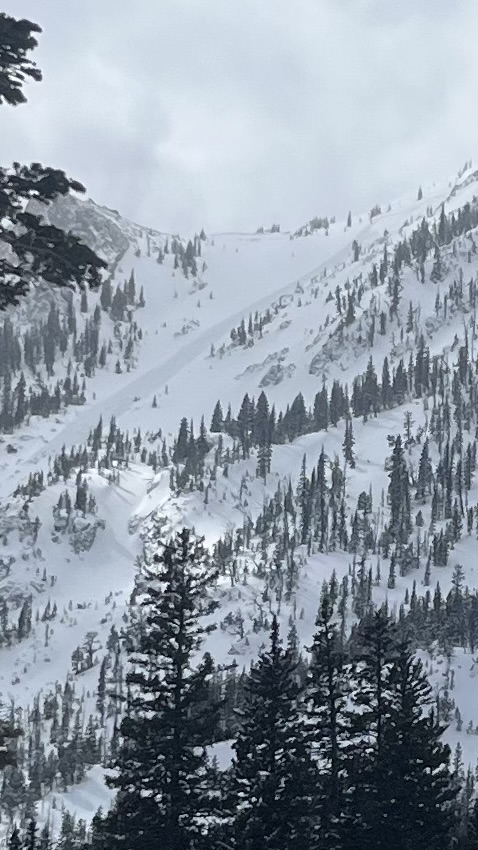
Spotted two fresh natural slides, one within Divide cirque on a NE aspect @ ~9,800 (D1, R1), and another on the N face of Hyalite @ ~10,200ft. that was mostly out of view, but could be estimated around similar size and destructiveness. These seem to have occurred within the last 24 hours, or after snowfall, likely windslabs on lee slopes.
We skied east of the central divide gully, avoiding wind issues to the west and solar issues to the east.
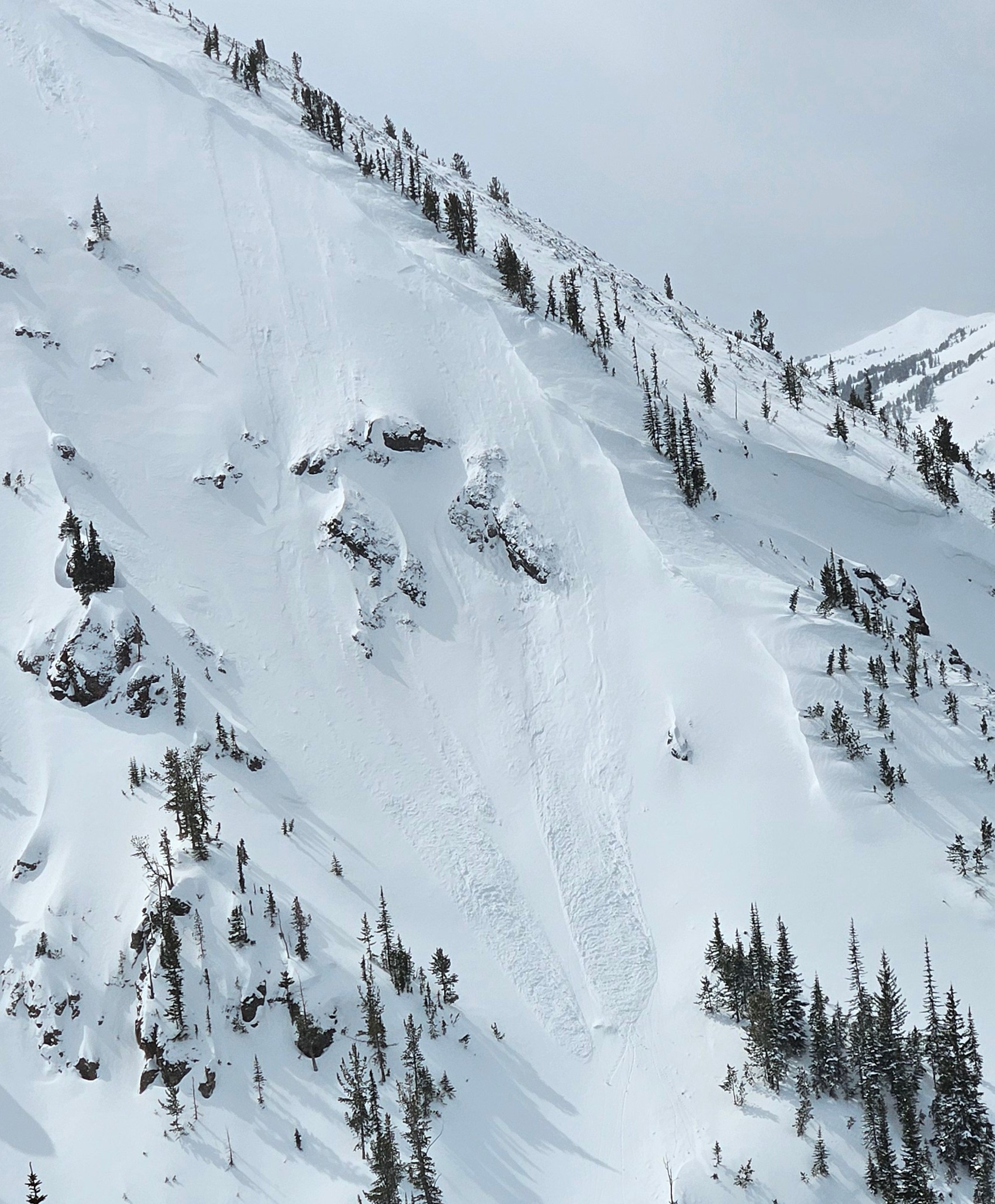
Full Snow Observation Report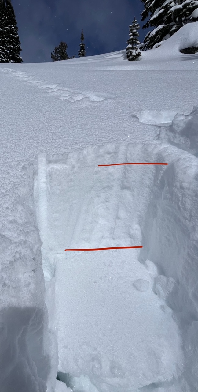
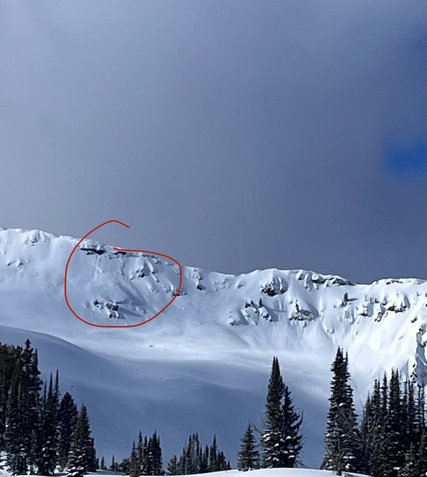
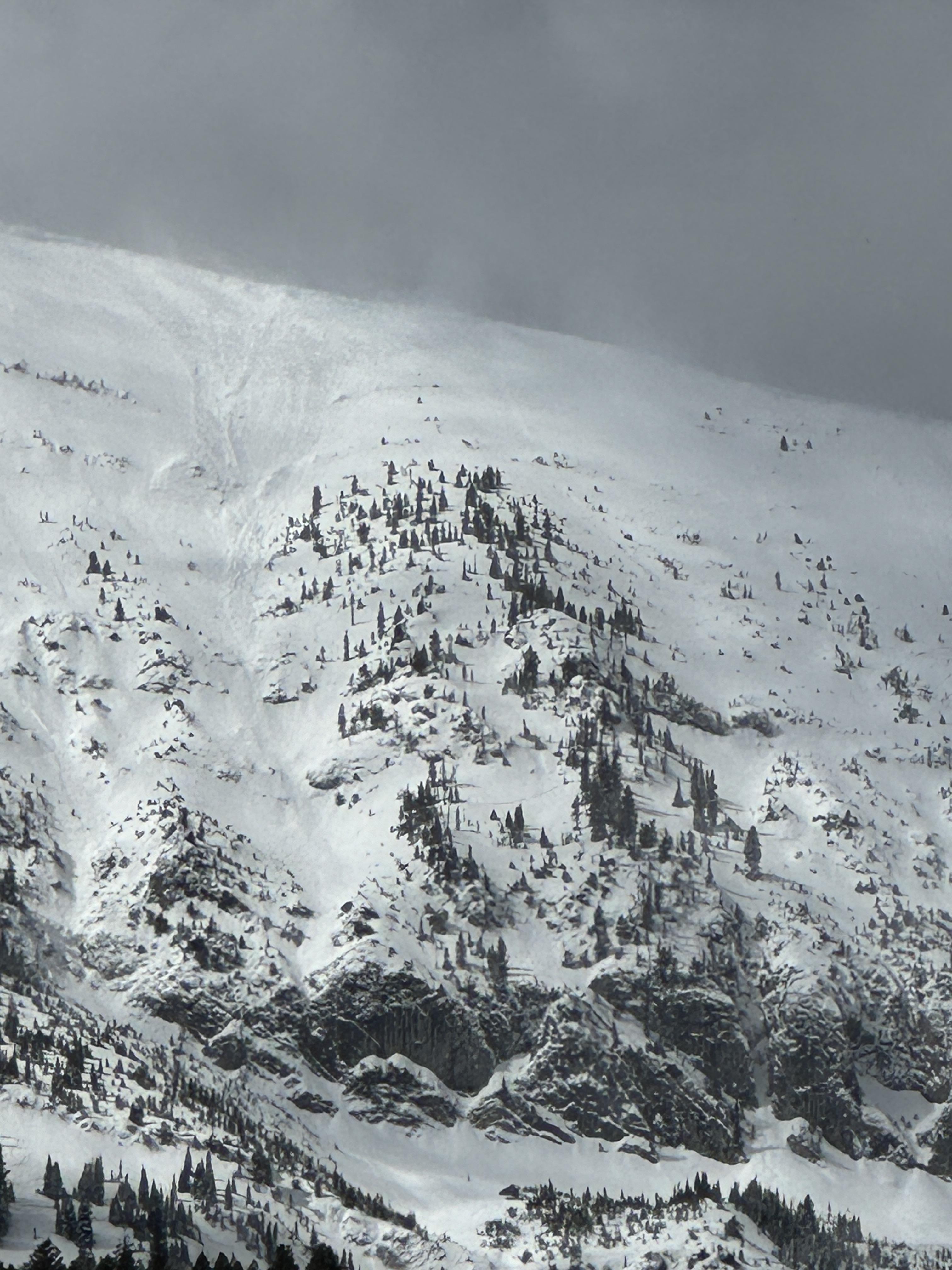
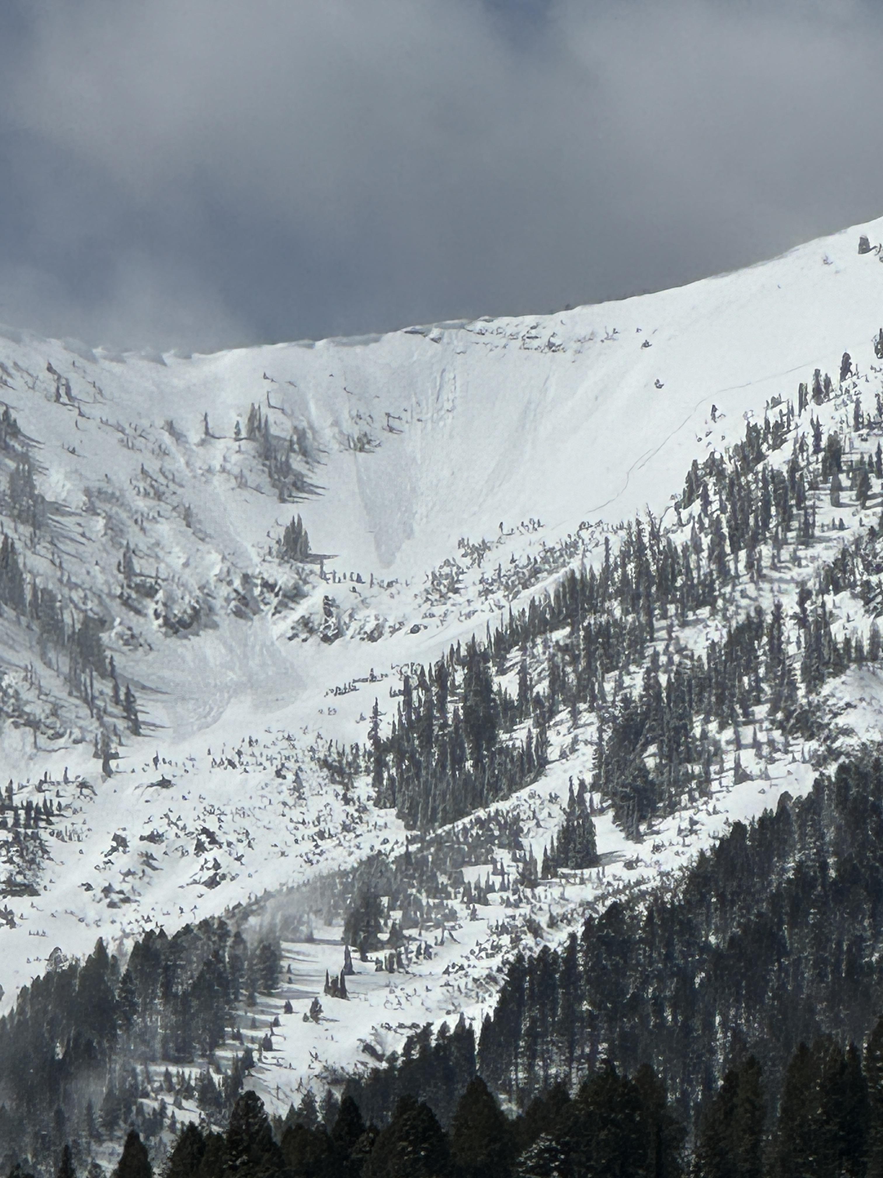
Spotted this big guy on the east face of Blackmore today. Seemingly natural and I believe it occurred in the last 36 hours or so. Debris had last nights snow on it. I’d estimate it at D2.
Full Snow Observation Report
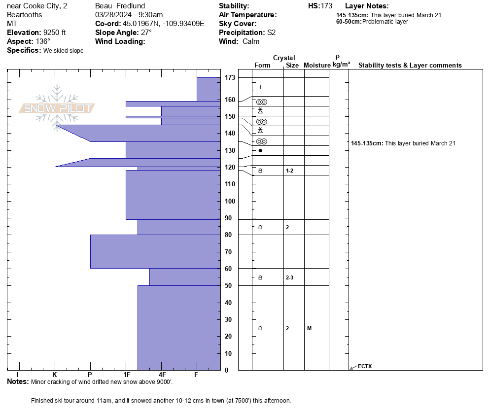
From email: "Snowpit from this morning: SE aspect, 9250'.
It snowed all day in Cooke (S2), mild temps, light westerly winds."
Full Snow Observation Report
Today, we skied near the wilderness boundary north of Round Lake. On a wind-loaded test slope at the top of our second ski run, we were able to get recent drifts to crack, but not avalanche. Slightly further down on a steep roll the second skier in our group triggered a small wind slab avalanche. This avalanche was 15-20' wide, 8" deep, and ran for about 30-40 vertical feet. The skier easily skied away from the slide and was not caught.
Winds remained mostly calm but increased by the end of the day. Snowfall through the day was enough to partially cover our morning tracks and we found 2" of snow on our snowmobiles at the end of the day.
Full Snow Observation Report

skiing north of cooke city today observed this Small windslab on a South facing slope ~9800 ft.
Full Snow Observation Report
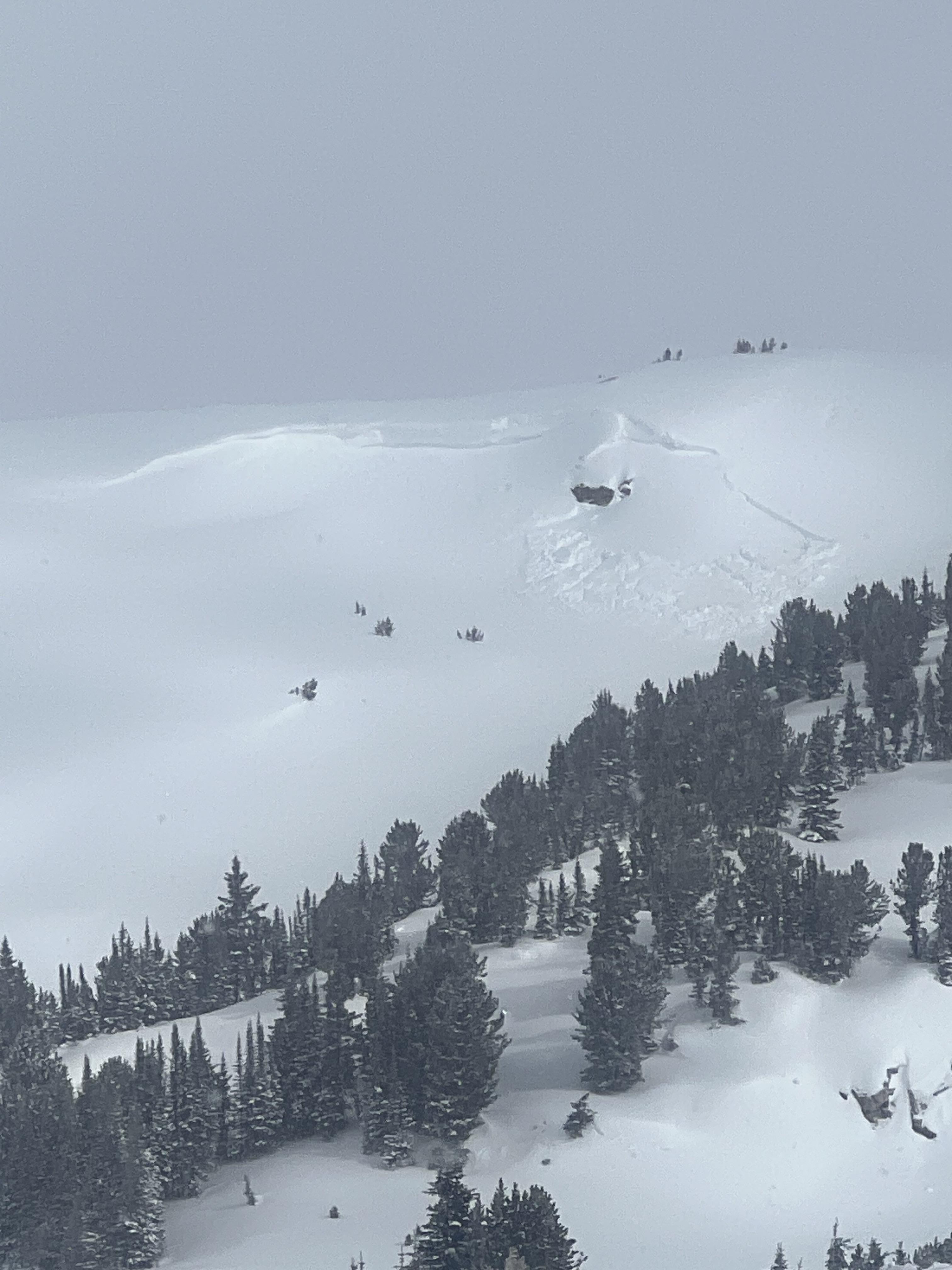
Today, we rode north of Cooke City through Abundance Basin around Scotch Bonnet ending at the East Henderson bench. We found anywhere from 4-12" of new snow that fell in the last 24-48 hours. Strong winds have transported this new snow into thick drifts even in more sheltered terrain. We did not see any recent notable avalanches but saw many crowns and debris piles from two weeks ago.
On the East Henderson bench, we dug a snowpit and found 235cm (almost 8') of snow. We found moist faceted snow 6' below the surface near the bottom of the snowpack. At the top of our snowpit was 12" of new snow above a stiff crust. Our stability test showed ECTN15 results on this interface.
Snow continued off and on through the day with little to no accumulation. Many slopes had signs of either wind-loading or had been scoured by recent wind resulting in thinner areas.
Full Snow Observation Report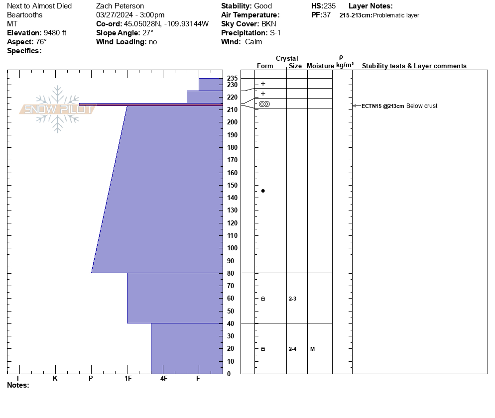

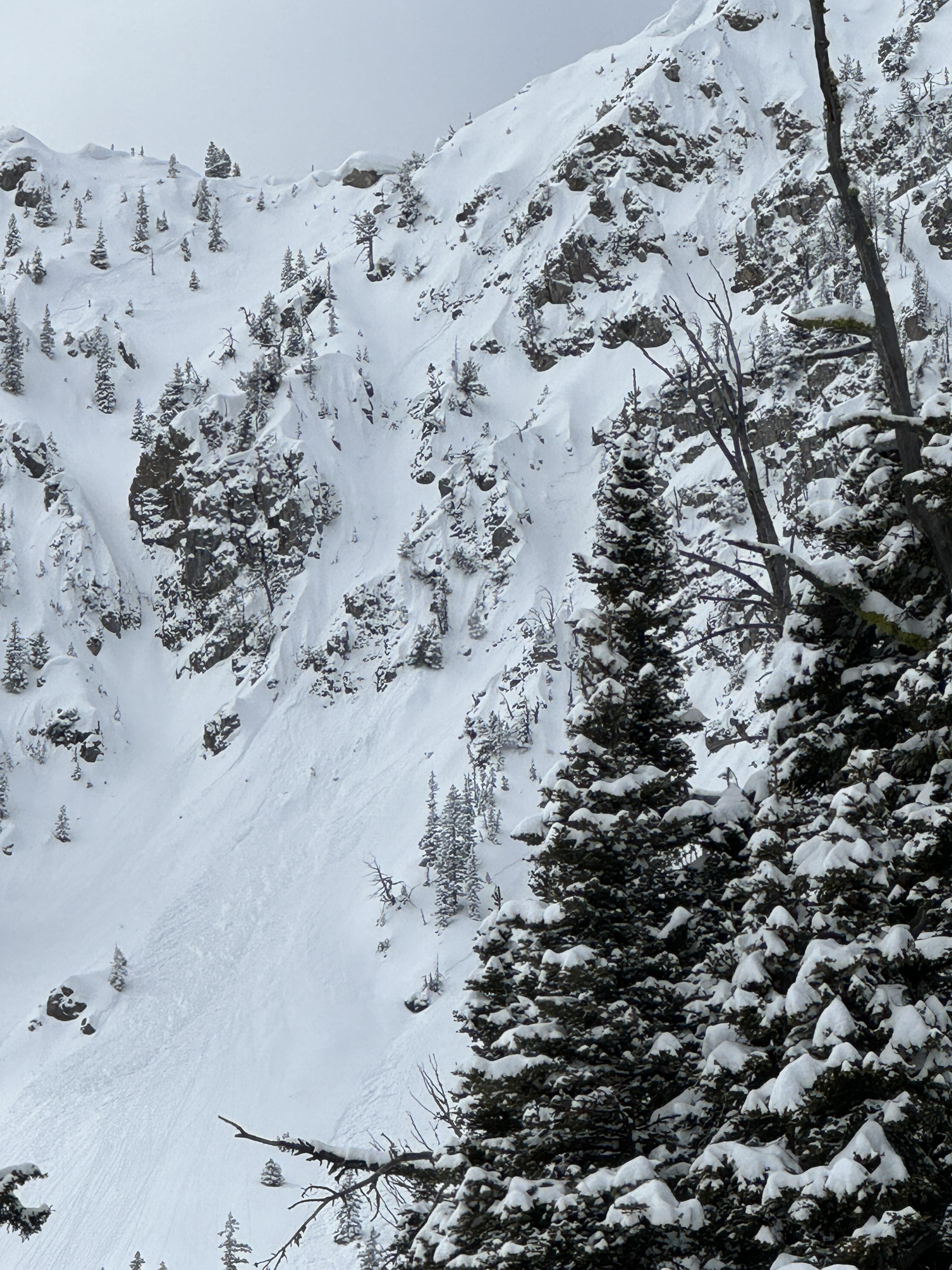
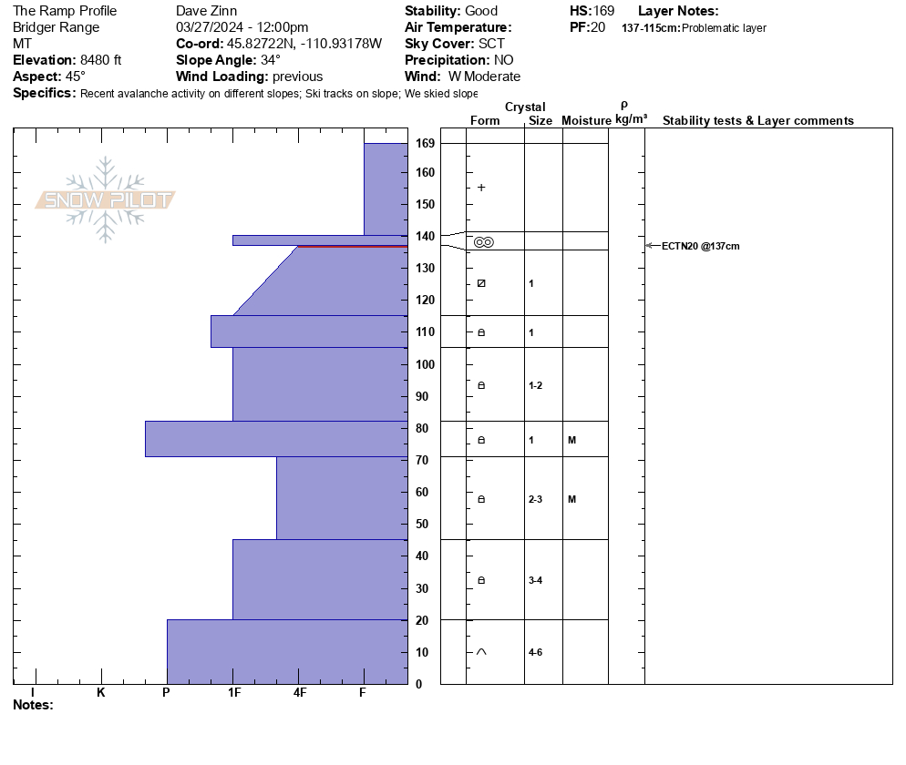
We toured up the Ramp. There was 6" of heavy new snow. The wind was transporting significant amounts of the recent snow at high elevations. The wind-loads weren't occurring on the ramp and lower elevation ridge terrain in a significant way. On our drive home we saw, what I assume were, natural wind-slab avalanches on Quarter Saddle (looked like a cornice collapse) and in Argentina Bowl. Bridger Peak was obscured by heavy wind-loading. There was a small wind-slab release out of Gibbs (I think), I suspect skier triggered, but I could make out a track.
On the Ramp, we observed several isolated drifts that would crack under the weight of skis. The snow was staying fairly cool and dry, but on a rollover, I pushed a small wet loose pocket downhill. Watch out when the sun and temps blast the recent snow! It is sitting on a firm crust and I expect things to get active.
We dug a pit to the south of the Ramp proper. The basal weak layers were the least weak I have seen all year. The snowpack was most from 80 cm to the ground and the facets and depth hoar are rounding. We are not out the woods, but things are improving. ECTN 20 on near-surface facets 30 cm from the top.
Full Snow Observation ReportGreat call on the CONSIDERABLE on wind-load. MODERATE elsewhere was correct.

From IG: Very touchy on Hollywood wall this morning. All slopes easily propagated 4-6” deep on a firm bed surface. Most were less than 50’ wide with the exception of the slide in the couloir which propagated down the entire couloir, maybe 500’ wide, and ran through the exits into the main bowl.
Full Snow Observation Report
Today there were strong winds loading snow onto the Northeast face off of Pine Martin Ridge, just North of Ram Pasture. When we got a better view of the slope, we noticed there had been a natural wind-slab avalanche (left), possibly triggered by a cornice fall. While transitioning, we saw a small part of the same cornice break off and trigger a similar wind slab avalanche (right).
Full Snow Observation Report
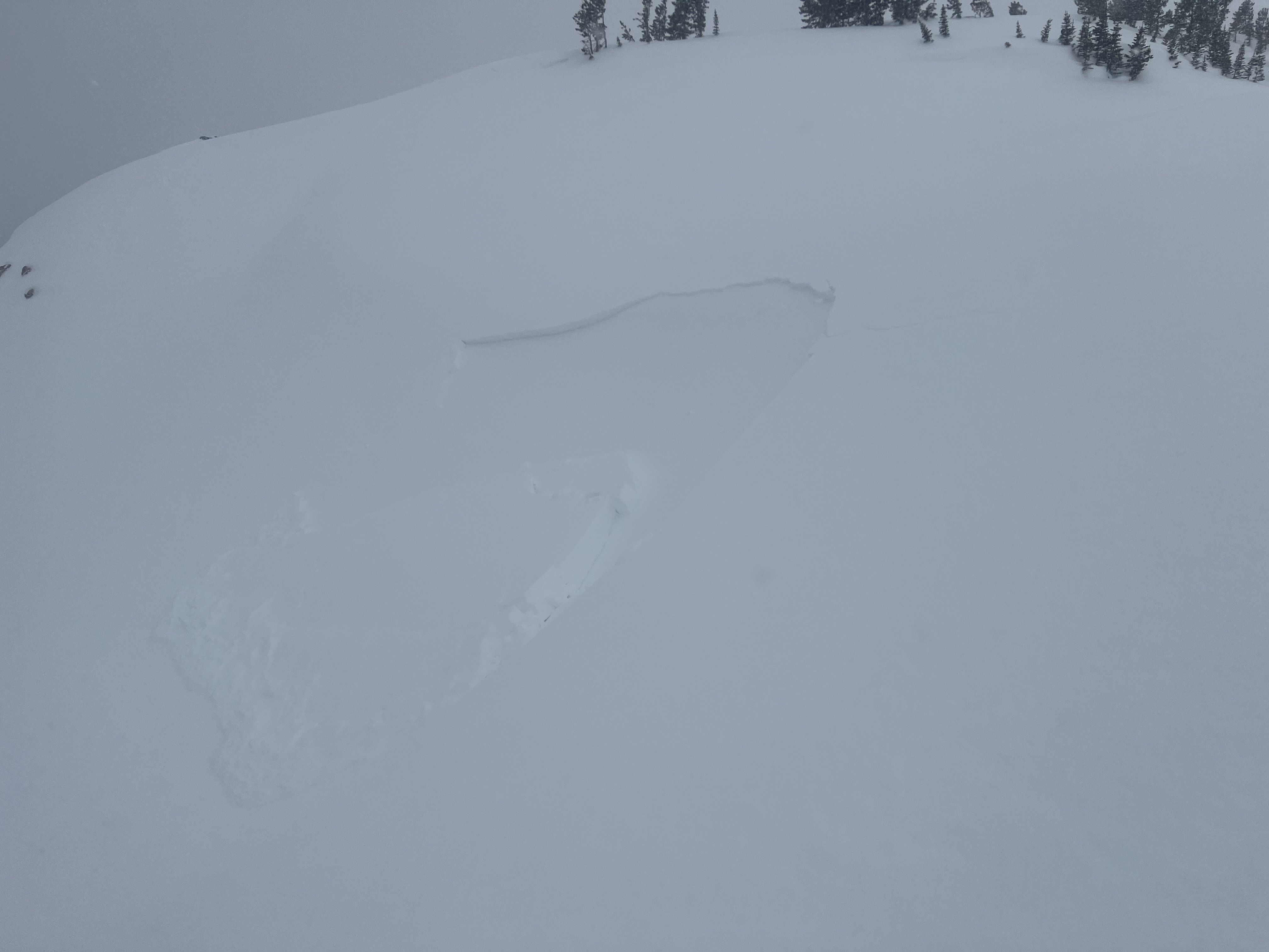
Triggered this small windslab while skinning near a steeprollover at the top of an East facing slope above Zimmer Creek. Crown was ~20 ft wide and ran a similar distance. 2"-10" at the deepest.
Full Snow Observation Report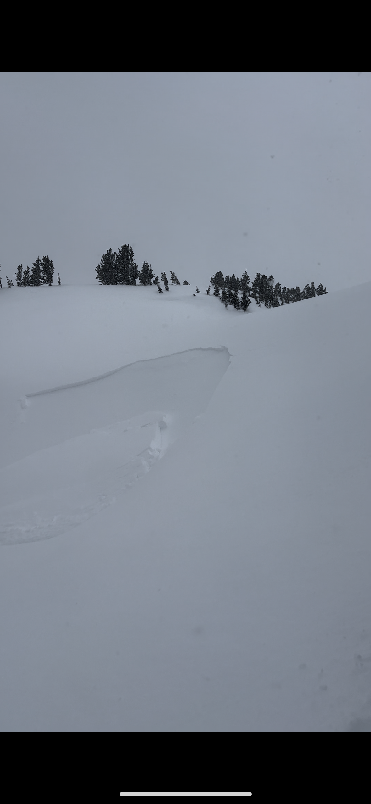
Saw small avalanches on almost every wind loaded slope out of fairy lake. The one we spotted in the pomp twins had a defined crown roughly 100ft across.
Full Snow Observation Report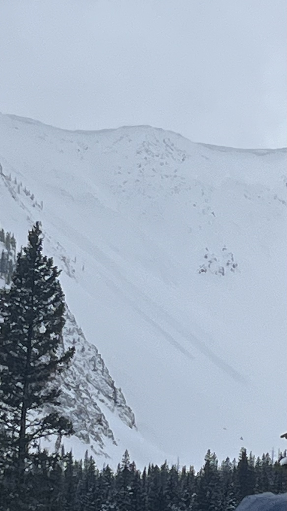
We toured over south Bacon Rind and into Ernie Miller Ridge today. The weather was variable, alternating between periods of calm winds and warm sun, and periods of heavy cloud cover, snow, and high winds. At the summit winds were strong out of the SW, but previous wind deposits further down pointed towards recent Northerly winds. These were strong enough to scour snow off the crust, and create drifts up to a foot deep. The sun was also affecting the snow surface, rapidly warming and wetting the snow above the crust. This wet snow was not bonding well to the crust. Some cold snow remained and made for good skiing.
We took the variability of the snowpack and the risks of a consequential slide into account and traveled through moderate terrain, avoiding excessive exposure.
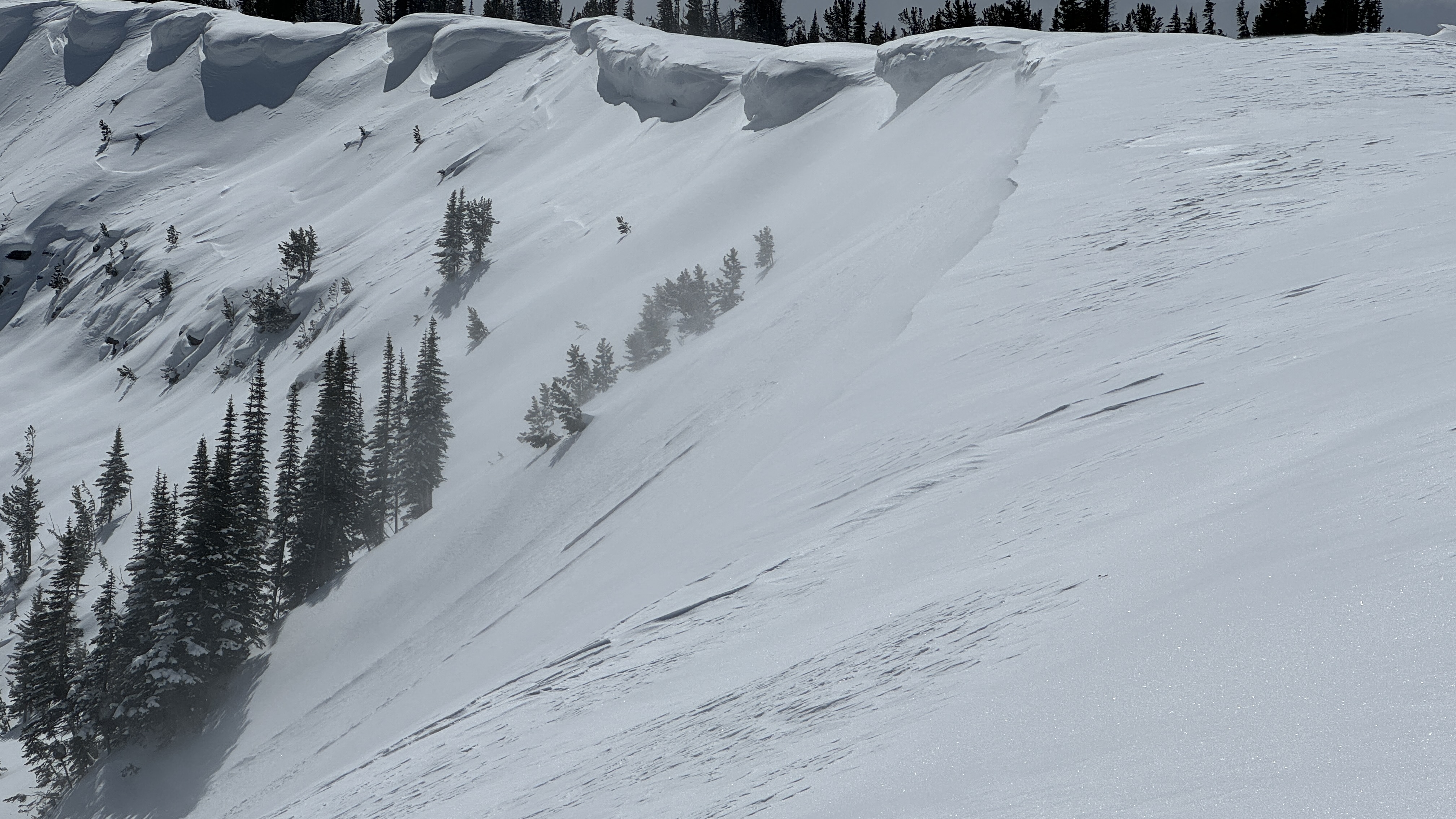
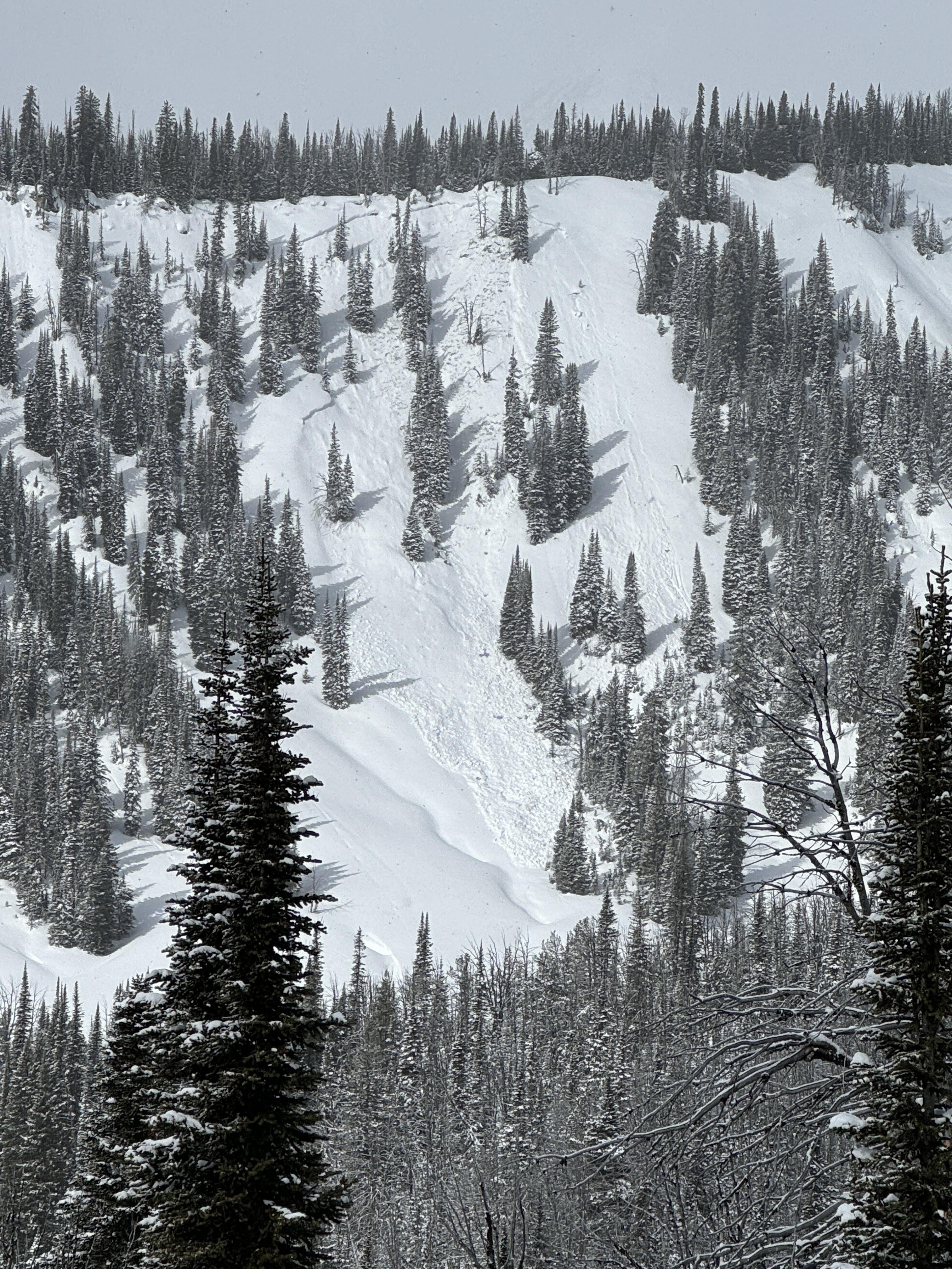
Full Snow Observation ReportWe rode into the weather station, across to the Wilderness Boundary, along the ridgeline to the Beaver Slide, and back. We saw one new wind-slab avalanche in Sunlight Basin. It was small. From a distance, it appeared to be about 6" deep and 30' across (R1-D1). The other notable avalanche activity was a full-depth wet slab avalanche that broke last week during the warm-up on Lightning Ridge.
We dug a 150 cm deep pit at the Wilderness Boundary. The basal facets and depth hoar were moist. The upper-level melt-freeze crusts were so thick and hard that even with a saw assist, we could not isolate the column to the ground. There were two newish near-surface facet layers in the upper 10" of the snowpack. No hazard now, but they will be something to watch when loaded.
Full Snow Observation ReportThe danger was good at MODERATE.