Good morning. This is Dave Zinn with the Gallatin National Forest Avalanche Forecast on Wednesday, February 1st at 7:00 a.m. Today’s forecast is sponsored by the Yellowstone Club Community Foundation and Montana State Parks. This forecast does not apply to operating ski areas.
In the last 24 hours, the Bridger Range received 4-7” of new snow, with 1-3” elsewhere. Mountain temperatures range from the single digits to teens F above freezing near Bozeman and Big Sky to the negative single digits F near West Yellowstone and Cooke City. Winds are 15-25 mph from the west to southwest and 5-15 mph in Cooke City. Today, high temperatures will be in the 20s F near Bozeman and Big Sky and in the positive teens F farther south. Winds will be 15-25 mph from the west to southwest, and the mountains will get a trace to 1” of snow.
Dangerous avalanche conditions exist in the mountains around Bozeman, Big Sky, West Yellowstone and Cooke City. Strong winds wreaked havoc on last week’s powder, forming thick drifts of hard, wind-blown snow on many slopes at all elevations and aspects. Weak layers in the upper three feet of the snowpack create conditions where avalanches can break widely across slopes. Avalanches failing on weak snow near the ground are unlikely but should not be ruled out. Avoid avalanche terrain and the runout zones below, as backcountry travelers can trigger avalanches from the flats above or below steep slopes. New snow exacerbates these problems, especially in the Bridger Range, where up to 7” fell in the last 24 hours.
Yesterday, Doug and Ian remotely triggered an avalanche on a small slope from 50’ away at Lionhead and heeded this clearest of warnings to avoid steep terrain (video). An explosive placed within Bridger Bowl Ski Area boundaries released an avalanche across most of the “Football Field” on Saddle Peak. The ski patrol DOES NOT mitigate avalanches outside ski area boundaries (i.e. Saddle Peak), conditions were such that inbounds mitigation also released an avalanche in the backcountry. This is the second large avalanche on Saddle Peak within a week; the first broke over 1000’ wide during last week’s storm (details). Skiers in the Flanders Drainage of Hyalite saw large natural avalanches that broke recently across ridgelines and through trees (details and photos). The Big Sky Ski Patrol triggered numerous hard-slab avalanches during their avalanche routes. Similar hard slabs of wind-drifted snow exist throughout the backcountry with the addition of unmitigated weak layers.
The avalanche conditions in Cooke City are the same, minus the ongoing strong winds. Yesterday, skiers northwest of Cooke City noted clear signs of instability when they triggered multiple collapses. Earlier this week, I avoided avalanche terrain in Cooke City after observing many recent avalanches and getting unstable results on buried weak layers up to 3’ deep in every test we performed (avalanche details and videos).
Watch our recent videos and read the observations page for detailed information about additional field locations. Browse the Avalanche Activity Log to note nearly thirty entries since January 25, many of which include multiple avalanches.
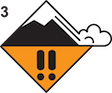
Conservative decision-making is essential today. Avoid steep terrain and the runout areas below. The danger is CONSIDERABLE.
Please share avalanche, snowpack or weather observations via our website, email (mtavalanche@gmail.com), phone (406-587-6984), or Instagram (#gnfacobs).

Dangerous avalanche conditions exist in the mountains in Island Park. Strong winds wreaked havoc on last week’s powder, forming thick drifts of hard, wind-blown snow on many slopes at all elevations and aspects. Weak layers in the upper three feet of the snowpack create conditions where avalanches can break widely across slopes. Build a wide margin for error today by avoiding steep terrain and the runout areas below avalanche paths.
KING AND QUEEN OF THE RIDGE, FEBRUARY 4TH
Do you like to hike? Do you like to ski? Then the King & Queen of the Ridge is for you. Hike, ski and raise money for the Friends of the Avalanche Center in their 2nd biggest fundraiser of the year. Join the effort to promote and support avalanche safety and awareness! Fundraising prizes for the top 5 individuals who raise over $500. No racing is necessary to compete for the fundraising prizes. Info is HERE. Race participants for the February 4th event must register separately with Bridger Bowl HERE.
Upcoming Avalanche Education and Events
Our education calendar is full of awareness lectures and field courses. Check it out: Events and Education Calendar.
February 4, 9 a.m.-3 p.m., LIVINGSTON Avalanche Fundamentals. Information and course registration are HERE.
February 5, 10 a.m.-2p.m. Companion Rescue Clinic Field Day in the Bozeman area. Required Online Classroom Session at 6 p.m. on Feb 3. Information and course registration are HERE.
February 9, FREE Avalanche Awareness at REI Bozeman. More details to come.
February 11, 10 a.m.-2p.m. Companion Rescue Clinic Field Day in the Bozeman area. Required Online Classroom Session at 6 p.m. on Feb 10. Information and course registration are HERE.
Every Saturday, 10 a.m. - 2:00 p.m. Avalanche Rescue Training, drop in for any amount of time. Round Lake Warming Hut, Cooke City. Free.
Loss in the Outdoors, is a support group for those who have been affected by grief and loss related to outdoor pursuits. Check out the link for more information.

Check out the weather and avalanche log for a rundown of recent weather and avalanche conditions.