Good morning. This is Alex Marienthal with the Gallatin National Forest Avalanche Forecast on Sunday, March 5th at 7:00 a.m. This information is sponsored by Grizzly Outfitters and World Boards. This forecast does not apply to operating ski areas.
Since yesterday morning, the mountains near West Yellowstone received 7-9” of new snow, near Big Sky and Cooke City received 2-3”, and 1” fell near Bozeman. This morning, temperatures are single digits to teens F, and wind is south-southeast at 5-10 mph with gusts of 15-20 mph. In the Bridger Range, east wind is 25 mph with gusts to 45 mph. Today, temperatures will reach high teens to low 20s F, south-southeast wind will shift to southwest at 10-25 mph, and snow showers could deliver 3-5” by this evening.
A person can trigger large avalanches that break at least 3-4 deep on buried weak layers. The mountains near Cooke City and West Yellowstone received steady snowfall for the last two weeks, and moderate to strong winds drifted recent snow into thick slabs which pushed buried weak layers to their breaking point. More snow today will keep the snowpack on edge and large avalanches are likely for a person to trigger.
Over the last week there were at least five human-triggered avalanches near Cooke City. Three of these slides resulted in partial burials (Town Hill, Round Lake, Mt. Abundance), and a skier triggered slide near Daisy Pass buried the group’s parked snowmobile (photos and details). Yesterday Doug looked at the crown of the recent slide near Daisy Pass. He found it broke on a layer of surface hoar that was buried in January (video), and the slope angle at top of the starting zone was as shallow as 31 degrees.
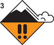
Unfortunately, this deep slab avalanche problem is difficult to assess because the weak layers are deep, often not reactive in stability tests, and might not be easily found in every snowpit. Recent avalanche activity is our sign to take a big step back and choose to ski or ride slopes less than 30 degrees, and be extra cautious crossing below steep slopes as well. Today, cautious route finding and conservative decision making are essential. Avalanche danger is CONSIDERABLE.

Yesterday in Hyalite, skiers triggered a very large, deep slab avalanche that caught and partially buried one of them (details and photos). Outside our advisory area in Paradise Valley, a skier was caught and badly injured in a large avalanche (details and photos). Also, skiers triggered a shallow fresh wind slab in Hyalite. They were not caught, but were in high consequence terrain where even a small slide would have been potentially deadly (photos and details).
The mountains near Bozeman and Big Sky received less snow last night and the last couple weeks than the mountains to the south, but recent avalanches are a clear sign that buried weak layers make large avalanches possible to trigger (Buck Ridge Rider triggered, Cabin Creek rider triggered, Natural in Sage Basin). While the likelihood of a large avalanche is relatively low where less snow has fallen, the consequences remain high. Take a step back from seeking bigger lines, and before riding or crossing any steep slope carefully assess the snowpack for buried weak layers and wind-loading. The most likely place to trigger an avalanche is on wind-loaded slopes. Buried weak layers may be difficult to find and assess, so steer clear of steep terrain if you have any suspicions. Smaller, fresh wind slabs are also possible. Watch for cracking across the snow surface as a sign fresh drifts are unstable, and evaluate terrain for the consequences of being caught in any size slide.
Today, avalanches are possible to trigger and avalanche danger is MODERATE.
Please share avalanche, snowpack or weather observations via our website, email (mtavalanche@gmail.com), phone (406-587-6984), or Instagram (#gnfacobs).

Dangerous avalanche conditions exist in Island Park. Over the last couple weeks, this area received feet of heavy snow which drifted into thick slabs, and more snow is expected today and tomorrow (recent observation). This steady, continuous addition of weight has pushed the snowpack to its breaking point. Large avalanches are likely to be triggered and could break naturally. Avoid riding on slopes steeper than 30 degrees, especially if they are wind-loaded, and be extra cautious crossing below steep slopes.
Upcoming Avalanche Education and Events
Our education calendar is full of awareness lectures and field courses. Check it out: Events and Education Calendar.
TODAY! March 3-5, Bozeman Splitfest. More info and register here.
March 9, 6 p.m.-7 p.m., 1-Hour Awareness - Spring conditions. FREE at REI Bozeman.
March 10 & 11, SheJumps - Women’s Companion Rescue Clinic. Online classroom session Friday evening followed by a field session from 10 a.m.-2 p.m. Saturday. More information and registration HERE.
Every Saturday, 10 a.m. - 2:00 p.m. Avalanche Rescue Training, drop in for any amount of time. Round Lake Warming Hut, Cooke City. Free.
Loss in the Outdoors, is a support group for those who have been affected by grief and loss related to outdoor pursuits. Check out the link for more information.
A list of all avalanche activity from our forecast area can be viewed HERE.