Snow Observations List
We toured out north of Bridger Bowl and onto the west side of the range, searching for shallow snow and reactive buried weak layers.
While we did find shallower, weaker snow compared to what we've seen on the east side, it is remarkably deep back there! There is close to 5 feet of snow at around 7200'. What was mainly present were layers of weak, faceted snow that formed during the high pressure at the end of January. These were capped with a slab of newer, dense snow. This slab and weak layer combo gave us ECTN's in all our snowpits. An atypical amount of snow exists in this zone, and while an avalanche breaking on this persistent weak layer is unlikely, there may be isolated areas where you may be able to trigger a small avalanche breaking at this interface.
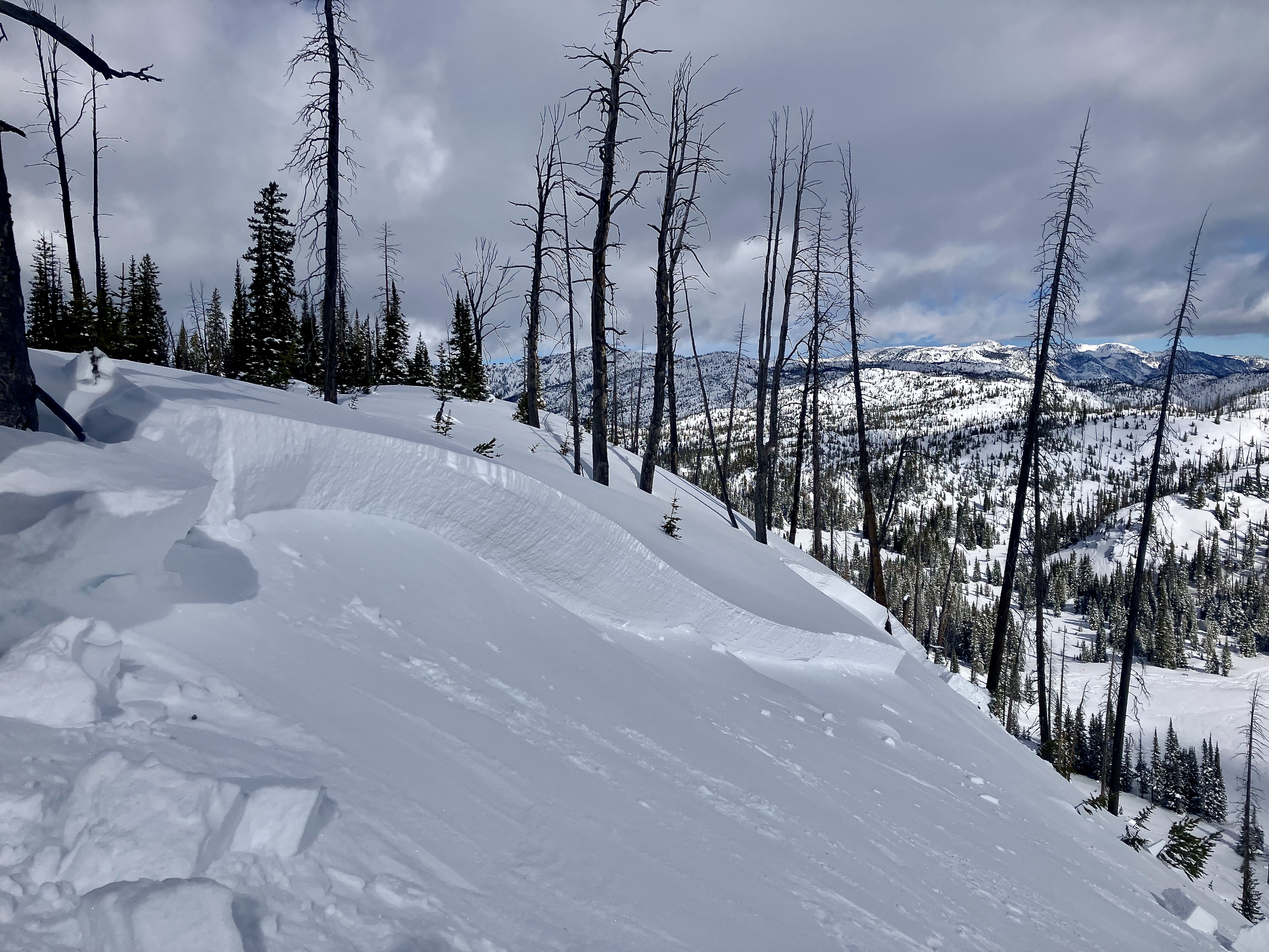
Apart from looking for weak layers, we were nearly blown off our feet a few times by strong westerly winds. There was significant snow transport occurring at upper elevations and ridgelines. Our ski tracks and snowpit were almost entirely blown in on our return back to Bridger, and we were able to trigger cracking in small, newly-formed wind slabs. With a few more inches of snow forecasted tonight, and continued winds tomorrow, our primary concern will be wind slab avalanches breaking in the upper 1-2' of the snowpack.
Outside of wind-loaded terrain, natural and human-triggered avalanches are unlikely on non-wind-loaded slopes in the Bridgers.
Full Snow Observation Report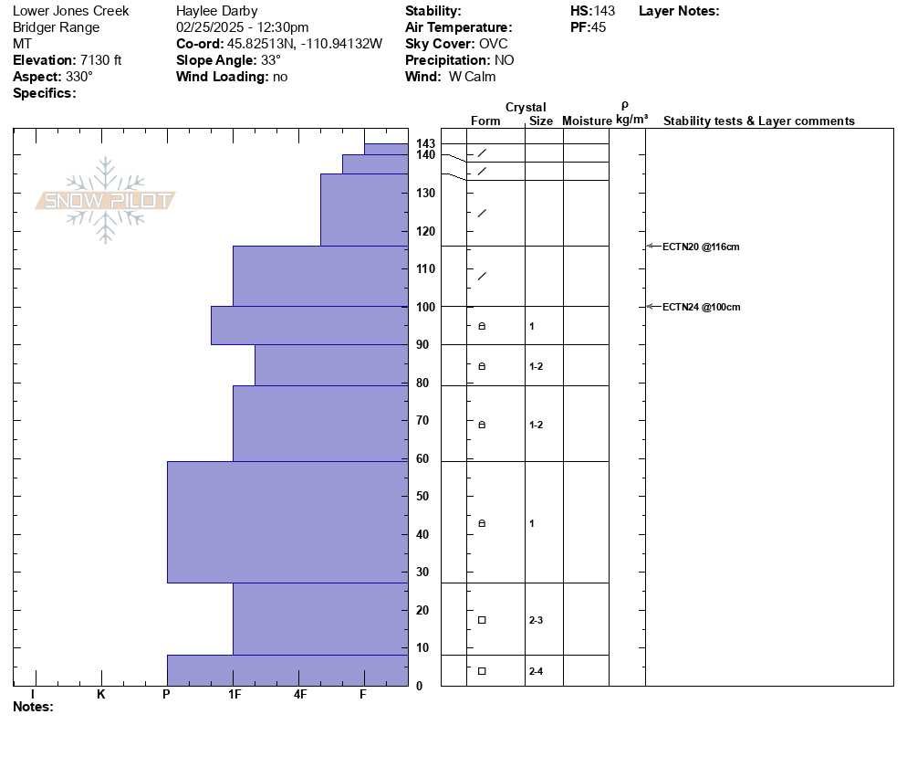

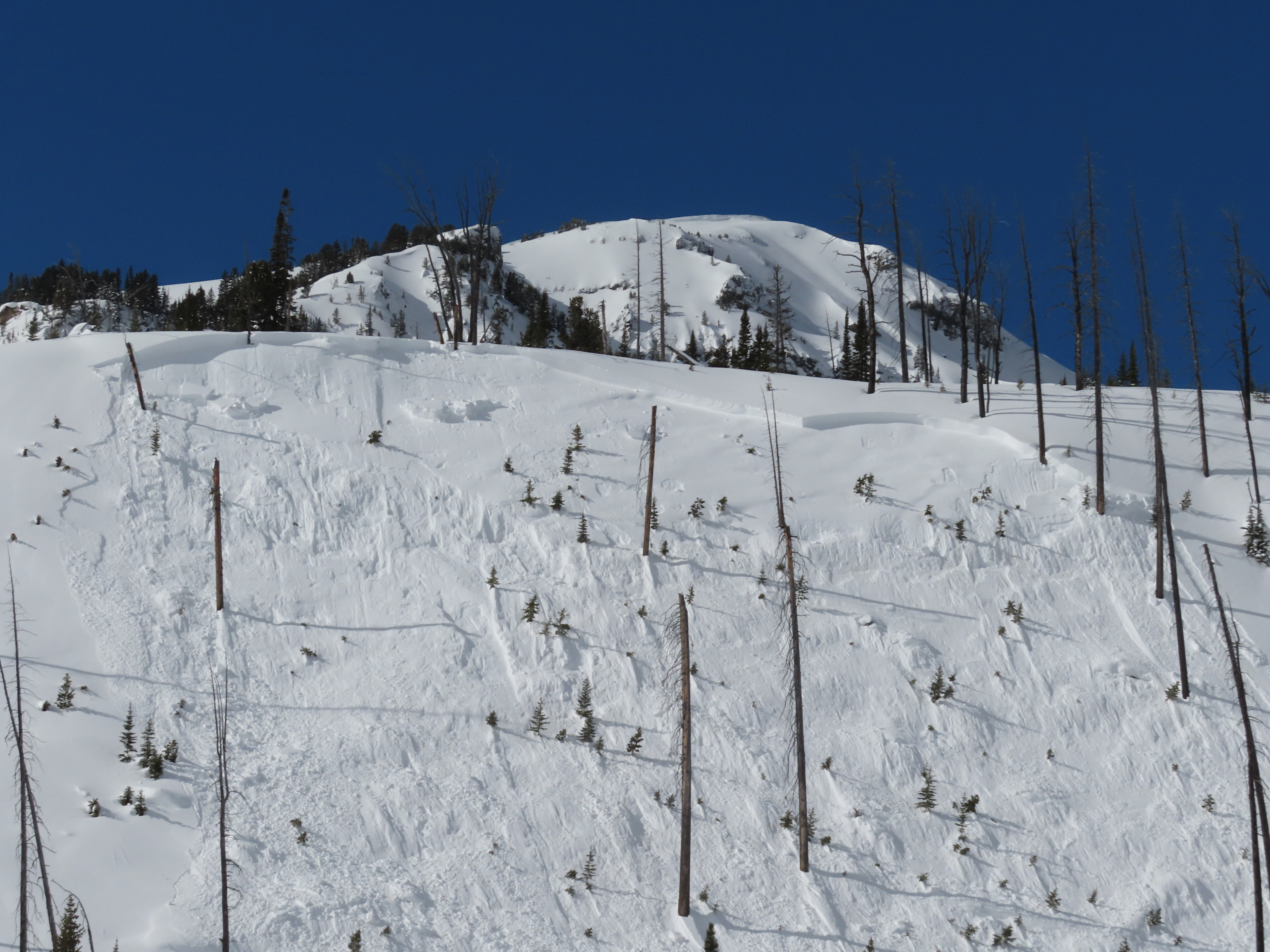
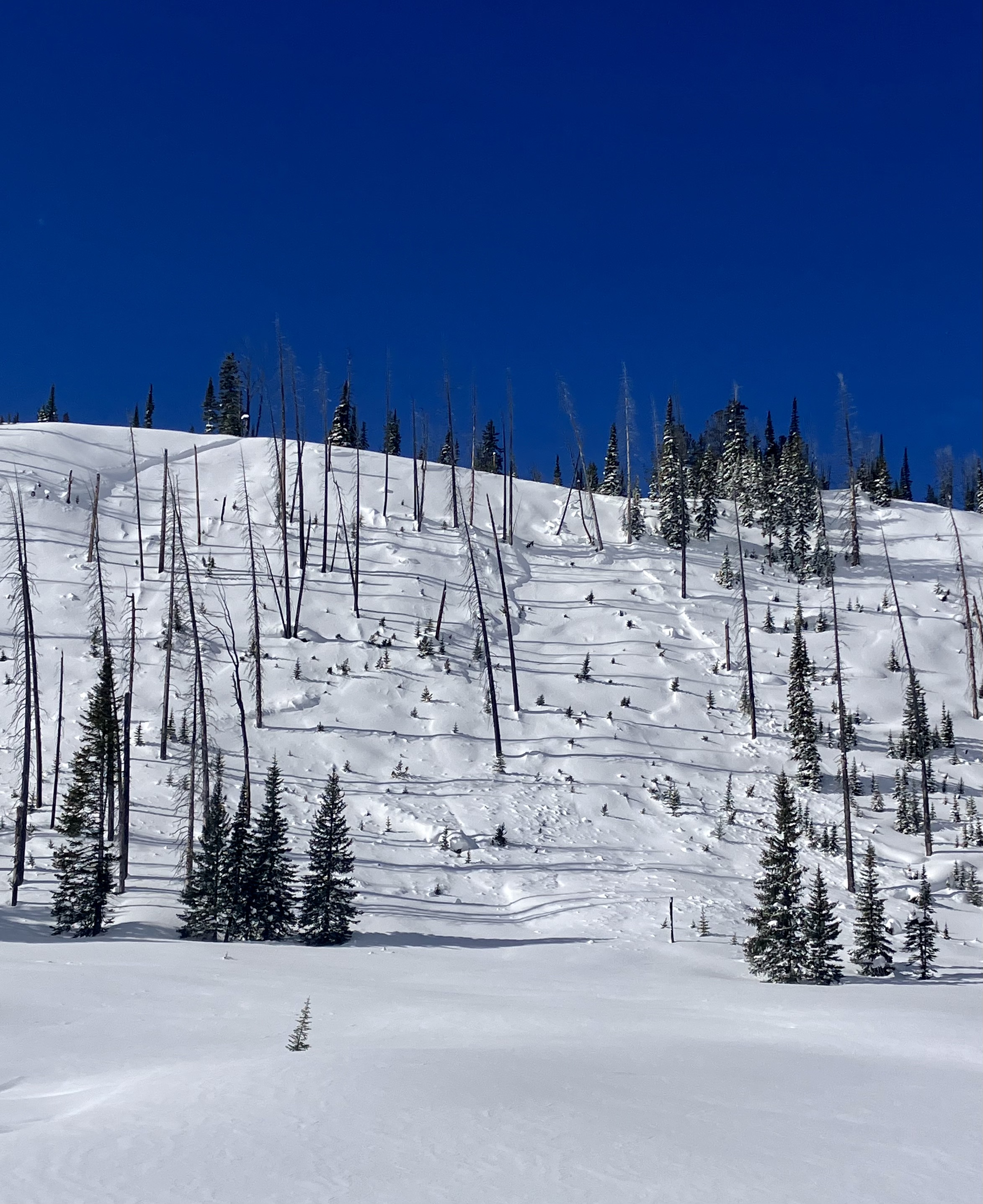
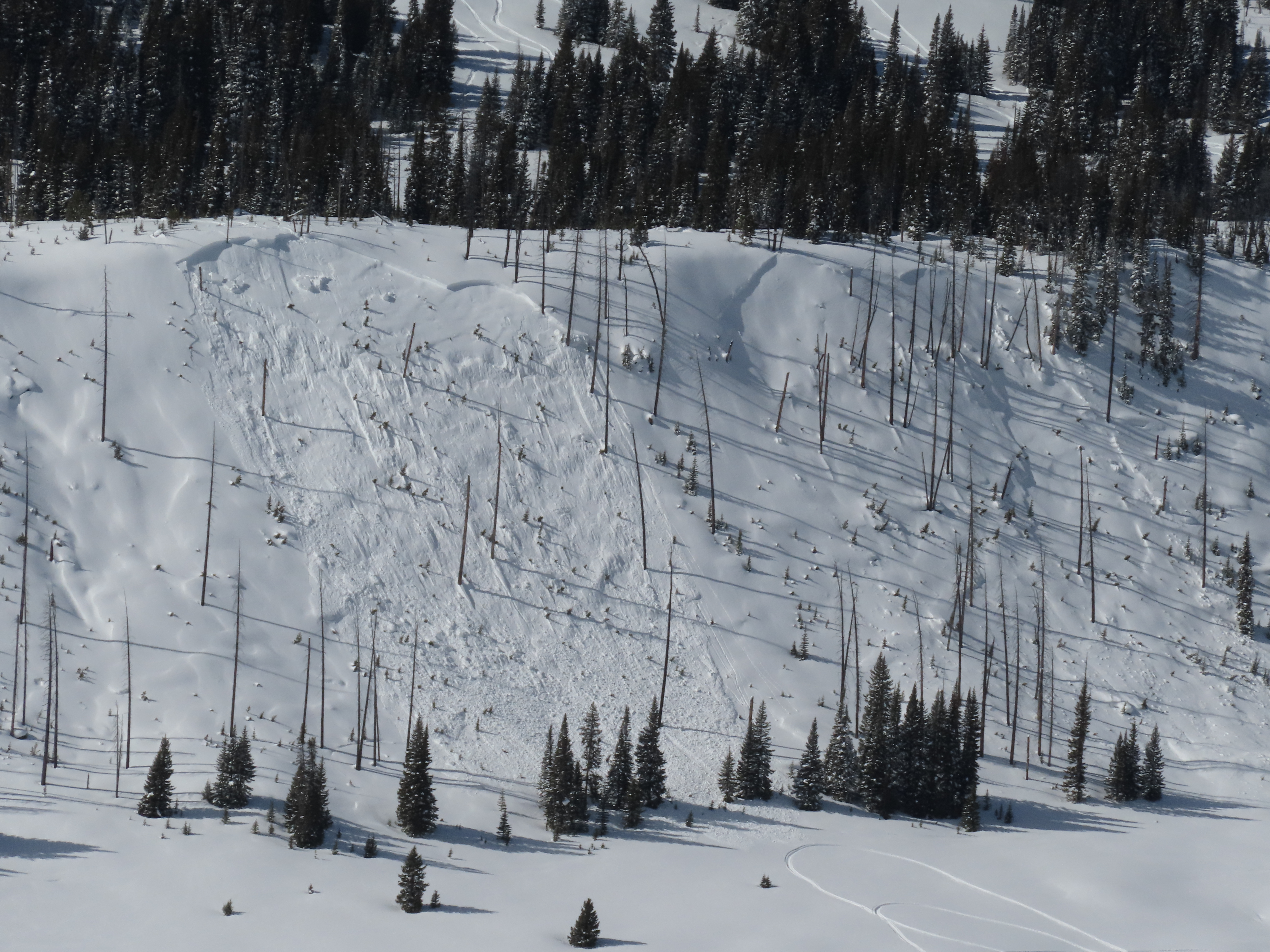
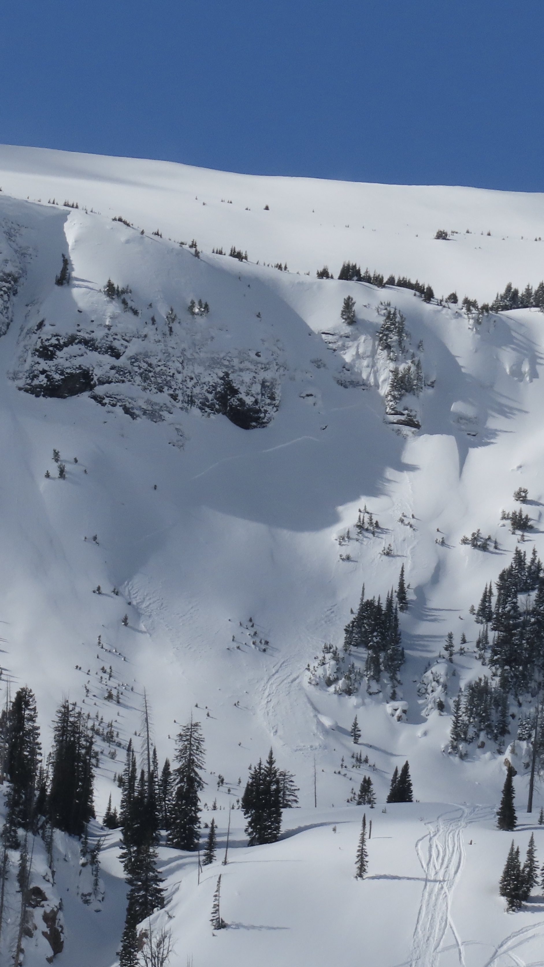
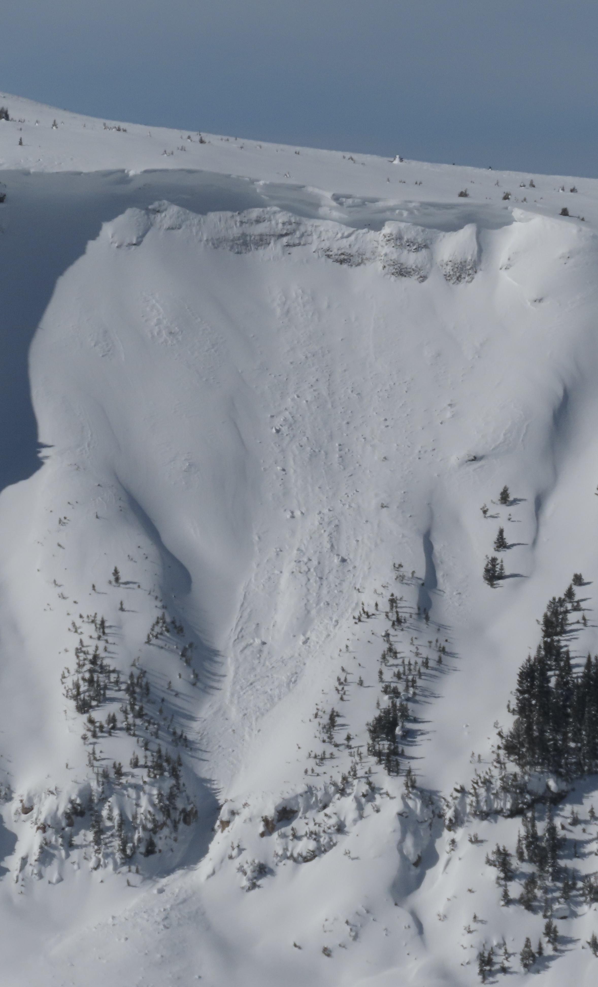
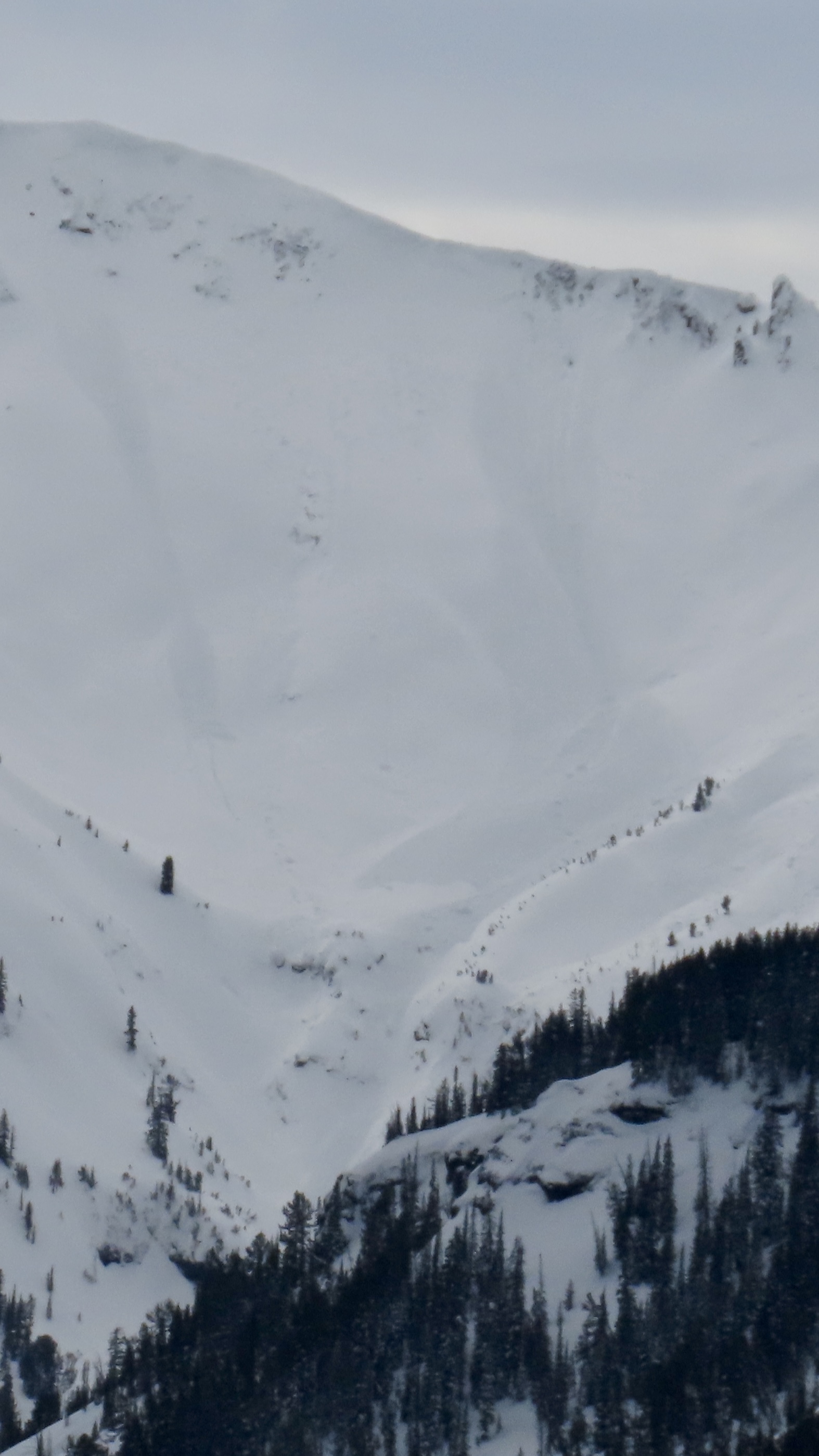
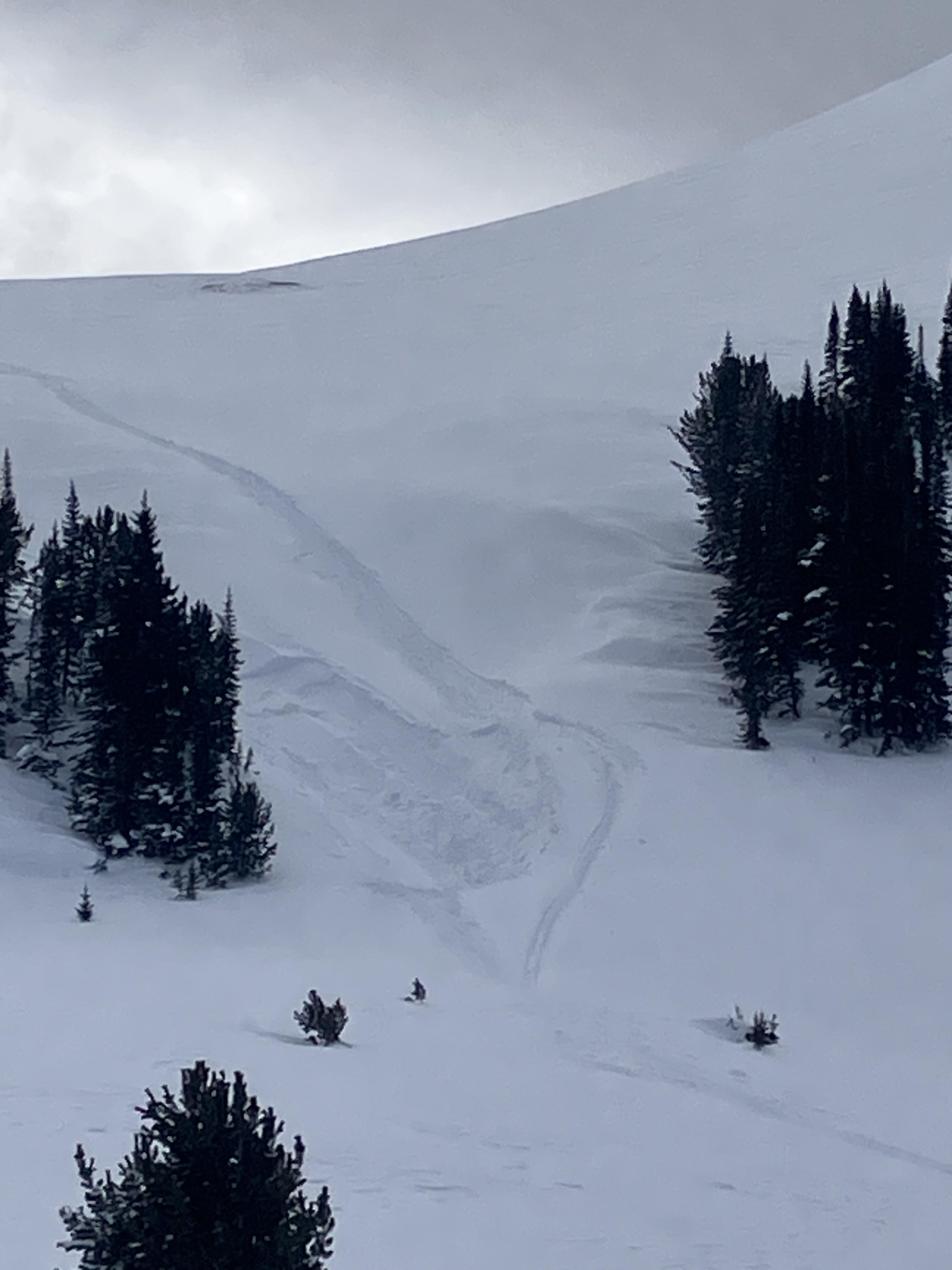
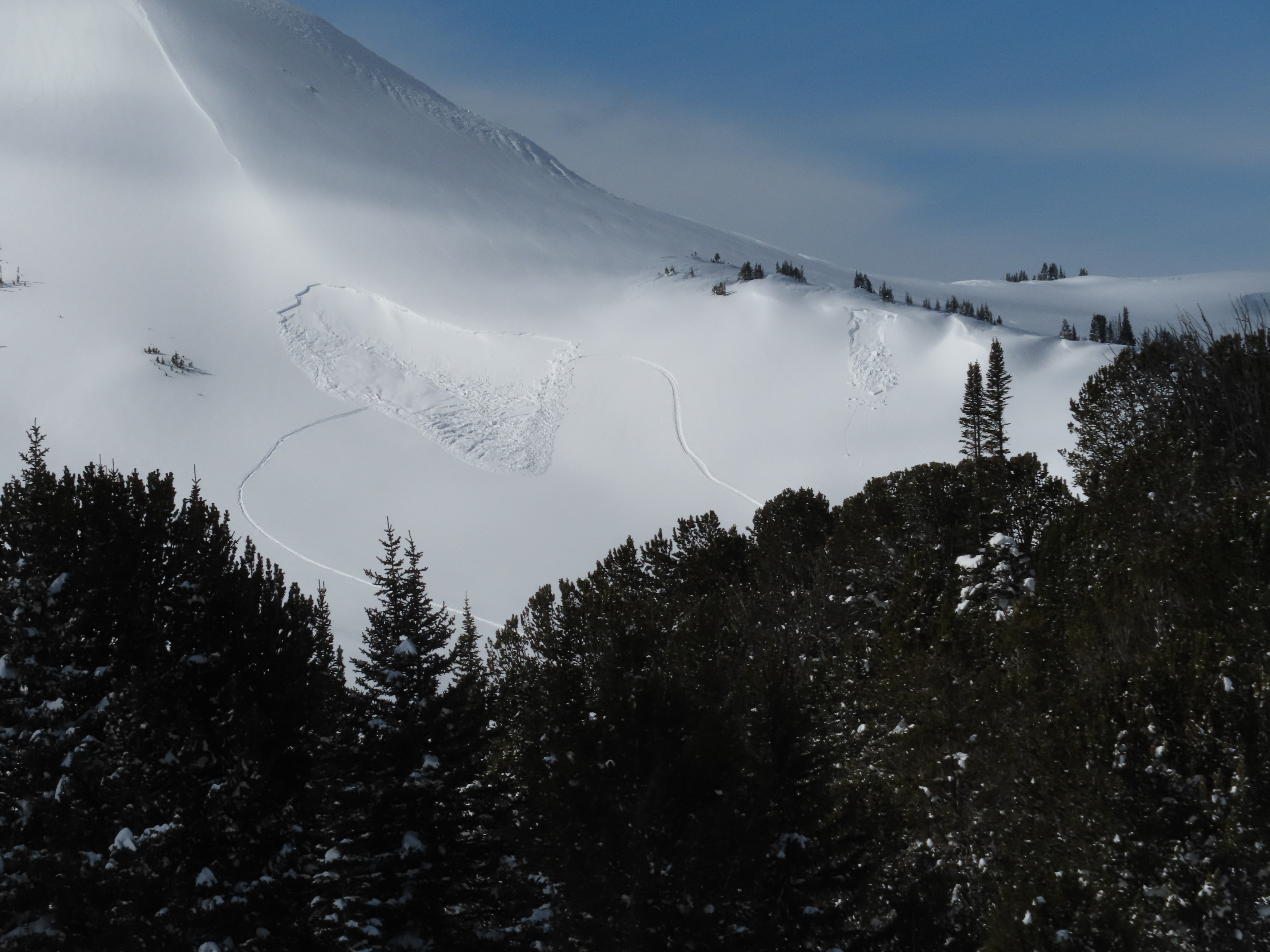
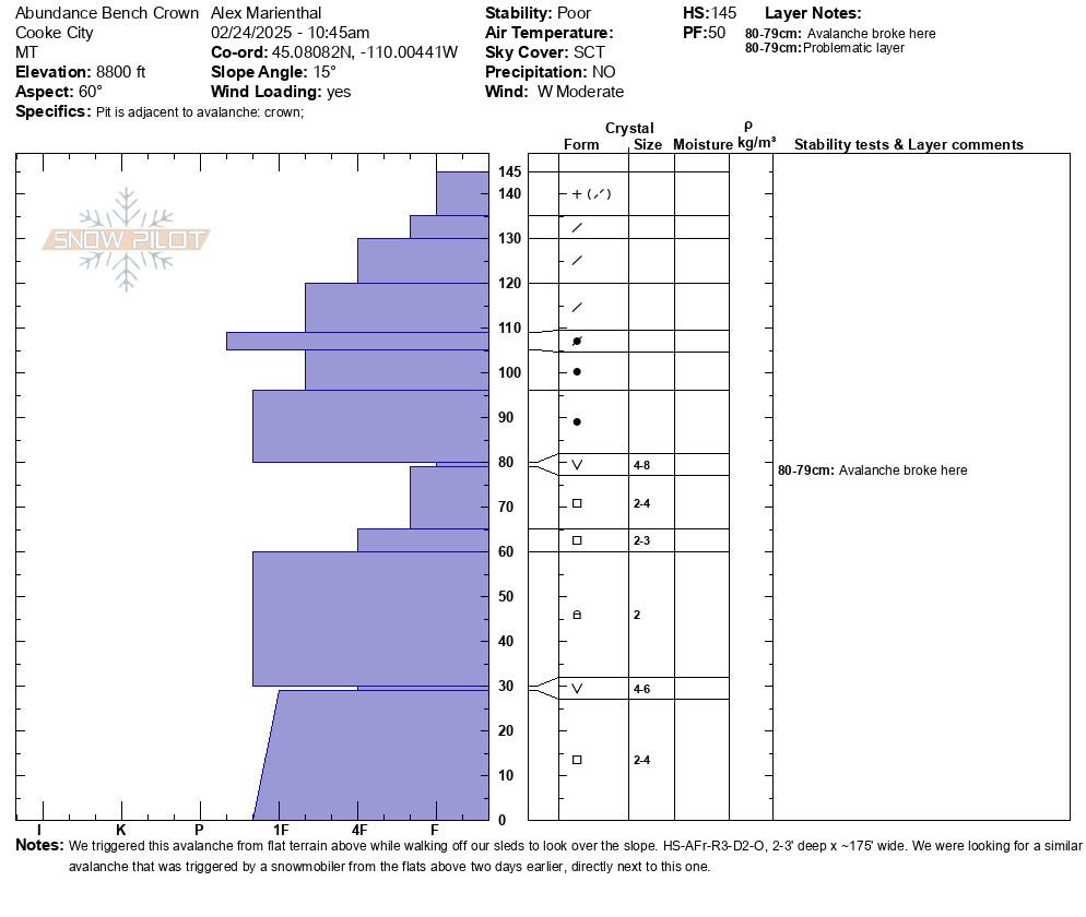
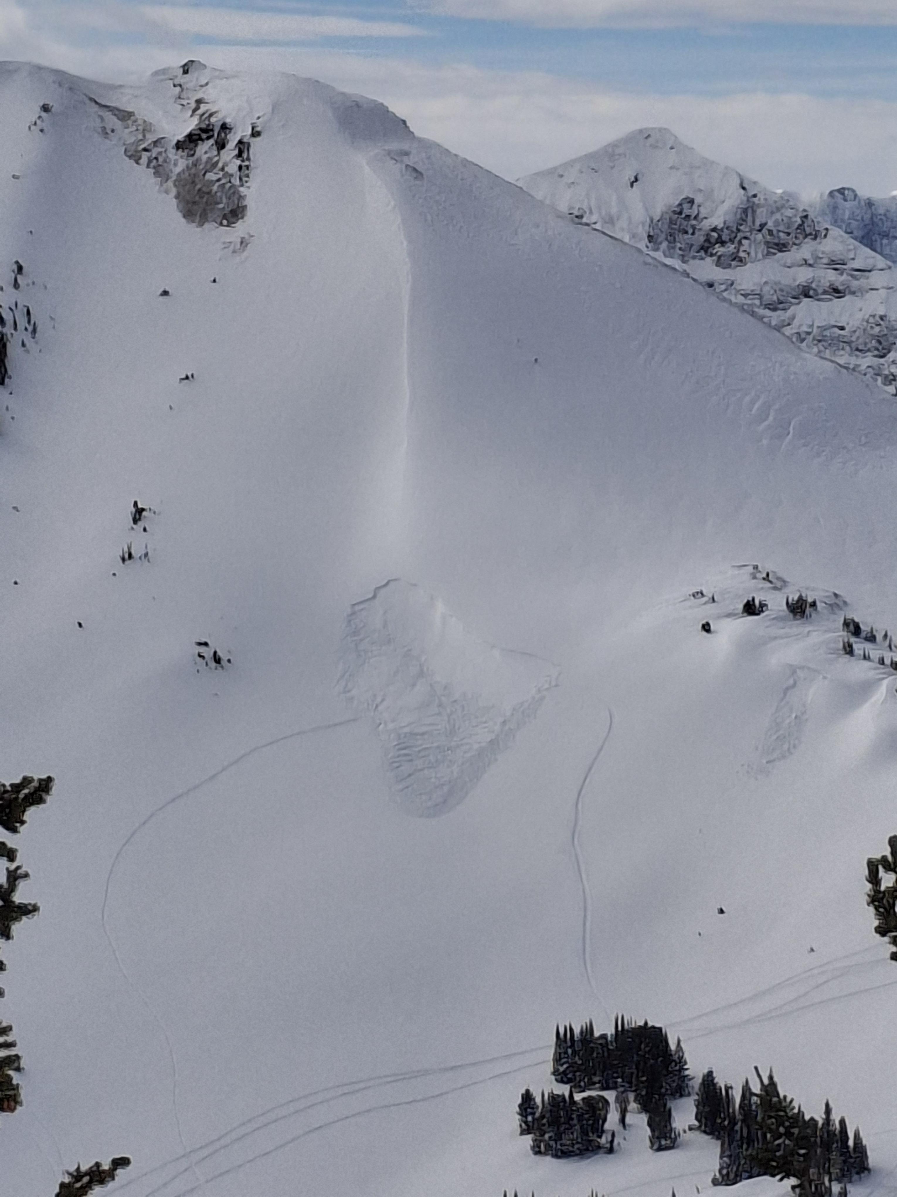
We went to look at an avalanche that was triggered two days ago, remotely from flat terrain above a steep slope, on the northeast end of Mt. Abundance. While looking for the avalanche from the flat bench above we triggered a similar sized slide directly adjacent to the previous slide. They broke on weak layers of facets and surface hoar that formed at the end of January. 2-3 feet deep and 150-200' wide. 1F to P- hard slab above the weak layer with 25cm of 4F to F snow at the surface. AFr-HS-R3-D2-O.
We also saw at least 3 rider triggered wind slabs, 4-5 natural wind slab avalanches, and a couple large cornice falls.
Strong wind had affected almost every piece of terrain, scouring some slopes, loading others, just stiffening the slab in many areas, and forming fresh drifts on every convex roll and along the edges of trails. Riding was still soft and fairly consistent in many areas.
I expect wind slab avalanches will be easy to trigger for a day or two more due to how reactive drifts were today... and it is still blowing and snowing a little more tonight.
The persistent slab avalanche problem is tricky because we have not seen any other avalanches of this type near Cooke City and it seems isolated, but slopes that harbor that instability might have just reached a tipping point with this round of wind-loading and dense snow, so it seems possible we could see a couple more of these avalanches over the next couple days or later this season. It will be a good idea to step back from most slopes steeper than 30 degrees during this wind-loading event, especially slopes with larger consequences like trees, cliffs and just generally large steep slopes.
Full Snow Observation ReportDave, after some thought and listening to the wind howl, a straight CONSIDERABLE for Cooke tomorrow may be reasonable given how widespread the wind-loading/fresh wind slabs are. Also feeling like we could get surprised by another persistent slab during this loading event has me considering a step back in terrain selection and traveling more cautiously... examples of places that would concern me: Marty's, south face of Abundance, the edges of Miller creek low off Daisy Pass road, Pebble Creek.

From email: Came out of Hyalite around 1:30 today. There were several small slides to the road in the canyon. One slid all the way to bare ground.
Full Snow Observation ReportToday I saw a very small wind slab on Republic Peak. Crown was 10 feet wide. No other avalanches observed
Full Snow Observation ReportFrom Text message: “Clean up on aisle hyalite! Couple small wet slides between the retaining wall and practice rock, big enough to reduce the road to one lane.”
Full Snow Observation Report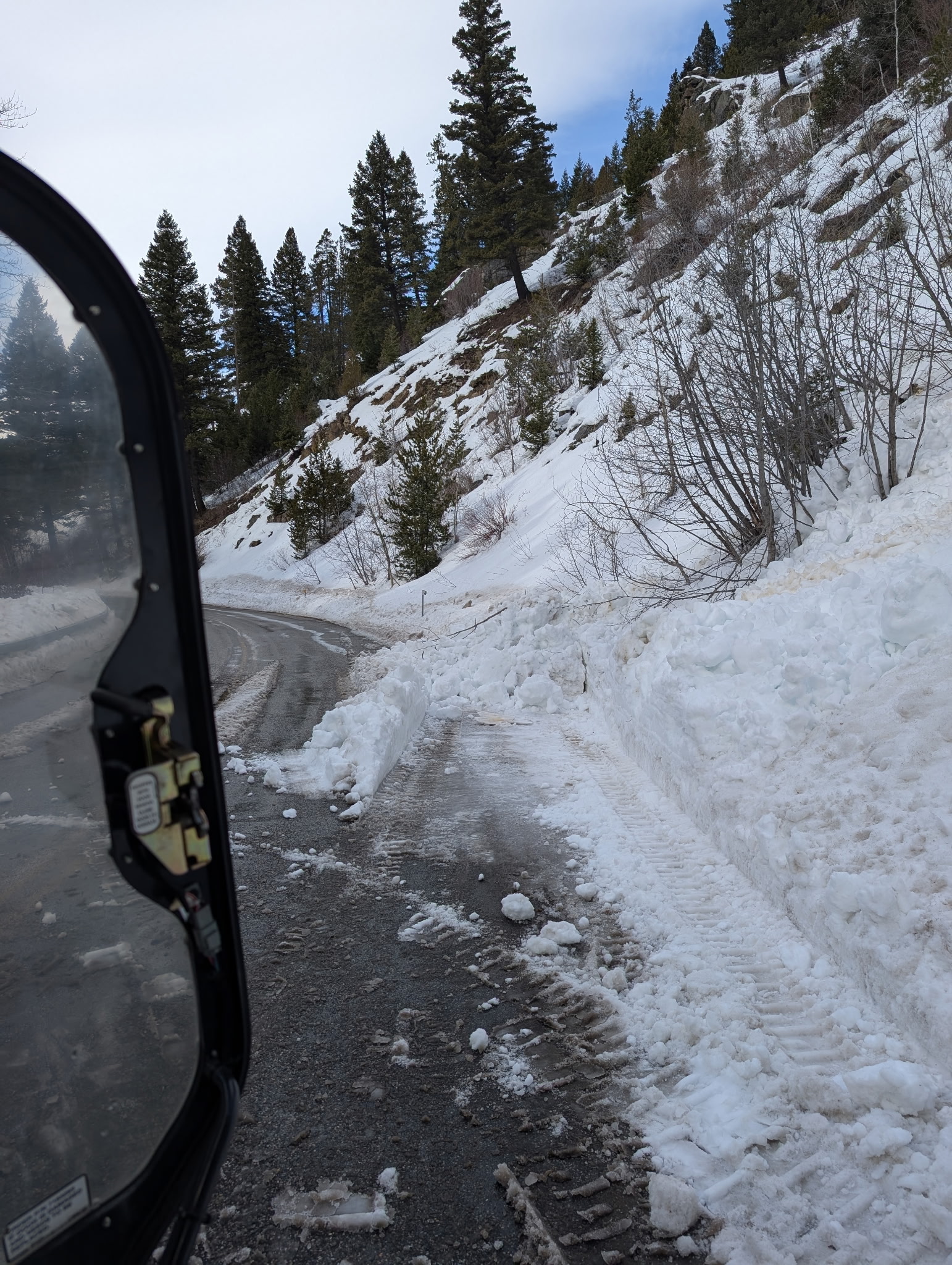
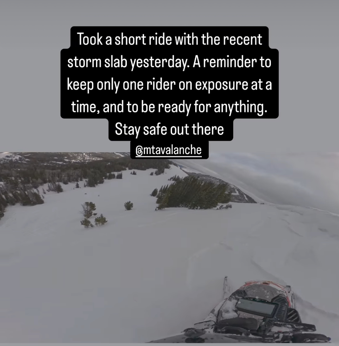
From IG Message/ Stories: “Took a short ride with the recent storm slab yesterday. A good reminder to keep only one rider exposed at a time, and to be ready for anything. Stay safe out there.”
Full Snow Observation Report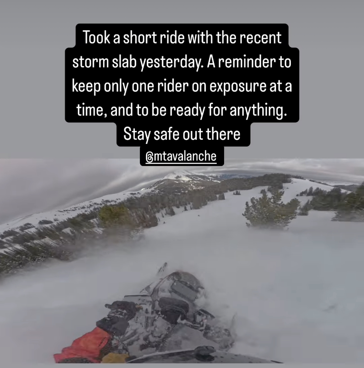
Observed a snowmobile triggered avalanche today. East facing slope, approx 9700', between Fischer Peak and LuLu pass. Rider was not caught. HS-AMu-D1-R1-I. Observed lots of wind transport and loading from strong w/sw winds today.
Full Snow Observation Report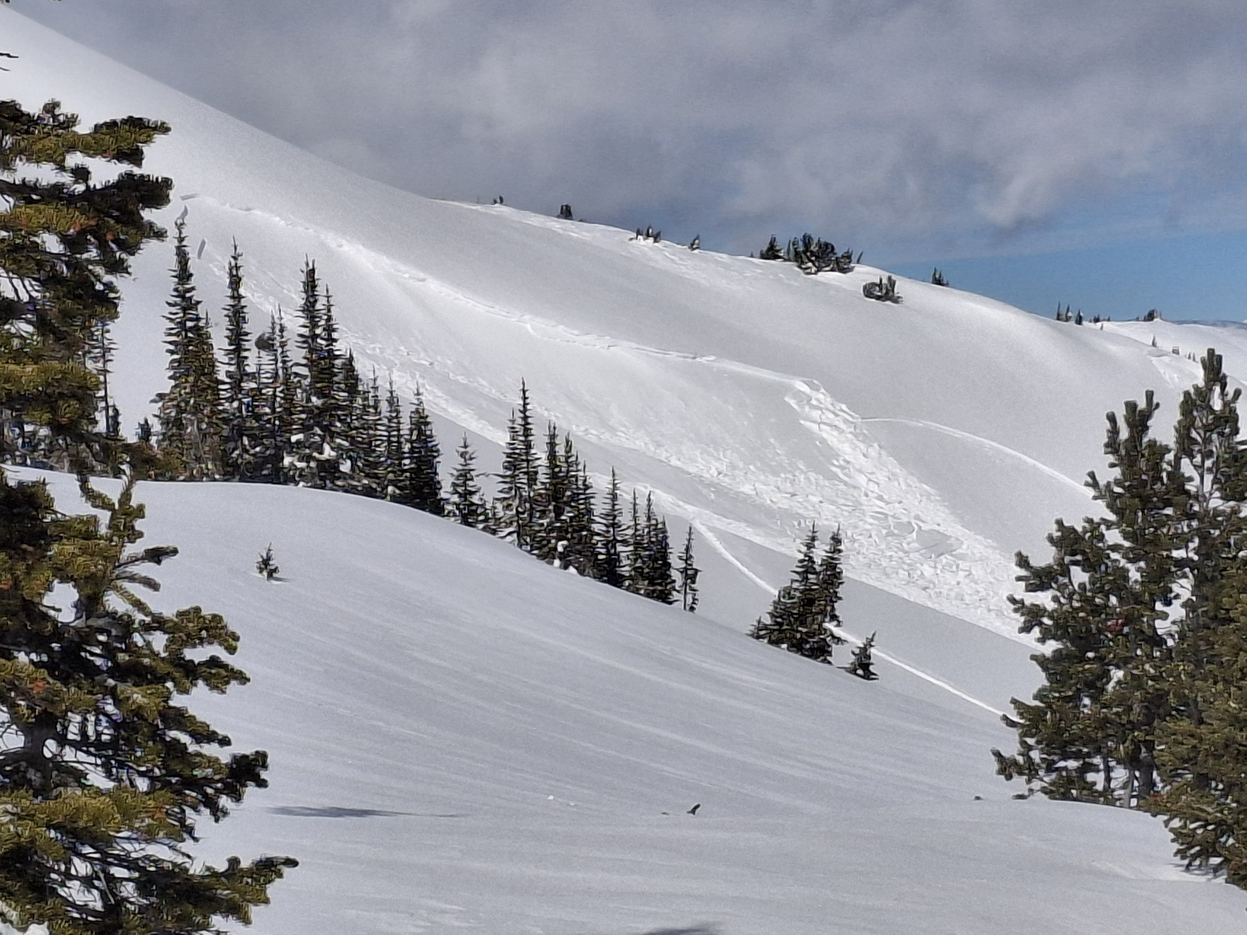
8761ft
43 NE
13 degree slope
HST 125
ECTP 12 50 down
Soft snow ski pen 30 cm
supportable pow
clear skis tell 11:20
11:20 few
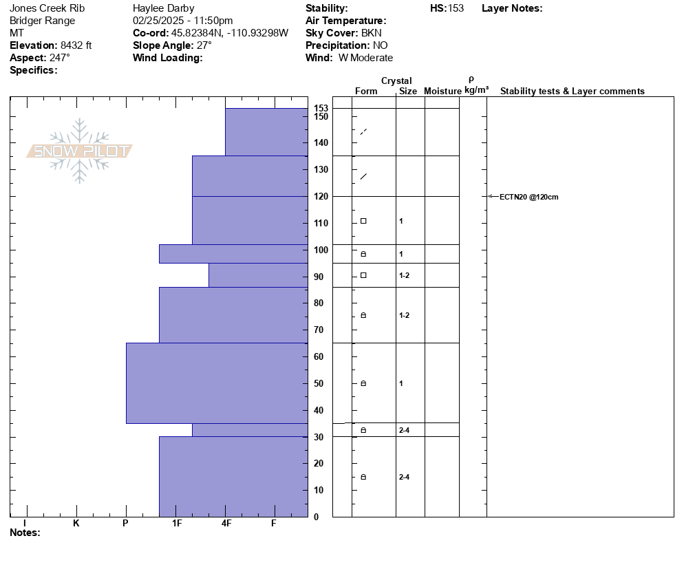
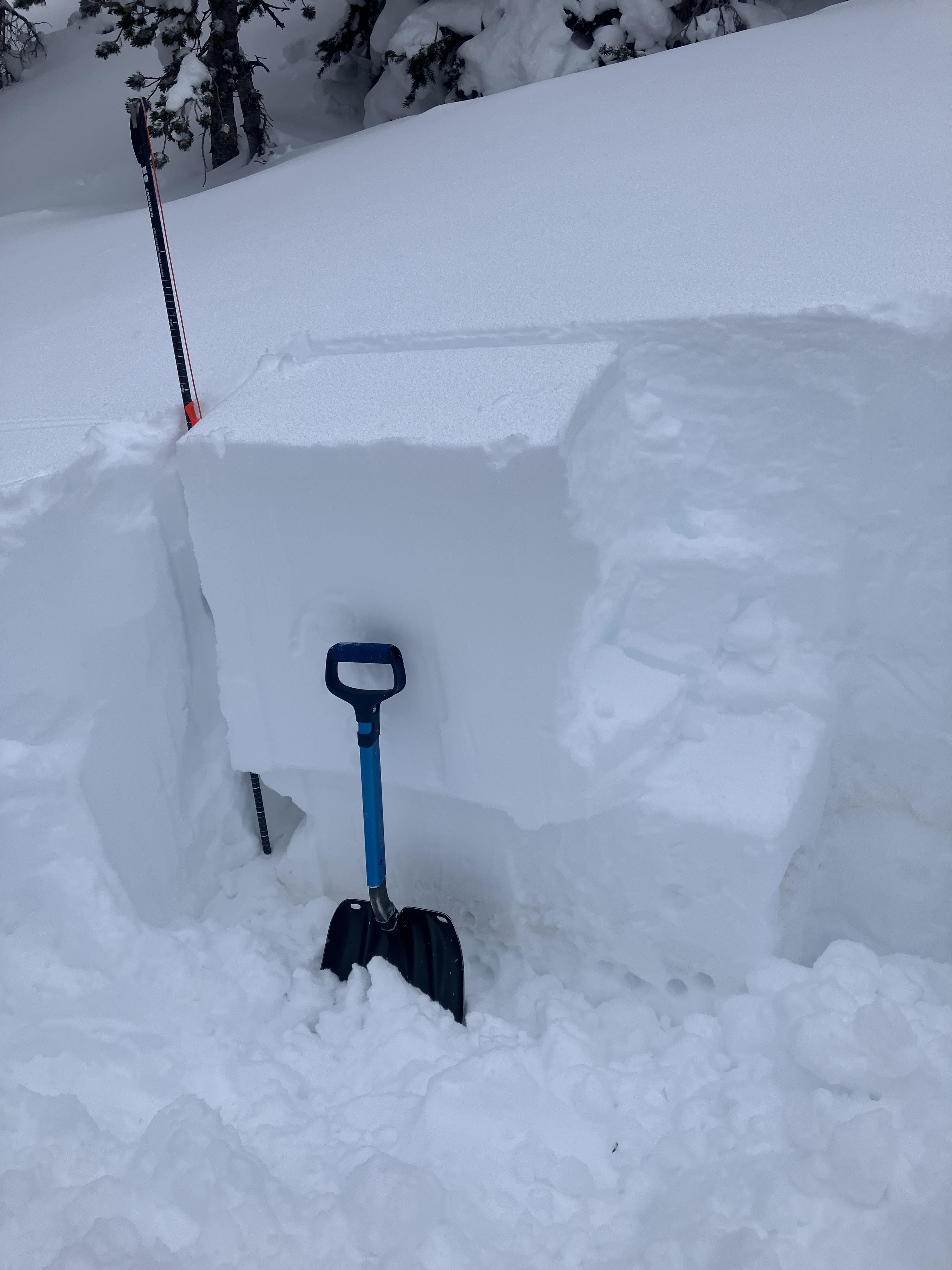
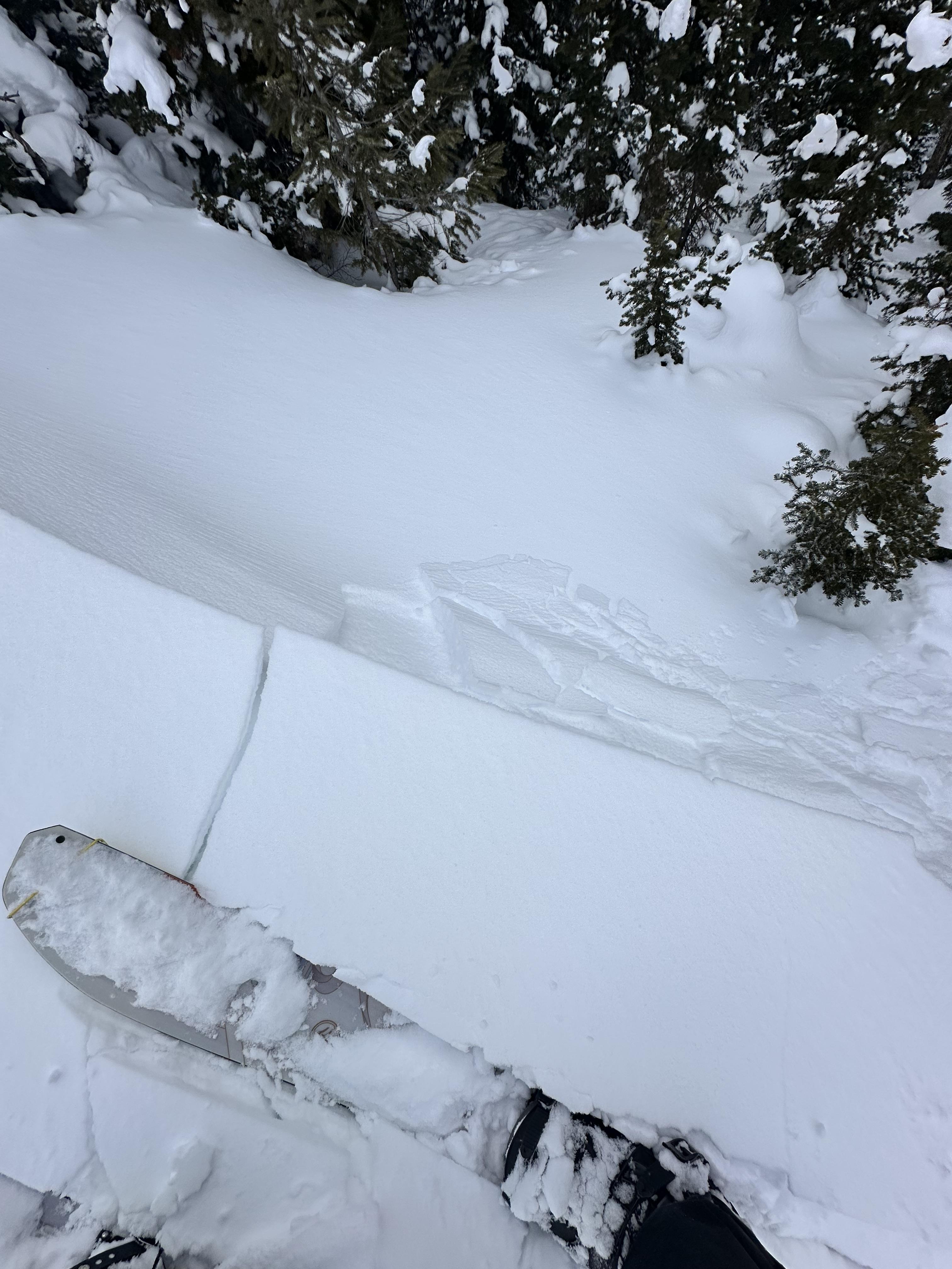
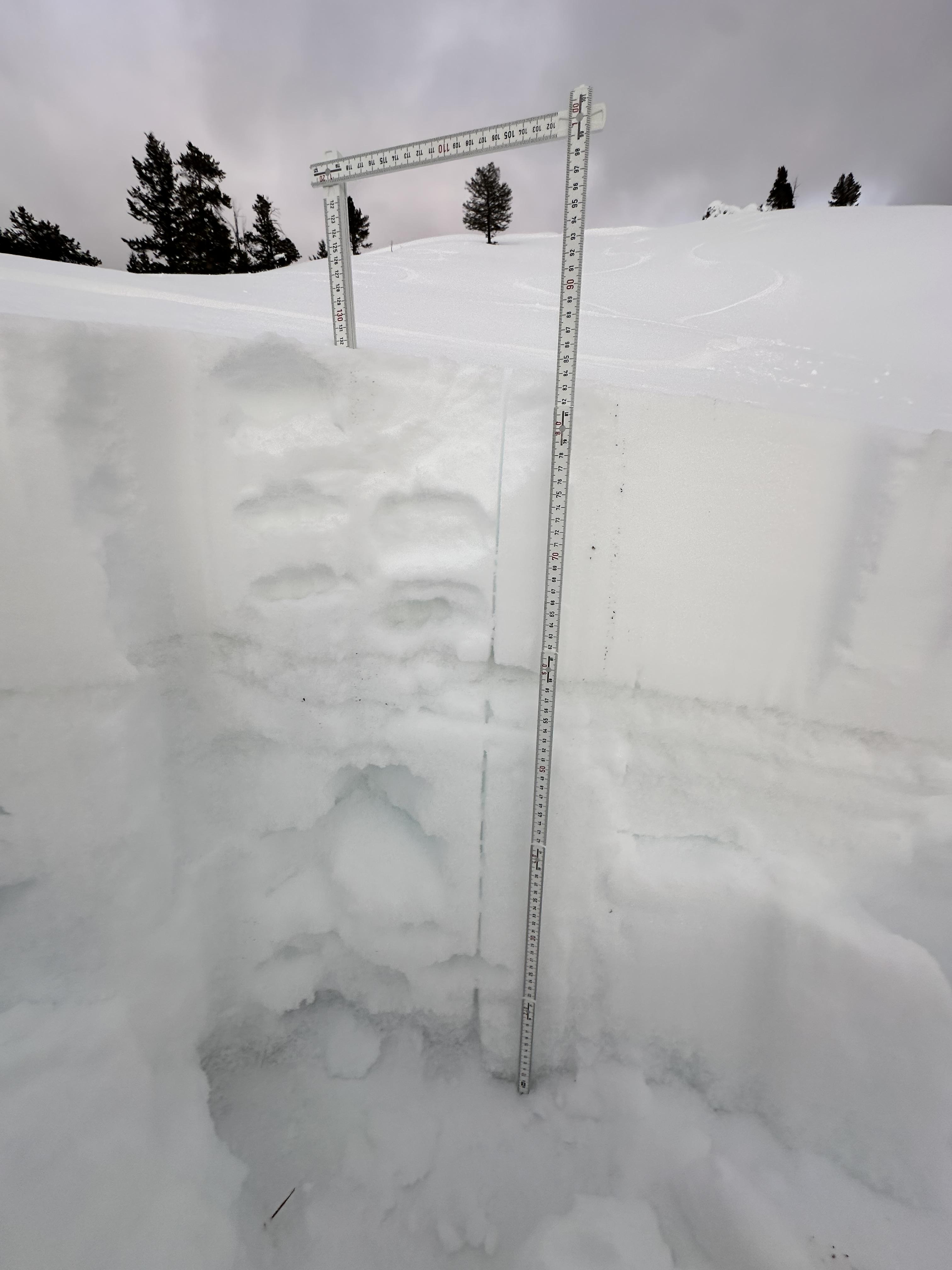
Full Snow Observation ReportWe went up Republic Creek to look at the stability of snow that has fallen over the last 2-3 weeks. Skies were overcast with light snow falling most of the day and winds were moderate with strong gusts.
We found a thin layer buried 2’ deep that showed potential to propagate and slide. We dug down 4 feet, just below the dirt layer that was deposited earlier this month. We got an ECTP30 that broke about 8" above that dirt layer. This was either on a thin layer of facets or preserved lower density dendrites.
We heard of an avalanche that was triggered yesterday which broke 2’ deep and 250’ wide, possibly on this same layer, on an east facing slope by Mt. Abundance.
The wind was blowing new snow into fresh wind slabs. We were able to easily to trigger a couple wind slab avalanches on test slopes. More snow is expected tonight and tomorrow which will increase the likelihood and size of wind slab avalanches, and the added weight could cause a 2-3’ deep avalanche to break a couple hundred feet wide. Be cautious of steep slopes as new snow and wind build slabs over the next couple days.
Full Snow Observation Report

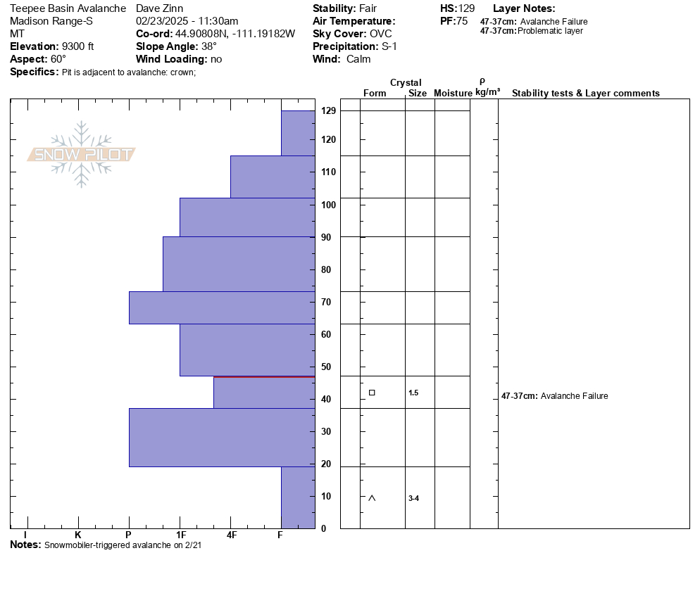
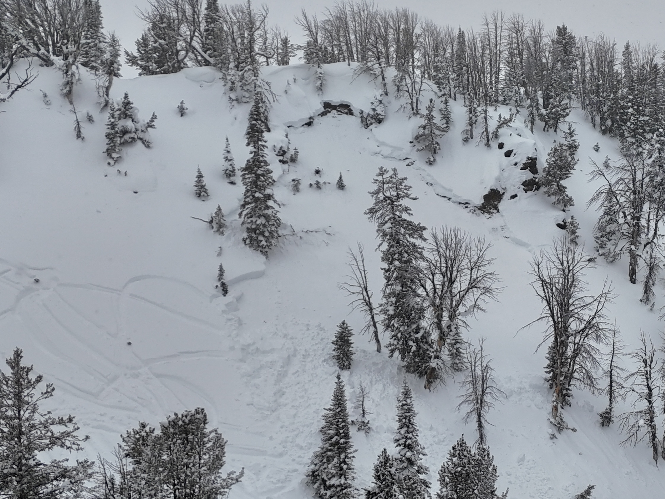
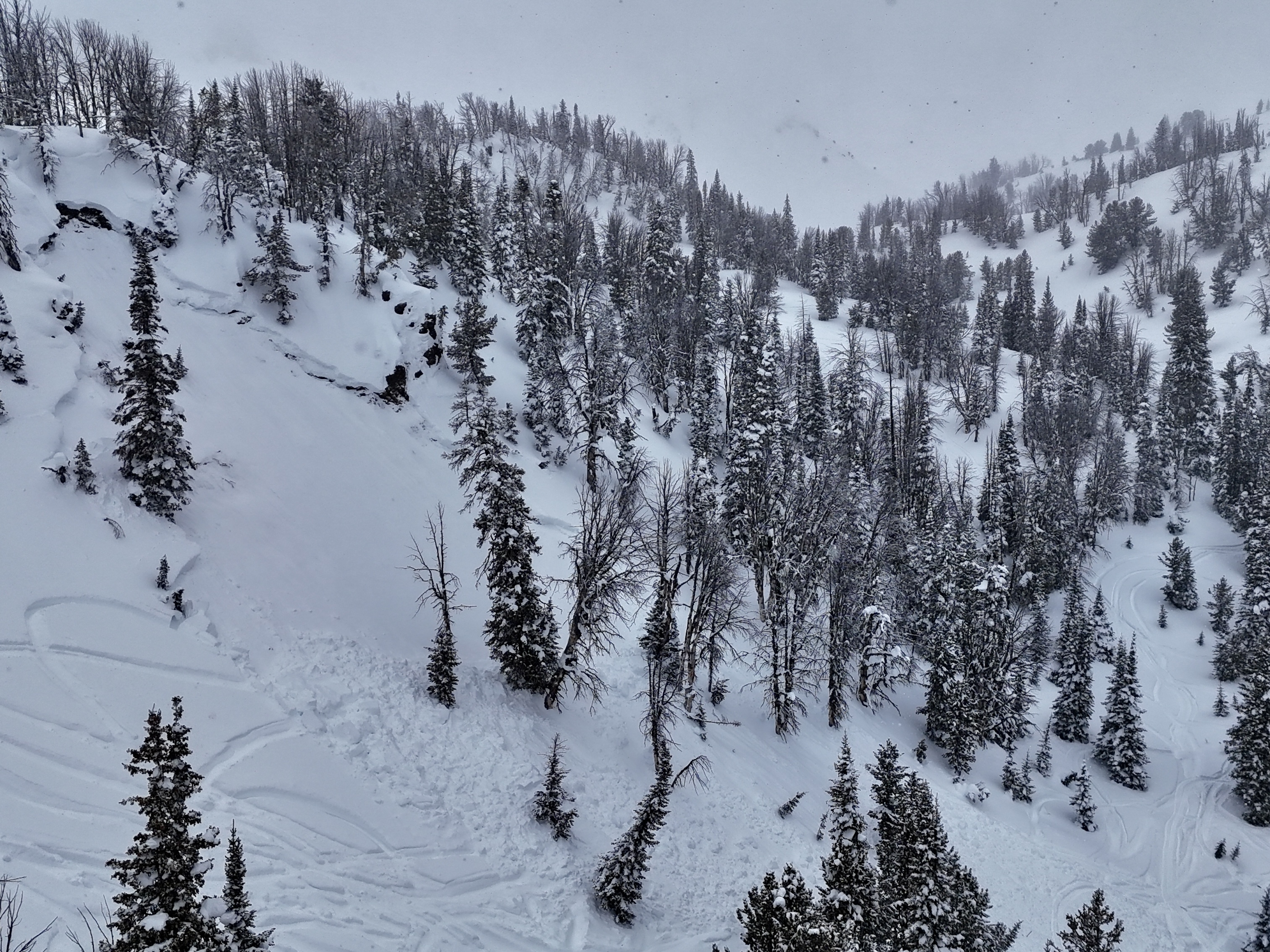
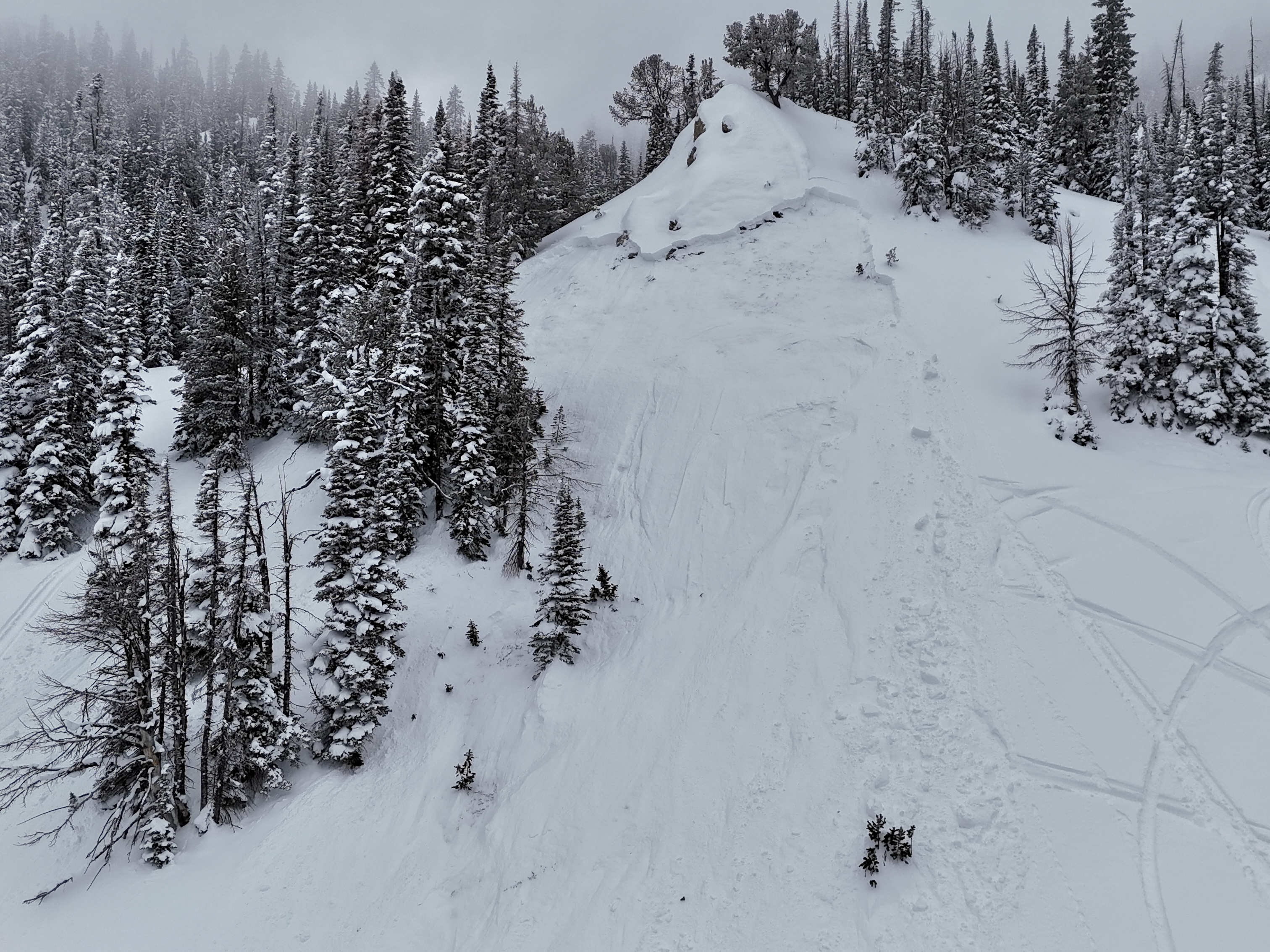
We got to ride into Tepee Basin with a pair of snowmobilers who were involved in an avalanche two days ago (2/23). The pair generously offered to join us and run us through the incident. It was an incredible opportunity to learn from each other. Read details about the slide.
The avalanche failed on the weak layer of facets that formed in late January. We also spotted another avalanche in similar, mid-elevation terrain likely triggered yesterday or earlier this morning. Both of these avalanches fit the pattern we've been seeing in Lionhead and the recent slide outside the forecast area in the Black Canyon area of Island Park. Other than the Black Canyon avalanche which is uncertain because we have not visited the site, the slides are taking place in mid-elevation terrain, smaller slopes with minimal wind-loading, and a thinner snowpack.
The snowpack in both the Tepee slides was thin relative to the average snowpack depth (129 cm).
Take Homes:
- You aren't good to go if you avoid the steep, upper-elevation, wind-loaded bowls. Steep slopes at mid-elevations harbor weak snow and have the potential for an avalanche.
- The persistent slab avalanche problem is alive and well. The epicenter of this problem is in the Lionhead area and the Southern Madison and Southern Gallatin Ranges.
- The issue with this avalanche problem is the distribution. It's nearly impossible to tell which slopes will slide and which ones won't. On many, the weak layer isn't so weak and the likelihood of triggering one is low. On other slopes, the weak layer is very weak and the likelihood of triggering one is up there.
Full Snow Observation Report
MODERATE is good today. We have a storm coming into the area tonight, an inch of water will take the danger to CONSIDERABLE for PWL issues.

Rode around the pioneer scenic byway with the motorized avalanche fundamentals course.
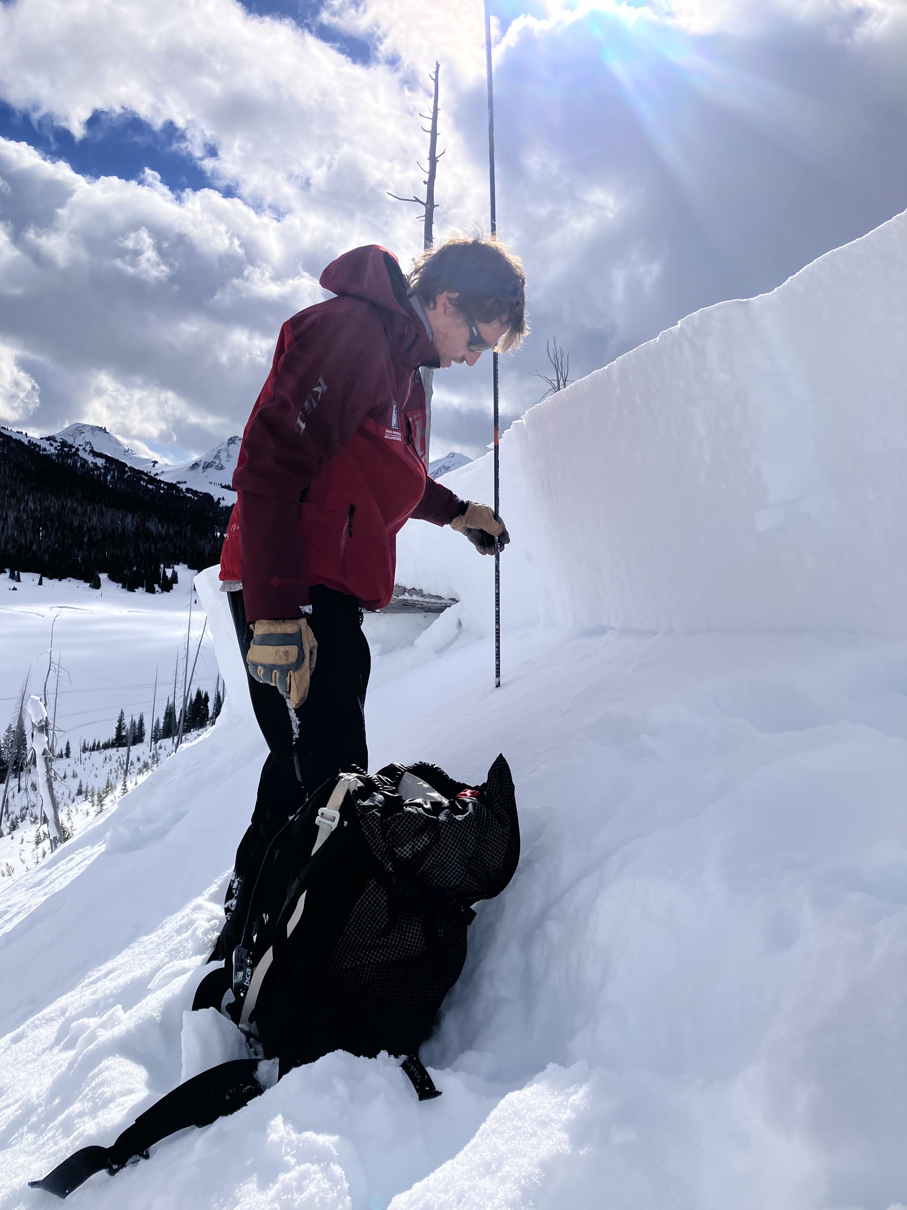
At 8500 SW aspect there was 120cm snow ( see picture for structure) ECTP17, ECTP23 failing on large basal facets/ depth hoar 25cm up from the ground. New snow from February is 1/2 the HS.
As the afternoon warmed up we saw roller ball, small loose wet avalanches and shooting cracking from snowmobile tracks. At the end of the day we observed a very small avalanche on a road cut, also shooting from a track.
We did not ride much off trail, where we riding the snowpack was shallow and you could easily punch into the weak snow.
Full Snow Observation ReportUp at G2 on Sunday (2/23) small wet sloughs were coming down to the left & right of the climb all day. A couple bigger wet slides had totally taken out sections of the bootpack approach from G2 to Hangover. Saw big pinwheels and sticky snow all day. Most stuff available to slough probably fell already but stay alert up there.
Full Snow Observation Report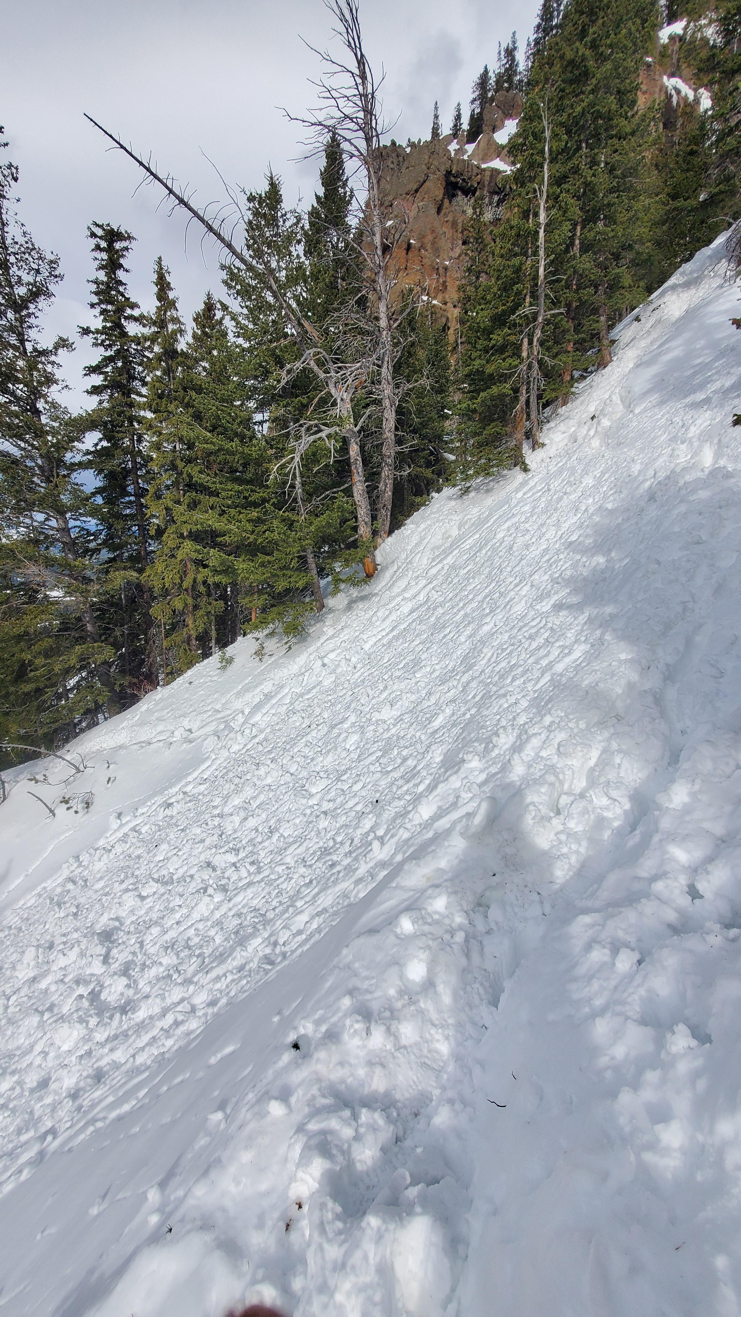
A rider triggered a slide on Saturday (2/22) on a bench below the east face of Mt. Abundance... Trigger point was from the top while driving by. 2' deep, 250' wide??
Full Snow Observation ReportFound moist snow that was starting to freeze on solar's in Hyalite at 8000' Friday. Went searching for better conditions up Specimen Creek today. The snow quality was much better at similar aspects and elevations. Northerly aspects stayed dry in both zones but I was curious about the difference in the two advisory areas. Looking at temps from weather stations the southern range has been 10f to 15f degrees cooler.
Stability was much different as well. In Hyalite, the nsf layer that was formed in late January, looked to be rounding and didn't produce propagating results or clean shears. Up Specimen I had an ECTP15 and a CT15 Q1 on the same layer. This certainly aligns with the forecast.
On a ridge up Specimen, winds were moderate from the SW and shifted SE in the evening. I did find thin reactive wind slabs and cracking in fresh drifts. Wind was actively transporting on the ridge. I felt wind loaded slopes had the greatest potential to slide since sheltered slopes only had a 25cm slab over the weak layer but I avoided avalanche terrain regardless.
Full Snow Observation Report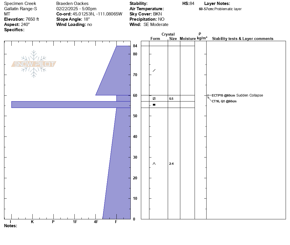
Saw a recent cornice triggered wind slab off of Hardscrabble Peak, crown looked fairly fresh. There was a second crown line below the rock band. Conditions were very windy, with snow still being transported. Most snow surfaces were wind affected, but saw no cracking or collapsing.
Full Snow Observation Report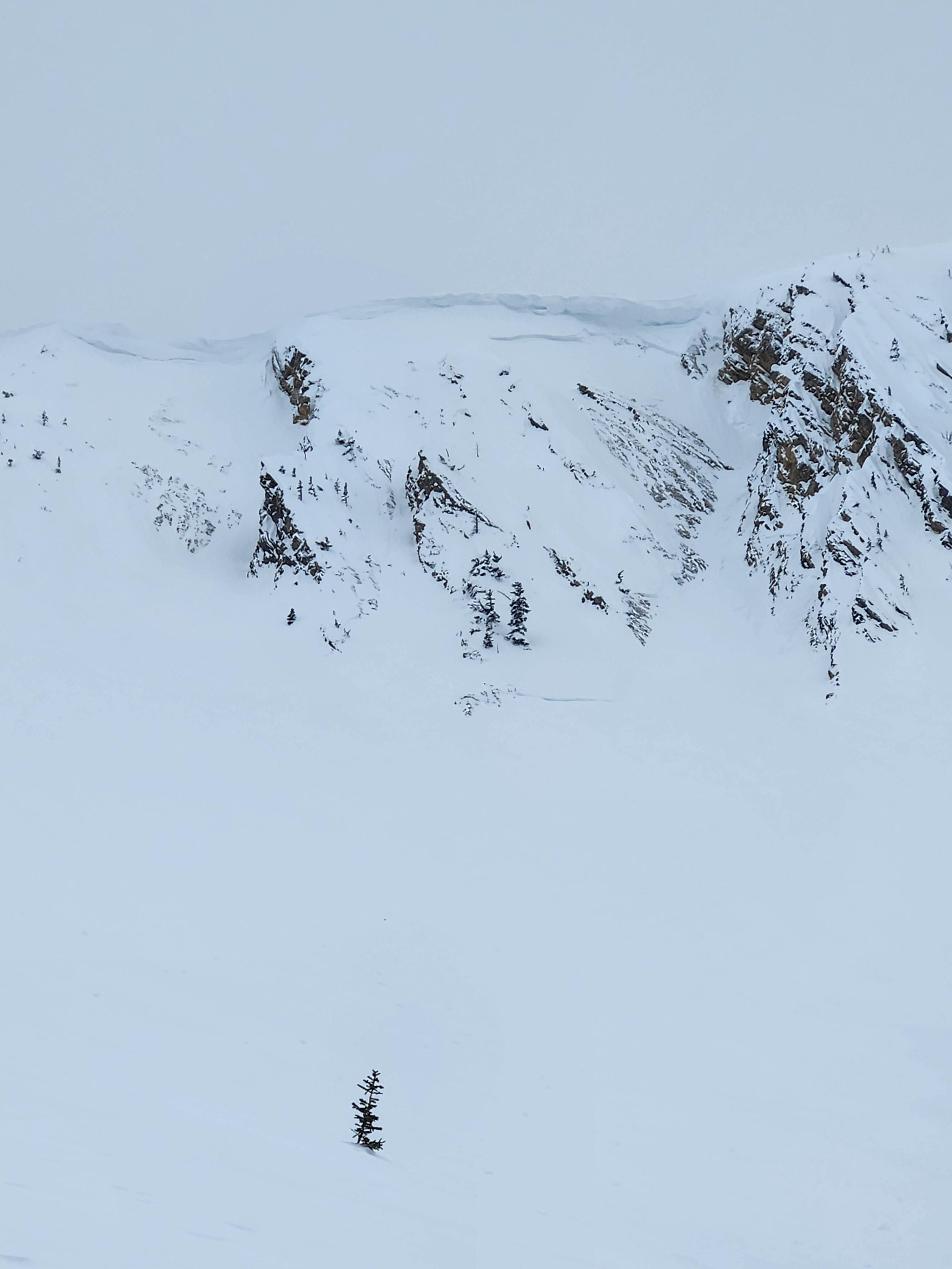
We skied in Maid of the Mist basin today. Solars had a sun crust preventing much snow from drifting, although the constant moderate winds out of the west were trying their best. We found multiple windslab pockets in the Fat and Skinny Maid, though these seemed fairly stubborn and were not propagating. Found some well developed (4-5 mm) basal facets in the talus of the Skinny Maid as well, and although we saw no signs of instability on this layer they are something to watch out for in steep thin terrain.
No recent avalanche activity visible except some loose wets and small cornice fall from the prior warm sunny days.
Full Snow Observation ReportCan confirm, it was blowing in the Bridgers. Up high it was still cool enough that a fair amount of snow was moving around, especially further north. Clouds of snow were coming off of the ridges and moving through the bowls near Fairy Lake and Fraiser divide. Around the of the Throne and in the mid elevations we found better, more sheltered snow conditions. The area around Ross Peak was very scoured. We saw a handful of small point releases on steep south slopes, likely from Friday, but no other recent avalanche activity. By mid-day/early afternoon, the snow lower down in the woods was getting pretty heavy and wet and anywhere with the slightest bit of sun exposure was developing a crust. Talked to a few skiers who toured in the Naya Nuki area, and they described variable snow and very windy conditions.
Full Snow Observation ReportDug in the snow with the Dillon Fundamentals course at Maverick today. Pit was NE facing Slope off Thin Air run @ 7770' When I stepped out of my skis I sunk all the way to the ground..
Snow was 90-100cm deep, with 45 cm new snow over a faceted lower half of the snowpack. Facets at 40cm above ground were 1-2mm and near the ground larger facets were mixed with wet depth hoar 4-5mm. We observed an ECTN22 @ 40cm on the smaller facets and an ECTP23 near the ground.
We avoided travel on solar slopes due to breakable crust, and mostly kept to the ski area. Did not observe any recent avalanches.
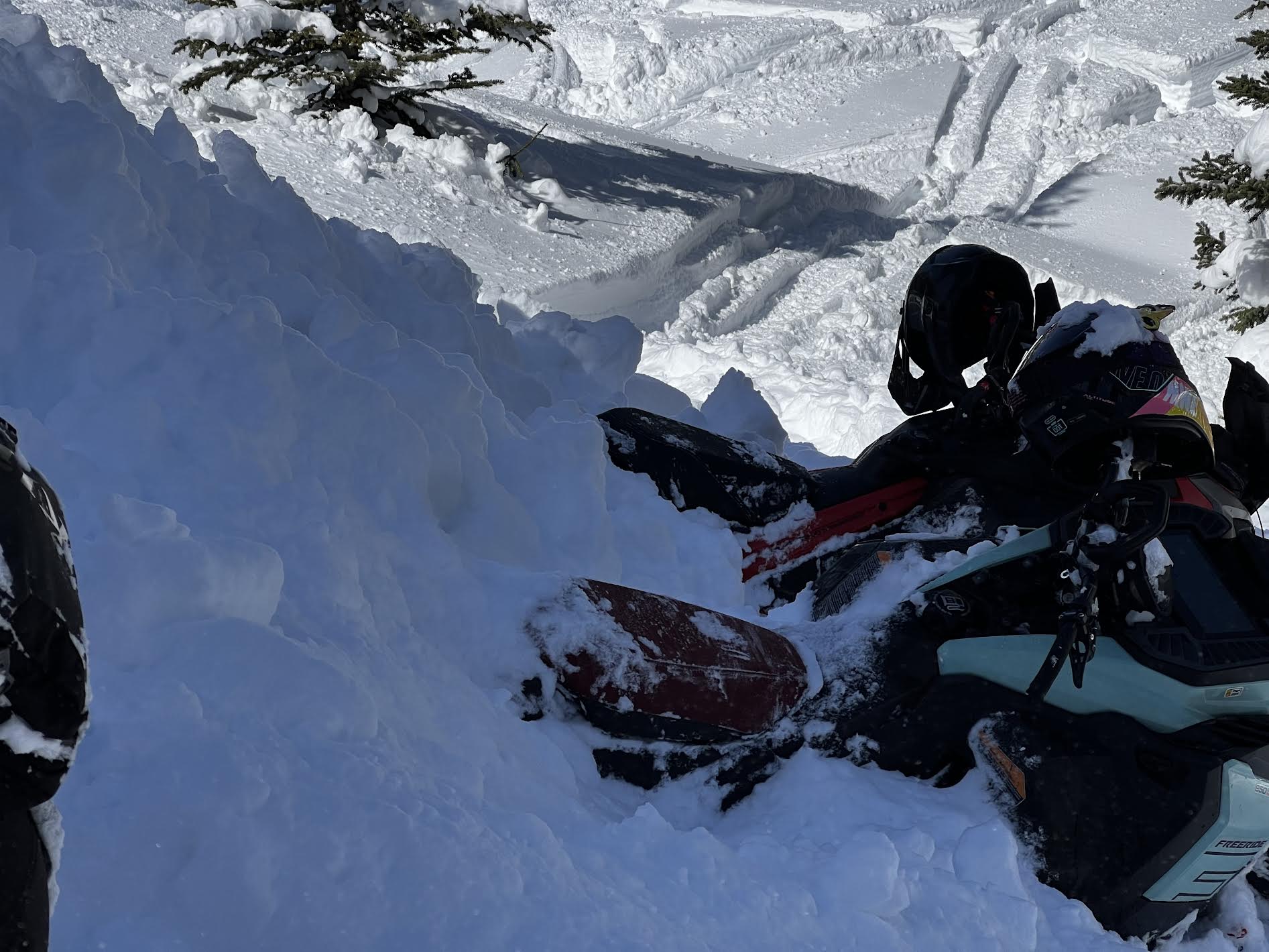
Full Snow Observation ReportFrom email: "One of my crew was partially buried in an avalanche today(head about 1’ down, leg and arm still above snow) at approximately 13:10 hrs. Slope was greater than 35 degrees, crown approximately 85 yards wide, over 3’ at its thickest point. I believe it was a NE exposure with wind loading at the top. I had a bad feeling about this slope and mentioned it to my crew and avoided riding on it until one rider ran out of gas and I had to help him. Upon completion of task, I rode back to a spot that wasn’t as safe a vantage point as what I had previously stayed at, but the intention was we were all on our way out. So I parked and within 30 seconds, I hear my friend yelling behind me. I turn and immediately think “oh he’s about to hit us”. So, I attempted to start up my sled, to no avail While watching behind me. Suddenly, a massive “snow cloud” appeared about 30 yards above him and it took about 2-4 seconds to register that it was an avalanche and not another rider careening out of control at us. By that time, it was too late to do anything. The avalanche had reached the back of my friend and my sled, pushing us forward about 6 feet at 3-4mph. After it stopped, I assessed 3 of four of our team was accounted for, and one (the one who yelled at us) was not. He was partially buried by the front of the avalanche much like our sleds were. Fortunately, within 5 seconds, I saw an arm and a leg sticking out of the snow and we had his airway and head cleared within about 20 seconds. He was located approximately 10 yards from us. "
Full Snow Observation Report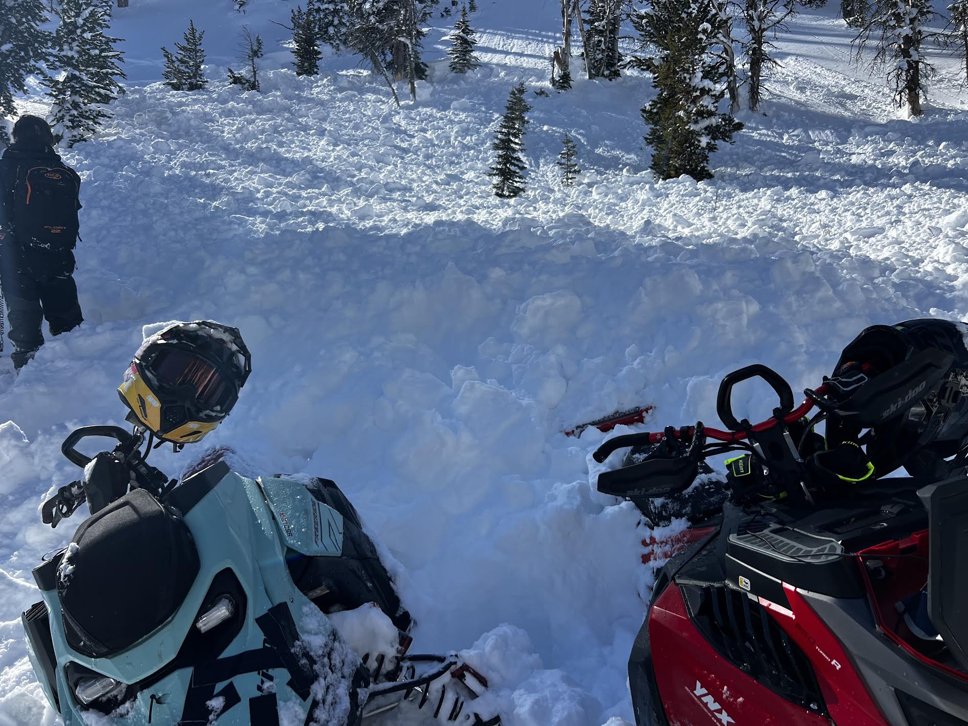
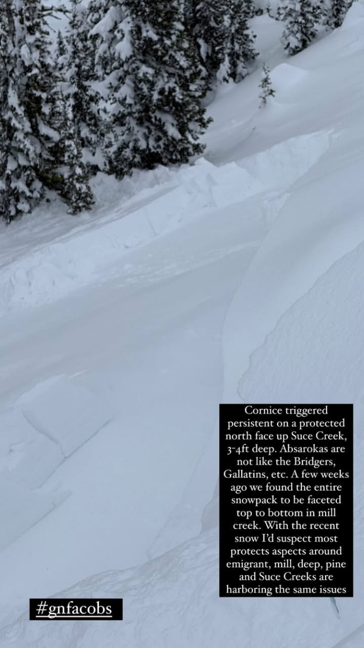
From IG story. "Cornice triggered persistent on a protected north face up Suce Creek. 3-4 ft deep. Absarokas are not like the Bridgers, Gallatins, etc. A few weeks ago we found the entire snowpack to be faceted top to bottom in Mill Creek...."
Full Snow Observation Report