Snow Observations List
Headed up Blackmore Sunday 12/15, late morning, was pleasantly surprised by the amount of new snow. Not sure how much was brand new, but up below the summit seemed like about a foot of fresh. Skinned to the ridge above the east face, plenty of wind at the ridge, dug a out on the east slope just below the ridge a bit north of where most people ski down in snow that was not wind affected. Isolated column test clearly showed a weak bond between new snow and old, decisive ECT-P 5 on the extended column test. Skied the trees out.
Full Snow Observation ReportOn our first column test was CTX and slid on the saw cut, in the video we didn’t get the same result but still very reactive.
During our extended column test we were at 9500ft on a North slope.
ECTN second tap storm slab
ECTN twenty three on ground facets
Full Snow Observation Report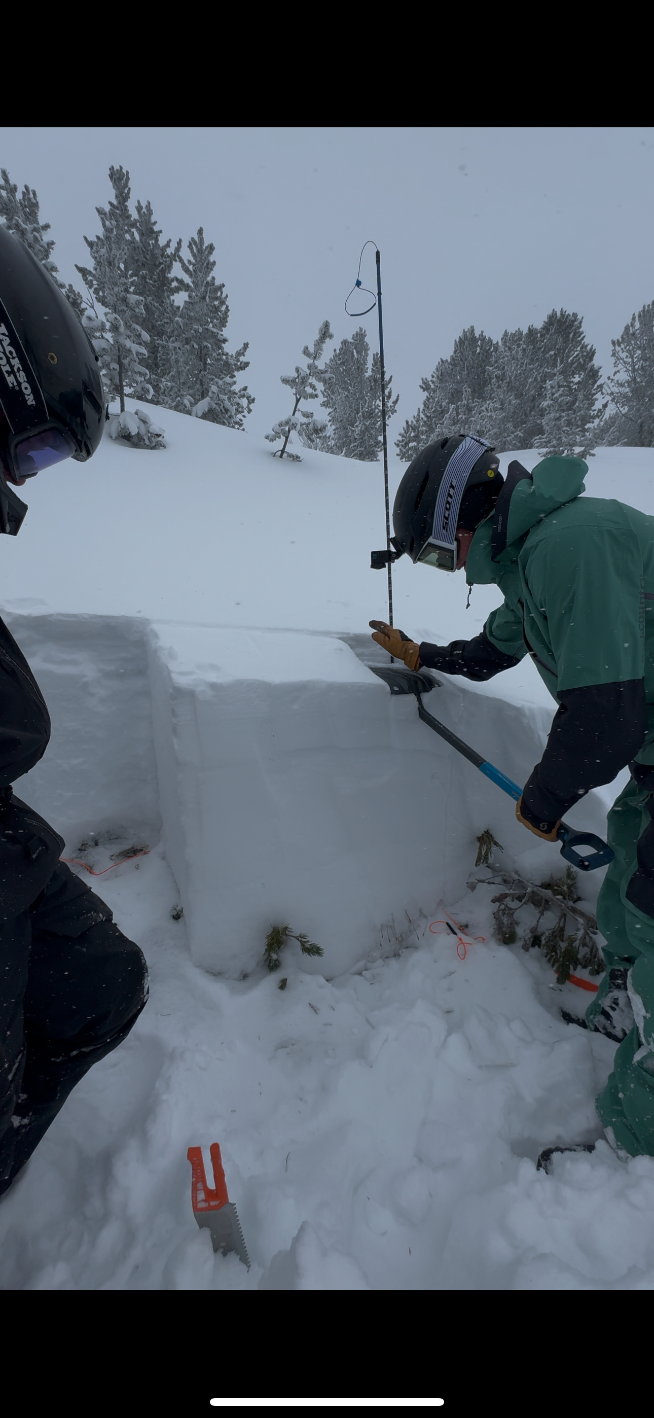
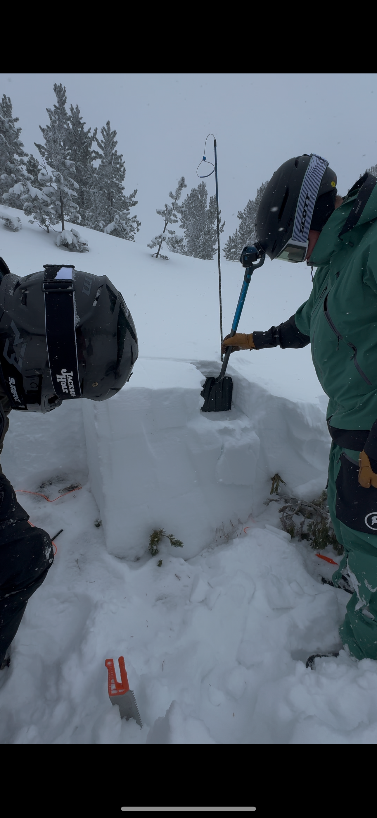
from @brendan_durrum_photo
Full Snow Observation Report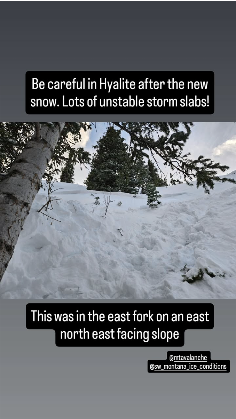
From IG: "Storm slab broke about 200’ above us as skinning up the hallway coming from the north side on the throne."
Full Snow Observation ReportFrom IG… “Please don’t tag me if anything. Thanks”
I observed a large whoomph about 150ft from the ridge (top of glades) going up Blackmore today while breaking trail. was definitely wind loaded area… I could feel the energy in the snowpack today once I got up higher, super sensitive it seems. ECTN 14 in my pit I dug lower down the meadow with no wind slab prevalent.
Full Snow Observation ReportFrom IG
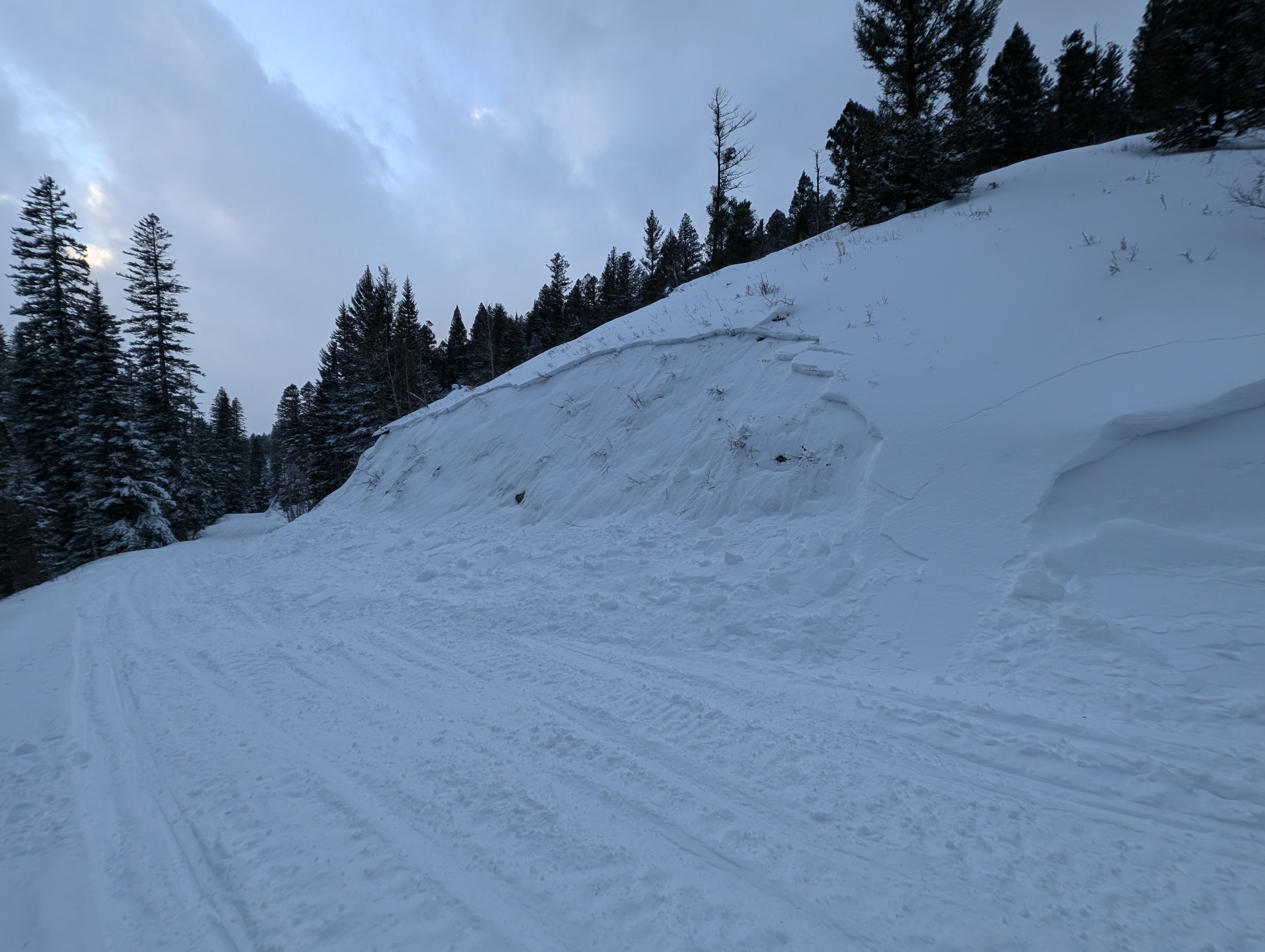
Small windslab triggered on approach for inspection. Failure interface had 5 mm Surface Hoar. Soft slab, remote propagation onto the adjacent slope. Debris covered about half of the road bed.
Full Snow Observation Report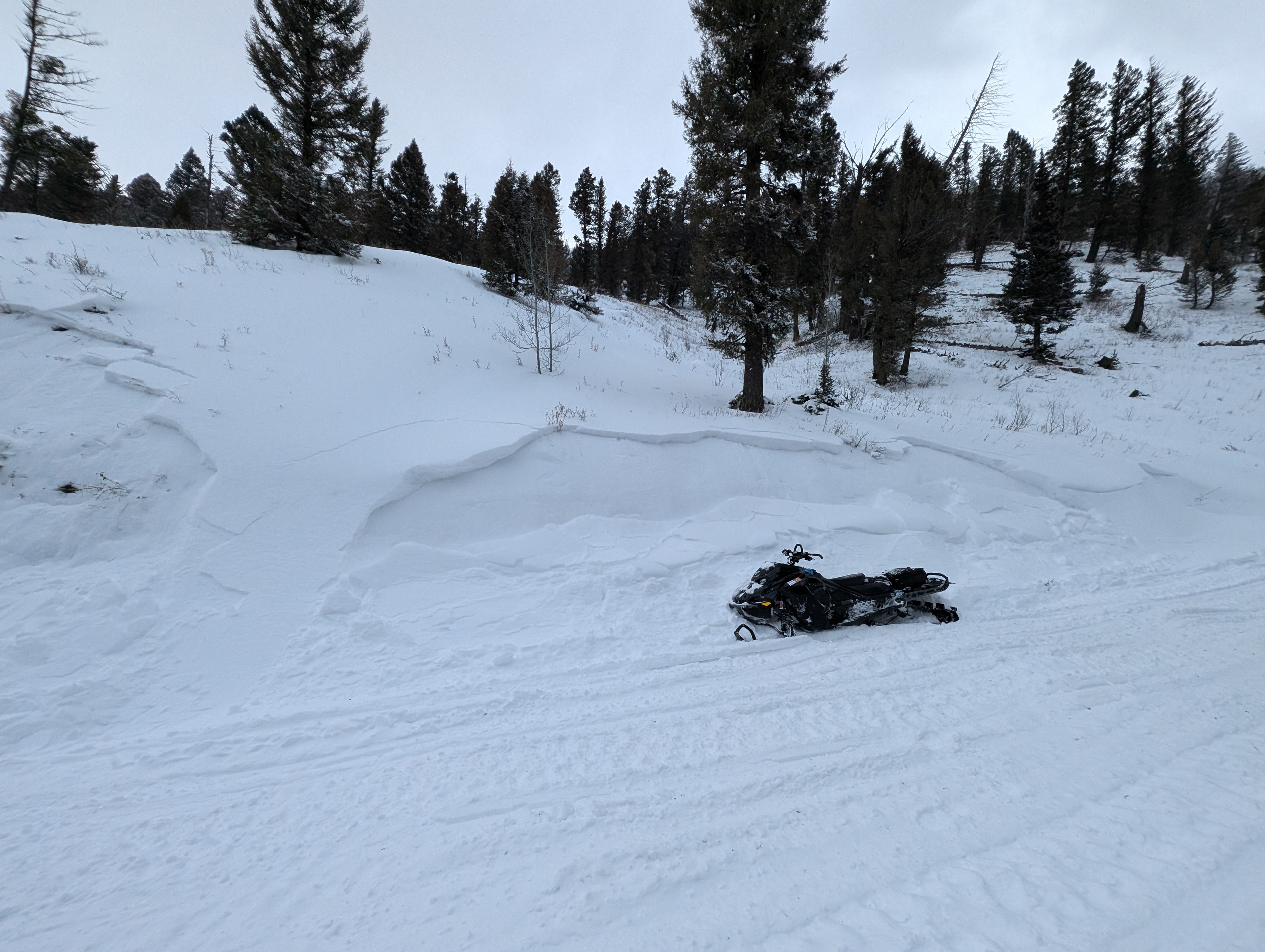
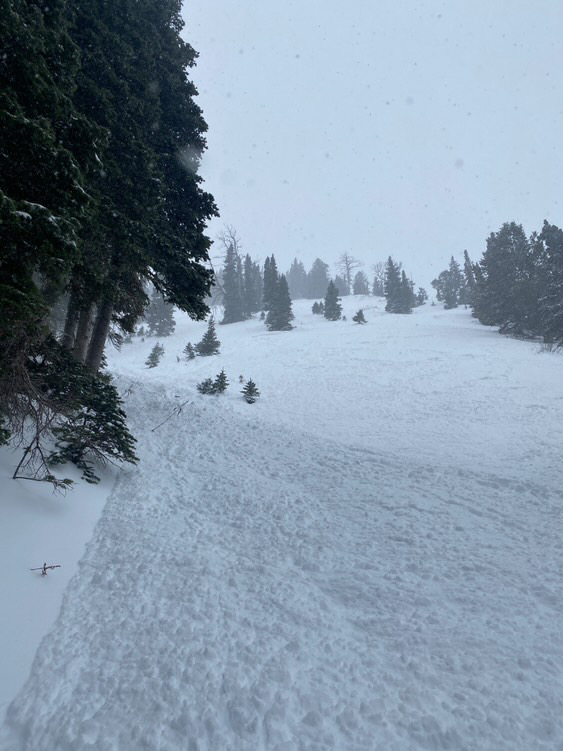
Sunday morning 12/15 we were skiing just Southwest of Henderson Mountain between the road cuts. The first skier in our party remotely triggered this slide from a slightly lower angle aspect about 50 ft to the skiers left of the slide where the snowpack was shallower. It broke on a convex rollover about 100 ft wide and ran about 80 ft. downslope. The crown averaged 30 inches and broke on sugary facets about 18 inches from the ground. No one was caught.
Full Snow Observation Report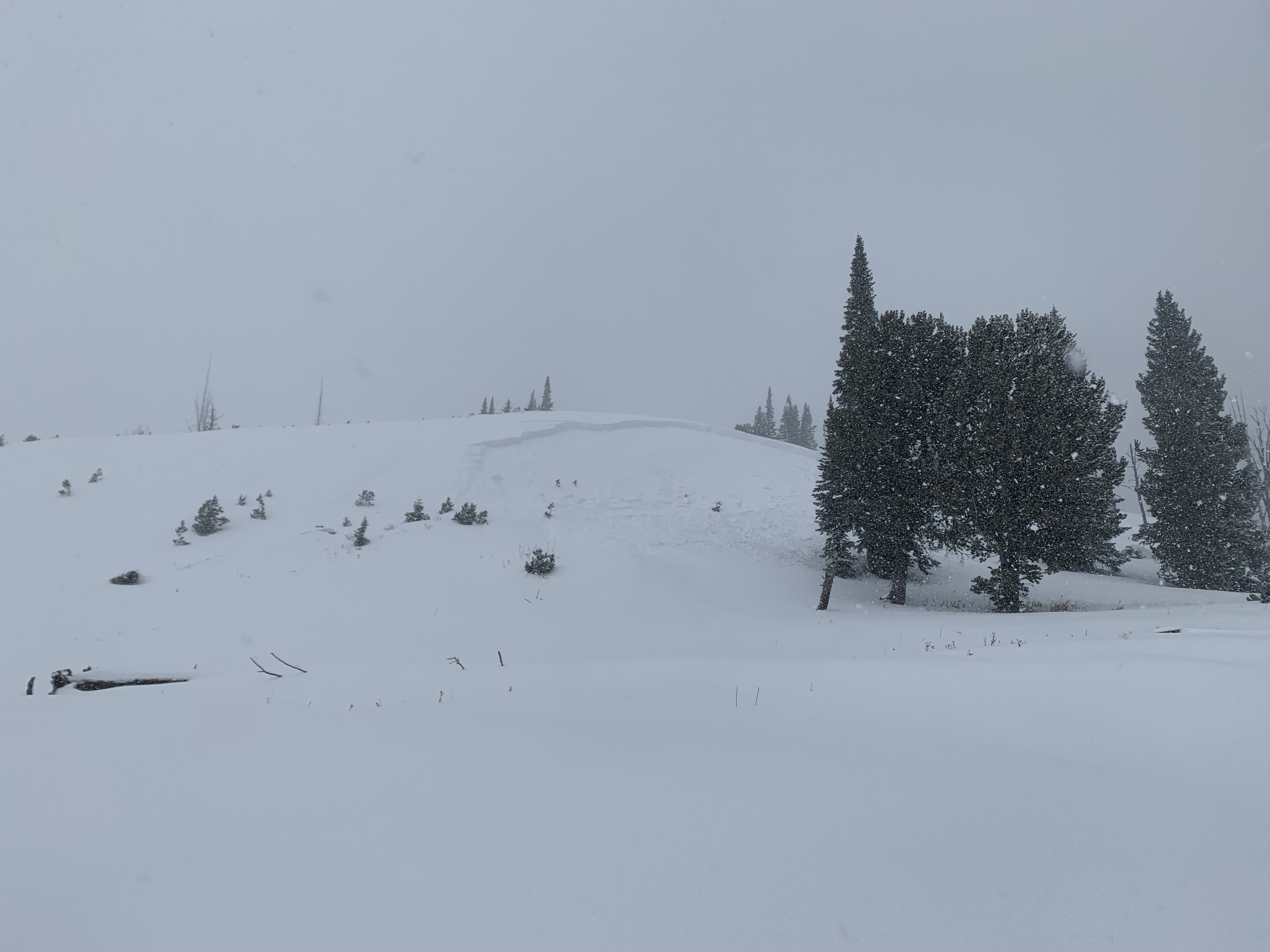
Skied into middle basin from Beehive this morning and found 8-12 inches of unconsolidated snow on top of a sun crust. While skinning back up to the Beehive/Middle ridge we remotely triggered 12 inches of storm snow on a SE facing gully from 15 ft away, the crown was ~50 ft long. ~8,200 ft.
Winds increased throughout the morning, actively loading E aspects.
Full Snow Observation Report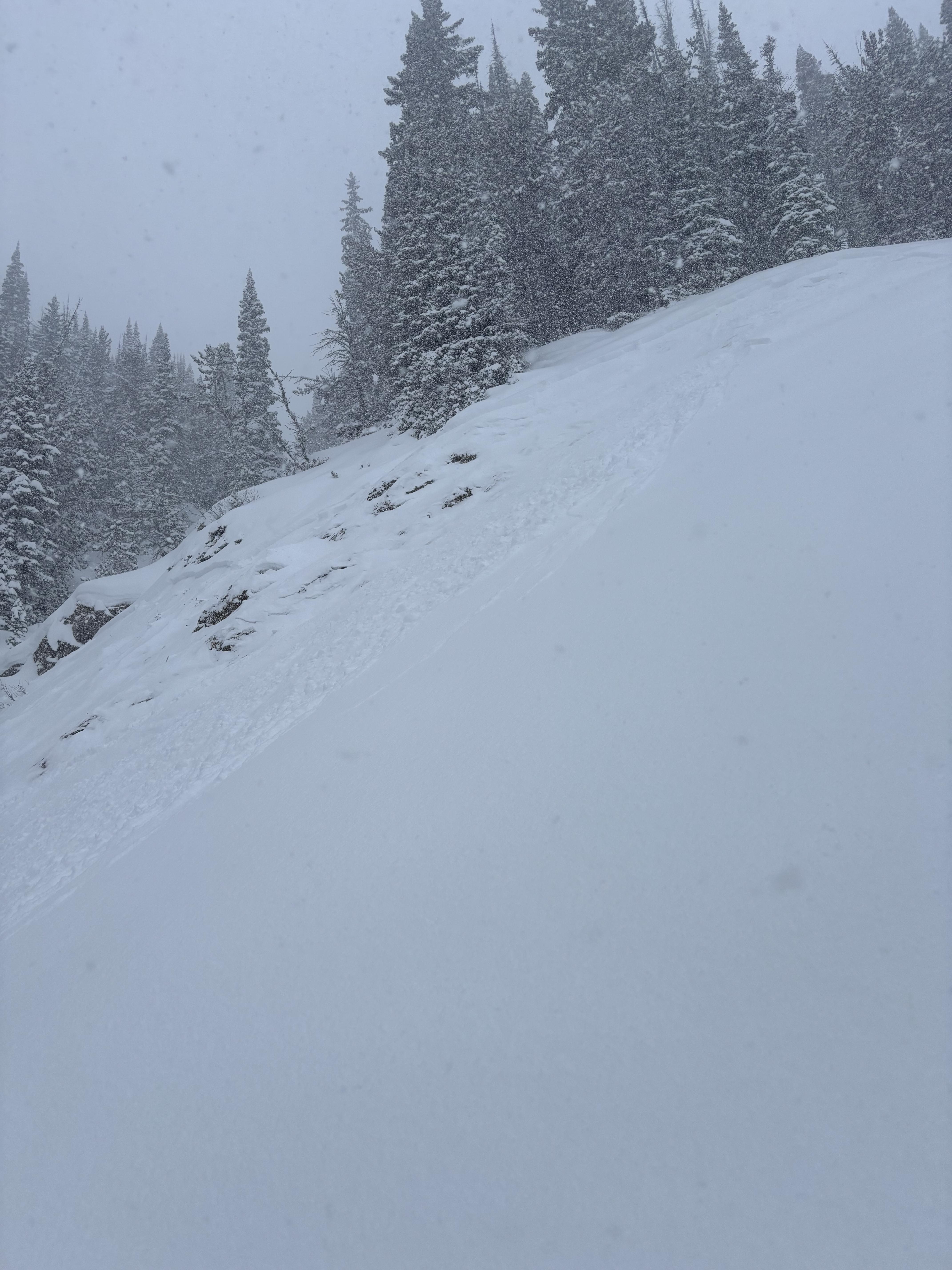
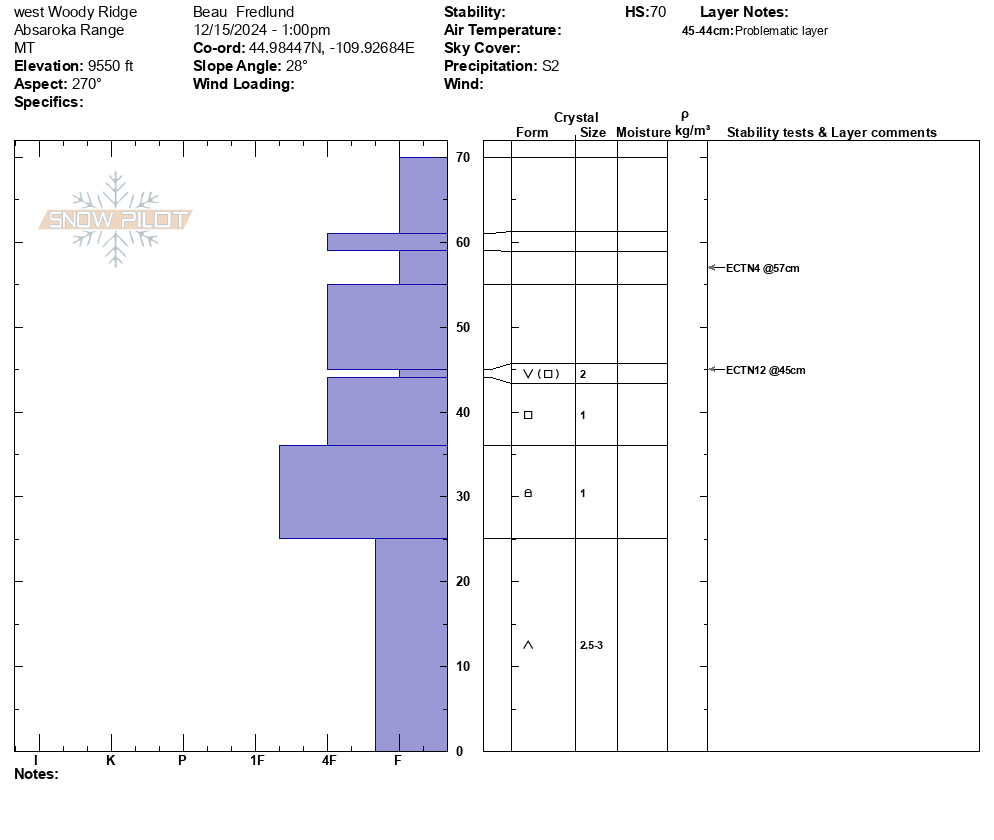
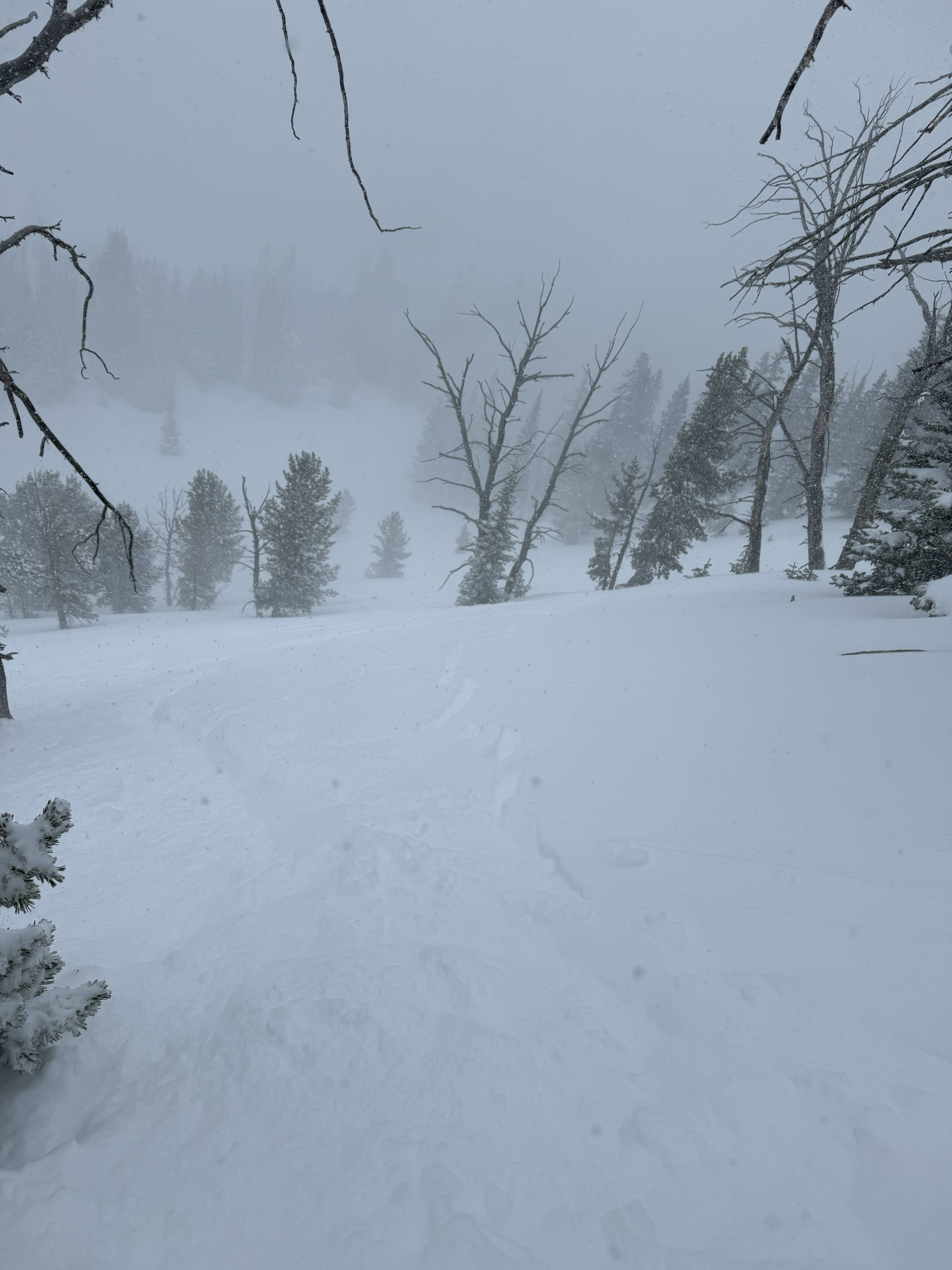
We skied east and west aspects of Woody Ridge today. It was snowing most of the day, with periods of heavy snowfall, which accumulated to about 4-5" of fresh throughout the day.
We found buried surface hoar in 3 different snowpits, on east and west aspects, between 9300-9700'. In each place the SH was buried under about 25cms of new snow, and I would describe it as somewhat irregular/ inconsistent, and mixed with some other faceted snow types. The SH crystals were generally about 2mm in size.
In our snowpit (file attached) at 9550', west aspect, HS 70, we had an ECTN12 at 45cms. (on that surface hoar layer).
No collapsing, no cracking. No avalanche activity observed (low vis).
One additional note was that slopes exposed to the SW wind had a thin rime crust that appears to have formed last night. The ridgeline was also noticeably rimed. In areas this rime crust was up to 1cm thick and 1F hardness. We were not finding this rime crust on leeward or sheltered slopes.
Full Snow Observation Report
We rode into Buck Ridge on December 15. It was snowing and the wind was whipping up the snow that had already fallen, so visibility was limited. We rode in to the top of First and Second Yellowmule to get a closer look. The total snow depth (where it isn't stripped down by the wind) varied from 20 inches to a little over three feet. There was 6" of new snow. Similar to other areas, new snow is falling on near-surface facets. In wind-sheltered areas, there is insufficient slab to result in widespread instability, and the critical ingredient is wind-loading. We got ECTNs 5-14 on the weak layer buried 6-8" deep with no deeper failures.
I am always nervous during periods of incremental loading because we will eventually hit the breaking point. I'm avoiding wind-loaded slopes and testing the upper 2 feet of the snowpack to assess for instability before considering steeper terrain.
Full Snow Observation ReportMODERATE felt appropriate. I am concerned about the incremental loading we will see in the next few days. Eventually, it will start to break. With another 0.5" SWE in the next 24 hours, I would bump to straight CONSIDERABLE.

About 6 inches of new snow at the trailhead around 9am. While touring to the ridge between beehive and middle basin we found strong wings actively loading east facing slopes. While moving north across the ridge, small test slopes showed cracking but no cohesive wind slabs yet. When skiing into middle basin, I stopped at the top of a convex roller and had cracks shooting out 50 feet in either direction from what seemed to be a soft slab in the new snow that slid about a foot or so. This was the most major sign of instability from the day. Lots of shooting cracks when skiing and skinning in the new snow. Throughout the day found anywhere from 8-15 inches of new snow, with the larger totals on wind loaded slopes.
Full Snow Observation Report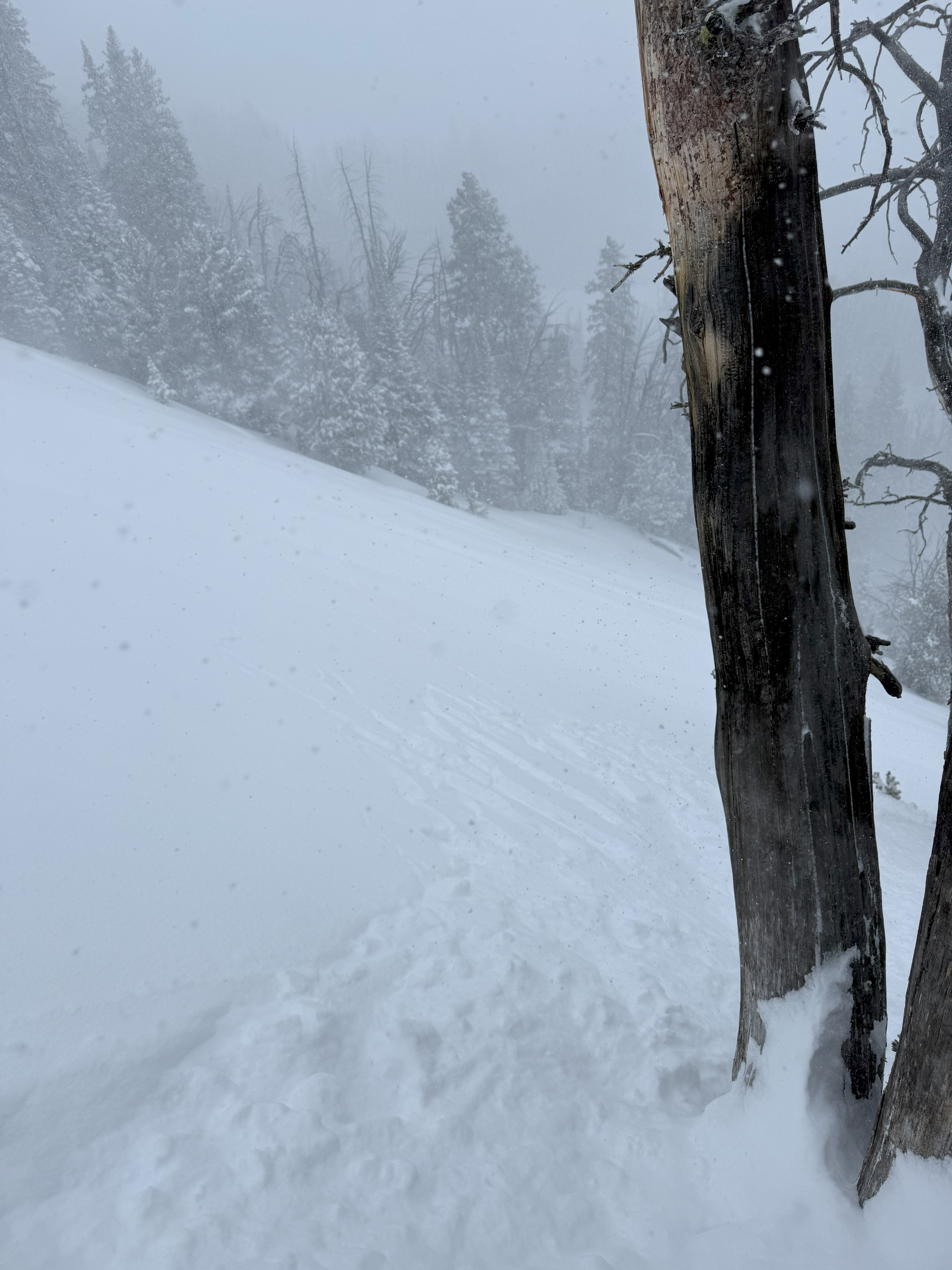
From obs: "It slid 10' or so."
Full Snow Observation Report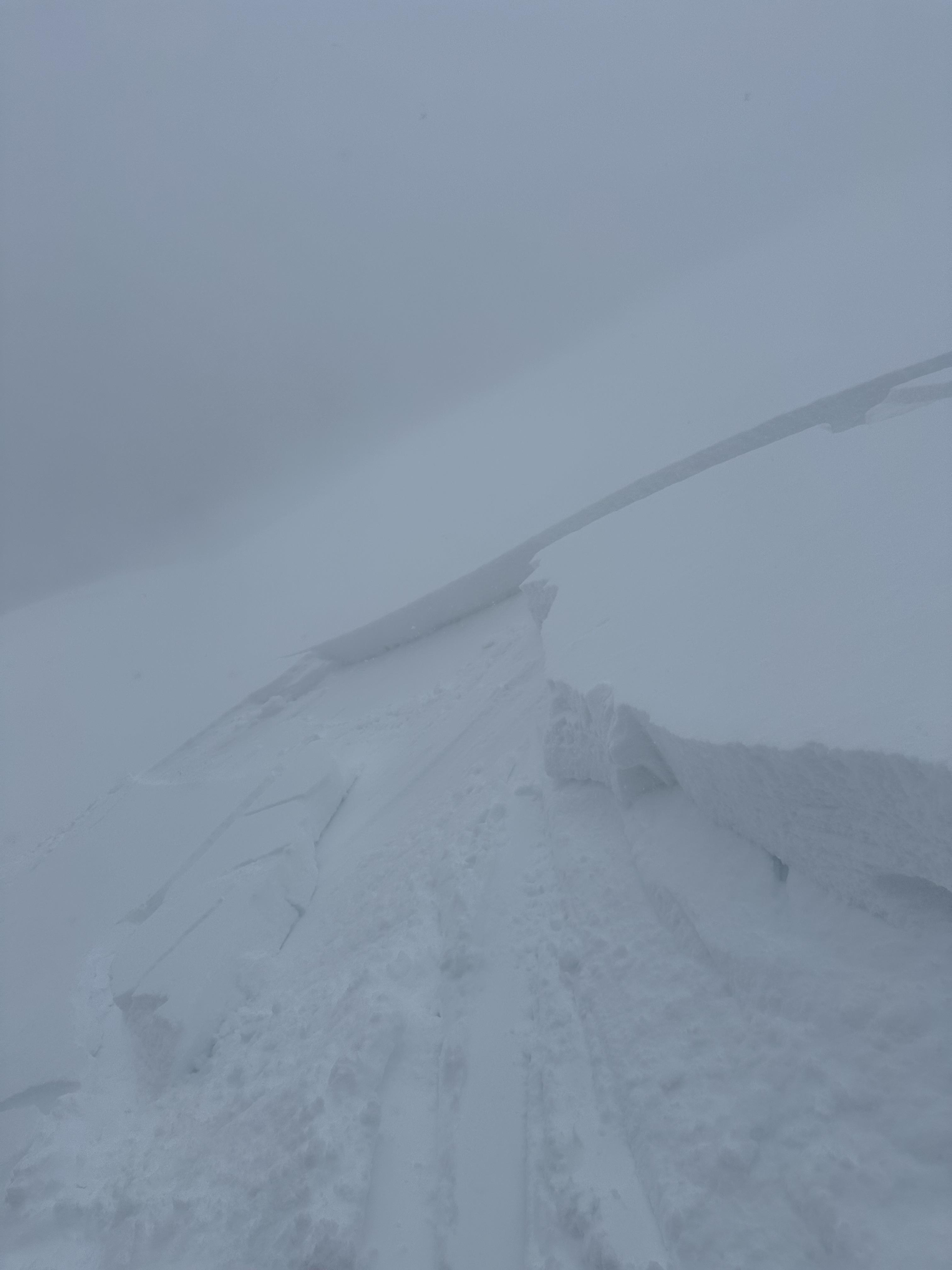
Hey Guys,
Brent and I got the public Avalanche Beacon Park installed today. It's located in the Old Airport area just off the Two Top trail, here in West Yellowstone. The 8 beacons are all buried. We could use some more snow to help cover them a little more, hopefully the next few days will provide that and we'll be off and rolling.
Thanks guys,
Jim Norlander
Full Snow Observation ReportDug a pit at 8650ft on a SE facing slope just a few miles west of Cooke City. ECTP15. Failed and propagated on facets underneath the most recent storm snow about 20cm down, didn't feel like a wind slab but presumably was partially wind loaded from the winds the past few days. Pretty much the entire snowpack under this recent layer is facets separated by crusts, with varying levels of crystal thickness, ranging from larger near the ground to finer higher up. HS 65cm.
Full Snow Observation Report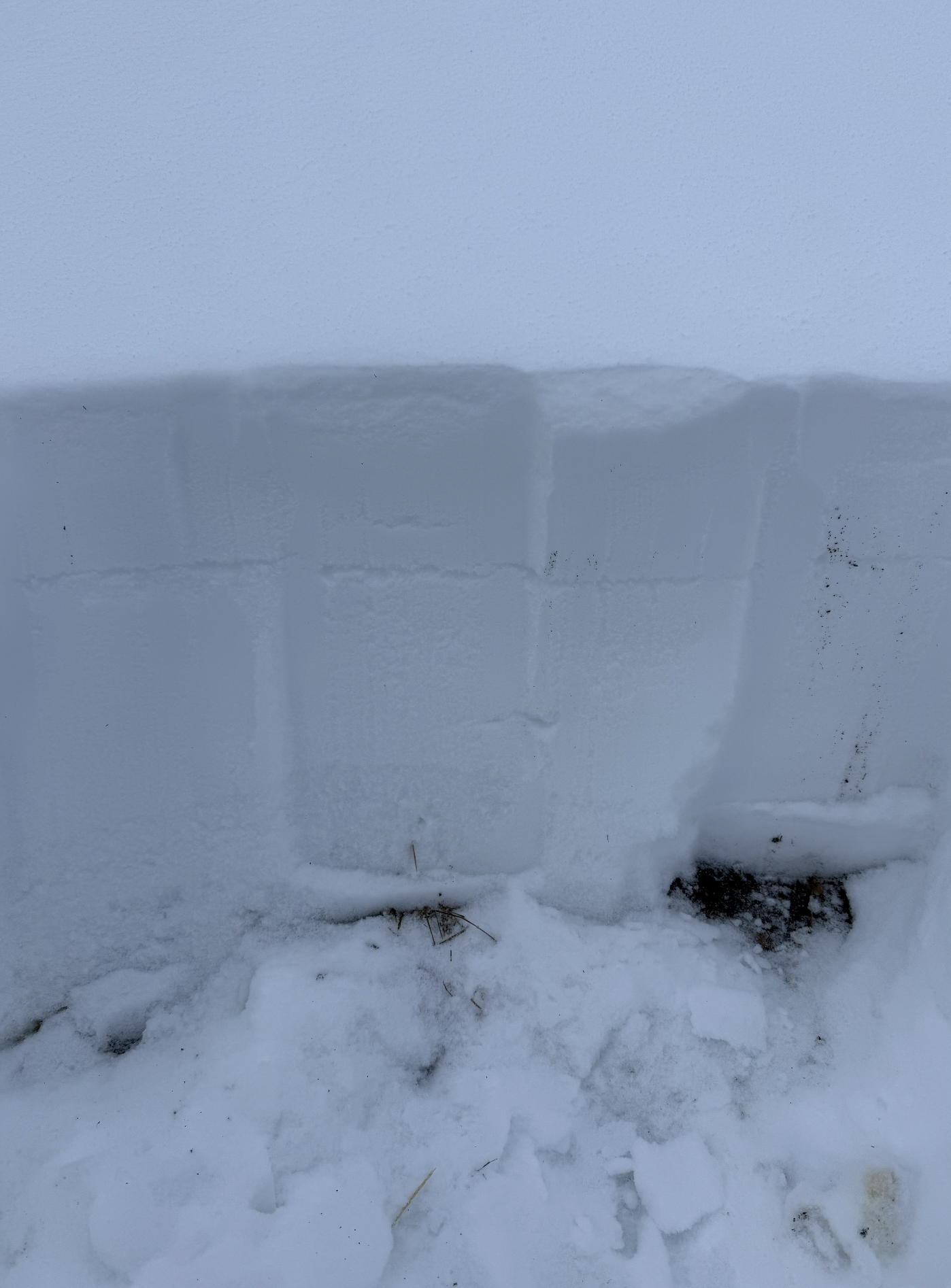

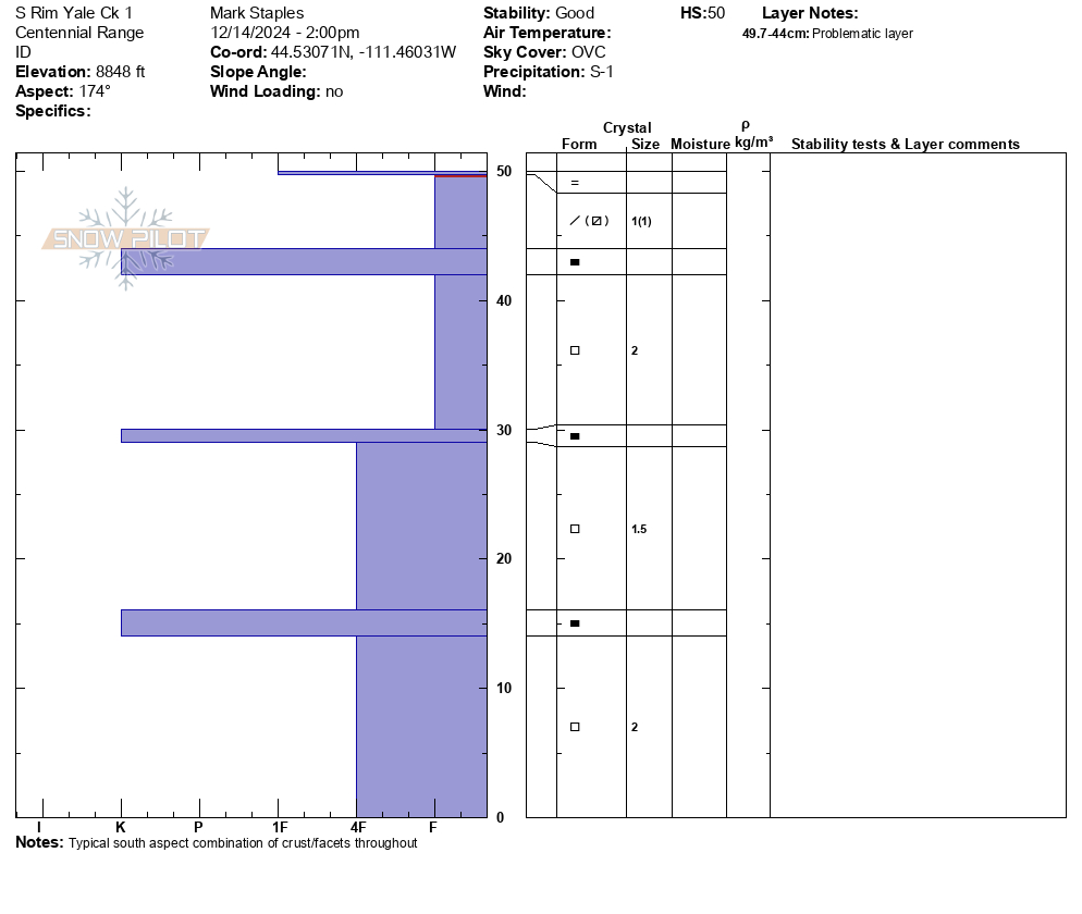
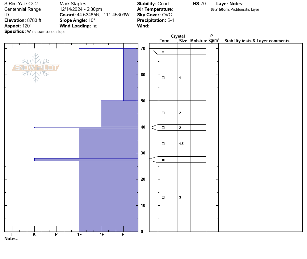
We rode into Yale Creek just south of Sawtell peak in the Centennials. Thin snowpack that is mostly faceted. There was a slight rain/mist the night before and again in the afternoon with warm air moving into the area ahead of the approaching storm. The rain/mist created a zipper crust on top of the snowpack.
The snow under that zipper crust is faceted and weak. It will be the primary weak layer once a slab forms on top.
Full Snow Observation Report
It's pretty rugged getting up to Yale Creek without using the maintenance road. Dropping into Yale is pretty rough but the Ride crew brought a chain saw to remove a log that is always in the way.

Toured into Flanders today with the goal of skiing the E bowl/SE glades. Winds on the way in were nearly non existent at lower elevations. As we gained elevation, winds increased significantly, but the snow in the E bowl where we skied was largely unaffected aside from a very thin wind skin. Snow on adjacent ridges was clearly being blown. Some good jumps on a small wind loaded test roll yielded no results and a quick hand pit showed a slab that was fairly well bonded to the layers below. The hand pit slab fractured within the old snow on a layer of small facets. Some ski pole probing in many locations showed a relatively consistent snowpack in terms of hardness, but the lower snowpack is certainly of the faceted variety.
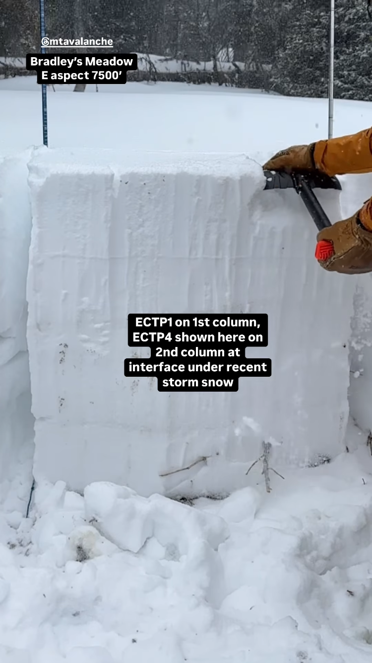
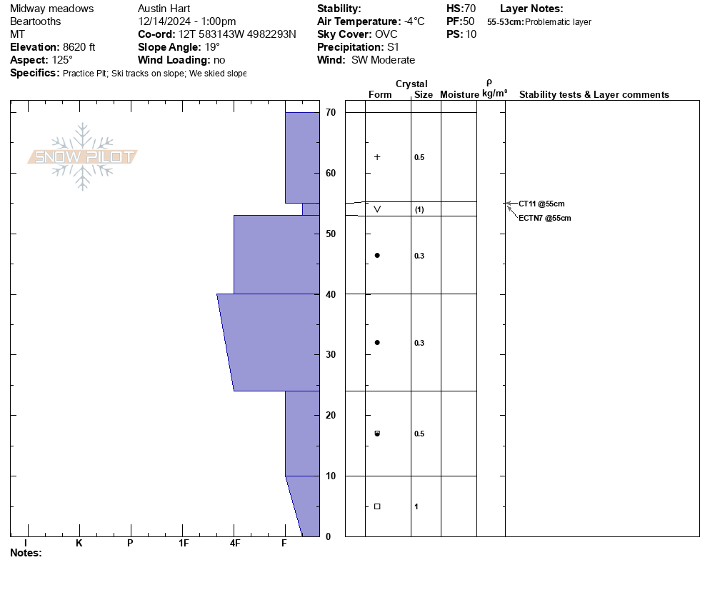
Full Snow Observation ReportToured up to Midway meadows, observed no cracking or collapsing. We found no propagation in our ECT at 8600' on a E aspect with HS 70cm. Found preserved buried surface hoar approximately 15-20cms below the snow surface. Low tide in tree exit, but fun skiing!
Full Snow Observation Report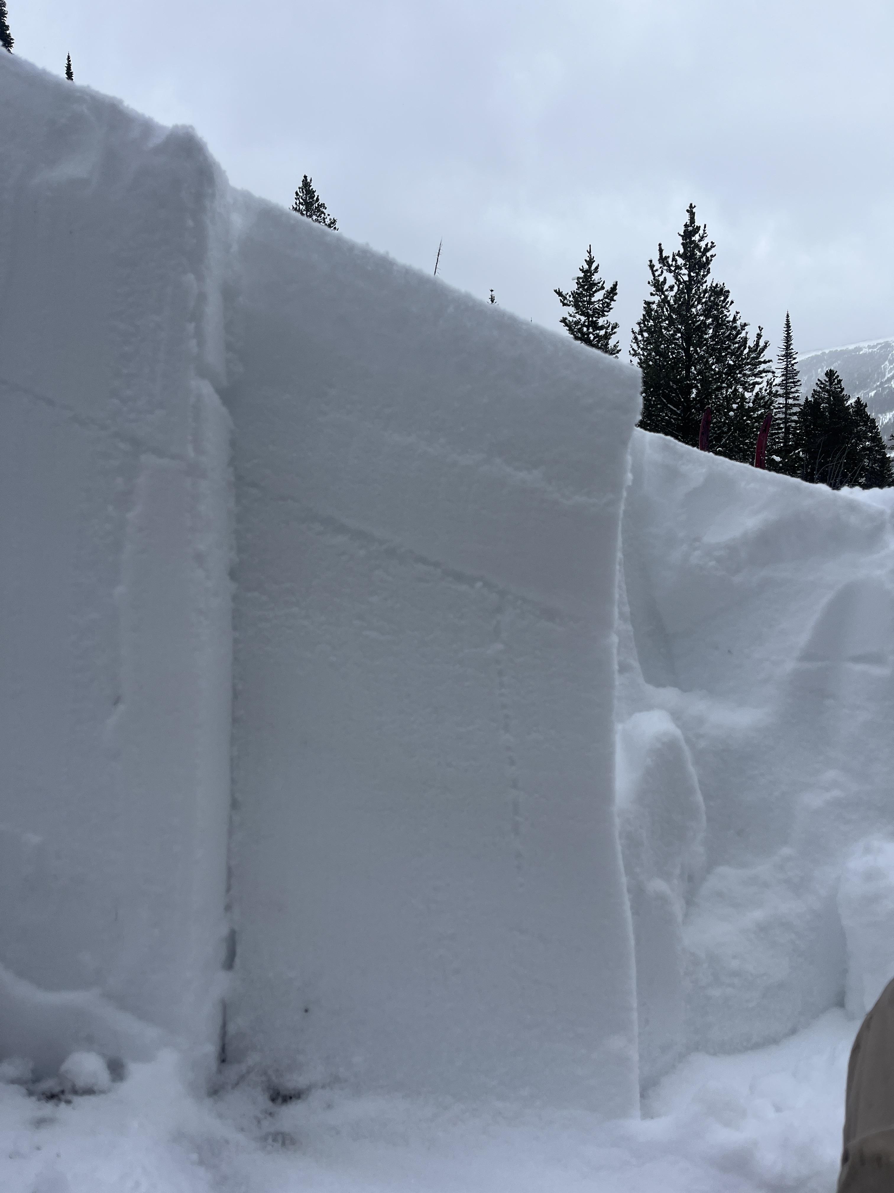
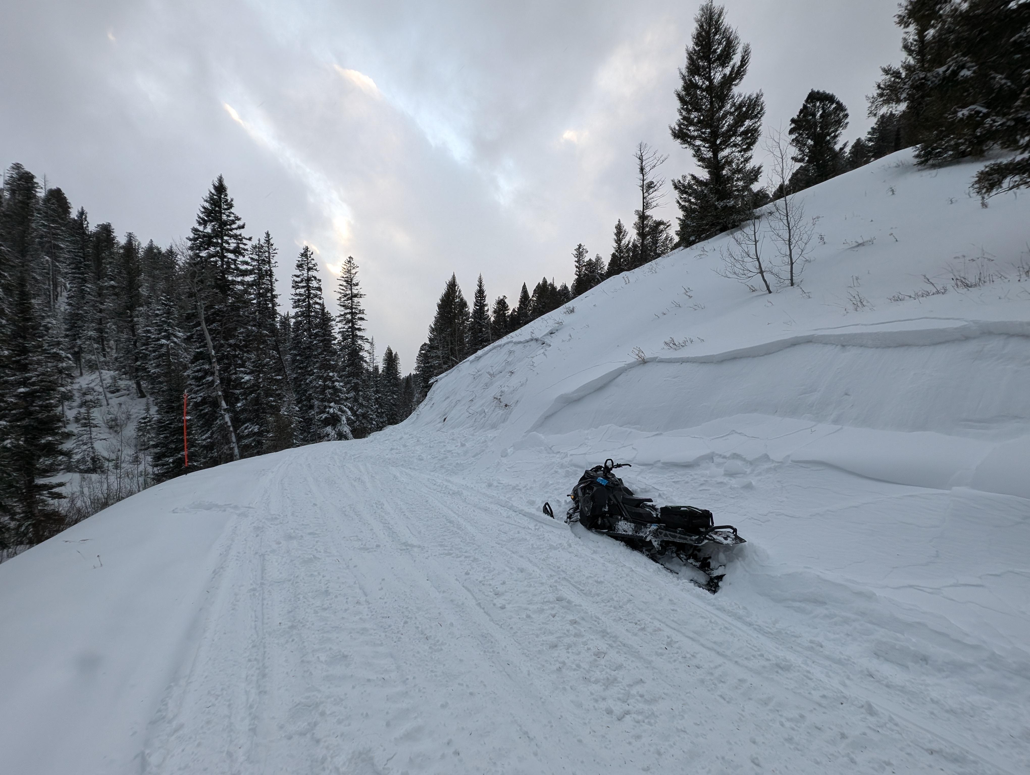
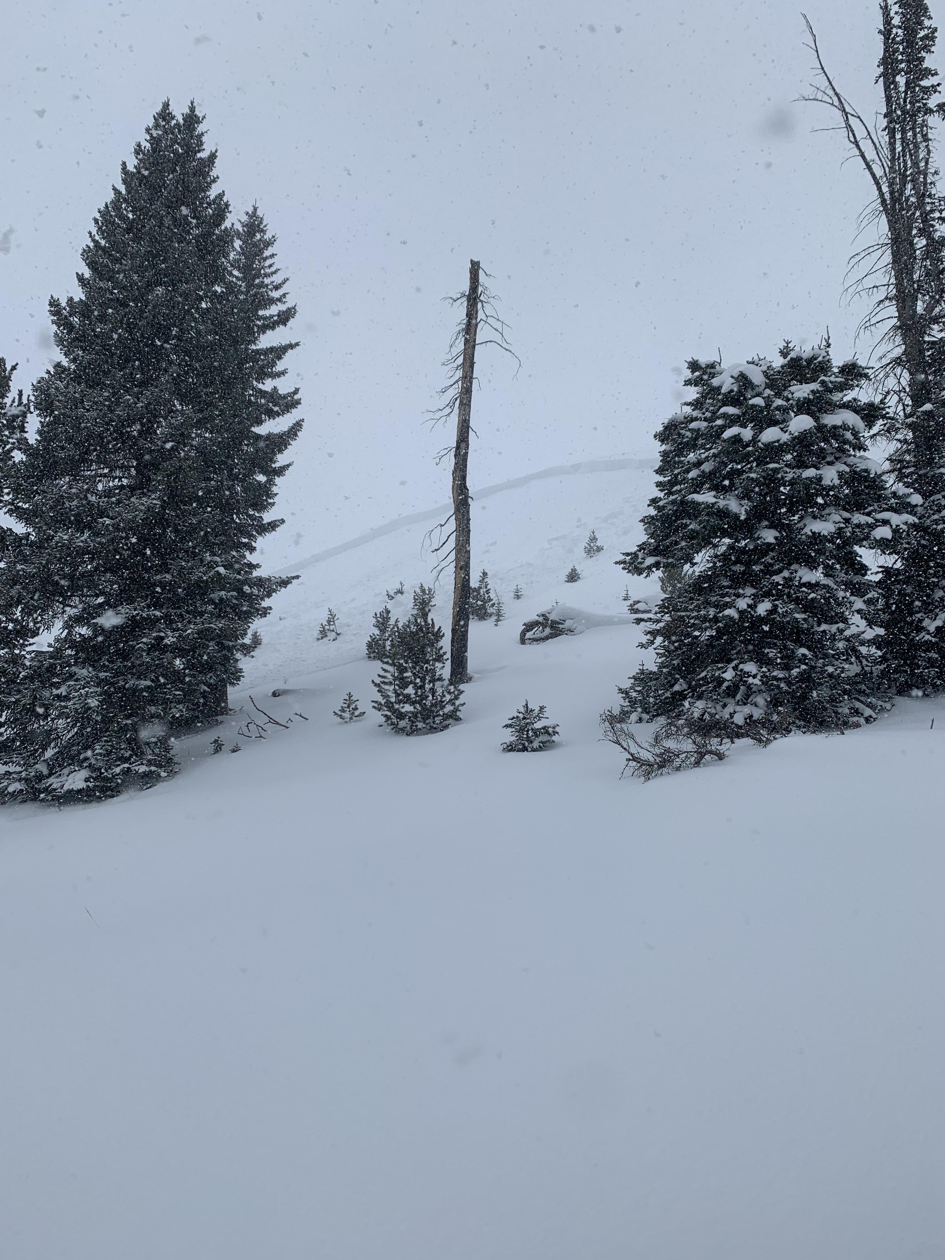
Gusty winds transporting snow in Taylor Fork on Saturday. Triggered a 4-5 inch deep wind slab that propagated about 50 ft at the top of a north east facing slope at 9,500 ft.
Full Snow Observation Report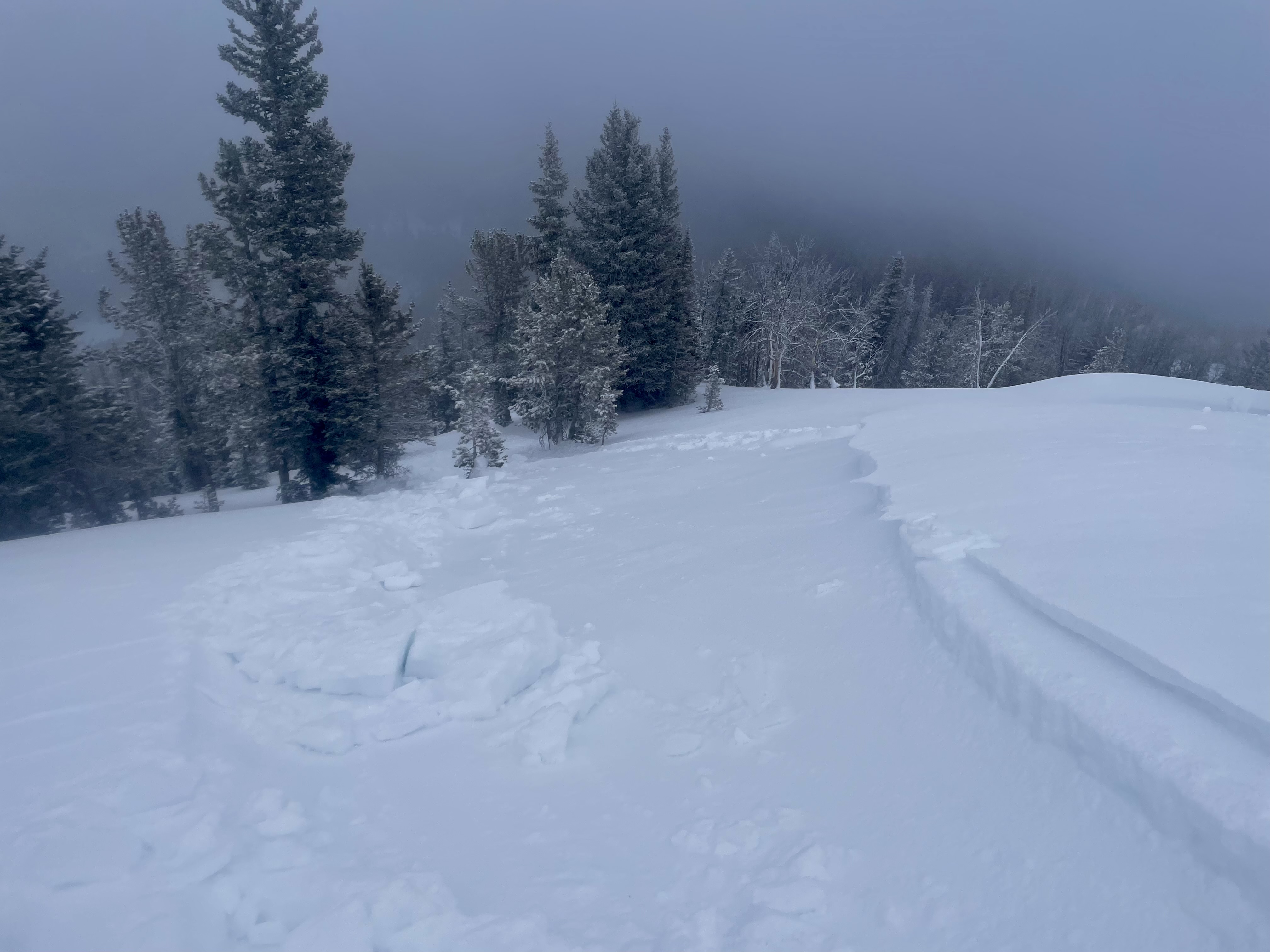
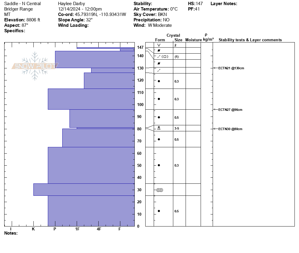
We toured up Saddle Peak from Schlasman's today, for the first time this season, to get our bearings on how the snowpack in this area is shaping up. We skied down Skyline ridge from the summit and saw evidence of previous wind loading. Small cornices exist at the ridge crest and the snow surface off the ridge was rippled by wind. Though it has been several days since the last storm, strong winds have been present all week, and many wind slabs sit on weak snow. Thus, skiing down, we steered clear of wind slabs on steep slopes, especially with the high consequence terrain with large cliffs and trees below us.
We dug a snowpit on an E aspect at 9070'. We found a 1' thick hard slab sitting on a foundation of faceted snow. We got an ECTP13 on an interface between this slab and a melt-freeze crust. We dug another snowpit at 8800', again on an E aspect; here we found a deeper and stronger snowpack.
Overall, we found quite variable snowpack depths and weak layer distribution. Currently, there is not widespread instability outside of recently developed wind slabs. Areas with a shallower snowpack (1-3 feet deep) had a consistent layer of faceted snow. Generally, these weak layers are not advanced, but we will continue to watch this snowpack setup once it is loaded with the weight of new snow.
Full Snow Observation Report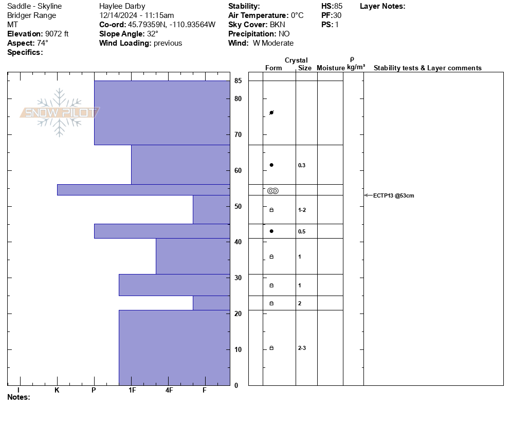
