Snow Observations List
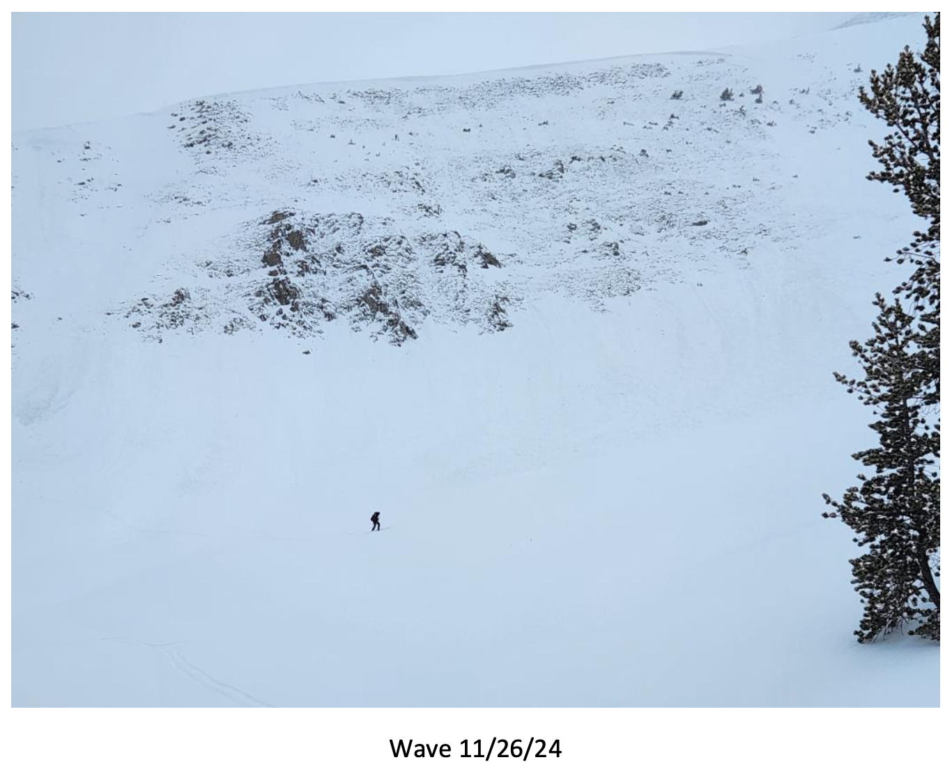
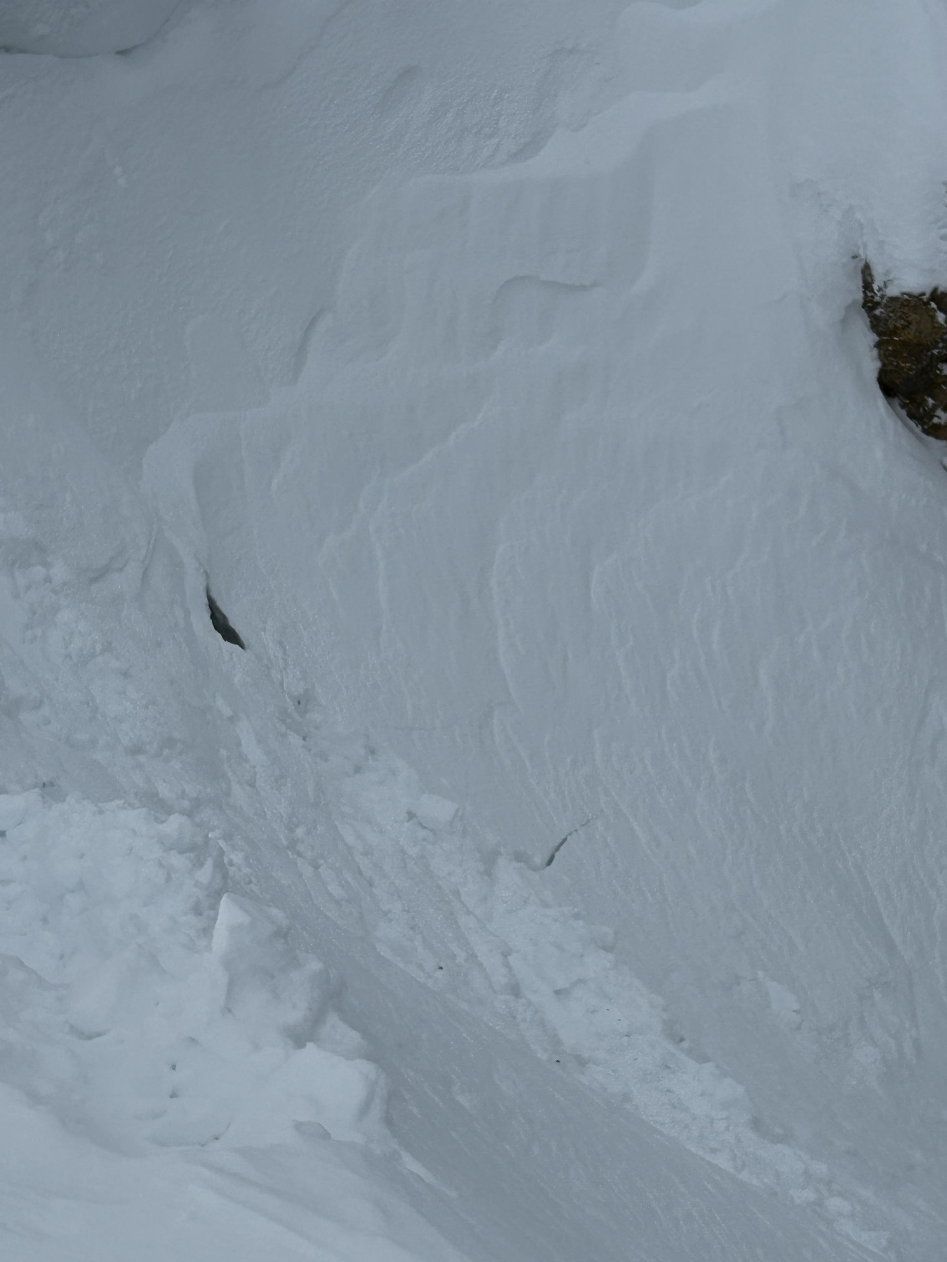
Big Sky Ski Patrol triggered this avalanche during mitigation work in The Wave on 11/26/24... "2-3' deep on an ice crust just above the ground with a 2# shot in the Upper rodeo. Volume was limited as most of the snow was loaded just underneath the cornice, but still produced a sizeable size 2... Other paths in the Lenin region ran meaty wind slabs, full track with no significant step downs." Photo: BSSP
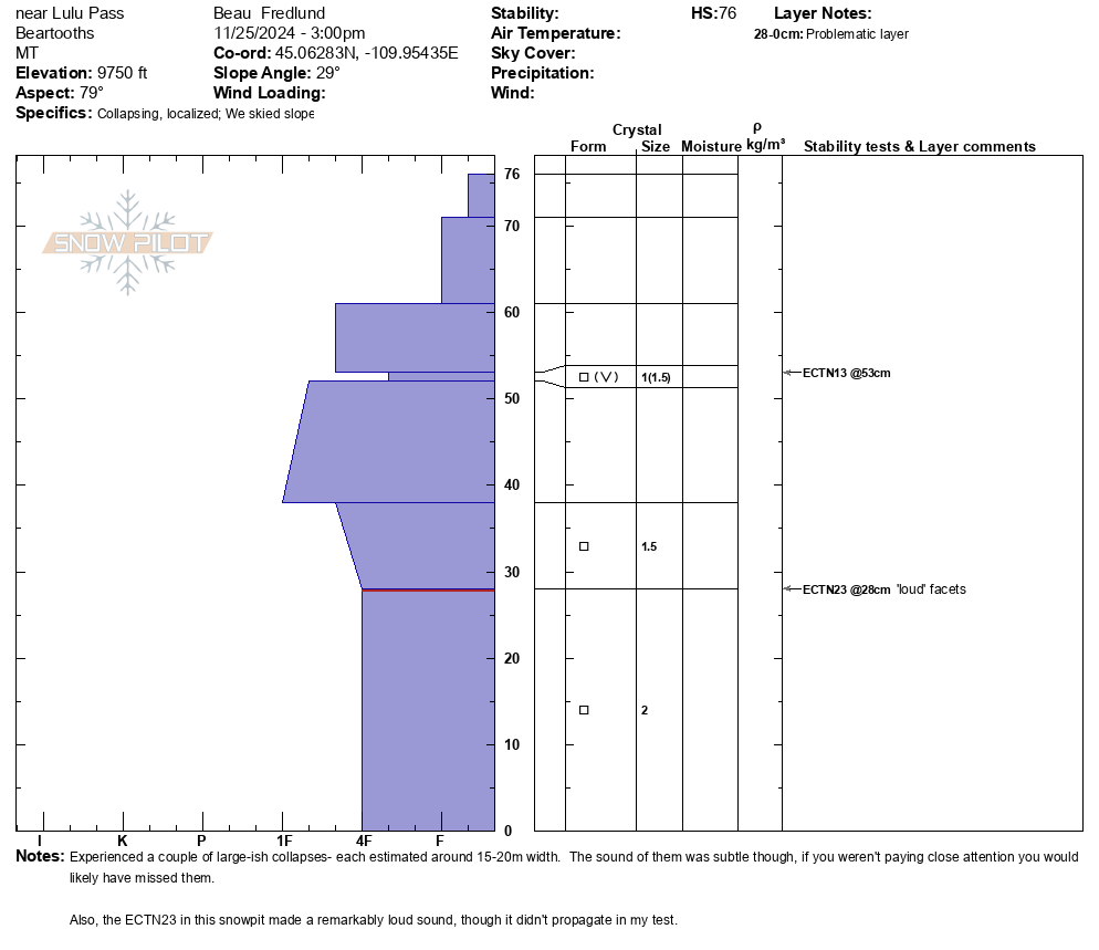
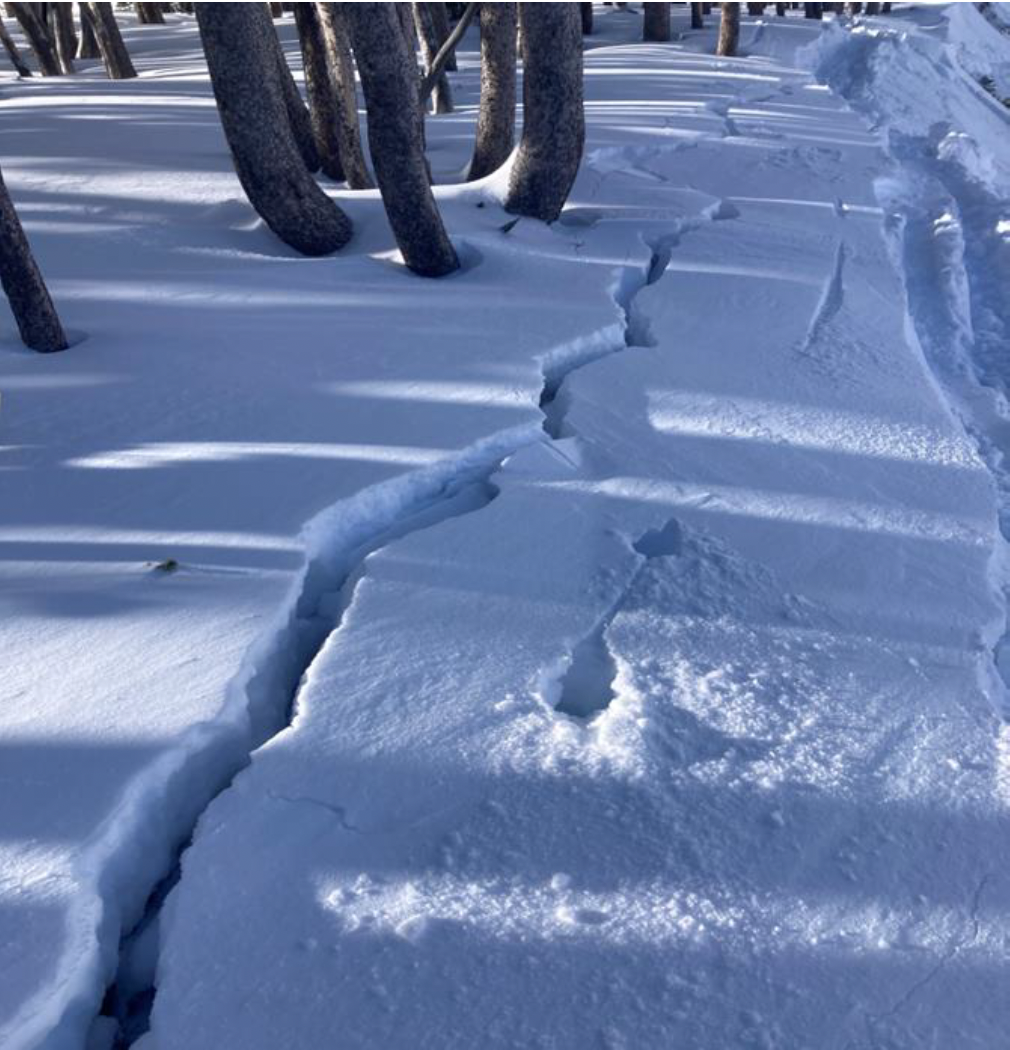
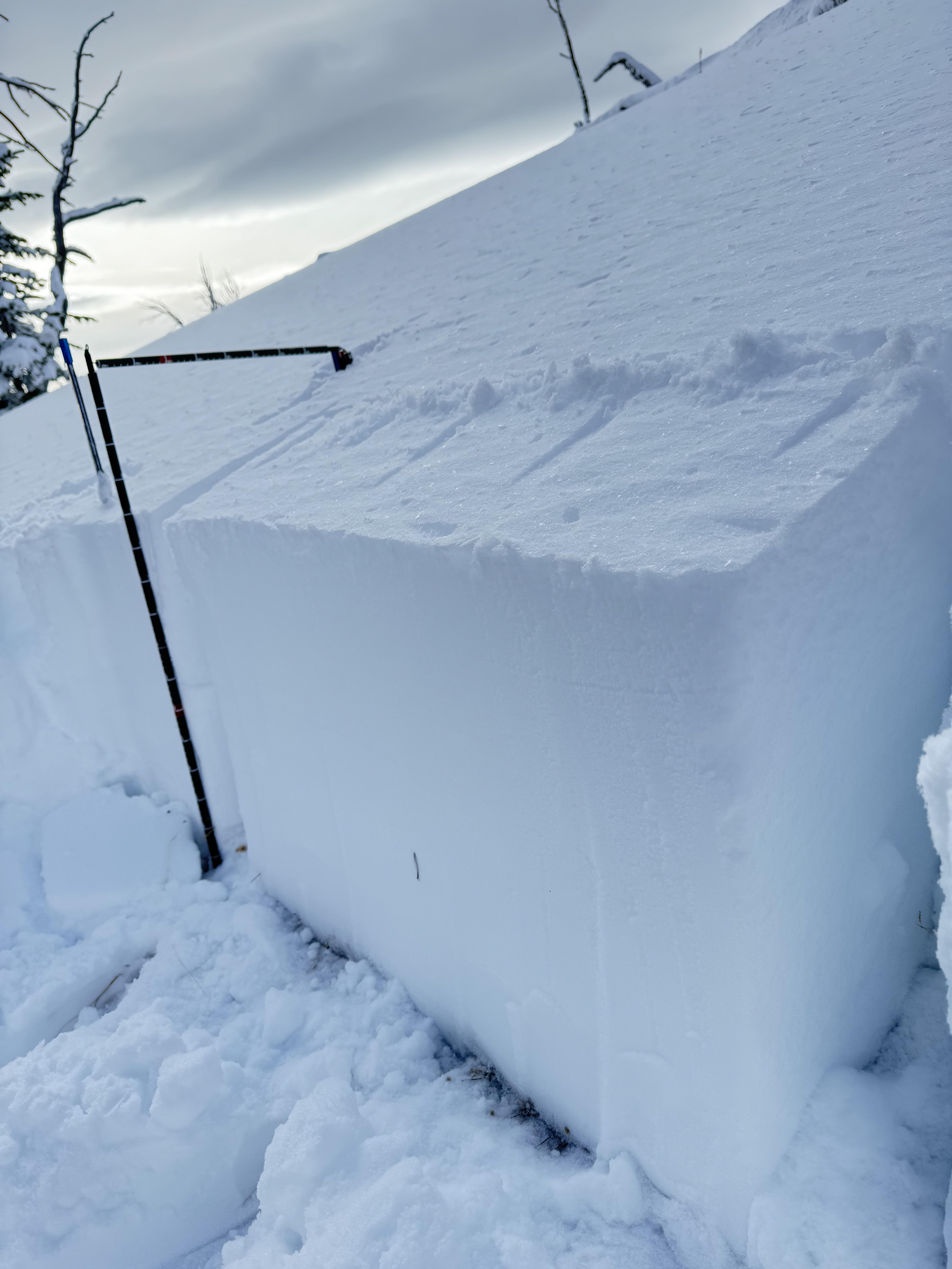
Full Snow Observation ReportSnowpit from near Lulu Pass attached. Localized collapsing on E, NE aspects between 9300- 9900', and no avalanche activity to report.
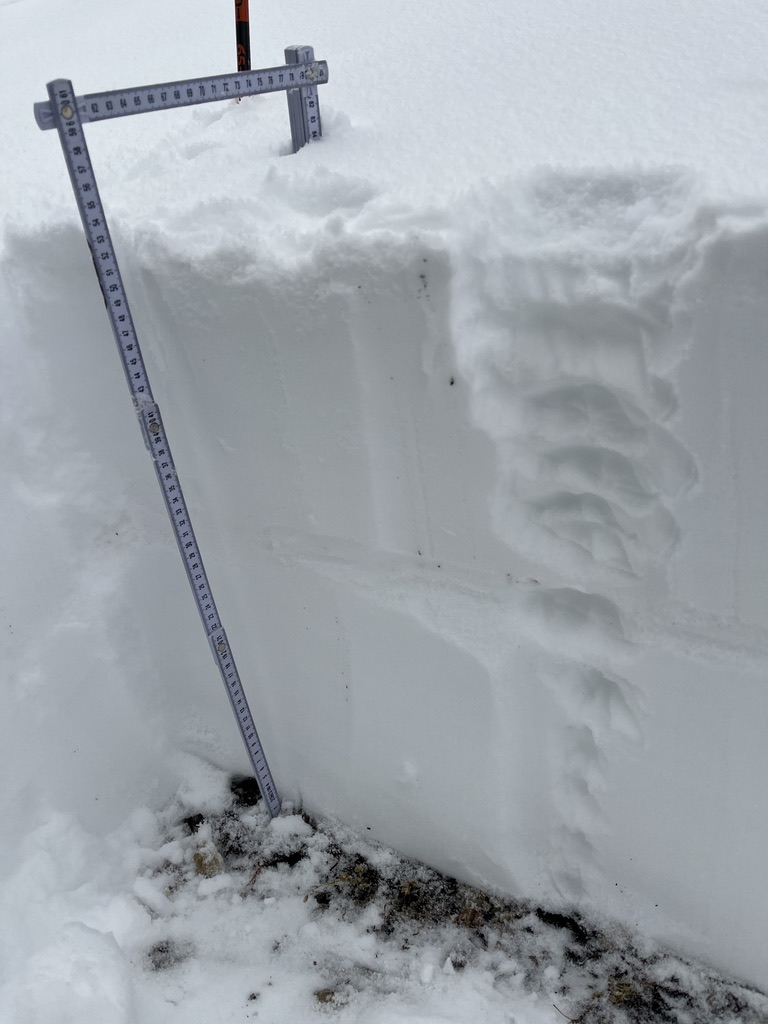
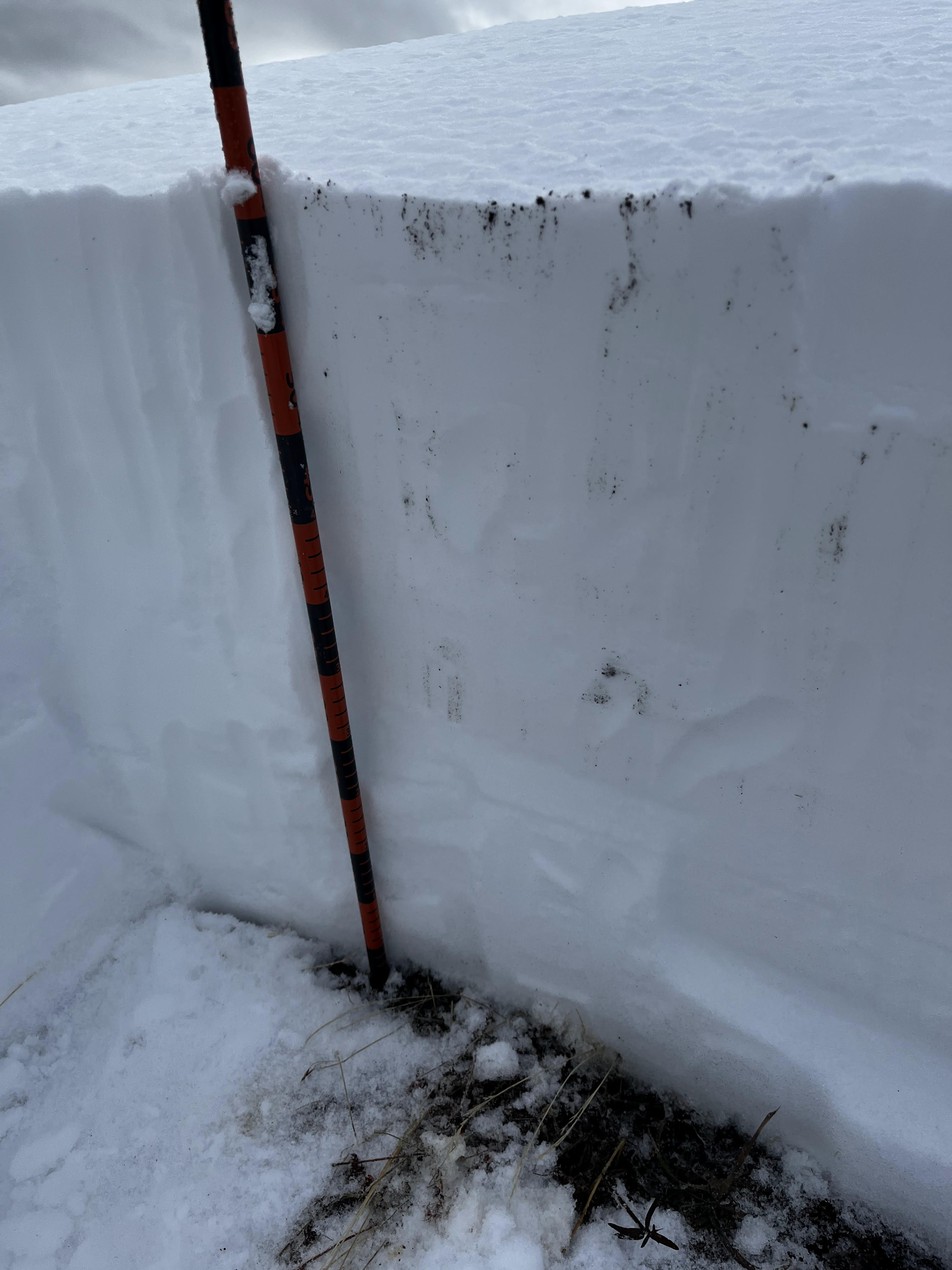
Full Snow Observation Report80 cm of snowpack on the lower ramp. Stable test results. Small layer of facets sitting on the surface and a small layer of facets under the most recent storm snow buried about 13 cm deep.
Full Snow Observation ReportDriving up Bridger Canyon this morning, we noted several natural avalanches in wind loaded terrain on Saddle Peak, the Football Field, and in Mundy’s Bowl. All The avalanches seems to be a similar wind slab problem. They broke just below the cornice line. From a distance and considering yesterday’s new snow, I would guess a foot deep or so (R2, D2, I)
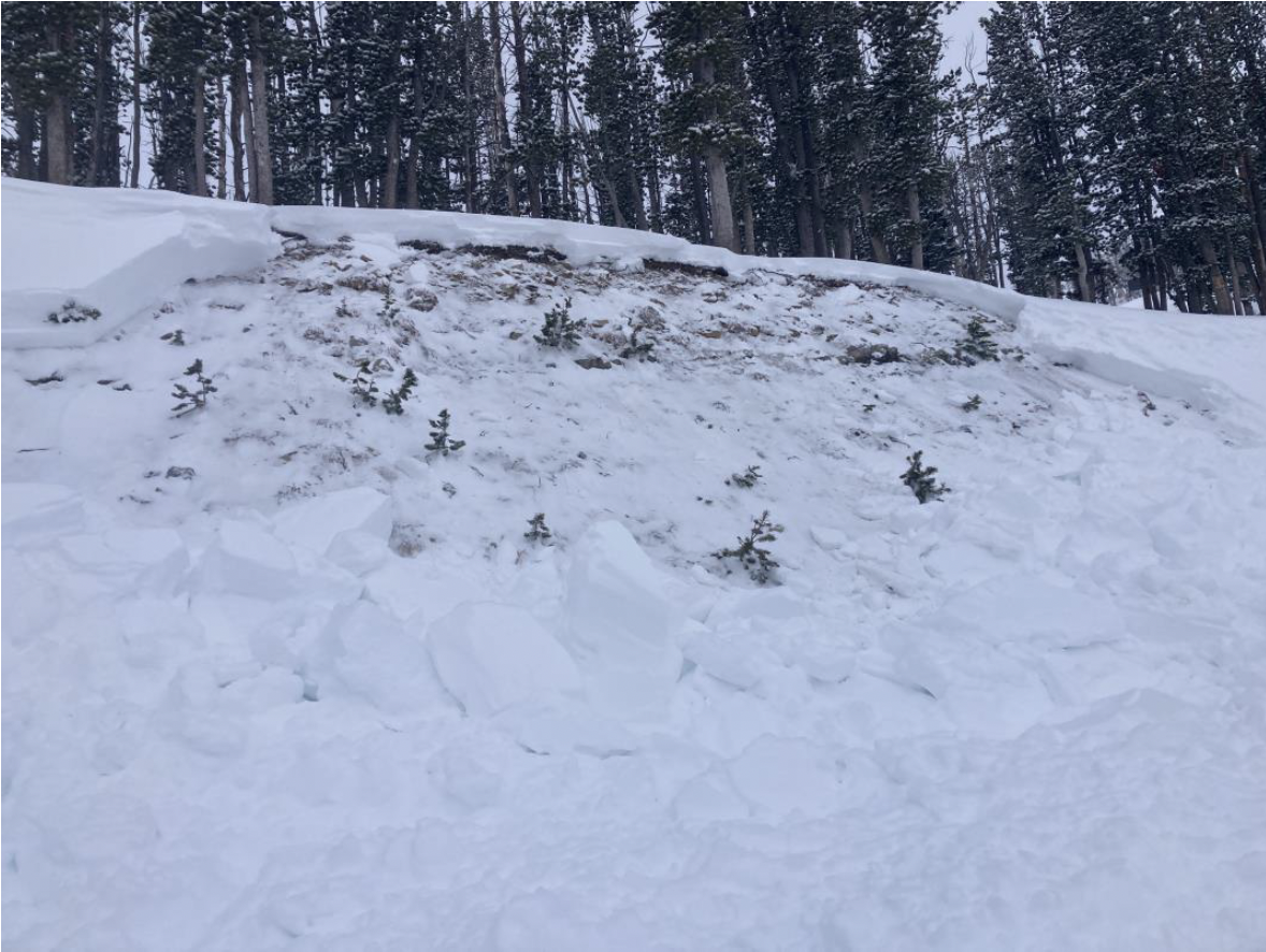
Full Snow Observation ReportFrom email: "Northerly facing terrain harbors October snow, which has faceted. It is holding up plenty of dense snow and wind slab from the quite snowy and windy November. It was unable to hold the additional weight of a human trigger, and two pockets failed at the ground, which produced avalanches. Crown height maxed at 2’. Notably, where it did not avalanche, the failure propagated hundreds of feet down the ridge. It is a good data point- northerly aspects near tree line have potential instability."
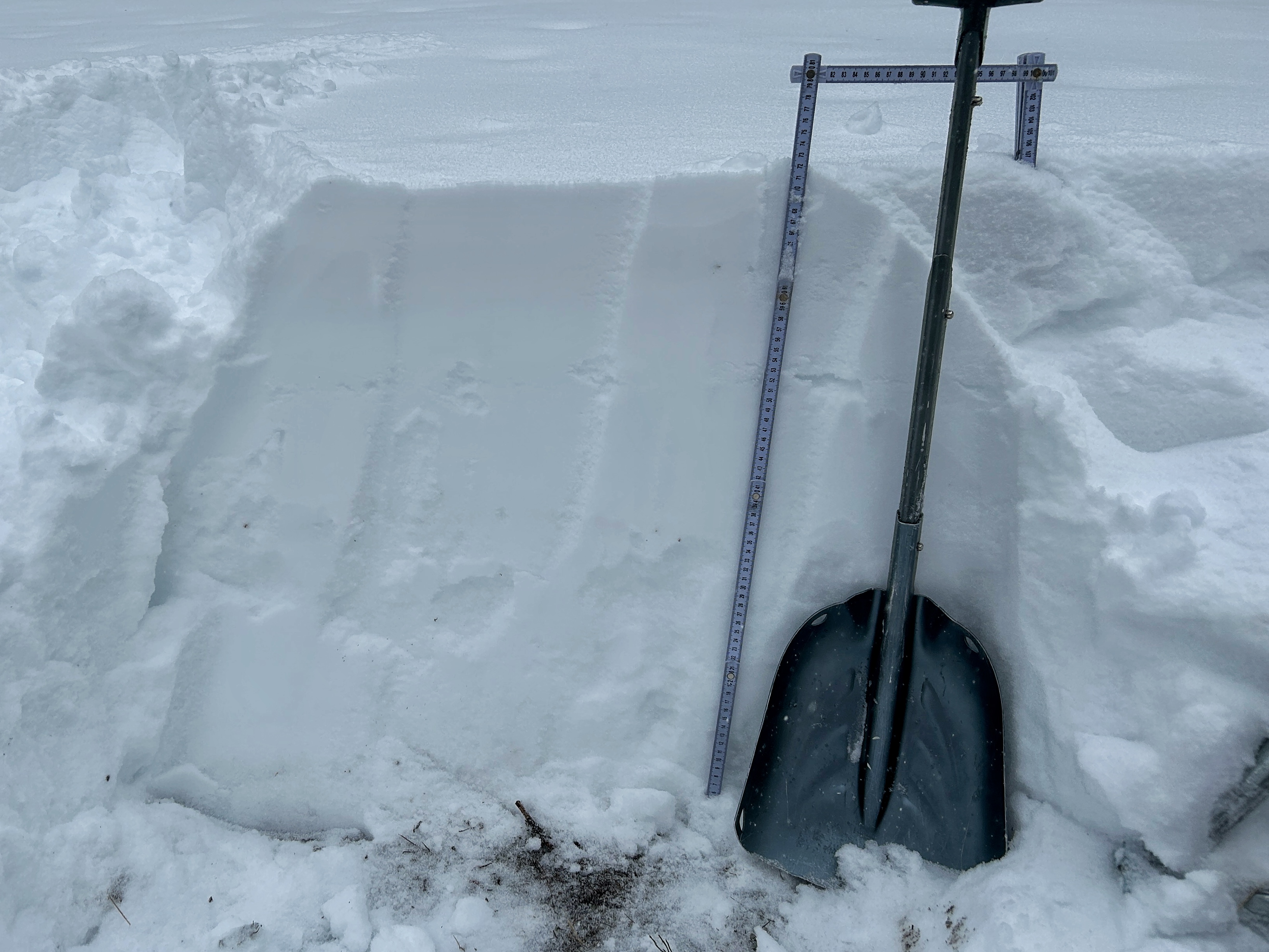
Full Snow Observation ReportPerformed Stability test on Henderson Mountain today. Elevation 9600', SW facing slope. HS 85cm, New Snow 20cm. Of Note, 1mm Rounding/Moist Facets at ground with 1CM Melt Freeze Crust 60cm from surface. 1mm Facets on either side of MFcr. ECTN 6 at new/old snow interface and ECTN25 on MFcr 60cm down. Generally pretty good looking snowpack for November 24. No collapsing or cracking of the snowpack and no recent avalanche activity observed.
Full Snow Observation ReportTook advantage of yesterday's fresh snow and headed to Beehive Basin for a short tour searching for soft snow. I did not make any formal observations on the day, but dug a handful of quick hand pits and probed for layers on a number of aspects. Our travel varied on all aspects except for true north facing slopes and we stayed between 8000' and 9000'. There seemed to be about 4-8 inches of fresh snow that fell on a variety of surfaces ranging from melt freeze crusts on solar aspects to snow that stayed dry through the last warm-up on shadier slopes. There was very little evidence of wind on the new snow and fresh cornice formation was minimal.
Overall snow depths ranged from about 2' to 3' and coverage was quite good for this time of year. Shadier slopes yielded an encouraging snowpack that felt mostly right side up with relatively strong grains. The new snow was not forming any real slab. On solar aspects the snowpack was much more variable/upside down and the snow underneath the melt freeze crust felt weak. On one particular hand pit, while cutting a block, the new snow and underlying crust failed in the old snow as one cohesive piece. Overall, great day out, with awesome snow, and I am excited about what I'm seeing for the most part.
Full Snow Observation ReportDug near the bottom of the Apron in a zone between the Apron and NW Passage.
NE aspect, 7500 ft, 29 deg slope angle
Total depth = 95 cm
Snowpack generally good, and the lower snow is surprisingly dense and strong for an early season snowpack. Yay!! There are a couple weak layers in the upper 20 cm, one was the interface with last night's new snow and the other was some graupel, but both only produced ECTNs.
ECT results
- two ECTNs in the upper 20 or 25 cm with less than 10 taps, one ECT in the lower snowpack with about 22 or 23 taps.
Nice snow and the parking lot was filling up by the time I was back at my car.
Full Snow Observation Report
I went searching for facets on the Ramp today and came up short on my results. The snowpack is still thin and the few measurements I took showed about a 50-60cm HS in most places. On the ridge itself at 8500', winds were blowing strong from the W, and at mid-mountain, gusts were strong enough to blow your hat off, but the Ramp itself remained relatively non wind-effected. In the few handpits I dug, I did not observe any sort of slab formation, nor faceted snow, but noted about 10-20cm of dense powder on top of moist snow to the ground, especially in thinner areas. I dug a quick pit just off from the ridge and noted an HS of 55cm with an 3cm decomposing crust about 29cm up from the ground. Snowpack ranged from fist hardness down to 1 finger at the base. And though the grains at the ground had some edges and corners, I did not note truly faceted snow at the base. Another thing: around 14:45 a strong burst of graupel fell for about 10 minutes that then changed to snowflakes. The pulse of that storm was dying off off by the time I skied off the Ramp around 15:30.
My main concern today were all the limestone sharks still very present out there, but in general N/NE facing aspects up high held good snow even after these warm temperatures!
Full Snow Observation ReportWind was ripping on the ridge and creating hard wind slabs 3-6” in depth. Without much new snow to transport they weren’t very large or widespread, but we got cracking and propagation on a steeper terrain feature (Hidden) near the ridge that led to us skiing a different line. The slab development was also found in isolated areas further down from the ridge in cross loaded gullies, but slabs were isolated to breaking at the skis.
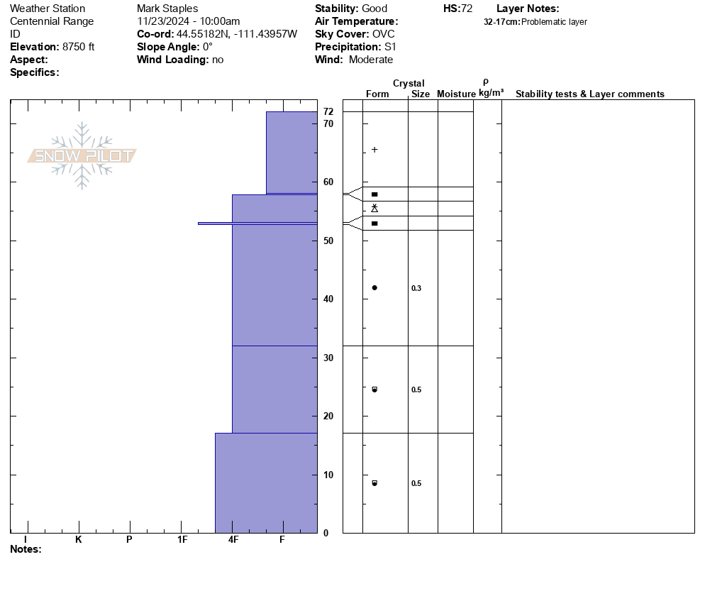
Full Snow Observation ReportWarm, stormy day. Winds moving a lot of snow around Sawtelle
Sawtelle Pk, Island Park
- 6500' - HS 30cm
- 7000' - HS 35cm
- 7500' - HS 40 cm
- 8500' - HS 50 cm
- 8800' - HS 72 cm
Snow felt warm dense and only lightly faceted. Overall promising start to the season.
Lionhead, West Yellowstone
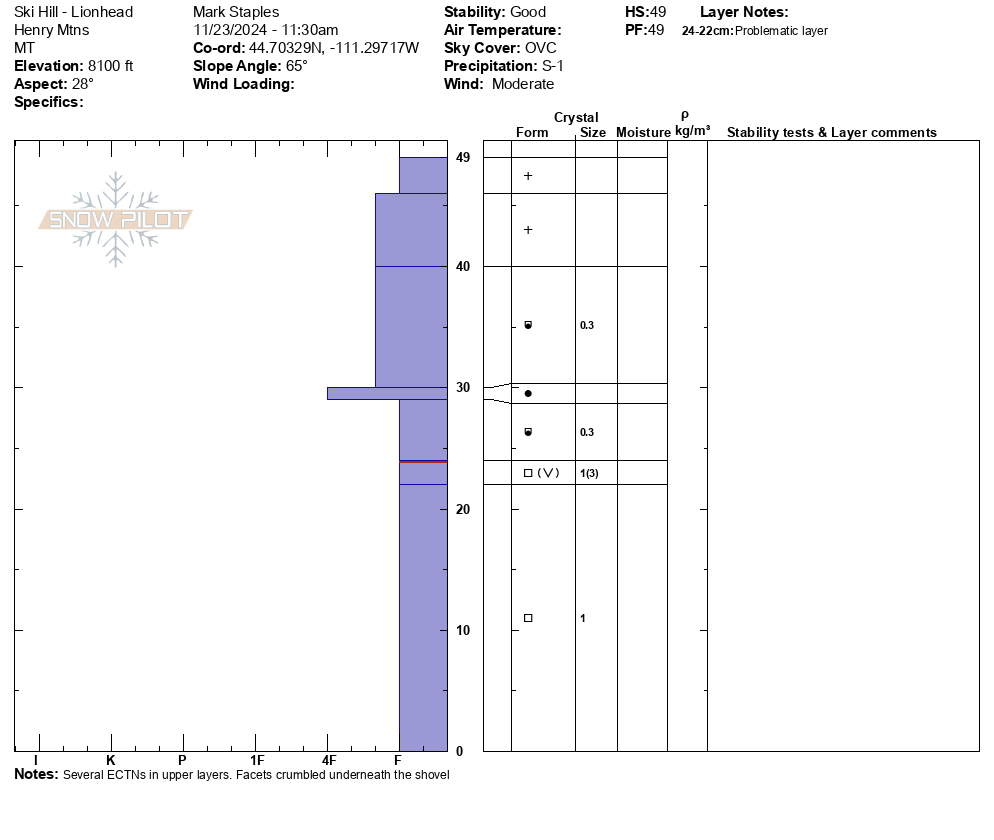
Barely enough snow at Ski Hill (el 8000') to get there on sleds. Also, very faceted with some surface hoar mixed in midpack. Overall, less snow and more faceted.
Full Snow Observation Report
Toured up to below Hyalite Peak yesterday morning before the storm. Despite all of the wet snow down low in hyalite, we found a dry snowpack beginning around ~8400’. Around 11am, winds really picked up in the alpine, with constant spindrift coming off cliffs of all aspects. We found lots of wind-affected snow, mainly scoured with the occasional 2-inch wind skin, but the wind was swirling in every direction and we couldn’t pinpoint an exact aspect being loaded.
In areas where the snowpack was deeper (>60cm) hand pits and probing into the snowpack revealed a fairly uniform structure, while thinner areas of the snowpack had more faceting.
The trail to hyalite peak is thin in many spots, but this storm should make the approach much better.
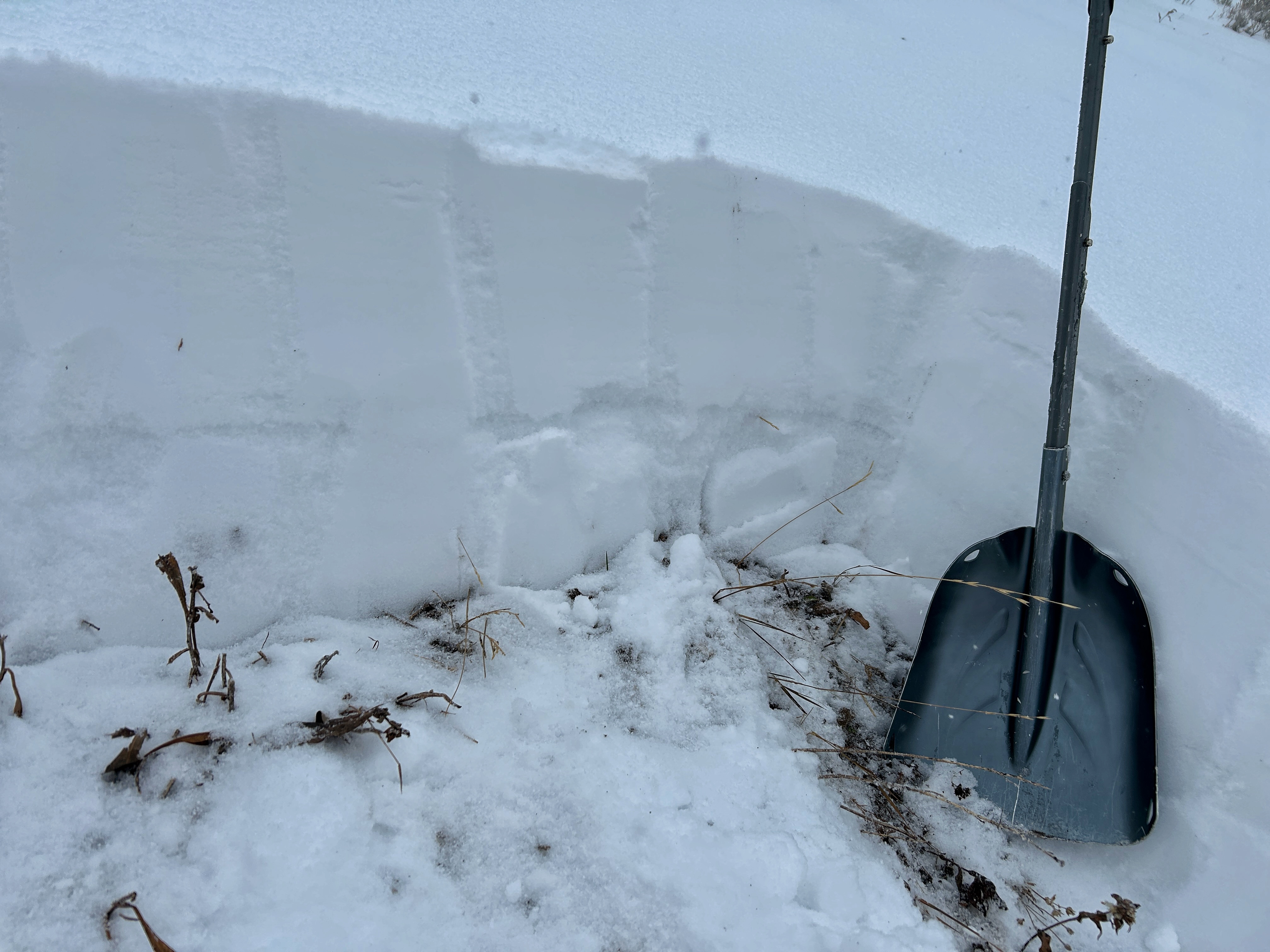
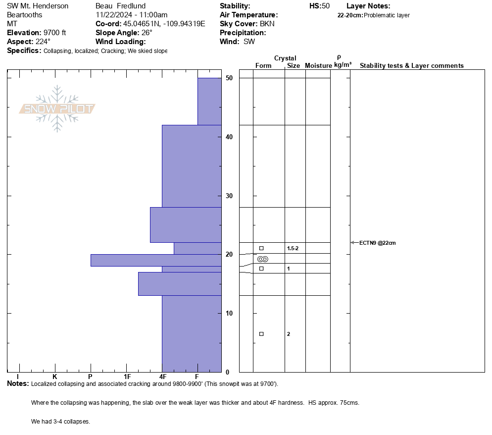
Full Snow Observation ReportLocalized collapsing and cracking yesterday on the upper slopes of Mt. Henderson, SW aspects. HS ranged from about 30-75cms.
Snowpit attached from a SW aspect about 9700', HS 50cms, ECTN9 @ 22cms (1-2mm facets above MF crust).
Full Snow Observation ReportToured up lick creek on Thursday morning. Mostly Cloudy, pretty warm around 37 degrees. Wind was gusting fairly hard at the ridge from the SW and had deposited and compacted lot of snow on the top of the NE Bowl. Dug a quick pit around around 8000' on the NE side of the ridge. Snowpack was about 60 cm deep and a quick compression test failed around CT 24 on near surface facets about 4 cm from the ground. The block that failed was a cohesive slab about 50 cm thick.
Full Snow Observation ReportWith the inversion and warmer temperatures yesterday, we (group of 3) discovered a super saturated, cohesive snowpack in Hyalite on the approach to High Fidelity. On the first pitch, I narrowly avoided a point release wet loose, probably around D1-1.5. After this we decided to bail. On the rappel, my partner narrowly avoided another wet loose, which he estimated to be D1.5 and deep enough to bury a person past their chest. The sun was not out but the mountains were shedding and there was evidence of warming and wind, because the trees had no snow on them. We were able to make ~2.5 feet in diameter “cinnamon rolls” by rolling a snowball downhill. If you’re going to any of the more exposed climbs in Hyalite, be very mindful of overhead hazards and wet loose problems which you would not expect this time of year.
Full Snow Observation ReportDave and I rode up Little Bear canyon to the cabin today . Strong SW winds had scoured most exposed areas near the cabin at 7500'. We also noticed clear wind drifting along the road. Off trail, the snowpack was supportable underfoot and we were not punching through to the ground. Temps were balmy at the truck, 45° when we left around 11am.
Full Snow Observation ReportFrom IG: "Isolated pockets on leeward slopes in the northern bridgers today… most on north facing couloirs. More prevalent down low where the snow was getting warm by 1pm. Base setting up nicely!"
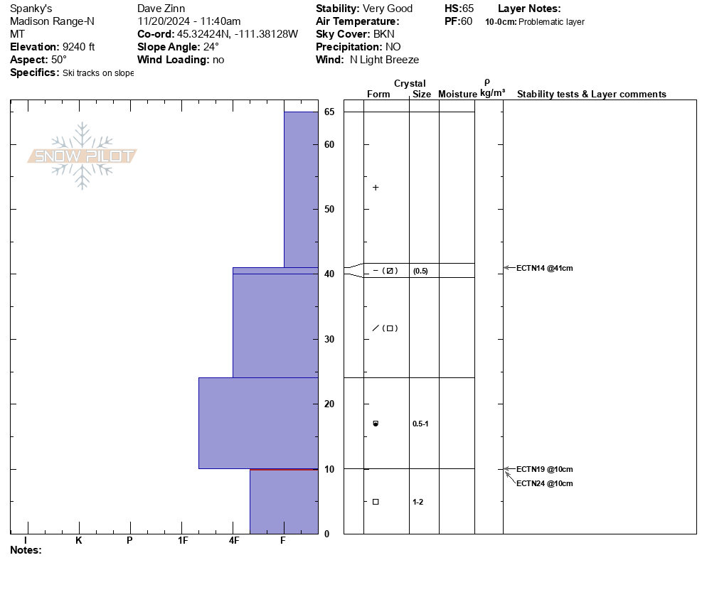
Full Snow Observation ReportWe toured up to the prayer flags, digging a couple of hand pits to look at the snowpack structure on Tyler's before bumping over the ridge to dig a full pit in Spanky's. We did not ski down into Bear Basin, but others had done so. We returned out through Exit Chute and back to the car.
The snowpack remains thin (20-25 inches of mostly unconsolidated base) and there were plenty of rocks and stumps to hit, but coverage was better than I expected (and probably better than most of December 2023). The structure was looking pretty good for early season. There were a few crust/ facet layers on west aspects, but nothing out of the normal. In our pit at the top of Spanky's (NE Facing at 9200'), there was a 10 cm layer of 4F facets at the base of the snowpack and some evidence of faceting throughout the older snow. However, the overall outlook is good for now. ECTN 14 at 41 cm and ECTN 19 and 21 at 19 cm.
Primary concerns were the shallow snowpack (we traveled downhill very slowly) and wind slabs. On the drive toward Gallatin Canyon this morning, we saw large plumes of snow blowing off the high peaks. We didn't see evidence of recent wind transport on our tour, but I'd be watching out for it.
Full Snow Observation ReportLimited info, but the danger seemed LOW where we were. MODERATE(?) on wind-loaded I suspect.
Tons of wind transport all over Hyalite. Gullies were spindrift torrents most of the day. Ridge lines had plumes for most of the day too. Small wind slabs building in the upper Mummy gully, approximately 6"-8" thick at most and 1F to P hardness. Some localized cracking around our boots but nothing more.
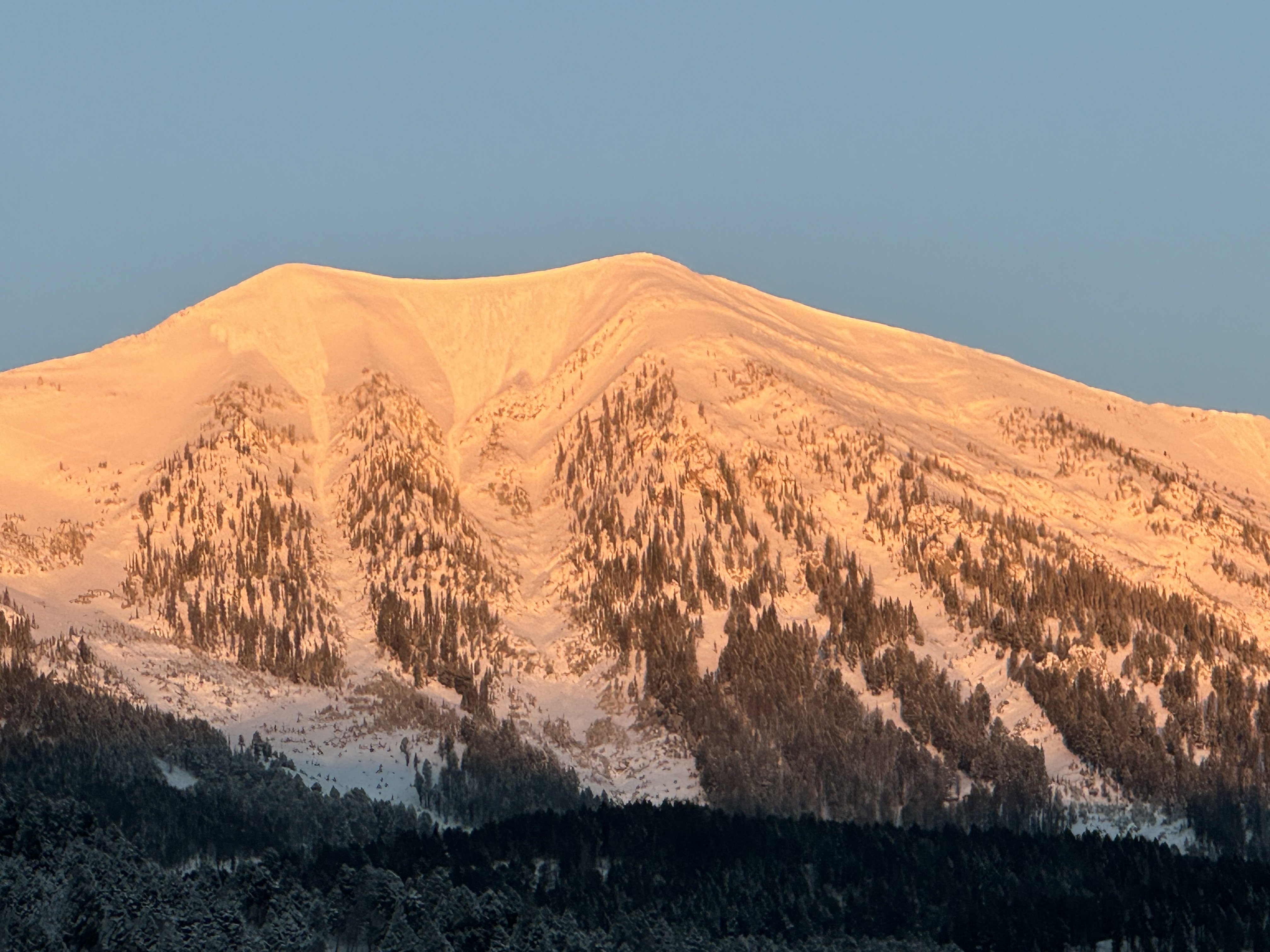
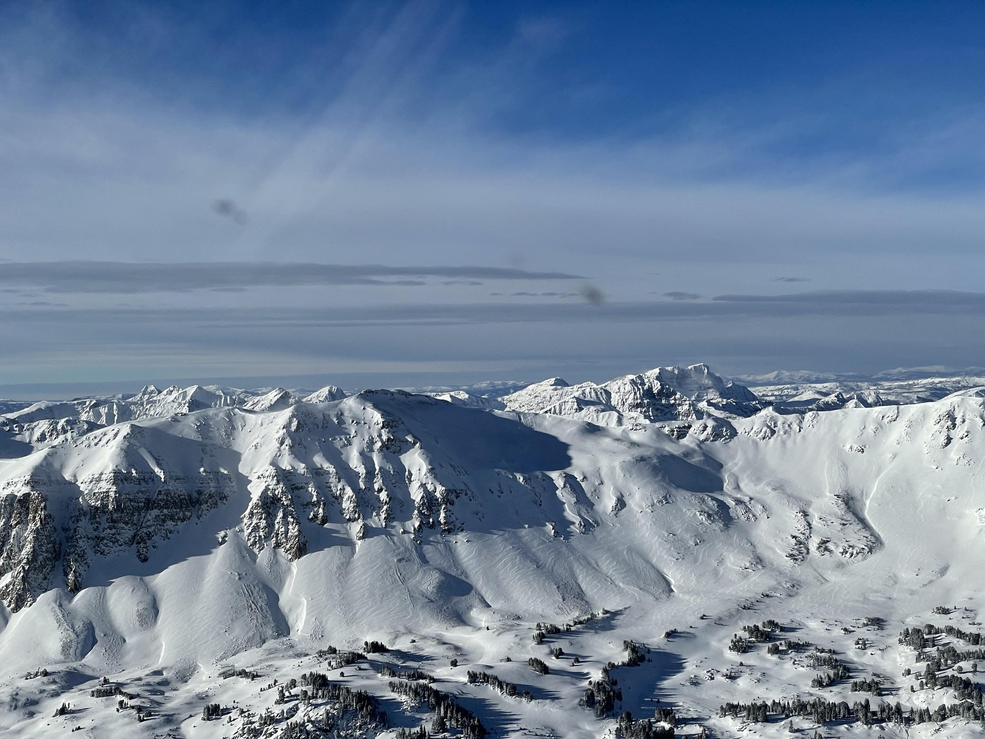
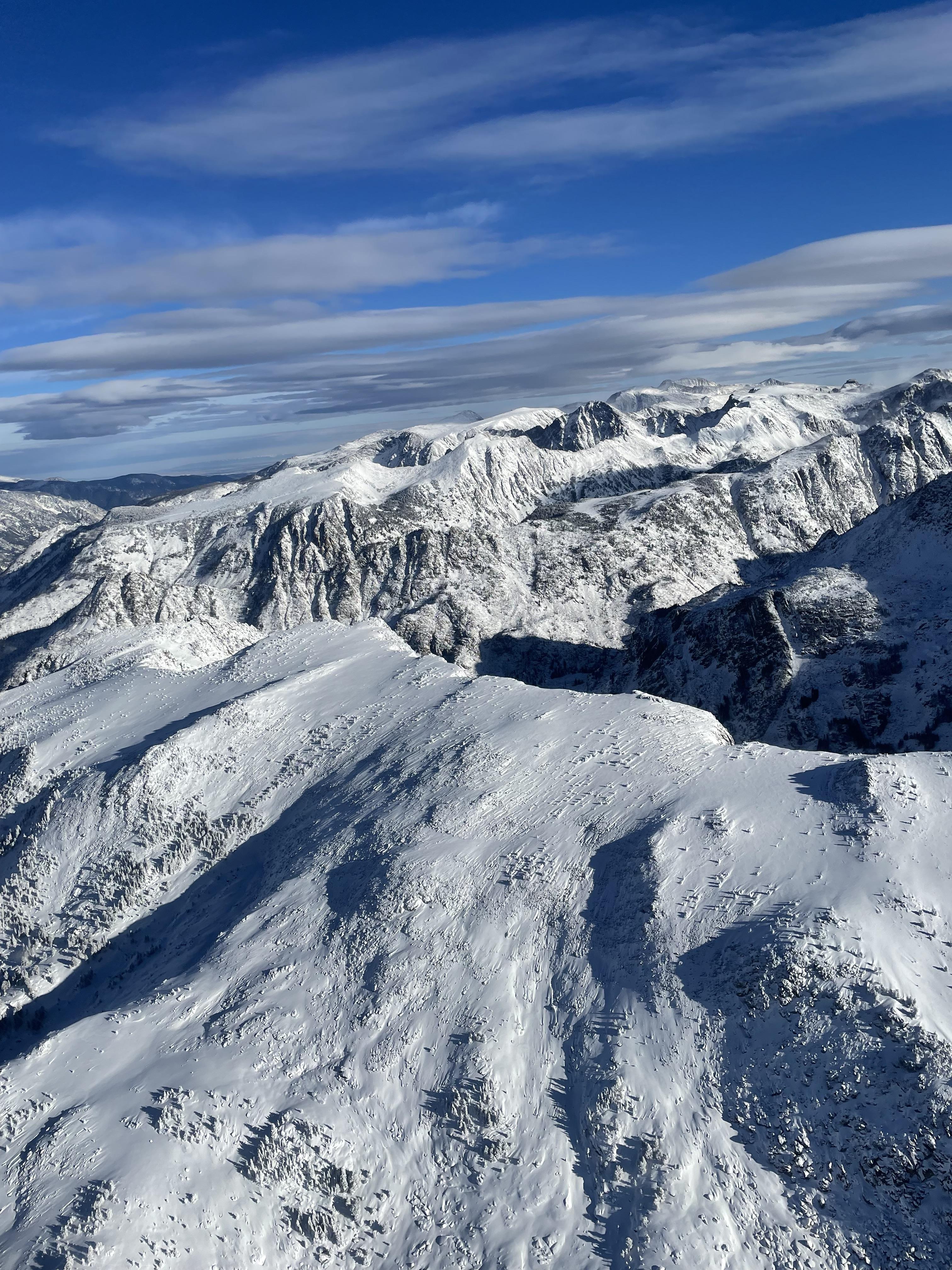
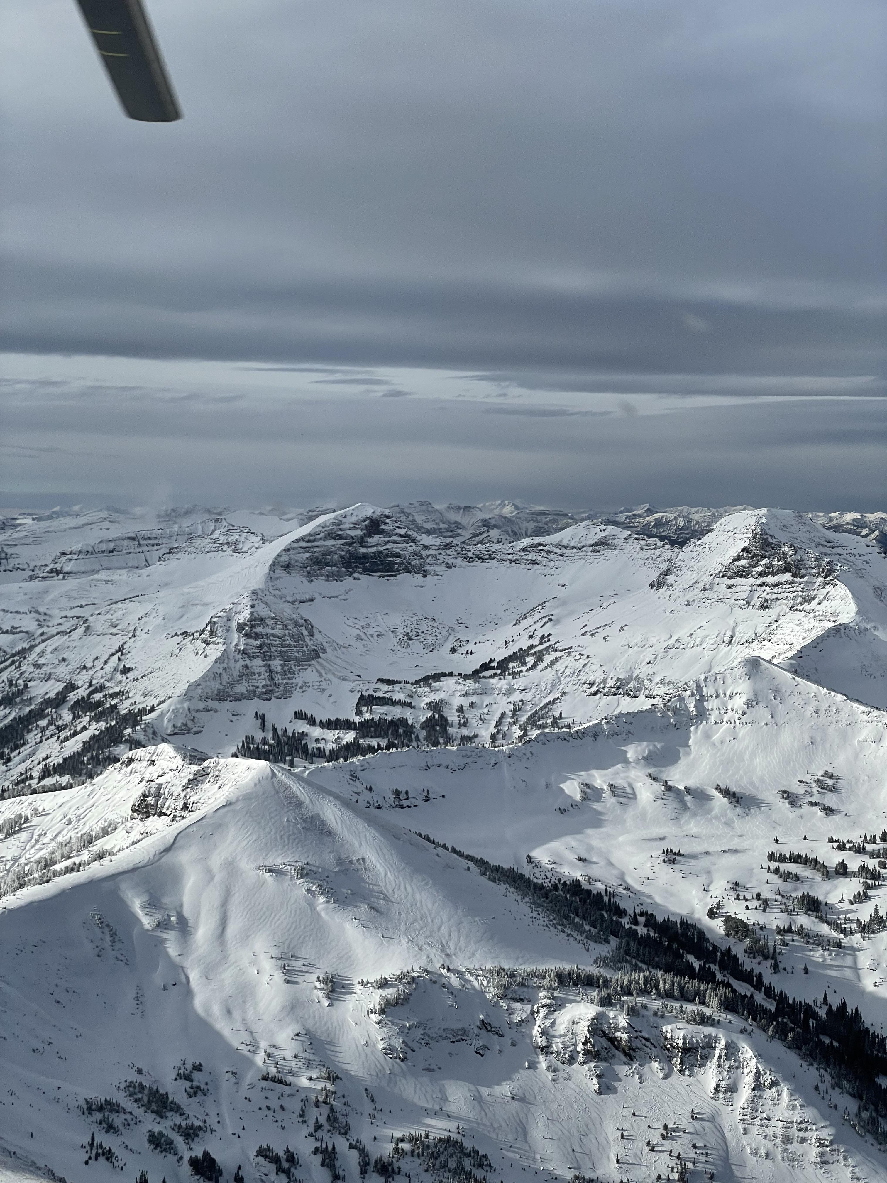
Full Snow Observation ReportFlew from Paradise Valley to Cody and saw large plumes of our snowpack moving off of the peaks and getting transported from strong winds which were more southerly in the western part of the range and westerly around Cooke. Evidence of heavy cross loading across Sheep mountain (pictures) and the whole range, I didn’t see any evidence of avalanche activity.
Full Snow Observation Report
