Snow Observations List
A skier near the top of the Alpine Lift at Bridger Bowl ski area took a photo of three avalanche crowns near Peter’s Point.
Full Snow Observation Report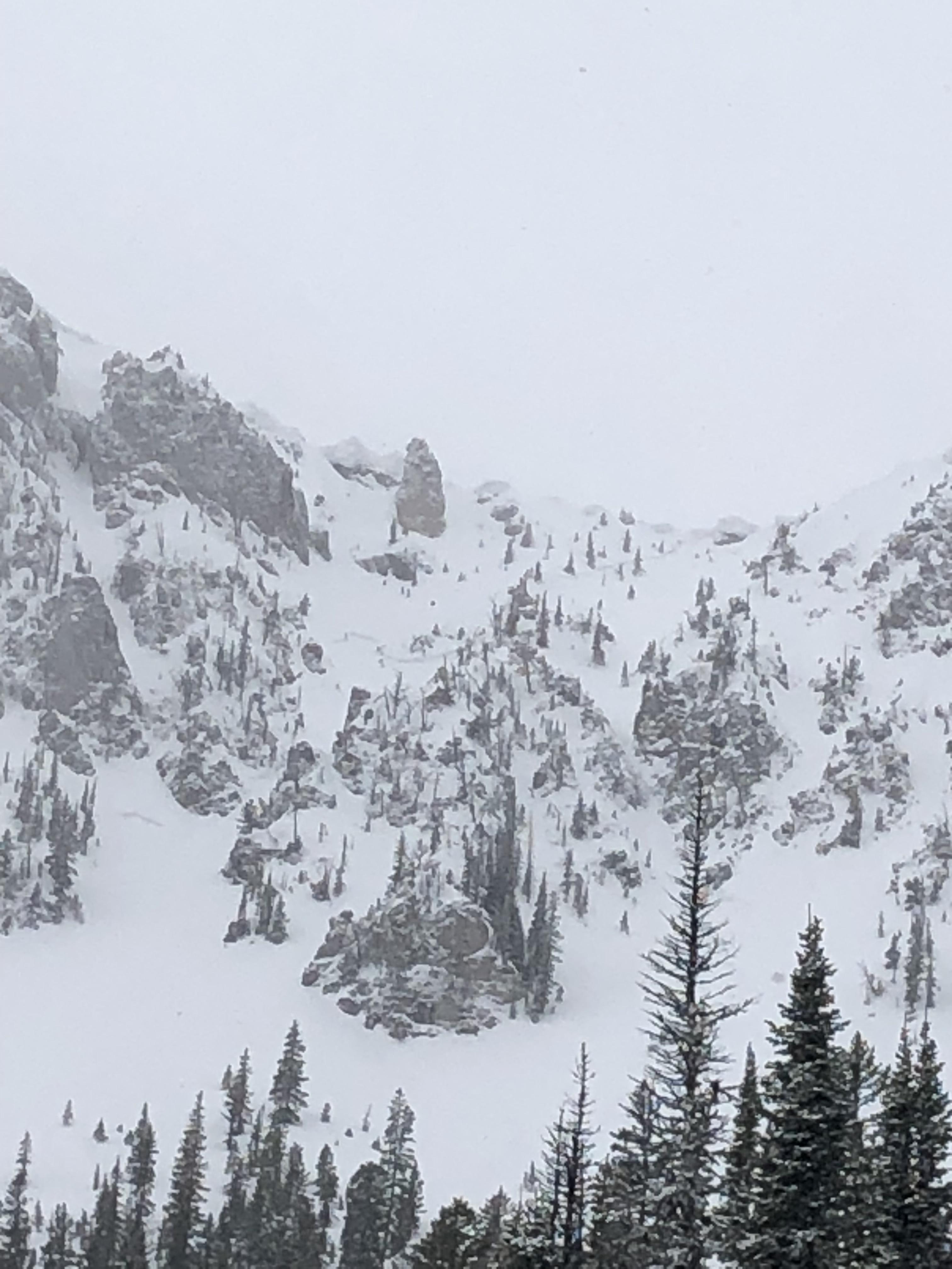
A skier triggered an avalanche on a test slope in Beehive Basin, breaking 12-16" deep and 75' across. The slide failed within the new snow.
Full Snow Observation Report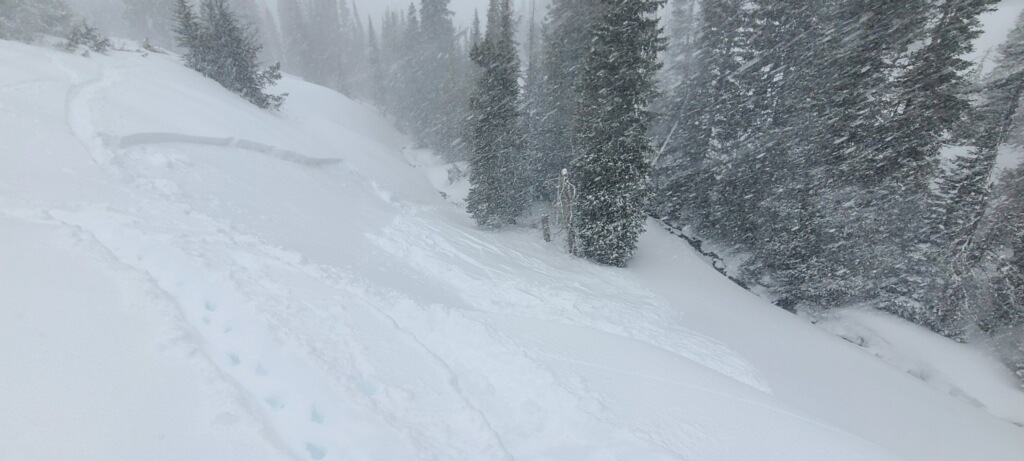
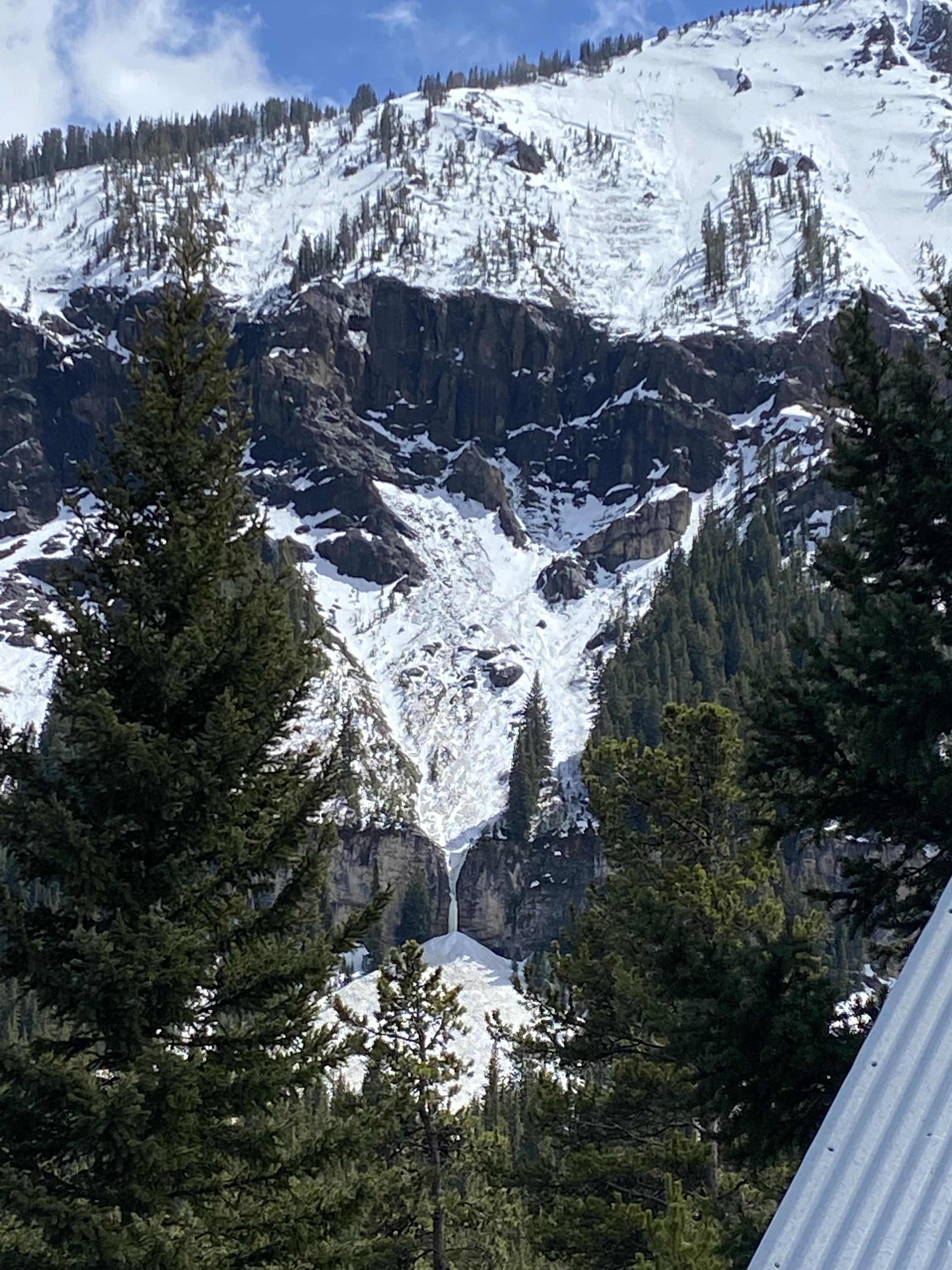
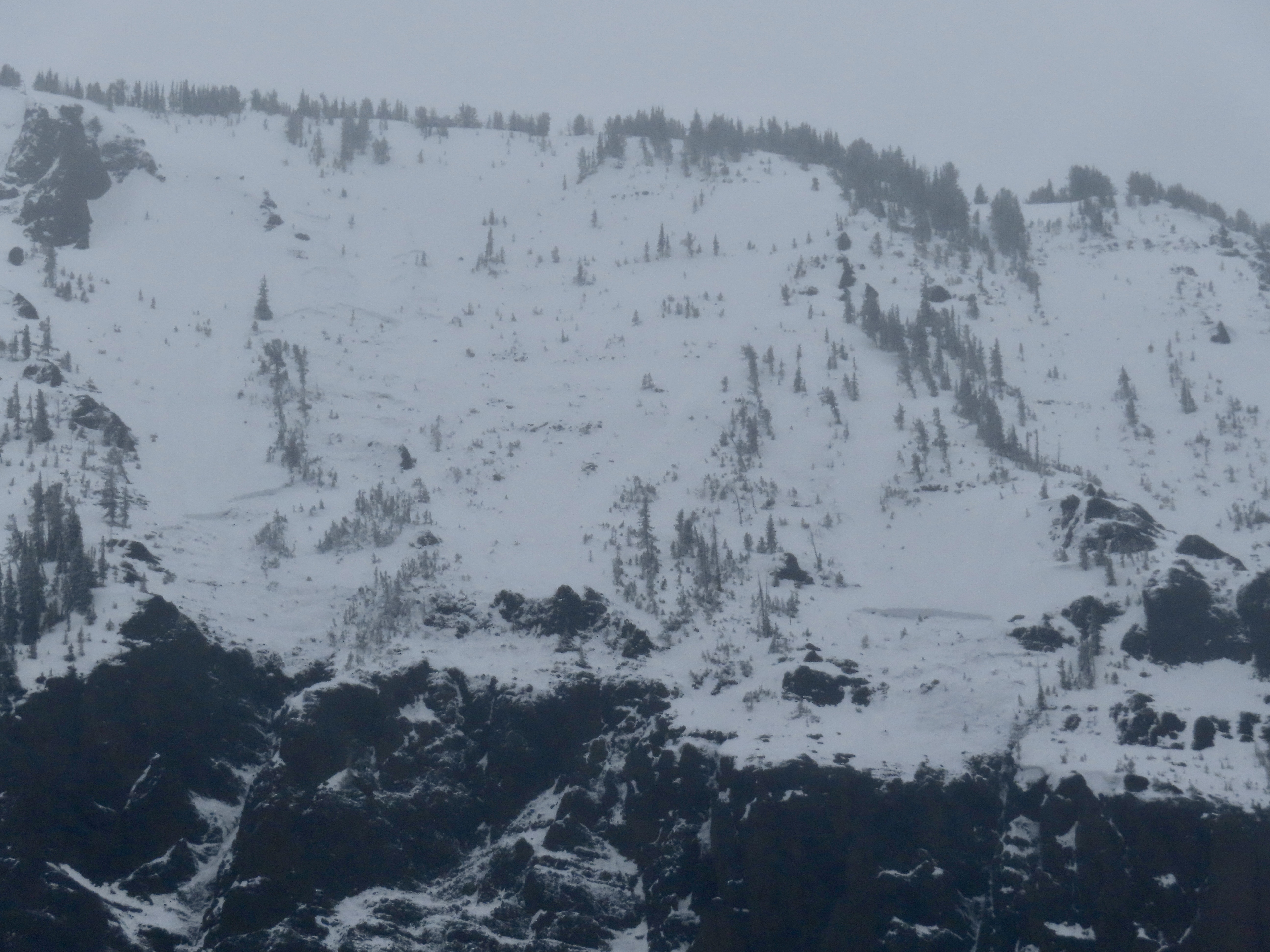
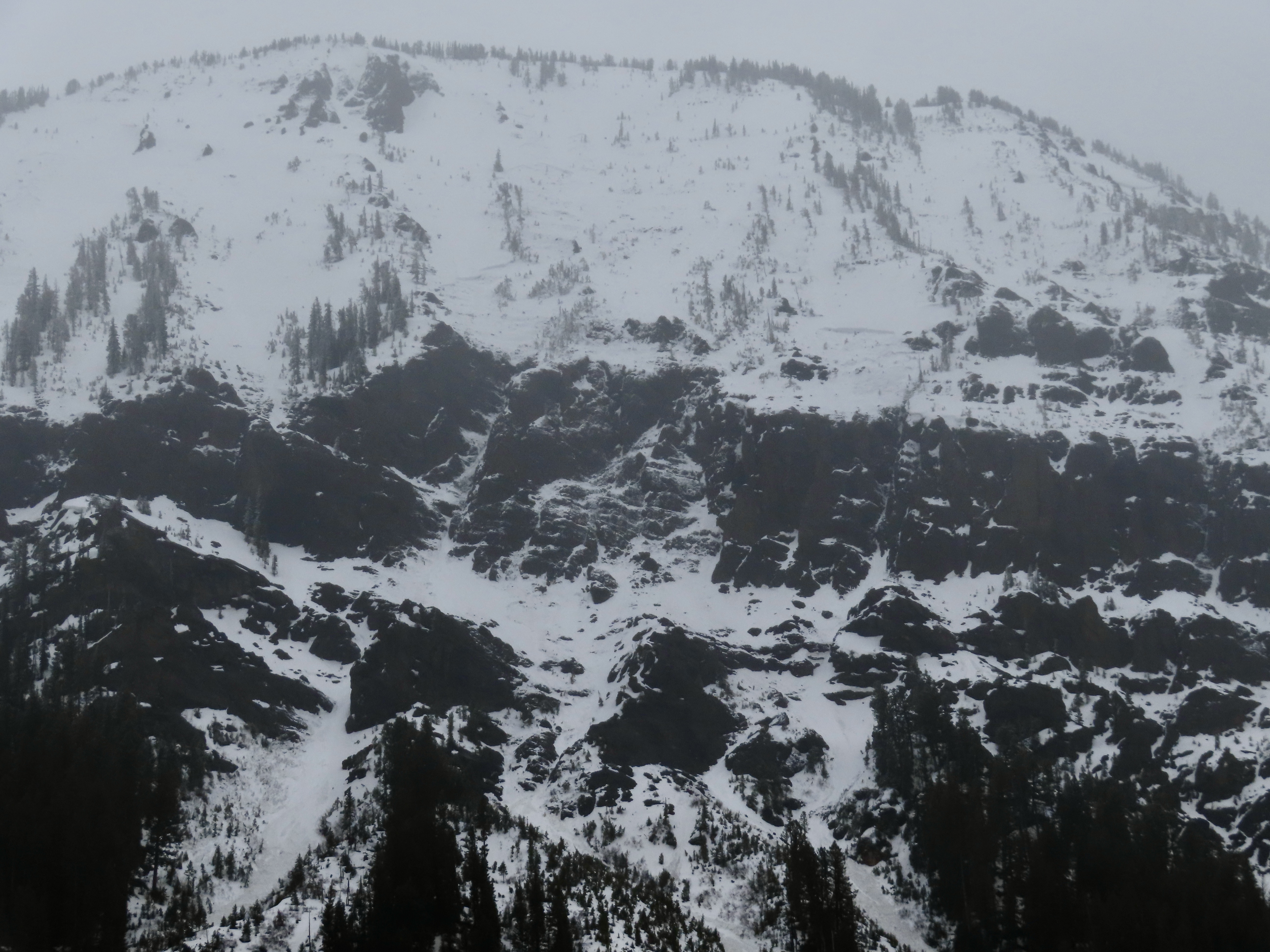
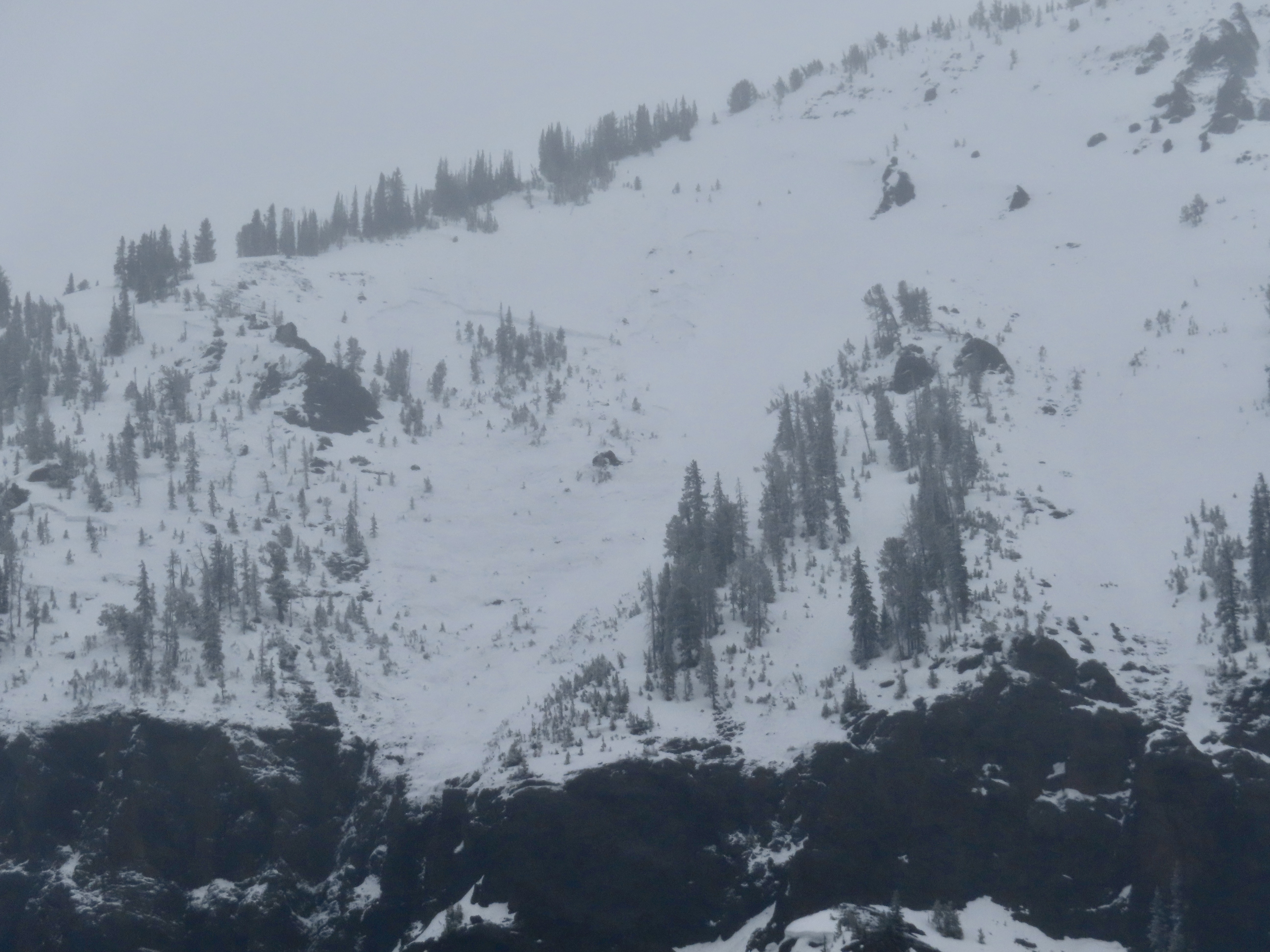
Saw a very large crown on a north face of a peak west of the hyalite area. Potentially peak 9662. The crown appears to wrap around multiple aspects for about 1/4 mile. Seen from the Bridgers around noon on May 4th. Probably went during this weeks storm, but it looks to me like it was much deeper than a storm slab.
Full Snow Observation Report
On 5/4/24 “…. a friend toured around Wolverine today. On his way out he heard a slide breaking trees (just before noon). Unknown location but he said it sounded like it was around/ above Texas Meadows. The action continues!”
Full Snow Observation ReportOur party (3) triggered a significant wet loose slide on the fin today. I, the first skier dropped in next to existing tracks from earlier in the morning. I made a couple of small turns in unskied snow to test it and decided that not much was moving. As I continued down the wet surface snow started to slide and accumulate. My partner called me on the radio to tell me a lot of snow was moving behind me and I cut left. I traversed hard to lower angle terrain until I felt I could safely descend the rest of the slope. My partners descended the bed surface until they could traverse out.
We made several key mistakes today. We knew it would be warm and that we should be up and down early. We left later than planned, moved slower than expected and failed to adjust our plan. We mistook lack of wet loose activity on similar aspects and elevations on features we could see as sign of stability. We failed to make a plan B or establish a turnaround time. We interpreted a party ahead of us that skied the slope as a go ahead. Another party approaching behind us added pressure to go. They also skied the slope after us in similar style to my partners.
In our favor, we communicated well, radios were key, stayed calm and we managed ourselves through the situation. I feel humbled and lucky to have gotten away with a free lesson. One that I didn't think I should have needed.
Full Snow Observation Report
Wind load on old crust, probably from Wednesday.
Full Snow Observation Report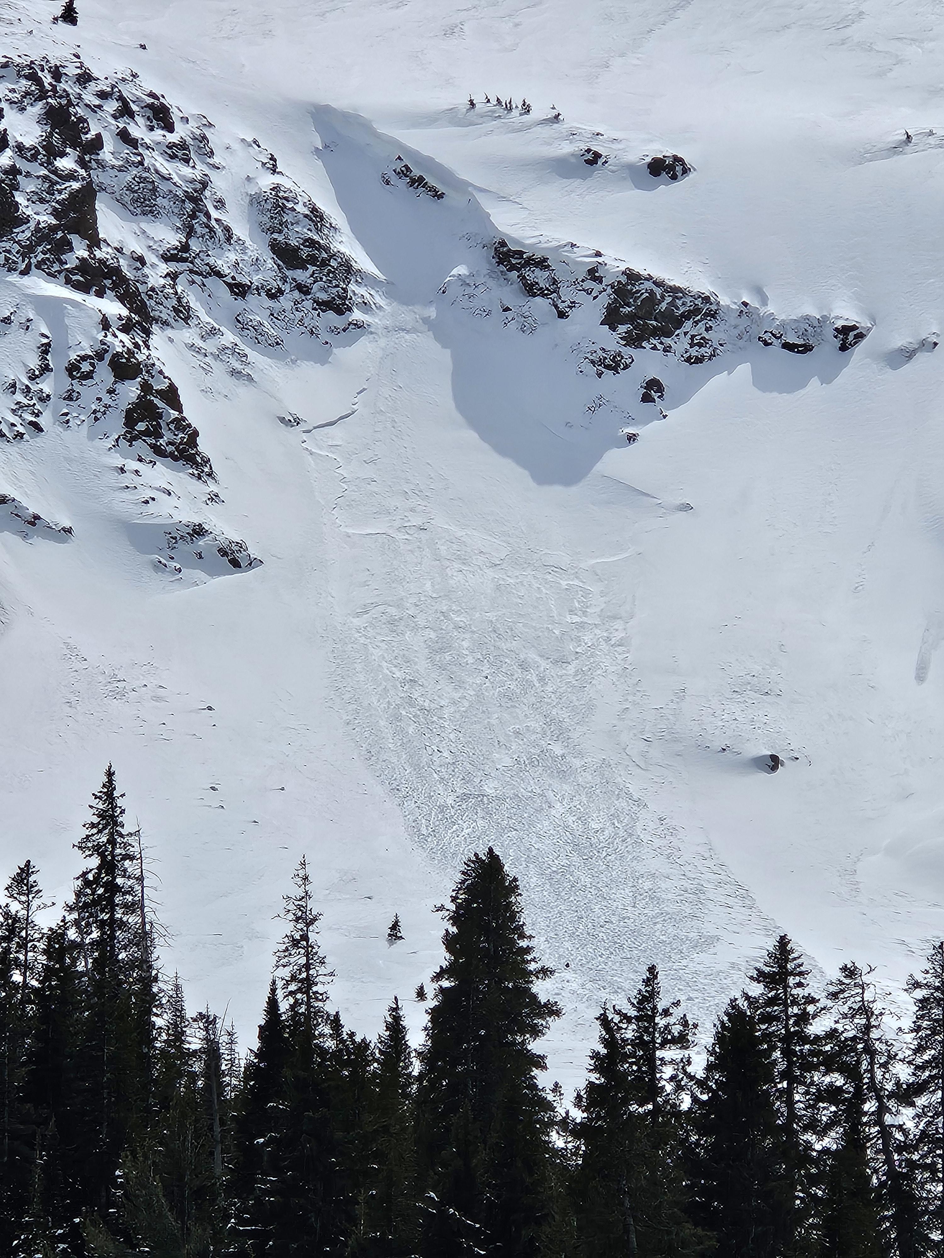
From email 5/2/24: "Triggered in the virtues this evening. 40' wide, 4-12" deep, failed as a dense, wind-packed slab on the rain/sun/heat crust underneath the most recent snow. I had marginal visibility but it looked like there were similar small-ish wind pockets that had failed in a few spots. Good skiing up high, fun first day up there."
Full Snow Observation Report
From email 5/1/24: "Hi crew. I triggered a soft slab avalanche on the North side of Sheep Mountain today. D1.5 200’ wide ran 200’. Crown was 6-12’’ deep. I was able to ride out of it and anchor in a safe spot.
It broke on our 7th lap and we had seen no signs of instability prior to the avalanche but wind loading was occurring and obvious. The avalanche broke and on a dirty crust that formed during a rain event last week."
Full Snow Observation Report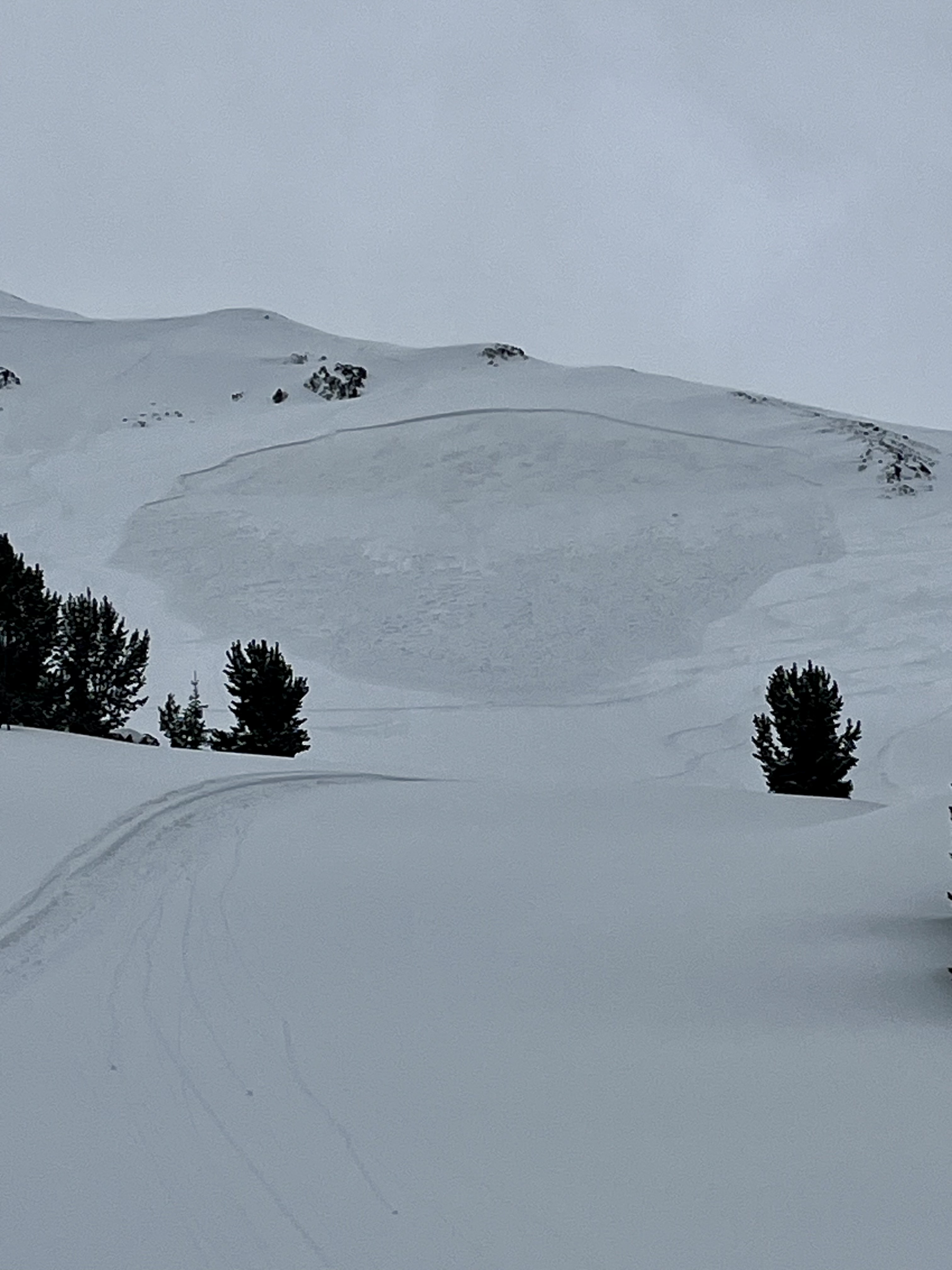
Toured up to Bradley's Meadow, and found about 6 inches of moderate density snow sitting on a thin M/F crust with wet snow underneath the pack.
Snow seemed well bonded and did not see any natural slides up on ridge. Not much sun was out, and it was snowing until 12 p.m.
Full Snow Observation ReportSkied north of Cooke City the last couple days ( Sat. 4/27 and Sun. 4/28), near Lulu Pass and Henderson Mtn.. Yesterday there was 2-3" of moist new snow, and the snowpack below had not refrozen up to 9500-10k', it was very wet and unsupportable below the new snow. Moderate east wind yesterday drifted the new snow into small slabs up high.
Today there was 1-2" new snow on top of a thin, breakable crust around 9,000', with wet unsupportable snow below the crust. The crust softened quickly in any sunshine midday. Pulses of heavy snow mixed with periods of partial sunshine and calm-light wind.
Saw only small slabs crack beneath skis along the ridge yesterday, and minimal wet snow avalanche activity. Despite minimal observed avalanche activity, it seemed like a skier or rider could trigger a larger wet avalanche, especially on slopes that received sunshine.
Photos attached of what appear like wet slabs possibly from Friday when the precip. started after the first night or two of poor freeze (North side of Republic, and Henderson Bench).
Full Snow Observation Report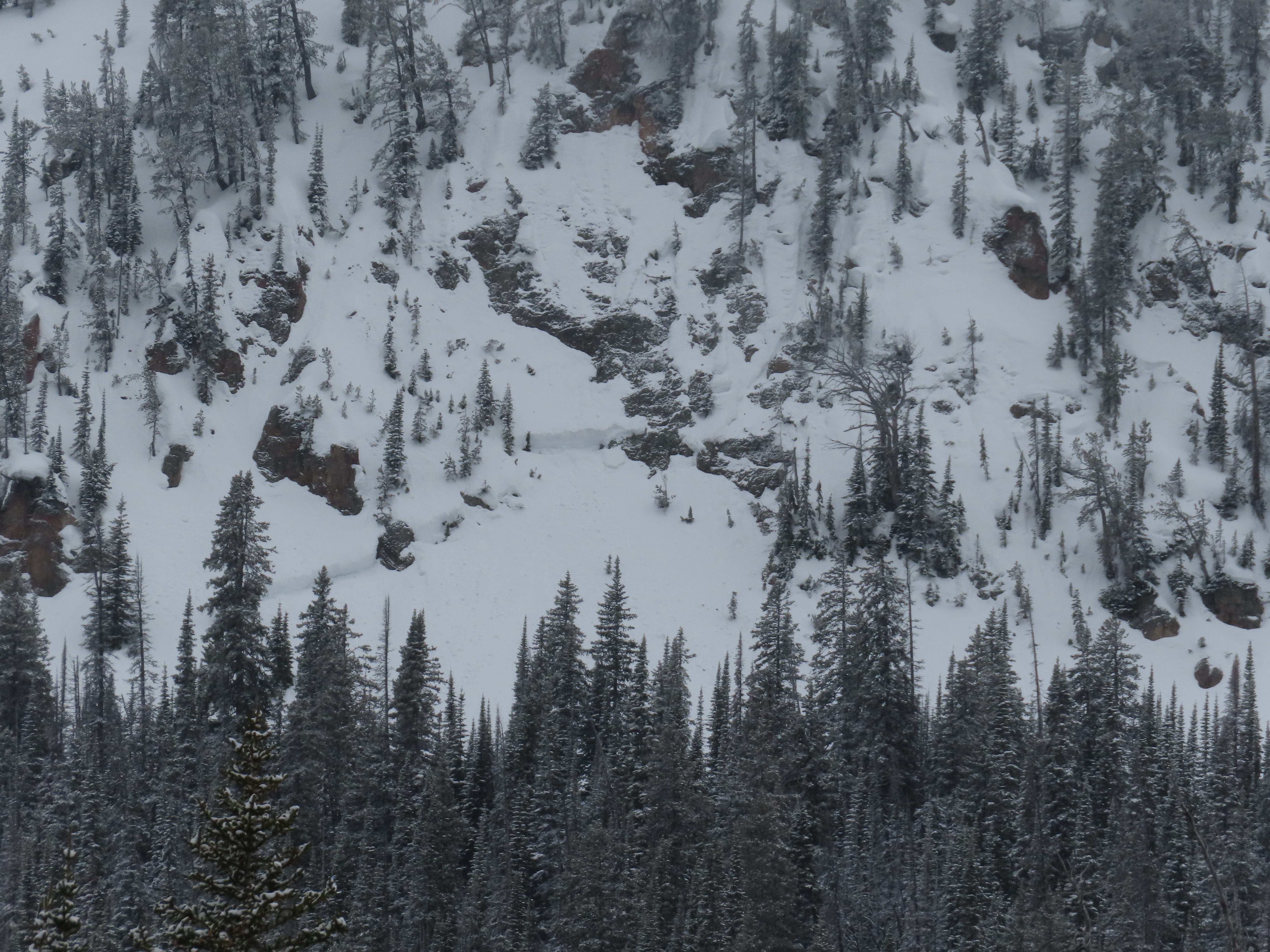
We toured to Elephanthead Mountain today (4/27/24). Most of the couloirs emptying into Mission Creek (e.g. Das Ist Ice, Pitchfork Couloirs) showed signs of recent, large scale wet slides. Higher on the mountain, we observed fairly recent avalanche debris and crowns of 4-5 feet. On our descent of Mission Creek, we crossed large, wet slide debris fields that buried our earlier skin track (see pic). Our decision was to stick to low angle terrain and to steer clear of runout zones of any couloirs.
Full Snow Observation Report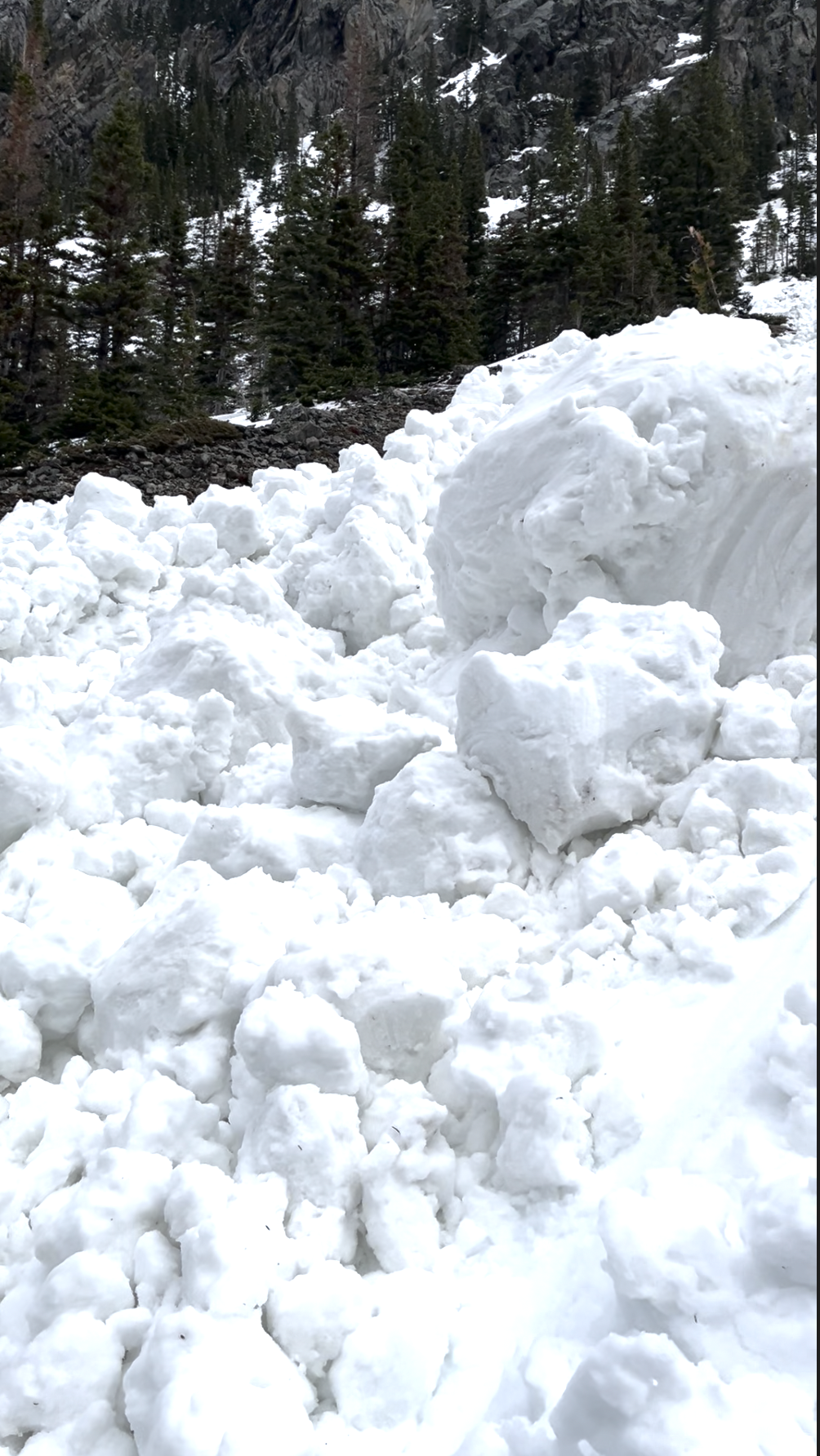
We toured into beehive today starting at around 7:30 AM. We found about 2-4" of fresh wet and heavy snow. Lightly snowing all day until we left around 12 when the snow picked up a bit. Passing fog in and out all day. Around 9400' we dug a pit to the ground (east facing). ~95cm deep. We found about 5" of thick snow from the last two days, on top of a thin layer of graupel and ~4" of very wet snow that had not refrozen from the previous warm-up. The rest of the snowpack was also wet to the ground, but not to the same extent that the upper couple of inches were. Near the ground was definitely a weaker structure, but was also now saturated and closer to "corn snow" than anything. Also noted an ice layer about half way though the snow pack.
In our pit we got cracking in the new snow (ECTN9) and in the top (8-9" down) of the saturated snow pack (ECTN18), but no propagation. A shovel shear test revealed our two layers being about 8-9" down at the bottom of the very wet layer, and at the interface with the ice layer halfway down. No collapses were observed. No avalanches were observed. We got some sluff while we were skiing, but only when skiing/hop turning aggressively. We chose to ski some steep and short couloirs.
The skin track had decent coverage besides a few spots in the trees. It was rain mixed with snow in the parking lot around 12:45, which quickly turned to rain as we drove towards big sky.
Full Snow Observation Report
On 4/26/24 large natural wet slabs were seen running on Wall Mountain near Silver Gate. An observer from Beartooth Powder Guides sent us a video of them happening at 3pm while it was 43 degrees F. I also noted a similar large crown on the north side of Republic Mtn. that probably also happened this afternoon.
Full Snow Observation Report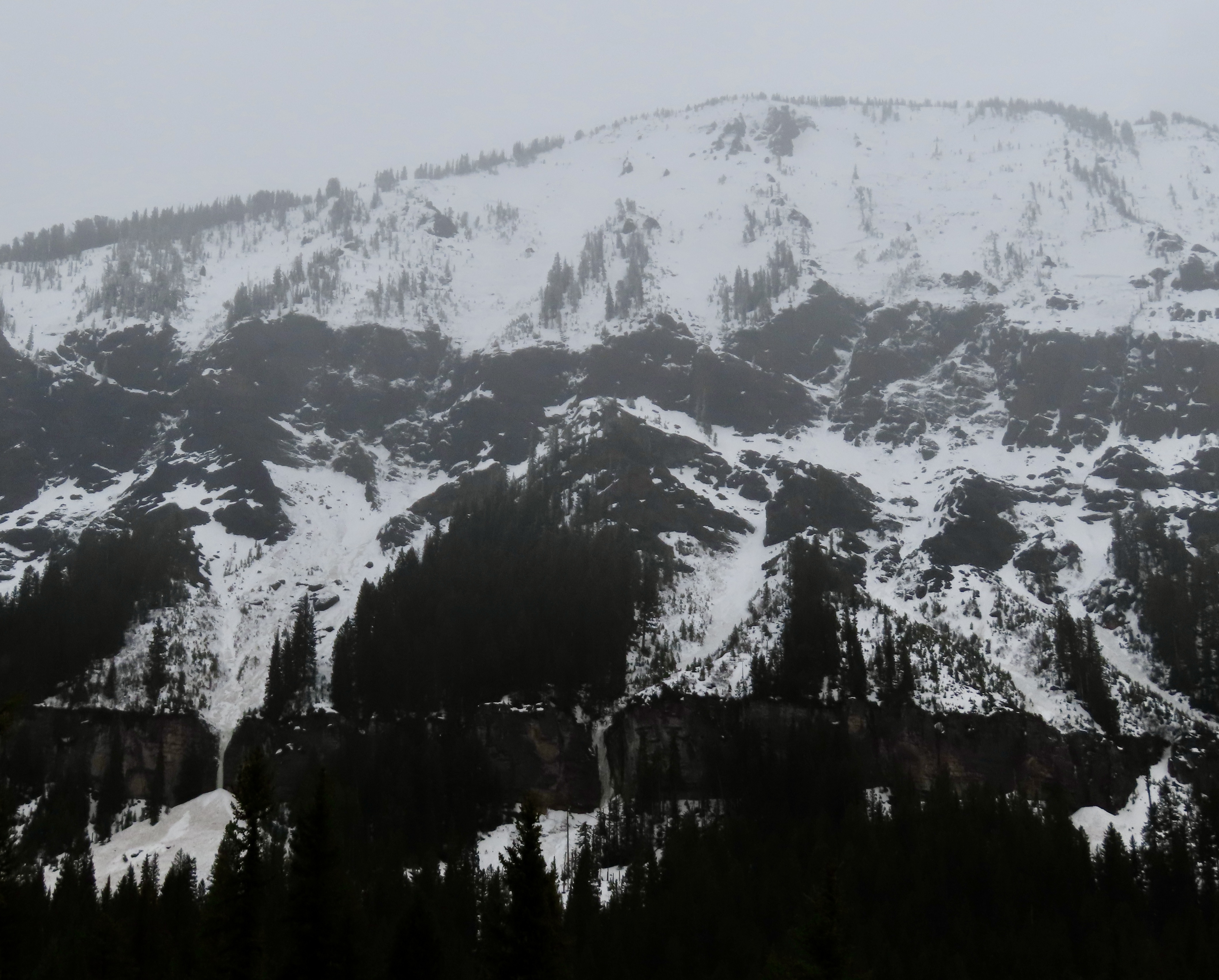
From IG on 04/26/2024
Full Snow Observation Report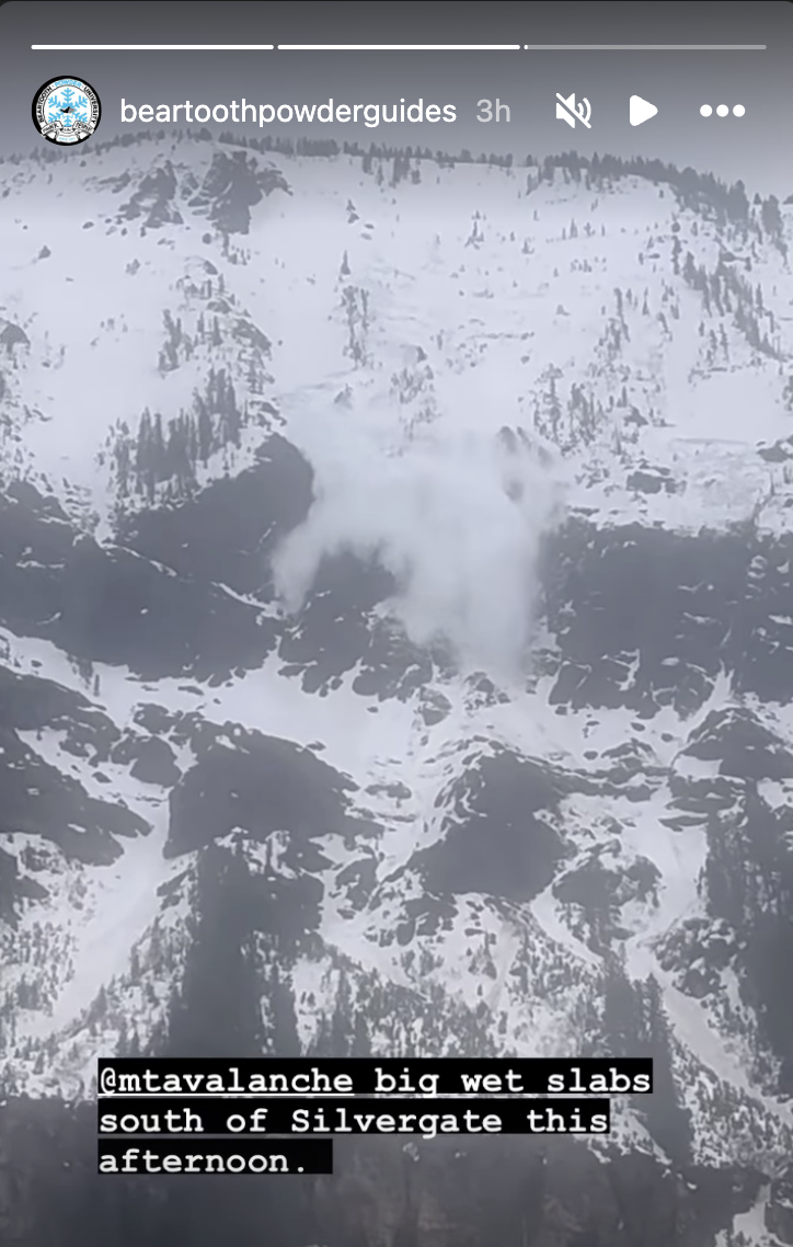
When setting out to Beehive Basin today we only imagined wanting to bail if rain line was at the trailhead, but had not expected our seasons long standing PWL to turn us around. With a few inches of snow at the trailhead and temps just at freezing we set out. The new snow yesterday/last night capped a warm snowpack, keeping the snowpack from freezing at all (no crusts or other signs of superficial freezes up to 9,200ft where we bailed despite the mid-20’s temps recorded overnight). Almost immediately out of the trailhead we got thunderous collapses so big we at first thought it was noise from control work at Big Sky. Further along we got collapses extending hundreds of feet out, valley wide and echoing up the basin. We dug to the bottom out of curiosity and found a saturated and unfrozen snowpack. The bottom 30cm was still all facets, giving the appearance that the remaining 90-110cm of consolidated snowpack was floating on air. We’re assuming the whumps/collapses are traveling along this layer of basal facets.
Full Snow Observation Reportthoughts/questions clipped from public obs. "I’m sure once it gets a solid freeze things will be alright again, but will the new snow continue to insulate the snowpack the next few nights despite the forecasted solid freezing temps? Or is this only a phenomenon that happens the 1st night of new snow falling on a warm snowpack? "
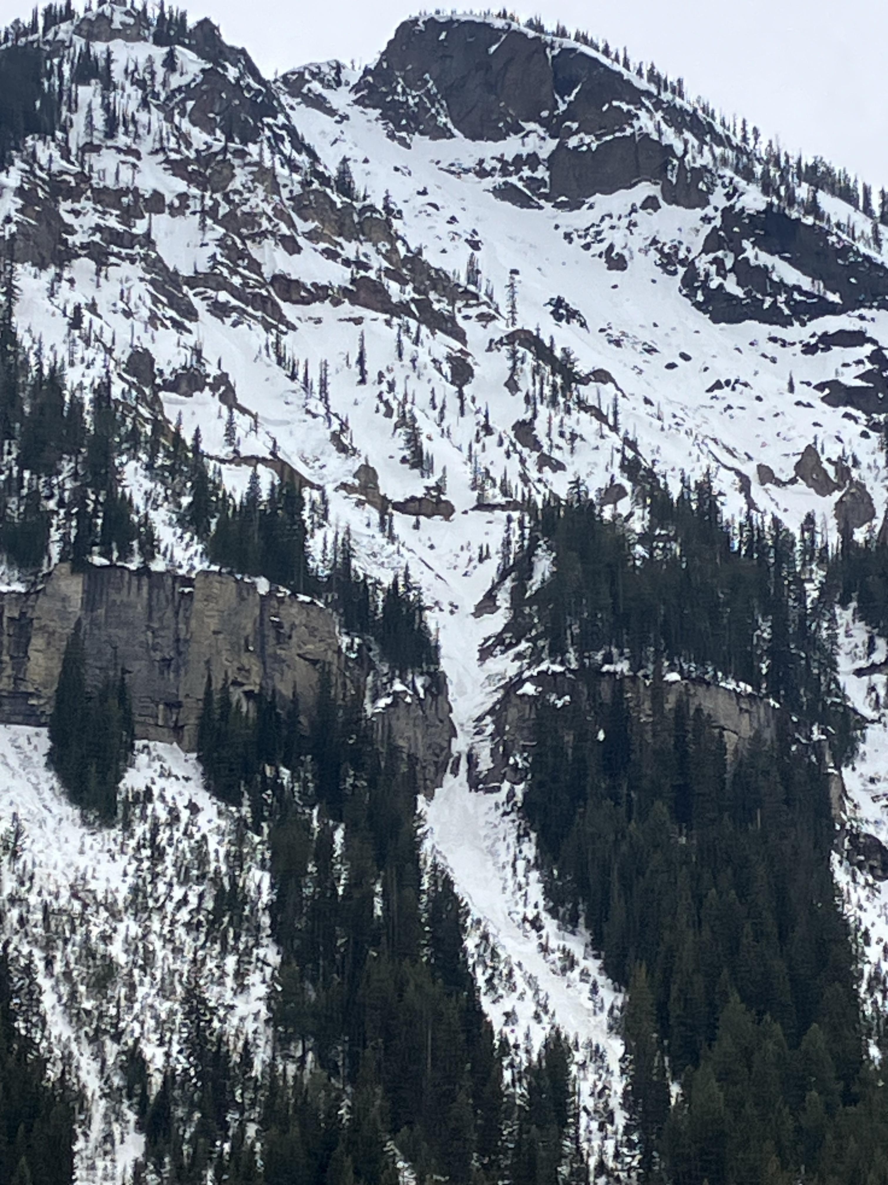
Came across a relatively large wet avalanche when approaching Texas meadows from Bradley’s meadows. Elevation around 7600ft, aspect, SSE. Depth: to ground.
Considering the new snow on top of the debris, I’m guessing this slid prior to the storm last week. The slide path was melted out to dirt. Out of curiosity, we dug just to the lookers right of the slide and found soft snow near the ground - still evidence of crystal structure but could make a snowball if squeezed. Best guess is that a point release wet slide entrained enough snow to step down and release the whole face.
Full Snow Observation Report
Elevation: 10231
aspect: ESE
time: 10:35, April 22nd
CTX - broke below isolated block, pit depth ~100cm
Avalanches in the goose lake area: small loose snow avalanches on shady aspects. Evidence of rollerballs and small cornice falls on sunny aspects from previous days.
Full Snow Observation ReportToured up around bell lake today and after a night of wind, triggered a very small wind slab in a north facing couloir at around 9500-10000ft. It was almost 10” deep and was about 10-15ft across. Snow was being loaded through out the day and was staying cold up high.
Full Snow Observation ReportDug a pit around 9700' on a WNW shaded aspect below a couloir on Miller Mountain in Cooke City. We found ~95cm snowpack, with 5-10" of lower-density fresh snow. We dug to the ground and found a consistent and firm snowpack all the way down, didn't find any facets at the ground. Isolated cracking, ECTN25 ~20-25cm down, below the thick melt-freeze crust from the warm-up immediately before this week's snow. The fresh snow had sluffed out on most chutes before we got there (likely during the storm) but we saw very little sluff triggered by our skiing
The fresh snow skied great on shaded aspects that hadn't been affected by wind. Non-shaded snow surfaces were definitely getting wet by 1 pm, the sun felt hot, but we didn't observe any wet slides before we left. The snow on the ride out was very wet, with watery-slush puddles on the lower parts of the trail.
Full Snow Observation Report