Snow Observations List
We rode from the bottom of Sawtelle over into Yale Creek. There was 5-7" of snow from last night and 14" of settled snow (2.0" SWE) from over the past week. Wind had formed thick drifts over the past week and was forming fresh drifts today. We did not see cracking in fresh drifts that we rode through. However, with new snow and wind-loading currently growing slabs, we expect avalanches breaking in the new snow and drifts are likely on steep slopes. In one snowpit we had ECTP13 on a thin layer of facets below the 14" of snow from over the last week. This could contribute to avalanches breaking under the weight of new snow and drifts as the slabs get larger. We did not see anything remarkable break on the weak layers deeper in the snowpack, but we are not trusting deeper weak layers during the ongoing loading this weekend, and we expect deeper avalanches are possible to trigger or could happen naturally.
Snow fell lightly all day with some heavier pulses, skies were overcast, and wind was light with moderate gusts from the west. We did not see any avalanches, but did not see much terrain due to limited visibility.
Full Snow Observation Report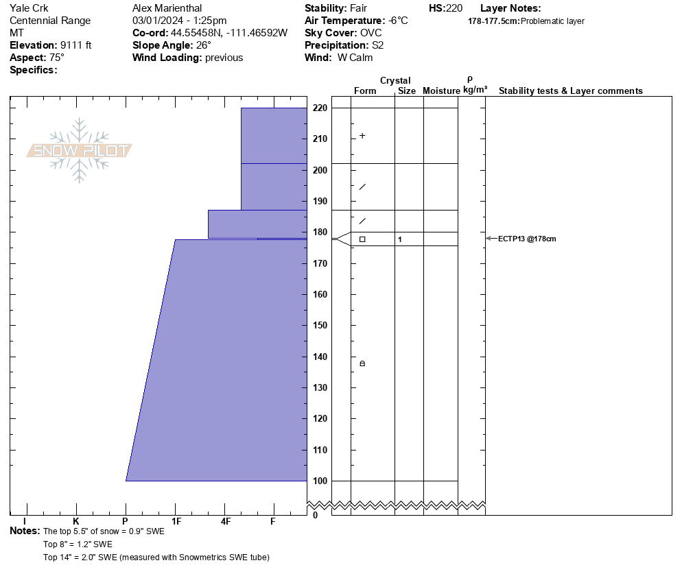

While touring in the Bacon Rind area today, our group experienced three audible collapses, one of which was extremely large and thundering. All of these collapses were experienced in the flat meadow areas below the typically skied slopes.
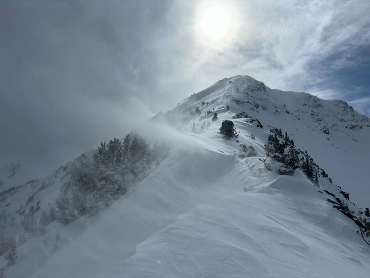
Full Snow Observation ReportThe snow ranger crew was out in the Bridgers today. The wind had just started picking up as we got out there and the 8-10" of new snow was really moving around. We spent some time near Fairy Lake and then moved over towards the Throne. By late afternoon there was lots of snow blowing through all of the bowls and down into the flats as well as heavy wind loading below the ridge top. The new snow is on a fairly hard surface from last week's wind and warmth and we did spot a few storm snow avalanches coming off of Hard Scrabble. As we left the Fairy Lake area we did notice several fresh slab avalanches along the ridge top and in the middle of the bowl between Naya Nuki and Sacajewea.
Full Snow Observation Report
Triggered by BBSP
Full Snow Observation Report
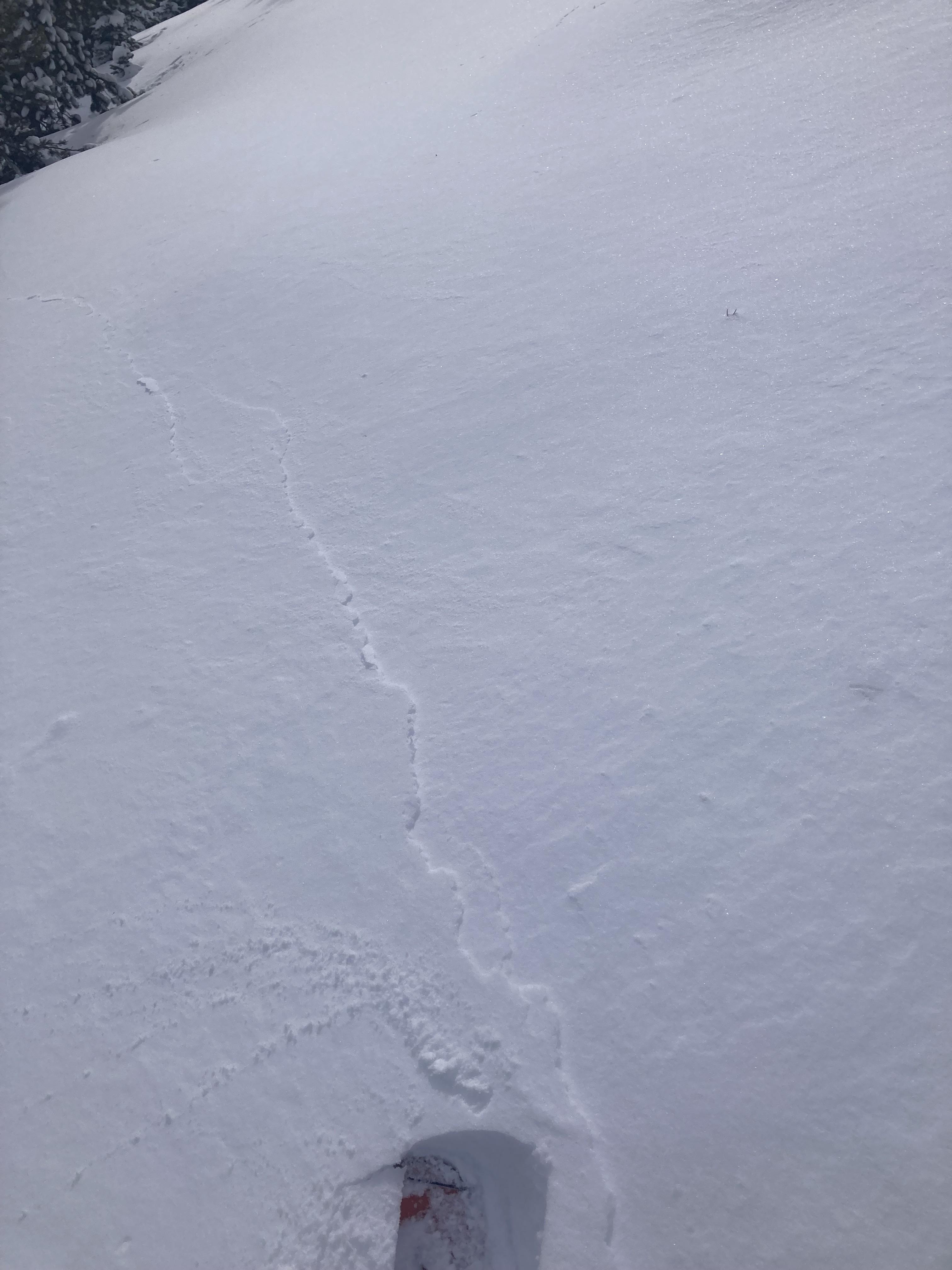
Skied the meadows northeast of Blackmore today. Saw numerous loose dry slides on the way up. Didn't see any wind slabs. No whumphs or shooting cracks. SW wind was pretty strong most of the morning. HS 240cm!
Full Snow Observation Report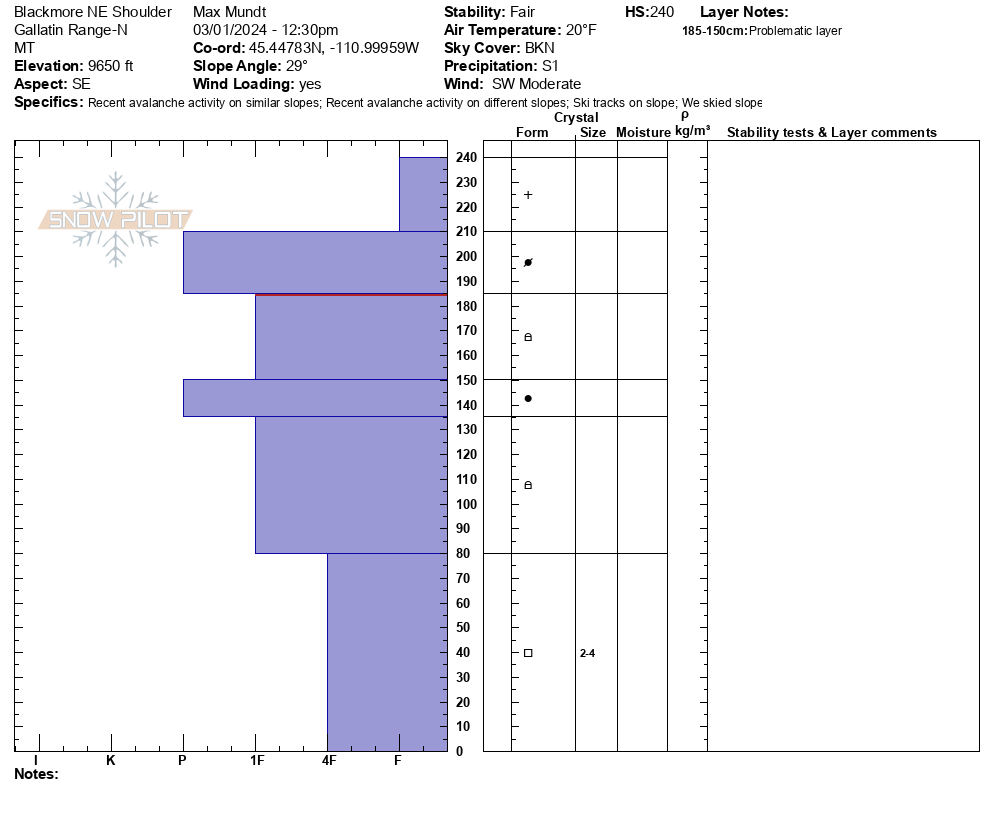
Two obs - two days ago I was poking around Mosier Creek drainage. Weird thing was that there was no wind impact - no drifts and snow was still on all the trees. Other than that, super weak snowpack with lots of collapsing. In fact at the lower elevations, snow pack was ~24" deep and my dog was breaking through all the way to the ground (she is about 60#)
This morning I was up in Bear Canyon - only about half the snow (4") as on the south side of town by SMS. Pretty bullet proof layer under the new snow, but it seems it came in wet enough that it adhered well. It wasn't even sluffing off at the break over points. Snow was not done at that measurement as it was still dumping when I left around 6:30.
Full Snow Observation ReportWhile on a walk up the main fork of hyalite today I noticed a slide on the west side of the drainage south of the maid of the mist
Full Snow Observation Report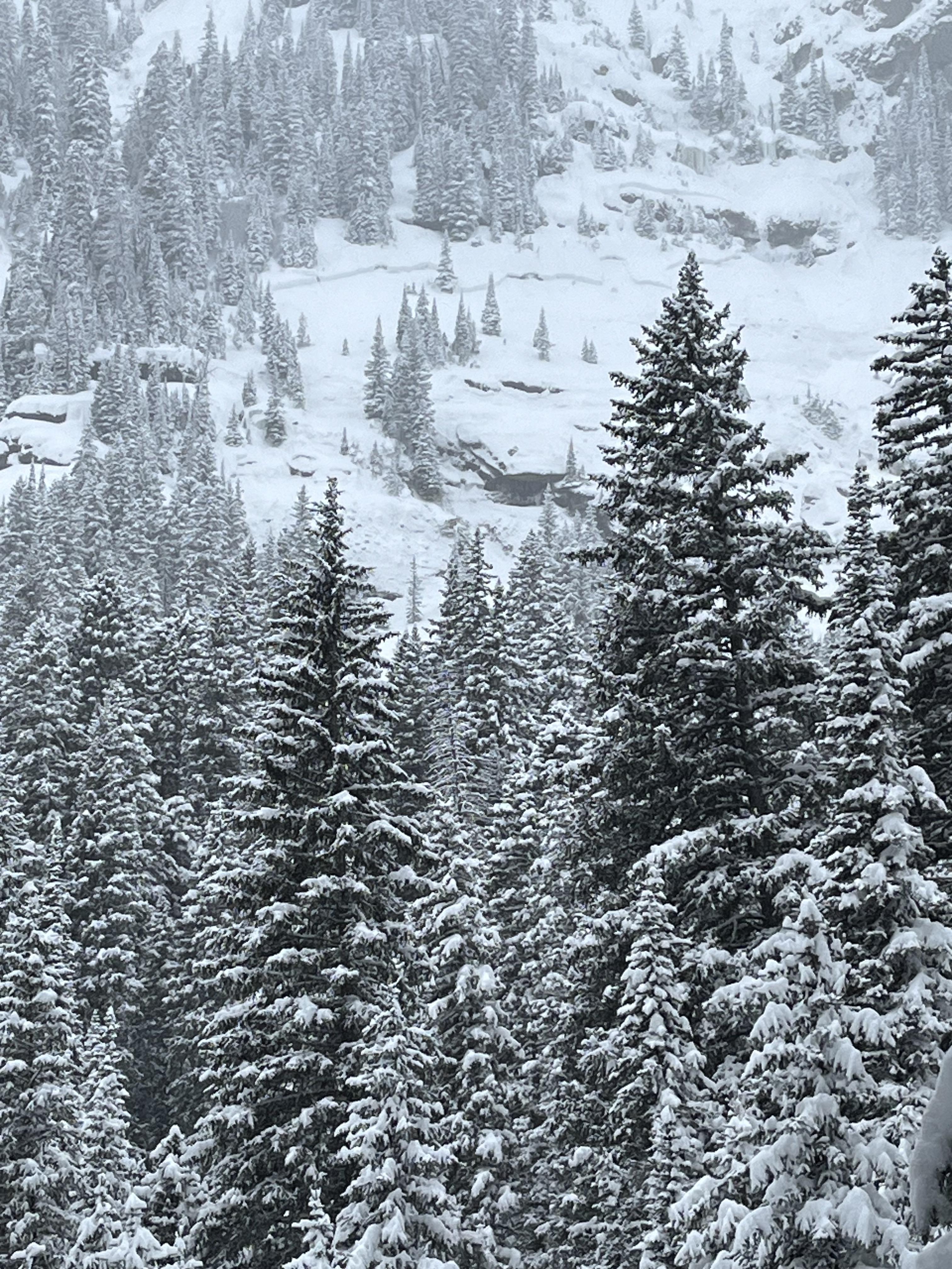
Climbing near the Silken Falls / Dribbles areas from 11:00 to 17:00, we observed strong winds throughout the day. HN was 7-12cm on valley floors, and as we passed the Dribbles on the approach we noted a 20-25cm stiff wind deposit near the base of the buttress was that 1F- in firmness.
Wind transport was intense throughout the day both in areas we traveled and visible plumes at alpine ridgelines with the amount of fresh snow available for transport —a photo will not do the experience justice. Due to the protected nature of the climbs we were on, it was hard to tell which direction winds were blowing from. We observed 15 to 45cm of snow in the gullies we traveled (N & NW facing, ~7600-8600'), with the average HS being 20cm. While there was limited wind stiffening at the surface of much of the snow in these gullies, wind slabs were not present in the areas we traveled. We did not travel to the very top of any gully system, so I cannot speak at length to the hazard at the upper reaches of this wall.
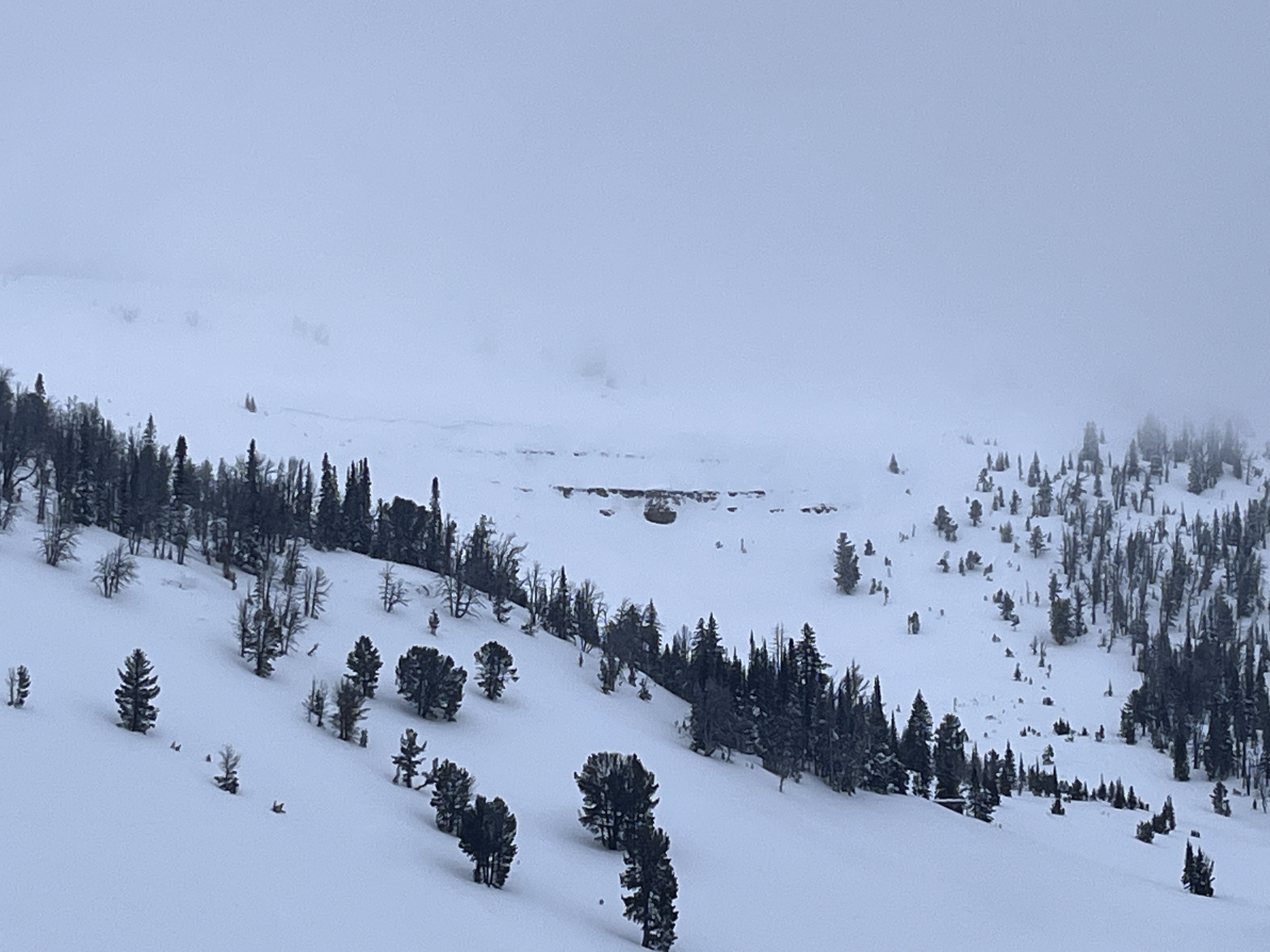
Looking out towards Divide Peak and the Divide Cirque at the end of the day, we noted 3 fresh crowns that were not present in the morning. These were D1 to D1.5 in size, breaking along the base of cliffs, and appeared to be wind slab avalanches from a brief peek through some glass. There was a lot of small loose dry activity that we observed across canyon at middle to upper elevations as you would expect with strong winds and fresh snow. All activity was in line with what one would expect given the forecast and weather inputs.
Full Snow Observation Report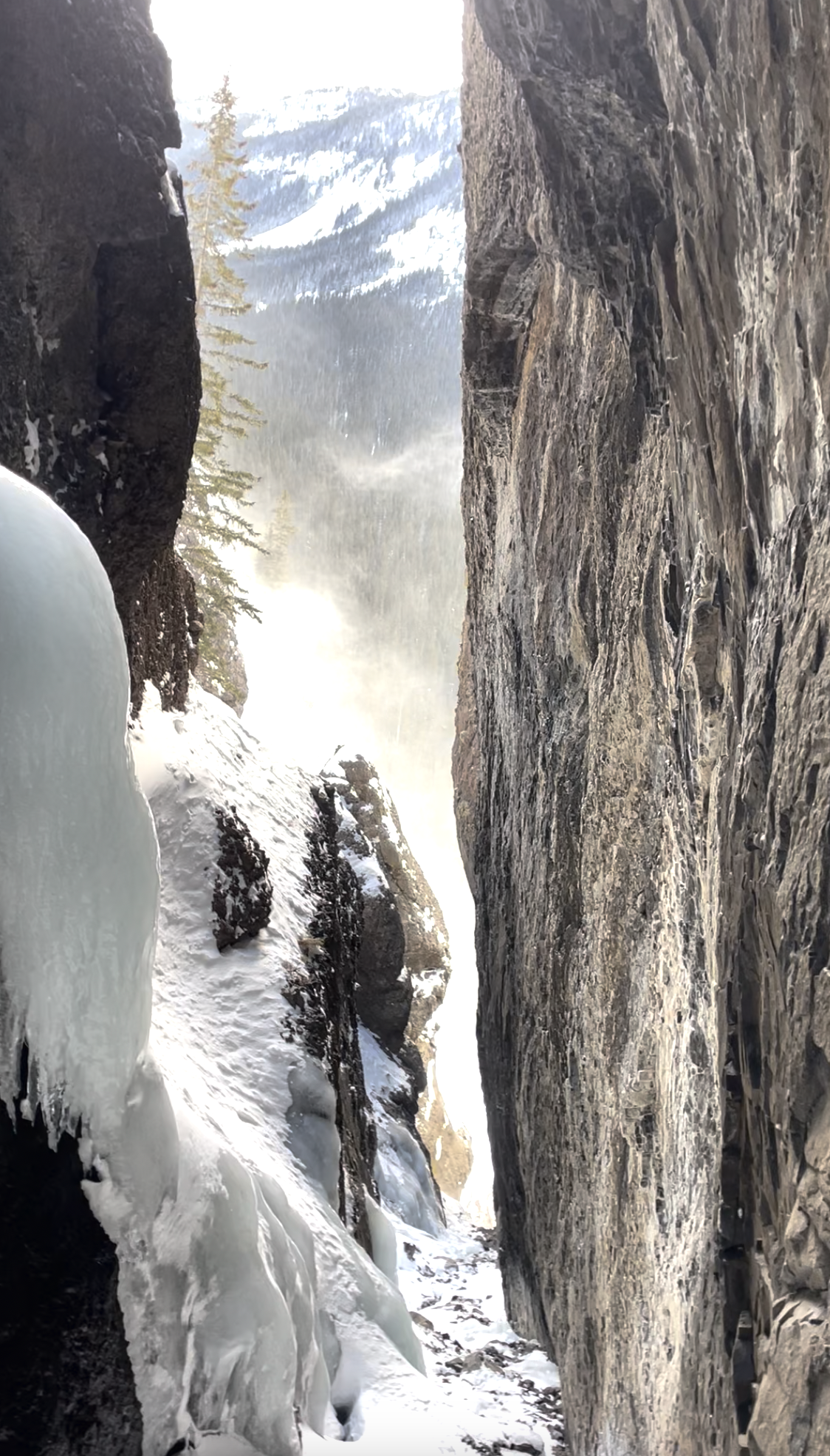

We rode portal creek meadows as an exploratory mission as neither Kyle Marvinney nor myself had ventured there much. New snow from the previous storm cycle had settled to about 4 inches, but it was hard to tell due to widespread wind effect. Judging from the snow, temps up there have mostly stayed below freezing during this previous warm cycle (after Monday/Tuesday storm), though there is fairly supportable crust below the storm layer. winds were blowing consistently 10mph up high gusting to and estimated 25mph. We observed one small avalanche in the riding area that occurred before the recent storm cycle and seemed characteristic of other similarly sized avalanches we have been observing throughout the season.
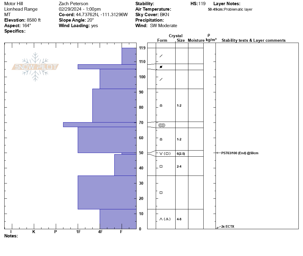
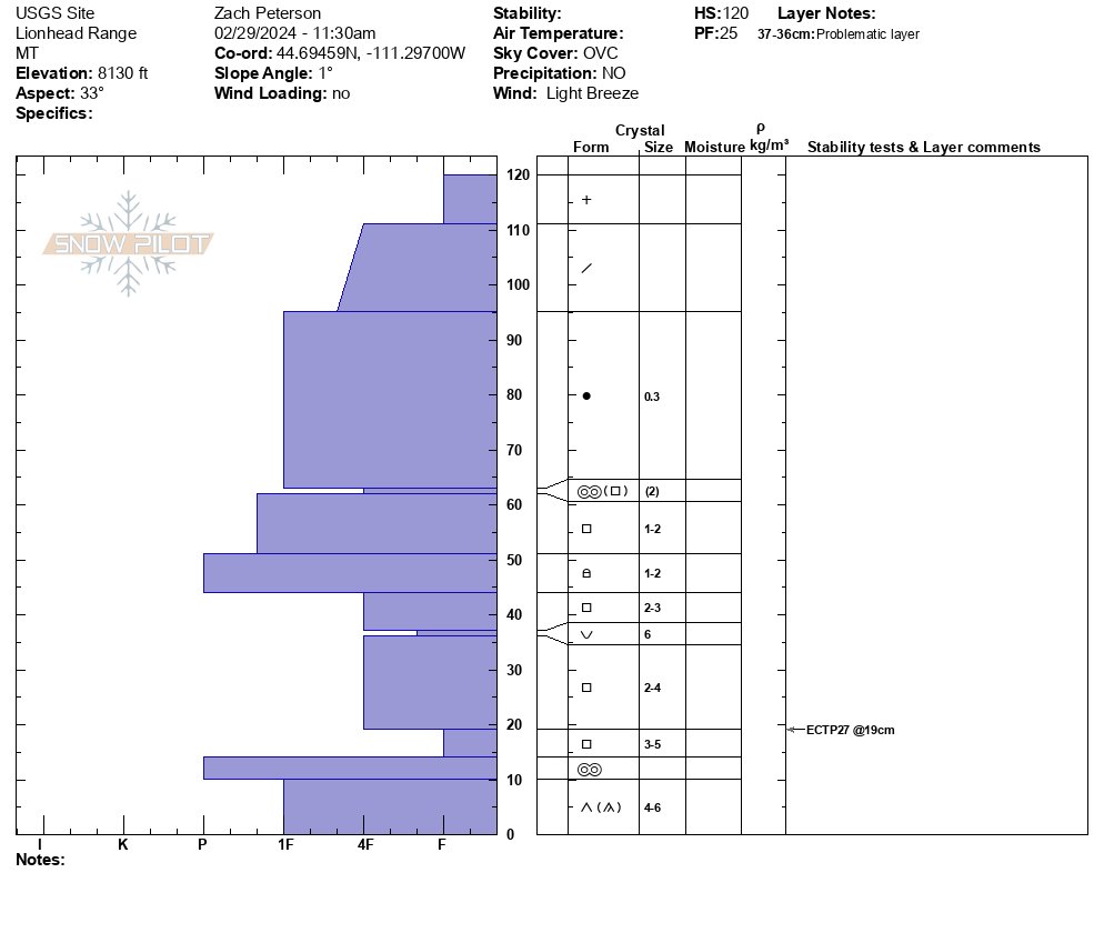
Full Snow Observation ReportWe rode into Lionhead with the USGS and USFS snow chemistry, hydrology and soil science teams. At the top of Ski Hill we dug a snow pit and in stability tests we got an ECPT27, that failed on weak snow near the ground.
From here we rode to Motor Hill via Denny Creek. While crossing below Lionhead Ridge we saw an avalanche in Airplane Bowl that likely happened a few days ago. This avalanche broke 12” deep and 100’ wide.
Above Motor Hill we dug another snow pit on an easterly aspect at 8600’. We had unremarkable test scores of ECTX (twice) and a PST 63/100 end. We saw a similarly poor structure as our previous pit, with weak sugary snow low in the snowpack.
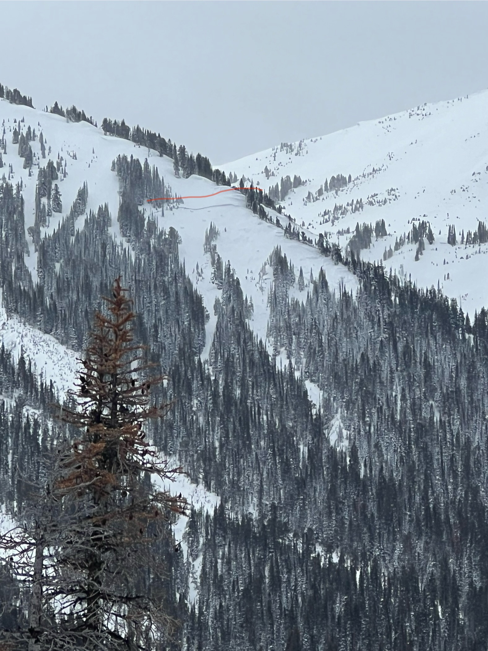
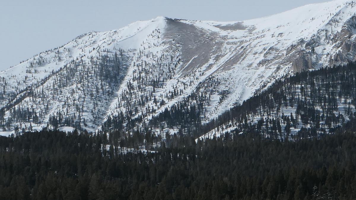
This morning with better visibility we stopped at the Hebgin pull out and were able to see 3 recent avalanches along Lionhead Ridge that were likely the result of recent wind blown snow.
Our snow pit results above and the lack of deep avalanche activity were encouraging and initiating failure is becoming more difficult. This will change with incoming snow and wind so expect the avalanche danger to increase. This storm will hopefully test the snowpack and we are curious to see if it results in widespread avalanches or is able to support the new and wind drifted snow.
Full Snow Observation Report
This snowpack can take 1” of water before going to a warning.
This is somewhat irrelevant with the incoming storm but the danger seemed closer to Moderate than Considerable today. Initiating failure was hard and there wasn’t evidence of recent activity following the last storm. We will see what this storm does but long term discussing Moderate danger seems appropriate.

Toured up Republic Creek today. Went to the ridge below Republic Mountain and then to Woody Ridge.
winds picked up throughout the day and by afternoon were moderate gusting to strong at treeline and ridge tops from the W,SW.
started lightly snowing around 1 pm.
observed 2 crowns in wind loaded terrain. One at the end of Woody ridge on a north facing sub ridge (Peterson’s prow ) and the other on an East facing Ridge seen from the top of Wyoming bowl.
Full Snow Observation Report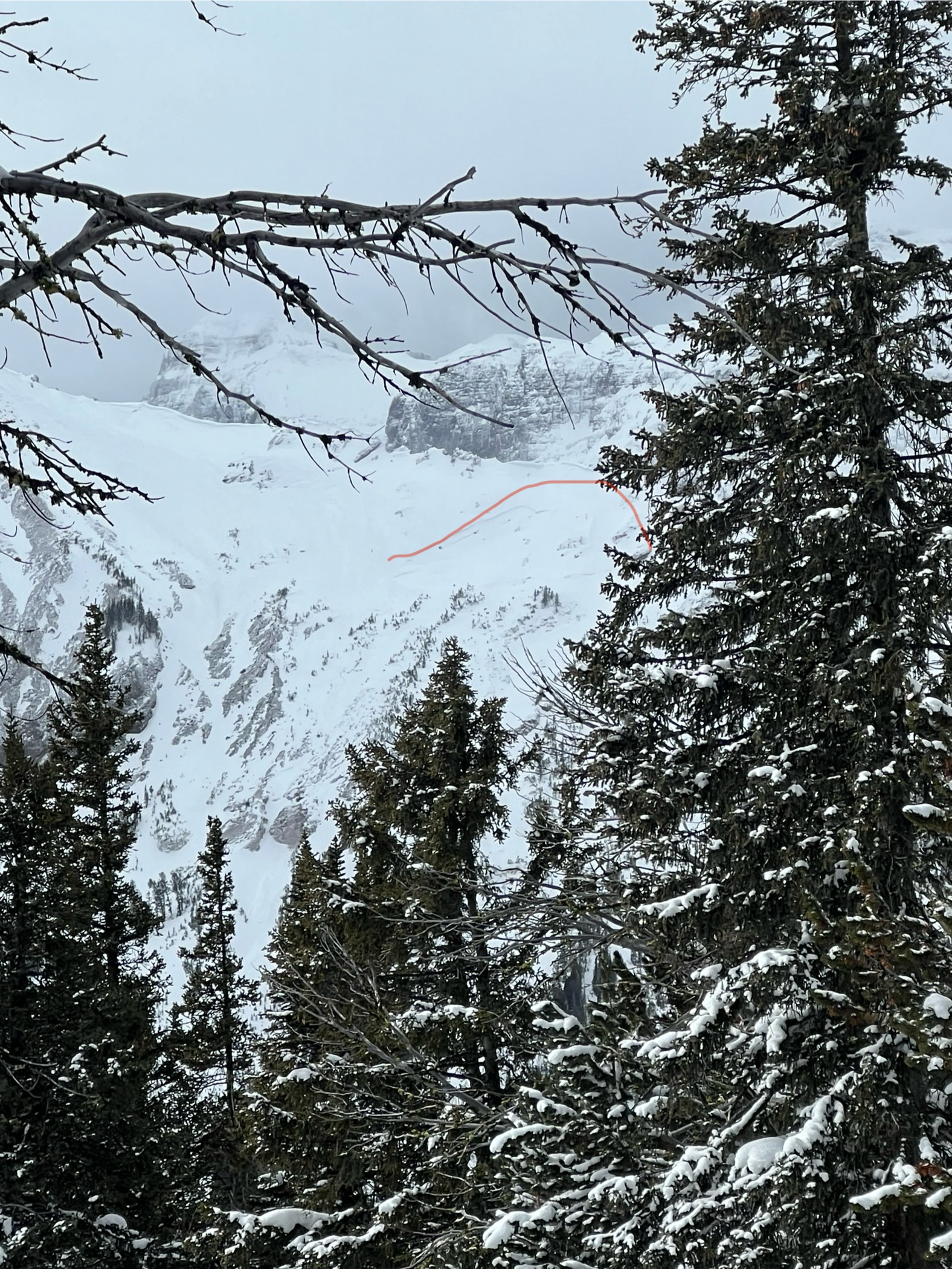
Rode Sawtell past two days. Very wide spread stout slab formed under the new snow that’s fallen. Heavy winds have scoured new snow away in places and deposited pillows in other aspects. Dug a pit with ECTX results but did not two layers of concern. One thin buried facet layer about 60cm down and the thick melt freeze about 80cm down. HS was 160 on a SE aspect about 8300.
Full Snow Observation ReportSkiing some dog pow across Hyalite reservoir between 7200-7800’ on a NE pitch I got lots of whumphs and shooting cracks while braking trail. This was a shallower snowpack than most other areas, it was still easy to break into basil facets with skis on.
Full Snow Observation Report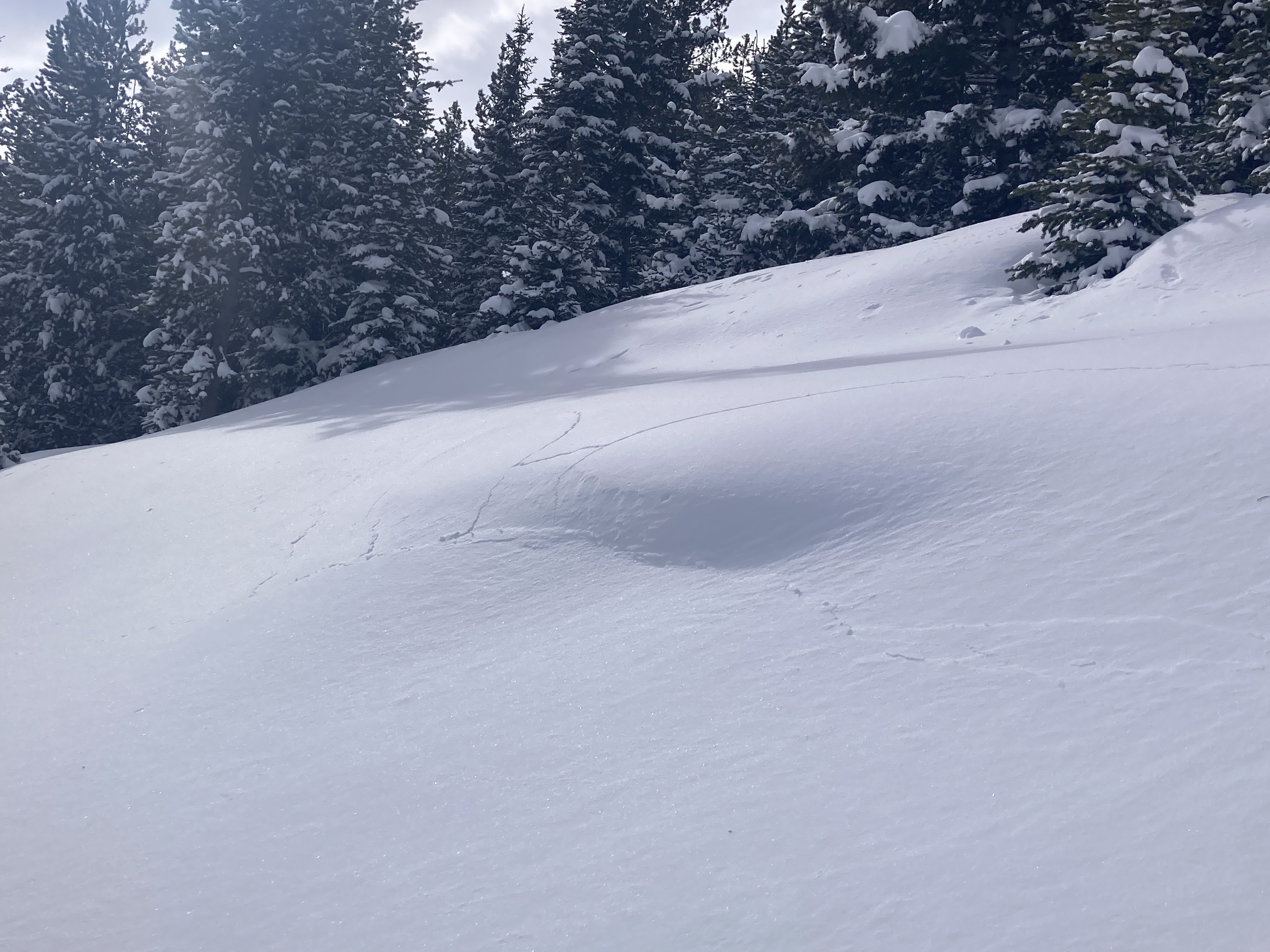
I was skiing inbound at Bridger Bowl today and noticed a small wind slab avalanche that failed on quarter saddle. I estimate comparing the photo to Google Earth that the slide ran 250 vertical feet and broke 100+ feet wide. Ongoing wind-loading and obvious instability.
Full Snow Observation Report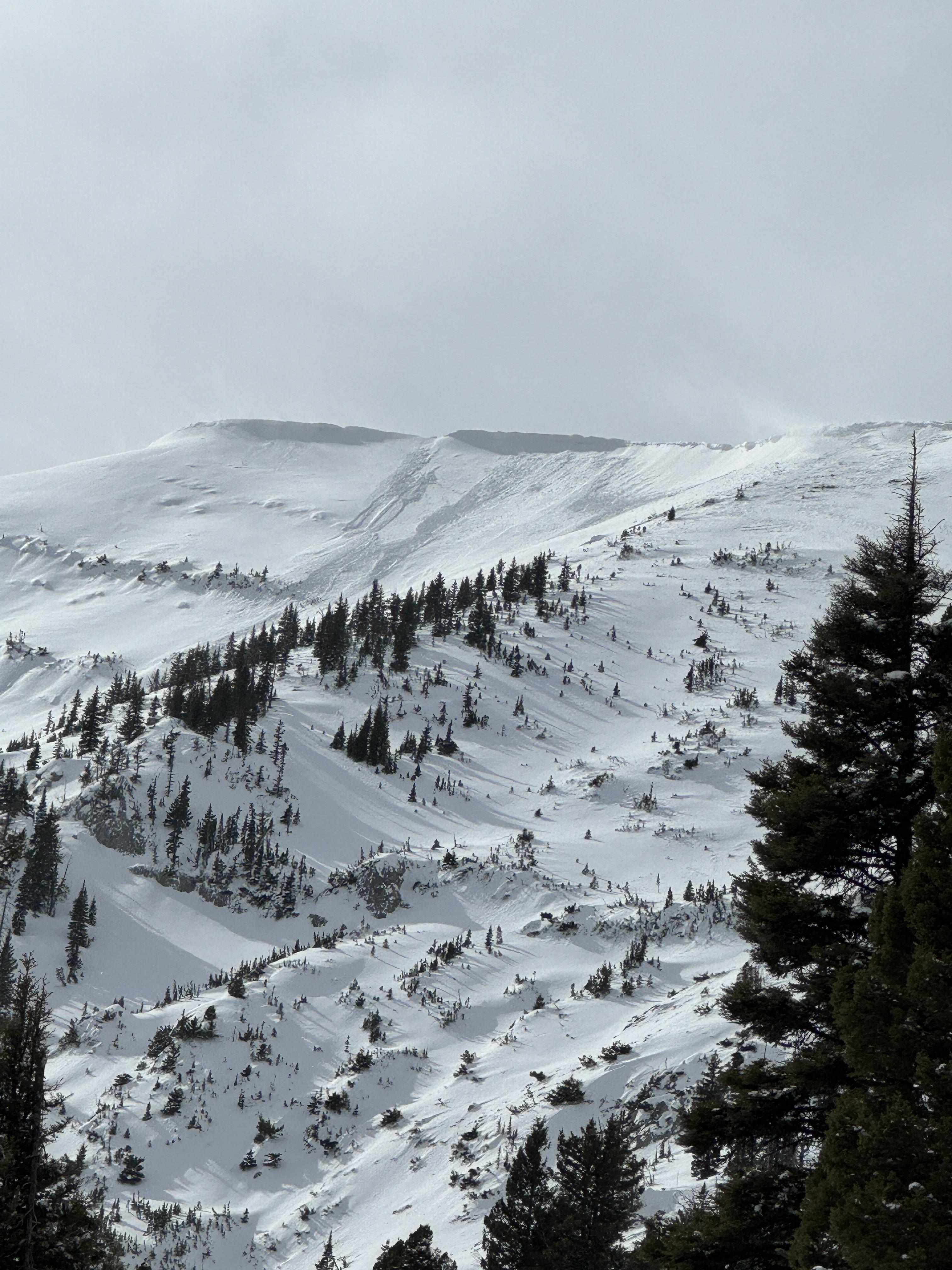
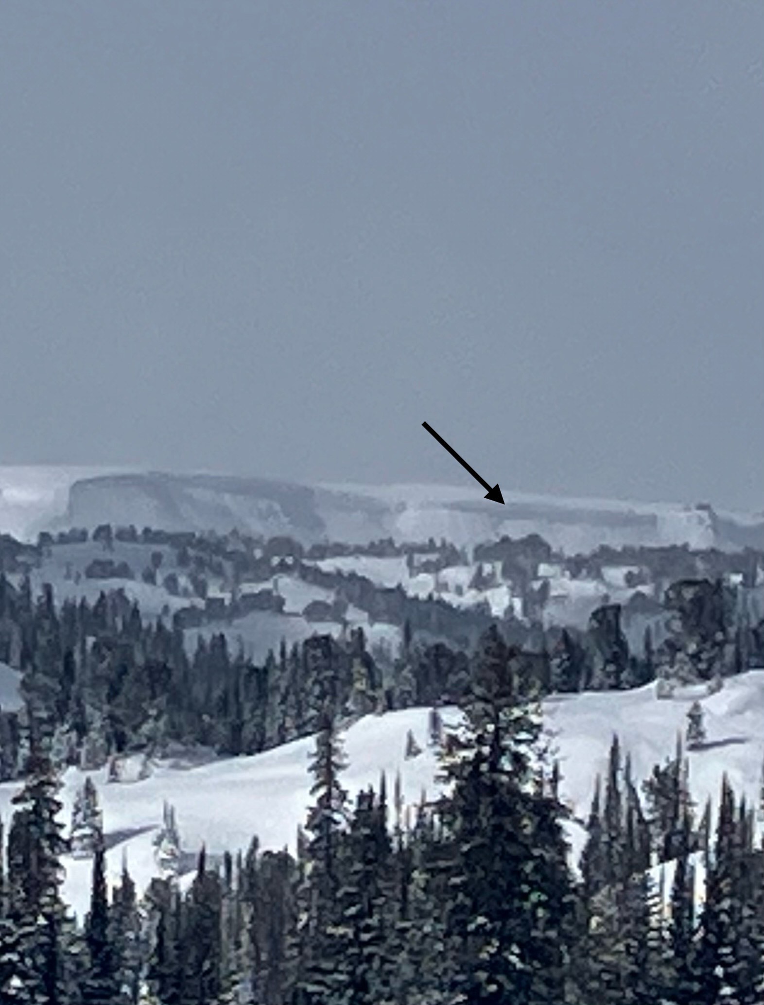
From IG: This avalanche was from this morning (02/28). It was windy and the gully was likely wind-loaded. One video shows the debris and crown. The pin on the map (below) shows the location of the debris.
Full Snow Observation Report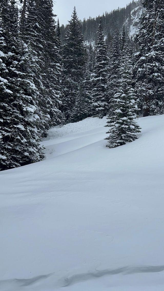

We exited Bridger Bowl ski area via the gate at the top of the Alpine Lift, ascended Bradley's Meadow and The Ramp and dug in one of the Refrigerator Chutes on a NE aspect at ~8000 ft. We found a snowpack that made us pretty hopeful about the direction things are headed in the Bridger Range. Snow depth was 160 cm and we got ECTX results. At least in this location, the weak layers are starting to heal. The early January weak layer was 1Finger hardness. We are not at all confident yet about how widespread this is, but nonetheless, it is nice to see things getting better somewhere.
Winds were calm below the ridgeline, but we could see big plumes transporting in Wolverine Bowl. Yesterday's skin track was completed drifted in in some places.
Around a foot of new snow from the last couple days made for good riding conditions.
Full Snow Observation ReportFelt MODERATE on non-windloaded slopes. CONSIDERABLE appropriate for the windload.

Touring from 6800' - 8800' breakable crust - both directions! Lots of whumphing down low but then none above 84-8600'.
Full Snow Observation ReportFrom email: "We didn't see any avalanches on E Henderson or E Sheep with decent vis on the ride in. One large avalanche on a heavily wind loaded slope below a huge cornice north of Scotch Bonnet. That one looked like it broke deeper/in the old snow, about 100' wide. Also saw one wind slab on a small slope north of Long Lake. 14-16" deep, 20' wide, and within the fresh wind slab. "
Full Snow Observation Report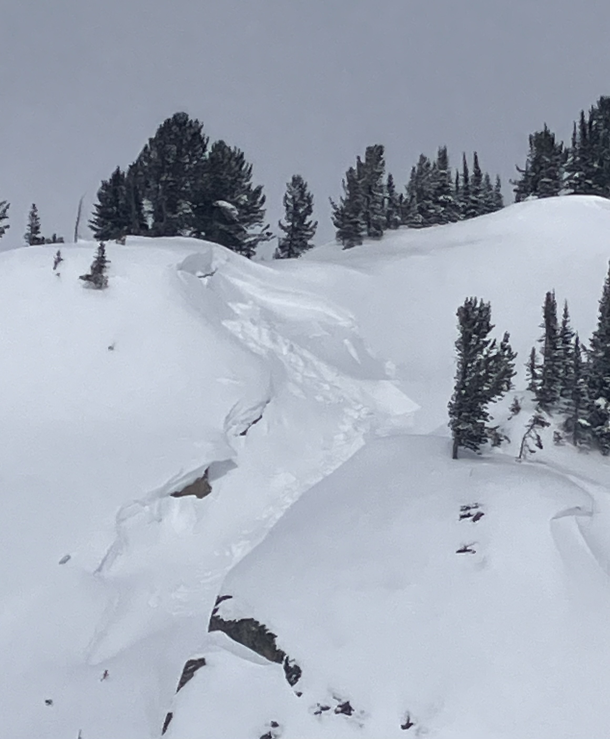
We rode up Taylor Fork around Skyline Ridge towards Cabin Creek. We found 12" of new snow had fallen over the last 24 hours. With poor visibility, we were unable to see any recent avalanche activity except for a small recent avalanche that happened near Beaver Slide. This was right next to a much larger slide that Doug and Ian had seen on 02/14/2024. While riding back we had a good view of the backside of Skyline Ridge above us and again saw no recent avalanche activity. However, many slopes had been stripped by recent winds. Strong winds and a foot of new snow that fell onto a weak snowpack kept us off of and out from underneath steep slopes, and recent snow made for pleasant riding conditions.
Full Snow Observation Report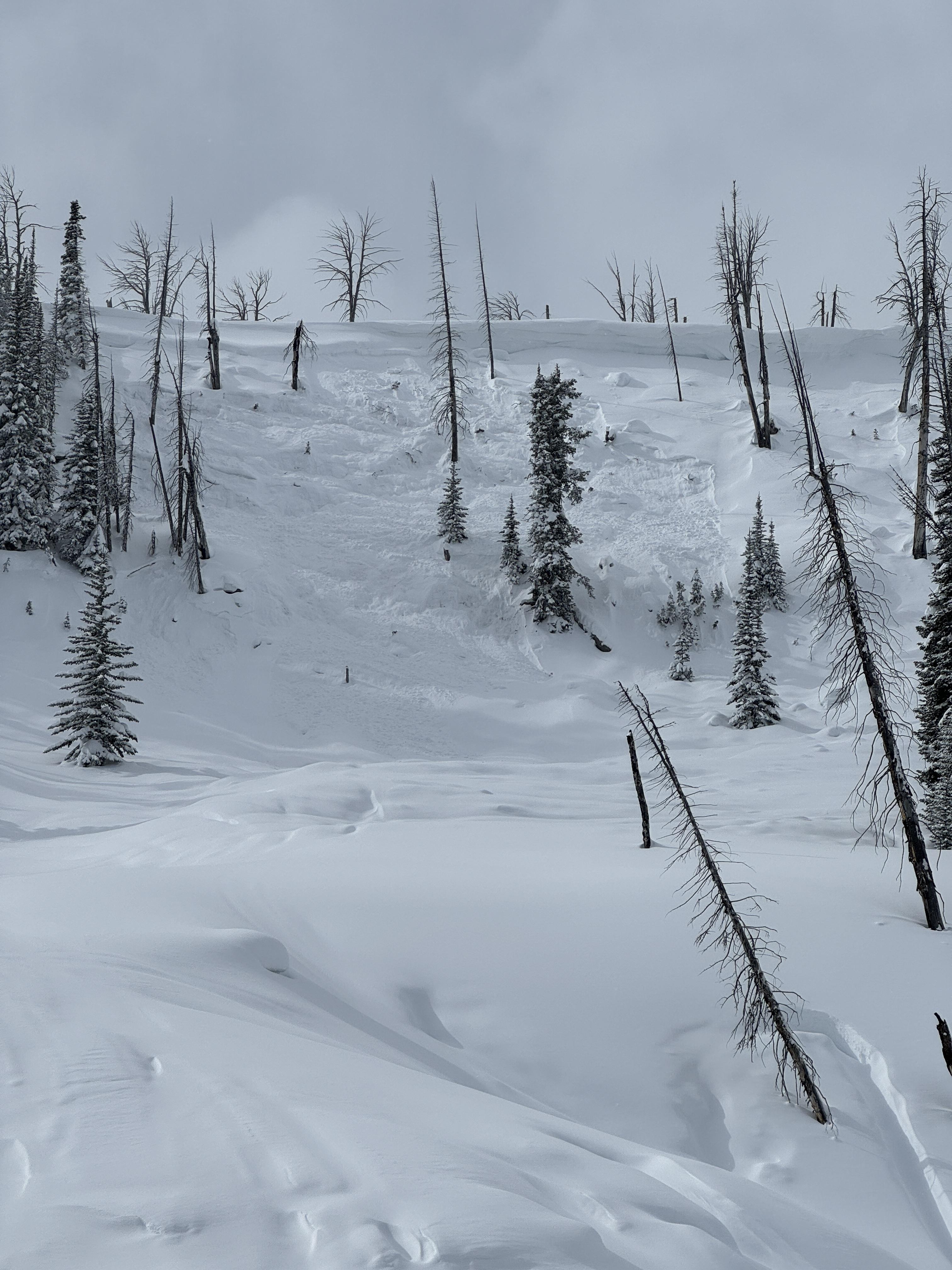

From IG message: “These are on the ridge between Miller Mtn and Sunset Peak on North aspect. All of the North facing ridge of Miller Creek up to Miller Mountain had similar slides too. The crowns filled back in overnight… The North facing ridge on Sheep Mtn slid as well, not sure on the trigger but a rider from another group send the following image of the Sheep slide“
Full Snow Observation Report