Snow Observations List
These avalanche were noticed yesterday morning (2/20), possibly happened on 2/18-2/19.
Full Snow Observation Report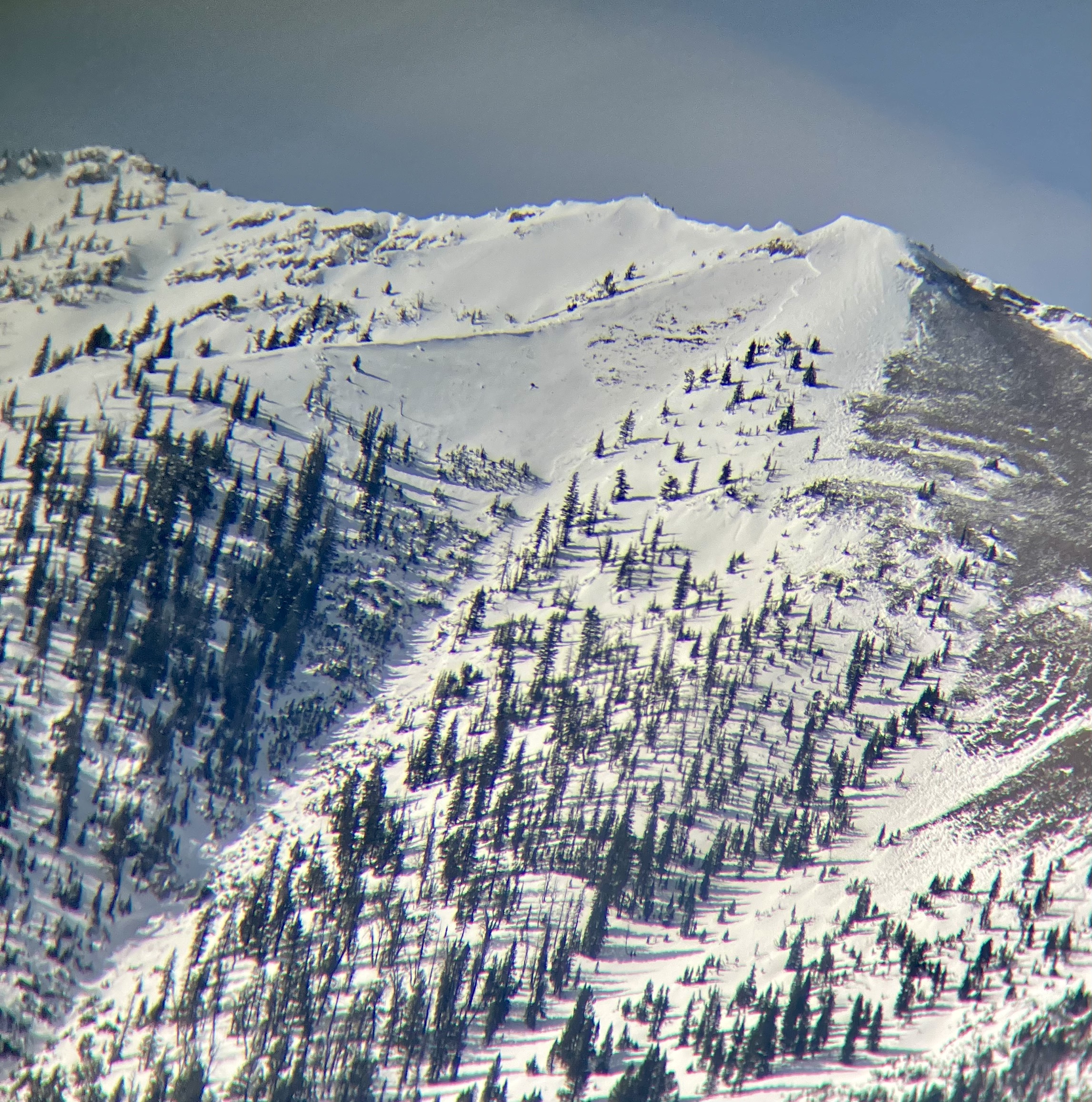
NW aspect, 13 degree slope, 7850 ft elev.
Total snow depth of 120cm
ECT X
Shovel Sheer (Hard) at 74cm
My ski partner triggered a big collapse/woomph from the our skin track, heading up from WY Creek back toward Republic Creek on an W facing slope. It was the second time we worked over this skin track, and it propagated to where I was at least, about 30 yards above them. I felt/heard the collapse 1/2 to 1 second after they triggered it.
It was snowing most of the afternoon in WY Creek with moderate winds with strong gusts at the ridgline coming out of the Southwest.
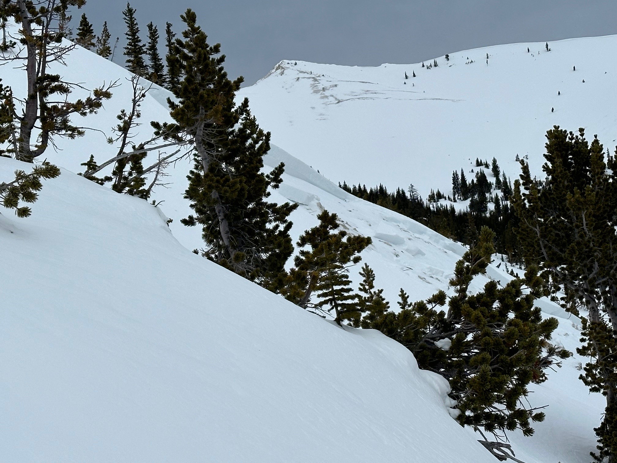
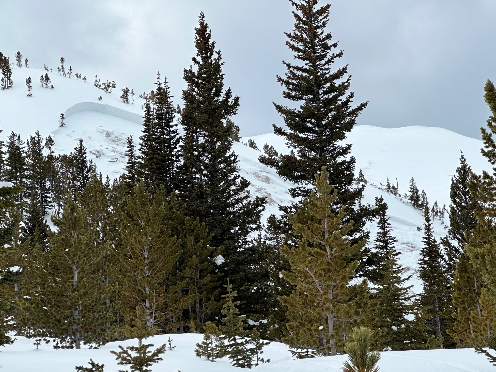
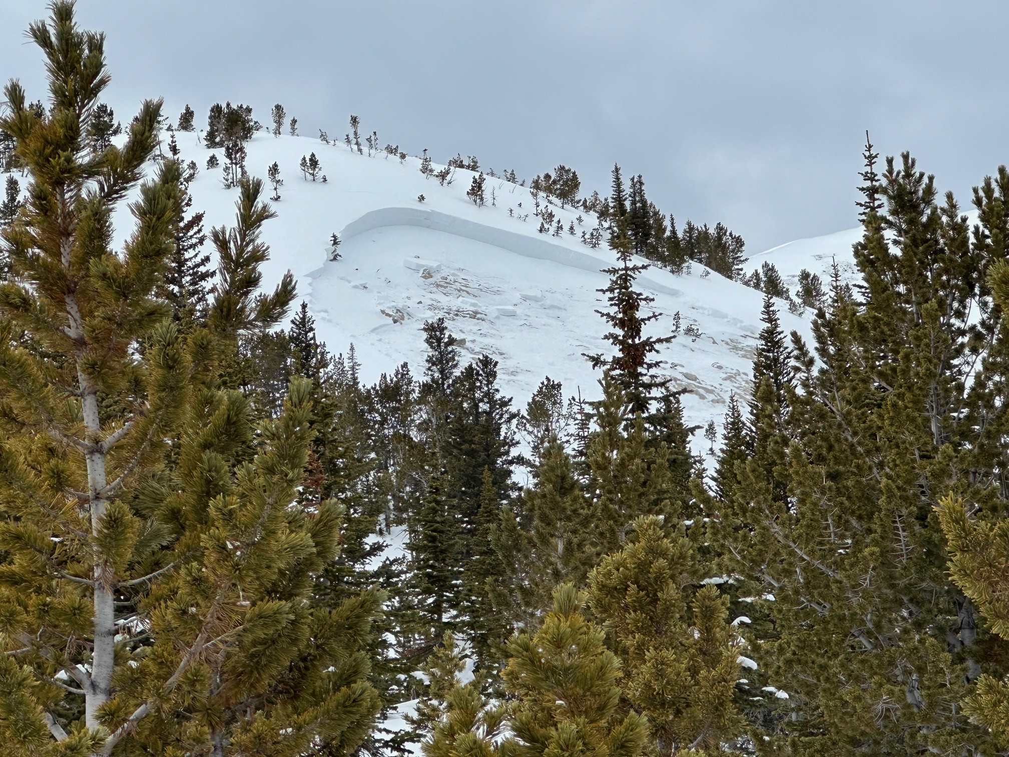
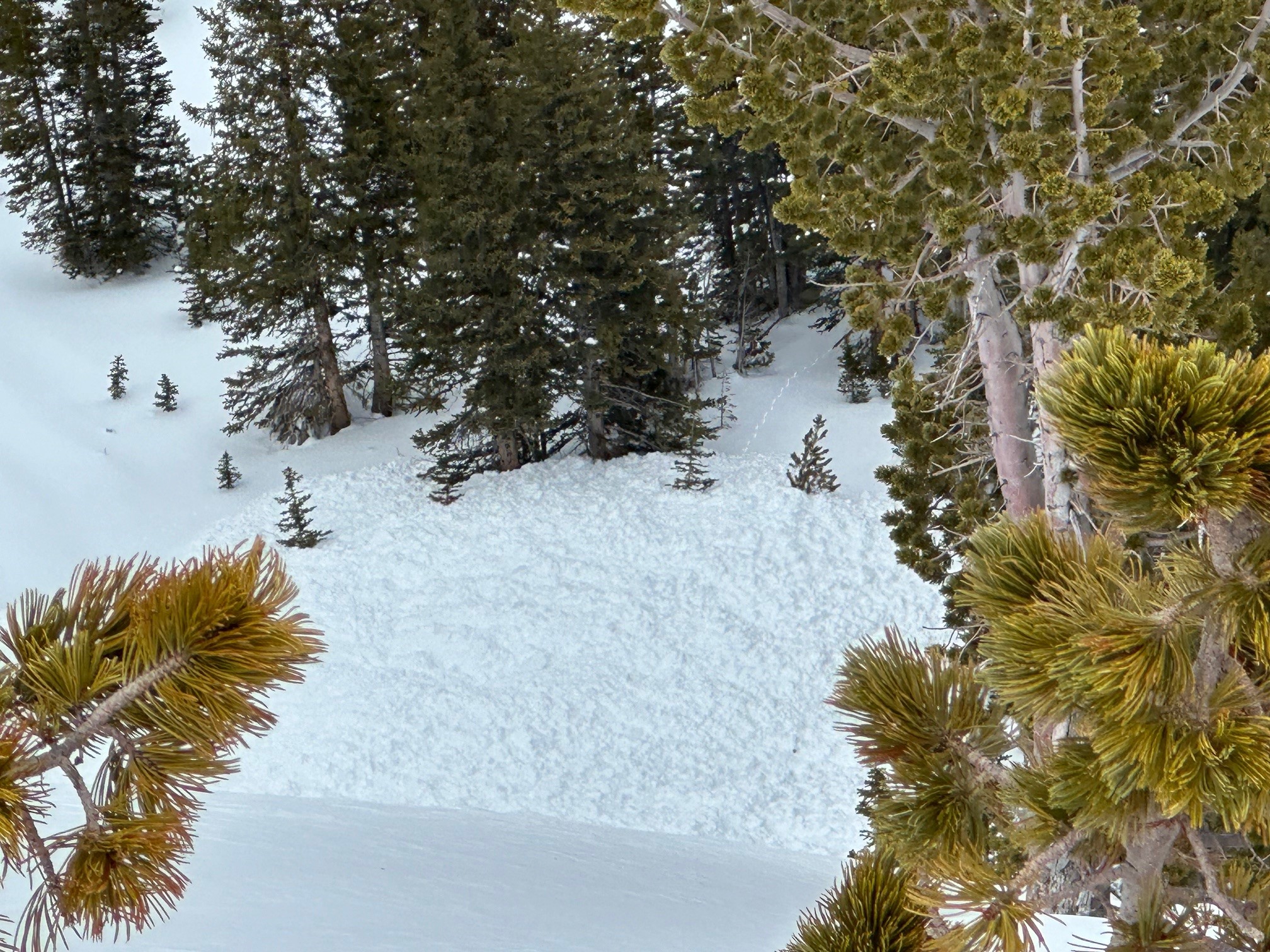
Full Snow Observation ReportOn the drive up Bridger canyon this morning we noticed an avalanche on an east-northeast facing slope at the ridge near Bridger peak that was not previously noted or reported. Likely natural, possibly happened overnight or yesterday, but maybe earlier and went unnoticed? It looked 1-2’ deep with rocks showing through parts of the bed surface. 200-250’ wide. Debris did not appear to make it all the way down the chute to flatter runout. But, light was not great and all dimensions were difficult to confirm.
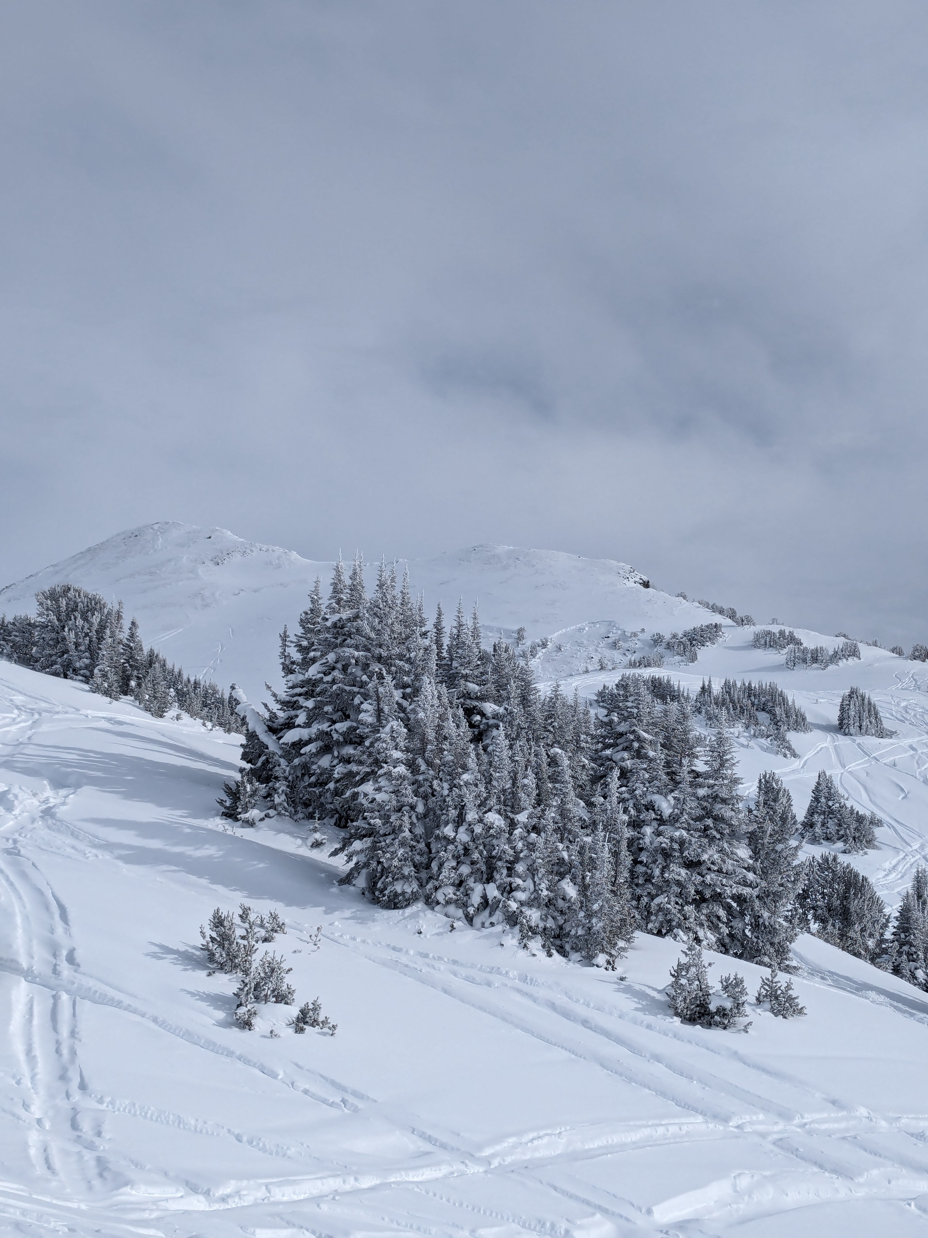
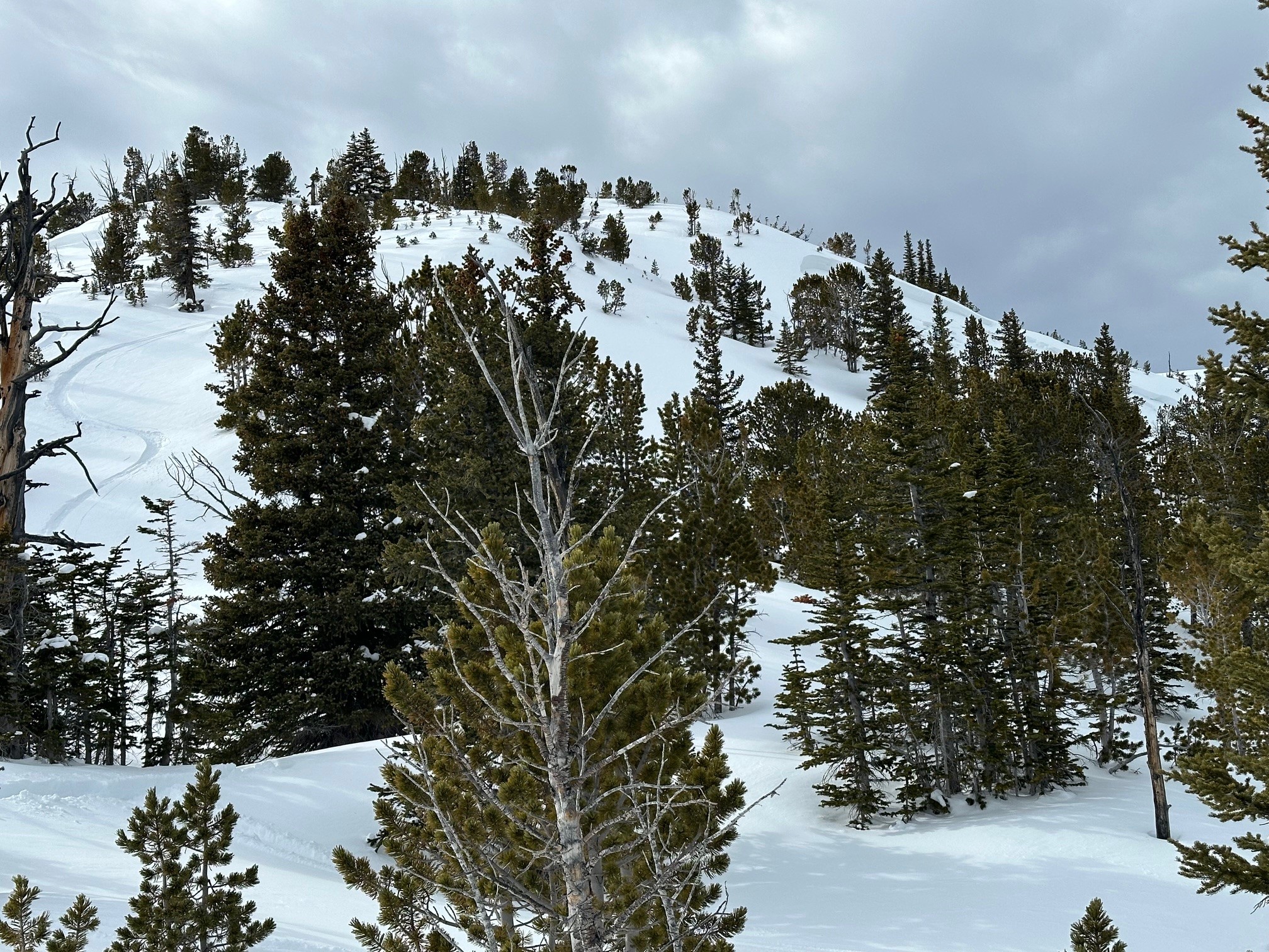
Full Snow Observation ReportWe skinned up the shoulder just south of the Bacon Rind skillet, through the upper meadows to the top of the Skillet and descended a similar route.
On our ascent we got no cracking or collapsing, but we did get some big collapses while we were descending through the trees in the bottom 1/3 of the ski run. We dug on SE and NE aspects in the upper meadows at around 8600 ft. ECTPs in the 20s on the surface hoar at the top of the December facets.
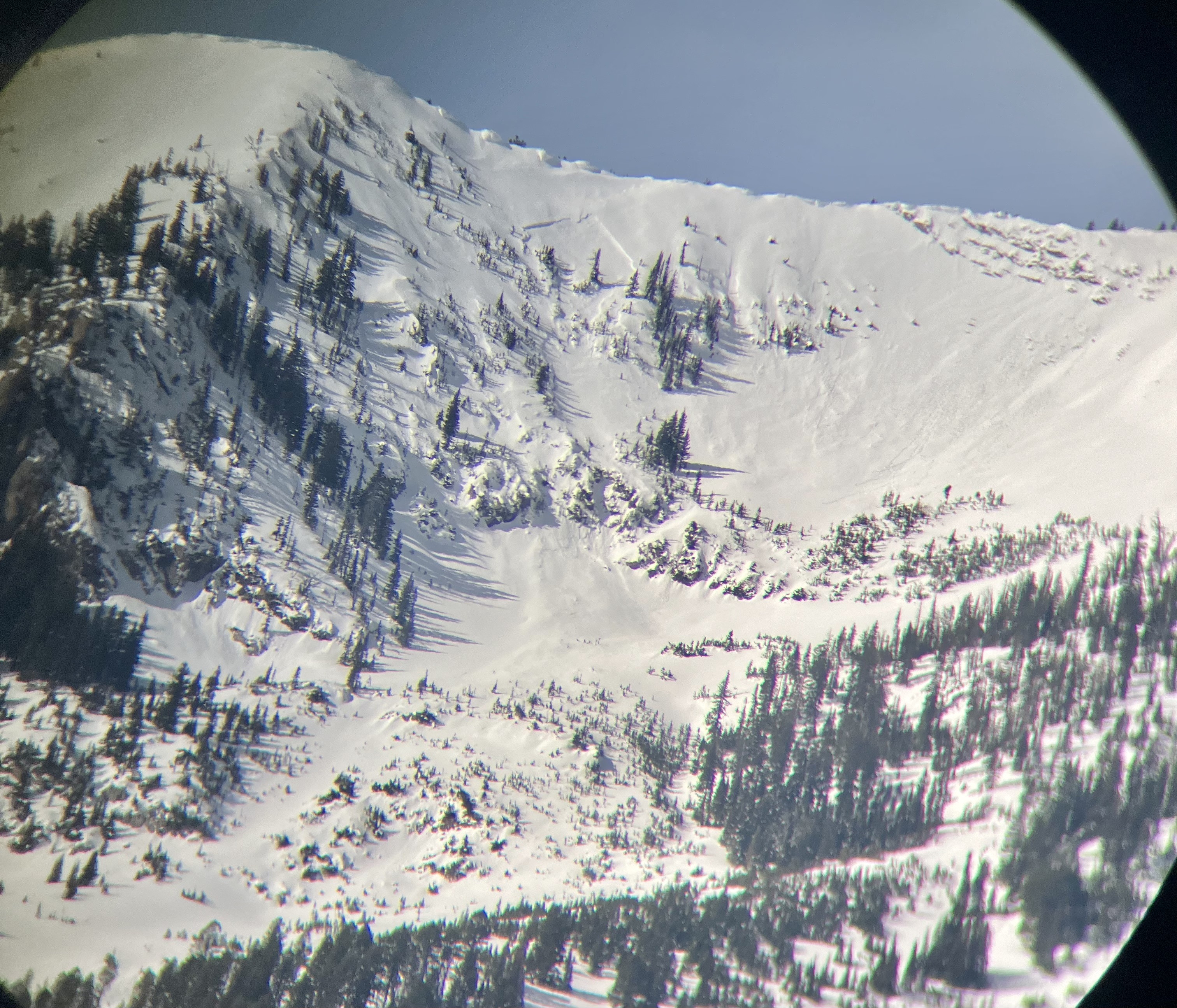
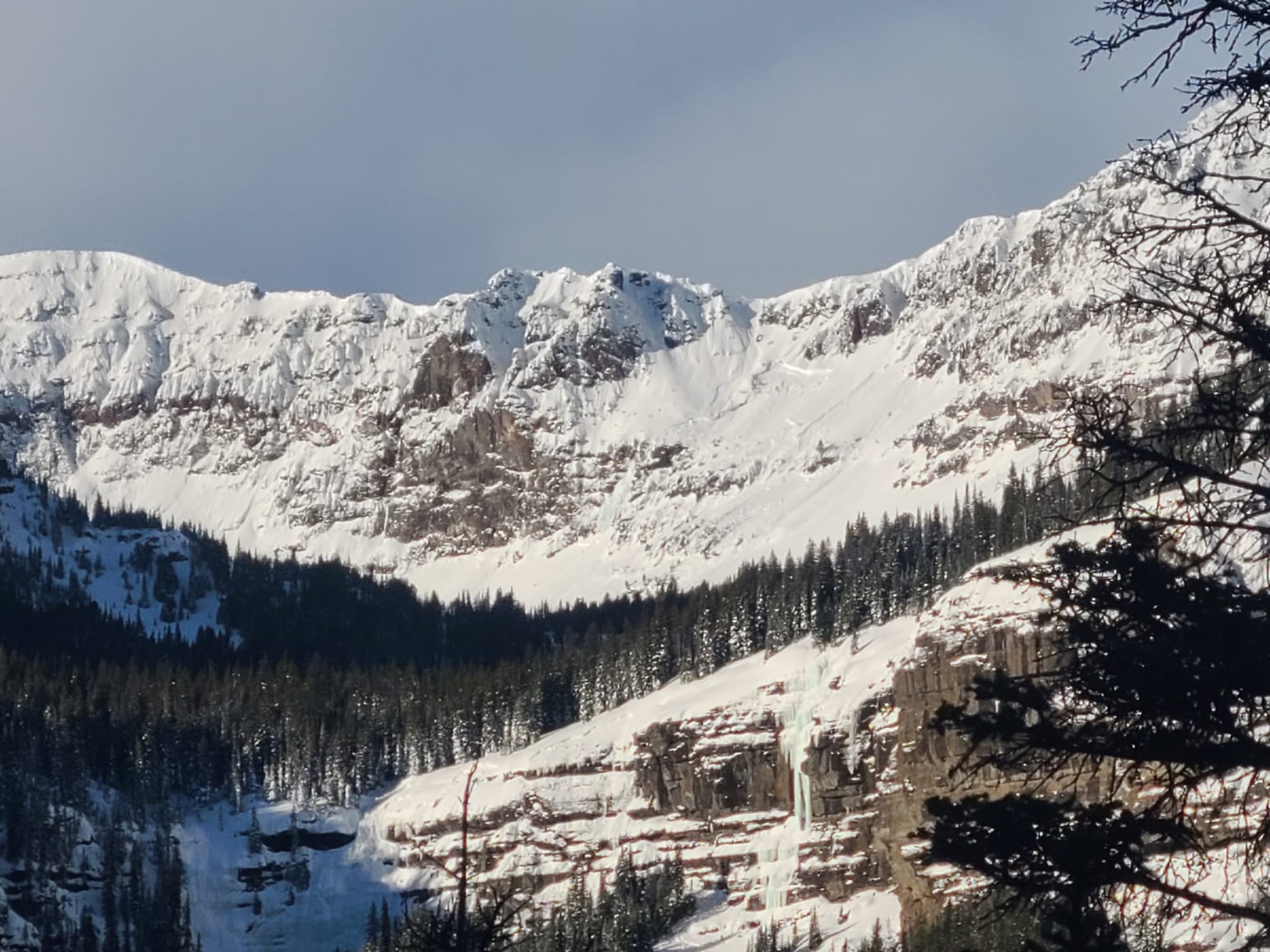
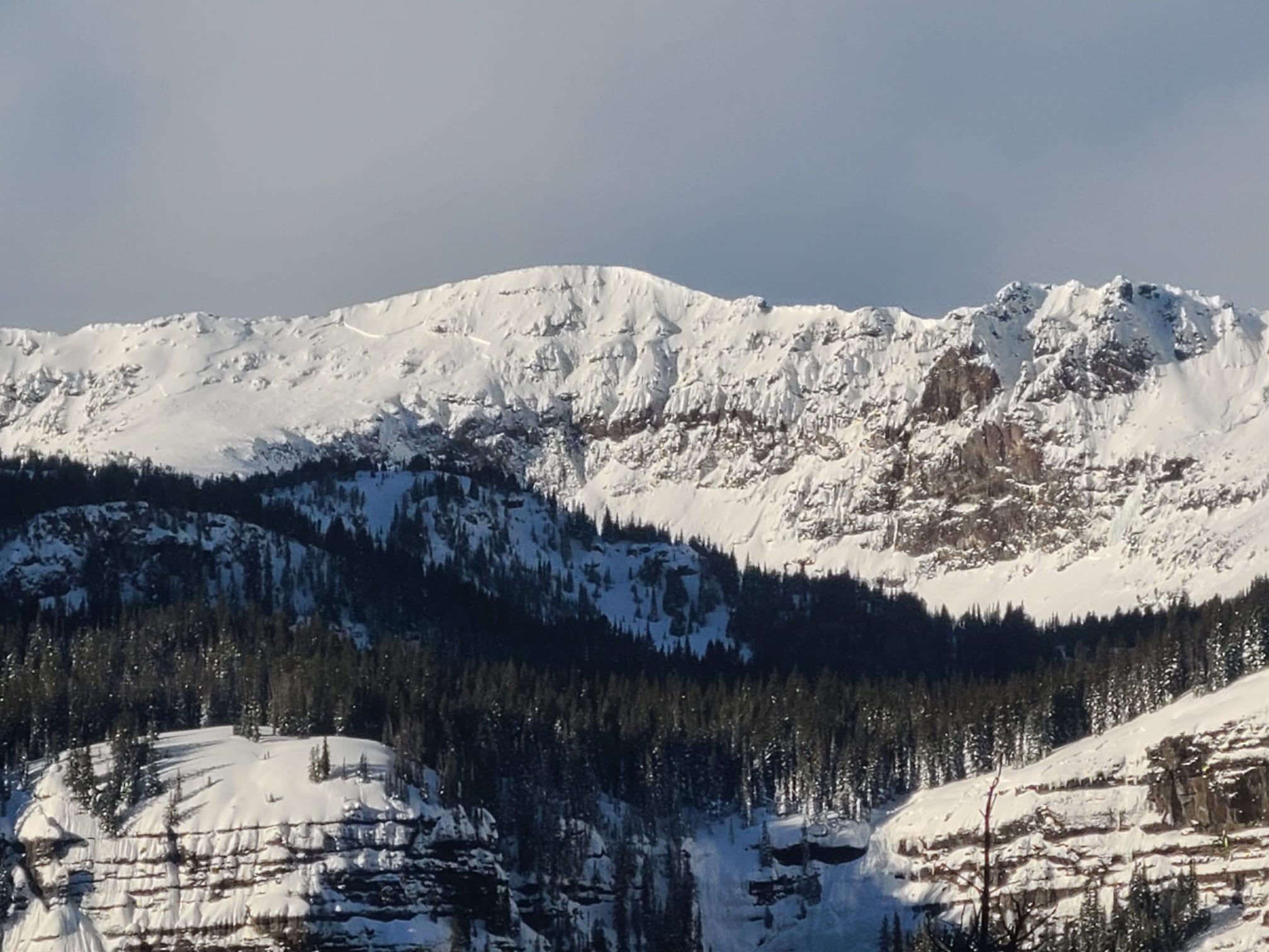
The skillet slid sometime recently. Based on the snow on top I'm guessing Thursday-Friday last week (Feb 15-16th), but it could have happened up to a week earlier. Broke ~2 ft deep, 150 ft wide, and it was hard to tell how far it ran, but I'm estimating 200 vertical feet.
We stuck to our conservative plan and enjoyed great low angle powder skiing and then bushwacking back to the car.
Full Snow Observation ReportCONSIDERABLE still seems right.

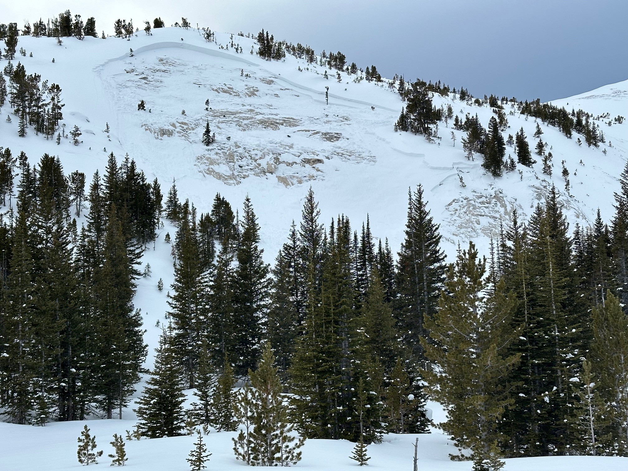
Saw this today. Relatively recent and a deeper failure than some of the other naturals on Saddle and the Football Field.
Full Snow Observation Report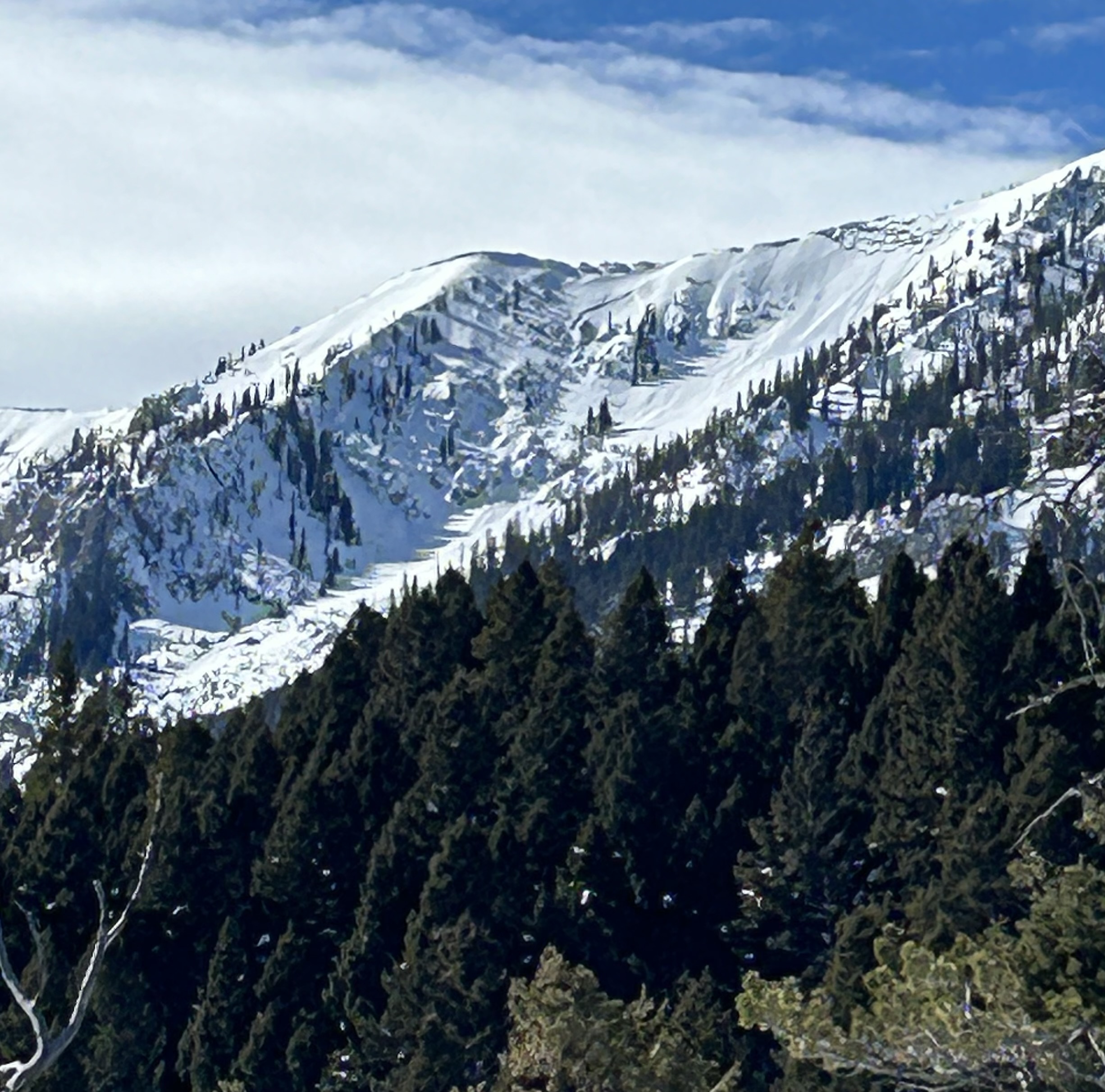
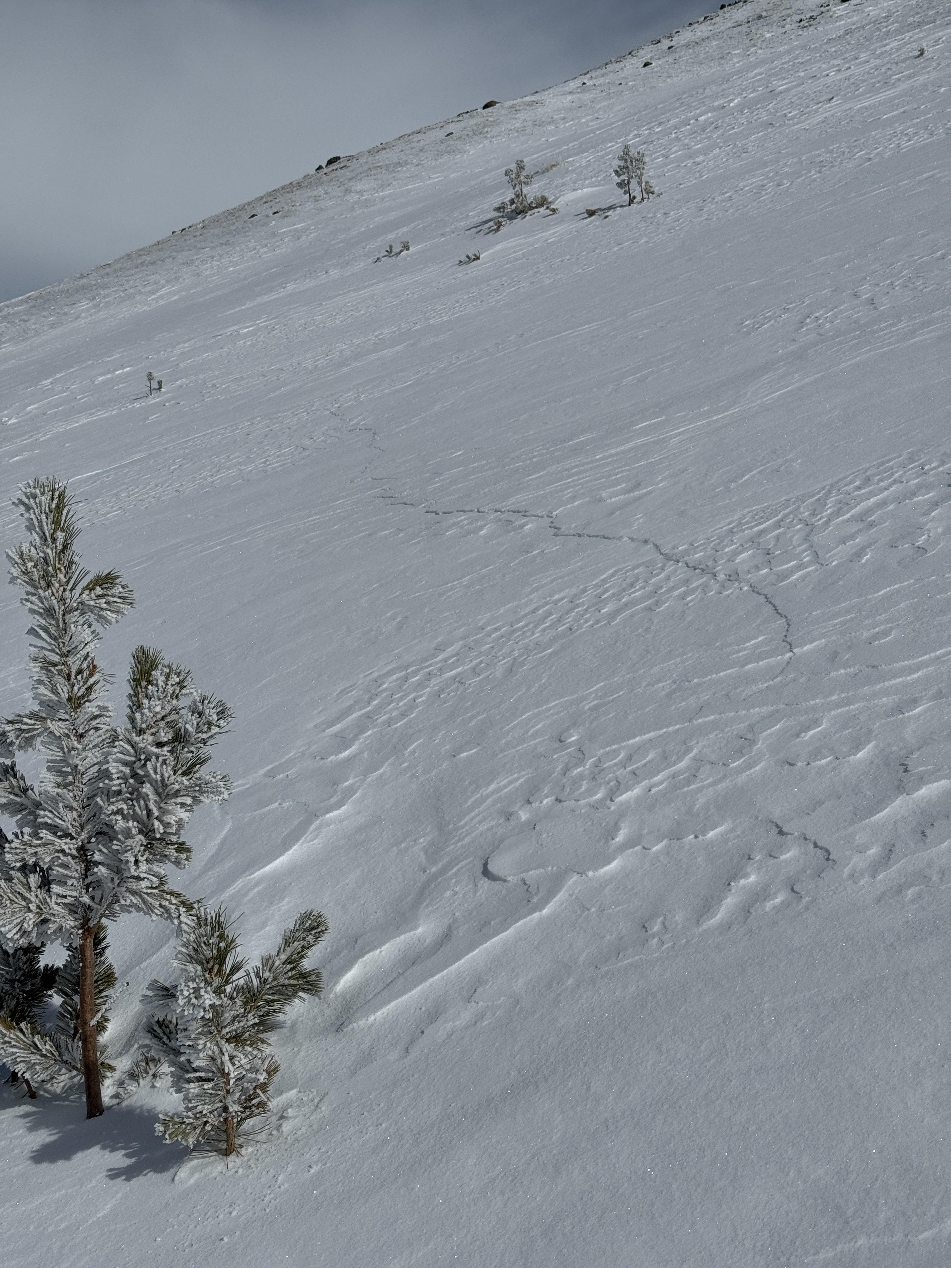
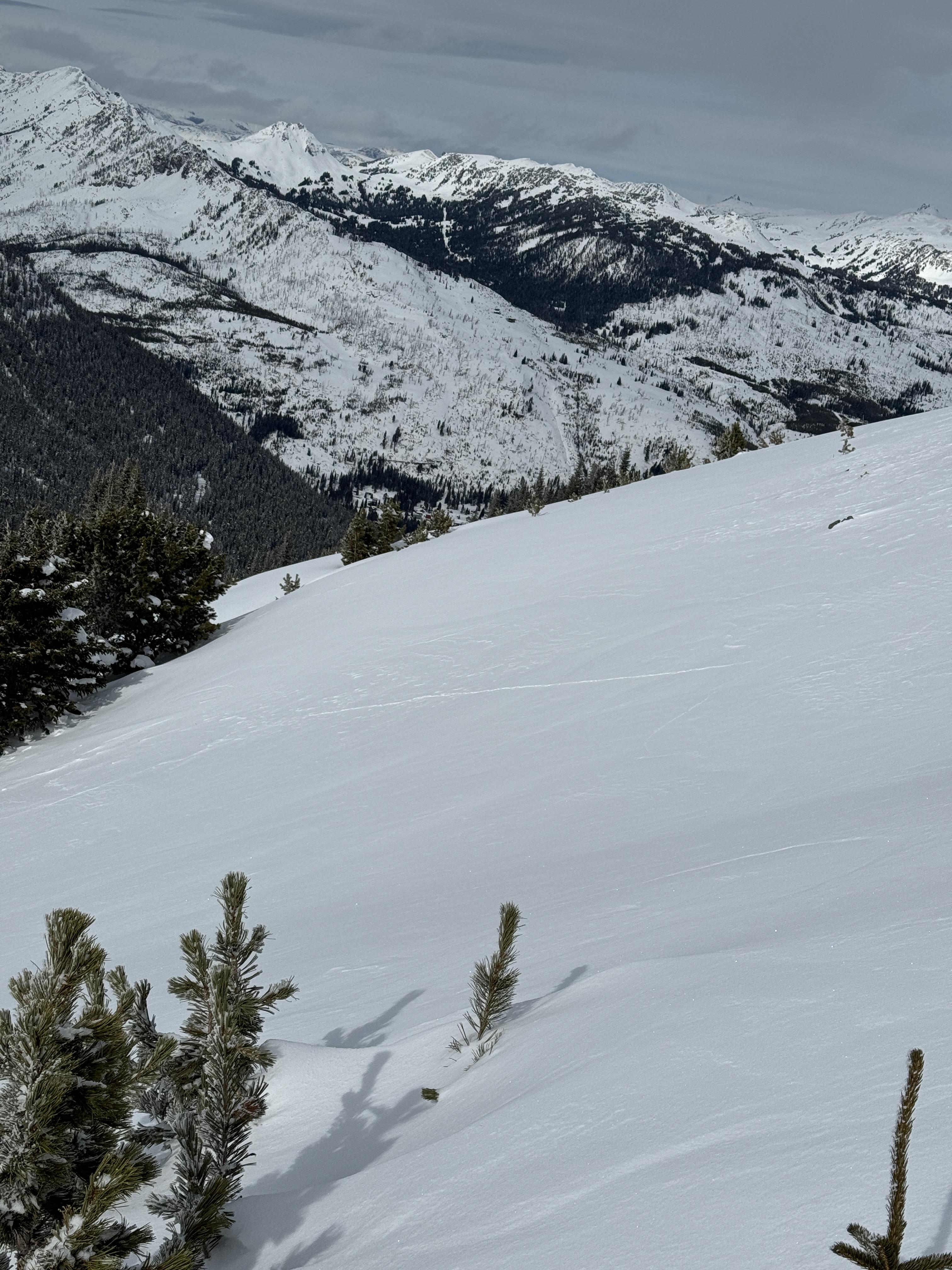
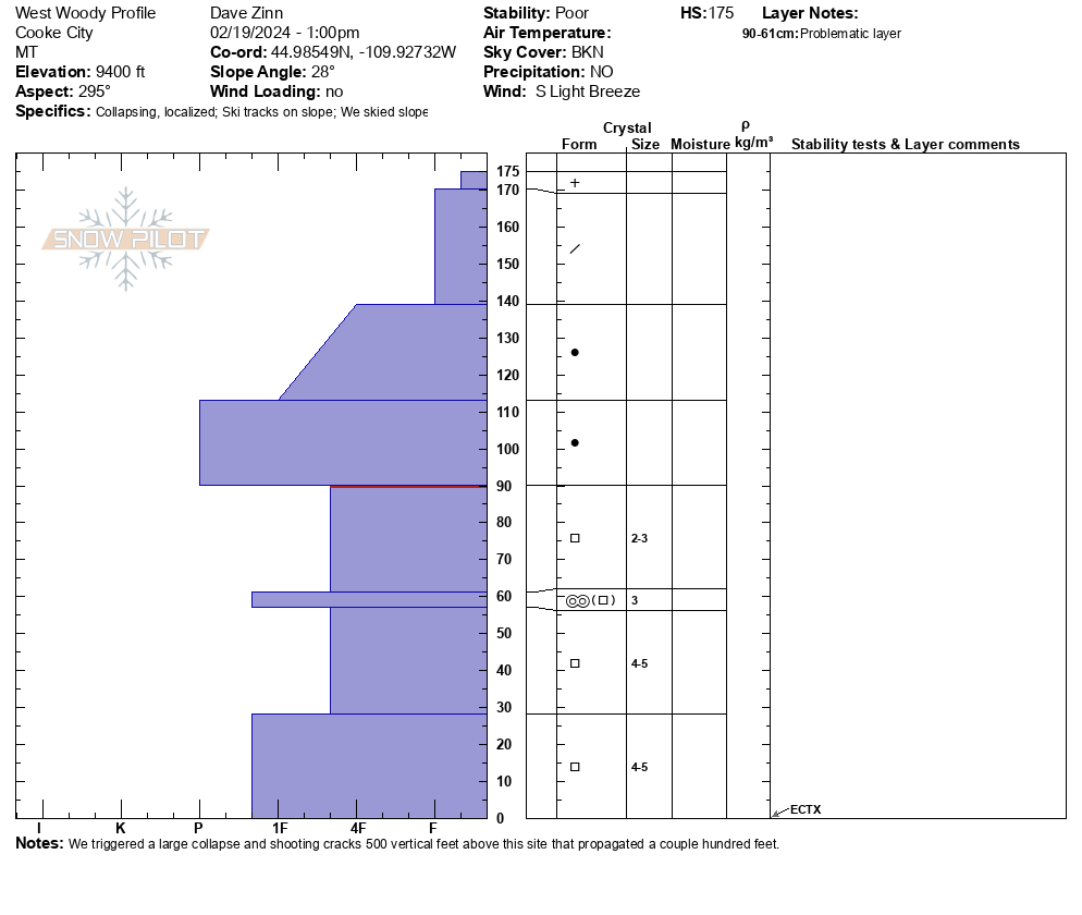
We choose to stay off slopes steeper than 30 degrees before leaving the town and heading south of Cooke City to West Woody Ridge. This decision was based on the recent and seasonal avalanche history in the area. There have been several large and dangerous human-triggered and natural avalanches and many other smaller slides failing on persistent weak layers. We stuck to our choice when we dug a snowpit and got stable test results (ECTX). Near the ridge and the starting zones of nearby avalanche paths, we triggered a large collapse that sent shooting cracks out a couple hundred feet. If the slope had been any steeper, we would have triggered an avalanche. Our conviction to stick to our plan kept us safe. We recommend that you make travel plans based on the big-picture indicators of INSTABILITY and ignore snowpits that indicate STABILITY.
In town, we heard vague reports of what sounded like another large, rider-triggered avalanche occurring on the north side of Scotch Bonnet near a human-triggered avalanche that broke on Friday. We also heard a report of localized collapsing in the Goose Lake area. And the group described hearing a boom and a roaring sound that they believed was an avalanche but did not have the visibility to confirm.
Full Snow Observation ReportThe danger was CONSIDERABLE. While there were tracks poking into avalanche terrain that did not trigger slides, there has been enough activity that I want to see a couple of days without avalanches before considering dropping the danger.

Nothing new, but we were in Tepee Creek today. Three of us dropped into a flat meadow on a (wide) ledge, and after sitting there for a minute or less, we all felt a "whump" and collapse. While the meadow had some small rolling terrain, it was flat overall.
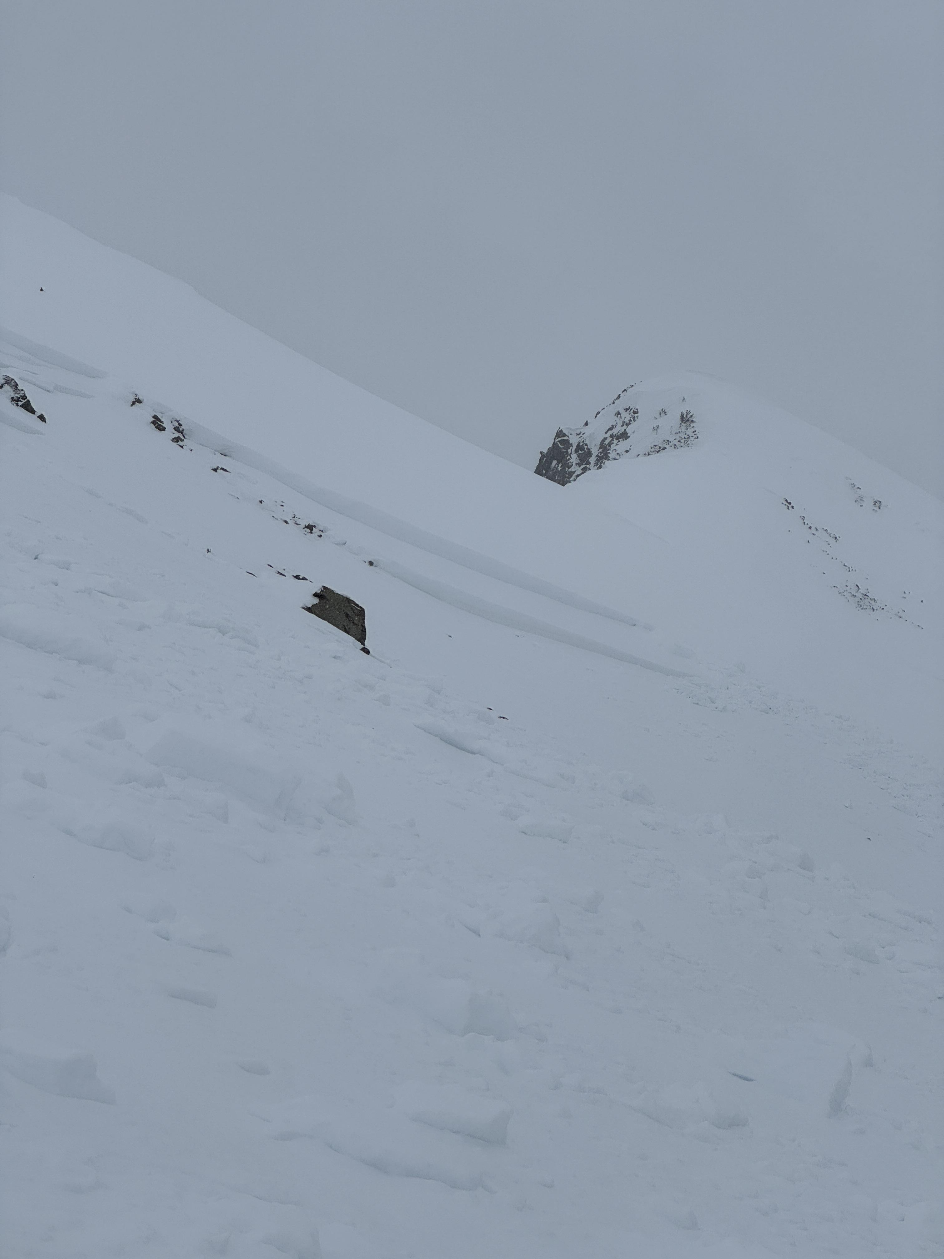
Full Snow Observation ReportLast Sunday we saw people touring up Scotch Bonnet and when we returned Monday we saw a large slide covering most of their tracks.
Full Snow Observation Report
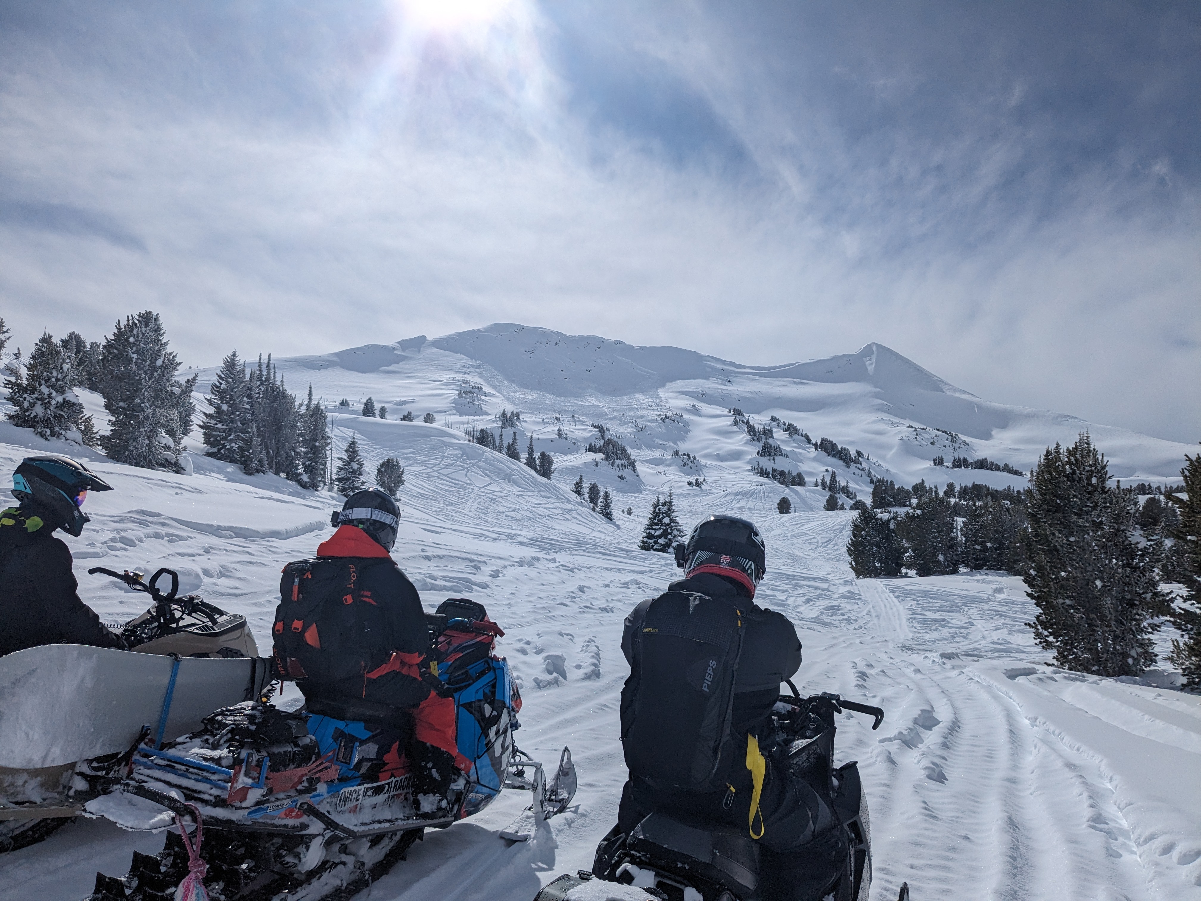
Accessed low angle settled powder runs via mellow ridge terrain adjacent to a known avalanche path which is steep, rocky and windloaded. We descended on lower angle terrain following uptrack. On second lap observed the crown and debris while climbing uptrack and suspected we remote triggered; it was not there on first lap. Slope angle 35-38 degrees estimated. Estimate crown depth 60-120 cms. Estimated debris depth 2-3 meters due to terrain trap of an abrupt transition to flat terrain at bottom of path. We did not approach the crown or debris due to hangfire. Starting Zone NE facing at 9100' on wind loaded convexity with unsupported terrain below and rocky bed surface and exposed rocks/cliffs. I would classify it as HS-ASur-R4-D2.5-O
Large collapses with cracks connecting weak spots in the snowpack for 50 feet around us while breaking trail. Slab has gotten quite a bit thicker and more cohesive with 3 inches SWE in past 14 days combined with relatively warm temps promoting settling, strong solar input on the southerlies, and some wind. Average snow depth 100 cms consisting of a F-1Fslab on top of 20-30 cms of large facets. A crust in between on solar aspects. There is a density break/layer of NSF in the slab you can see in some of the photos where it appeared to shear between those layers. A very scary snowpack even for the Pioneers which regularly harbor PWLs throughout the season.
Full Snow Observation Report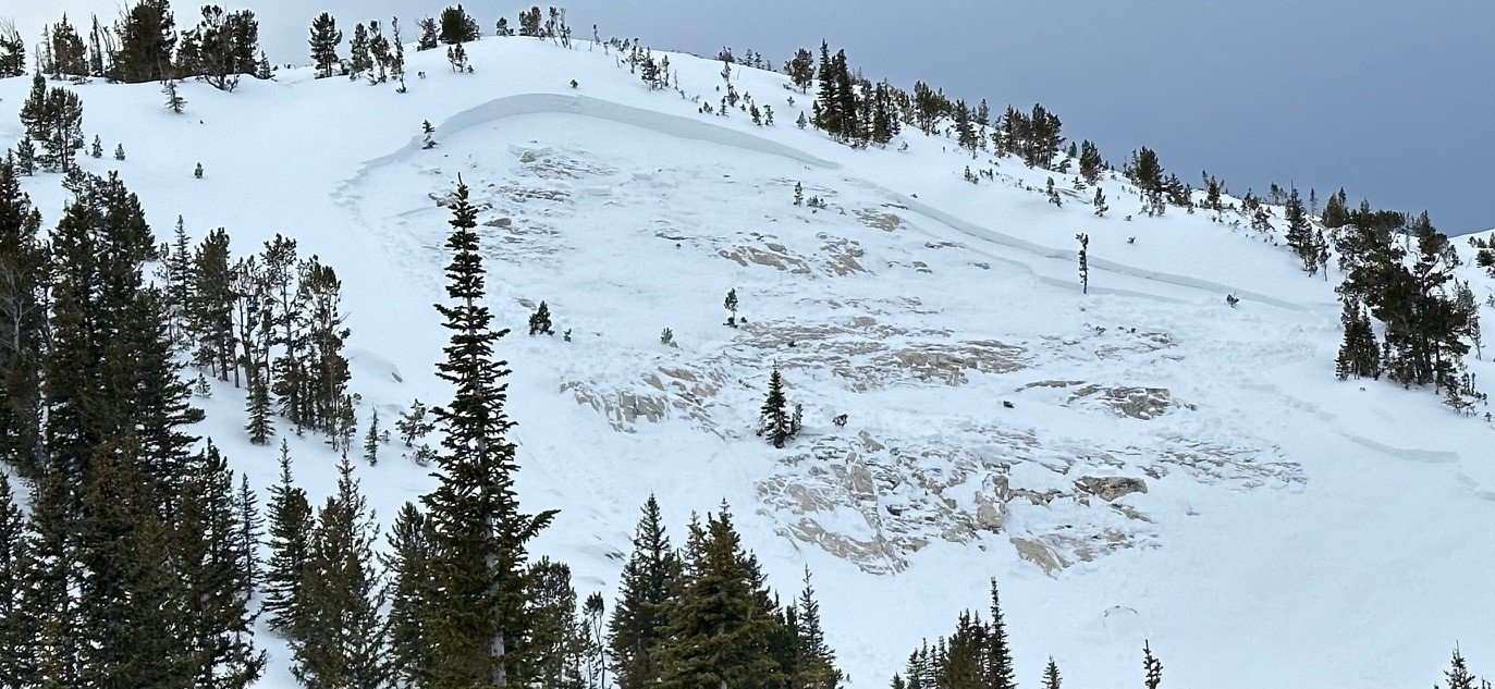
While transitioning at the top of mineral mountain burn, a member of our party stepped away from our packed out transition spot and likely the deeper impact from his ski boots triggered the weak layer beneath us and created a massive whumf that propagated hundreds of feet and was strong enough to knock snow off of nearby trees. Nothing we observed slid but the collapse was extremely evident.
Full Snow Observation ReportFrom the approach trail to Mummy II we saw two large crowns on the ridge associated with Mt. Bole. Not sure when they happened, but they looked pretty big! Observed Monday morning, February 19
Full Snow Observation Report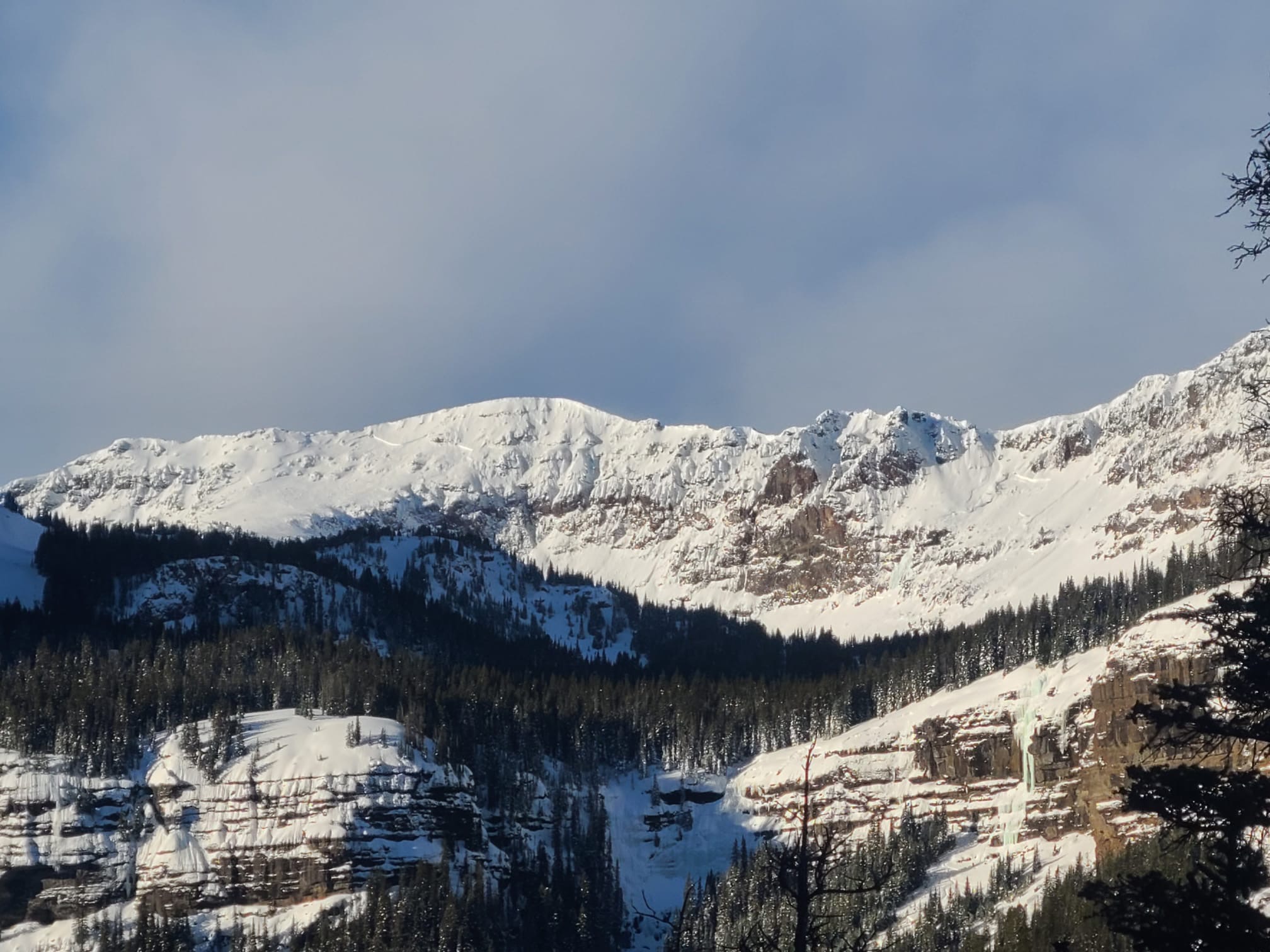
the snow is still bad! We were on top of bacon rind in the YNP, and dug a pit for fun and education of one of our party members. Experienced some BIG whoomphs on the way up and got very unstable scores. A Q2 CT19 and ECTP24, both around 85cm down into the snow pack (on the top of the very faceted layer we're seeing all over the advisory area.
Best,
Joe
Full Snow Observation ReportCentennial range blue and Wilson creeks. Did not see any signs of avys , or snow collapsing or whooping. Riders were on exposed slopes steeper than 30 degrees on all aspects high marking. It seems the centennial range has A more stable pack than other advisory areas. Although did not evaluate snow pack or dig pit, we stayed in low angle terrain
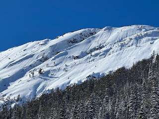
Full Snow Observation ReportFrom email: "Noted several 1-2 day old dry loose in steep terrain above the cliffs to the lookers left of Hang Ten. Also A large avalanche. crown propogated through the cliffs and looked to be about 200' wide and 1 1/2-2 ft. deep. Debris was no longer visible so I suspect this ran sometime during or shortly after the storm. (02/15)."
Full Snow Observation Report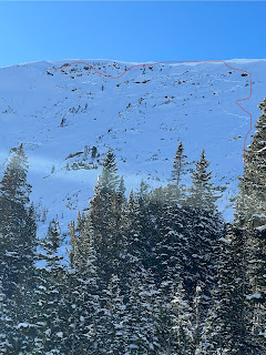

From email: "Photo natural avalanche on a NW aspect at 9000', taken north of Cooke City today. It likely happened right around Feb. 15th."
Full Snow Observation Report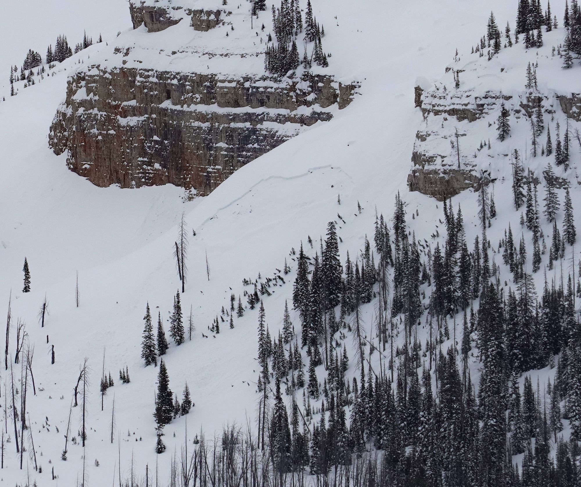
Went touring up Pebble Creek today and got multiple whumpfs/large collapses when stepping off the skin track.
Full Snow Observation Report- Widespread stubborn collapsing, often triggered by 3 or 4 person on the slope.
- Numerous small D.5 loose dry observed in steep terrain.(mostly likely occuring in the last 24 hours)
- 12" to 14" reactive wind loaded protect on the east side of ridge tops
- Propagation in extended collum test found on multiple aspects at 9000ft
- Light to moderate winds out the west
- Consistent snow through out the day S1 to s2
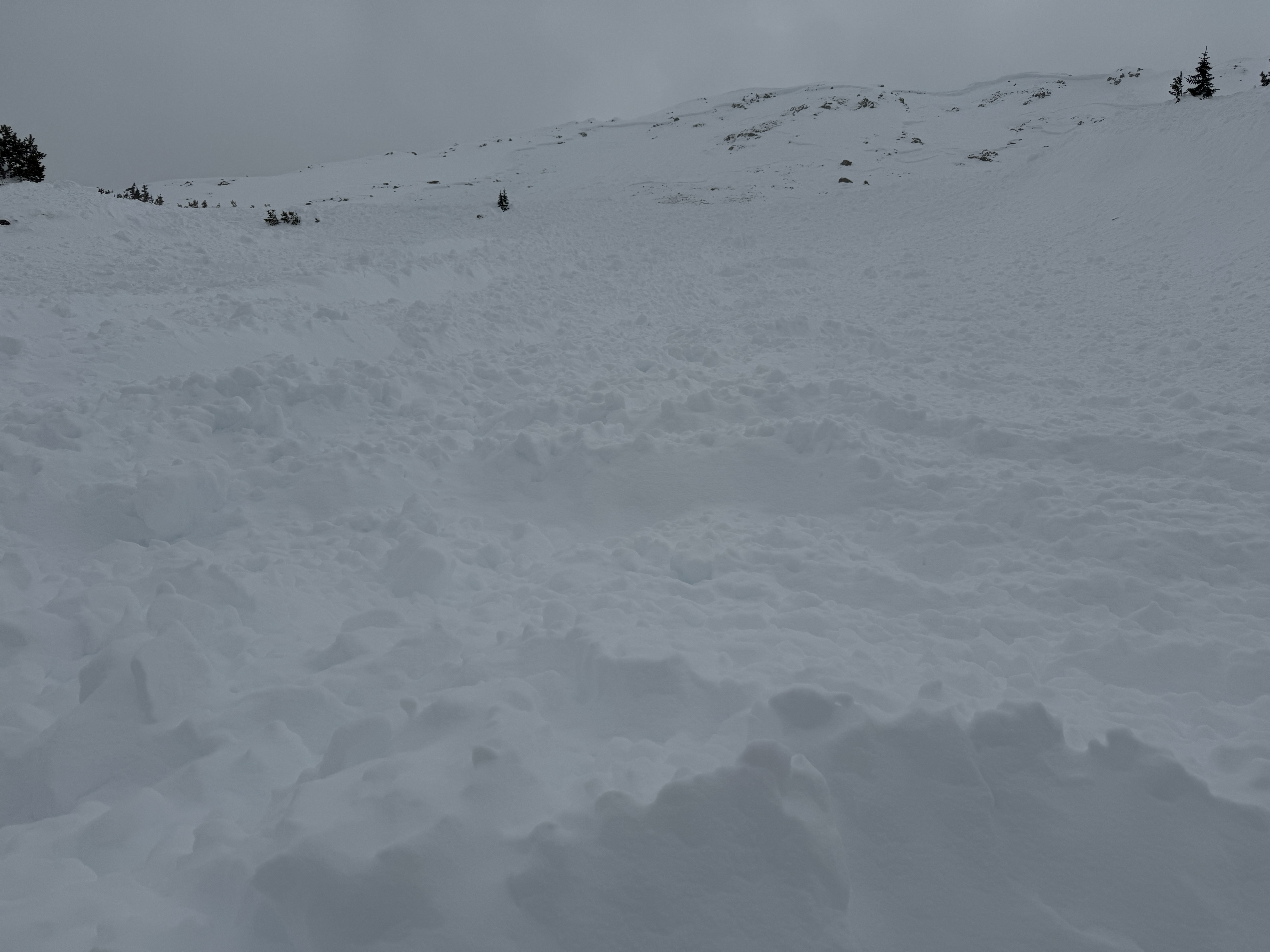
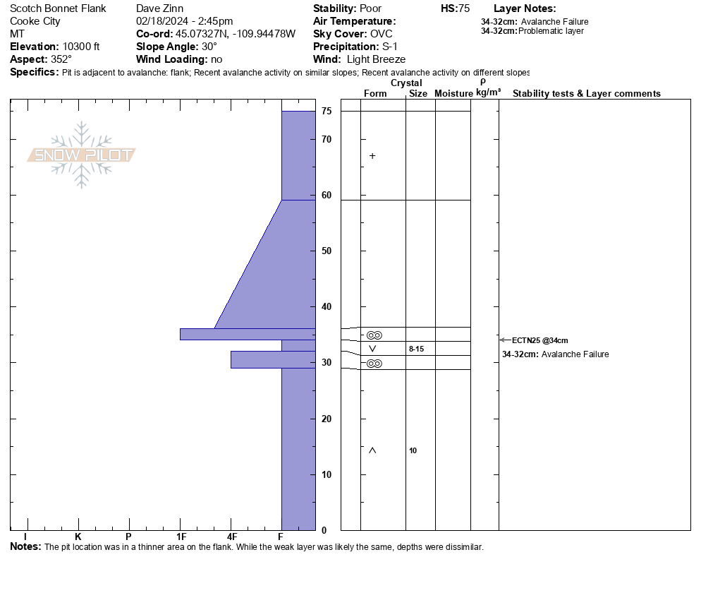
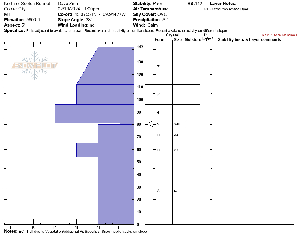
Avoiding avalanche terrain remains our risk mitigation strategy in Cooke City (2/18). We investigated a large avalanche on the north side of Scotch Bonnet that ran 400 vertical feet, broke 400 feet wide, and failed 5 feet deep. You would need to get lucky to survive getting caught in a slide that size, and triggering them is likely on slopes steeper than 30 degrees. There was a small avalanche on a steep rollover below the toe of the debris. Digging in their flank and crown, respectively, we found that they both failed on the layer of surface hoar. This was interesting in that there was well-preserved surface hoar at upper elevation slopes often exposed to the wind. However, the actual failure point is somewhat irrelevant, given the multiple weak layers in close proximity within the snowpack.
Full Snow Observation ReportThe danger was CONSIDERABLE. Riders are poking at steep terrain in many areas and really getting into it in some. Avalanches are still getting triggered but not with the regularity I expected. My feeling is that the snowpack can take 0.5" SWE and remain CONSIDERABLE. Much over that, go back to a warning.


Several naturals observed from the past few days. Large collapse on a NE 25 degree slope
Full Snow Observation Report