Snow Observations List
Went for a ski tour in the Southern Madison's up Lightning Creek in search of a deeper snowpack. Our tour brought us up Woodward Mountain via the E sub-ridge with a plan to ski in the bowl to the north on a NE aspect. The snowpack varied immensely due to sun effect/wind loading but overall found 50-60 cm of snow in the deeper locations. We performed 3 CTs in representative locations of our intended ski line and had results of CT21 Q2, CT15 Q2, and CTN. The columns broke on a layer of 4F facets midway down from the surface. Combining this data with a lack of other signs of instability (cracking, whumpfing, recent avalanches, recent loading), we decided to ski our intended line.
Snow quality on the ascent and decent varied from "ripple pow" to breakable wind crust to unbreakable wind crust. Overall, was a great day in the BC getting familiar with our early season snowpack even though good ski conditions lacked.
Full Snow Observation Report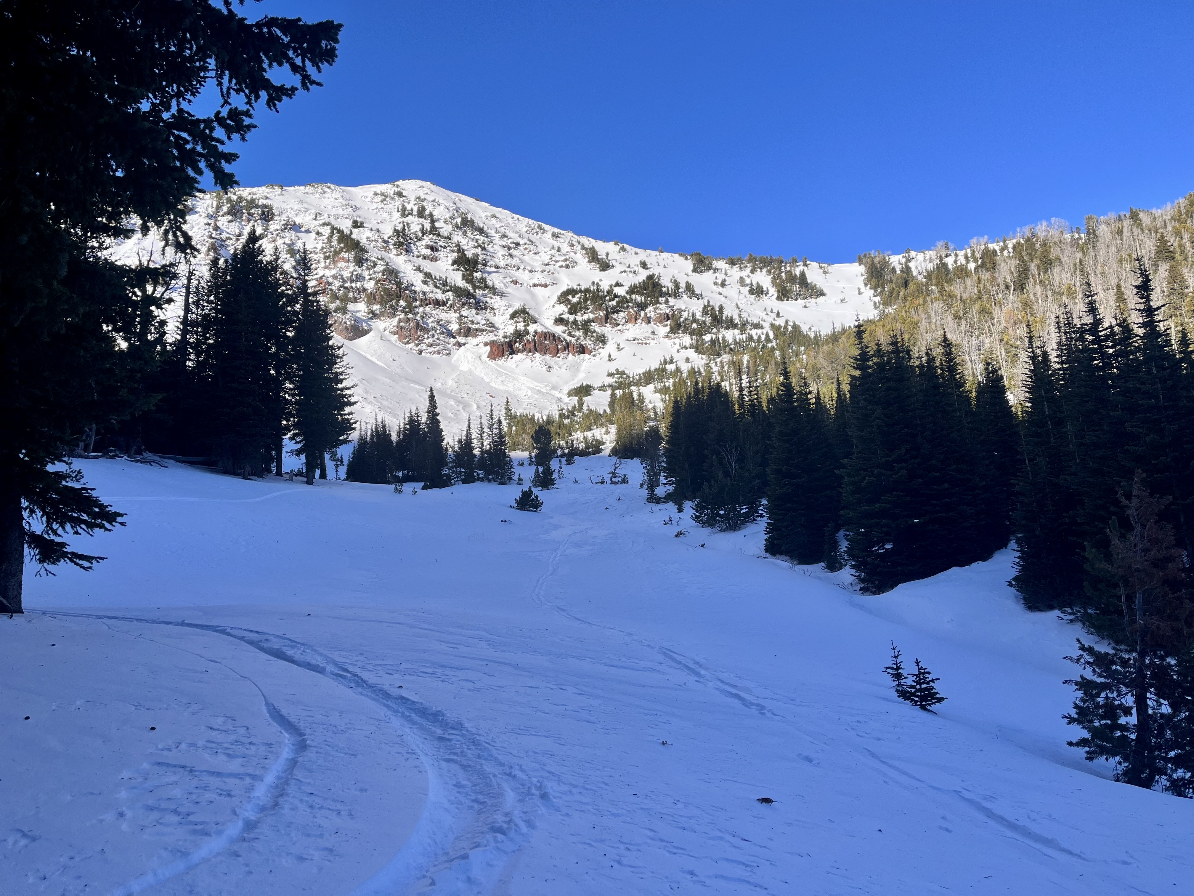
Went for a couple quick tours over the past two days in the Northern Bridgers. In October Bowl at 8157' on a NE aspect I found a HS of 30 cm with recent fist hard snow in the top 10 cm. The new snow sat on top of a 5 cm knife hard crust likely from the warm snow/rain event last week. Below the crust were 15 cm of 1F facets. The crust progressively deteriorated when moving up in elevation. Near the top of October Bowl I performed two CTs in a a location where the HS = ~50 cm. My results were CT12 Q3 and CT15 Q3.
Full Snow Observation Report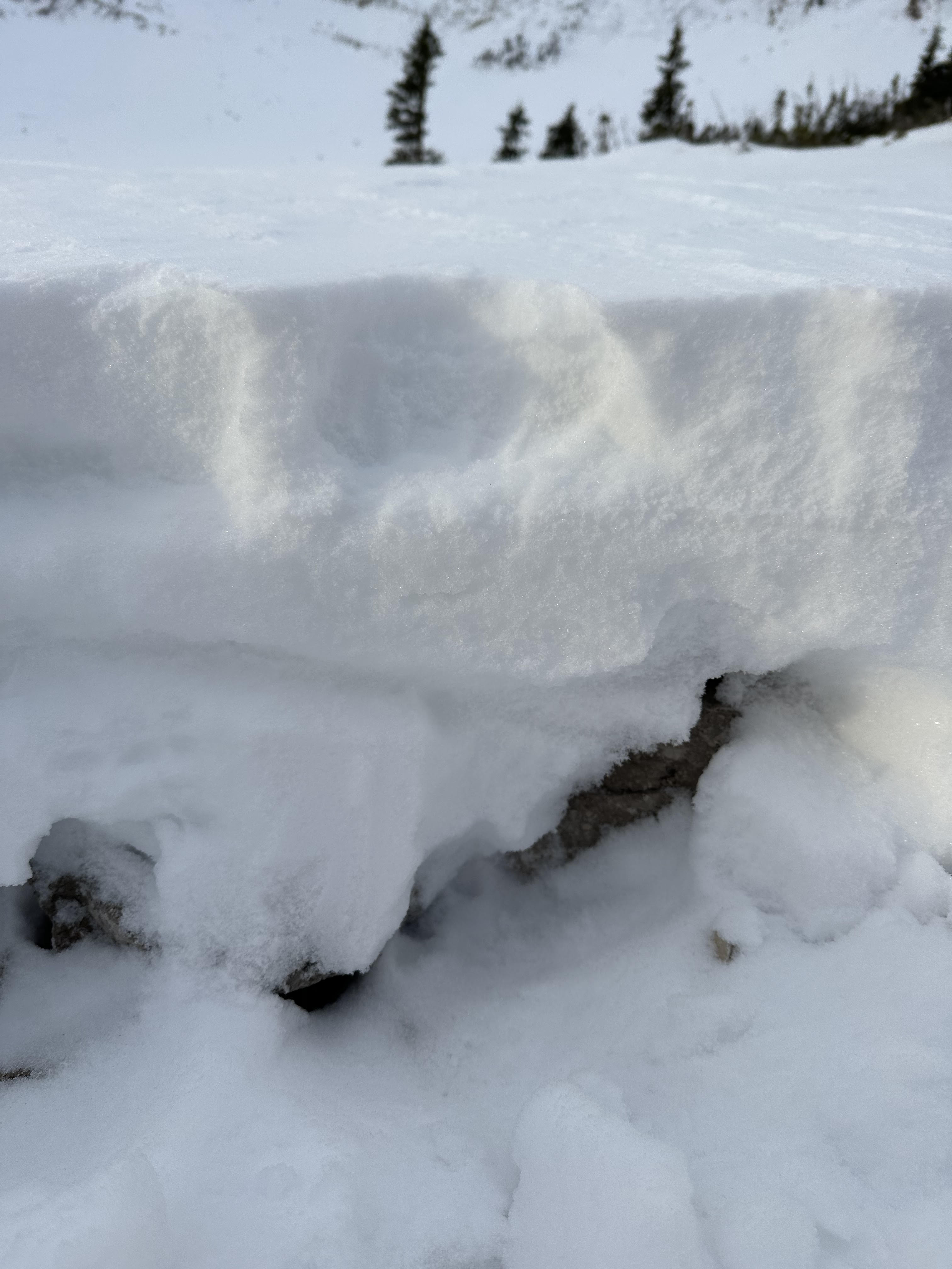
No avalanche activity was seen during a short tour south of Cooke City. ~1-1.5' of snow at low-mid elevations. Supportable crust on solar slopes with 3-4" of new snow on top.
Full Snow Observation ReportGot into the bowl below the face of the peak and didn’t feel comfortable going any further wind slabs were present on the level surfaces around the lake with facets underneath that. Also note that snow depth was minimal to about a foot but quickly increased around the 9000ft mark to the 2-3ft range.
Full Snow Observation ReportOn our way up the main fork we noticed a drastic increase in snow depth, and wind effect with elevation. The height of snow was around 50-70cm near 9500 ft/treeline, though we were walking anywhere below 8200 ft. As well, the effects of the wind during the week were very noticeable once near treeline, with some ENE aspects sheltering a 3-4 inch wind slab, which we also noticed in the lee of the many rocks and saplings still above the snow surface. Our pit (dug in a location without this windslab, but still loaded) showed a decently sound structure with good test results.
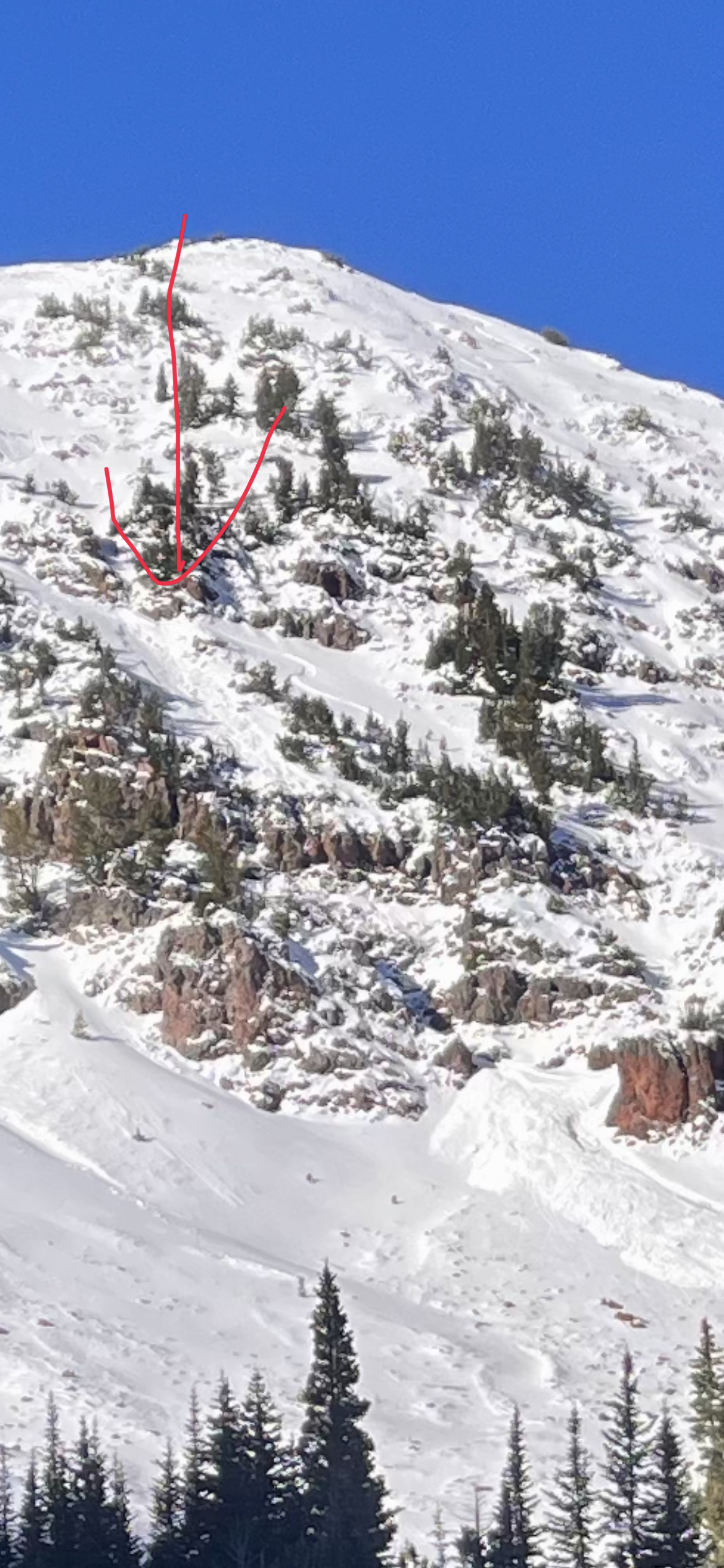
A separate party mentioned that they had seen the remnants of an avalanche higher in the bowl near the summer trail, but we did not go this high and did not see it ourselves.
Full Snow Observation ReportWe went up to check out the bottom of The Great One and saw where the old slide occurred. Wind loading had already built up snow right at the crown. We did some pole made single columns and consistently pulled off 6 inch chunks. We turned around and skied the lower part of The Great One. We dug two pits below The Other One and had the lower pit fail a ect at 26 and the higher one at 13. I attached a video of the lower pit. We turned around and skied out after.
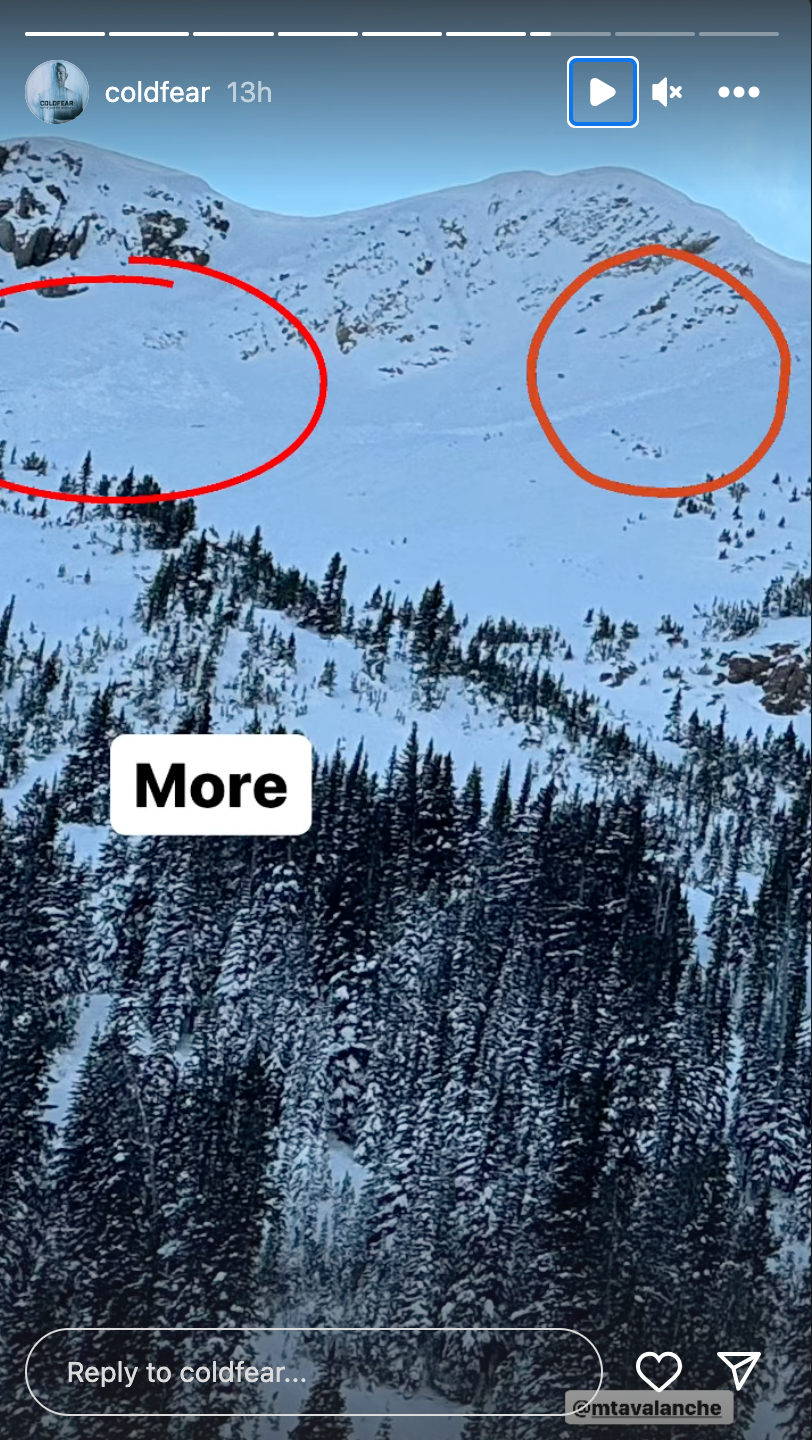
Full Snow Observation ReportAvalanches on Henderson Mountain near Cooke City were reported via instagram on 11/9/2023. Estimating they occurred a day earlier.
From message: "on Henderson in Cooke just above the lulu trail. It was surprising to see so much activity"
Full Snow Observation Report
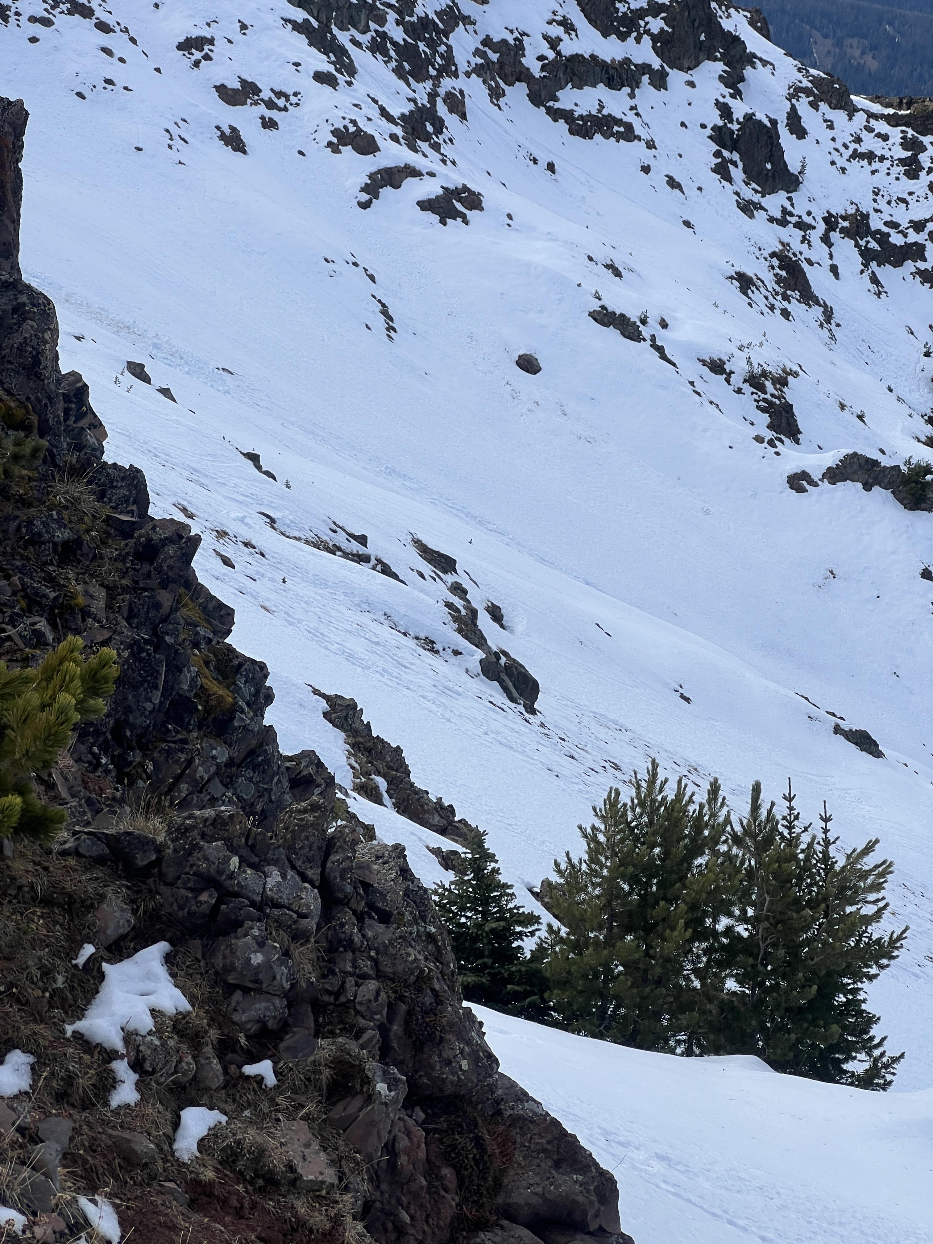
Skier triggered windslab in the Great One off of Naya Nuki peak, skier was carried 15-20ft before arresting. Slide was triggered roughly halfway down the couloir where the right wall dips away exposing the snow to wind. Hard consolidated snow over facets, roughly 1-1.5 ft thick, ran about 50-100 ft before pouring over the cliff faces below. North- northeast aspect.
Full Snow Observation Report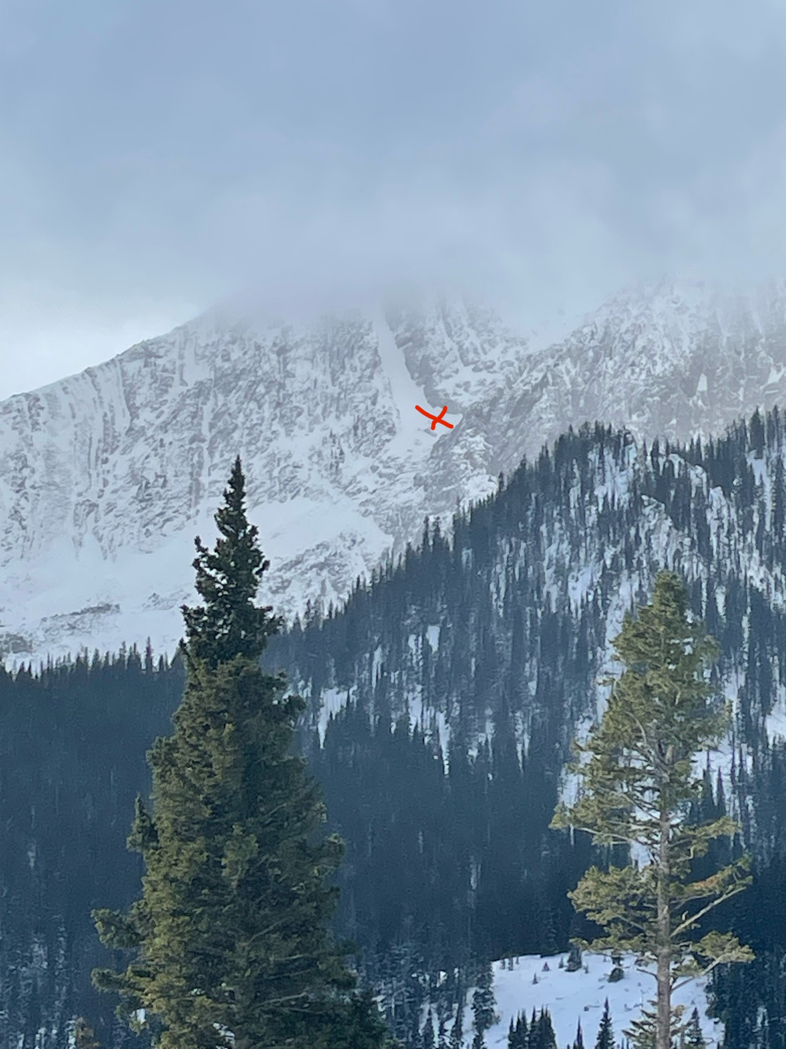


Snowpit attached from today: SW aspect, 9800', HS: 57.
Surfy/ supportable, good early season turns. Though some signifiant collapsing experienced while trail breaking- on buried SH that formed on Halloween.
No avalanche activity to report.
Full Snow Observation Report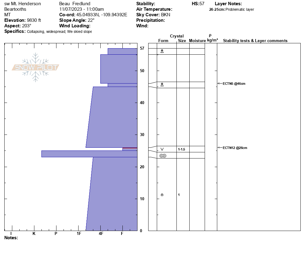
A hiker at Bridger Bowl noticed a small, loose snow avalanche near the Apron. Noting that it was a, "Good reminder as to how little snow is required to have an avalanche!"
Full Snow Observation Report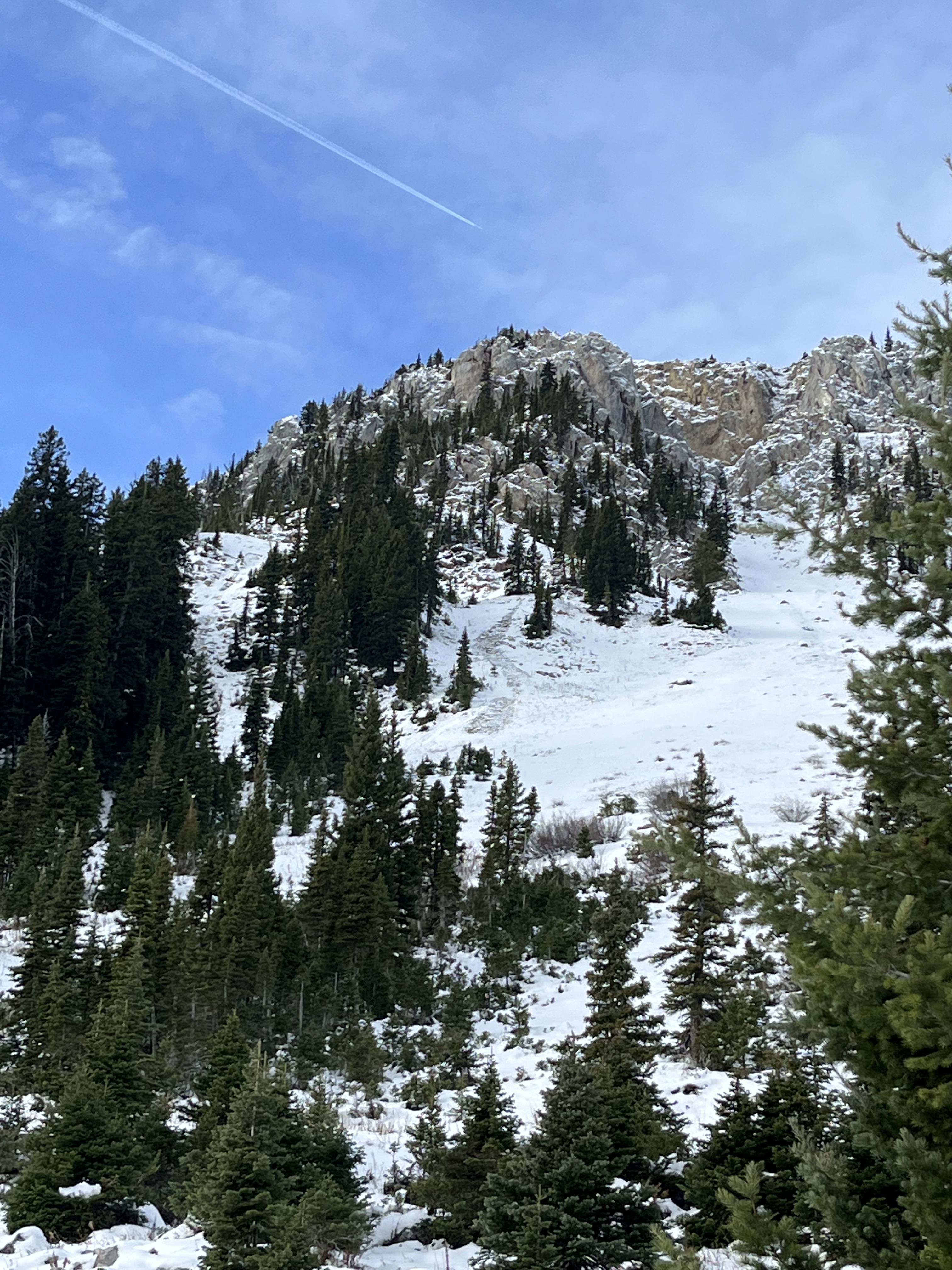
Went for a skin up to Hyalite Peak yesterday to check out snow conditions. We found about 8-12 inches of new snow sitting on a base at Hyalite Lake. We saw no signs of instability in the area. Small cornices were observed on the Hyalite saddle, and a hit or miss 1 inch wind slab directly below the ridge.
Full Snow Observation Report
Was out alpine climbing today and observed the north face of Blackmore had slid already.
Full Snow Observation Report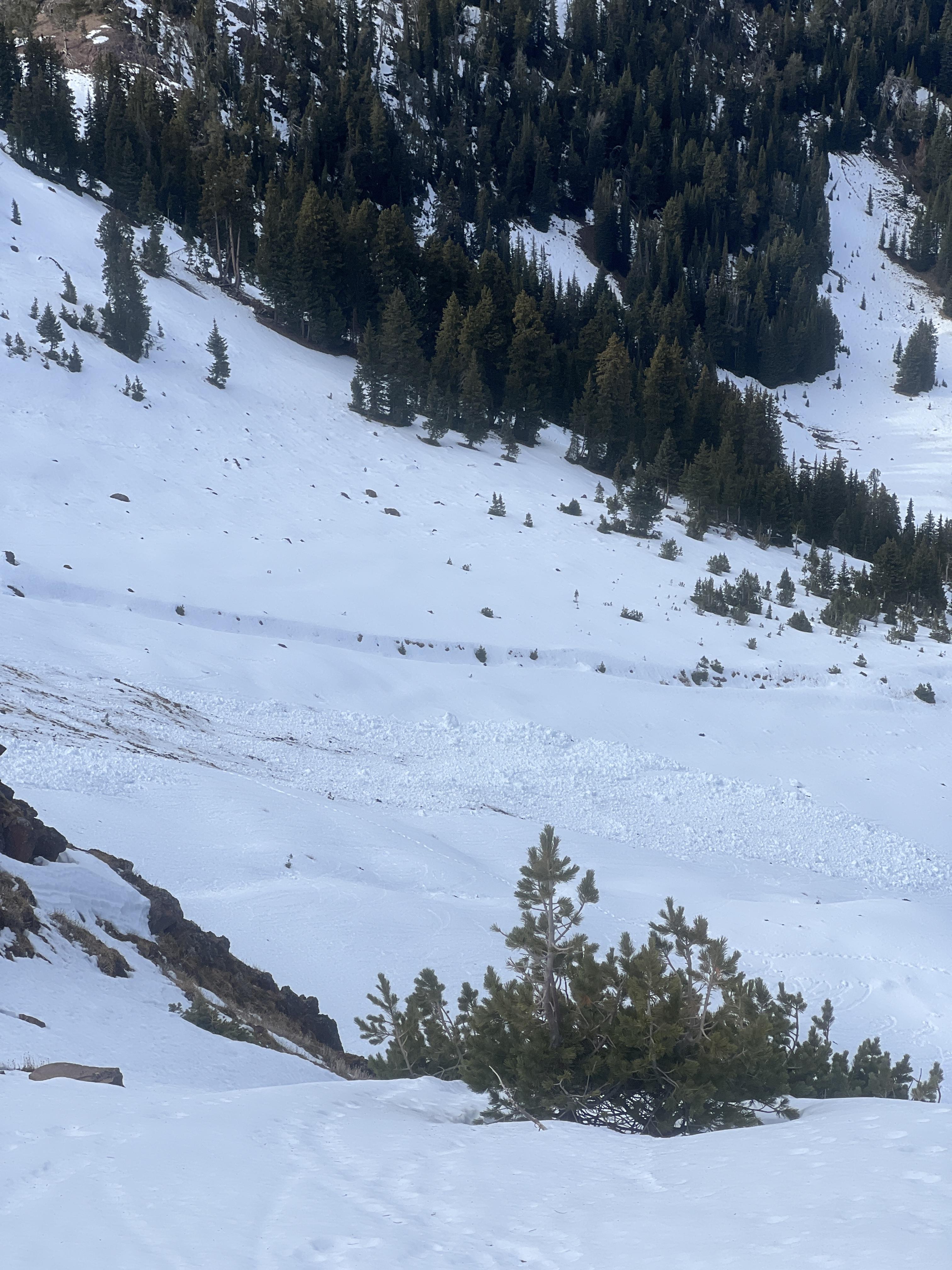


From IG: “Pine creek today, some small wind slabs and a full depth wet slide off black mountain”
Full Snow Observation Report
Three clear storm layers and wind effect piling up larger drifts. Snow height at 9k ft averaged 85-90cm. The rain layer in the center of the pack creating a sheer surface that with more load could trigger the third storm layer.
Full Snow Observation Report
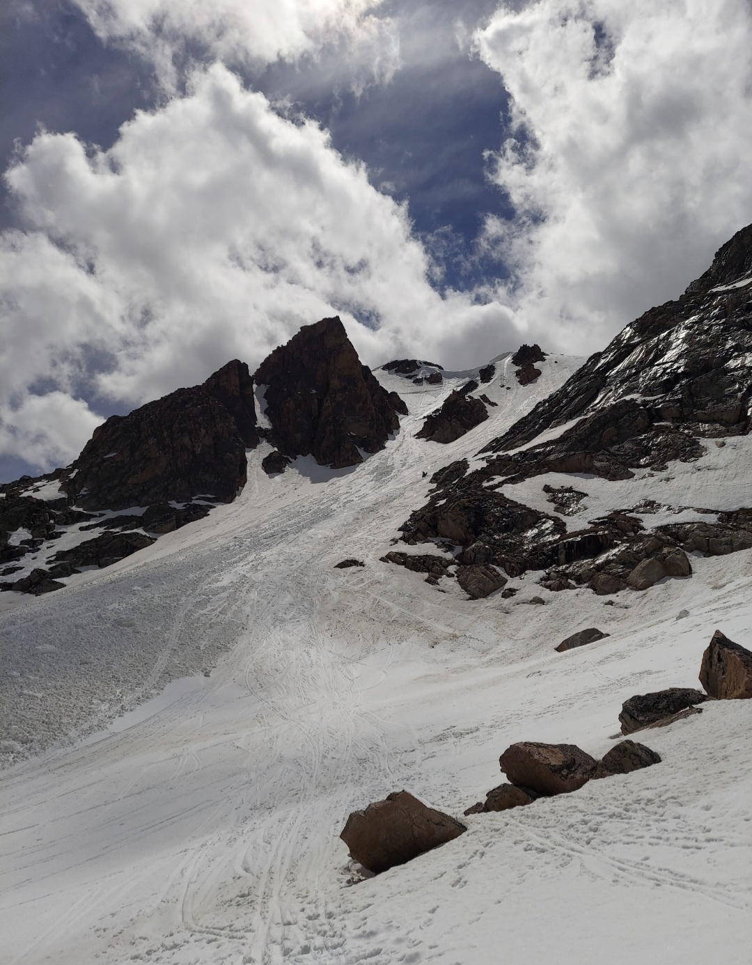
Sent a couple emails to mtavalanche.com with pics of a R3.9D11 that just missed me by inches last year. Just a heads up about Cornices and slabs
From email: “These pics are from last June 10-11, after the pass reopened on Friday. I was skiing the Gardner headwall at 5:30, solo, when this monster released. Yah. The initial cornice collapse triggered and entrained a secondary slab of varying thickness whose crown is seen in one of the photos.”
Full Snow Observation Report
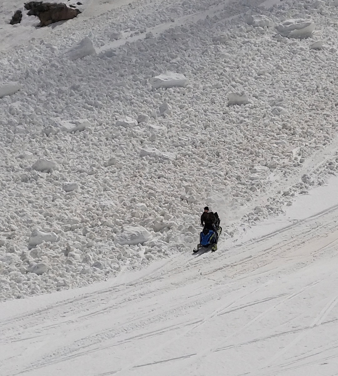
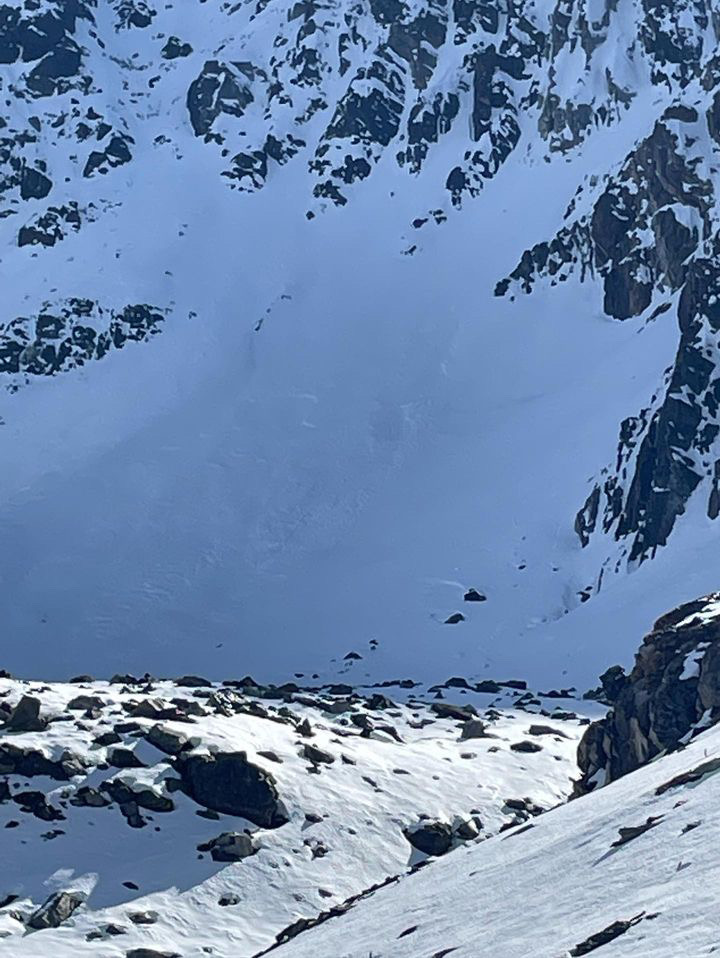
Snowmobilers saw a recent wet slab on the northeast face of Henderson Mtn. on May 20, 2023. Video attached.
Full Snow Observation Report
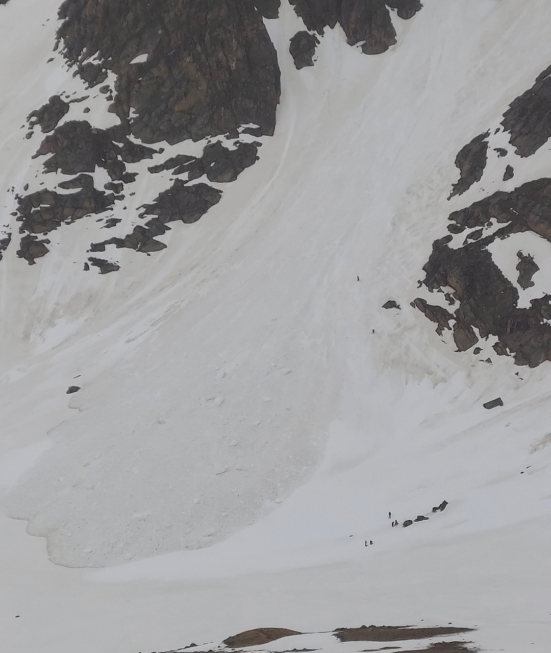
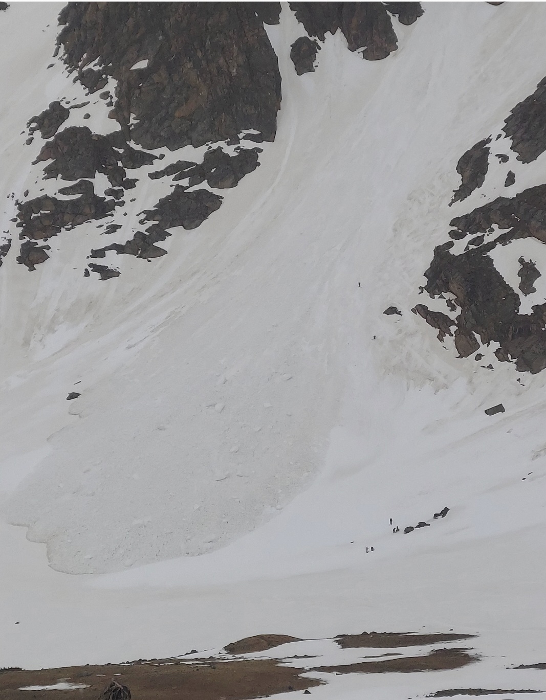
Wet slab avalanche on Hollow Top Mtn., Tobacco Roots
ENE facing slope at 8,800’
Full Snow Observation Report