Snow Observations List
We toured in Hyalite today. By 10:30 in the morning we saw wet, natural avalanches coming down east facing cliffs. We also saw several pinwheels from yesterday. By noon we were at 9,900' on a SE facing aspect, and the snow surface was wet at this altitude. Once we were down at 9,000' the top 8" of snow was wet, and it was beginning to move as a slab on small rollovers.
Full Snow Observation Report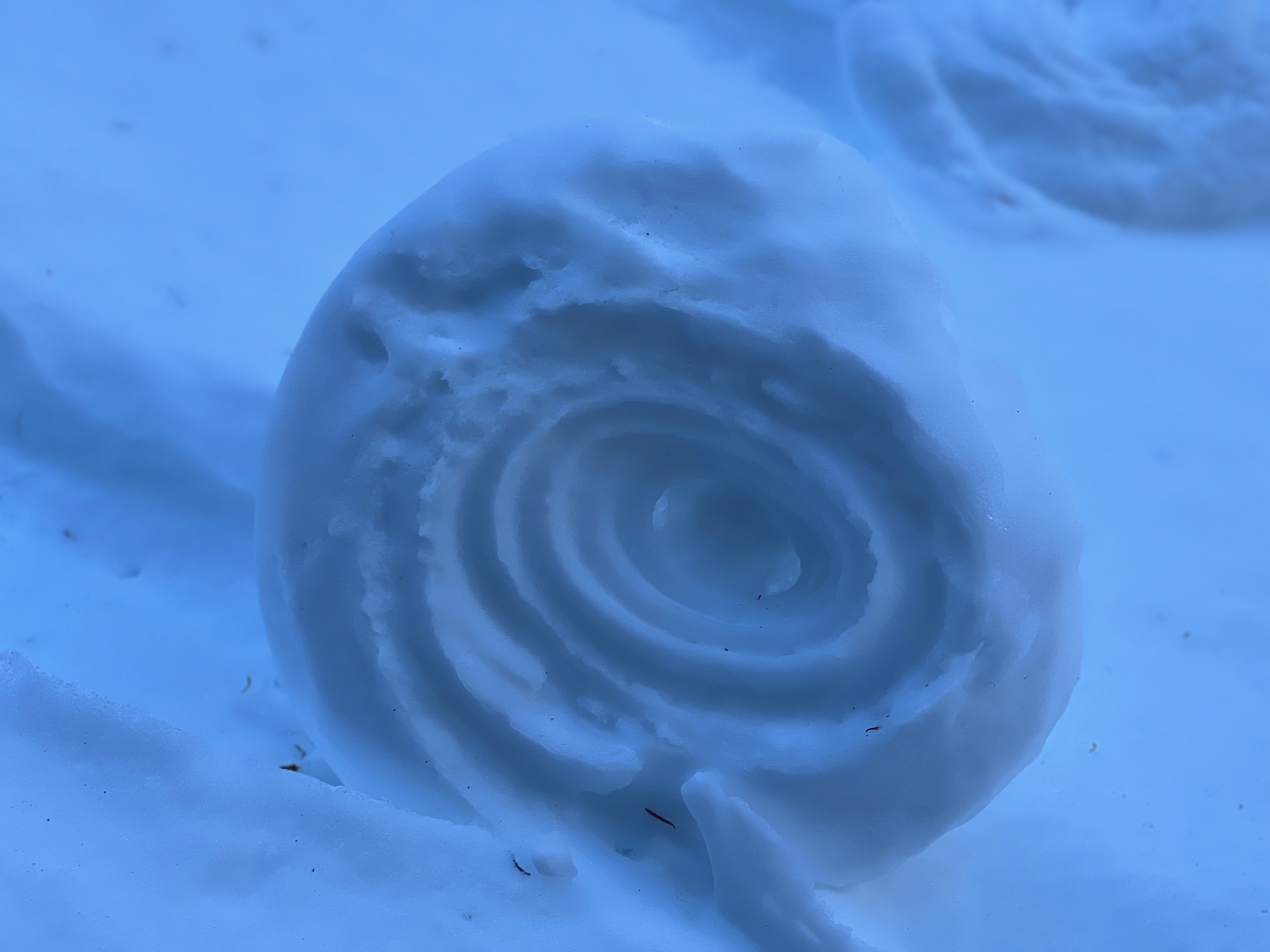

We skied three runs south of Quake Lake, up to 9400 ft. Most snow was crusty until it warmed up, but we found some powder in the shade and on north and east aspects, especially up high. Dug a pit at 8400 ft, N aspect, 32-degree slope. Result was ECTN-20 at 25 cm, and ECTN-22 at 35 cm. Sheared fairly cleanly. We were halfway up the avalanche chute at that point, so skied down with no incidents and skied two other tree runs.
Full Snow Observation ReportWe toured into Emigrants southeast bowl on Saturday. We found thin and reactive wind slabs on north facing slopes. Our ECT on a north face gave us stable results below the wind slab layer. It was the second day in a row of high temperatures and full sun but there was very little wet slide activity in this zone. We observed multiple old crowns in the surrounding mountains that looked to be a few feet thick. They were possibly breaking on a crust layer we found about 2 feet deep in our pit.
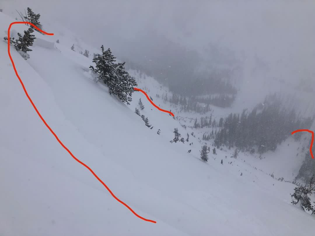
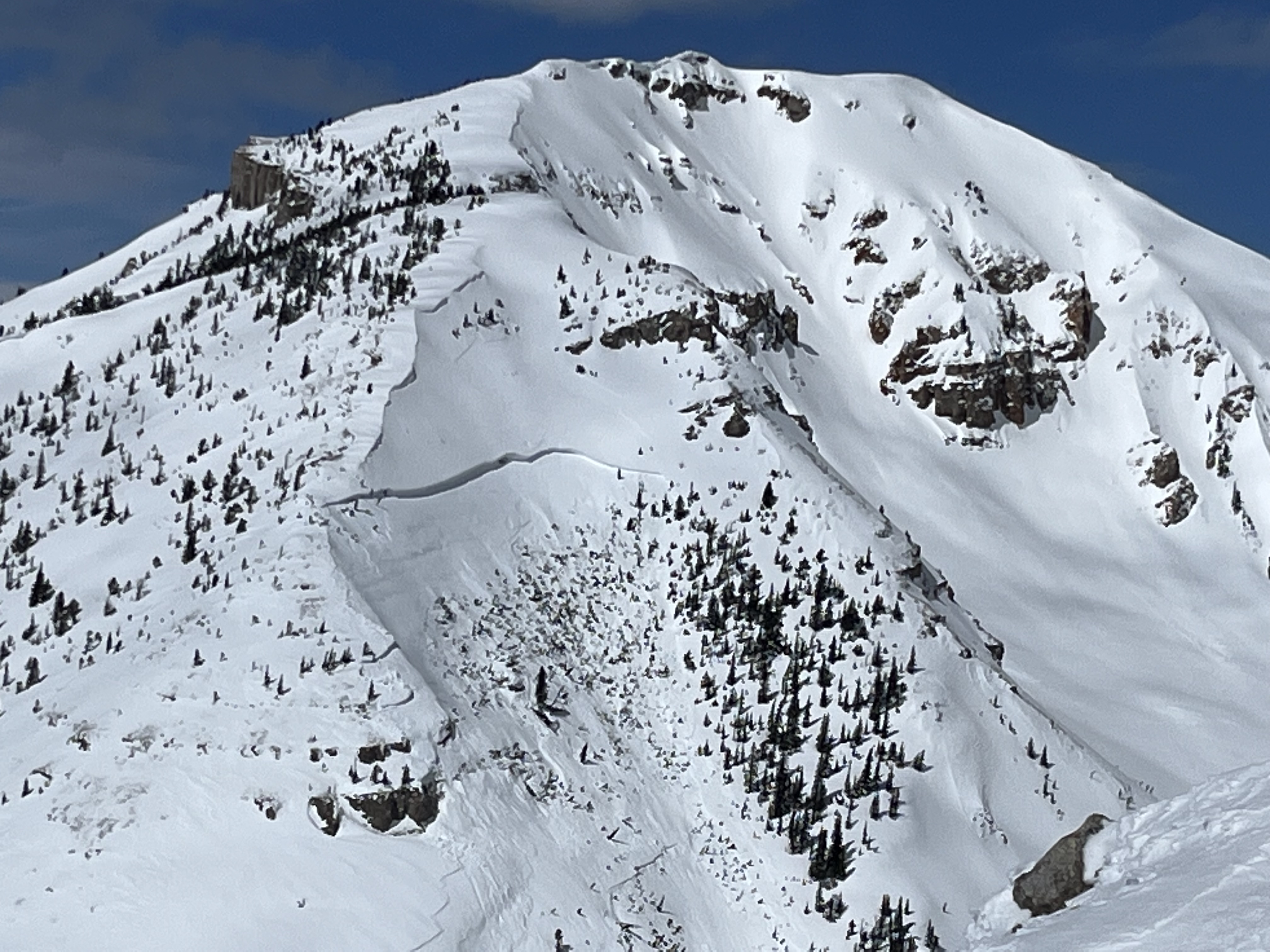
Full Snow Observation ReportDocumenting local avalanche cycles, attached is a photo of an avalanche on the south face of Mt. Abundance taken yesterday, that likely happened last Sunday (?) when we got 1" of SWE overnight. Lots of debris chunks the size of refrigerators. Crown mostly covered by wind blown snow.
Full Snow Observation Report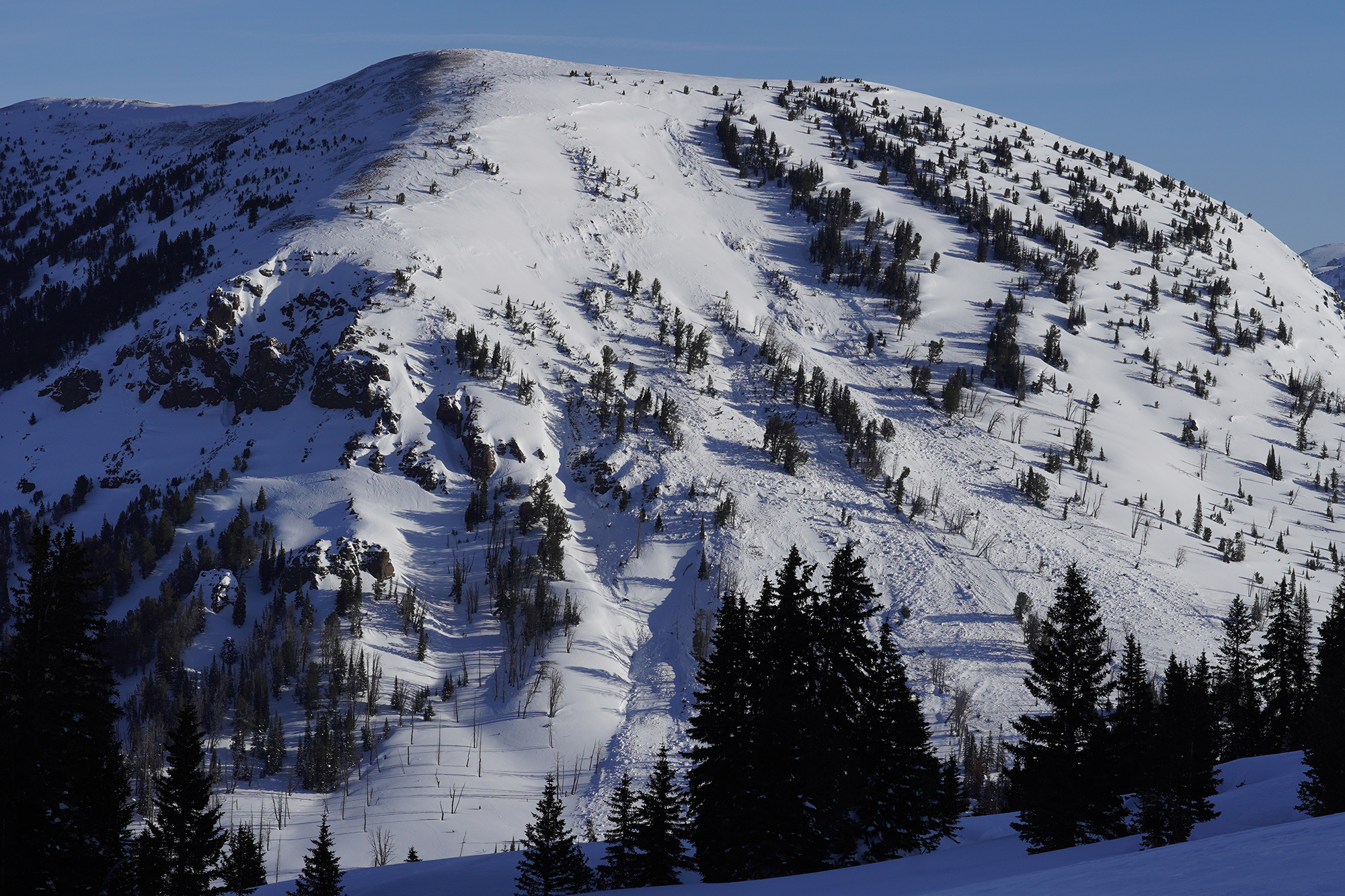
We toured out to republic pass. Saw mutliple small natural wind slab releases. We dug a pit on Republic Pass around 9800 ft on a north facing slope with lots of wind, got an ECTP 26 @ 30cm down from the snow surface on a very thin layer of facets. We only dug a ~5ft deep pit but found very stiff and solid snow throughout the snow pit (1 finger to pencil stiffness). Very little fresh snow was on the surface due to the wind ripping through the pass. It snowed for the whole first half of the day, lots of wind but only about 1cm of accumulation.
Full Snow Observation Report
Lots of naturals and maybe a rider triggered avalanche seen today. Steep solar aspects had lots of wet loose activity and small cornice/pillow fall.
Full Snow Observation Report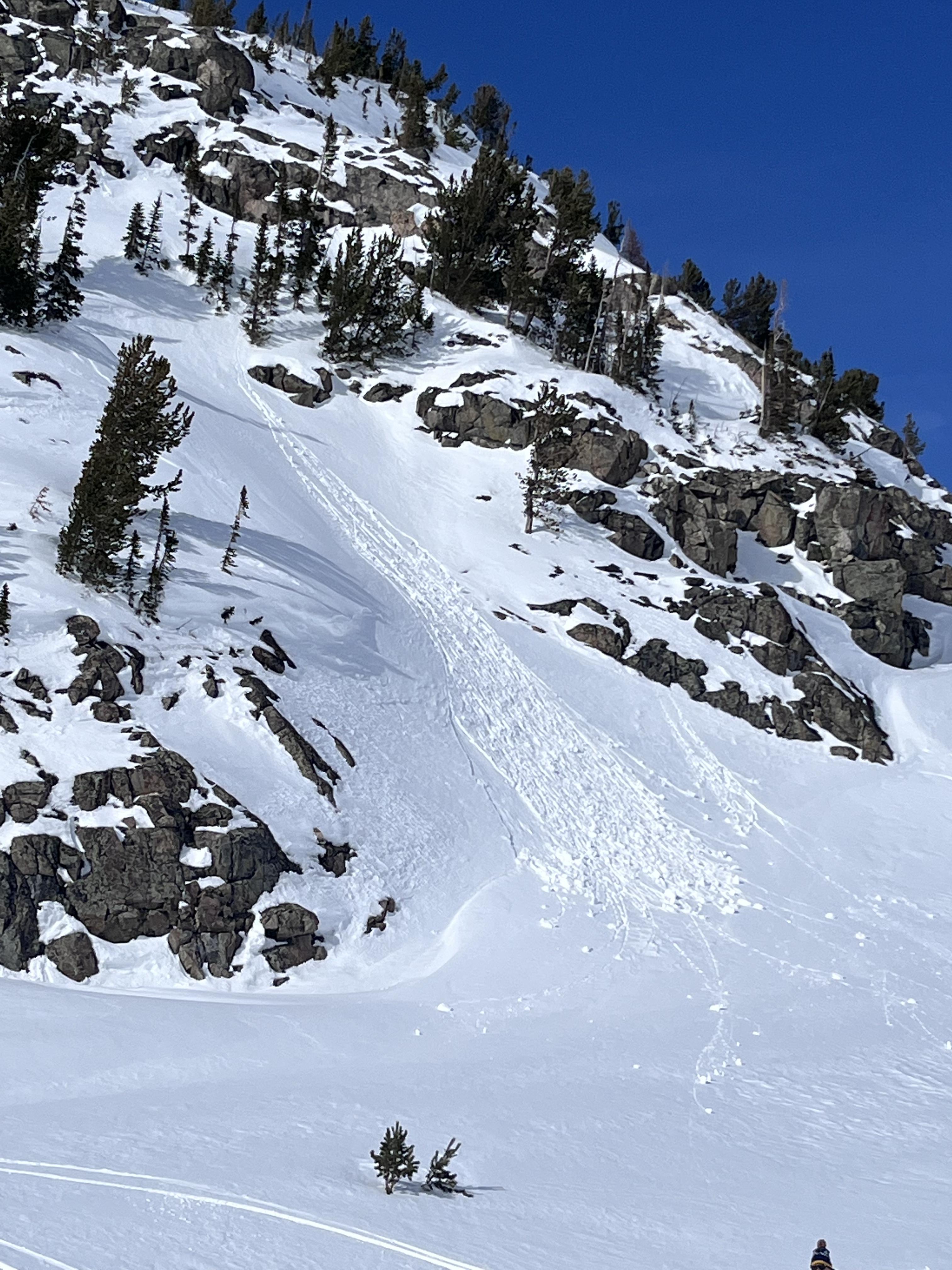

Went for a ski on Jumbo Mountain via the Lava lake parking lot....
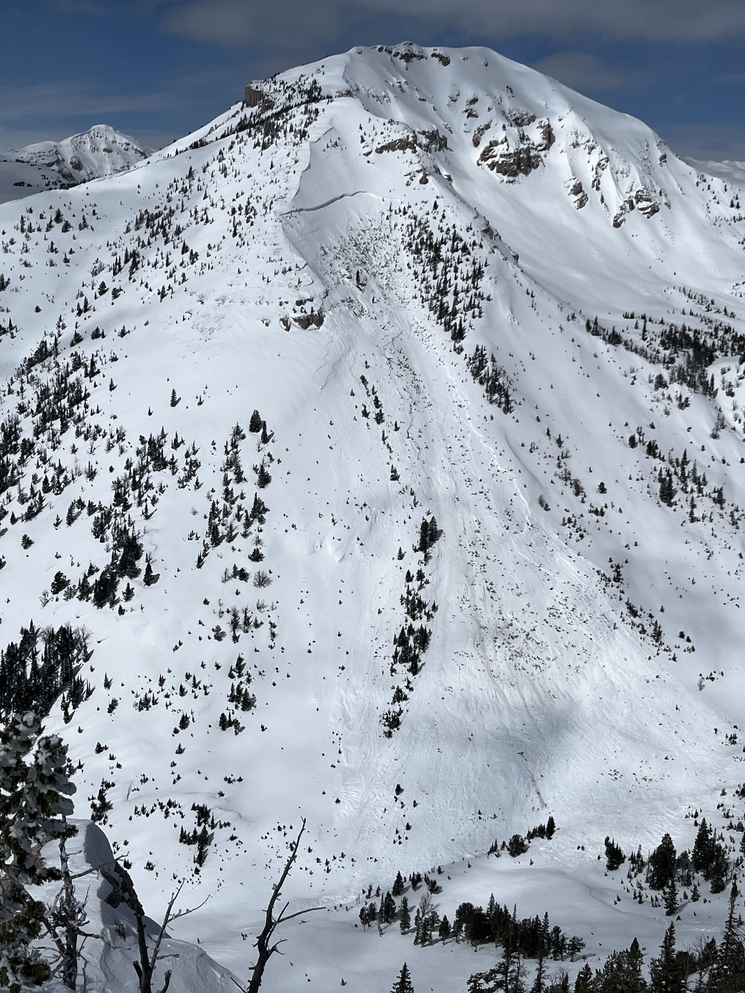
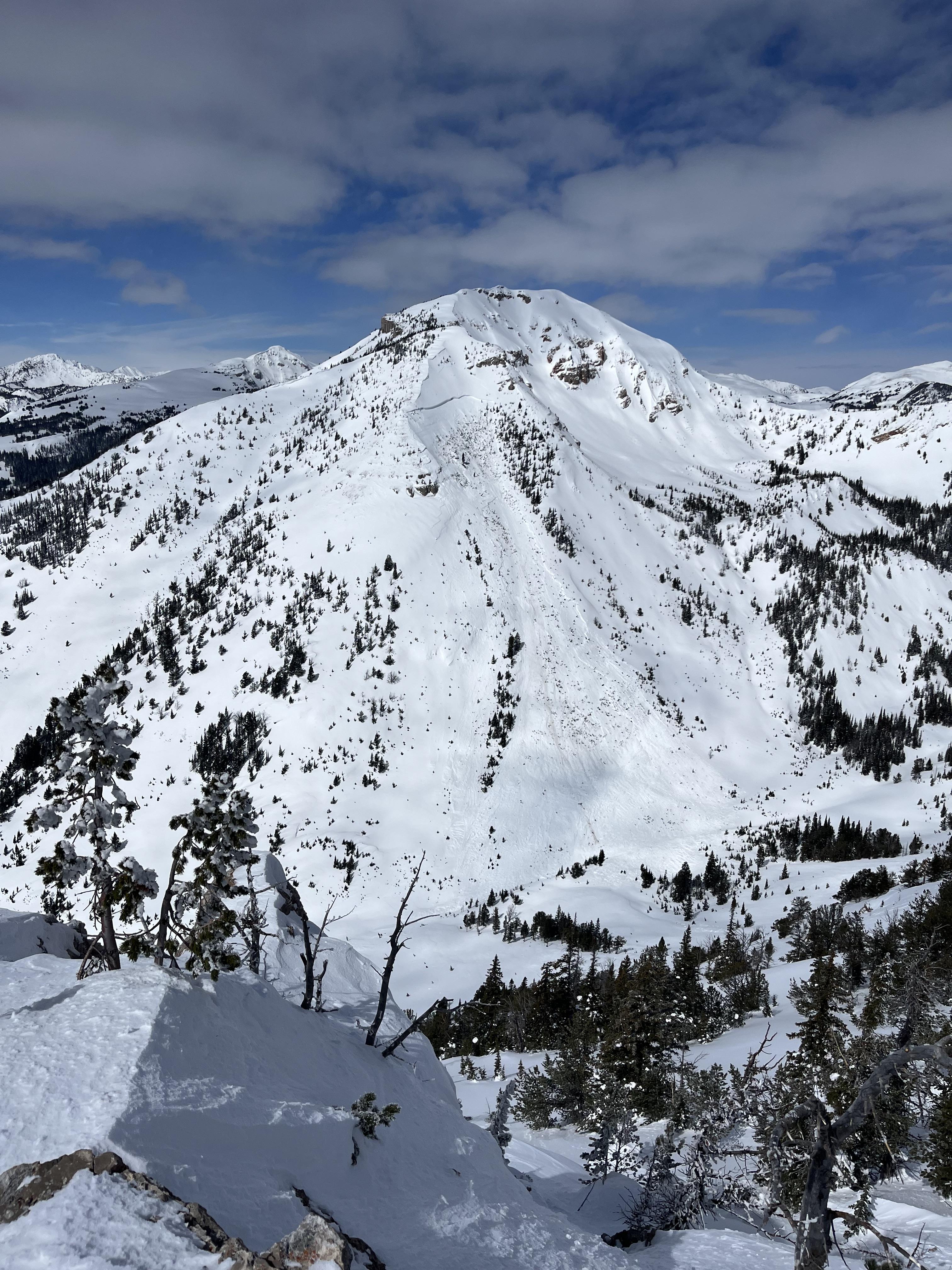
The big surprises for the day were 3 separate deep slab avalanches since the most recent loading event (likely 4/3). Photos are attached. The first that we sighted was on the N/NE face of Jumbo. It appears to be cornice fall triggering a windslab that stepped down, photo attached.
HS-N-R2-D2-O @ around 10000ft on the N/NE face of Jumbo.
the next that we sighted was a large deep slab on the E face of the ridge just north of the true summit of Jumbo.
HS-N-R2-D2.5-O @ around 10,000ft.
The real show stopper was on the E face of Jumbo.
HS-N-R4-D3.5-O/G. Approximate crown width of 1000ft and average depth of 6-8ft. Total run of around 2000ft. A few photos attached.
other slides of note, a few D1-1.5 WL slides low in the basin SW facing. Also, an older deep slab on N facing terrain just south of Hell Roaring Lake, D2-D2.5.
Full Snow Observation Report

I went through the area of Three Rivers Peak yesterday, and there had been a pretty nice cycle of large slides recently. One on the east face of Three Rivers broke 6-800’ wide 2-10’+ deep, and ran full track. It only had a couple inches of snow on it, so I think it ran sometime during the recent warm days. Some of the walls along the slide were over 20’ high, and I imagine the debris pile might make it through the summer.
I also observed a couple older slides on E\NE aspects that were older, but not a whole lot smaller.

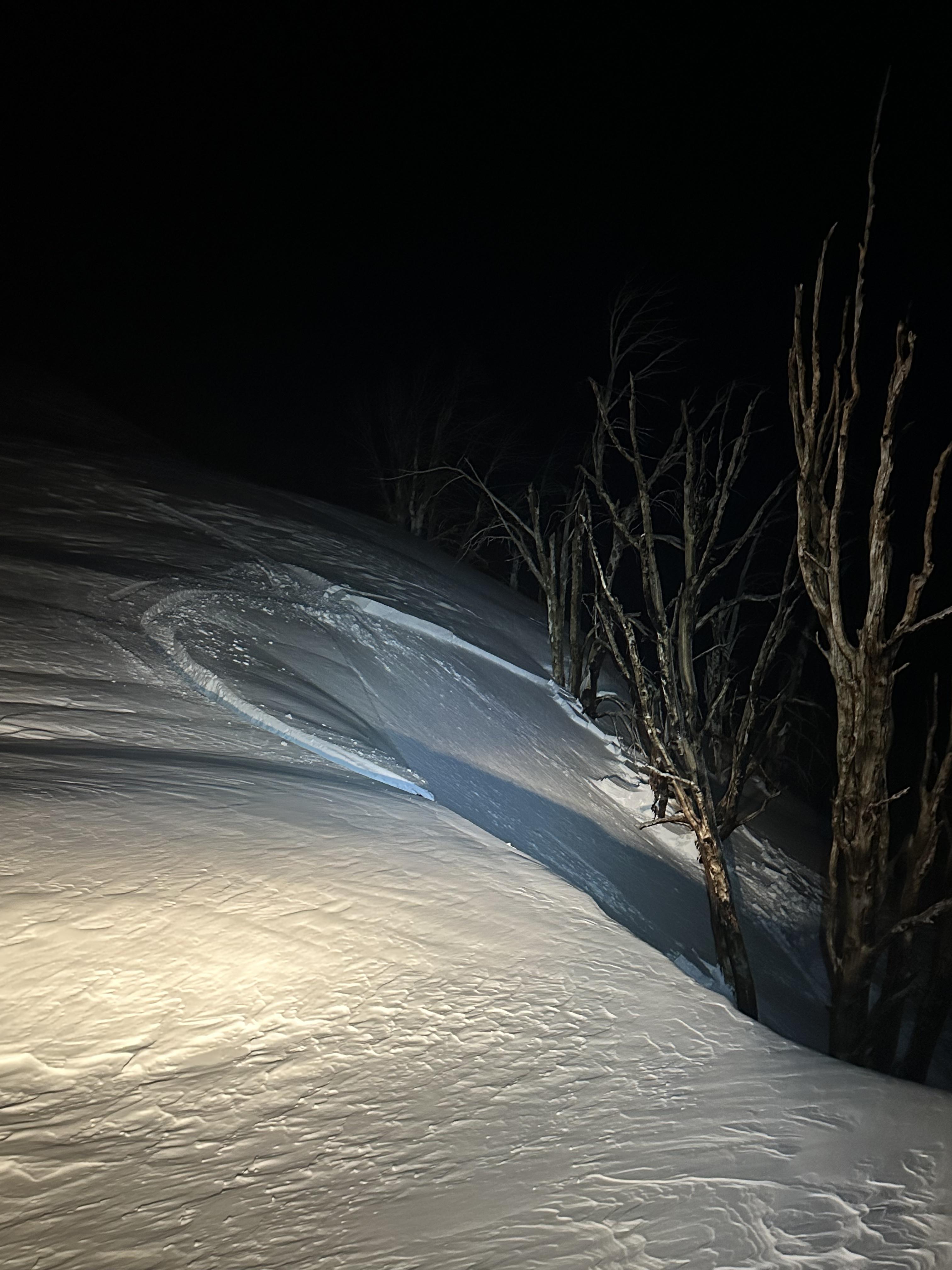
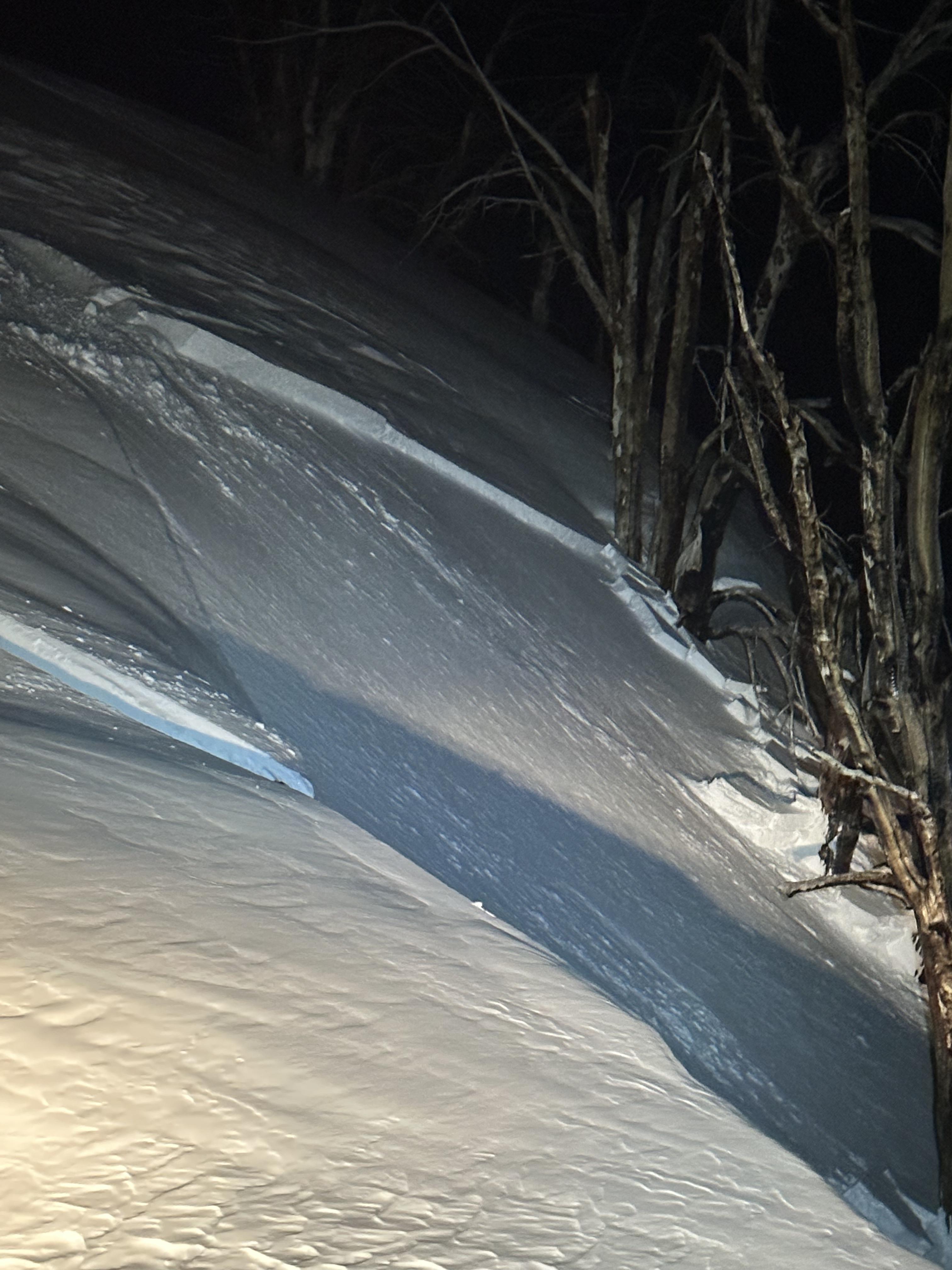
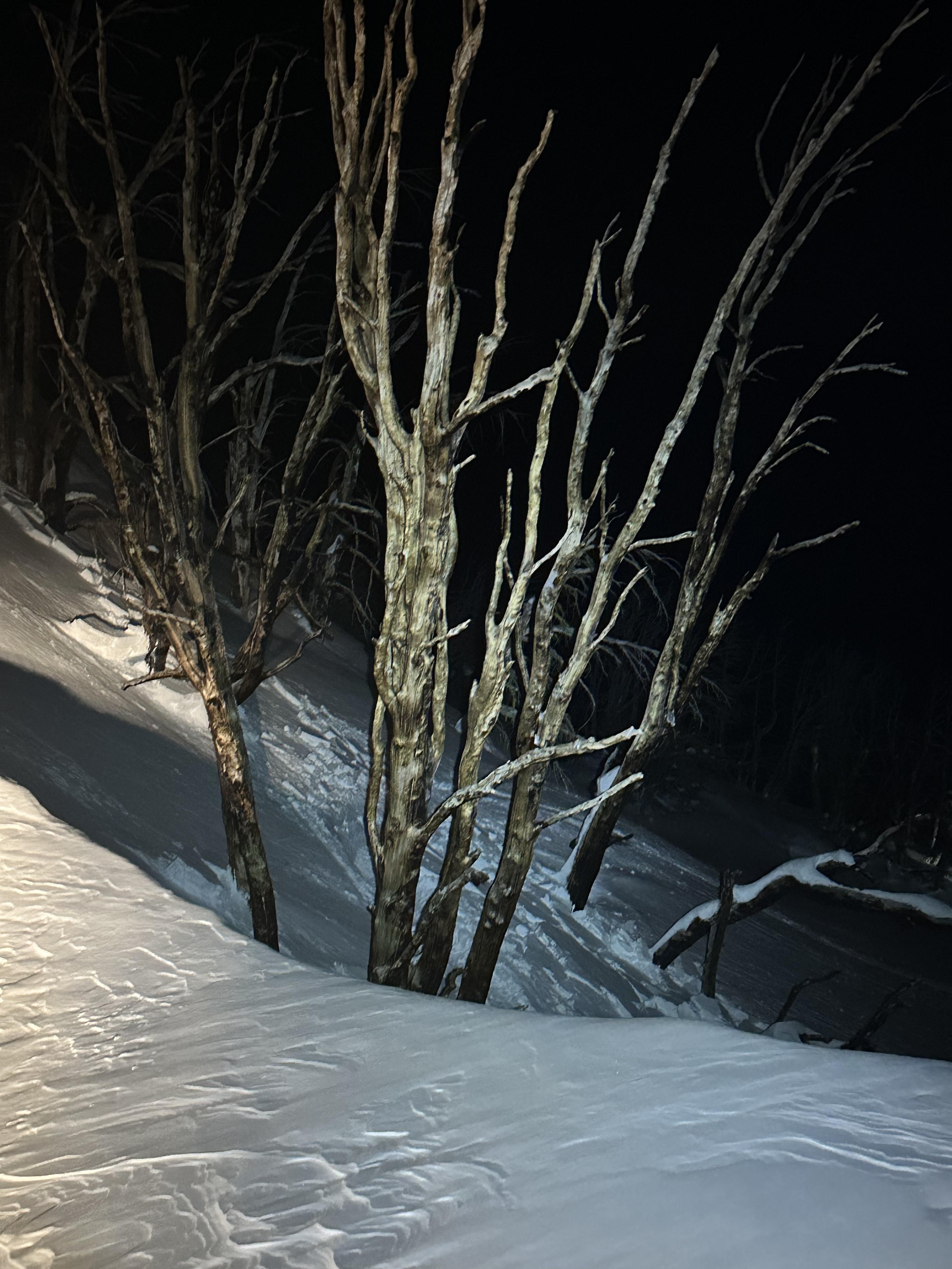
Small wind slab triggered by snowmobile. Slope was assessed by group as wind blown before climb. No one was caught. East facing slope, Storm castle Ridge.
Photo one shows trigger point where the Snowmobiler carved hard and set off the slab deeper in the snowpack
Full Snow Observation Report
We rode through Carrot and Sage Basin and up to the weather station above Sunlight Basin. We dug a pit on a SE facing aspect to see if the snowpack was transitioning from dry to wet. At 9,200' the air temperature was 18 F and the snowpack was dry throughout. Despite the cool temperature the snow surface was close to becoming wet (31 F). This was a good reminder that the sun angle has a significant impact on the snow surface this time of the year, which causes rapidly changing conditions. Additionally, we had an ECTP 13 on a layer of near surface facets 1.5' below the surface sitting on top of a melt freeze crust. This weak layer and the one near the bottom of the snowpack remain a concern.
Full Snow Observation Report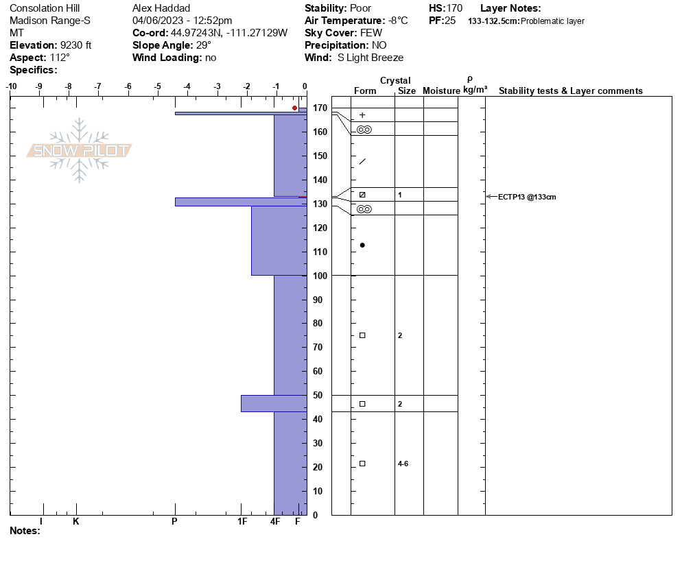
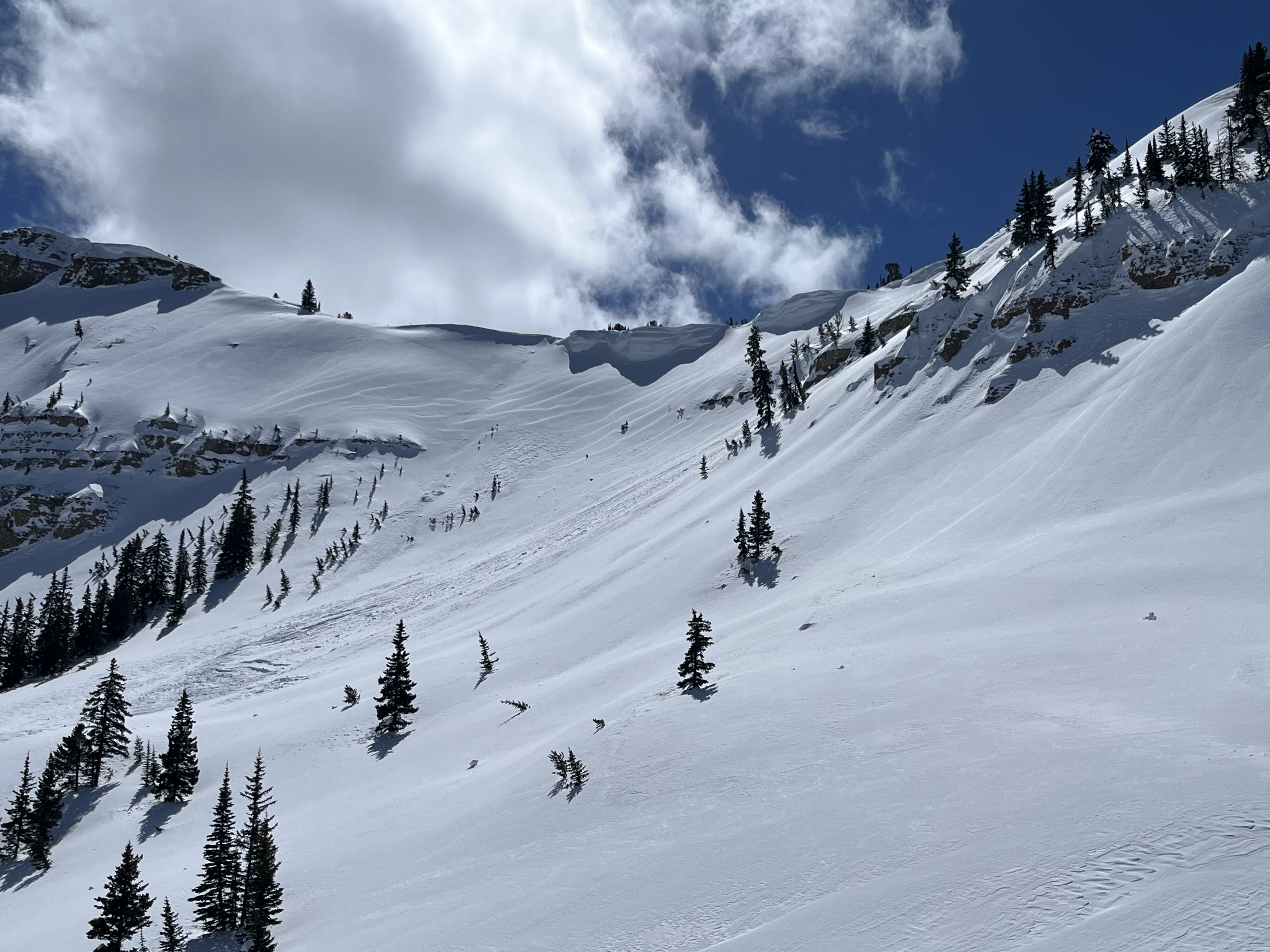
South of Saddle Peak, ~8500', ENE aspect, 2-3' crown depth estimated and likely cornice-triggered. N-facing snow remained dry until the latter afternoon when a high sun angle cooked everything but the truest due north. Avalanche appeared to be all new snow likely on a PWL buried near the end of March. Winds moving snow up high, but everything appeared locked on.
Full Snow Observation Report
We road into the Meadow Lake Canyon heading up above the lake in the Lemhi Range. Witnessed very sketchy conditions low and higher elevations. Saw 4 avalanches about a week old and many shooting cracks down low and a very nasty 20" think top layer on the snowpack. In that 20" inch layer on top was approx 8" consolidated snow on a 1" think ice layer and another 8-10" of consolidated snow on many feet of faceted sugar snow. We had shooting cracks hitting the cut banks of the road, heading up to around 9,000 ft where we started running into about week old slides. Slides were size 2 to 3. Slides were noted on NE, SE, NW, facing slopes. The bigger slides were at 10,000 feet.
Full Snow Observation Report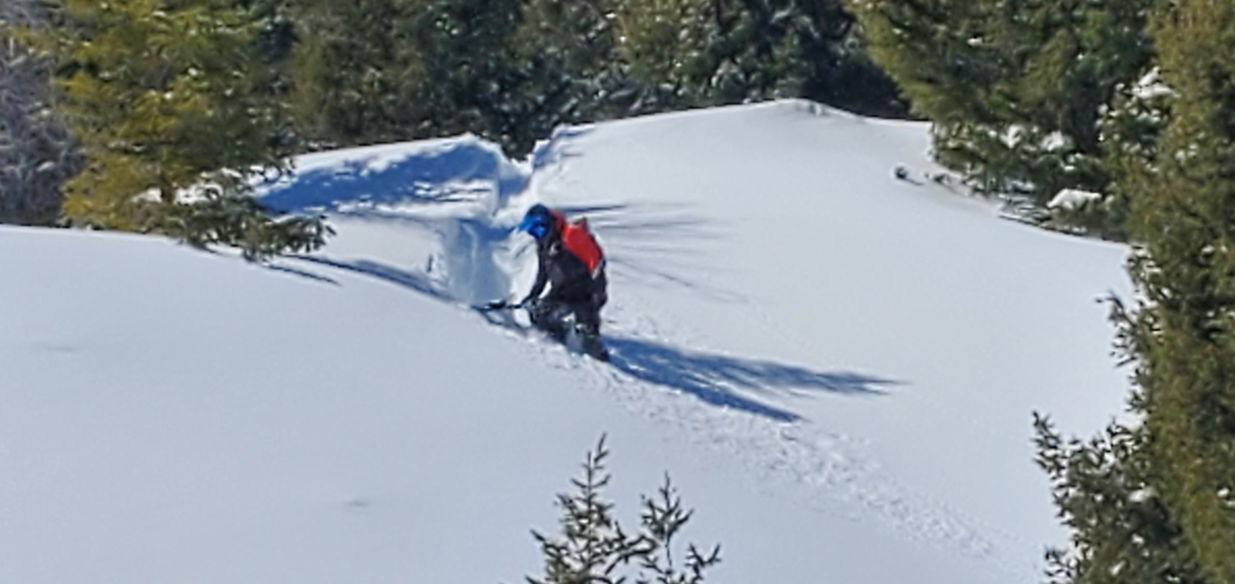
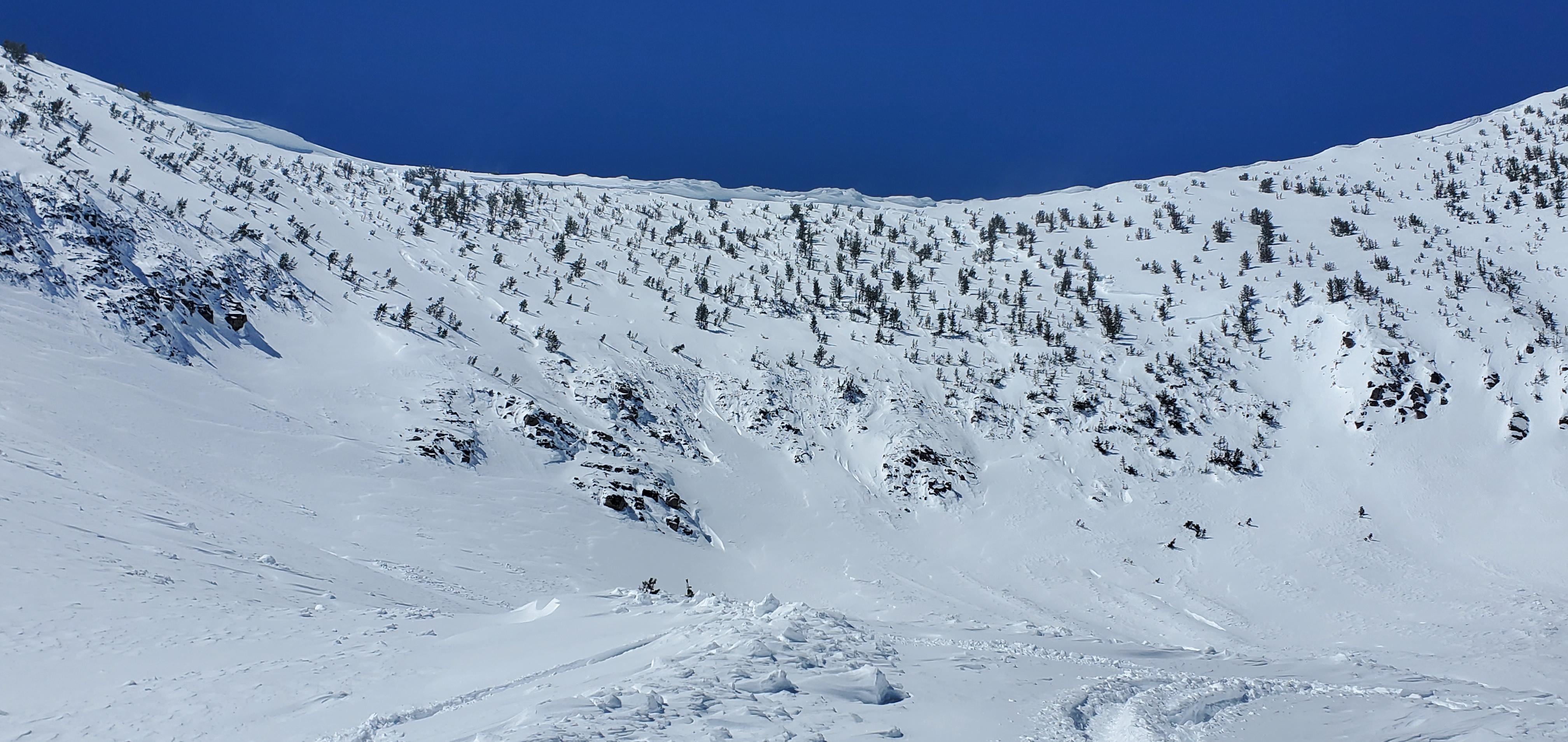
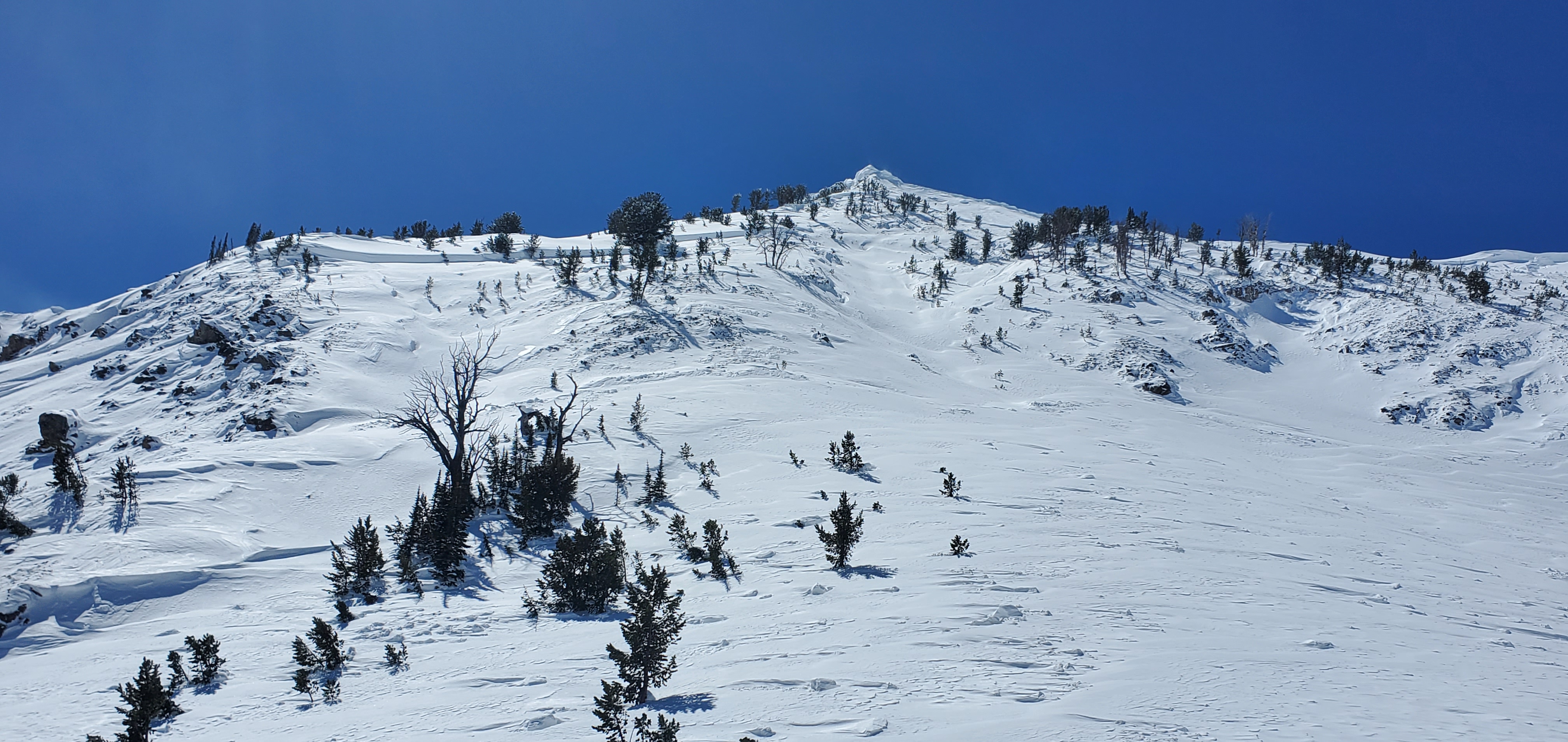
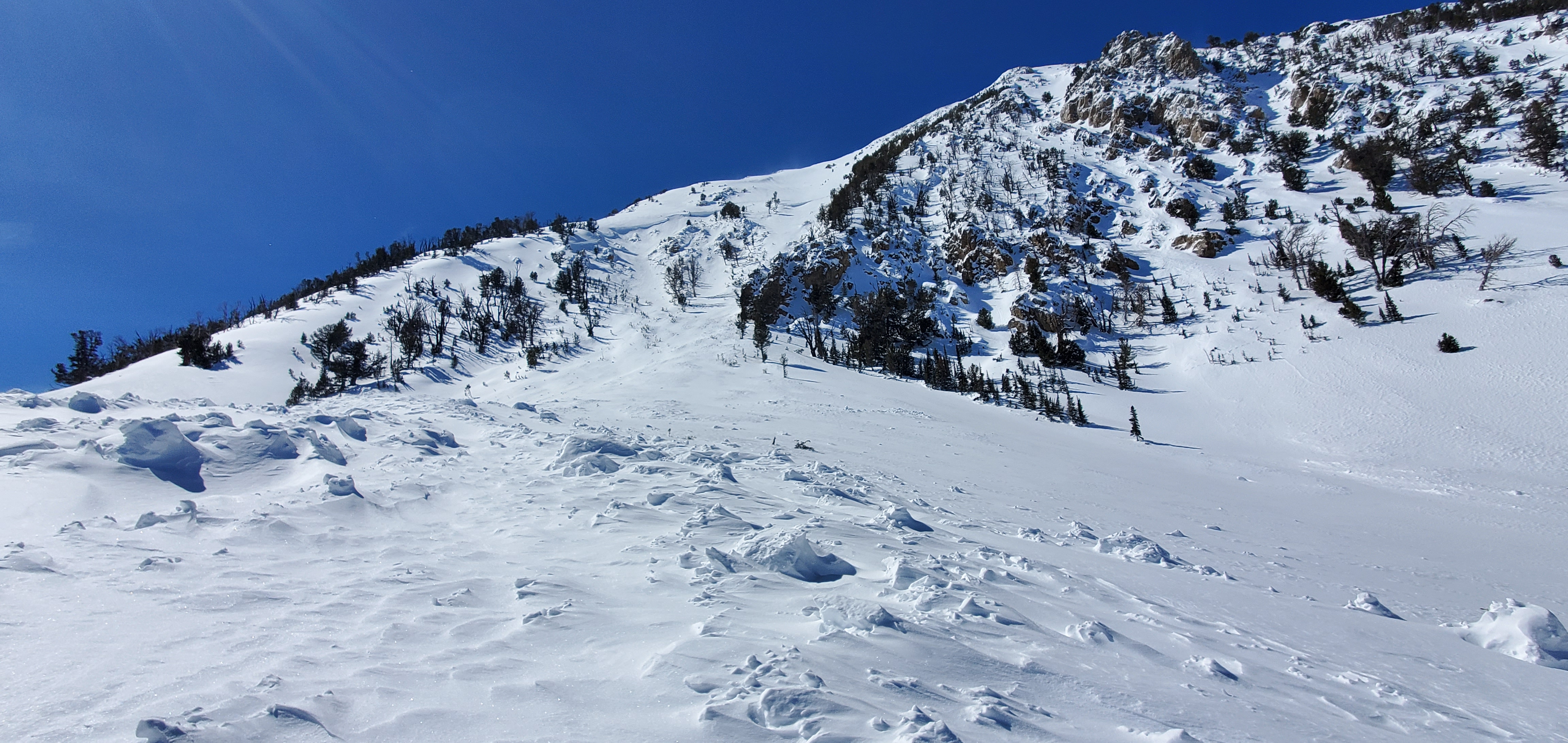
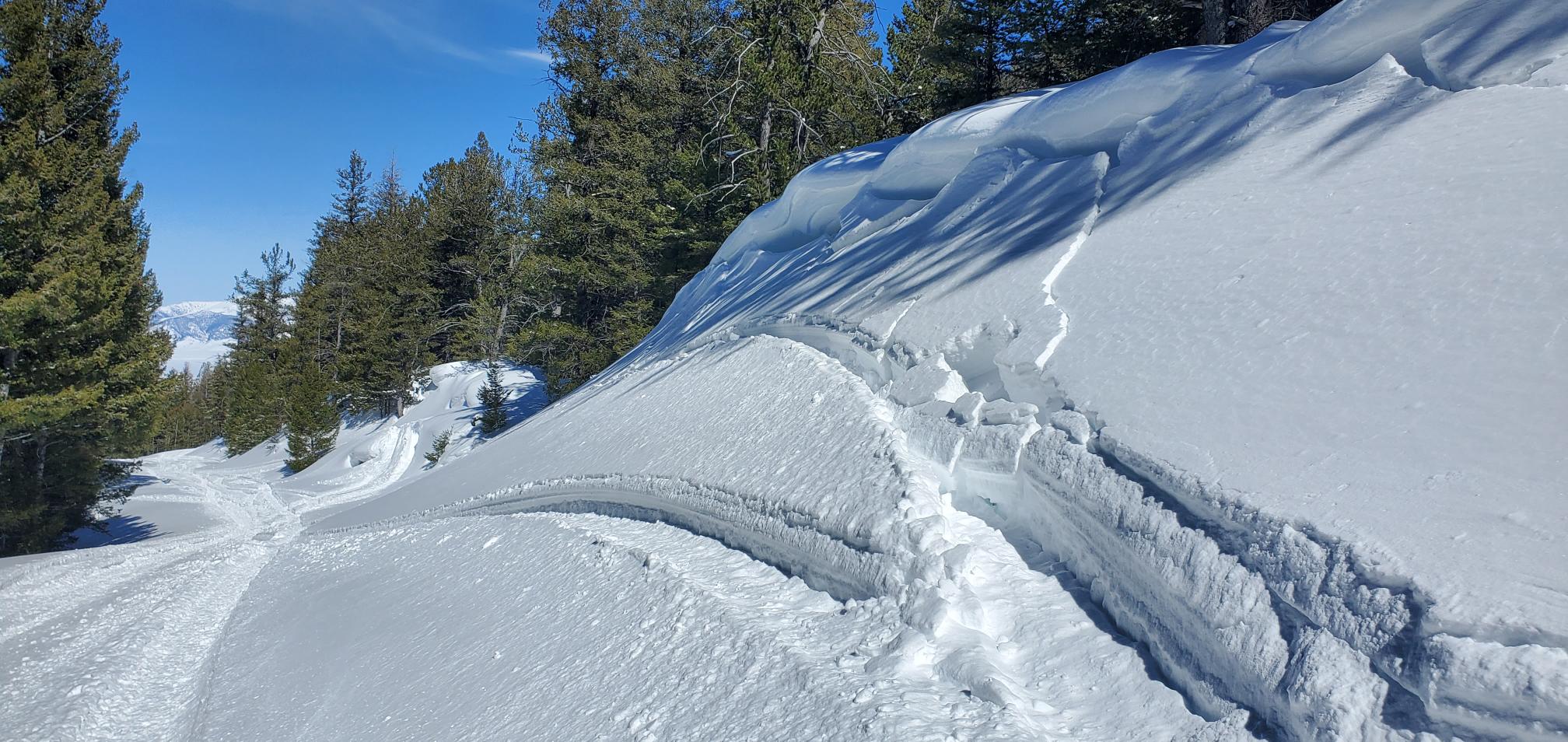
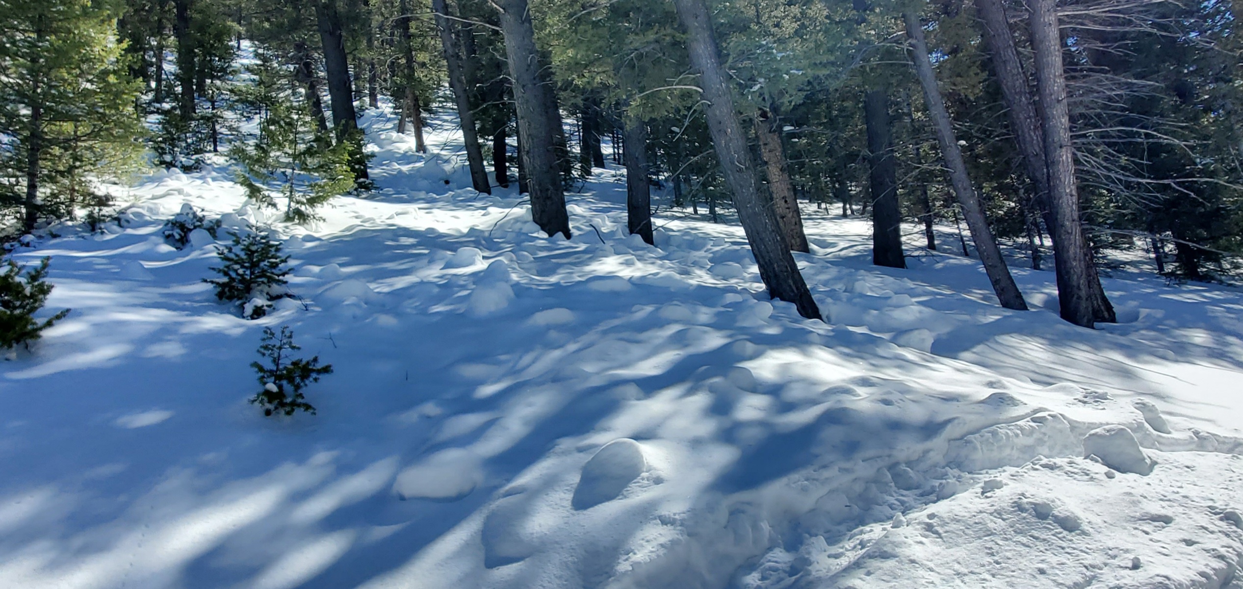
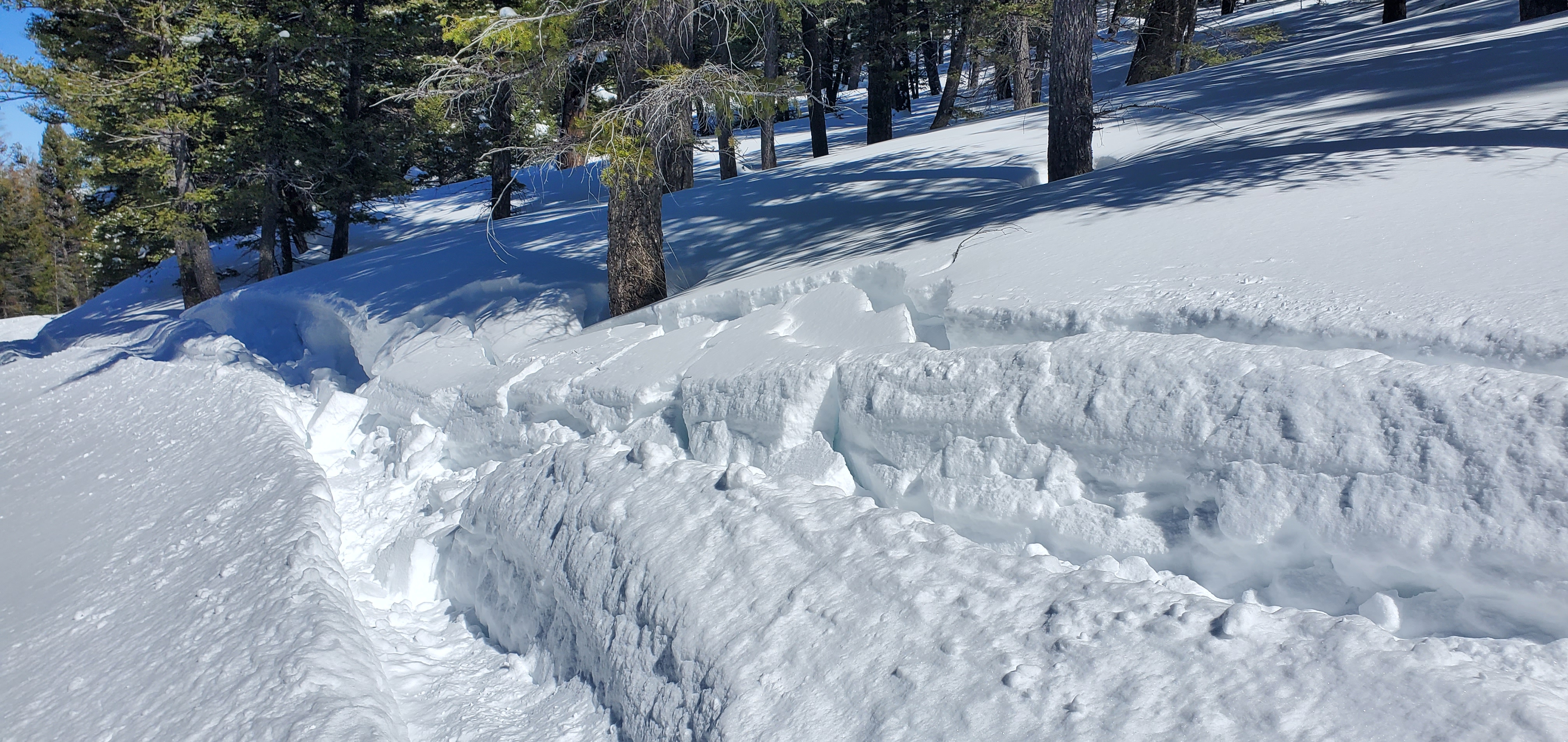
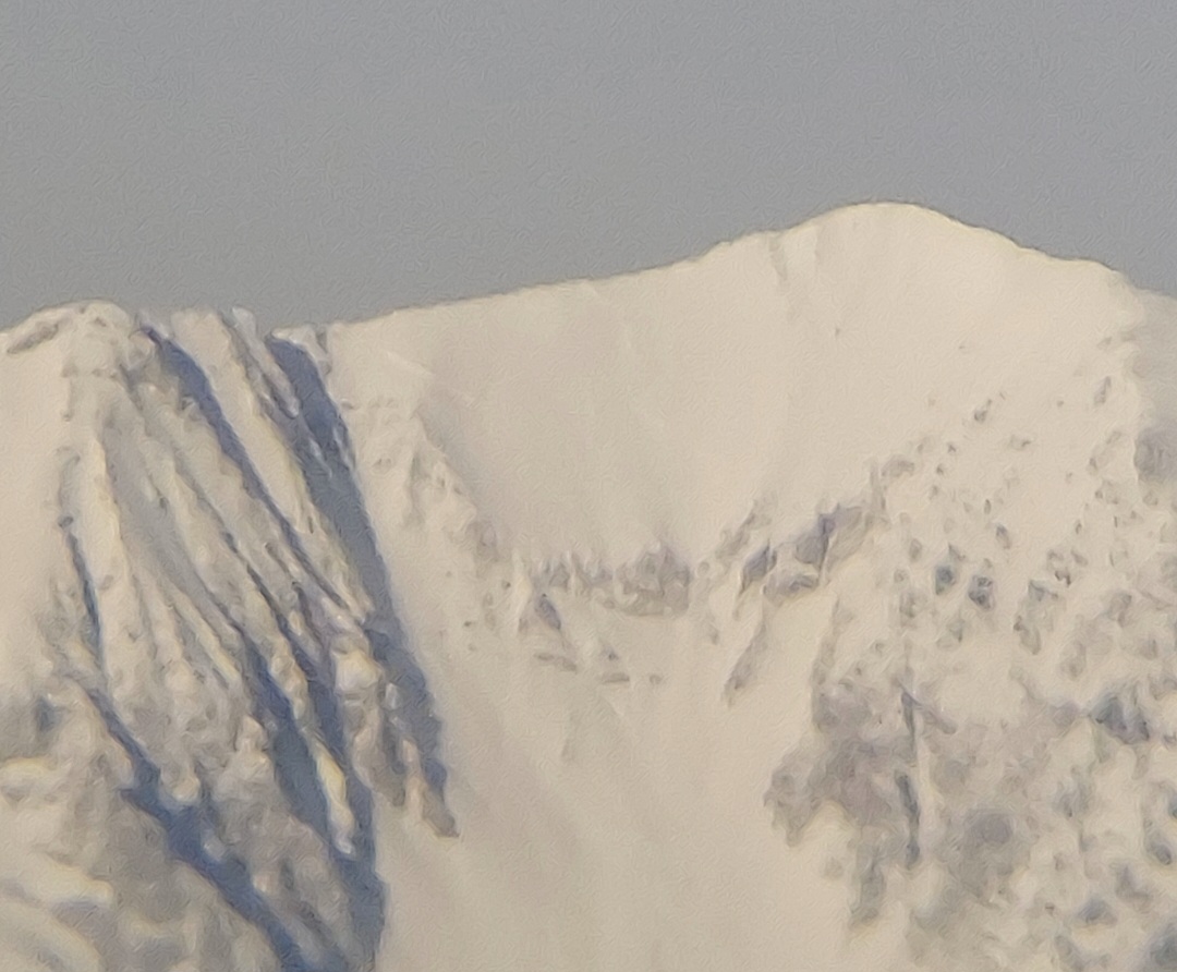
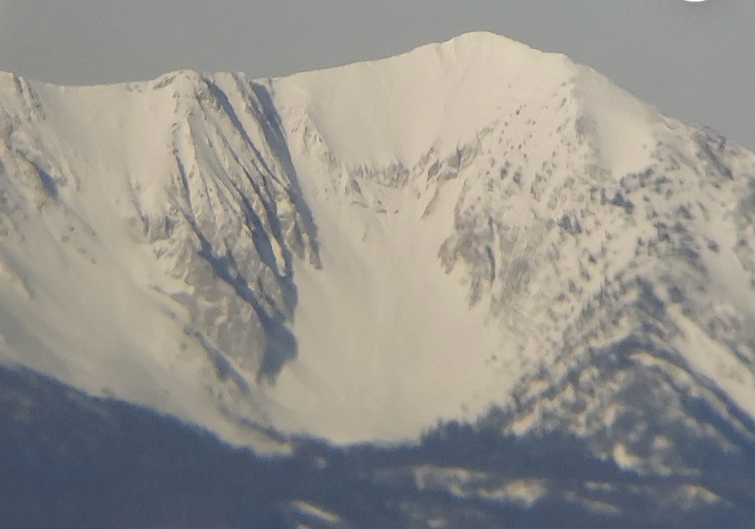
Photo of recent, natural wind slab avalanche near Cooke City. (which likely happened last night)
The avalanche is on a SE aspect around 10,000'. The crown looks to be about 1-3' deep and 75' wide.
The SW/ W winds were moving a good bit of snow around this morning/ today. (more so than the Lulu wx station would lead someone to believe.)
No collapsing today. Minor cracking of the fresh drifts. Fairly widespread wind effect above 9500'.
Also observed a couple of isolated wet loose avalanches today too.
Expecting more wet loose tomorrow in places..
Full Snow Observation Report

From instagram: Skier triggered windslab on Scotch bonnet near Cooke City. Approximately 75 ft wide.
Full Snow Observation Report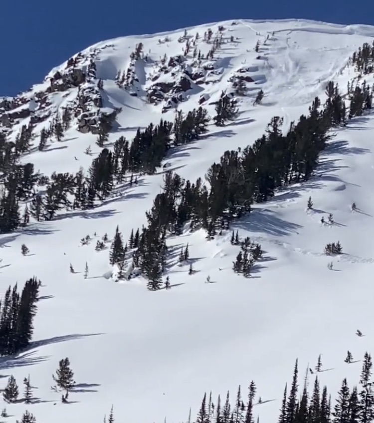
Skinner triggered slide north of the hourglass. Run name unknown. Remotely triggered from ridge line; snowboarder said he was skinning 35 feet away from trigger point; no one buried. I also observed point releases as I was skinning up to texas meadows; snow seemed to change quickly under blue skies and increasing temperature. Slide ran in front of me, taking out the skin track.
Full Snow Observation Report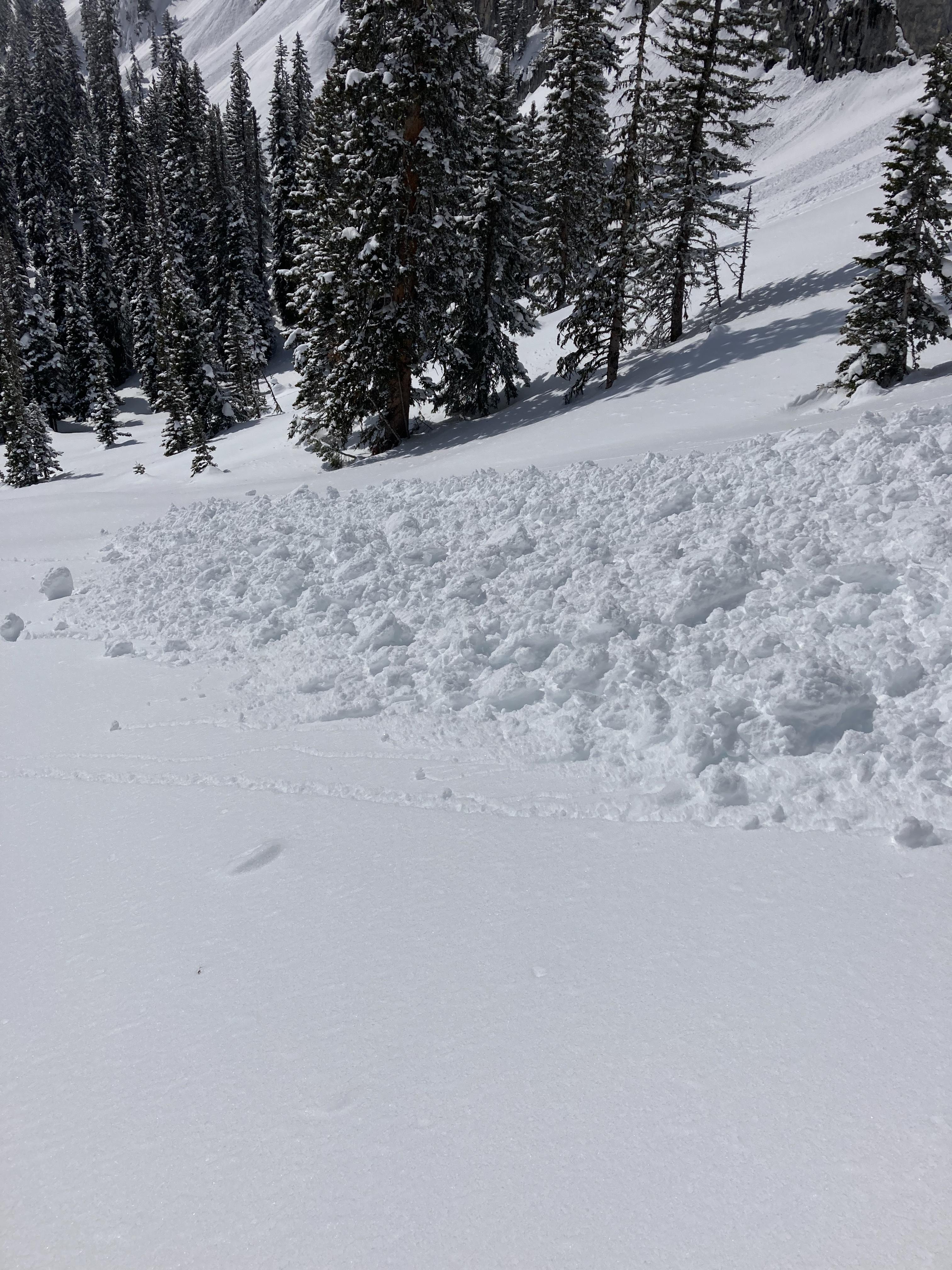

Overall seemed like a deep HS (220 cm) versus other years I’ve seen here. High strength in pit (ECTP26), failure on facets below melt-freeze crust down 60 cm, and with no more obvious signs of instability. Felt weak snow deeper, but only dug in the top meter. North winds increasing throughout the day and any wind affected snow was shallow in depth. South aspects were crusted but protected N-facing or tree skiing was still great.
Full Snow Observation Report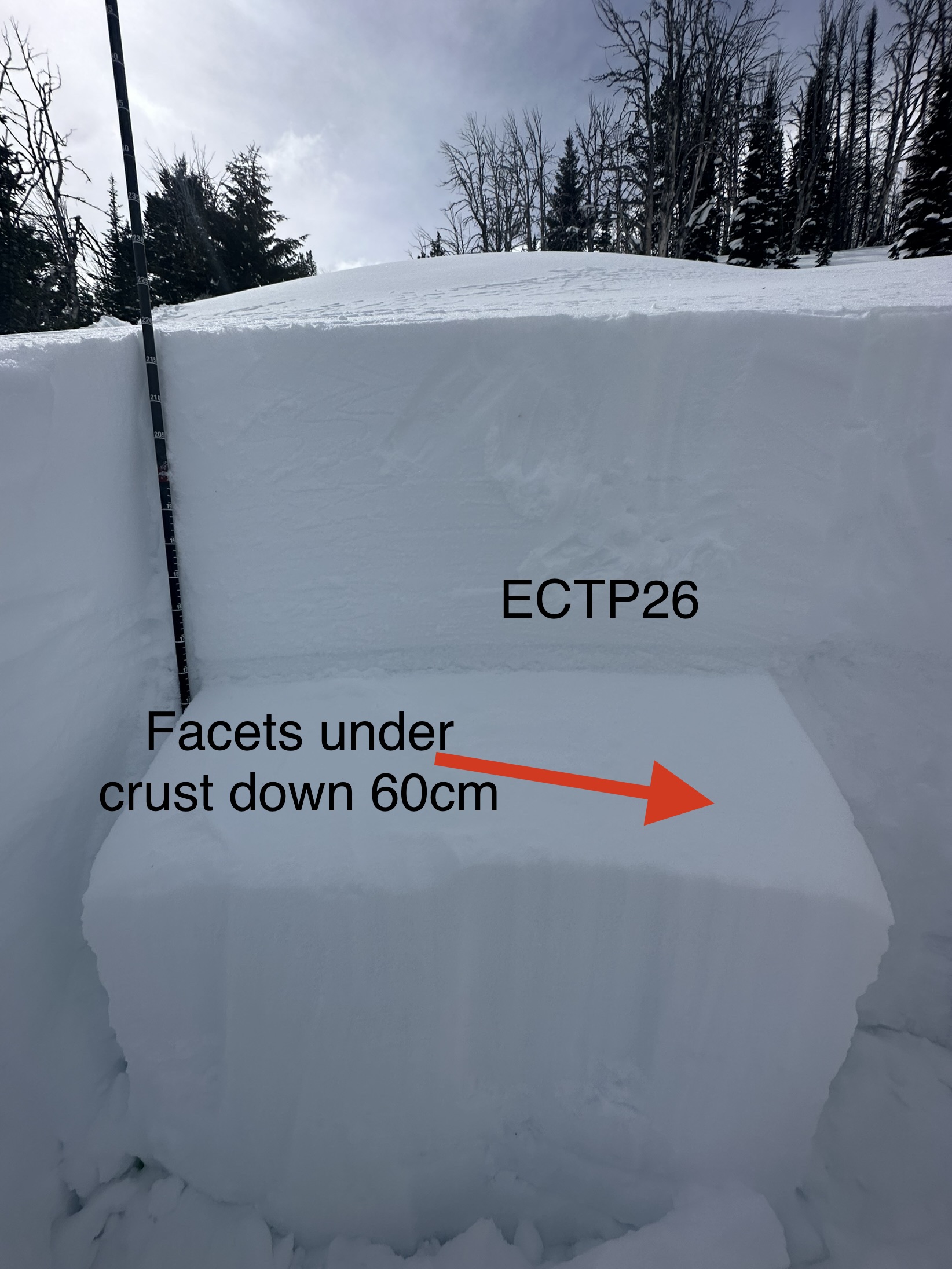
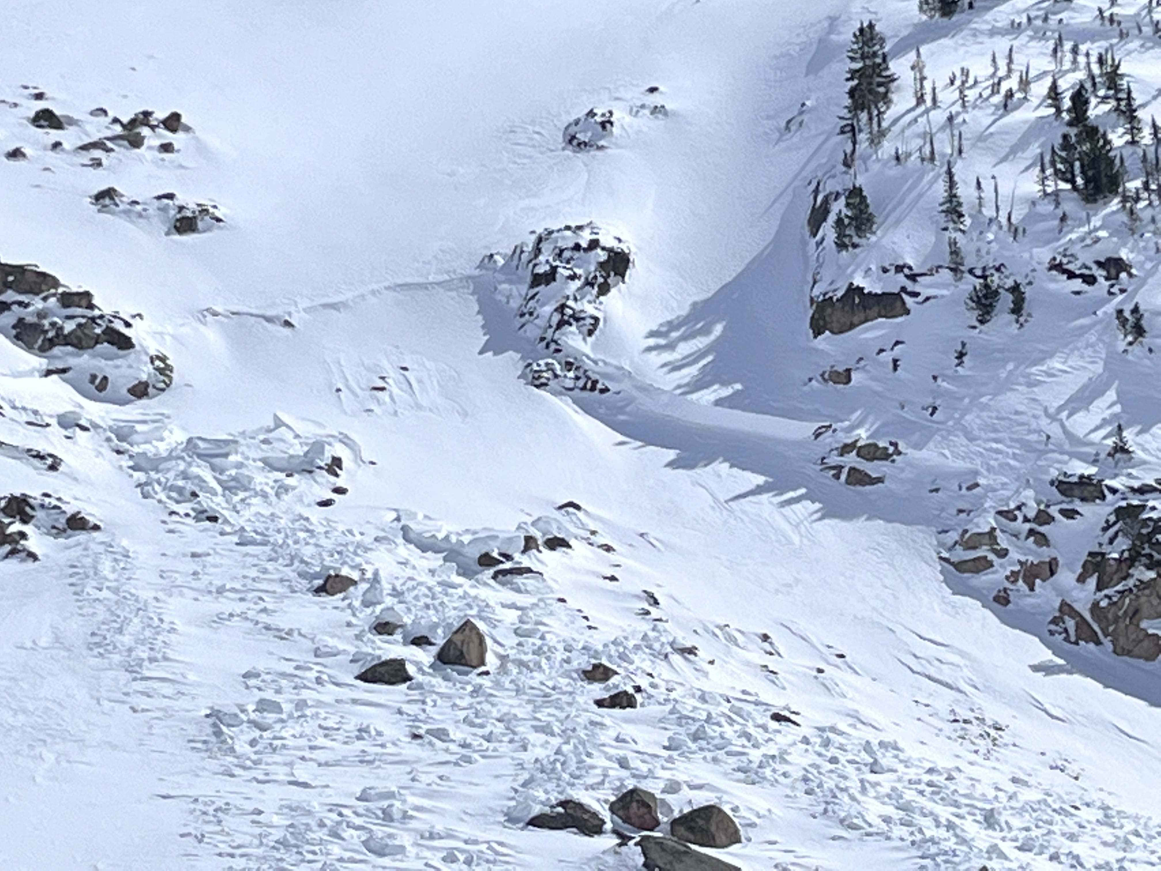
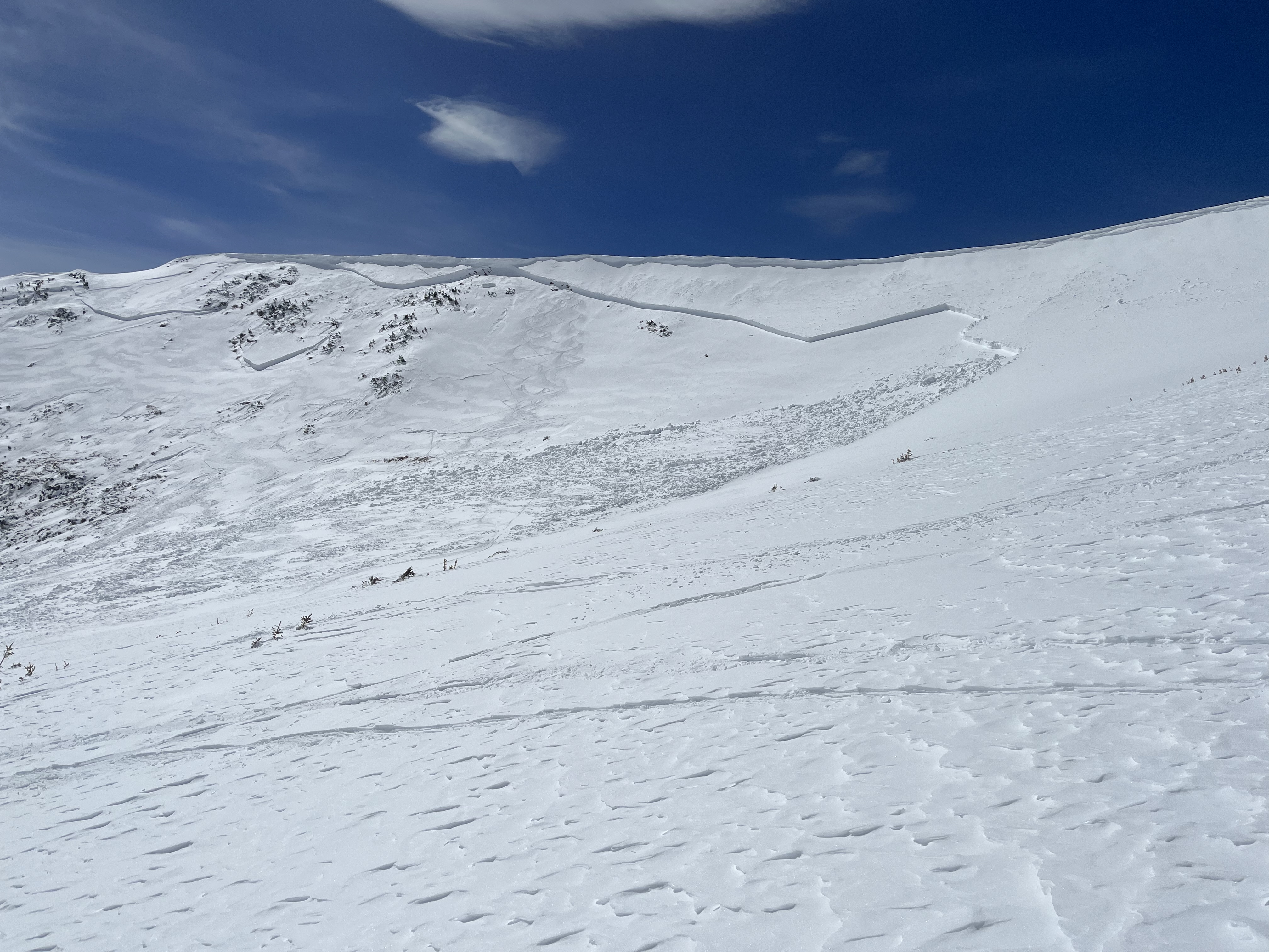
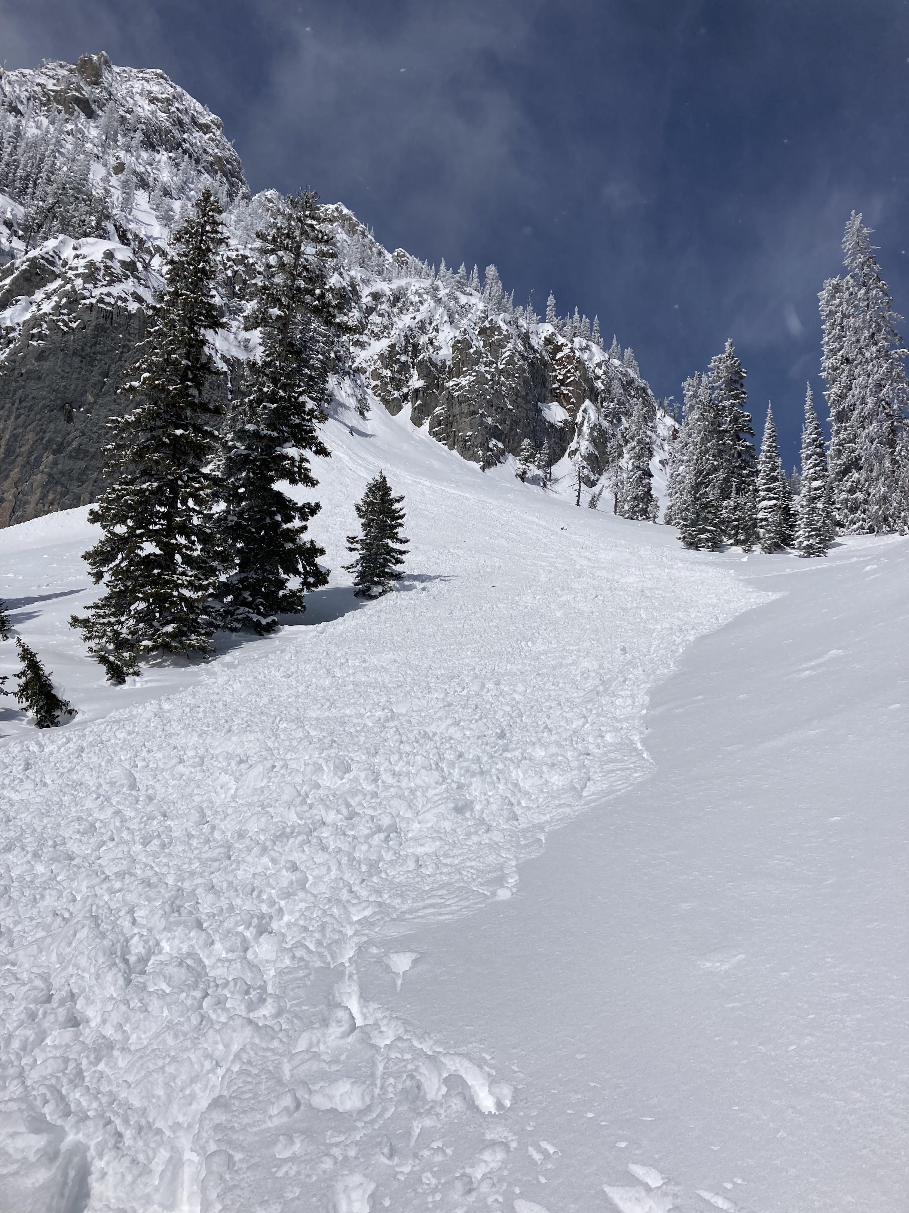
We rode into Lionhead Ridge to pull the weather station for the season. There was a large natural avalanche that broke yesterday on Bald Peak it was bounded laterally by the terrain, so it only broke a couple of hundred feet across, but it appeared to be 4-6' deep and ran the full available vertical into the creek below. This avalanche was the key piece of information for the day and answered the question of whether or not the snowpack is continuing to produce deep slab avalanches with every storm, it is.
After dealing with the weather station, we rode around to Denny Creek and up under LH Ridge. We saw three more avalanches that broke at least a few feet deep and several storm slab avalanches that failed within the new and wind-drifted snow. No other observed avalanches were as large as the one on Bald Peak.
We stayed in terrain less than 30 degrees steep, with minor exceptions on small slopes. We avoided all large, wind-loaded slopes and crossed below them cautiously. The snowpack maintains the characteristics of mid-winter, and deeply buried persistent weak layers remain a concern. Going forward, we will continue to assess the upper few feet of the snowpack for instability before considering any steep slopes. We will continue to manage the deep slab avalanche problem through avoidance (of avalanche terrain) and consequence minimization (by selecting non-wind-loaded slopes that are smaller and free of terrain traps).
Full Snow Observation Report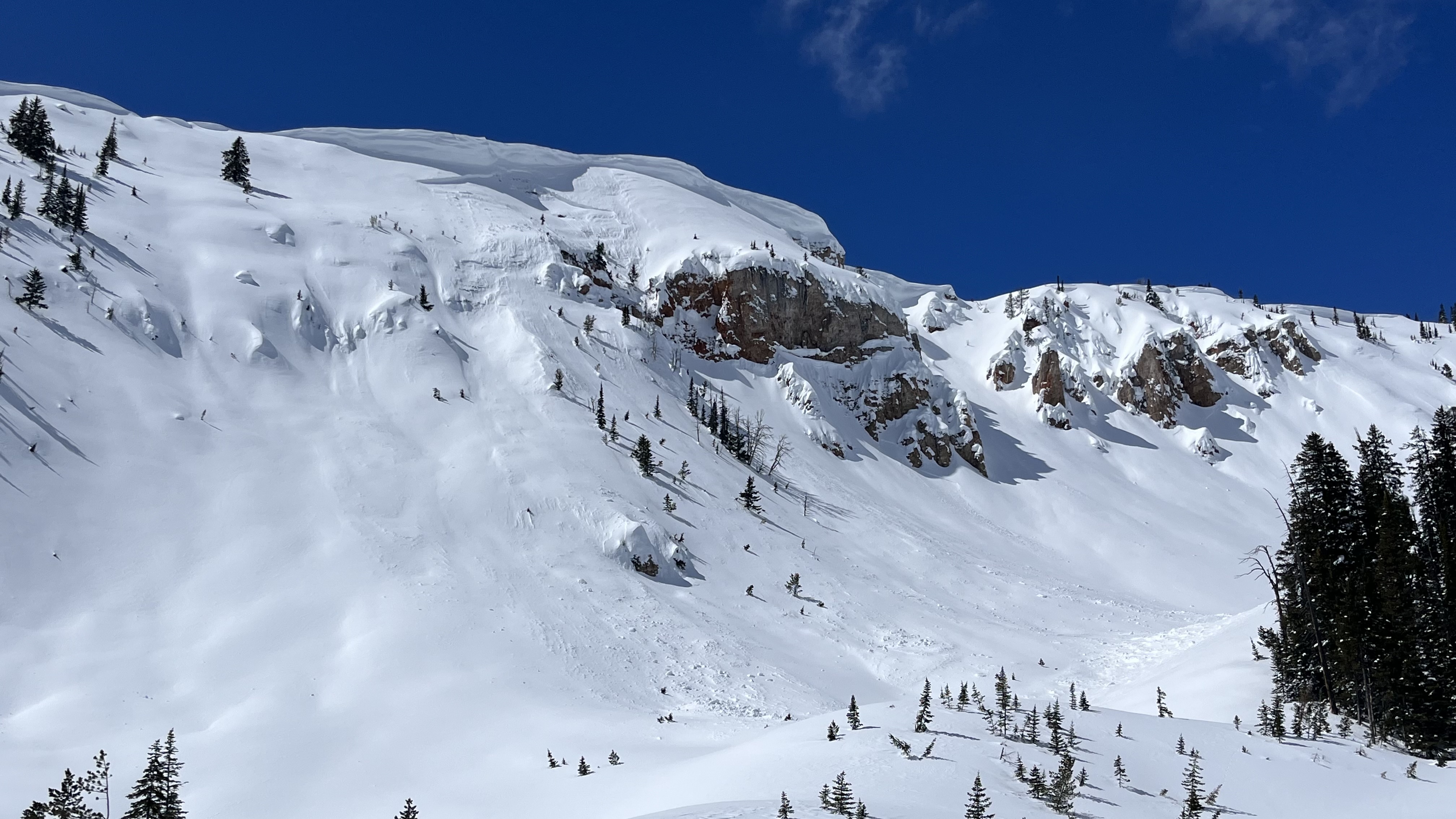

From IG: “Wanted to touch base about an avalanche we triggered on the shoulder of Mineral Mountain today. While skinning up there was obvious wind loading coming from the south. I kicked around a bit near the edge of the ridge (no cornice) and remote triggered this slide from 20’ away. It broke 12-18” deep, and propagated 700-800’ wide. Ran full length of the slope into old growth trees 1200’ below. Would estimate R4 D3. We found good stable skiing on the south aspect (~35°)”
Full Snow Observation Report