Snow Observations List
Slab avalanche on NE facing slope at 7,500 feet - slid to the ground.
Full Snow Observation Report
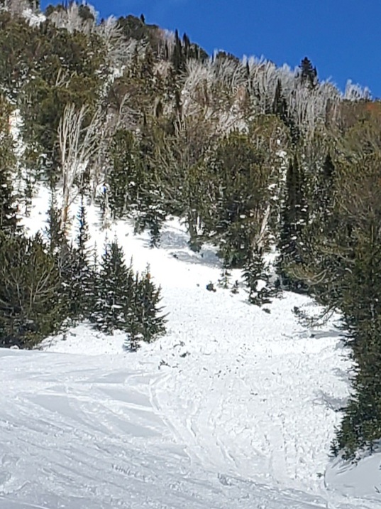
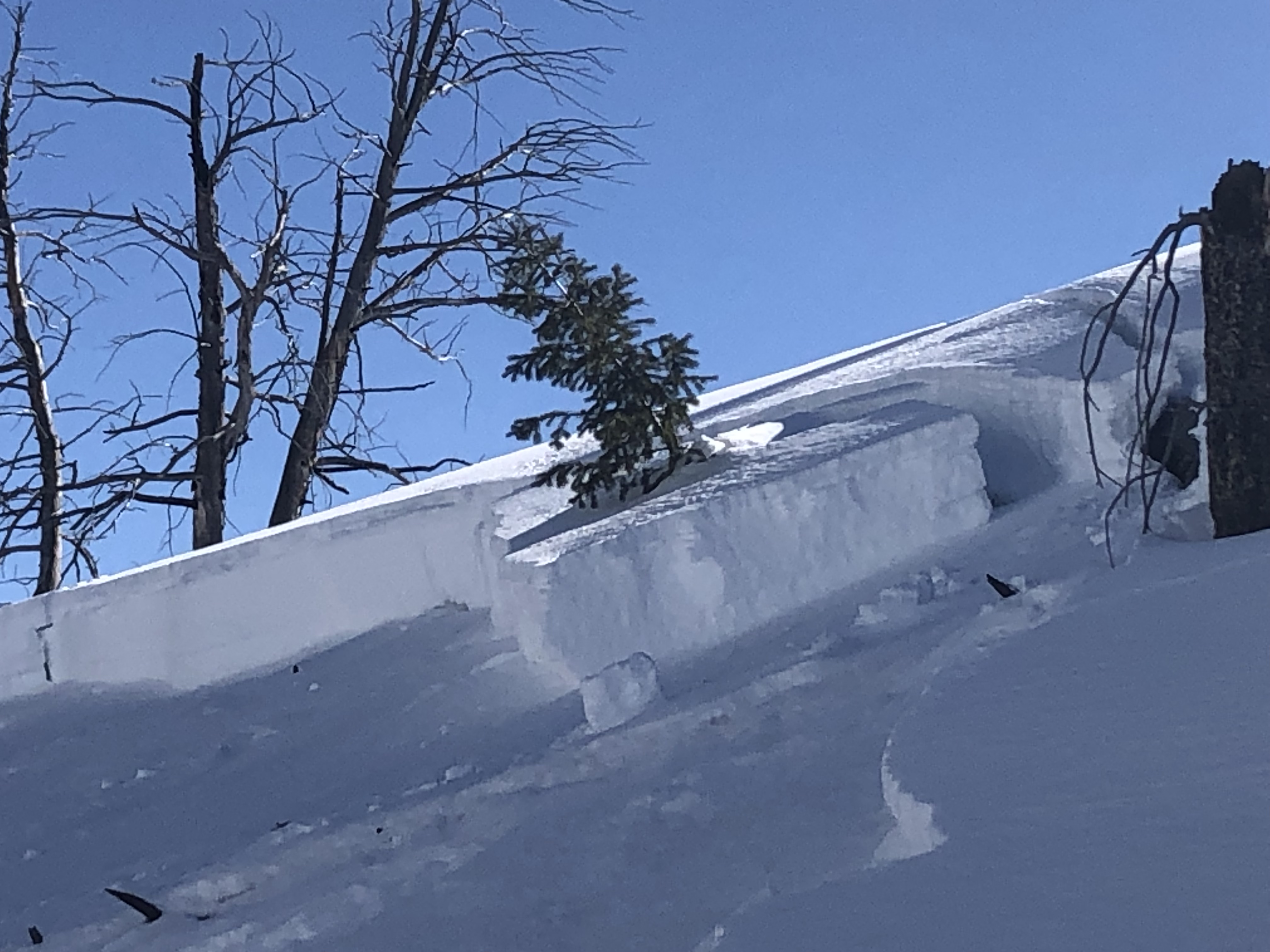
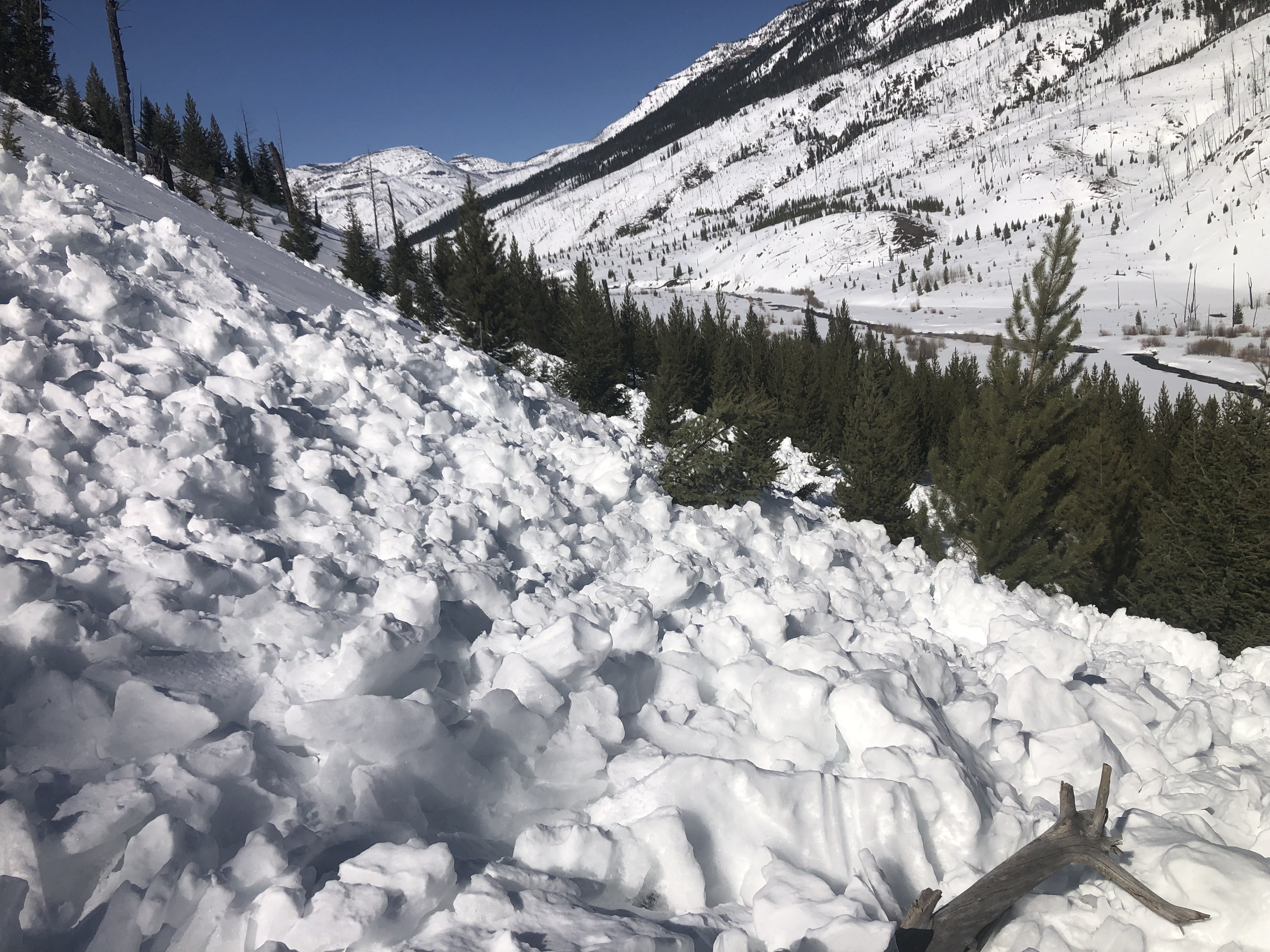
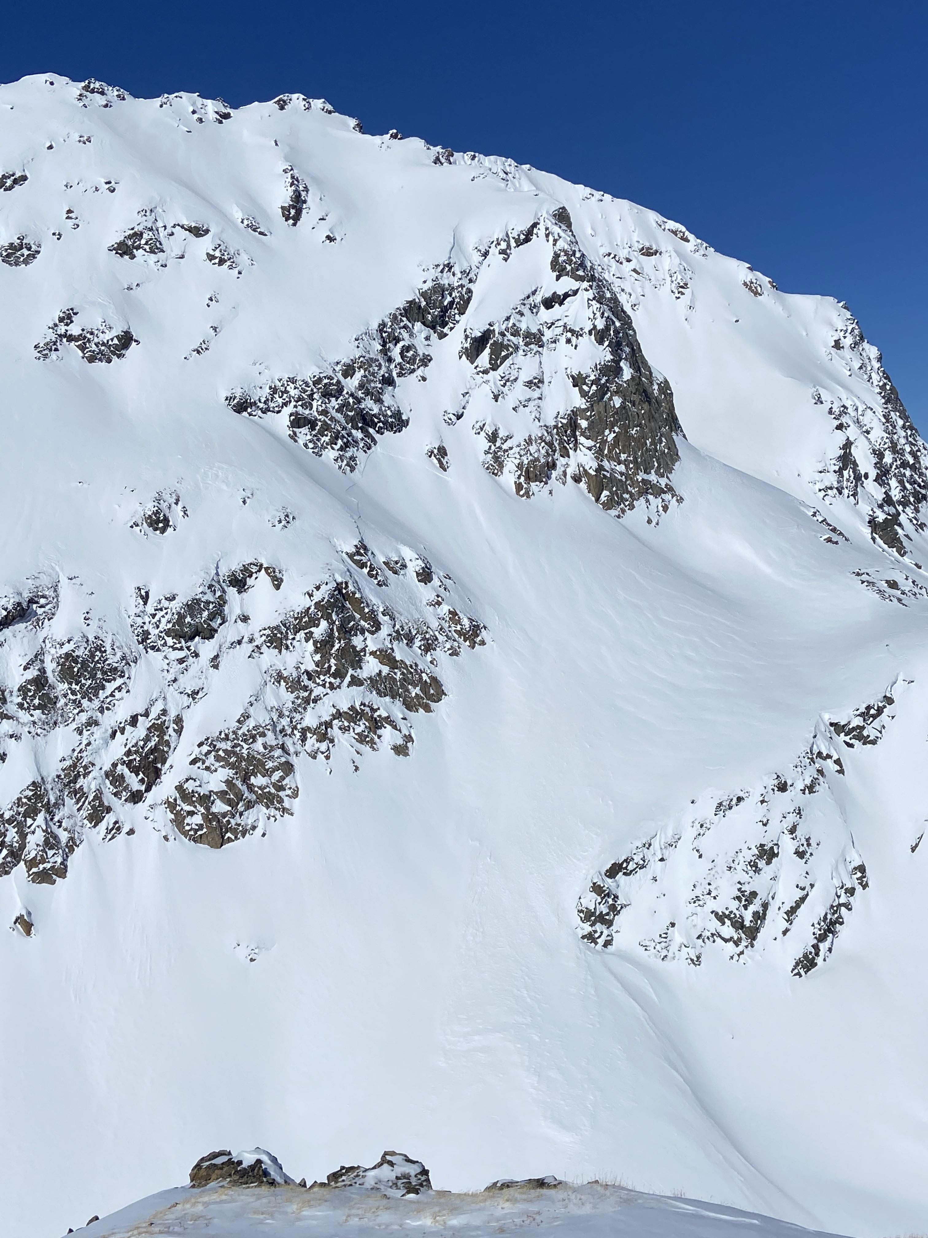
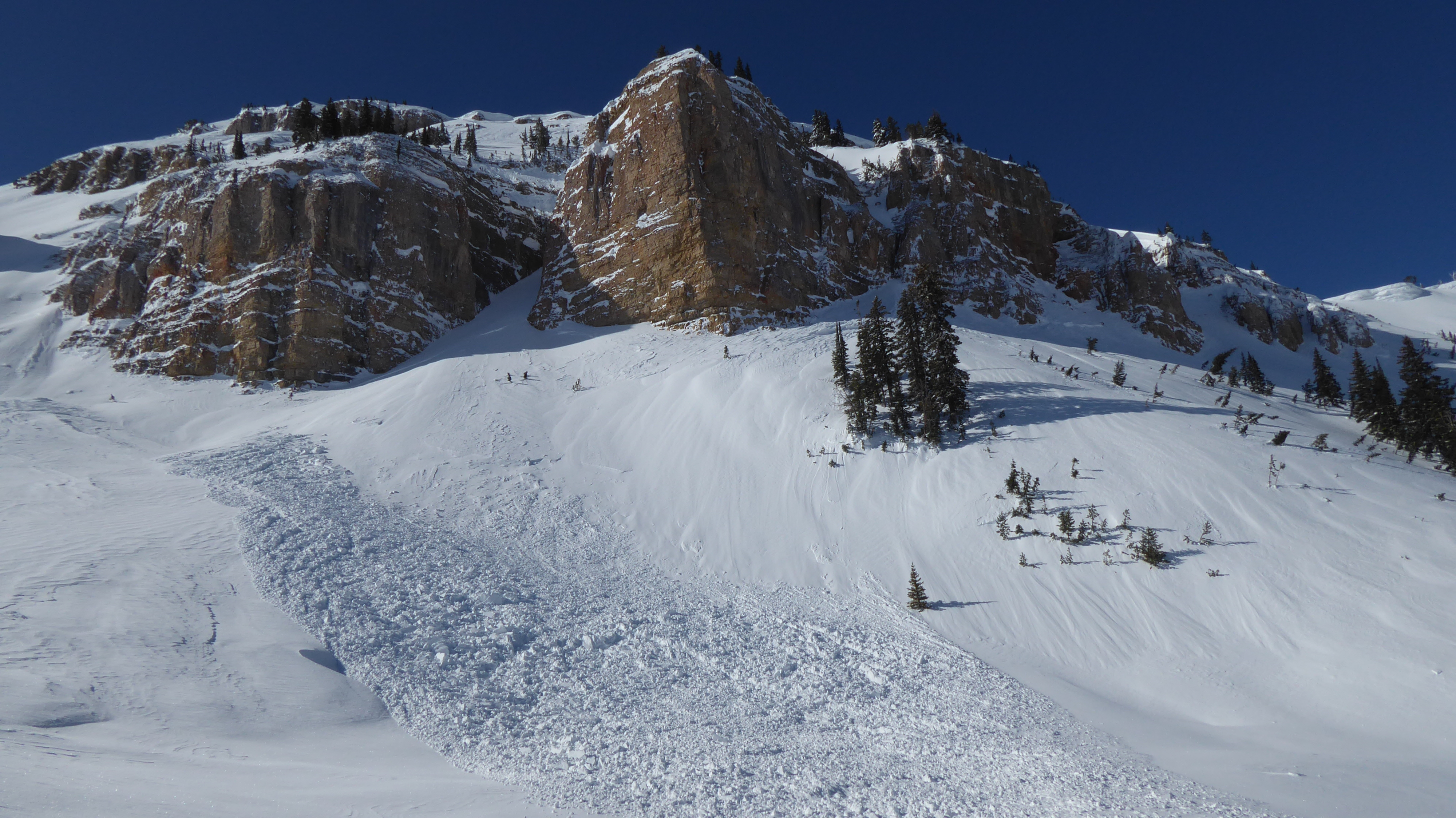
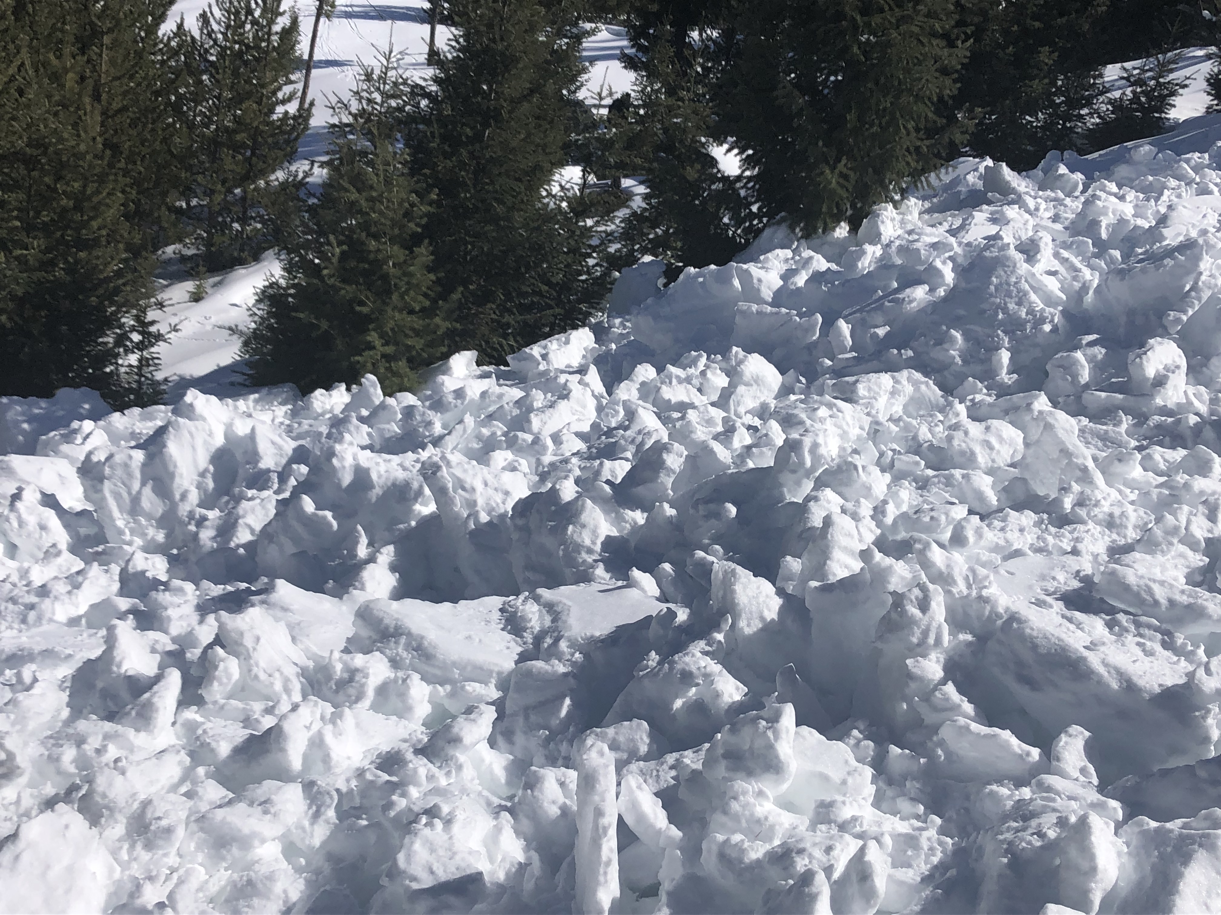
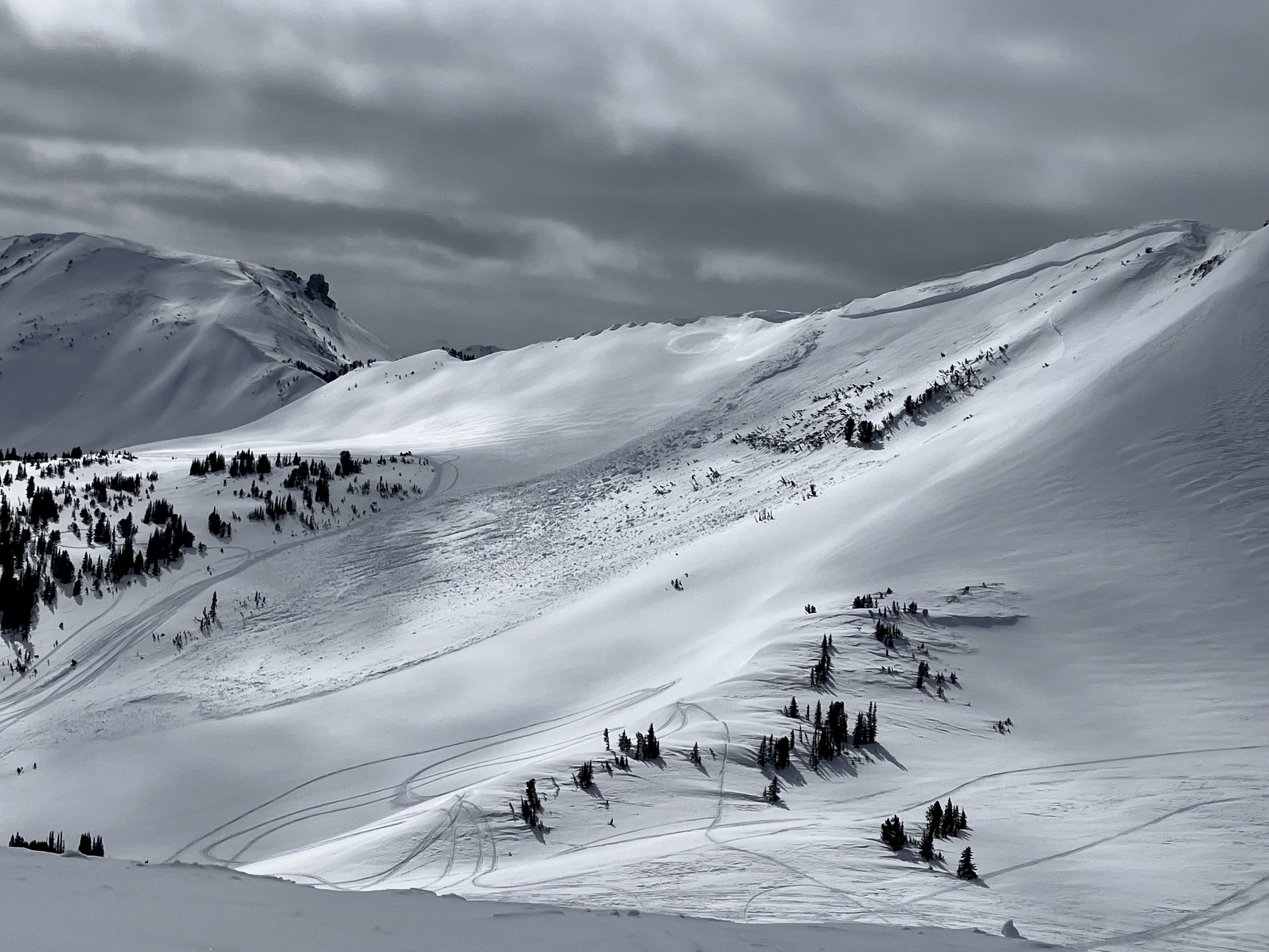
Myself and two partners were skiing in the crazies 3/17-3/18. Dug 2 pits and got similar results, ectn15 18cm down and n28 30cm down with depths of 300-400cm and no deeper pwls on N/NE aspects at 8300ft and 9600ft. No recent avalanche activity other than a few small 6in storm/wind slabs on southern aspects. Snowpack was very right side up everywhere we toured and had skied 3 different NW to E faces. On 3/18 we headed to ski a NE facing couloir at 10000ft, skinned/booted the first ~300ft and found similar snow to everywhere else. About halfway up hit a rocky section with some depth hoar, I noted plate crystals up to 1cm wide at ground. Should’ve turned around there but thought maybe it was just a short rocky section. I had also just measured the slope angle at 52 degrees which gave me false confidence there would be no developed slab. Wallowed through weaker snow for another ~50ft then finally decided to turn around due to the difficult boot packing, hitting our 3pm turn around time, and the weak snow pack. As I booted to the middle of the line to find better snow the slab broke off 10-20ft above me wall to wall. I was the only one caught and was carried 500ft of vertical. Didn’t get buried and no lost gear so extremely lucky all around. The avalanche was estimated D2/R4 with a 18-30in crown and 30ft wide.
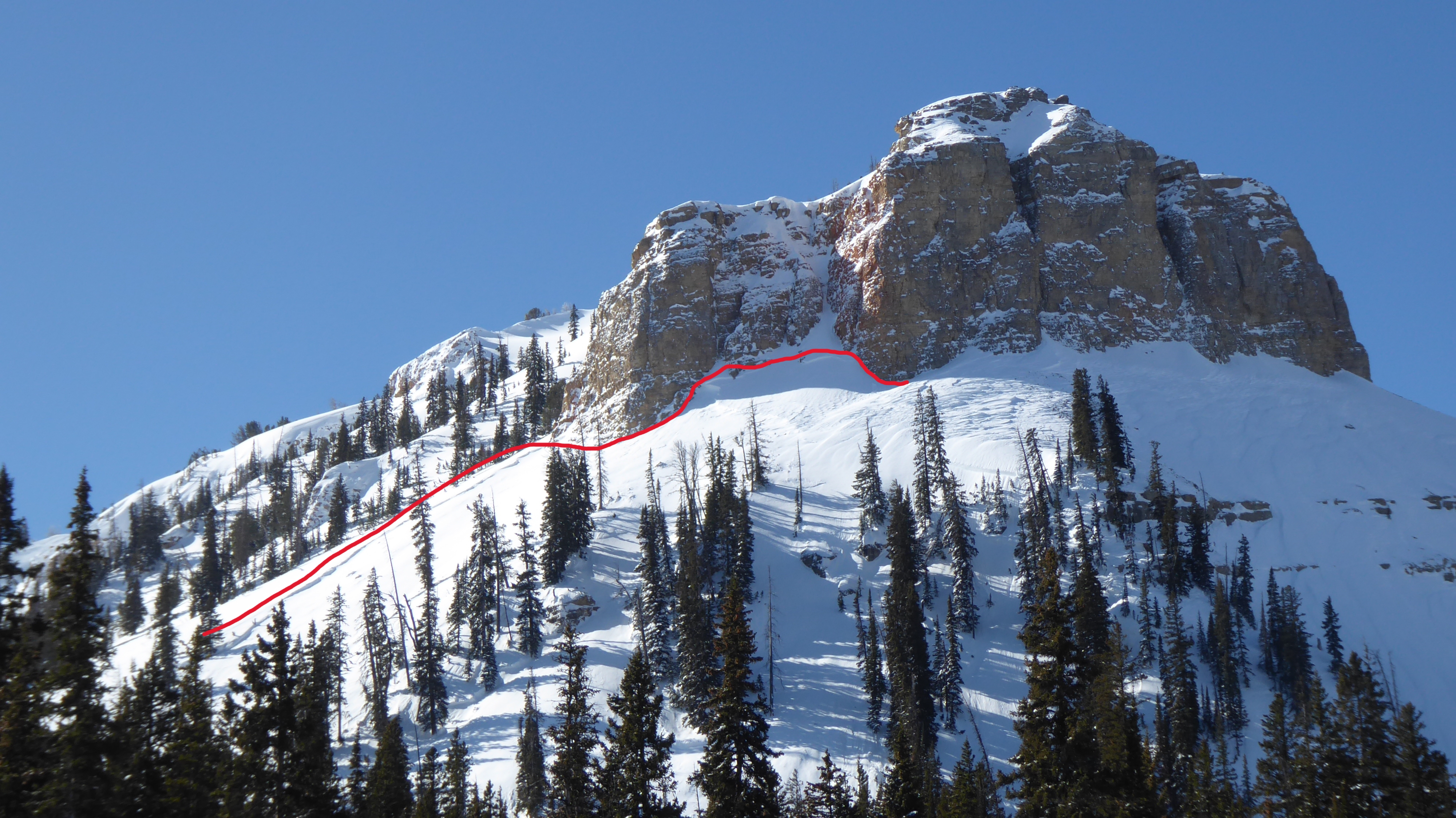
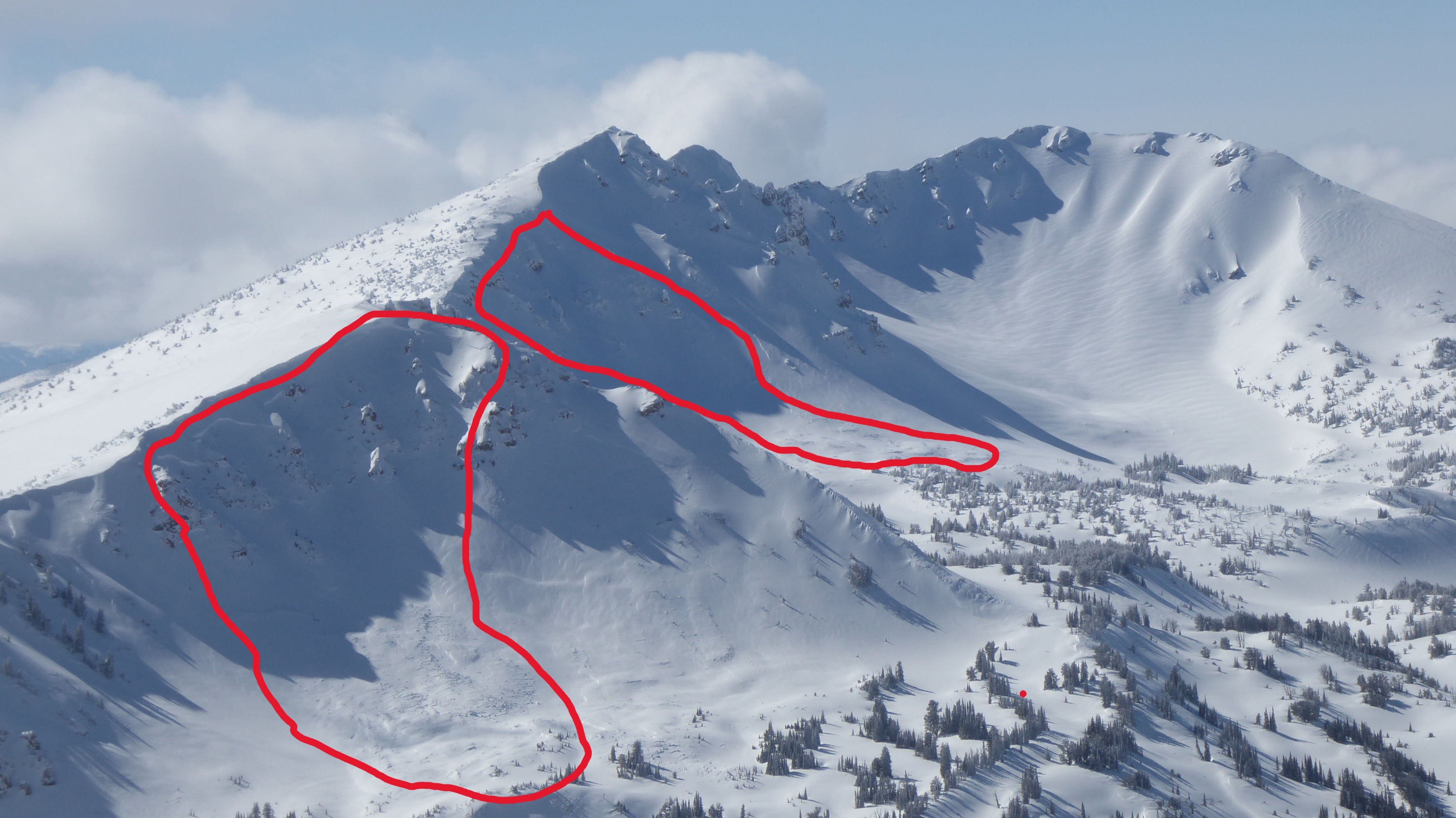
Full Snow Observation ReportD3 slab avalanche on SE corner of Giant Castle Mountain north of Pahaska, WY appears to have been triggered by a skier between 3/16/2023 and 3/18/2023.
Full Snow Observation Report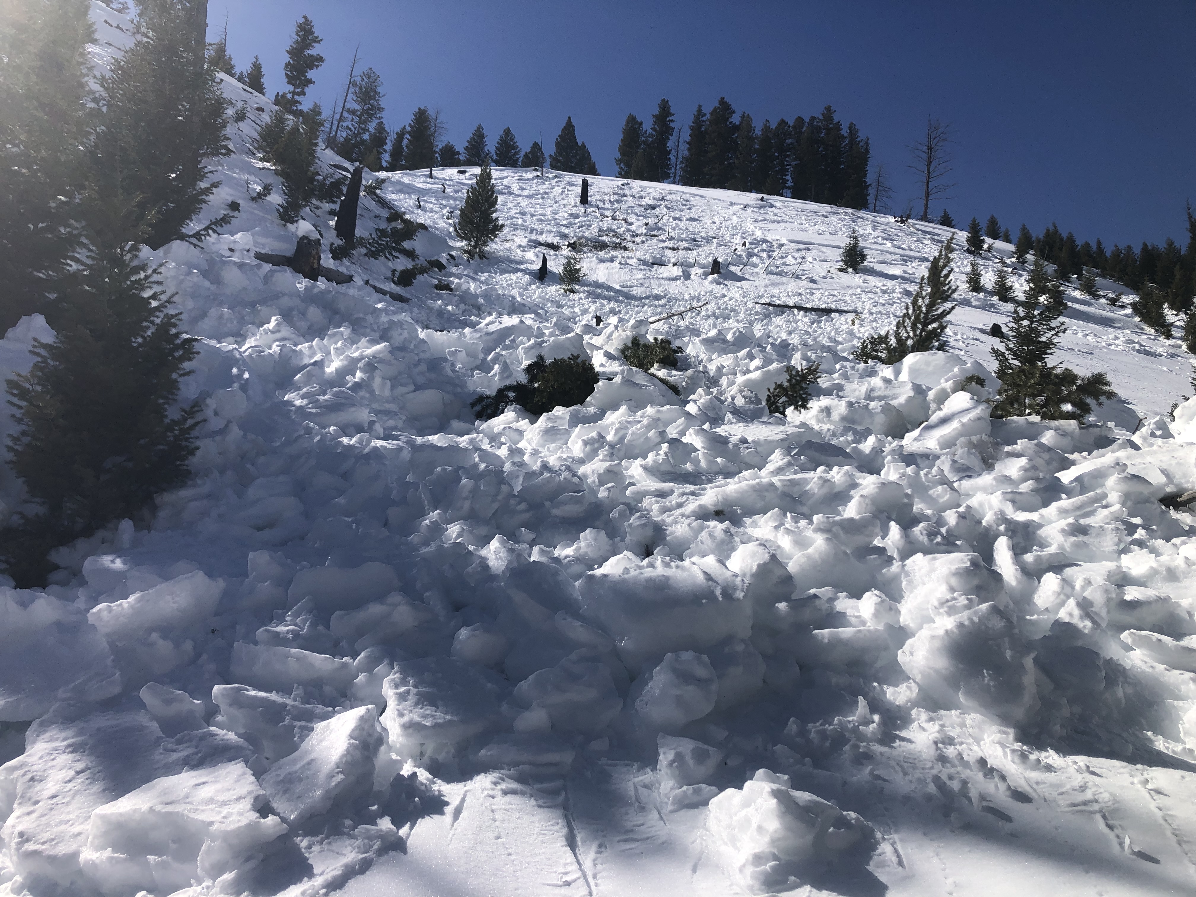

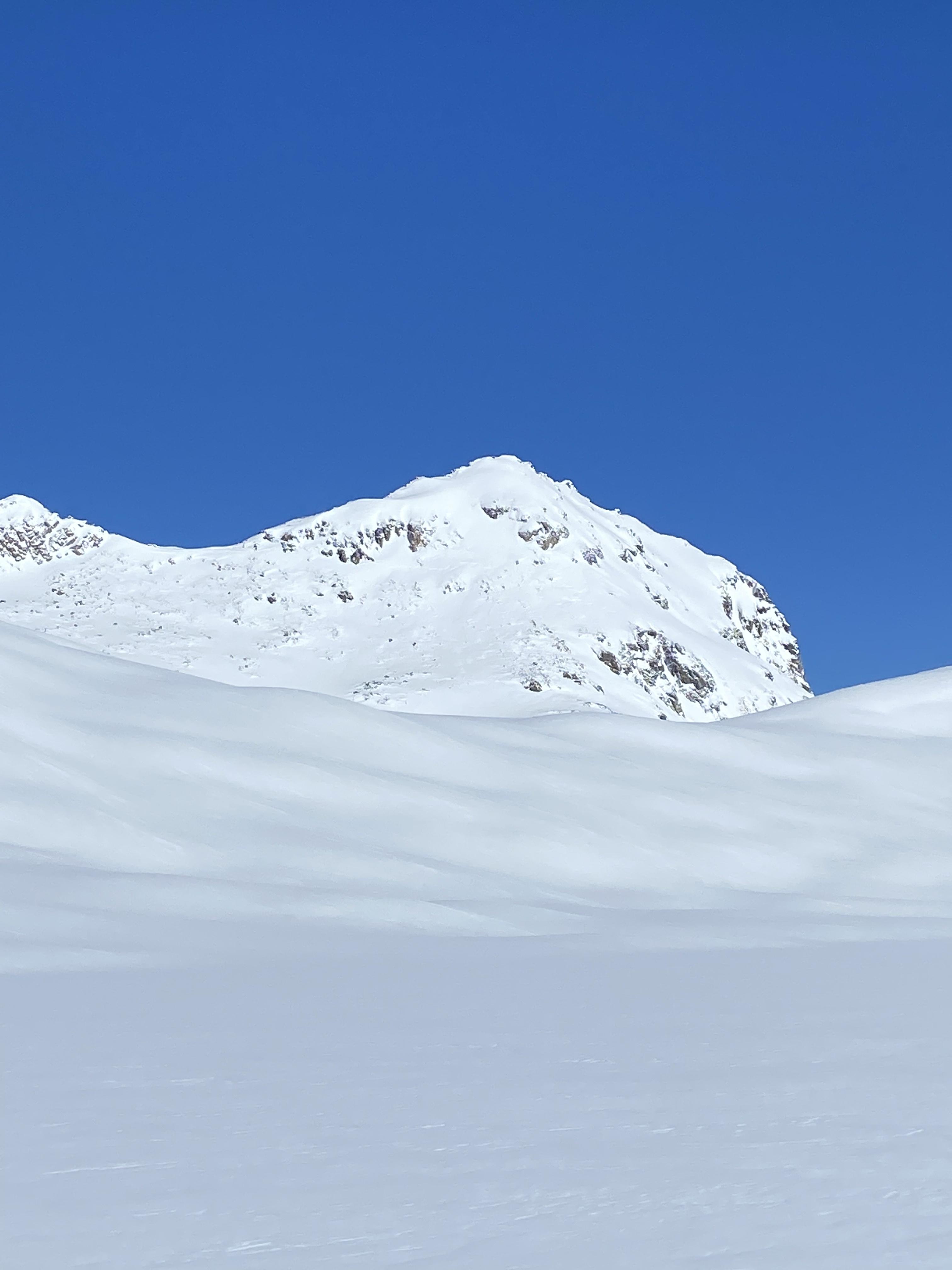
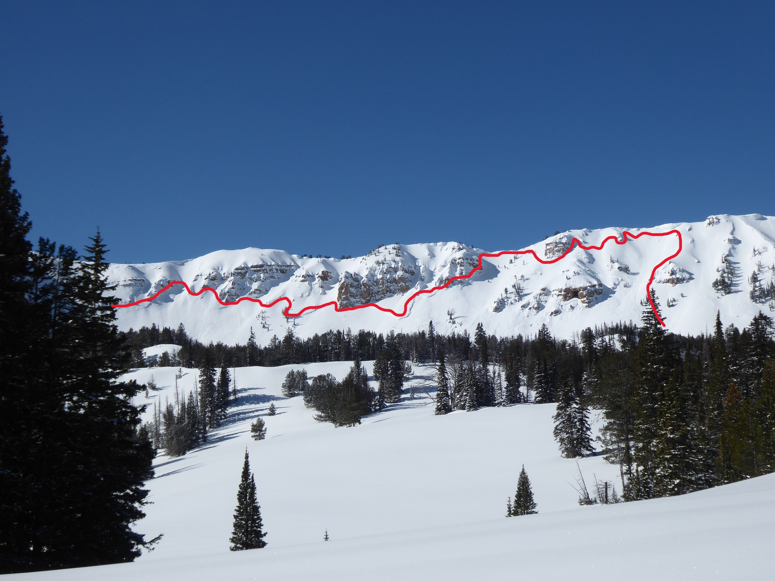
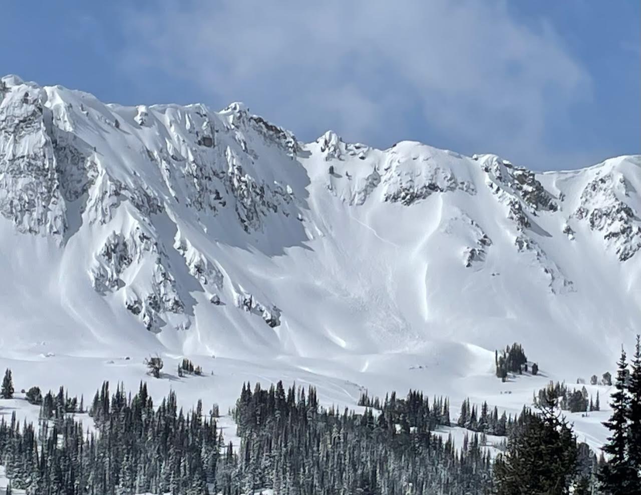
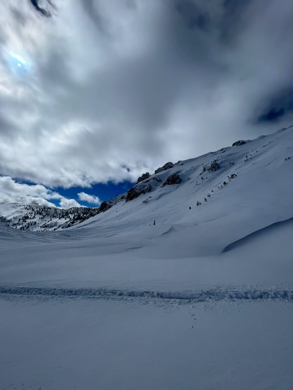
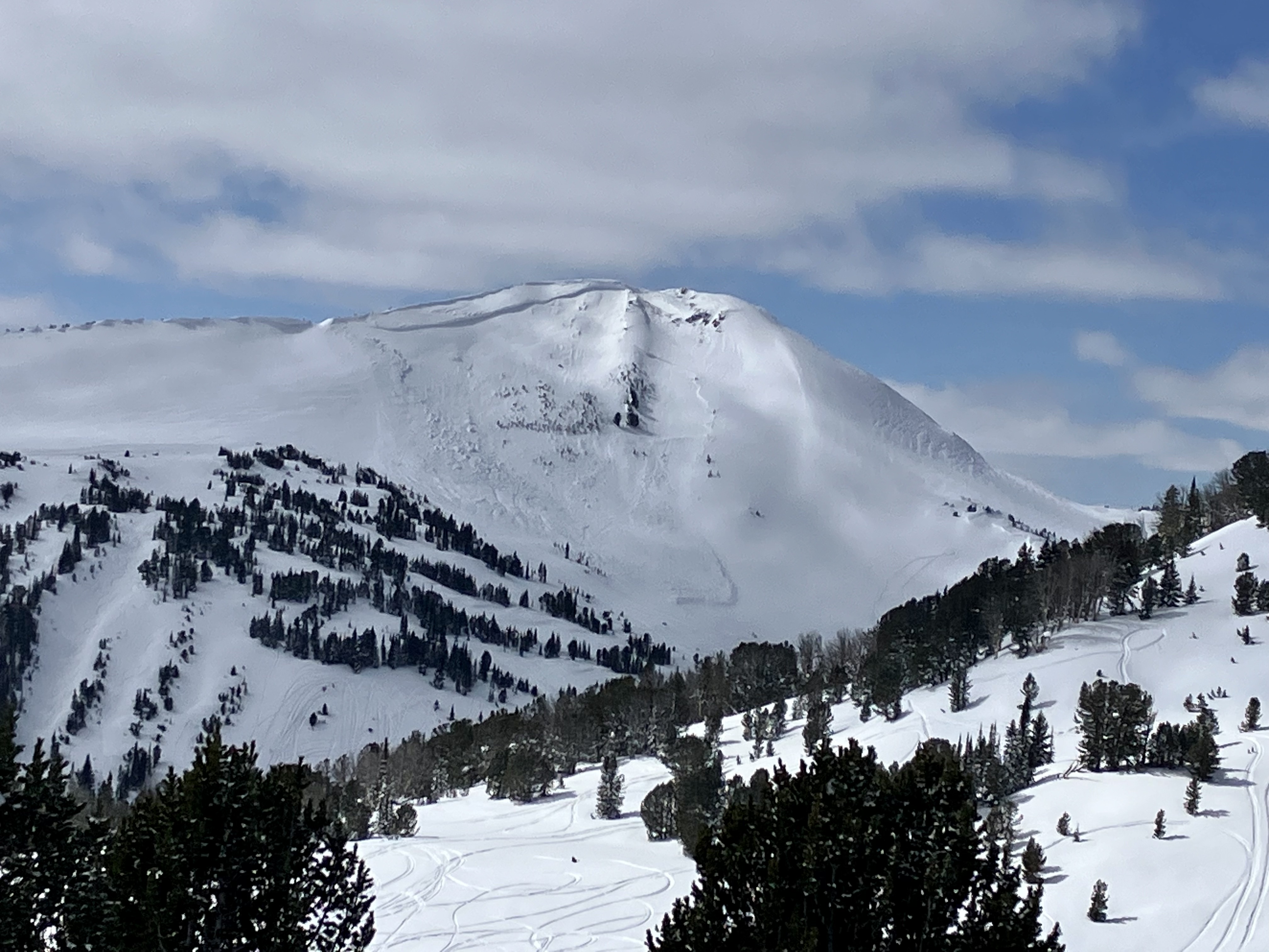
Large avalanche crown across the east facing saddle off the north side of Electric Peak. Roughy around 10,500 ft, around 800 feet across the crown, looked to have broke around 1-2 feet deep and would guess it happened in the last few days. Lots of active wind loading happening.
Full Snow Observation Report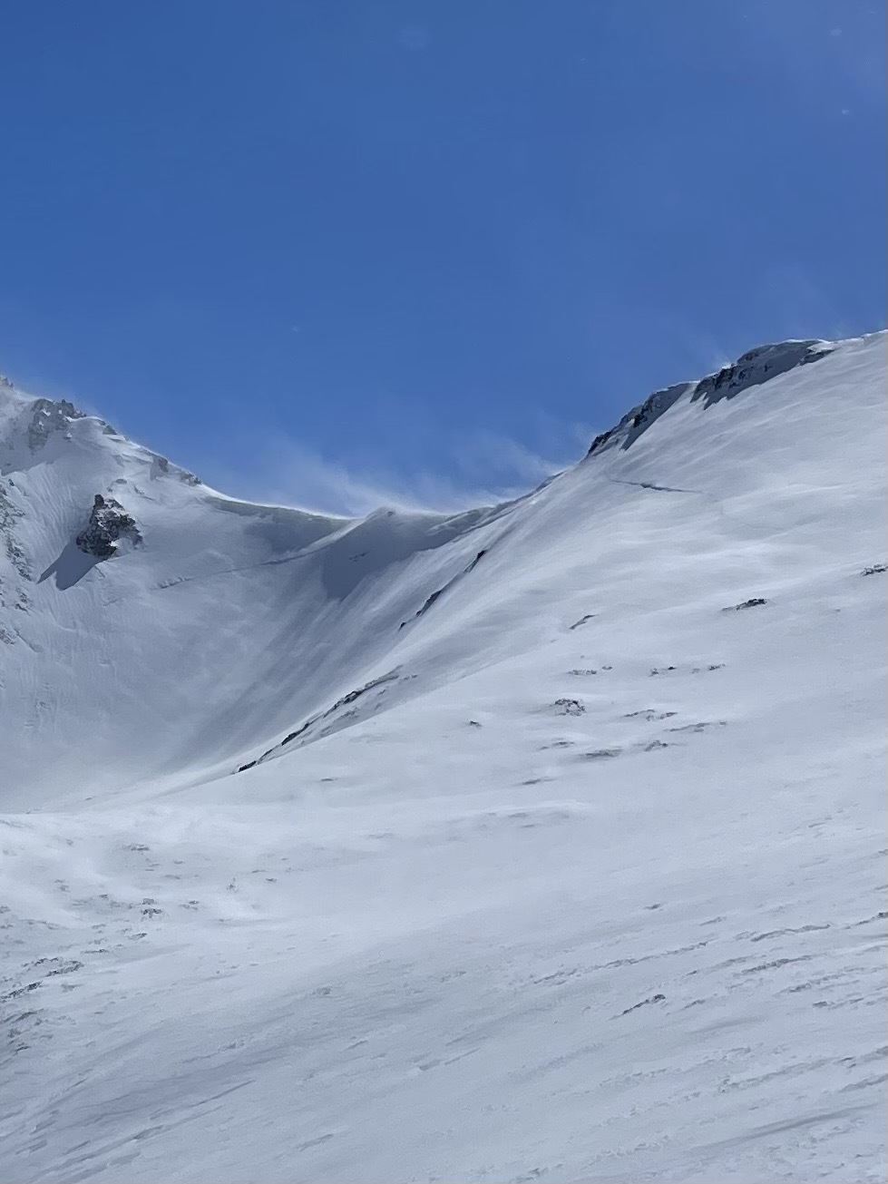
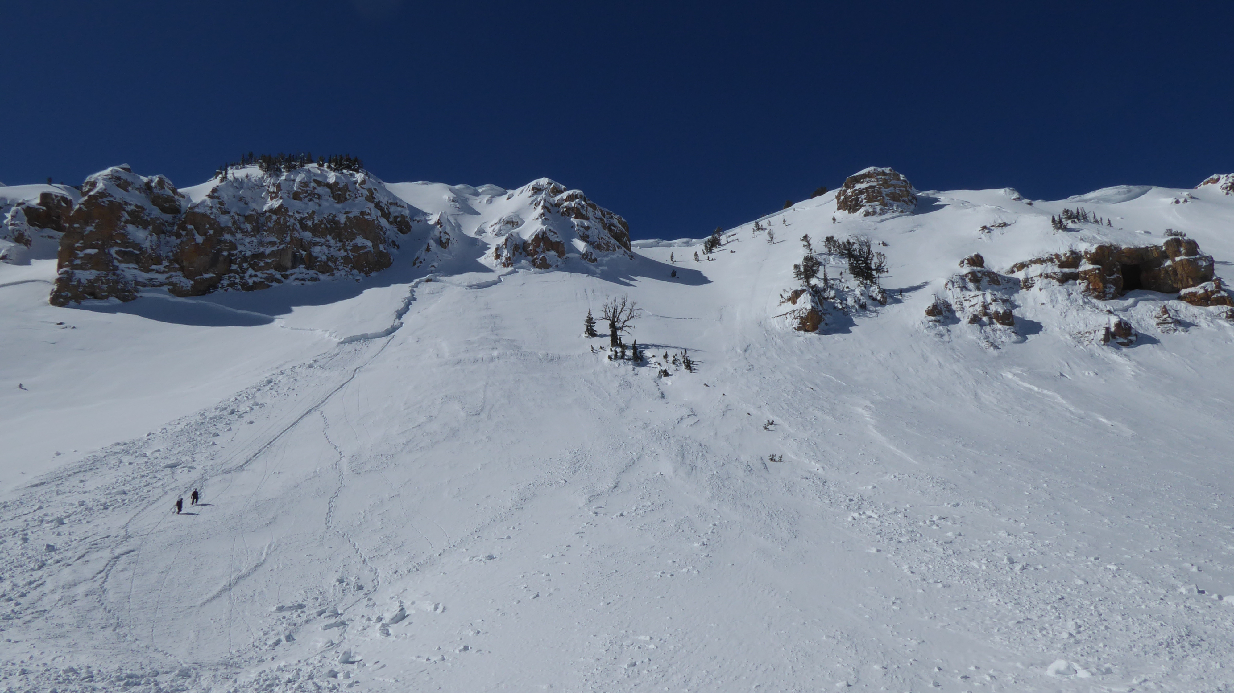
Watched two riders on the north side of Henderson / Daisy pass high marking. One triggered an large avalanche and got stuck at the crown. Crown was taller than him. Guessing 8-10’ deep and 200+ yards wide. His friend had his back turned to the slide and didn’t see it happen. We were across around the sheep mtn/ Scotch Bonnet area and watched the whole thing happen. We boogied over there as fast as possible to help.
Full Snow Observation Report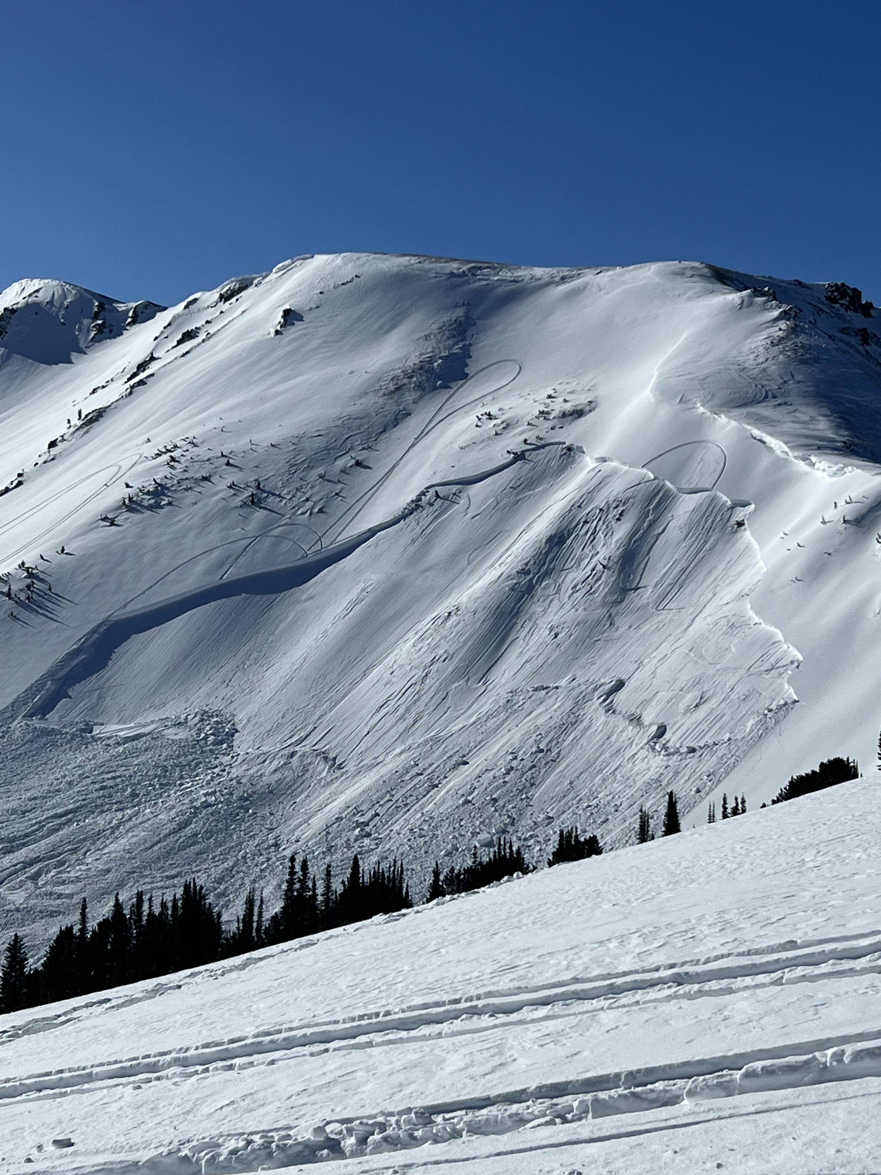


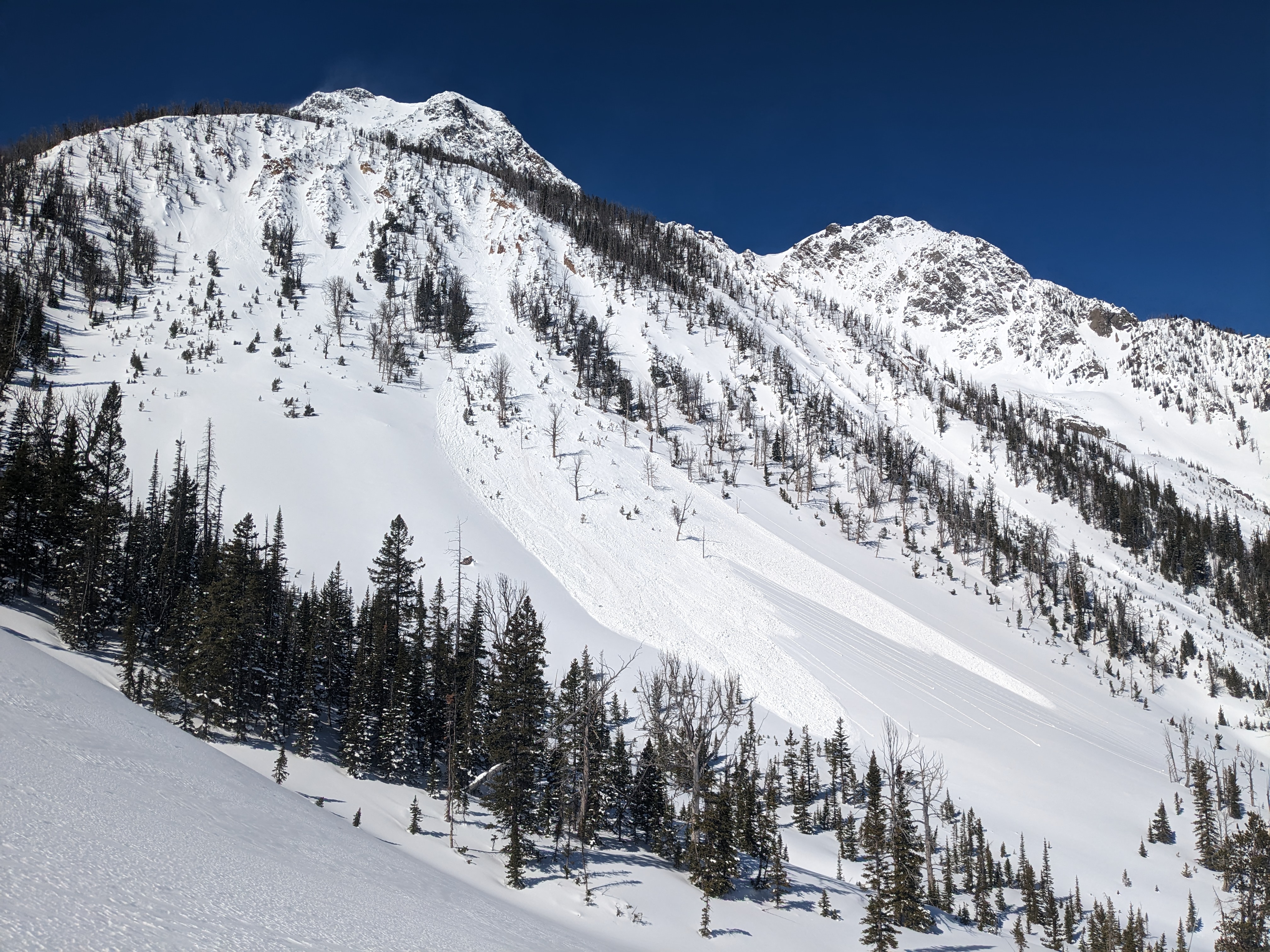
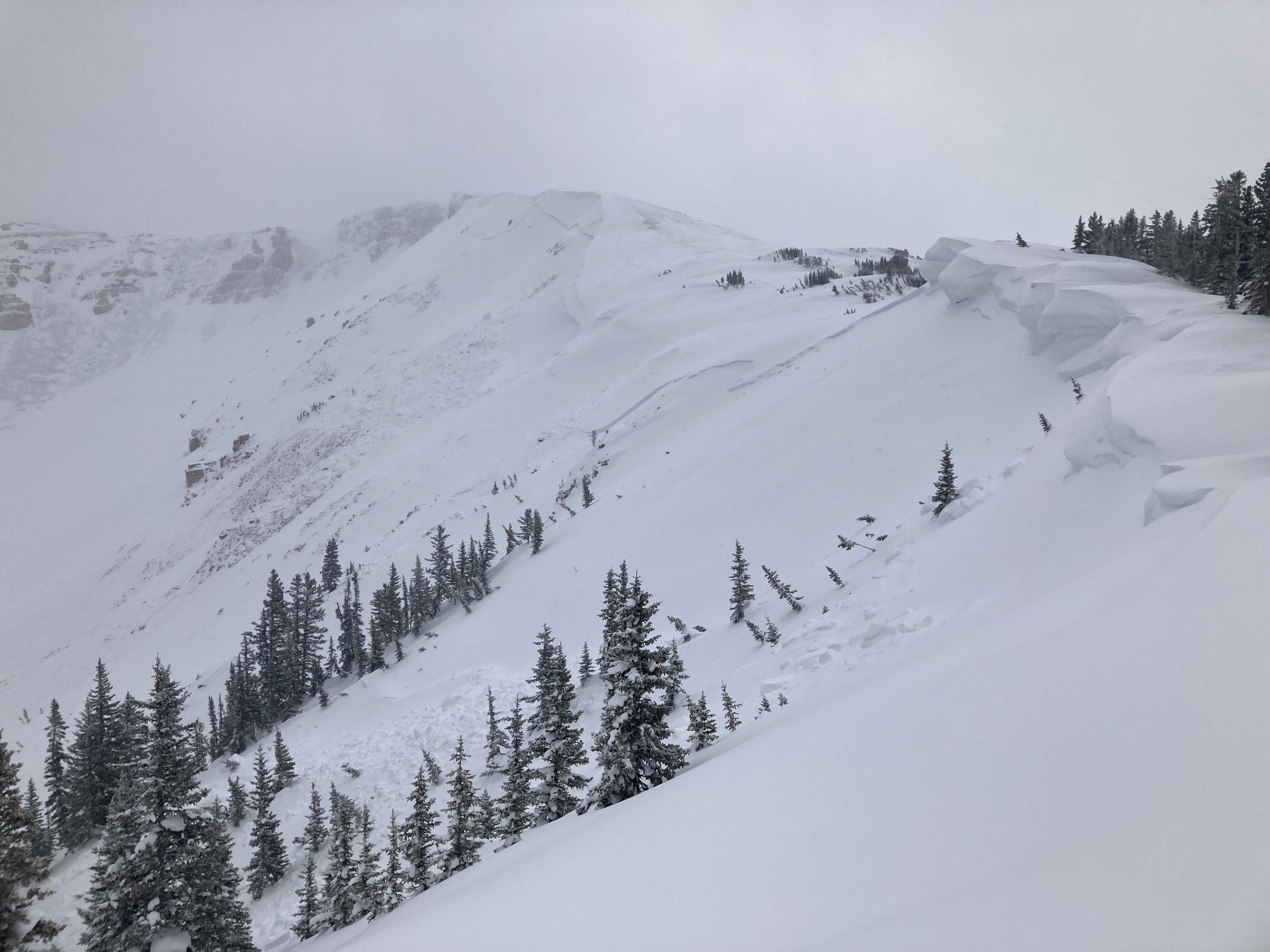
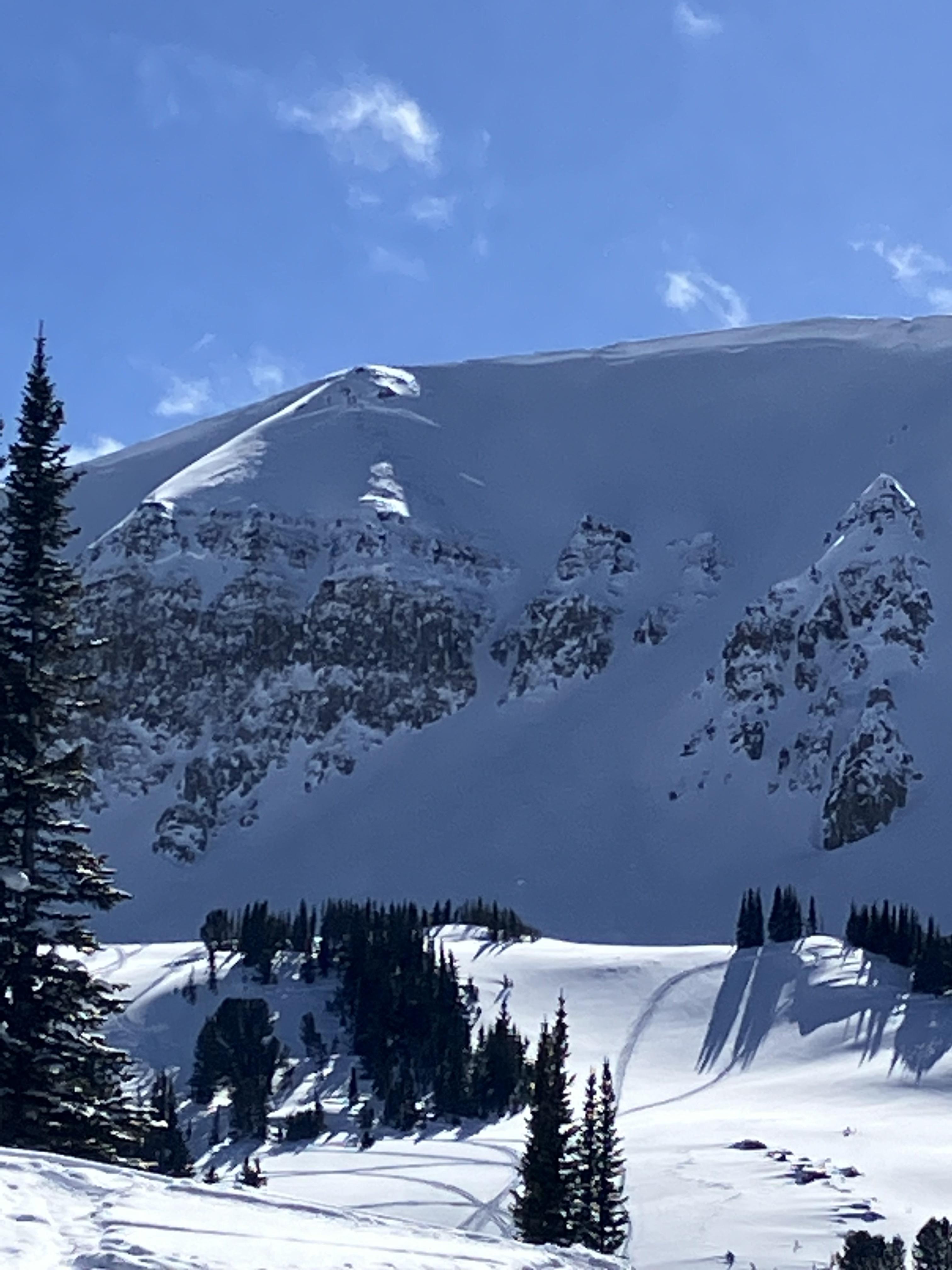
Numerous slides observed on Saturday 3/18 on the flanks of Emigrant Peak during a tour up its east bowls. The largest ones seemed to be on SE aspects.
Full Snow Observation Report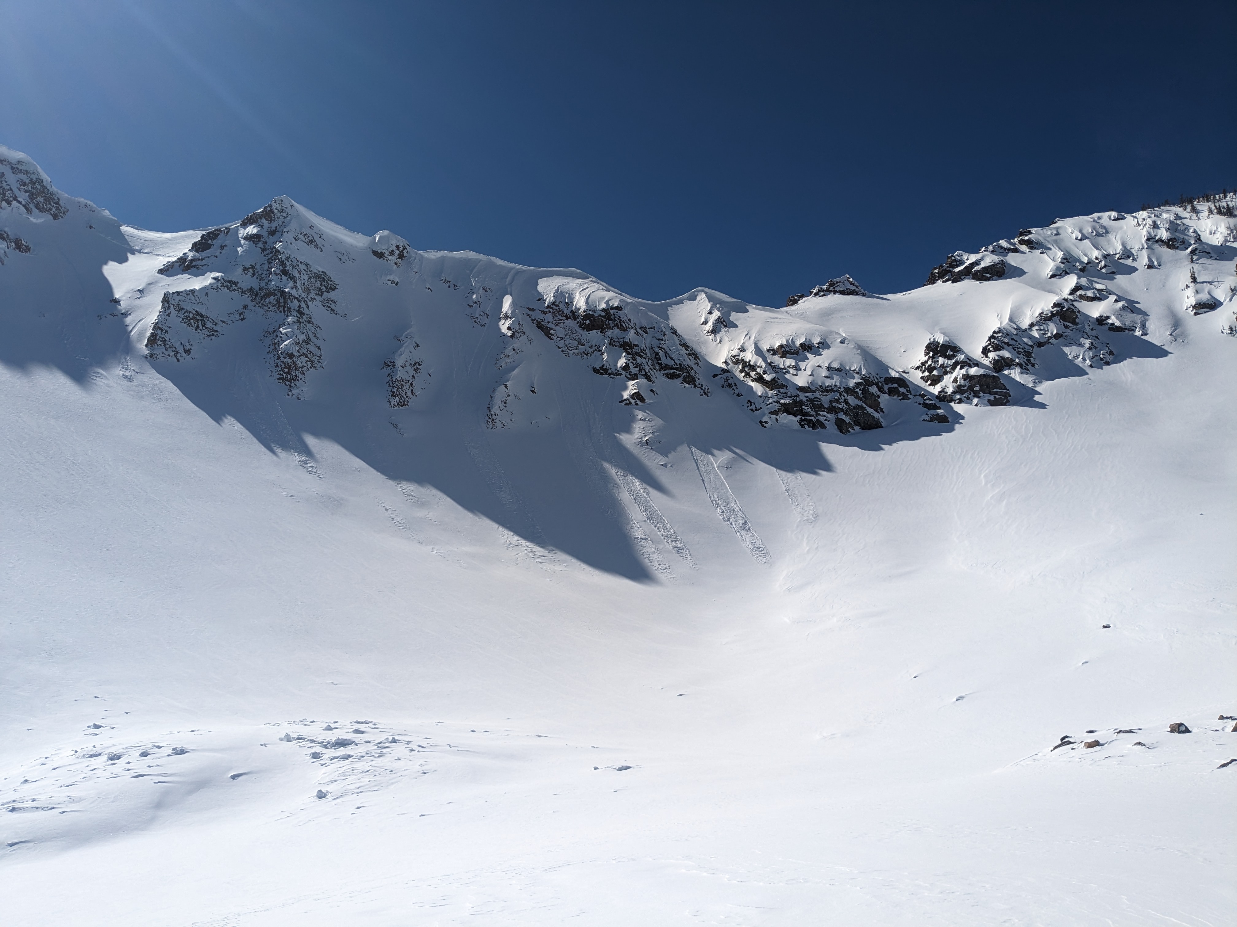
A few recent slides were visible today on south, east and west aspect around goose lake zone. Looked like mostly wind slabs in the new snow. Pit on East aspect was deeper than three meter probe. Showed relatively right side up pack in the first meter. ECTN 23 about 20 CM down. No other signs of instability observed.
Full Snow Observation Report
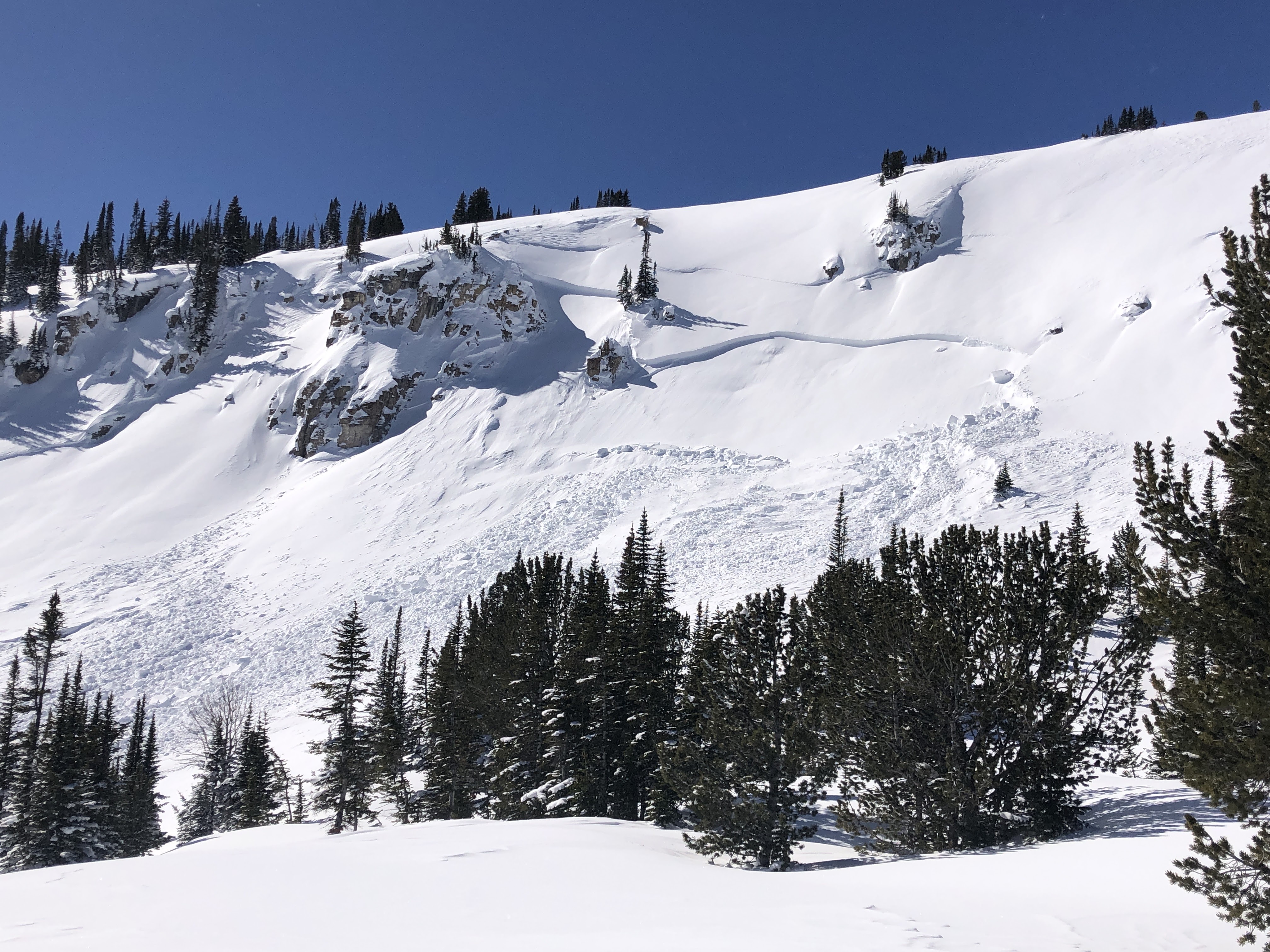
Riding around Lionhead and into the back bowls revealed an extensive avalanche cycle that occurred with the Avalanche Warning 2 days ago. Some slides were hard to see since they were buried in snow while others were more fresh. Crown lines near the ridges, debris piles at the bottom of slopes, and debris pushed high onto trees were evidence of the recent activity. Many slopes avalanched; more than we've ever seen in this area.
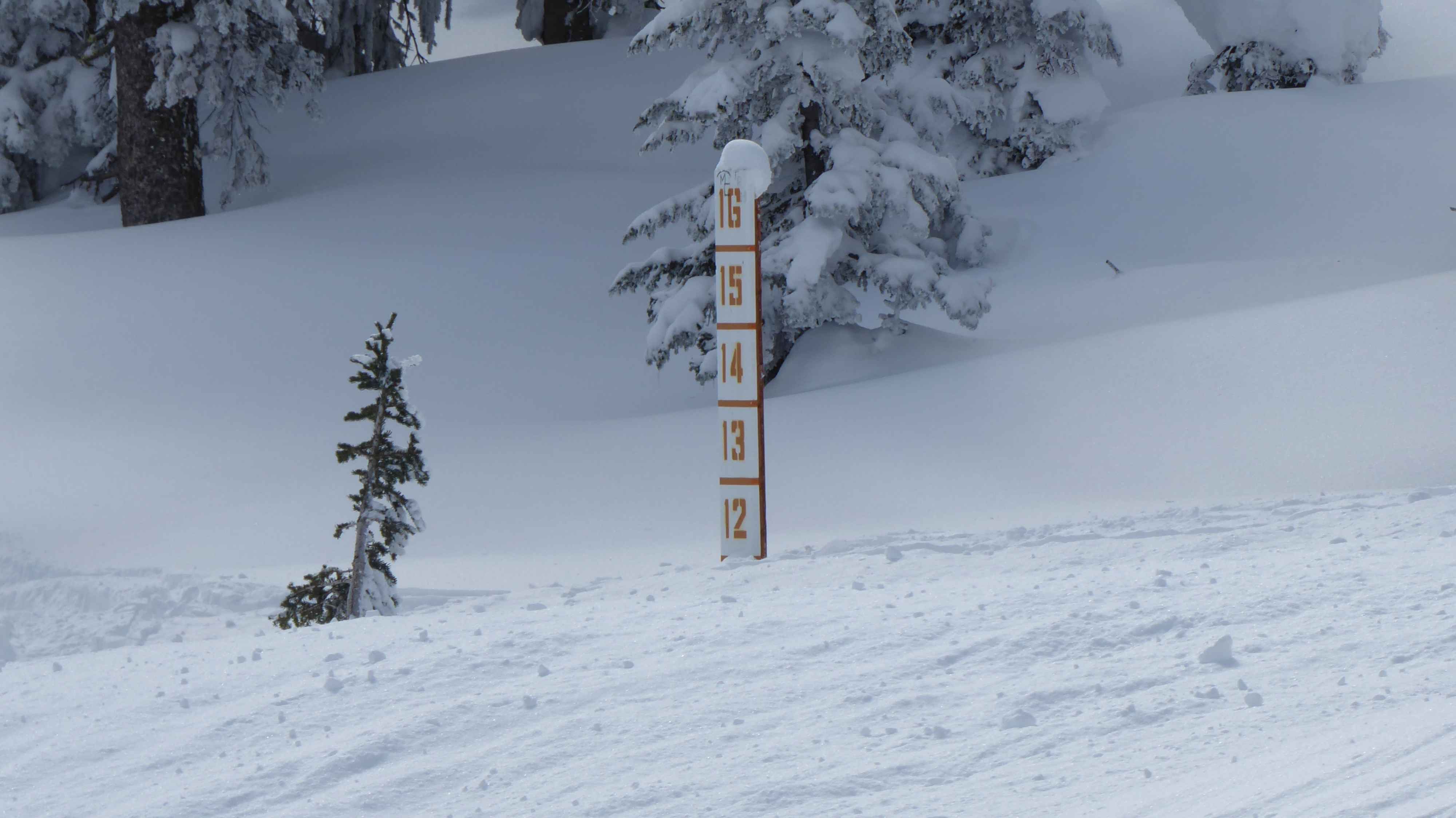
We dug in 1 crown and measured 11" of SWE above the weak layer (1mm facets) that avalanched. Every weak layer has a breaking point, and this layer needed about 11 feet of snowfall to get it to avalanche.
Full Snow Observation Report


Big scary avalanche on a wind loaded slope on mount Bole.
Full Snow Observation Report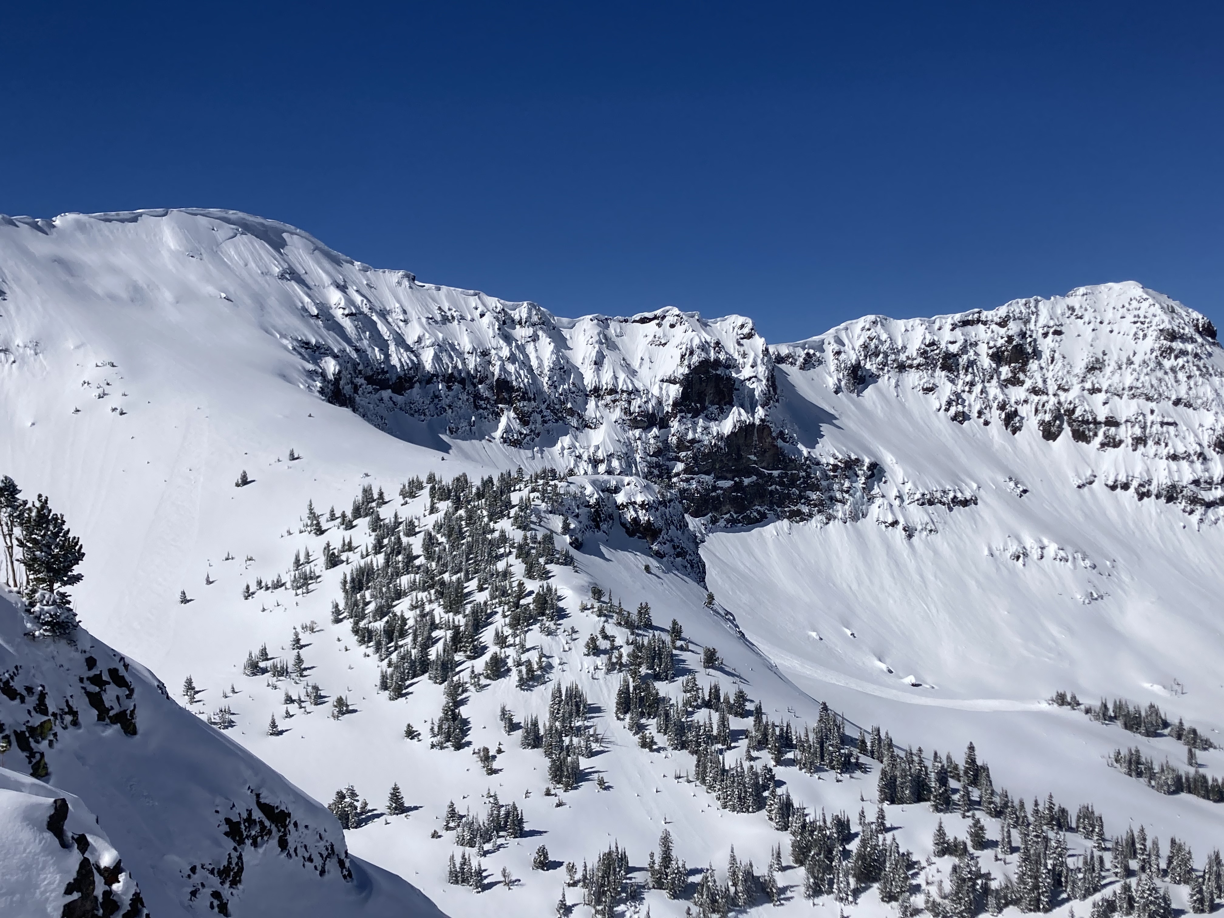
Side by side D2 natural slab avalanches at on SE edge of Giant Castle Mountain north of Pahaska, WY (occurred on 3/16/2023).
Full Snow Observation Report
From the FAA road up Sawtelle Peak outside Island Park we were able to see many crown lines and debris piles from the last 2 days of Avalanche Warnings. Most avalanches involved new snow, but there was 1 deep avalanche on Mt. Jefferson's east face that was large (D3). The FAA did avalanche control and an avalauncher round triggered a small, but deep slide (2-5' deep) and a larger explosive on another slope yielded no results. We saw 8 backcountry avalanches from the road. These were east and north facing, the only aspects available for viewing.
The snowfall totaled 3' and it will take a few days for the snowpack to become more stable. In the meantime, be patient and stay off of steep slopes.
Full Snow Observation Report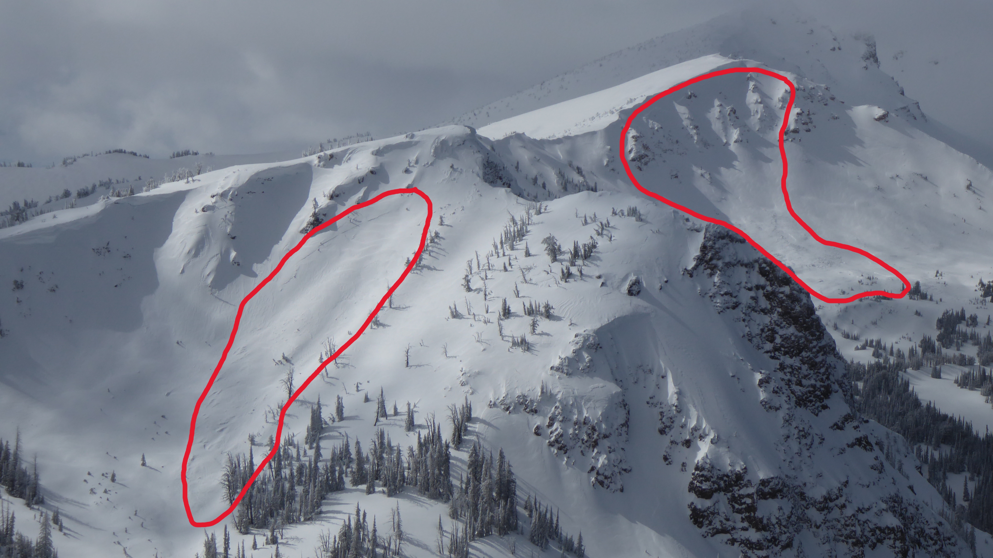
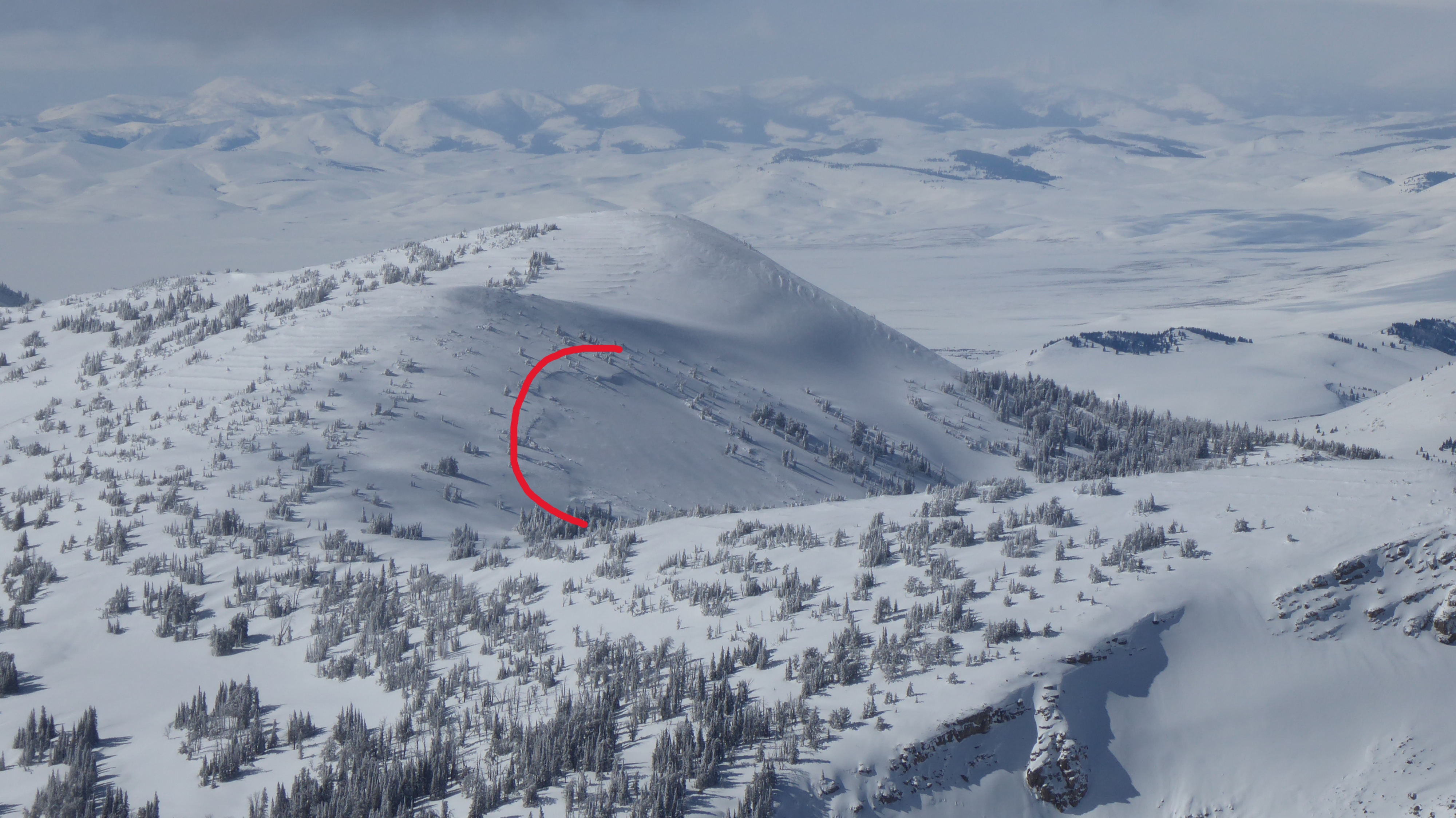

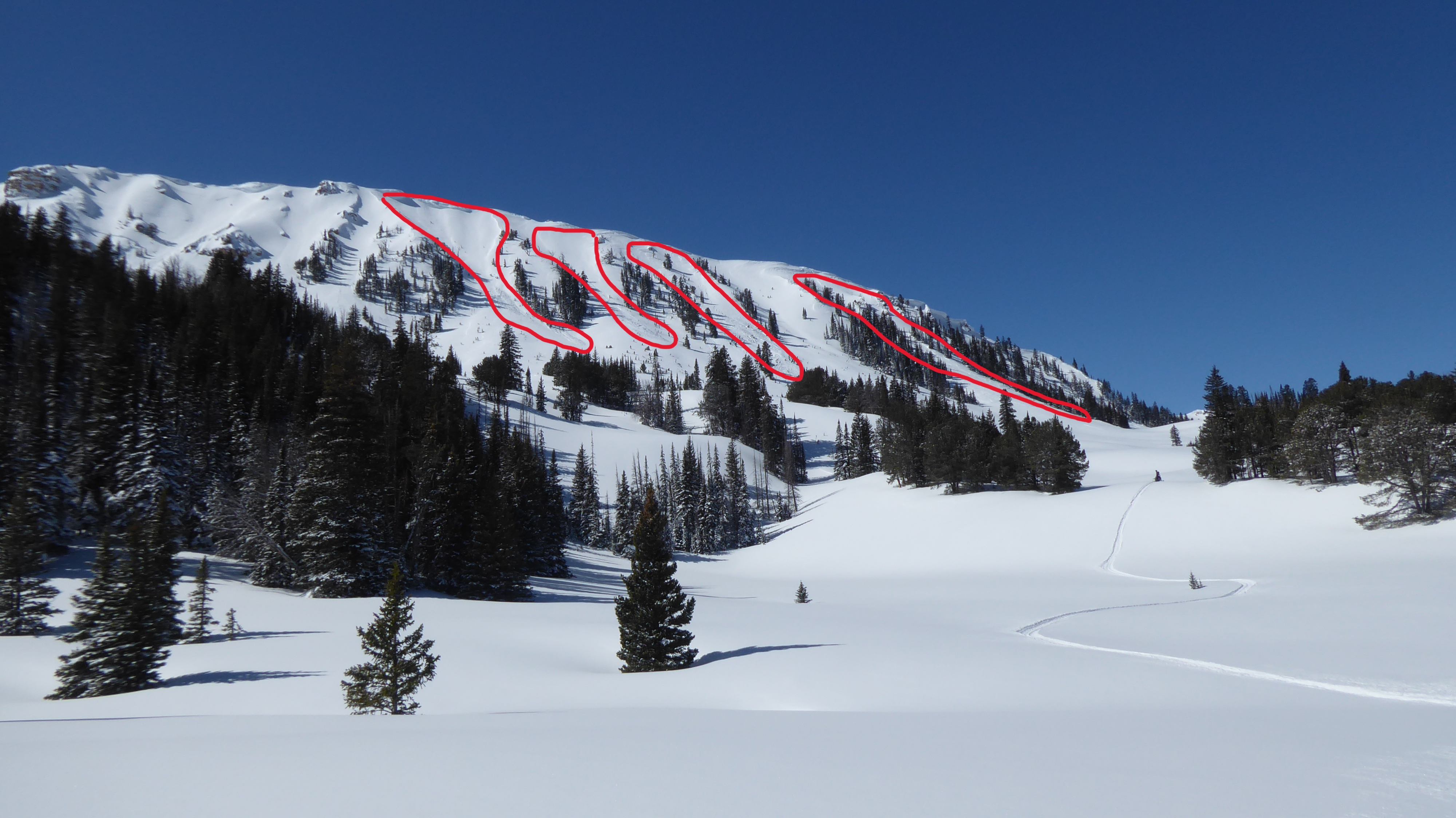
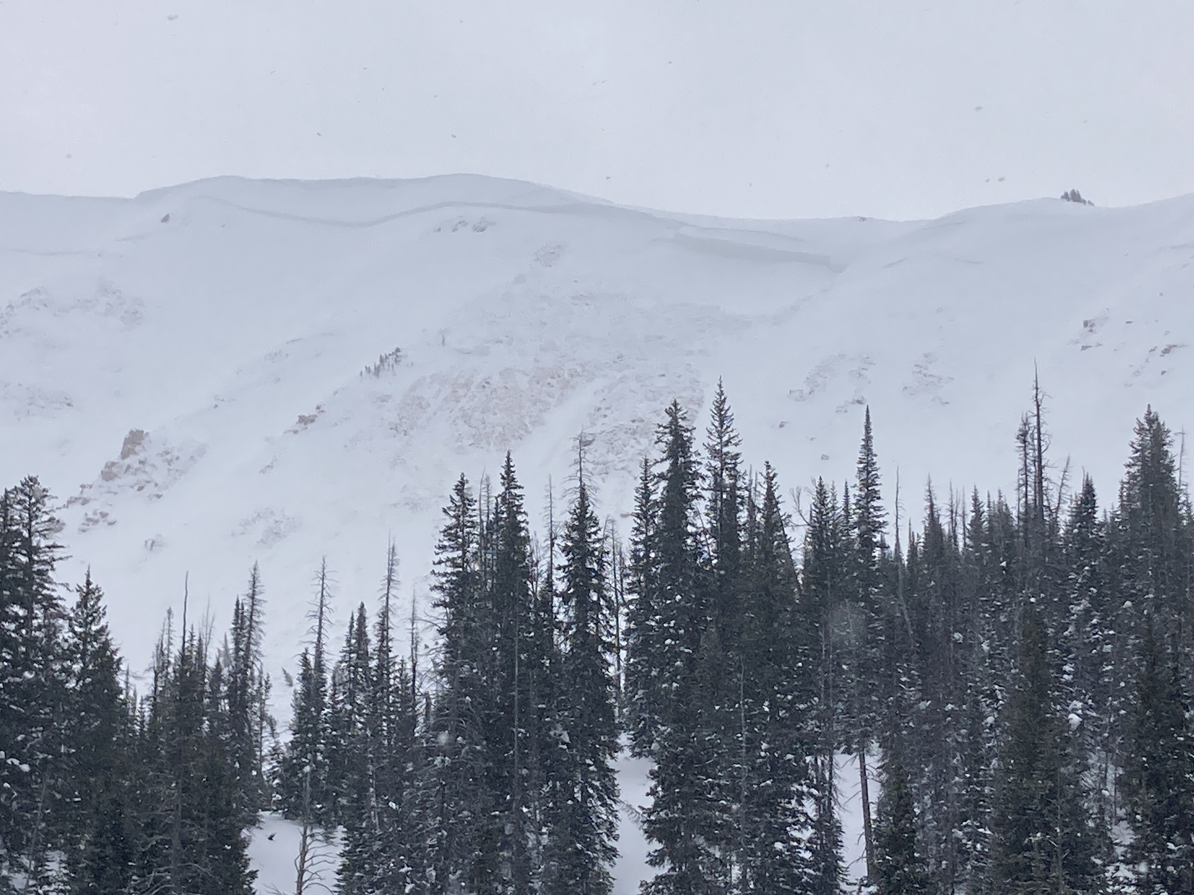
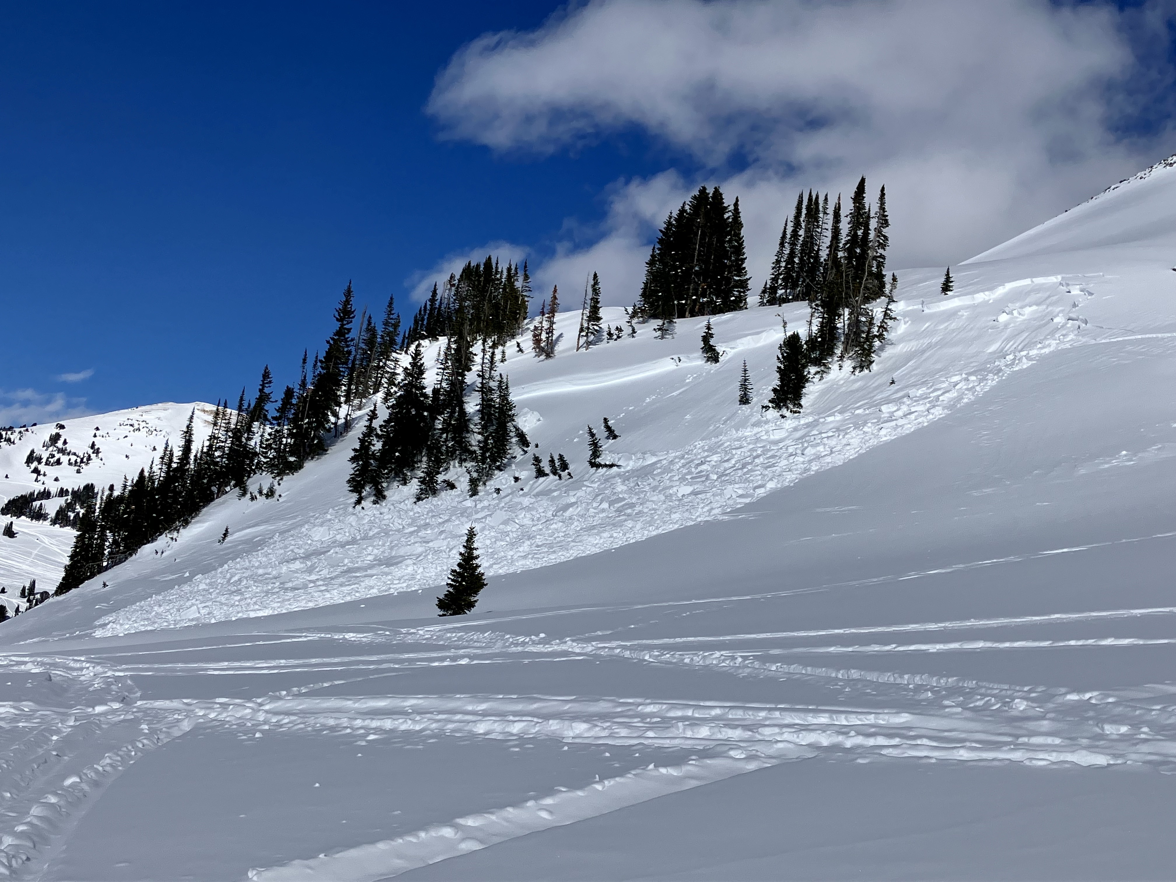
Saw this natural D2 soft slab off the east aspect of Miller Ridge. The crown looks shallow, so I’m guessing it ran at the storm interface.
No other avalanches or signs of instability observed. Winds were light out of the NW and the HN of the settled snow was about 10cm.
We rode into Tepee Basin. There was 1-2 feet of new snow with a few inches falling during the day. In a brief period of clearer skies we saw two natural avalanches on the steep slopes above the basin. Neither was huge, R2-D2. One ran about 500', both looked to be 1-3' deep. We saw another natural avalanche near Bacon Rind into the Gallatin River.
The avalanche warning was certainly justified. We did not go near any steep terrain. Dug one pit and measured 1.8" SWE in the storm snow. ECTP 20 about 2 feet deep and an ECTP23 failed on the basal facets. We would plan to avoid steep slopes and runout zones for a while waiting for things to stabilize.
Full Snow Observation Report

Rode out Buck Ridge through 2nd & 3rd Yellowmules, McAtee Basin, and then out to Cedar Mtn. Saw no avalanches or signs of instability (no cracking, no collapsing). There were a few inches of new snow (2-4") that had been blown around by very strong winds. Fresh wind drifts had formed overnight on the trail and in spots our tracks were blown in by the time we were headed back out. The chief avalanche concern today was avalanches breaking in wind drifts. The possibility of triggering a slab breaking deep in the snowpack was a secondary concern.
With snow and wind on the way tonight and through tomorrow, avalanches in the new snow and deep in the snowpack will both be more likely tomorrow. Expect an elevated danger. The details will depend on the amount of snow and wind, so make sure to check the forecast in the morning.
Full Snow Observation Report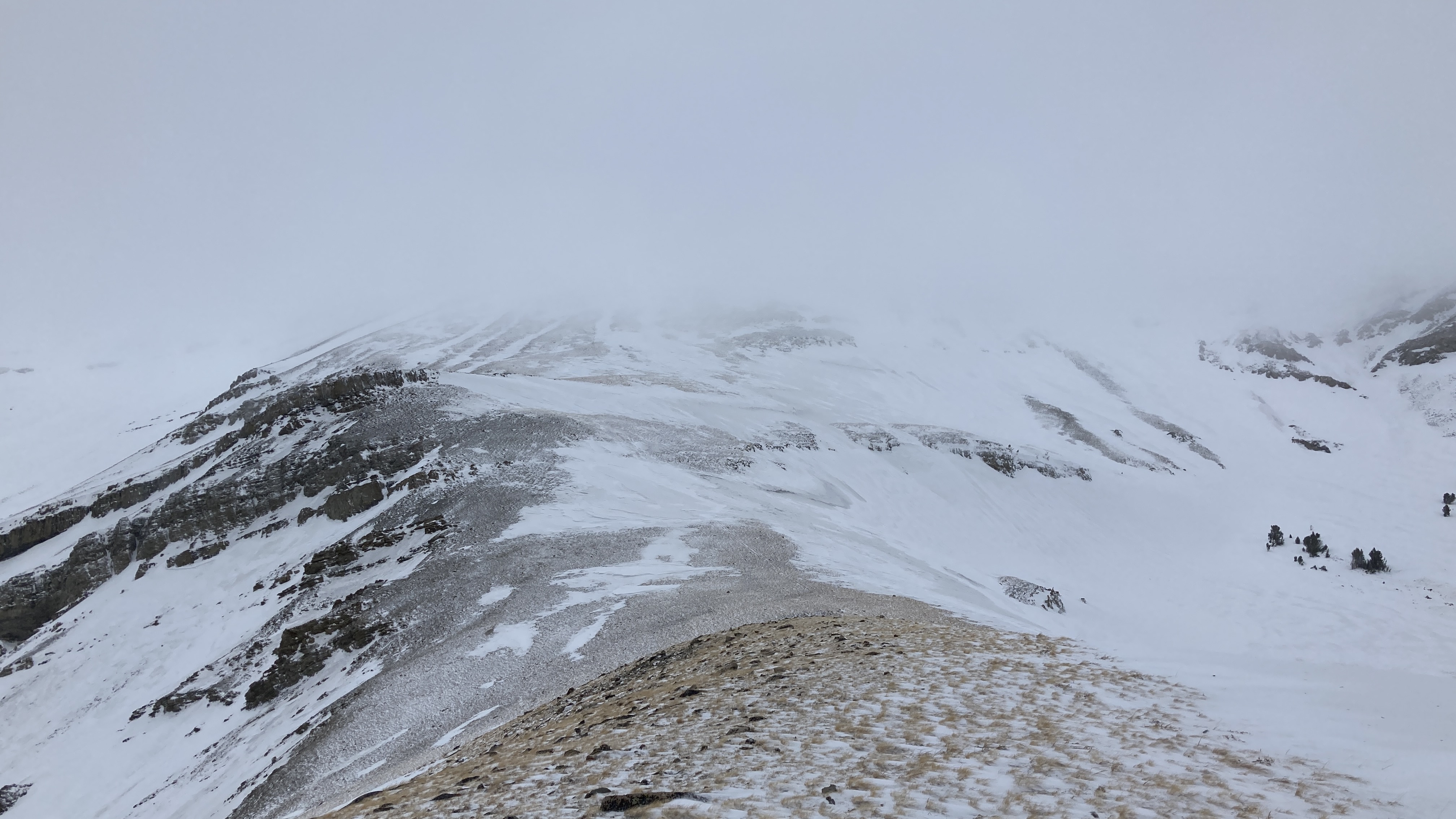

I went on a little loop up and around Red Mountain today, and have a couple slides to report. Most notable was one that spanned about 2000’ of the north side of Red Mountain. It seemed to be 1-3’ deep in the newer snow, for the most part, but a portion of it broke 15’+ deep and ran at the ground. Judging by how little snow was on the debris, I’d guess it ran sometime Friday night or Saturday. This bowl frequently produces large avalanches, but this one was a real peach.
I also saw another (much) smaller 1-2’ deep slide on the west-facing road cut just north of the Bacon Rind pullout.

Via IG: “Large natural avalanche on the east side of redstreak peak down near West Yellowstone.
And then another natural one right on the shoulder of white peak on the boundary.”
Full Snow Observation Report

Via IG: “Electric peak via Betty gulch avalanches. Assuming they are natural!”
Full Snow Observation Report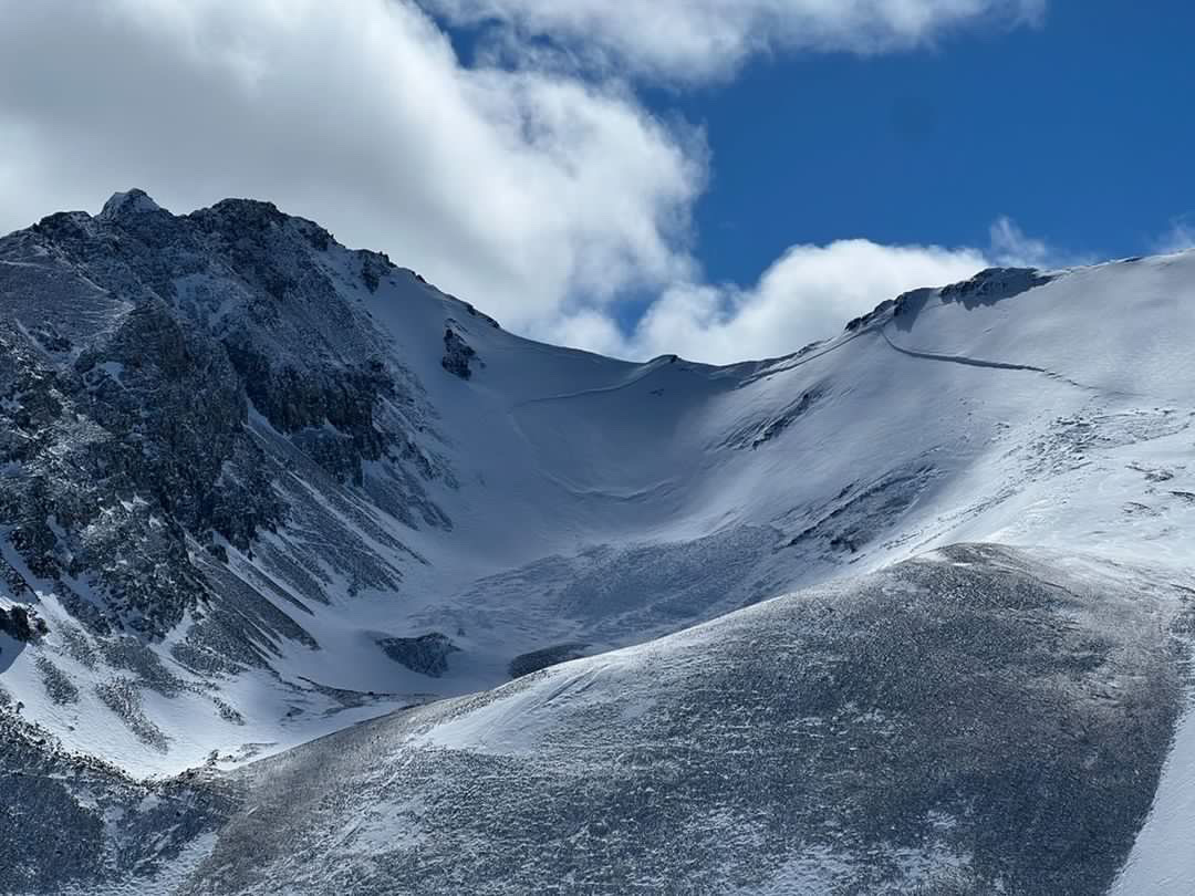

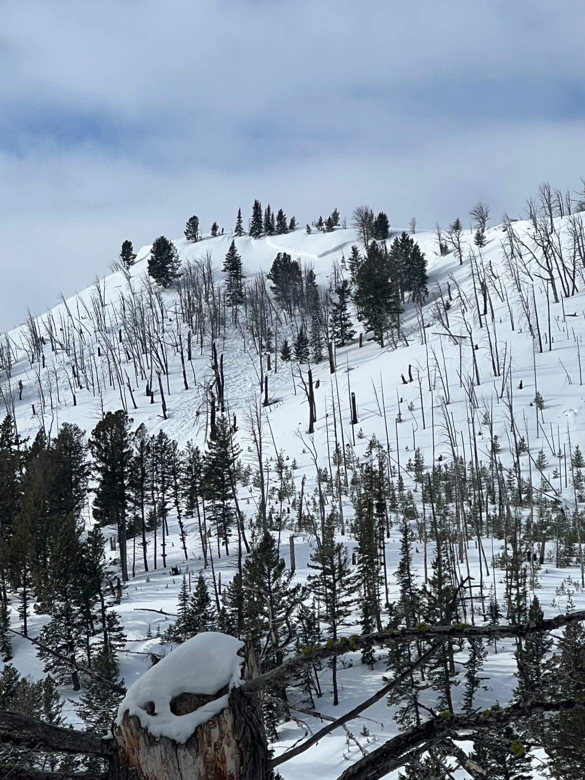
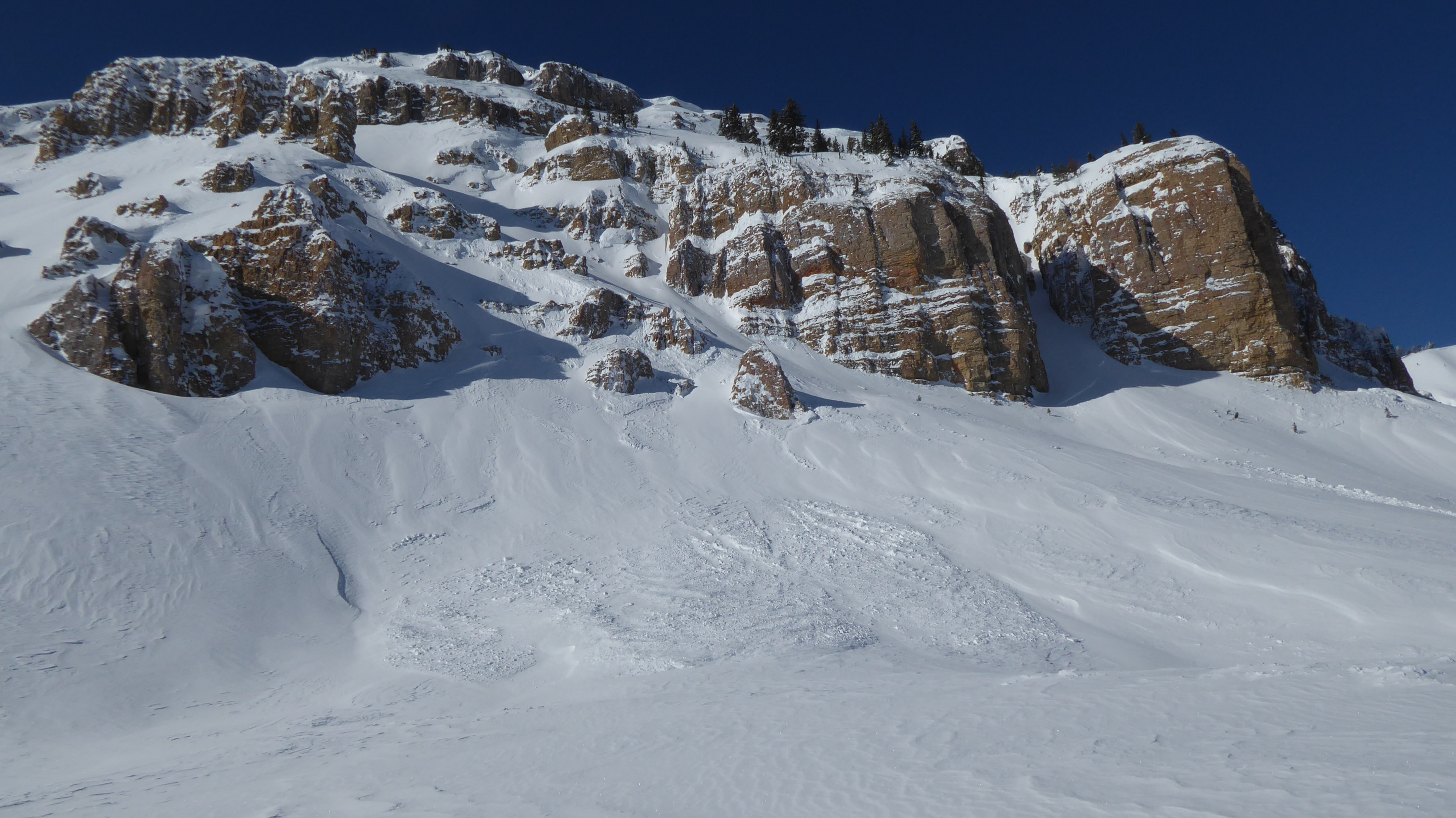
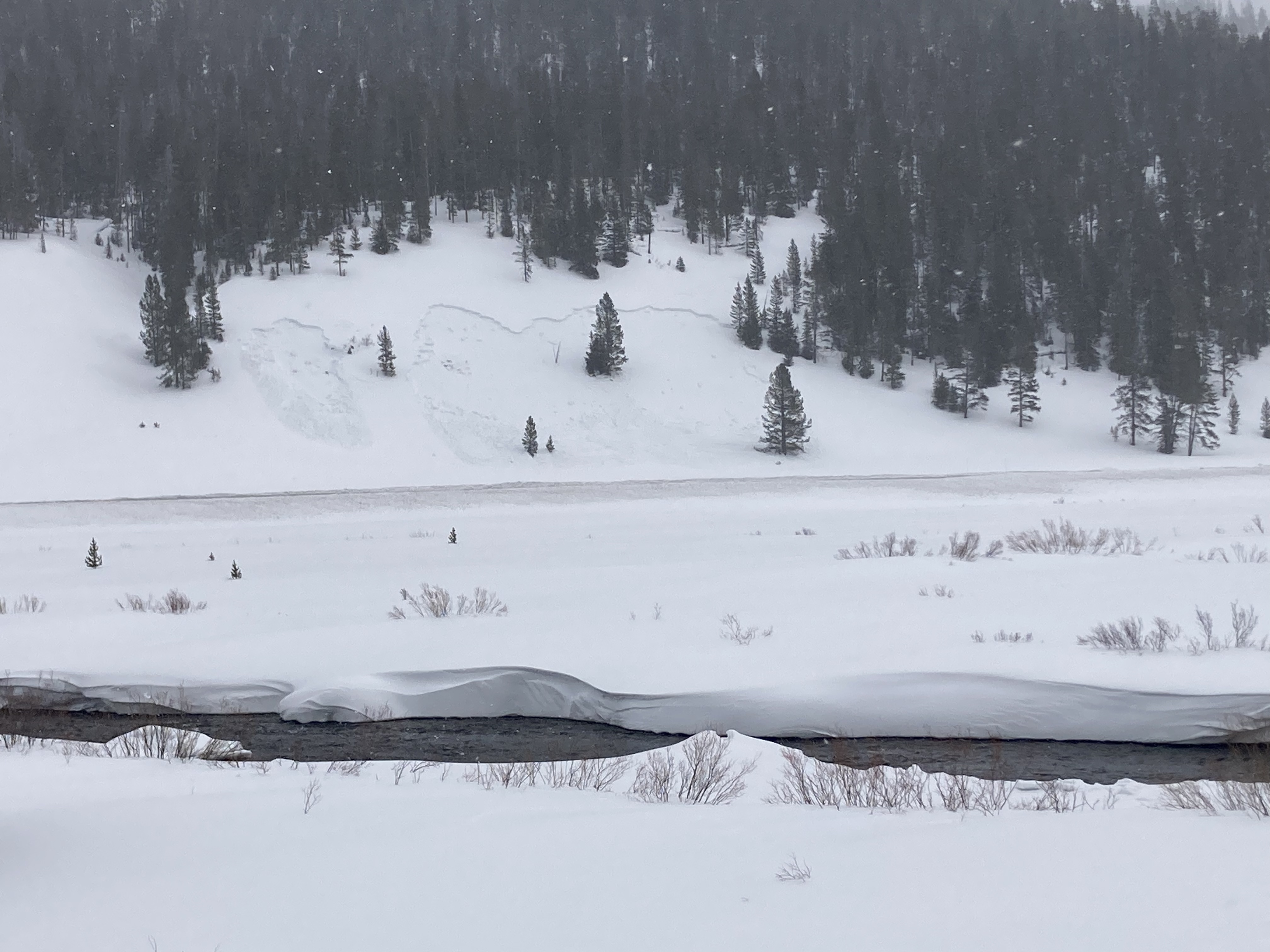
Big (tennis court size) collapse and whumpf on the upper meadows at Telemark Meadows in flat terrain. No other reactivity to report from a few laps on the main ski slope.
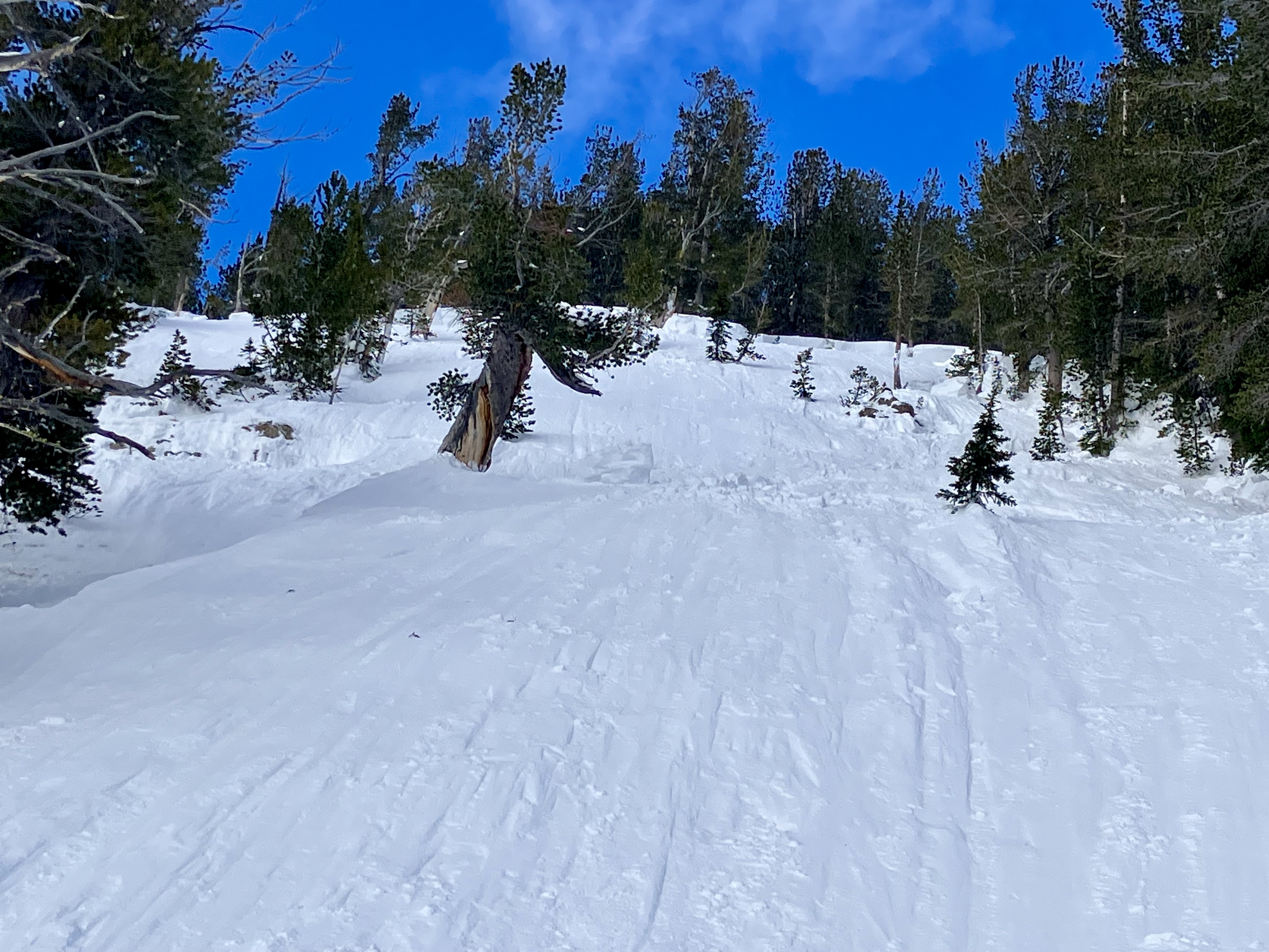
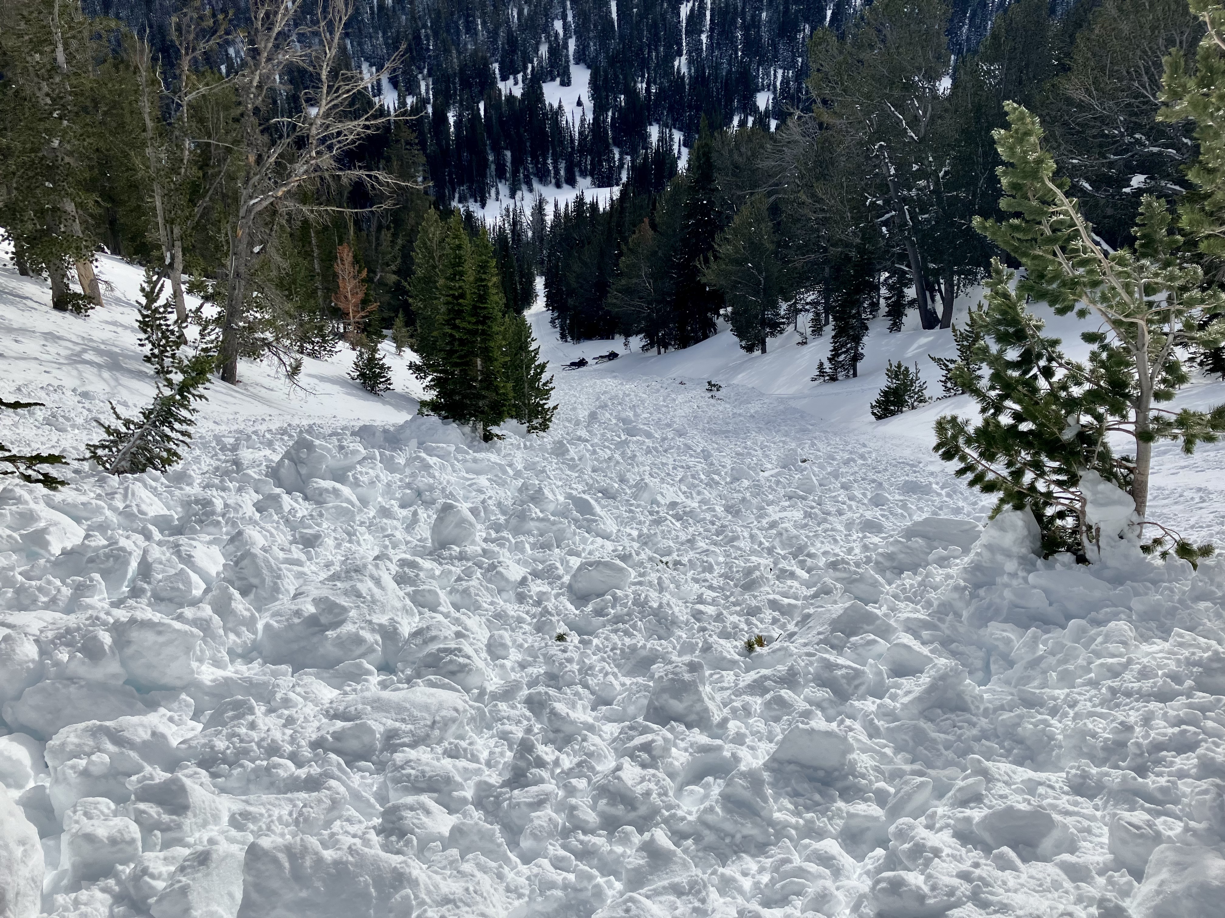
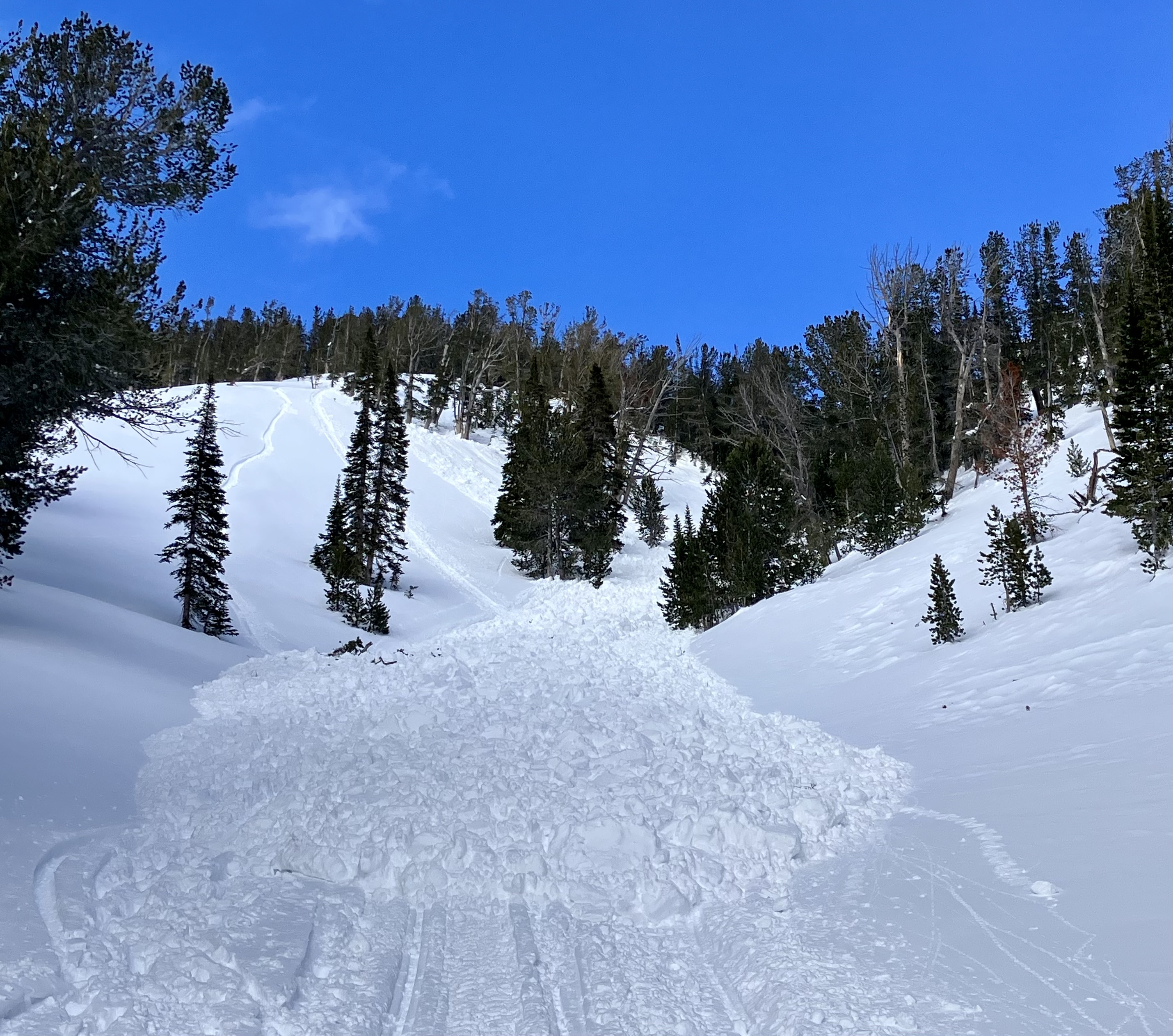
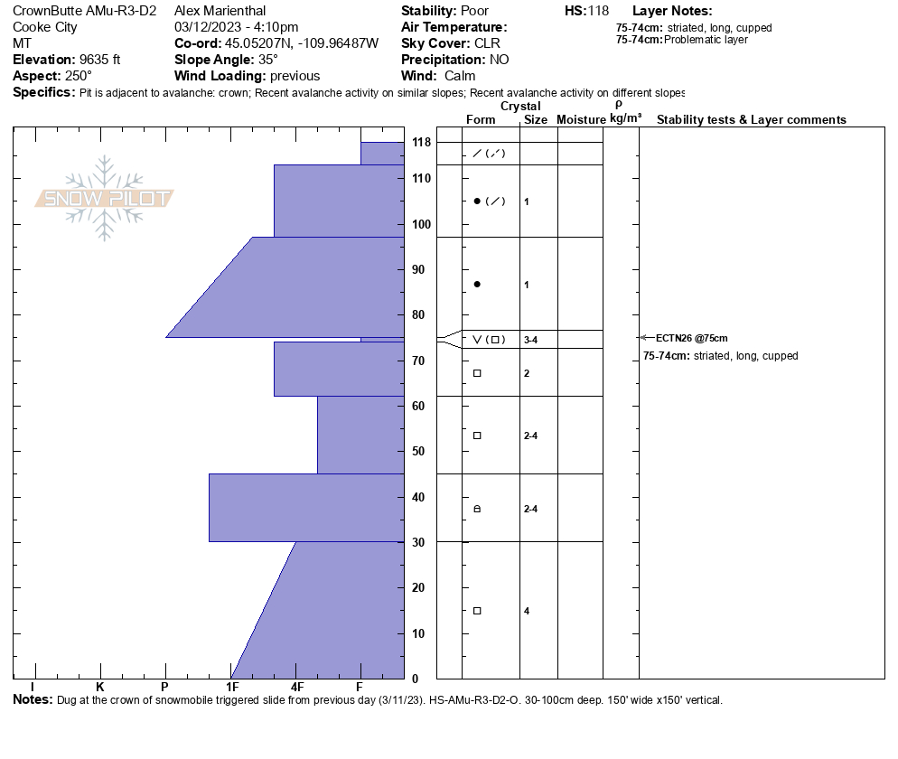
Full Snow Observation ReportToday we rode north of Cooke City and looked at recent natural and Human-triggered avalanches. The slide on Fisher Mtn. was very large and appeared up to 10 feet deep. It had much more volume in the debris than the slide that was triggered on this same path in December.
We also looked at the slide on Crown Butte that was triggered by a snowmobiler yesterday. This was on a SW aspect at 9,600'. It was 1-3 feet deep and broke on a layer of surface hoar and large facets below a hard slab of wind-drifted snow.
We saw two slides that had not been reported previously. One natural on the east side of Sheep Mtn. that was a hard slab of wind-drifted snow on a heavily wind loaded slope near the high ridgeline at 10,500'. The second was snowmobile triggered on a path called "Marty's" above Daisy Pass road. This was similar aspect as the slide on Crown Butte yesterday, and likely had a similar snowpack structure. We checked the debris for a beacon signal to be sure no one was caught, and did not find one. This may have been triggered today (3/12).
This recent activity is a clear sign the snowpack remained unstable with the recent loading event. Due to these slides breaking on persistent weak layers, I think similar human-triggered avalanches remain likely.
Full Snow Observation Report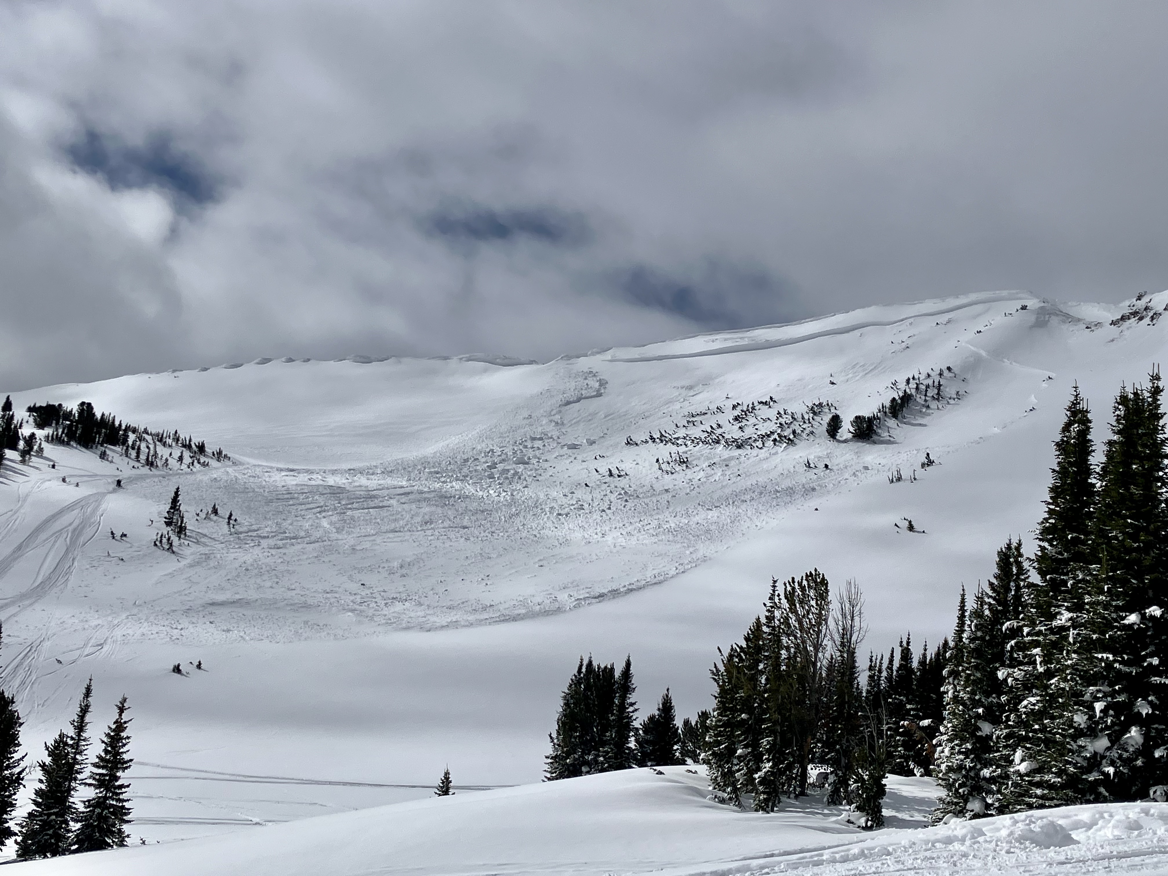

Heard tree breakage, saw plumes of snow and sliding snow at the bottom of the slide path. Our group spoke with the sledders and skiers that were on slope and confirmed none were caught. Skiers reported feeling slide tremble and backed down the mountain. Main breakage was near top of the third shoot from the lookers right.
Full Snow Observation Report