Snow Observations List
Rider triggered avalanche on crown butte. Saw and heard reports of small rider/skier triggered wind slabs North of Cooke City.
We rode along Buck Ridge and into the first and second Yellow Mule, then rode into MacAtee and Muddy Creek. Wind was calm to light and not transporting snow. There was signs the wind blew previously, from the north. We did not see any recent natural or human triggered avalanches. We dug a pit near the wilderness boundary in Bear Creek. It was 212 cm deep and we had two ECTXs, one of them propagated after an extra 5-6 hits on surface hoar 2 feet (55-60cm) deep. Overall stability was good and avalanches are trending towards unlikely. Slopes that have recently formed fresh drifts may remain unstable for a couple more days.
Full Snow Observation Report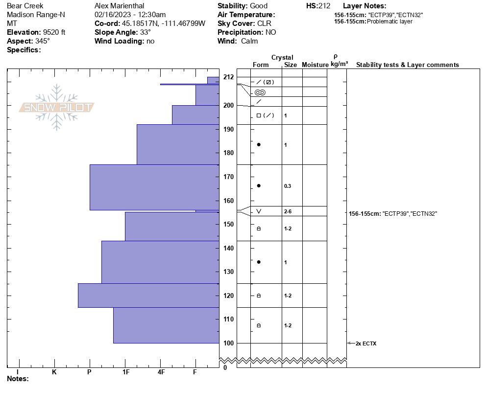

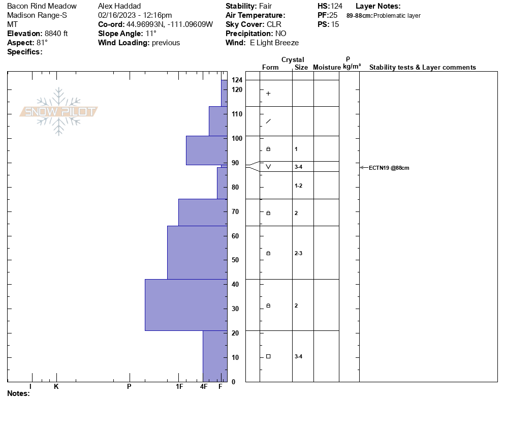
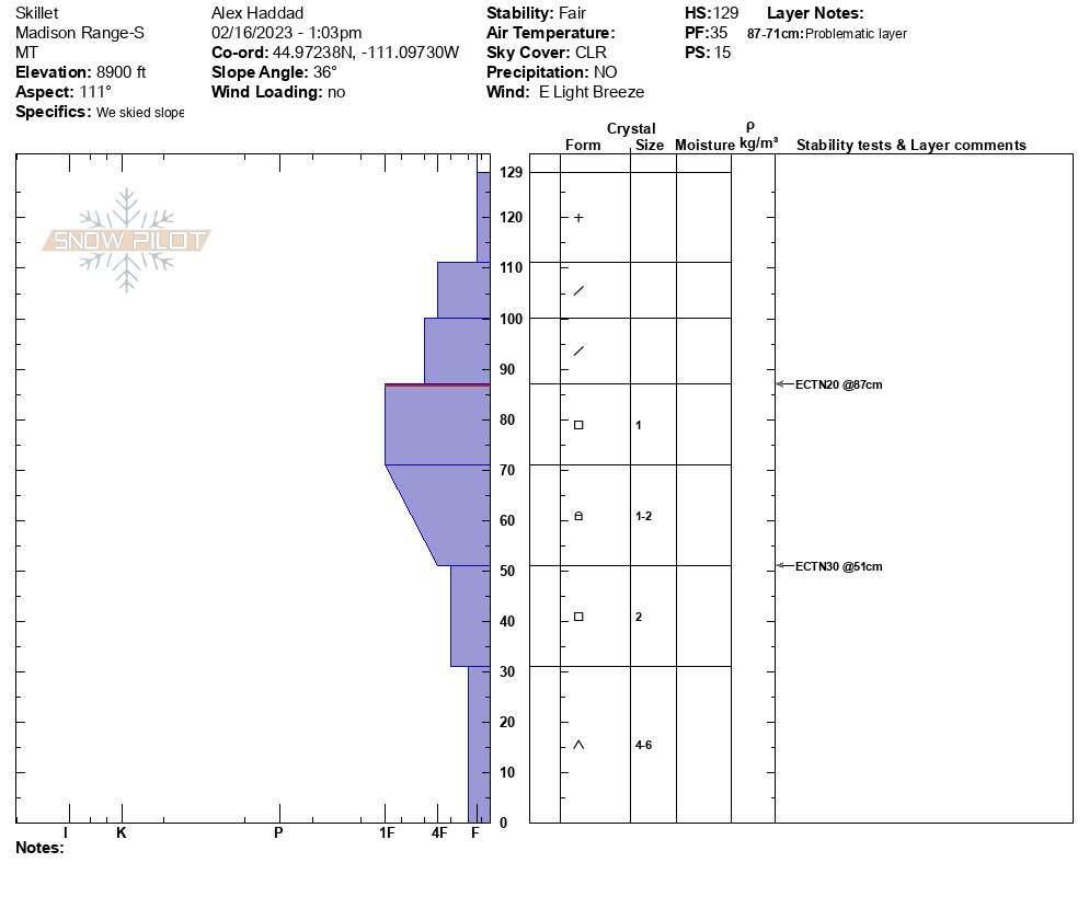
We toured up to the Skillet today. We noticed that winds from the NE had drifted the 4-6" of storm snow throughout Bacon Rind. The wind drifting is a bigger concern in the less sheltered areas of Bacon Rind. We dug two pits on a SE aspect at 7500', and 8,600'. There is a melt freeze crust sitting atop a layer of facets 4-6" below the surface, and this propagated easily in our pits (ECTP 3, ECTP 11). This is not a concern now, but it could be when new snow falls on this weak snow. Next, we dug a pit in the meadow to the south of the Skillet at 8,800'. We found surface hoar 14" below the surface, and it did not propagate in our test. In our pit at the top of the Skillet, we did not see propagation either. The terrain we were in today is trending towards stability.
Full Snow Observation Report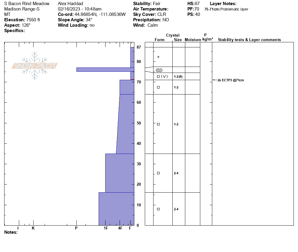

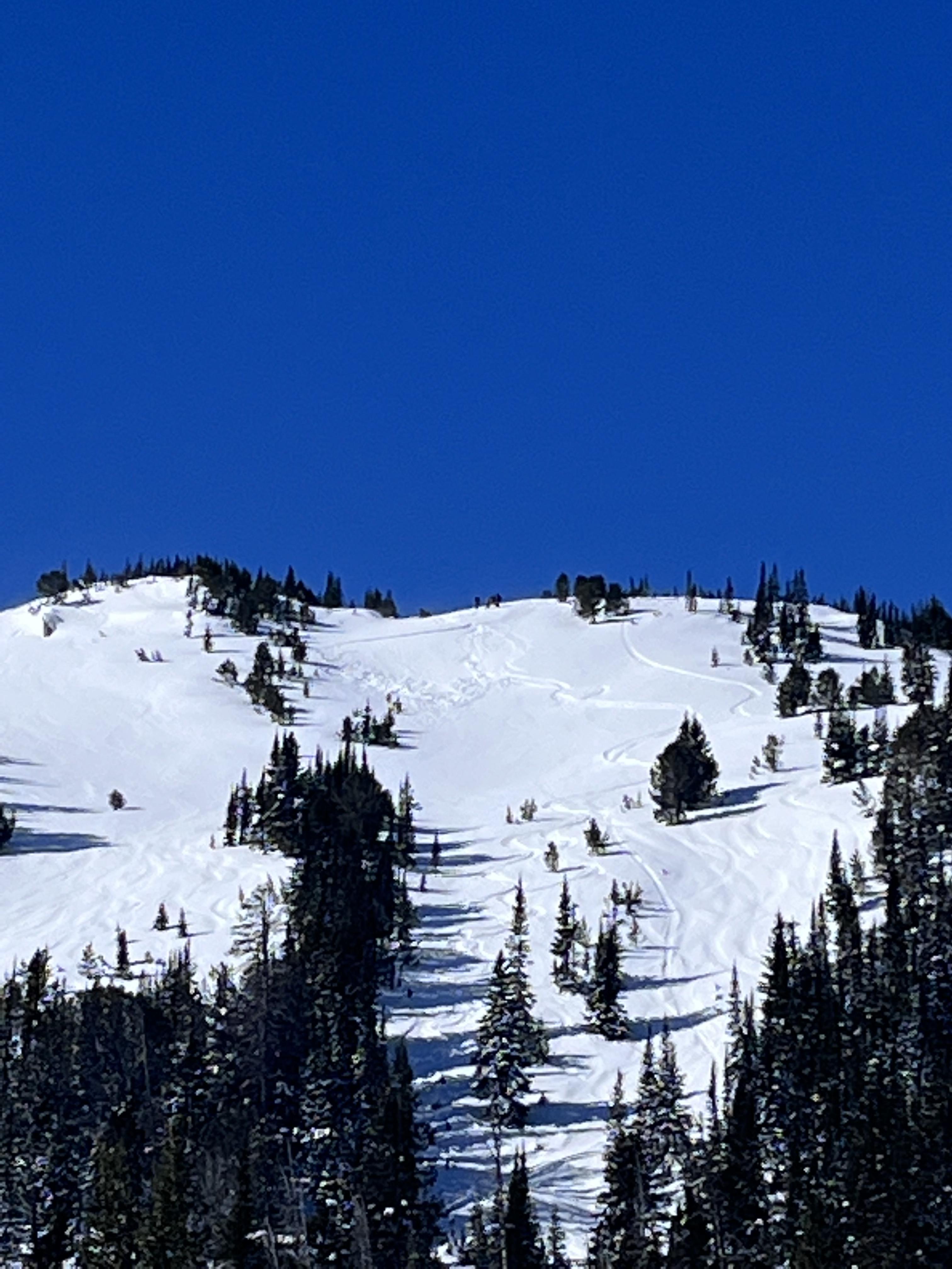
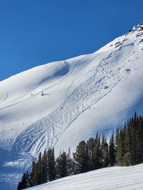
Saw debris and what looked like a crown line from a natural avalanche that probably happened a day or two ago in palace butte basin on a NE aspect above Arden lake. My best guess is 150ft wide crown, 1-2ft deep?
Full Snow Observation ReportAbout 34 degree rollover, 14 inch crown.
Full Snow Observation Report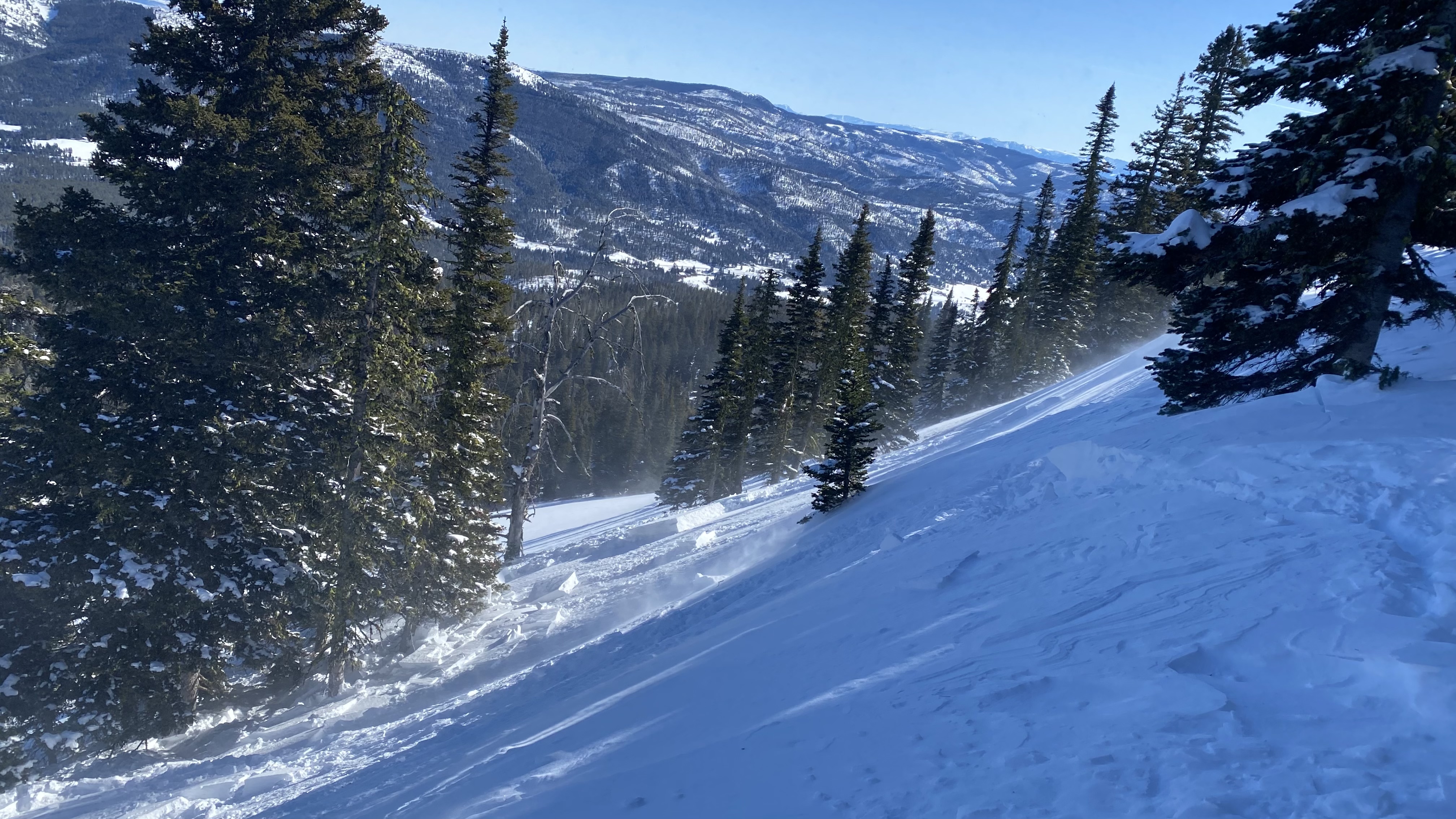
We measured 14" of snow from Tuesday's storm with 1.6" of snow water equivalent. We were encouraged that we did not see any natural (or human-triggered) avalanche activity. However, there is a significant caveat to this. East to Northeast winds stripped the steep slopes of Carrot and Sage Basins that are regularly wind-loaded by the prevailing winds. Thick drifts in abnormal locations were evident. Ridgetop were we rode had pillows of drifted snow and we could see cornices running downhill on the SW side of Sage Peak that indicated the gullies and depressions were cross-loaded. We dug a couple of pits. The first, in Sage Basin was unremarkable. The second, at the edge of Sunlight Basin, yielded an ECTP23 on a layer of facets/ surface hoar buried two feet deep.
We avoided wind-loaded slopes and recommend digging to test weak layers in the upper three feet of the snowpack before riding/ skiing in steep terrain.
Full Snow Observation Report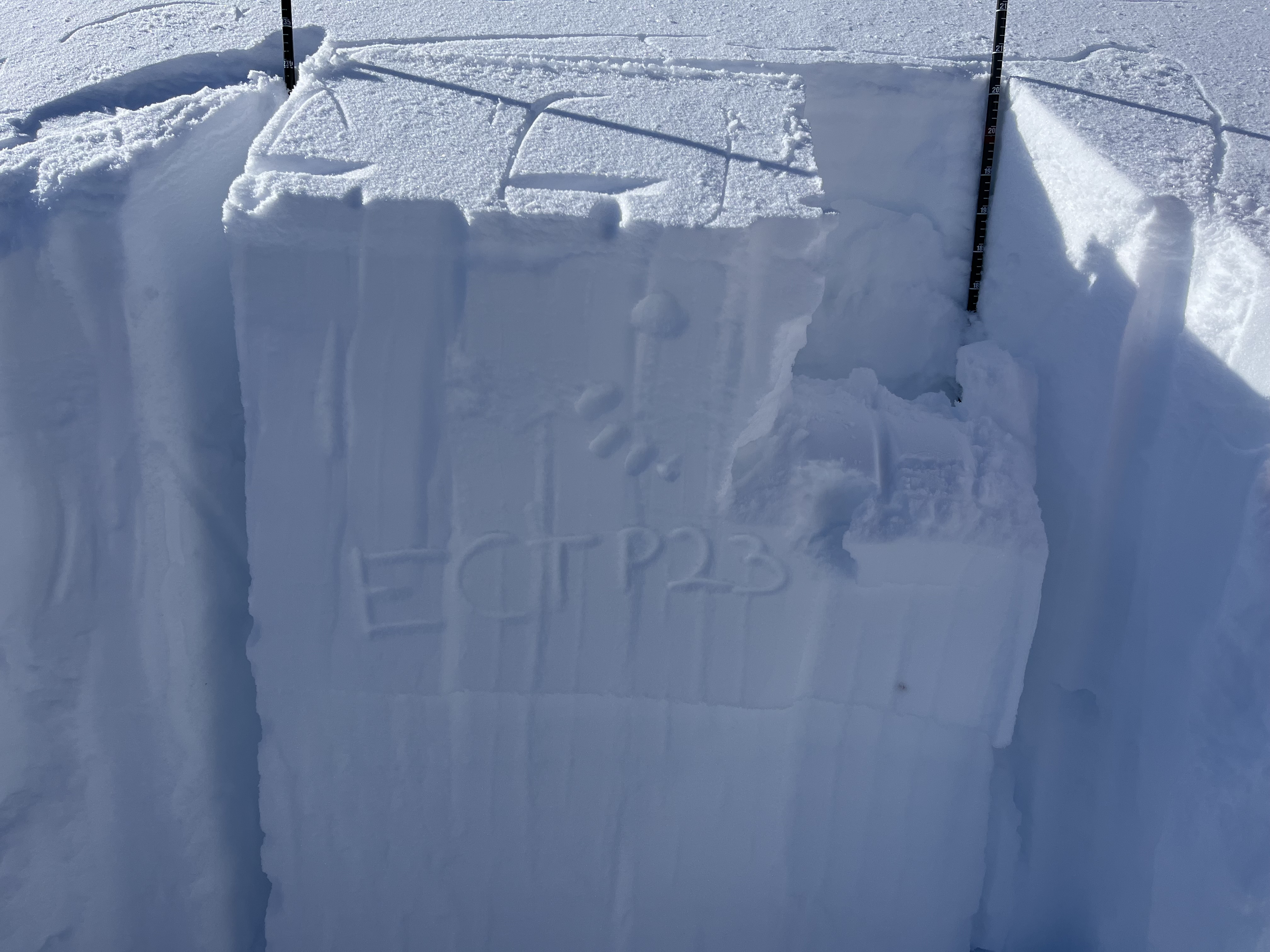

Riders north of Cooke City on 2/16/23 saw an avalanche that appeared to be recently snowmobile triggered.
Full Snow Observation Report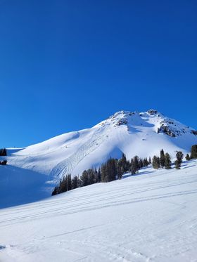
Small storm slab released on a small piece of terrain. East aspect around 9200.
Full Snow Observation Report

The Bozeman snow ranger crew rode on Buck Ridge today and did not see any recent avalanche activity. There was 4-6 inches of new settled new snow over very firm older snow, so the riding was somewhat deceptive (not the easiest). We rode out to Bear creek and the wilderness boundary there and noted that the new snow had been blown around quite a bit on the ridge tops. Some folks had done some pretty aggressive riding in the upper portion of McAtee Basin but didnt trigger anything. We also rode down Muddy Basin a ways and found much better riding there; less sled traffic and likely better wind shelter than buck ridge proper. We peeked into the Yellow Mules and did not see any recent activity there, either. Hope that info is helpful!
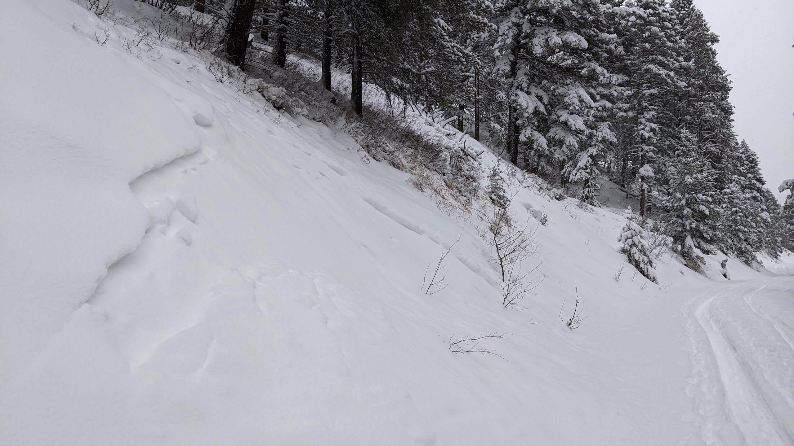
Full Snow Observation ReportLow winds/no snow transport when I was up there and the east face had little to no wind effect, probably 16-18in new snow. Saw this slide with about a 8-12in crown and 100ft wide on the north face, didn’t see any other activity aside from some small point releases on really steep east aspects.
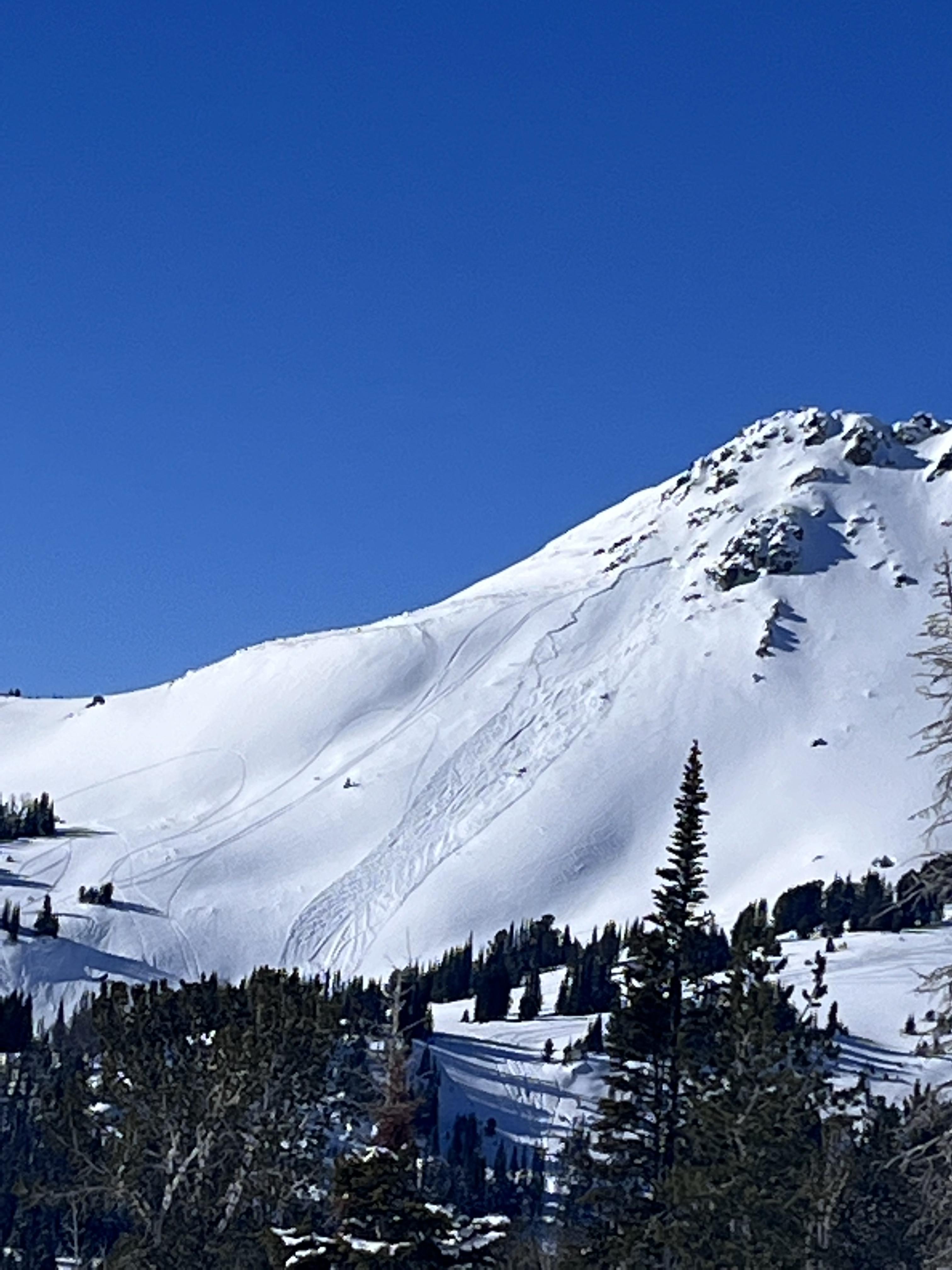
From another party: Saw a sizable avalanche on the north east face of Blackmore, likely broke mid storm and was partly filled in already - estimated 20" deep, 100' wide. Had shooting cracks and collapsing while ascending northeast ridge. Hand pits showed planar results on an 8" harder slab beneath all the blower on top.
Full Snow Observation Report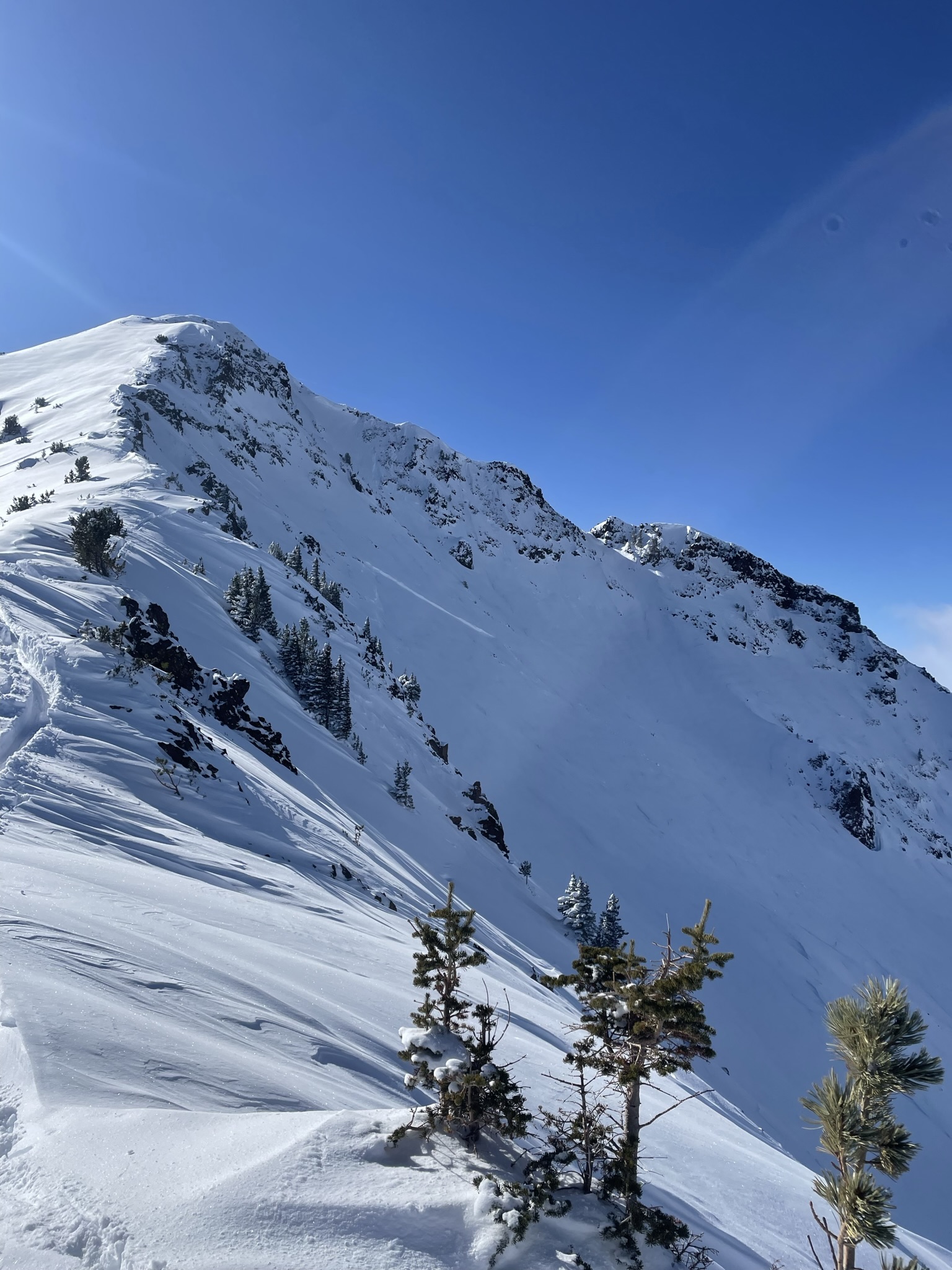
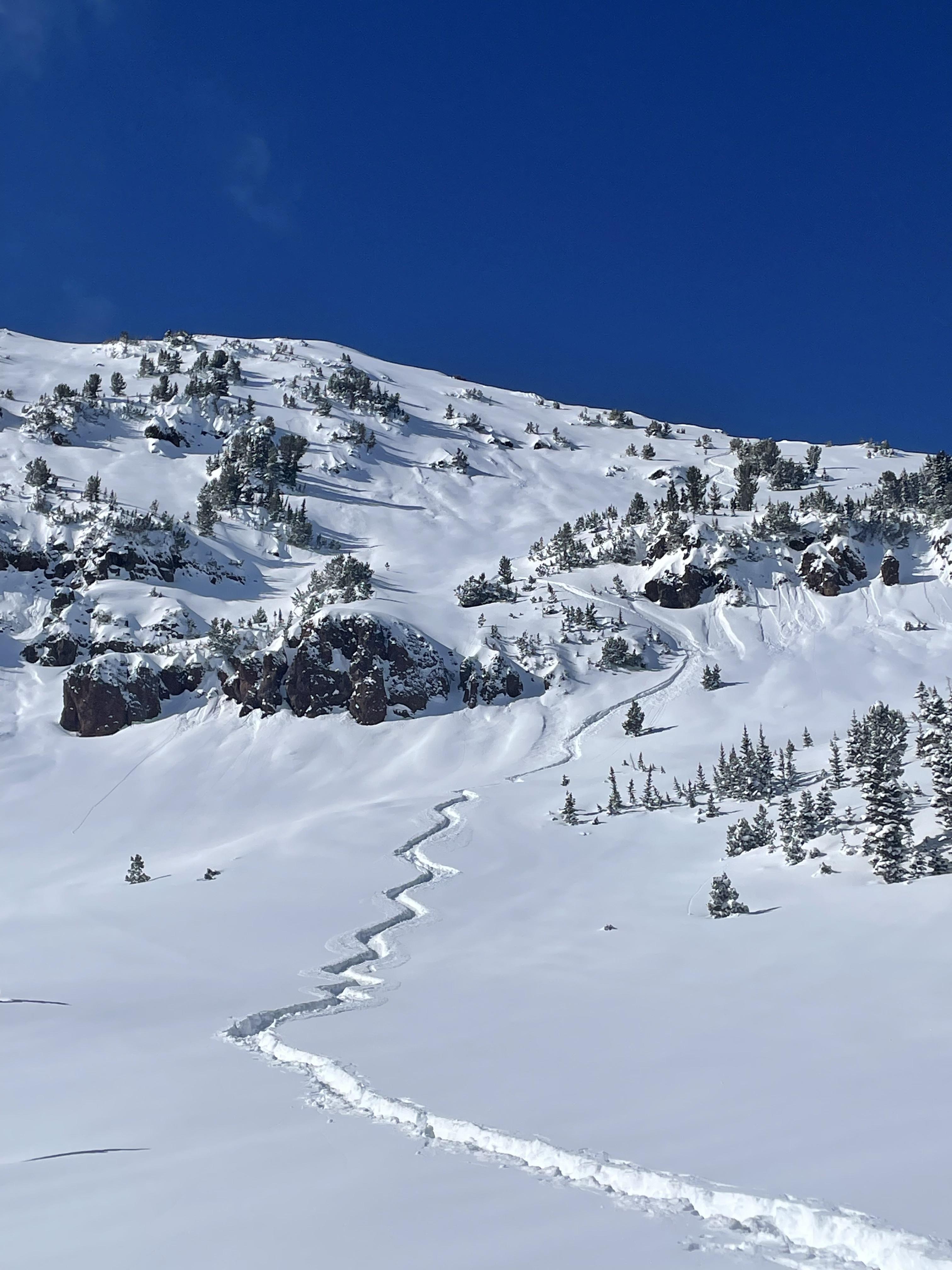
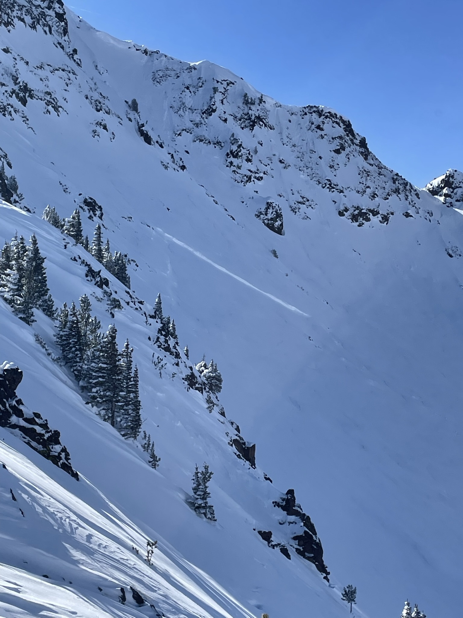
We toured up the Ramp near Bridger Bowl Ski Area today. On our tour up we saw a few small cracks in front of our skis in the new snow. Also, there were a few crowns and sluffs on higher peaks in the range. The wind blew from the W/SW throughout the day, and it was transporting the new storm snow into harder snow drifts. We dug a pit at 8,300' on a NE facing slope. The snow was 5 feet deep (HS = 150). The weak, sugary snow below the 8-10" of new snow were not reactive in our tests (ECTX 2x). The storm snow is becoming more stable as we move further from this storm. Now, the main concern is terrain with wind-drifted snow.
Full Snow Observation Report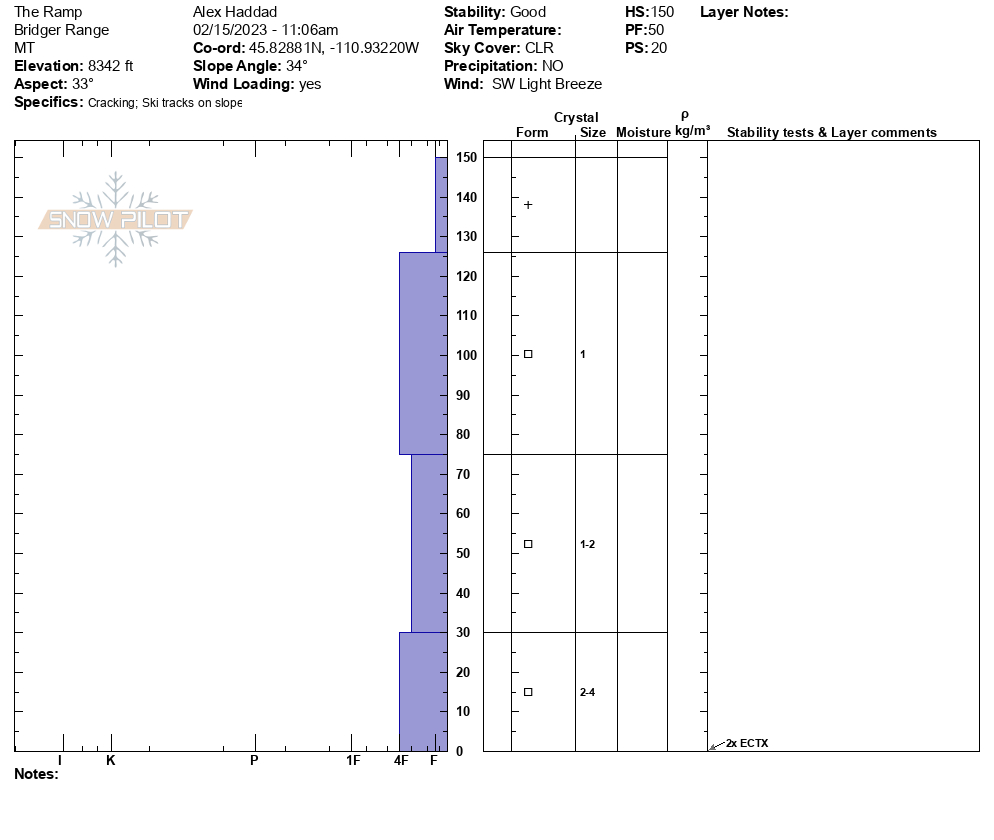

In Beehive with AAI Pro 1. Storm snow measured at over 30 cm, roughly double what was reported at Big Sky/YC. 5% density. Wind Slabs slowly building from L to M N winds, both WS and Loose Dry touchy on all slopes steeper than 35 with a MFcr as the interface - basically everything W, S, E aspects below 9500 (probably above too but we didn't go that high). One skier triggered wind slab observed low in the "tyler's" slide path on a SW aspect, 8700 ft, 35 deg, SS-ASu-R1/D1-I. No evidence of active persistent slab, 11x pits @ 8500 SE, HS 170, ECTX for all.
Full Snow Observation Report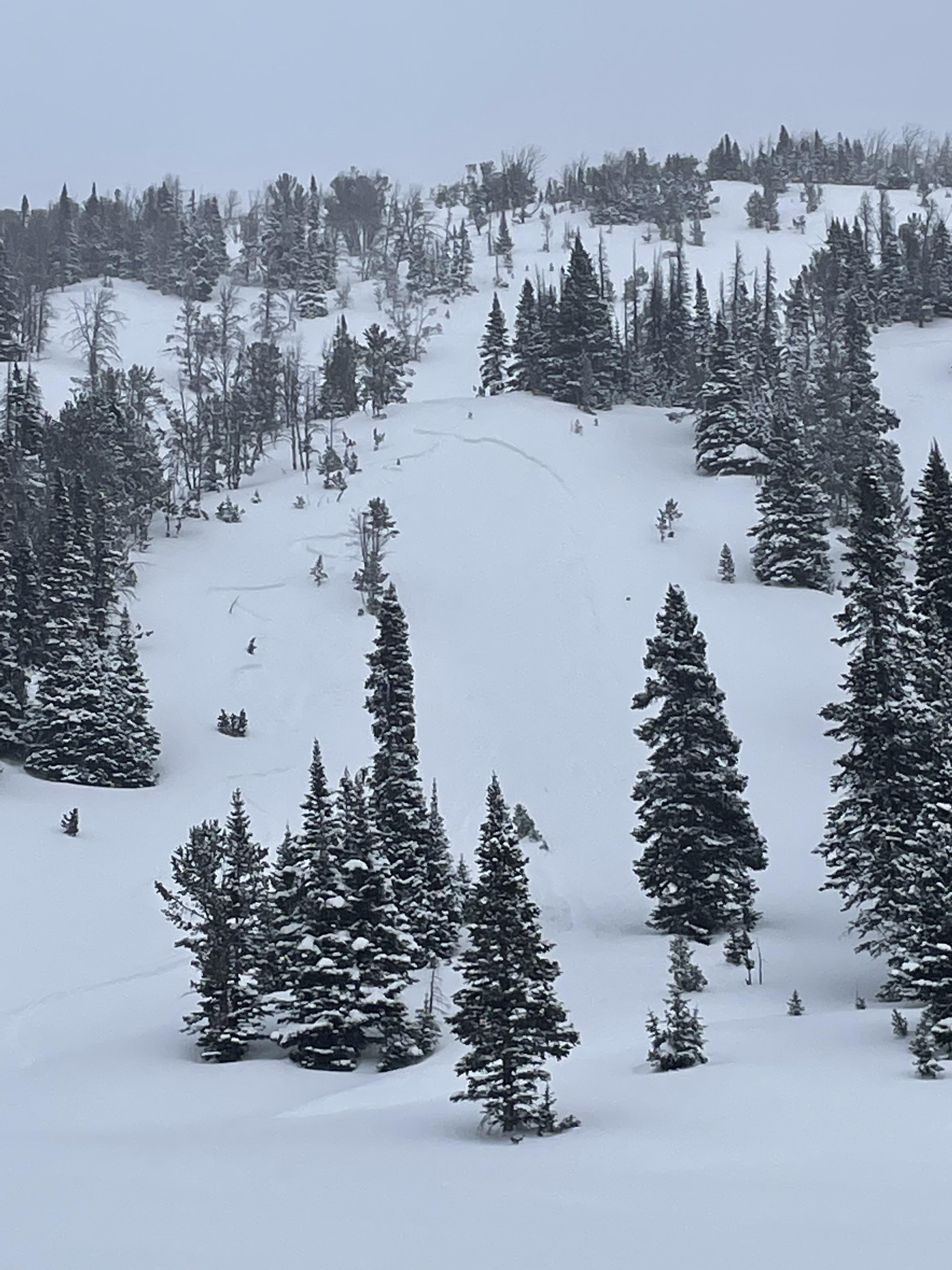
We observed a few small crowns on steeper road cuts in Sourdough today, NW and W aspects. 4-8" at crown, 20-40' wide, ~10' vertical. They looked like storm slabs that had run overnight, maybe on a density change in the storm snow. Debris piles were small and covered with 2-3" of new snow. Low consequence, but maybe enough to surprise a kid or a dog. Photos were taken shortly above the 2 mile marker.
Full Snow Observation Report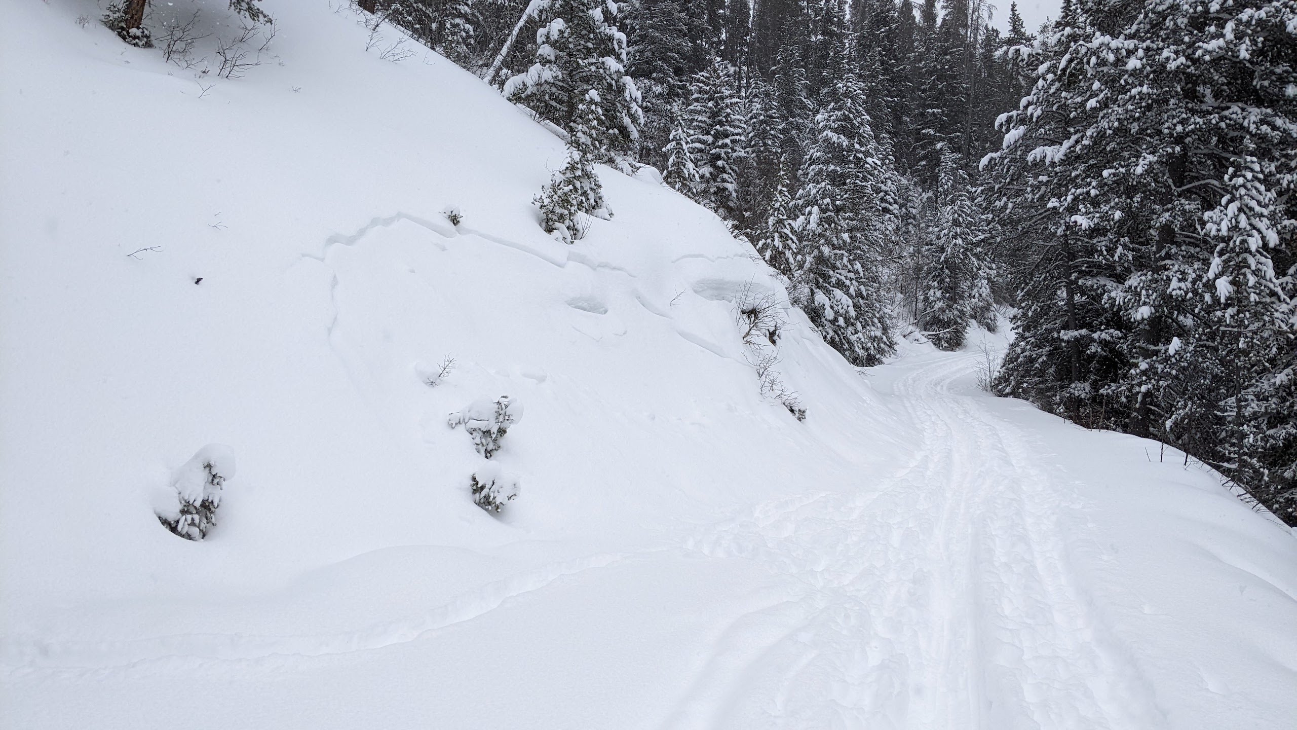
Just a little more than 4-7” snow in Hyalite this morning
I skied at Lick Creek area and there’s 18-24” and still dumping
Low density
In the meadows I skied (not the Main meadow - too far to break trail  ) snow is on pretty firm melt / freeze crust. Heard a few whumps skinning up
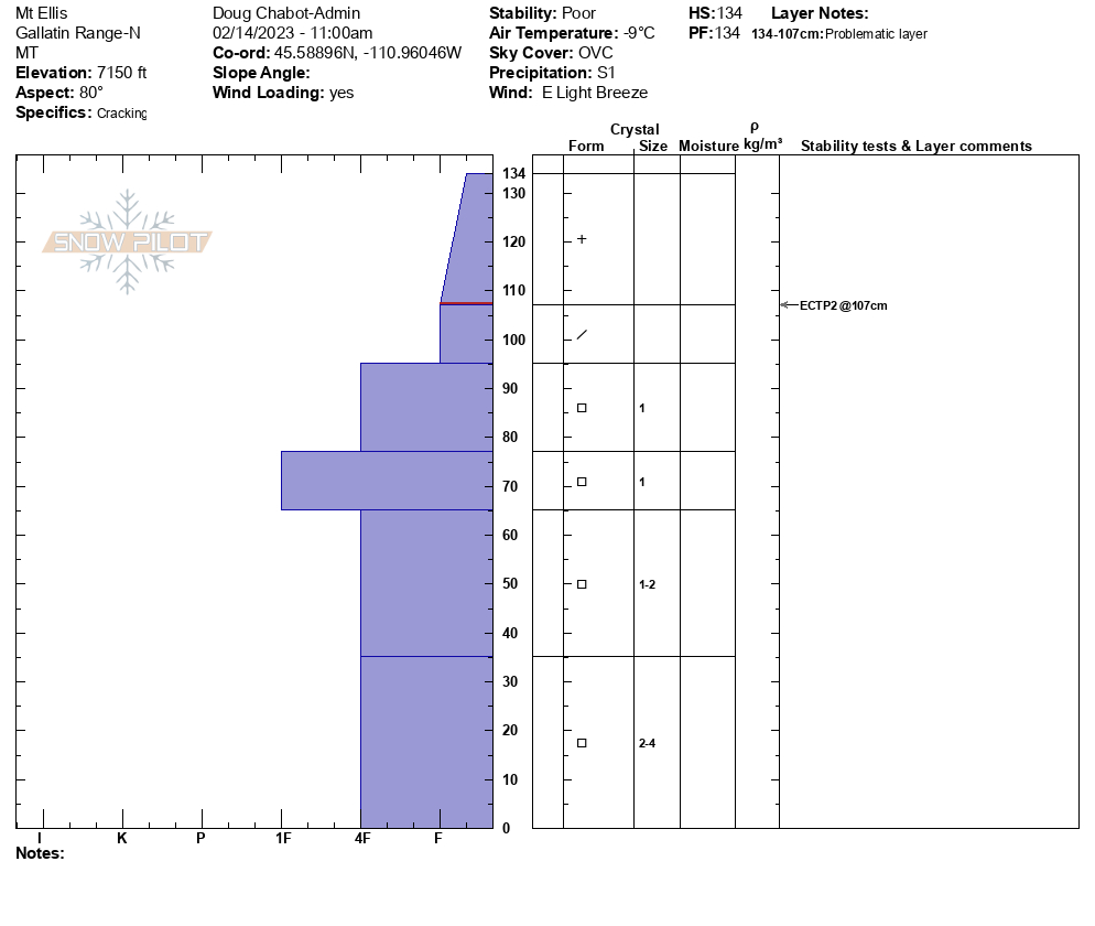
We broke trail into Mt Ellis in 12-14" of new snow (8% density). At the ridgeline east wind was just starting to pick up. The new snow was also beginning to form a cohesive slab. We had no whumpfing and only minimal cracking, but with new snow and wind we decided to stay out of avalanche terrain. The snowpit structure is weak and I sunk to the ground when I stepped out of my skis. A stability test showed poor stability (ECTP2) underneath the new snow which confirmed our assessment. We skied good snow on low-angled slopes back to the car.
Full Snow Observation Report

Was about 80% of the way up to the top of the middle meadow on history rock this morning when we remotely triggered a small avalanche from the skin track. Slide was just new snow that had fallen within prior 24hrs. Crown of about 8 inches, 20ish feet wide by 20 feet long. Face that slid was east facing. We took this as a sign to reconsider skiing something even as low key as history rock and decided to ski the skin track back.
[Dropped the pin for this observation exactly where I believe the observation to have occurred. Took an OnX waypoint while out there to help too.]
Full Snow Observation Report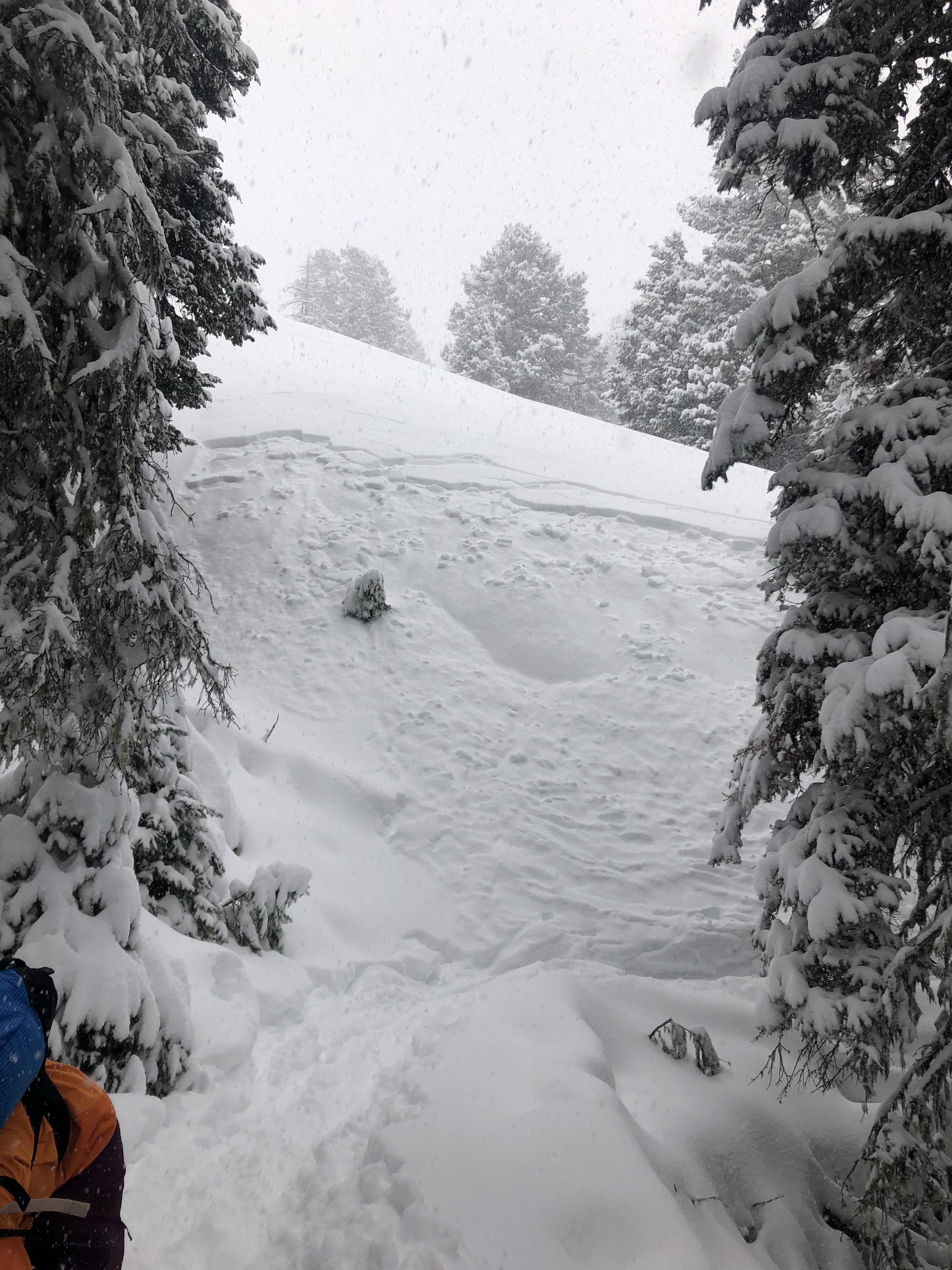
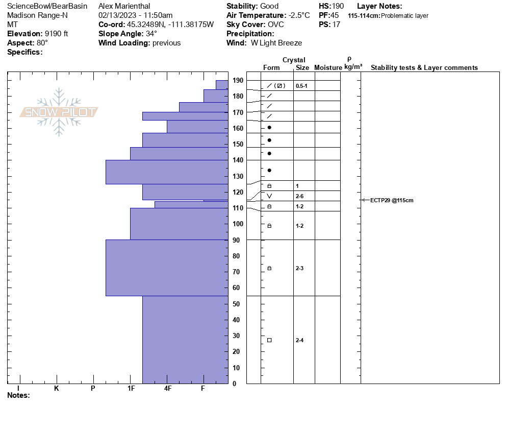
We toured into Beehive Basin and dug a pit at the top of the west facing slope near "Tyler's" around 9,000'. The snowpack is often shallower here and weaker. HS was 116cm and we had ECTX. There were 4-6mm facets near the ground and 2-4mm facets above that which could be a problem with a large load, but seemed unlikely to cause an avalanche today. We went over the ridge and dug on an east aspect at 9,100'. Here HS was 190cm and we could see the stripe of surface hoar 75cm down. We had an ECTP29 on the surface hoar layer. Stability has been trending better with minimal recent snow, and avalanches breaking on these weak layers seem unlikely unless they are loaded by a big storm...
Full Snow Observation Report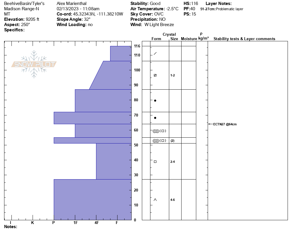

Snow shoed from the lower reaches of the fairy lake trail head to the lake today. Wind picked up mid morning moving a lot of loose snow around and had 1’ ground blizzards at times. Snow seemed to be pretty weak in most places I traveled creating hard conditions to snow shoe effectively off trail. I never dug a pit but in helping dig out a few snowmobiles the snow was mostly made of facets and inconsistent in structure.
Full Snow Observation Report
Found widespread surface hoar up storm castle creek on all sheltered slopes above 7500’
Full Snow Observation Report