Good morning. This is Doug Chabot with the Gallatin National Forest Avalanche Forecast on Thursday, March 21st at 6:45 a.m. Today’s forecast is sponsored by Advanced Innovation and Cooke City Motorsports. This forecast does not apply to operating ski areas.
This morning, under cloudy skies, temperatures are near freezing at 8-9,000’ with westerly wind blowing 10-15 mph and gusting to 30 mph. Today will be cloudy and wind will increase from the W-SW at 20-30 mph. It will rain in the valleys and snow in the mountains with 1-2” of snow predicted during the day. Colder weather and snow is on track for the weekend.

All Regions
The freezing levels are around 9,000’ in the northern ranges and 8,000’ in the south. Clouds, wind and dropping temperatures won’t allow the snow to melt much further, but a unique situation is presenting itself: potential snowfall on a wet surface. This could create a weak layer called melt-layer recrystallization (lecture video).
Without sunshine, warming and melting, the wet snow avalanche danger is gone. However, the weak snow near the ground is still a problem. Two days ago a large avalanche was triggered near Mt. Blackmore when this layer failed. One skier was injured and extricated by Gallatin County Search and Rescue (details and photos). Our snowpack throughout the forecast area is more similar than not. Right now, when a large avalanche happens we extrapolate that instability to our entire area. My video from Saddle Peak shows weak snow at the bottom of a 7’ deep snowpack. Ian found a similarly poor structure in Portal Creek which dovetails with our entire region’s snowpits and field videos (Portal video and obs; snowpits).
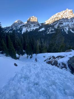
The snowpack is in transition today as precipitation falls (both rain and snow) and the temperature drops. This transition is dynamic and snow does not like quick change. Today we need to be vigilant in the backcountry because our uncertainty is high. The snowpack is being poked in unusual ways and it might catch us off guard. Given the deeply buried weak layer of faceted snow, mistakes can result in large avalanches. Getting into avalanche terrain is not out of the question, but it’s a bigger gamble given today’s changing weather, changing snow surface and extra uncertainty. Basically, it’s a little funky out there.
The avalanche danger throughout our entire forecast area is a serious MODERATE.
If you venture out, please fill an observation form. It does not need to be technical. Did you see any avalanches? How much snow is on the ground? Was the wind moving snow? Simple observations are incredibly valuable. You can also contact us via email (mtavalanche@gmail.com), phone (406-587-6984), or Instagram (#gnfacobs).
Upcoming Avalanche Education and Events
Our education calendar is full of awareness lectures and field courses. Check it out: Events and Education Calendar.
Loss in the Outdoors is a support group for those affected by loss and grief related to outdoor pursuits. Check out the link for more information.
If you like surveys about avalanche forecasts, here are two for you. One is on interpreting avalanche forecast information, and the other is about recognizing uncertainty in the forecast.