Good morning. This is Ian Hoyer with the Gallatin National Forest Avalanche Forecast on Friday, March 22nd at 7:00 a.m. Today’s forecast is sponsored by Montana State Parks and Highline Partners. This forecast does not apply to operating ski areas.
There are 3-4” of new snow in the Bridger, Madison, and Gallatin Ranges, and near Cooke City. 1” fell at Lionhead and in Island Park. Winds gusted into the high 40s to 60s mph yesterday afternoon and are now 10-15 mph with gusts of 30-40 mph out of the north and west. Winds today will continue to be moderate and westerly. Temperatures this morning are in the 20s F. Temperatures this morning are in the 20s F. High temperatures will be in the 30s and 40s F. Expect a mix of sun and clouds today with a few snow showers possible (and maybe a little rain at lower elevations) but with no significant accumulation is expected.

All Regions
A couple inches of snow yesterday, accompanied by strong winds, added a new avalanche concern - slides breaking a foot or two deep beneath newly formed wind drifts. Watch out for and steer clear of these wind drifts to entirely avoid this hazard or carefully evaluate how well the drifted snow has bonded to the old snow surface. Cracks shooting out in front of you mean that you’ve found an unstable drift and should back off steep slopes. These slides could easily push you into trees, rocks or off a cliff or pile snow up plenty deep to bury you.
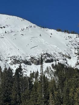
Avalanches breaking deeper in the snowpack are less likely, but still very possible. Every couple days for the last two weeks someone has triggered a big, deep slide. The latest was near Mt. Blackmore on Tuesday, breaking 3 feet deep, catching one skier and causing injuries that required a helicopter evacuation (details and photos). Last week’s slides include a similar one in the Taylor Fork that caught a snowmobiler (details and photos), a huge remotely triggered slide in the Absarokas (details), and a monster on the north face of Mt. Blackmore (details). With the deeply buried weak layers, reliably assessing the likelihood that one of these slides will break on any particular slope is challenging if not impossible. This means that your best tool for mitigating the hazard is sticking to safe travel practices - only exposing one person at a time to steep slopes, watching your partners from a safe spot while they’re on those slopes, and making sure everyone is carrying rescue gear (avalanche beacon, shovel, and probe).
The avalanche danger is rated MODERATE throughout the entire advisory area.
If you get out please submit an observation. It does not need to be technical. Did you see any avalanches? How much snow is on the ground? Was the wind moving snow? Simple observations are incredibly valuable. You can also contact us by email (mtavalanche@gmail.com), phone (406-587-6984), or Instagram (#gnfacobs).
Upcoming Avalanche Education and Events
Our education calendar is full of awareness lectures and field courses. Check it out: Events and Education Calendar.
Loss in the Outdoors is a support group for those affected by loss and grief related to outdoor pursuits. Check out the link for more information.
If you have a few minutes, take a survey on how you interpreting avalanche forecast information in hopes of improving avalanche forecasting methods.