Good morning. This is Alex Marienthal with the Gallatin National Forest Avalanche Forecast on Sunday, March 24th at 7:00 a.m. Today’s forecast is sponsored by Basecamp Gallatin and Yamaha and Uphill Pursuits. This forecast does not apply to operating ski areas.
This morning the Bridger Range has 2-3” of new snow, and elsewhere 4-6” has fallen. Temperatures are teens to low 20s F. Yesterday afternoon, as snowfall began, wind from the southwest increased to 15-25 mph with gusts of 35-60 mph. This morning wind shifted west-northwest and lessened to 5-15 mph with gusts to 25 mph. Today, snow showers will continue, temperatures will be in the 20s F, and wind will be from the north-northwest at 5-15 mph with gusts to 25 mph. By tomorrow morning another 1-3” of snow could fall with a possibility for more in the Bridger Range.
All Regions
Today’s new snow creates additional avalanche hazard, especially where southwest-west winds drifted the snow into thicker slabs. These slabs will be easy for a person to trigger and potentially large enough to bury someone. Also, a person can trigger larger avalanches that break multiple feet deep and hundreds of feet wide on buried persistent weak layers. These potentially massive avalanches have become less likely over the last couple weeks, but the consequences remain severe, and today the likelihood has increased on wind-loaded slopes.
The most recent avalanche that broke on a deeper weak layer was last Tuesday near Mt. Blackmore, and resulted in a skier being caught and injured requiring a helicopter rescue from GCSAR (details and photos). Yesterday near Cooke City skiers triggered a large collapse of the snowpack on a low angle slope (details). Additional reminders of this hazard include a huge remotely triggered slide in the Absarokas last week (details), a rider triggered slide in Taylor Fork (details and photo), a big slide that broke naturally on the north face of Mt. Blackmore (details), and this video from early January showing the very poor foundation of the snowpack supporting all the snow that has since fallen. Assessing the stability of the deeply buried weak layers is difficult. To manage this problem, the best strategy is careful terrain selection and sticking to safe travel practices.
Be extra cautious of steep wind-loaded slopes today. Signs that slopes are wind-loaded include cornices hanging off the ridgeline above, a textured or rounded pillow-like snow surface, or cracks shooting across the surface from your feet or skis.
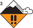
If you plan to ride steeper slopes, choose smaller and simpler slopes with clean runouts free of trees, cliffs, rocks or confined gullies, and without recent wind-loading. Only expose one person at a time to steep slopes, watch your partners from a safe spot while they’re on those slopes, and make sure everyone carries rescue gear (avalanche beacon, shovel, and probe). Today, on wind-loaded slopes human-triggered avalanches are likely and the avalanche danger is CONSIDERABLE, and on non-wind-loaded slopes the avalanche danger is MODERATE.
If you get out please submit an observation. It does not need to be technical. Did you see any avalanches? How much snow is on the ground? Was the wind moving snow? Simple observations are incredibly valuable. You can also contact us by email (mtavalanche@gmail.com), phone (406-587-6984), or Instagram (#gnfacobs).
Upcoming Avalanche Education and Events
Our education calendar is full of awareness lectures and field courses. Check it out: Events and Education Calendar.
Loss in the Outdoors is a support group for those affected by loss and grief related to outdoor pursuits. Check out the link for more information.
If you have a few minutes, take a survey on how you interpreting avalanche forecast information in hopes of improving avalanche forecasting methods.