Good morning. This is Dave Zinn with the Gallatin National Forest Avalanche Forecast on Monday, March 25th at 7:00 a.m. Today’s forecast is sponsored by Cooke City Super 8/Bearclaw Bob’s and the Idaho State Snowmobile Association - Avalanche Fund. This forecast does not apply to operating ski areas.
Mountain temperatures are in the single digits to teens F this morning, with 5-15 mph winds from the southwest to northwest. Yesterday, there was 1-2” of new snow across most of the advisory area, with 0” in Cooke City and up to 3” in the Centennial Mountains. Today, high temperatures will be in the 20s to low 30s F with 5-15 mph winds from the southwest to northwest. The mountains will receive a trace to 1” of new snow in the next 24 hours.

All Regions
Human-triggered avalanches are possible across the advisory area. They are most likely to fail 6-18” deep on steep slopes where the wind has drifted recent snow in thicker slabs. However, the possibility of large avalanches breaking on deeply buried weak layers should continue to drive terrain selection. While these large slides have become less likely, they remain highly consequential, taking out nearly the entire season’s snowpack, breaking many feet deep and hundreds of feet wide.
A week has passed since the last large avalanches failed near the base of the snowpack. These slides broke 3+ feet deep, injured a skier and nearly swept a rider downhill had he not grabbed a tree to avoid getting carried (Blackmore details and photos, Taylor Fork details and photos). It is a mistake to think they are not possible today. Yesterday, a group in the Bridger Range found deep instability in their pit near Ross Peak (details), and two days ago, a skier triggered a collapse with cracks that shot out 50 feet on Woody Ridge in Cooke City (details). Go back a bit further on our weather and avalanche log to read through details about the unusually high number of avalanches breaking on this season’s persistent weak layers (video). As Doug recently discussed from Saddle Peak, a smaller avalanche or cornice fall could trigger one of these monster slides, or a backcountry traveler could get unlucky and cross a trigger point where the snowpack is thinner, initiating a very dangerous avalanche (video).
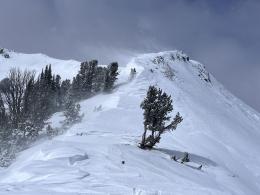
The weekend’s storm created the potential for avalanches within the new and wind-drifted snow. Yesterday at Buck Ridge, Alex saw a natural slide that failed around 18” deep and noted that these avalanches, while small compared to those breaking deeply on persistent weak layers, are large enough to bury or injure a rider or skier (video). Terrain features of concern include slopes below or adjacent to cornices, areas with pillows of drifted snow or with a textured snow surface, and slopes with signs of instability such as cracking.
If you choose to play in avalanche terrain, identify and avoid wind-loaded slopes. Select low-consequence terrain (smaller, less steep pitches without terrain traps), and follow safe travel practices by carrying rescue gear and traveling one at a time in avalanche-exposed areas while a partner watches from a safe spot. The danger is rated MODERATE.
If you get out please submit an observation. It does not need to be technical. Did you see any avalanches? How much snow is on the ground? Was the wind moving snow? Simple observations are incredibly valuable. You can also contact us by email (mtavalanche@gmail.com), phone (406-587-6984), or Instagram (#gnfacobs).
Upcoming Avalanche Education and Events
Our education calendar is full of awareness lectures and field courses. Check it out: Events and Education Calendar.
Loss in the Outdoors is a support group for those affected by loss and grief related to outdoor pursuits. Check out the link for more information.
If you have a few minutes, take a survey on how you interpreting avalanche forecast information in hopes of improving avalanche forecasting methods.