Good Morning. This is Alex Marienthal with a spring weather and snowpack update on Wednesday, April 12th. The Gallatin National Forest Avalanche Center has stopped issuing daily avalanche forecasts for the season. We will issue weather and snowpack updates on Monday and Friday mornings through April. This information does not apply to operating ski areas.
This morning, temperatures are high 20s to mid-30s F, and wind is out of the southwest at 10-20 mph with gusts of 30-40 mph. Today will have increasing clouds and temperatures reaching low to mid-40s F. Wind will continue out of the southwest at 15-30 mph before colder air and snow arrive this evening. Tomorrow and Friday temperatures will be mid-20s to low 30s F, and tonight the mountains could get 1-3” of snow. Tomorrow heavy snow is expected to deliver 10-12” to most of the mountains in southwest Montana with more possible in the Bridger Range, Hyalite and Big Sky.

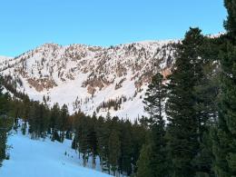
Last weekend an abrupt change to spring brought above freezing temperatures and sunshine that melted the snowpack for the first time this season. Dangerous wet snow conditions developed over the last two days after temperatures did not freeze for two nights in a row. There were large cornice breaks (Mt. Abundance, Northern Madison), and a few natural wet slabs and multiple wet loose avalanches large enough to bury a person and snap small trees (Natural on Baldy, Saddle Peak and Bridger, Big Sky, across road in YNP).
Last night’s below freezing temperatures froze the snow surface and helped stabilize the snowpack, and today cooler temperatures and clouds will reduce the chances of natural wet snow avalanches. However, a person could still trigger large wet avalanches on steep slopes where the snowpack did not freeze overnight, or where the snow surface becomes soft and wet from above freezing temperatures today. If tonight’s storm begins as rain it could quickly weaken the snowpack and make wet avalanches more likely. Avoid travel on and underneath steep slopes where the snow surface is not frozen, start early and anticipate the snow to become weaker later in the day. Give cornices a wide berth along ridgelines and avoid slopes directly below them.
Tomorrow, wet snow avalanches will become less likely, but heavy new snow will create dangerous avalanche conditions. Avoid steep terrain during the storm, and before crossing or riding any steep slopes carefully assess the stability of new and wind-drifted snow. More heavy snowfall may cause deeper avalanches to break on old persistent weak layers (recent deep slabs: Northern Madison Range, Southern Gallatin Range, Lionhead Area and Bridger Range), so your best bet is to choose simple, low angle terrain, especially during and immediately after storms.
There is still a full list of avalanche hazards to manage if you are out in the mountains this spring. Our avalanche and weather log shows avalanche activity occurred on most days for the past few months, and avalanches are not stopping quite yet.
We will issue spring snowpack and weather updates twice a week through April, and we will share relevant avalanche and snowpack information on our website and social media. If you get out, please send us your observations no matter how brief. You can submit them via our website, email (mtavalanche@gmail.com), phone (406-587-6984), or Instagram (#gnfacobs).
INFO and REMINDERS
Bridger Bowl Ski Area is closed, and ski patrol is no longer performing rescues and making terrain closure decisions for you (video).
Hyalite Canyon road is closed for motorized use until May 16.
GENERAL SPRING SNOWPACK AND TRAVEL ADVICE
Spring weather can be highly variable and create a mix of avalanche problems. Snow conditions and stability can change drastically from day to day or hour to hour. Anticipate rapid change and plan accordingly. Abundant snowfall over the winter with more spring snow to come makes avalanches possible into summer.
NEW SNOW AND WIND LOADED SLOPES
Spring storms are notorious for depositing heavy amounts of snow in the mountains. Even with a deep and generally stable snowpack throughout the advisory area, heavy and rapid loads of new snow will decrease stability. The main problems to look out for are avalanches breaking within the new snow, wind slabs, and loose snow avalanches. The likelihood of triggering an avalanche spikes during and immediately after snowstorms. New snow instabilities tend to stabilize quickly, but it’s a good idea to give fresh snow a day to adjust before hitting big terrain. New snow instabilities can be challenging to assess, and spring storms bond to old snow differently across aspects and elevations. Conservative terrain selection is essential during and immediately following storms. Avoid wind-loaded slopes and slopes steeper than 35 degrees for 24-48 hours after new snow and wind.
New snow can quickly change from dry to wet on a spring day, and stability can decrease rapidly with above freezing temperatures or brief sunshine. New snow may bond well early in the morning and then easily slide later. Wet loose slides are likely during the first above freezing temperatures or sunshine immediately after a storm. Anticipate changes in snow stability as you change aspect or elevation and over the course of the day. An early start is always an advantage. Be ready to change plans or move to safer terrain at the first signs of decreasing stability.
WET SNOW AVALANCHES
Spring and wet snow avalanches go hand-in-hand. Above freezing temperatures, rain, and/or intense sunshine cause the snow to become wet and weak and make wet avalanches easy to trigger or release naturally. Conditions tend to become most unstable when temperatures stay above freezing for multiple days and nights in a row. Avoid steep terrain, and be aware of the potential for natural wet avalanches in steep terrain above you, if you see:
- Heavy rain,
- Above freezing temperatures for more than 24 hours,
- Natural wet avalanches,
- Rollerballs or pinwheels indicating a moist or wet snow surface,
- Or if you sink to your boot top in wet snow.
In general, if the snow surface freezes solid overnight, the snowpack will be stable in the morning and stability will decrease through the day as snow warms up. The snow surface hardness, rate of warming, duration of sunshine, aspect and elevation determine how fast stability will decrease through the day. Be aware that sunny aspects may have a wet snow avalanche danger while shadier slopes still have a dry snow avalanche danger. Getting off of steep slopes should be considered when, or before, the above signs of instability are present. Wet snow avalanches, whether loose snow or slabs, can be powerful, destructive and very dangerous. Conservative terrain choices, starting early in the day, and careful observations can keep you safe. See Alex’s recent video, and this article for more spring travel advice.
CORNICES
Cornices along ridgelines are massive and can break under the weight of a person (photo). Prolonged above freezing temperatures and rain make them weaker and possible to break naturally. They can break off suddenly and farther back than one might expect. Cornice falls can also entrain large amounts of loose snow or trigger slab avalanches. Stay far back from the edge of ridgelines and minimize exposure to slopes directly below cornices. Regardless of whether a cornice triggers a slide or not, a falling cornice is dangerous to anyone in its path.
DISCLAIMER
It does not matter if new snow falls or not, avalanches will continue to occur until the existing snowpack is mostly gone. Always assess the slope you plan to ride with diligence and safety in mind. Do not let your guard down. Travel with a partner, carry rescue gear and only expose one person at a time in avalanche terrain.
Have a safe and enjoyable spring and summer!
Doug, Alex, Ian and Dave
For more spring travel advice see this article from our GNFAC forecaster blog.
Snow will be around the mountains for a month or two and avalanches will continue. When warm temperatures return, wet snow hazards will increase. If there are big spring snowstorms, dangerous conditions may develop for new snow avalanches and wind slabs. With either extended warming or a big storm, there is still a lingering possibility of deep avalanches breaking on weak, sugary snow near the ground. See this article for some general spring travel advice.