Good morning. This is Dave Zinn with the Gallatin National Forest Avalanche Forecast on Wednesday, April 10th, at 7:00 a.m. Today’s forecast is sponsored by Basecamp Gallatin and Yamaha and Spark R&D. This forecast does not apply to operating ski areas.
Mountain temperatures are in the upper teens to 20s F this morning with 10-20 mph winds from the west to the northwest. In the last 24 hours, the mountains received a trace to 2” of new snow, with 3” in the Taylor Fork. Today, high temperatures will be in the 30s to low 40s F, skies will become mostly sunny, and the wind will blow 5-15 mph from the west to the northwest.

All Regions
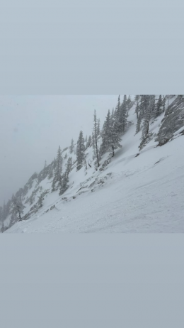
The sun will break out from behind the clouds today, and the danger of wet snow avalanches will rise as the snow from recent storms starts sliding on the underlying crust. The size and frequency of these avalanches depend on how much snow fell during the last storm (Over 2 feet in the Bridger Range, 12” around Big Sky and 4-7” everywhere else), how warm the temperatures get, whether lingering clouds shade slopes and if wind cools the snow surface. Though there is uncertainty about the timing and extent of wet snow avalanches today, recognizing the signs of increasing danger is relatively simple. A wet snow surface, cinnamon roll-like snowballs shedding from steep rocky areas and small natural slides indicate that the danger is increasing. Have a safe exit plan, as conditions can change quickly. Shift to cooler aspects or head home as this transition occurs.
Dry slab activity within the new and wind-drifted snow has decreased since this weekend (avalanche activity log). However, dry slab avalanches within the recent storm snow are the primary concern before the warm-up and throughout the day at high elevations and shady north-facing slopes. Our recent videos from The Ramp and The Throne demonstrate digging down until you hit the thick upper ice crust to test for instability in the top few feet of the snowpack before committing to avalanche terrain. Selecting non-wind-loaded terrain is a good way to reduce the risk of triggering a slide.
While a low-probability event, the structure to produce very large avalanches remains present, especially on steep high-elevation slopes and those that remained cool through the recent warm-ups. If seeking this type of terrain, recognize the residual risk of triggering an unsurvivable avalanche and follow safe travel protocols to limit the number of people who might get caught. Slopes that went through recent melt-freeze cycles or less steep, small slopes are safer.
The danger is rated MODERATE and will rise to CONSIDERABLE for wet snow avalanches.
Our last daily forecast of the season is Sunday, April 14.
If you get out please submit an observation. It does not need to be technical. Did you see any avalanches? How much snow is on the ground? Was the wind moving snow? Simple observations are incredibly valuable. You can also contact us by email (mtavalanche@gmail.com), phone (406-587-6984), or Instagram (#gnfacobs).
Upcoming Avalanche Education and Events
Hyalite Road Closure: Hyalite road is closed to ALL MOTORIZED VEHICLES until the morning of May 16. This is a regular annual road closure to reduce road damage during the spring thaw. Bicycle and foot traffic are allowed. Contact the Bozeman FS Ranger District for more info.
Events and Education Calendar.
Loss in the Outdoors is a support group for those affected by loss and grief related to outdoor pursuits. Check out the link for more information.
Lorea Zabaleta wrote a great article in the Bozeman Daily Chronicle highlighting the work of the GNFAC. You can read it here.