Trip Planning for Island Park

as of 5:00 am
Apr 300″ | NA
Apr 29 0″ | NA
Apr 28 0″ | NA
9885′     04/27 at 10:00
30.0℉
NW - 19mph
Gusts 43 mph
8750′     05/01 at 10:46
116.2″ Depth
0.0″New
7710′     06/07 at 12:00
66℉
0″ Depth
Bottom Line: Spring weather can be highly variable and create a mix of avalanche problems to watch out for. Snow conditions and snow stability can change drastically from day to day or hour to hour. Anticipate rapid change and plan accordingly. Plenty of snowfall over the winter with more spring snow to come makes avalanches possible into summer.

Snow Observations- Island Park

@waxeman
Island Park
CENTENNIAL RANGE
Huge Wet Slide Centennials
Snow Obsdrvation includes images

Photo from IG 4/13/23: @waxeman

Full Snow Observation Report
E. Melissa
Island Park
Hellroaring Creek
Natural slides on all aspects of Nemesis Mountain
Snow Obsdrvation includes images

Our party of 6 stayed at the Hellroaring Creek hut over the weekend. The winds and snowfall were intense, with the snow turning more graupelly by mid Saturday.
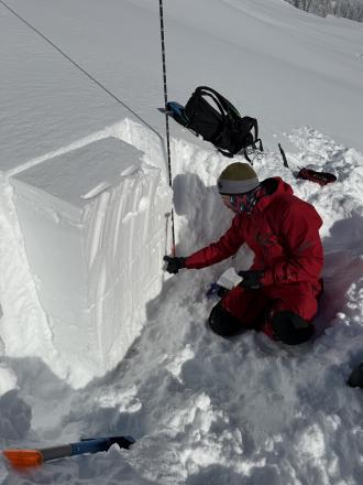
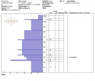
We dug a pit on a southerly aspect of Mount Nemesis, near the hut around 8000.’ We noted the complex layering, including a weak layer about 20” down that failed on the 23rd shovel hit. 

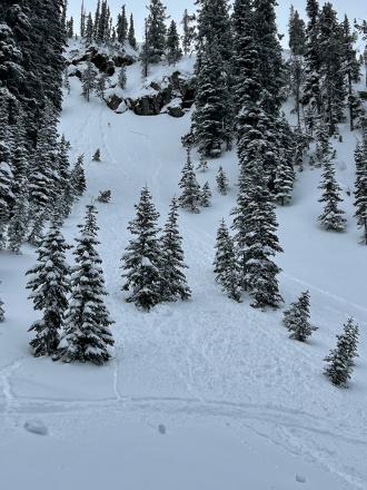
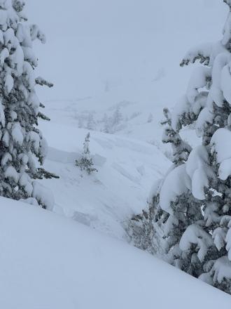
On Sunday morning the sun broke through for a bit and allowed us to view the widespread avalanche cycle that occurred overnight on all aspects. Across the creek, we saw a large crown (approx 3’ in depth) in the meadows. 

An avalanche that occurred on Nemesis’s south face ran from mid mountain all the way into Hellroaring Creek, running over our old skinner. 
 

The natural slides on Nemesis’s north face were some of the biggest we have seen in any slide, knocking out a lot of trees towards the bottom.  

Full Snow Observation Report
A. Dunn
Island Park
Hellroaring Creek
Hellroaring Creek Avalanche Cycle
Snow Obsdrvation includes images

Toured into the hellroaring creek 3/15-3/19. Snowing and blowing hard on 3/15 till approx 1500 hrs when wind veered to the north and skies cleared for the rest of the trip with generally cold temps and light winds. Solar aspects heating up in the day with extensive sun crusting on steeper slopes facing the south half of the compass. Observed aftermath of extensive avy cycle(s) one of which prior party reported occurred approx 3/10-11 at higher elevations on Nemesis (above 8000 ft.). And another on lower elevation steep slopes above creek at approx 7500 ft that may have ran during the storm on 3/14 as less snow covered that debris than the higher elev runouts. Everything observed were on westerly aspects and deep slab avalanches breaking approx 90-120 cm down. We did not investigate the weak layer. Suspect it to be the crust facet combo observed by a previous party in early March. Heavy wet snow possibly mixed with rain on 3/14-15 likely tipped the scales for these lower elevation slopes below 7500. No signs of instability of the new storm/wind slab during the five day trip, however we did get a few large collapses but these were isolated to heavily wind loaded areas in more exposed terrain. No other natural or human triggered avalanches observed during the trip. Many machiners were out testing steep slopes after the storm and we saw no signs of any human triggered avalanches. We did not measure height of snow but judging by the buried hut and the non-motorized boundary signs barely poking out of the snow, thinking about 10 feet deep at 8000 ft.

Full Snow Observation Report
GNFAC
Island Park
Sawtelle Peak
Many natural avalanches in Island Park
Snow Obsdrvation includes images
Snow Obs contain video

From the FAA road up Sawtelle Peak outside Island Park we were able to see many crown lines and debris piles from the last 2 days of Avalanche Warnings. Most avalanches involved new snow, but there was 1 deep avalanche on Mt. Jefferson's east face that was large (D3). The FAA did avalanche control and an avalauncher round triggered a small, but deep slide (2-5' deep) and a larger explosive on another slope yielded no results. We saw 8 backcountry avalanches from the road. These were east and north facing, the only aspects available for viewing.

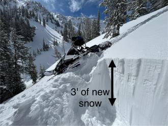
The snowfall totaled 3' and it will take a few days for the snowpack to become more stable. In the meantime, be patient and stay off of steep slopes.

Full Snow Observation Report
GNFAC
Island Park
Centennials - Idaho
Frozen Cow Tag Conditions Check
Snow Obsdrvation includes images
Snow Obs contain video

Heavy snow and strong winds are creating dangerous avalanche conditions. The snow is letting up and the sun will poke out this weekend, but the snowpack needs time to stabilize. If the wind continues, loading from drifting is equivalent to loading from new snow. We observed shooting cracks where snow on top of a rain crust 6-12" deep was sliding easily on steep rolls. 

Steer clear of steep slopes, especially those loaded by wind drifts and avoid gullies with walls over 30 degrees. Opt instead for meadows and tree riding under 30 degrees where the snow is deep, and you'll be safe from avalanches. 

Full Snow Observation Report
Anonymous
Island Park
Hellroaring Creek
Hellroaring Observations

My group and I spent March 5th - 8th in the Hellroaring Creek drainage on the SW side of the Centennials. We were right on the heels of the 13ish day long storm in the Island Park area. From what we gathered, the snowpack was handling the loading very well. We saw no natural avalanches. Pits dug on shady aspects were around 250cms deep and had few noticeable weak layers and no reactivity during testing. Pits on South and West aspects were about 200cms deep and had a thin pencil hardness crust (melt/freeze I believe) ranging from 115-140cms above ground. This crust had facets around it and was reactive in column tests but showed now propagation in the ECTs.

Full Snow Observation Report
GNFAC
Lionhead Range
Airplane Bowl
Many naturals and 1 human triggered slide
Snow Obsdrvation includes images
Snow Obs contain video

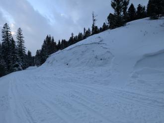
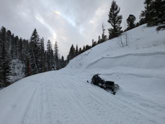
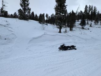
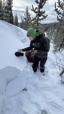
We saw 6 natural avalanches on our ride in Lionhead. They all involved snow in the last week or two. On our exit we ran into who a group that witnessed a sledder triggering this slope. It was about 3 feet deep and was clearly wind loaded. Luckily he was not caught. When folks are triggering slides we know other slopes are also unstable. Be careful out there!
Full Snow Observation Report
B. Rasmussen
Island Park
Centennials - Idaho
Deeper every day

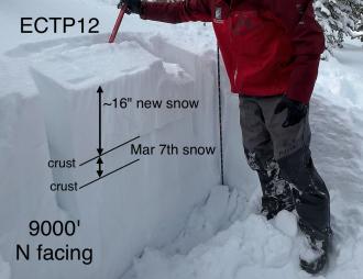
The combination of wind and storm snow has created potentially hazardous conditions at mid and high elevations, be extra cautious on wind loaded slopes and wary of any slope steeper than 30 degrees whether it is wind loaded or not. We have seen in excess of 3 feet of new snow in the Centennial Mountain range during the last week alone, without any break for the newly loaded slopes to stabilize. The PWL's deeper in the snowpack are largely dormant but could still be triggered in the shallower areas. Or a large loose snow avalanche could step down to the deeply buried PWL's. With the new round of snow expected during the next 48 hours, things could get a little dicey. 

Over 20 inches of new snow has collected during the previous 4 days. Additionally we have accumulated new snow during 12 of the last 13 days.

Upwards of 20 inches of snow is available for transport. Light winds can move a large amount of snow. More snow is scheduled for most days of the next week.

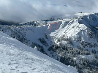
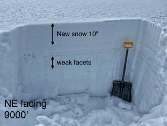
I only found one avalanche during today's tour, but our route was cut short just when we were going into the best terrain for avalanche activity because the travelling conditions became so difficult. NE aspect at 9000', crown broke about 3' deep immediately under the cornice. R2 D1 naturally triggered likely early morning of 3 March.

I saw some failures with my CT, but the extended column test scored an ECTX. The storm snow from the previous 48 hours has become my biggest concern with plenty of snow available for transport. Many large and deep soft wind drifts were encountered throughout the day.

My biggest concern is in the additional weight added to the snowpack incrementally most days during the last two weeks. With the available snow for transport and heavily wind loaded slopes our mountain terrain has become very hazardous on any slope steeper than 30 degrees. 

All terrain above 30 degrees has been closed. We stayed on shallow slopes the whole day and were very aware of surroundings at all times. This is not the time to explore unknown terrain only to find yourself in a dangerous situation.

Full Snow Observation Report
GNFAC
Lionhead Range
Ski Hill
Future wind-loading will be a problem
Snow Obs contain video

We rode to Ski Hill and dug. HS was 230cm and the top 60 cm was from last week. the top 25 cm was F hardness powder. No wind when we were there. We got an  ECTX. We then rode to the old weather station at 8700' and had HS 210 cm. Same layering but got ECTP20 about 65 cm down at the interface of the old snow surface and this weeks deposit. I looked with a hand lens and did not find facets, just a density change. But with the top foot being F powder it would not take much to build drifts that would slide

We also saw one small slide on the drive on a roadcut a Fawn Pass that looked to be 1.5' deep and 50' wide, soft slab

Full Snow Observation Report
High Mtn Adv
Lionhead Range
Two Top
Sledder triggered slide, Two Top

From FB: Had some tourists in the shop trigger an avalanche on two top yesterday. Didn't get exactly where or much details. Steep tracked up slope they set off. Just a partial sled burial.

Full Snow Observation Report
GNFAC
Island Park
Mt Jefferson Bowl
Remotely triggered an avalanche, Mt. Jefferson
Snow Obsdrvation includes images
Snow Obs contain video

We rode up Yale Creek and into Mt Jefferson Bowl. Walking to the edge we triggered an avalanche (intentional) on a slope that was getting wind-loaded. It broke up to 1.5 feet deep, 250 feet wide and 50 feet vertical. The new wind drifts were sensitive to triggering and the slabs propagated wide. Weak layers at the old snow surface may have helped us remotely trigger the slope. The two things to look out for in the Centennials are weak layer of sugary snow or feathery surface hoar in the upper 3 feet of the snowpack and slopes that are freshly wind-loaded.

Full Snow Observation Report
GNFAC
Island Park
Yale Creek
Finding weak layers in Island Park
Snow Obsdrvation includes images
Snow Obs contain video

We rode up Yale Creek to across from Arange Peak, then back into Yale Creek. We dug 3 snowpits looking for weak layers and found them a foot or two under the surface. Feathery surface hoar mixed with small, sugary facets were found in all. This layer was not propagating in our tests, but we know that nearby in Lionhead they avalanched. We are not completely trusting of these layers, especially at higher elevations where wind drifts would be adding even more weight to these layers.

Full Snow Observation Report
GNFAC
Lionhead Range
Lionhead Ridge
Avalanches and remote trigger
Snow Obsdrvation includes images
Snow Obs contain video

As we rode into Lionhead we saw many slides that either ran naturally or from cornice falls. Most of the slides happened Fri or Sat. Winds are blowing strong at all aspects and elevations. Slopes are being loaded further and we triggered a small slide (video) from 50 feet away (aka remotely triggered). This is a serious sign of instability and we were careful to not get on or underneath avalanche terrain.

Full Snow Observation Report
K. Allred
Island Park
Two Top
Winter storm warning
Observation Date:

January 26, 2023 - January 26, 2023 

Submitted:

January 27, 2023 

Observer:

RRS - Kevin Allred 

Zone or Region:

Island Park 

Location:

Mount Two Top (NNE 7680')

Signs of Unstable Snow

Recent Avalanches? 

 None Observed 

Cracking? 

 None Experienced 

Collapsing? 

 None Experienced 

We Traveled to the Two Top area. Due to low visibility and new drifting snow Our snow pit location was in a lower tree covered elevation. We observed a surprisingly strong snowpack void of the obvious buried SH layers we found higher. With new snow available for transport and strong SW winds we observed wind loading on NNE aspects in the area. 

Snow Stability

Stability Rating: 

Good 

Confidence in Rating: 

 Moderate 

Stability Trend: 

Worsening 

Bottom Line

The Buried SH layers are still present especially in higher elevation open slope areas. With the arrival of new snow, accompanied by strong winds the potential to form a wind slab over a PWL (Buried SH) could have serious consequence to riders in this area.

Advanced Information

Weather Summary

Cloud Cover:

Obscured 

Temperature:

15° 

Wind:

Strong , SW 

New/Recent Snowfall:

1 inch of new snow reported from the previous night. 

Winter storm warning had been issued for the area. 18'' of new snow in higher elevations followed by strong winds. We observed new snow available for transport at all elevations 

Avalanche Observations

Avalanche Observation Comments:

None observed

Snowpack Observations

NNE aspect 7680' HS 175cm CTN

Avalanche Problems

Heightened awareness of increasing avalanche danger with the arrival of this storm.

Terrain Use

Our travel mindset for the day, to not travel in avalanche terrain over 30°.Due to low visibility, blowing and drifting snow our travel plan was impacted and our route was shortened. I learned later of 2 riders in the Keg springs area that dropped into Carrot canyon unable to get out due to a damaged Snowmobile they where rescued by Clark county SAR 03:30 this morning. All where cold tired but SAFE! A big thanks to Clark County SAR A reminder of the dangers of back country travel

Full Snow Observation Report
K. Allred
Island Park
Two Top
Buried Surface Hoar layers near Two Top

Signs of Unstable Snow

Recent Avalanches? 

 None Observed 

Cracking? 

 None Experienced 

Collapsing? 

 None Experienced 

We observed a strong cohesive snowpack on a wind loaded slope NE of Two Top. But we noticed three separate buried SH layers. First 5cm from surface second @ 25cm third @55cm. These buried SH layers tend to be touchy. They are concerning in that the deeper layers rest above and below densely packed wind blown slab.

Three separate layers of Buried SH within the top 100cm of the snow pack. The top layer @5cm from the surface is not worrisome at this time but with added snow in the future it has potential to become a problem layer. The second and third layer @25cm,@55cm,from surface could be human triggered, with the potential of a deadly slab avalanche.

Advanced Information

Weather Summary

Cloud Cover:

Partly Cloudy 

Temperature:

17° 

Wind:

Light , SW 

New/Recent Snowfall:

No resent snow 

Upper elevations mostly sunny the past 2 days.Lower elevations experienced AM fog Light winds. We noticed ridge top blowing snow.

Advanced Information

Weather Summary

Cloud Cover:

Partly Cloudy 

Temperature:

17° 

Wind:

Light , SW 

New/Recent Snowfall:


Avalanche Observations

Avalanche Observation Comments:

Observed several natural avalanches on NE ridge at Two Top below cornice in steep wind loaded terrain

Snowpack Observations

NNE aspect 8186ft, 44.62319,-111.24732, HS230,PWL buried SH@ 5cm,25cm,55cm from surface. First test, CTMsc@55 second test CTMsc@25. ECTN27@25 

layer of SH,@ 55cm below surface

Layer Depth/Date: Jan.22,2023  
Weak Layer(s):  Jan 5, 2023 (SH) 
Comments: Buried SH 5,25, 55, CTMsc@55, CTMsc@25 ECTN 27@ 25

Buried layers of SH. These layer's seem to be very widespread throughout the region. They are worrisome in that they could be human triggerd with deadly potential.

Terrain Use

Our travel Plan to avoid any terrain greater than 30°. There are many options in this area to have a challenging ride without exposing the group to avalanche hazard.


Full Snow Observation Report
K. Allred
Island Park
Yale Creek
Test

Observation Details


Observation Date:

January 21, 2023 - January 21, 2023 

Submitted:

January 21, 2023 

Observer:

RRS - Kevin Allred 

Zone or Region:

Island Park 

Location:

Yale Creek (SSW) 

Signs of Unstable Snow

Recent Avalanches? 

 None Observed 

Cracking? 

 None Experienced 

Collapsing? 

 None Experienced 

Found a layer of near surface facets 25 cm from the surface not problematic now but with new snow coming this could become a layer of concern 

Snow Stability

Stability Rating: 

Good 

Confidence in Rating: 

 Moderate 

Stability Trend: 

Steady 

Bottom Line

The snow seems to be very stable found a MF crust 45cm / surface from a warming trend early in January. Below the MF layer a strong cohesive slab. 15cm layer of DH at ground level average grain size of 2 mm 

Advanced Information

Weather Summary

Cloud Cover:

Clear 

Temperature:

17º 

Wind:

Calm , SW 

New/Recent Snowfall:

Trace of new snow past 24 hours 

Mostly clear skies light winds out of the south west no blowing snow 

Avalanche Observations

Avalanche Observation Comments:

None Observed

Snowpack Observations

Head of Yale Creek 8470' elevation SSW aspect HS 175 CTM SC @ 20 cm below surface on a near surface FC. ECTN 

Avalanche Problems

Our primary concern is a layer of SH that is variable in distribution . This layer was not evident in our snow pit location. 

Terrain Use

Our travel plan avoid avalanche terrain over 30° We traveled to observe an avalanche fatality site from 1998. The area had heavily trafficked by snowmobile activity. We remained with our conservative travel plan at 30°

Full Snow Observation Report
B. Rasmussen
Island Park
Centennials - Idaho
buried surface hoar
Snow Obs contain video

We are finding impressively strong snowpack. But we also have a weak layer buried about 2 feet into the snowpack that is very worrisome. It's deep enough that when triggered will be deadly, consider consequences and know where the persistent weak layer is before exposing your group. We have been on the snow all week and find lots of powder to play in without using slopes and connected terrain that is greater than 30 degrees.

SE aspect, 7640 ft, HS 130, PWL buried SH 83, DH 45, CTHsc@83, ECTN23@45. 

This PWL is widespread, but not necessarily reactive in all areas. We did feel a collapse on this same aspect and elevation yesterday, near Sawtelle Creek so we went back to test and found some results. 

Full Snow Observation Report
B. Rasmussen
Island Park
Sawtelle Peak
Whumpf near Sawtelle Peak

I dug one pit at 8200’ NE aspect in Yale ECTX. Kevin was a little lower and around on the east side of Sawtell, he felt a big wumph. He didn’t confirm what layer, but this is probably your buried SH.

Full Snow Observation Report
Anonymous
Lionhead Range
Two Top
Small avalanche off Two top, west Yellowstone
Snow Obsdrvation includes images

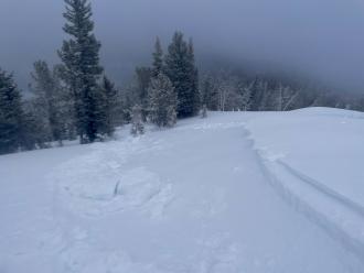
Small avalanche broke while descending to less exposed areas.  Approximately 80 yards wide, 18” deep.  Slid for approximately 90 yards from crown.

Full Snow Observation Report
GNFAC
Lionhead Range
LIONHEAD AREA
Natural and sledder triggered slides, Lionhead
Snow Obsdrvation includes images
Snow Obs contain video

Dave and Doug rode around and saw multiple natural and 1 sledder triggered slide on Lionhead. Some were thin and just involved news snow and others were deeper and broke on the buried surface hoar layer.

Full Snow Observation Report

Relevant Photos

Displaying 1 - 40
  • From email: “These pics are from last June 10-11, after the pass reopened on Friday. I was skiing the Gardner headwall at 5:30, solo, when this monster released. Yah. The initial cornice collapse triggered and entrained a secondary slab of varying thickness whose crown is seen in one of the photos.”

  • From obs 5/7/23: "Natural R3-4, D4 ripped out a large chunk of the south face of Wilson during the last warm period I would assume. Debris everywhere and one large boat-sized pile even scoured a path further down than the rest of the debris. Looked to be a mix of wet loose and wet slab release from high up. Alpha angle at the bottom of the debris was 25 degrees" Photo: C. Ellingson

  • Give Big Gallatin Valley is May 4-5. The Friends of the Avalanche Center are participating again this year and thank you for your support. Between 6pm on May 4 through 6pm on May 5 you can support your favorite local non-profits. Donate Here.

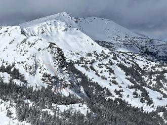
  • Photo from IG 4/13/23: @waxeman Slide probably occurred last weekend 4/8-4/11?

  • From obs. 4/7/23: "I went through the area of Three Rivers Peak yesterday, and there had been a pretty nice cycle of large slides recently. One on the east face of Three Rivers broke 6-800’ wide 2-10’+ deep, and ran full track. It only had a couple inches of snow on it, so I think it ran sometime during the recent warm days. Some of the walls along the slide were over 20’ high, and I imagine the debris pile might make it through the summer. I also observed a couple older slides on E\NE aspects that were older, but not a whole lot smaller." Photo: S. Reinsel

  • From obs. 4/7/23: "I went through the area of Three Rivers Peak yesterday, and there had been a pretty nice cycle of large slides recently. One on the east face of Three Rivers broke 6-800’ wide 2-10’+ deep, and ran full track. It only had a couple inches of snow on it, so I think it ran sometime during the recent warm days. Some of the walls along the slide were over 20’ high, and I imagine the debris pile might make it through the summer. I also observed a couple older slides on E\NE aspects that were older, but not a whole lot smaller." Photo: S. Reinsel

  • From obs. 4/7/23: "I went through the area of Three Rivers Peak yesterday, and there had been a pretty nice cycle of large slides recently. One on the east face of Three Rivers broke 6-800’ wide 2-10’+ deep, and ran full track. It only had a couple inches of snow on it, so I think it ran sometime during the recent warm days. Some of the walls along the slide were over 20’ high, and I imagine the debris pile might make it through the summer. I also observed a couple older slides on E\NE aspects that were older, but not a whole lot smaller." Photo: S. Reinsel

  • From obs: "On Sunday morning, the sun broke through for a bit and allowed us to view the widespread avalanche cycle that occurred overnight on all aspects. Across the creek, we saw a large crown (approx 3’ in depth) in the meadows. 

    An avalanche that occurred on Nemesis’s south face ran from mid-mountain all the way into Hellroaring Creek, running over our old skin track." Photo: Eric and Melissa

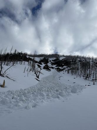
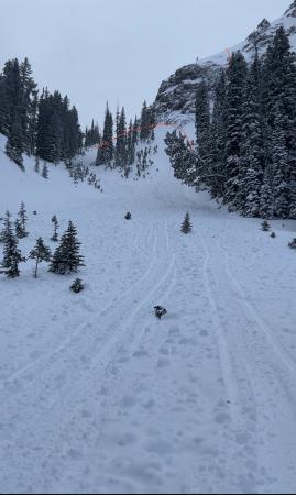
  • Skiers in the Hellroaring Creek area of the Centennials got a good view of the aftermath of an avalanche warning on March 14 and 15. They saw many avalanches that broke 3-5 feet deep. Photo: A. Dunn

  • Skiers in the Hellroaring Creek area of the Centennials got a good view of the aftermath of an avalanche warning on March 14 and 15. They saw many avalanches that broke 3-5 feet deep. Photo: A. Dunn

  • Skiers in the Hellroaring Creek area of the Centennials got a good view of the aftermath of an avalanche warning on March 14 and 15. They saw many avalanches that broke 3-5 feet deep. This is one of many west-facing steep slopes above the creek that ran. Photo: A. Dunn

  • Skiers in the Hellroaring Creek area of the Centennials got a good view of the aftermath of an avalanche warning on March 14 and 15. They saw many avalanches that broke 3-5 feet deep. This is one of many west-facing steep slopes above the creek that ran. Photo: A. Dunn

  • Skiers in the Hellroaring Creek area of the Centennials got a good view of the aftermath of an avalanche warning on March 14 and 15. They saw many avalanches that broke 3-5 feet deep. Photo: A. Dunn

  • Skiers in the Hellroaring Creek area of the Centennials got a good view of the aftermath of an avalanche warning on March 14 and 15. They saw many avalanches that broke 3-5 feet deep. Photo: A. Dunn

  • Skiers in the Hellroaring Creek area of the Centennials got a good view of the aftermath of an avalanche warning on March 14 and 15. They saw many avalanches that broke 3-5 feet deep. Photo: A. Dunn

  • Snow bikers saw the debris and crown of a large avalanche that broke on a heavily wind-loaded slope on Mt Jefferson in the Centennial Mountains. Look to the upper left of the photo to see what they estimated as a 6' deep crown. Photo: R. Gravatt 

  • From the FAA road up Sawtelle Peak outside Island Park we were able to see many crown lines and debris piles from the last 2 days of Avalanche Warnings. Most avalanches involved new snow, but there was 1 deep avalanche on Mt. Jefferson's east face that was large (D3). The FAA did avalanche control and an avalauncher round triggered a small, but deep slide (2-5' deep) and a larger explosive on another slope yielded no results. We saw 8 separate avalanches from the road. These were east and north facing, the only aspects available for viewing.

    The snowfall totaled 3' and it will take a few days for the snowpack to become more stable. In the meantime, be patient and stay off of steep slopes.

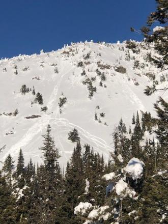
  • Riders observed many natural avalanches at Lionhead. Photo: A Steckmest

  • Riders observed many natural avalanches at Lionhead. Photo: A Steckmest

  • Riders observed many natural avalanches at Lionhead. Photo: A Steckmest

  • Riders observed many natural avalanches at Lionhead. Photo: A Steckmest

  • Riders observed many natural avalanches at Lionhead. Photo: A Steckmest

  • Riders observed many natural avalanches at Lionhead. Photo: A Steckmest

  • Riders observed many natural avalanches at Lionhead. Photo: A Steckmest

  • From IG message: "3 different slides lionhead area. One was very big the run out was 20 feet tall and quarter mile long" Photo: T. Urell

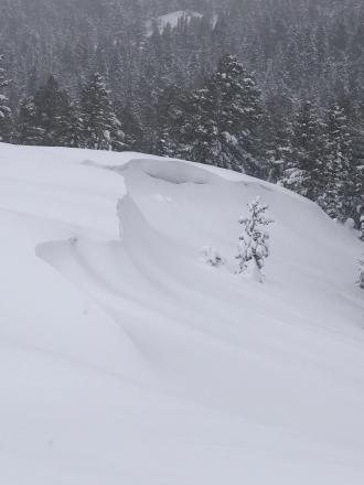
  • On Buck Ridge today (3/5/23) we found fresh, unstable drifts. This fresh slab was 4-6" deep. Cracking like this is a sign that wind slabs will avalanche on steeper slopes. Photo: GNFAC

  • Skier triggered deep slab avalanche on NE face of Hyalite Peak 3/4/23.

  • A rider observed recent avalanches on wind-loaded slopes near Lionhead on 2/25/23. Photo: K. Allred

  • Dave Zinn measures snow water equivalent to see how much weight was added to the snowpack from the recent storm in Island Park. Photo: GNFAC

  • We rode down a narrow gully to get into the head of Yale Creek in Island Park. We descended one at a time, just in case our assessment was wrong. There was older debris in the gully. Photo: GNFAC

  • Surface hoar can often be seen as a grey stripe on the wall of your snowpit as was the case at Bacon Rind in the Southern Madison Range on 1/23. Photo: GNFAC

  • Small avalanche broke while descending to less exposed areas.  Approximately 80 yards wide, 18” deep.  Slid for approximately 90 yards from crown. 
     

  • Small avalanche broke while descending to less exposed areas.  Approximately 80 yards wide, 18” deep.  Slid for approximately 90 yards from crown. 

  • Small avalanche broke while descending to less exposed areas.  Approximately 80 yards wide, 18” deep.  Slid for approximately 90 yards from crown. 


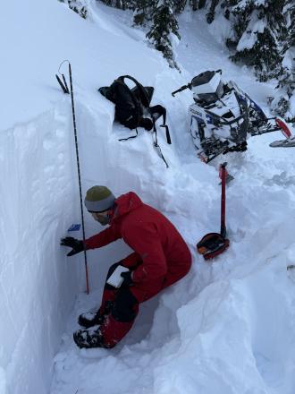
  • Digging a pit near East Hotel Creek in Island Park where we found a layer of surface hoar buried two feet deep. Photo: GNFAC

  • On a Jan. 16 tour into Beehive, we found the concerning layer of feathery surface hoar buried under 6" of snow. It is widespread from Big Sky through West Yellowstone and Cooke City. It has produced avalanches near Hebgen Lake, with more snow, it will likely produce avalanches in Beehive too. Photo: GNFAC

Videos- Island Park