Snow Observations List
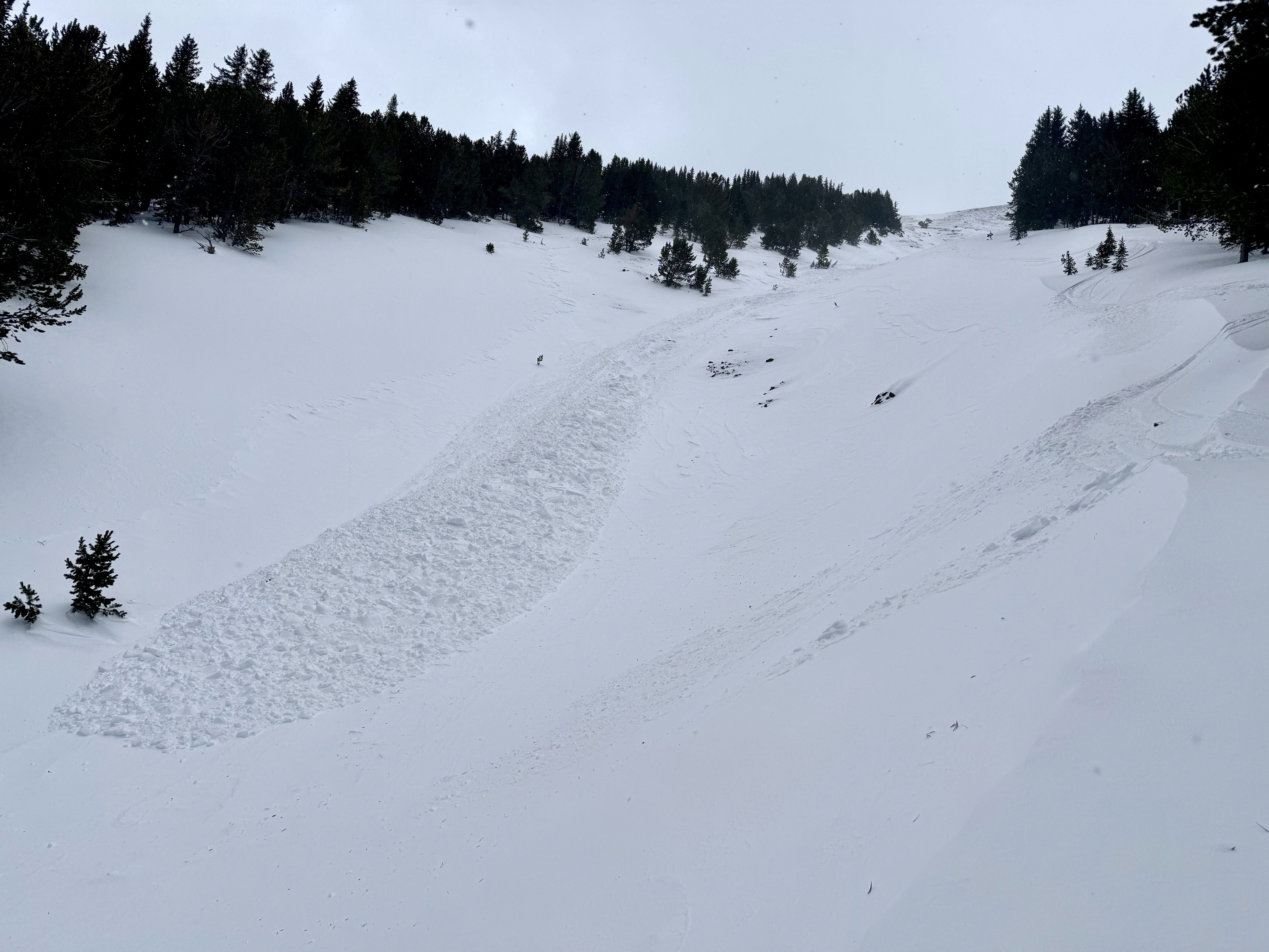
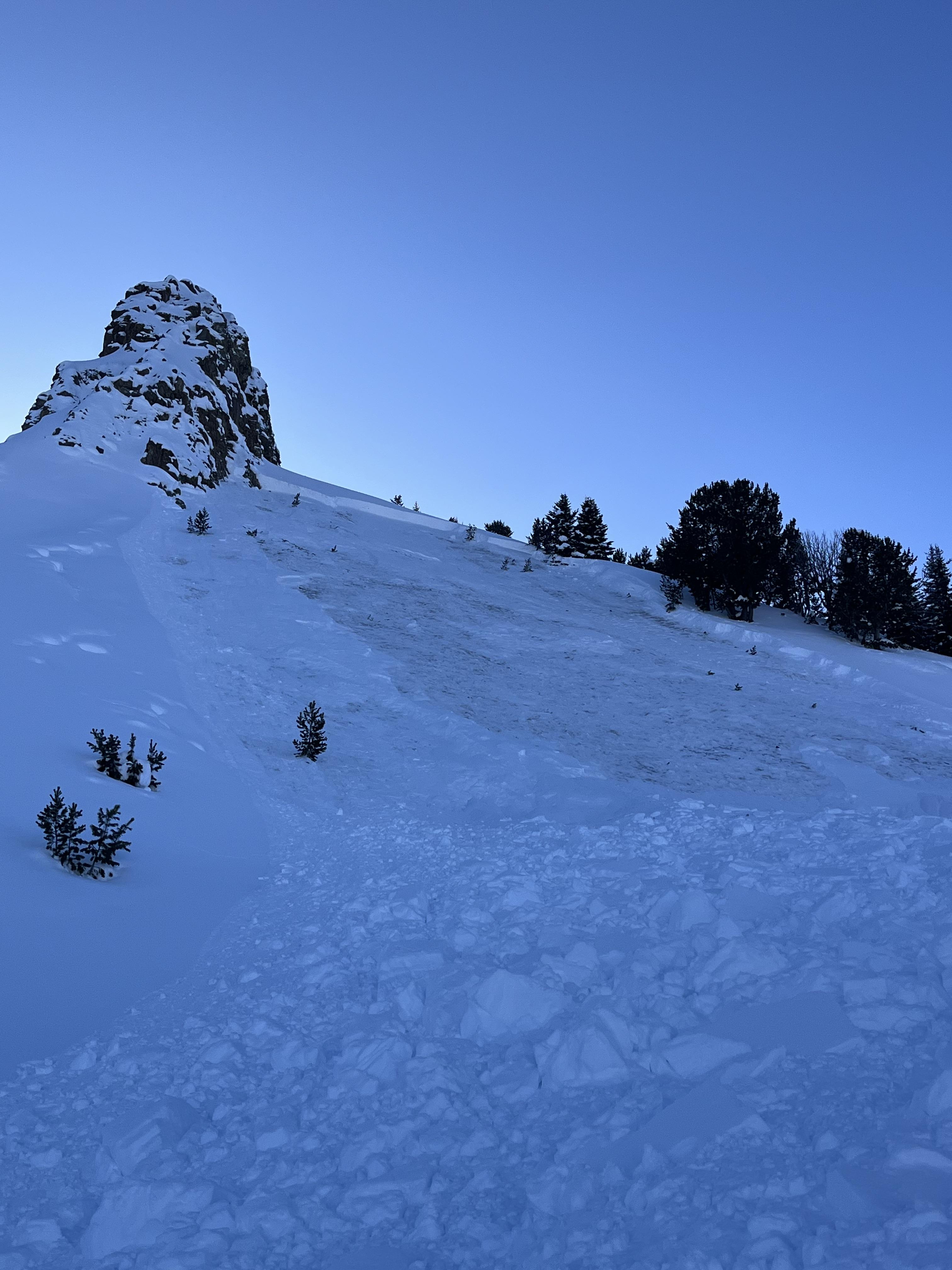
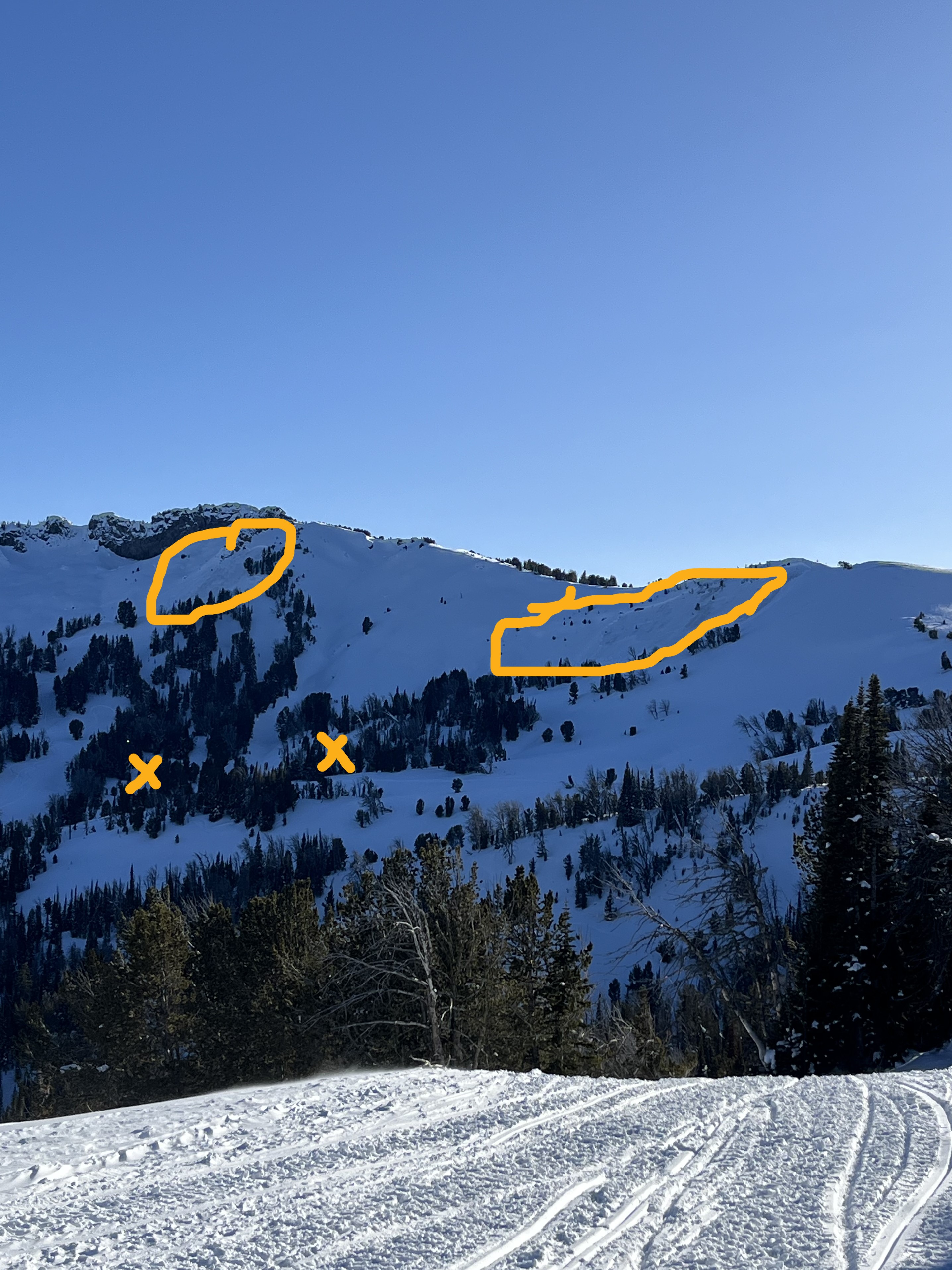
I was skiing inbound at Bridger Bowl today and noticed a small wind slab avalanche that failed on quarter saddle. I estimate comparing the photo to Google Earth that the slide ran 250 vertical feet and broke 100+ feet wide. Ongoing wind-loading and obvious instability.
Full Snow Observation Report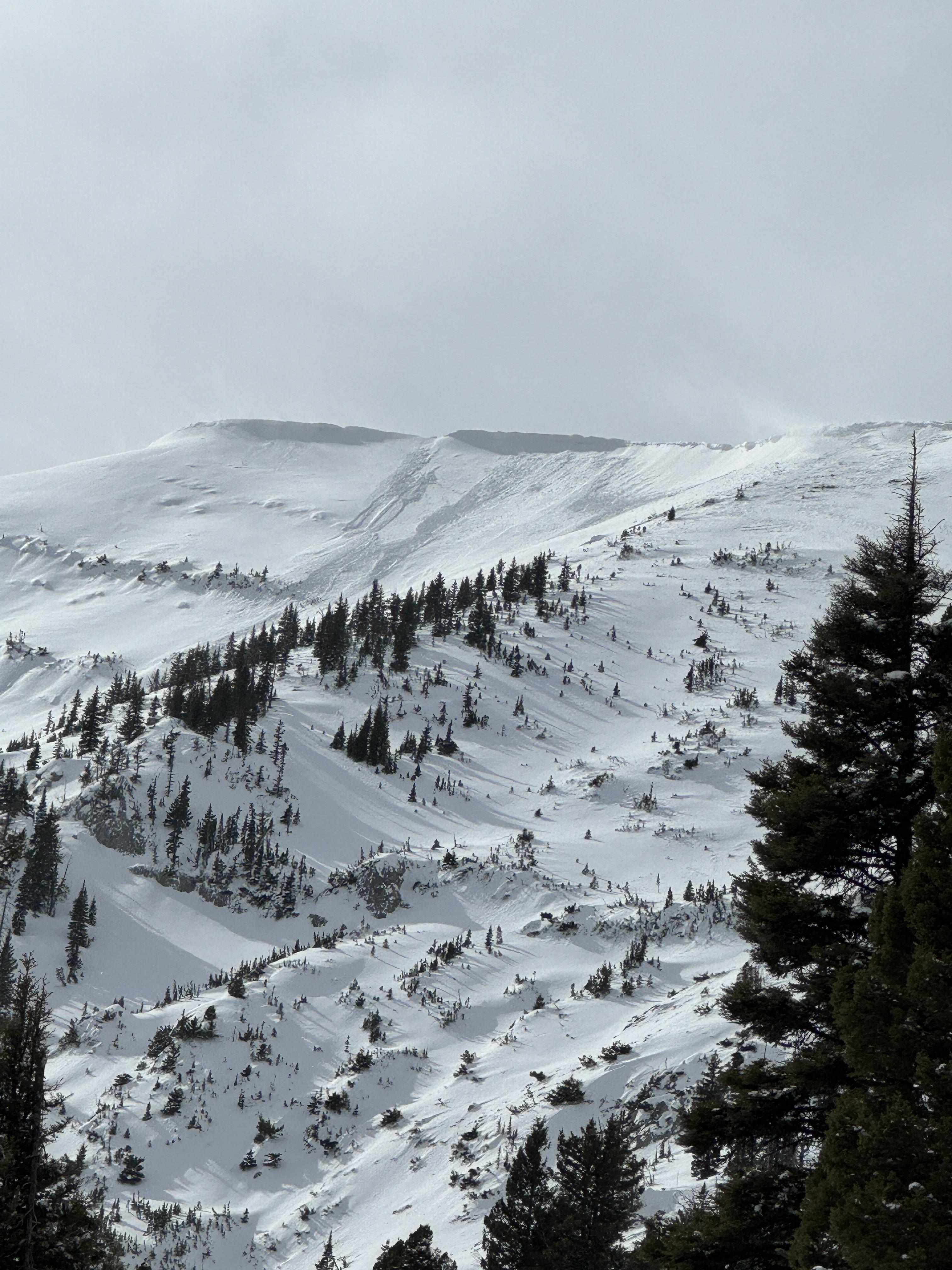
From IG: This avalanche was from this morning (02/28). It was windy and the gully was likely wind-loaded. One video shows the debris and crown. The pin on the map (below) shows the location of the debris.
Full Snow Observation Report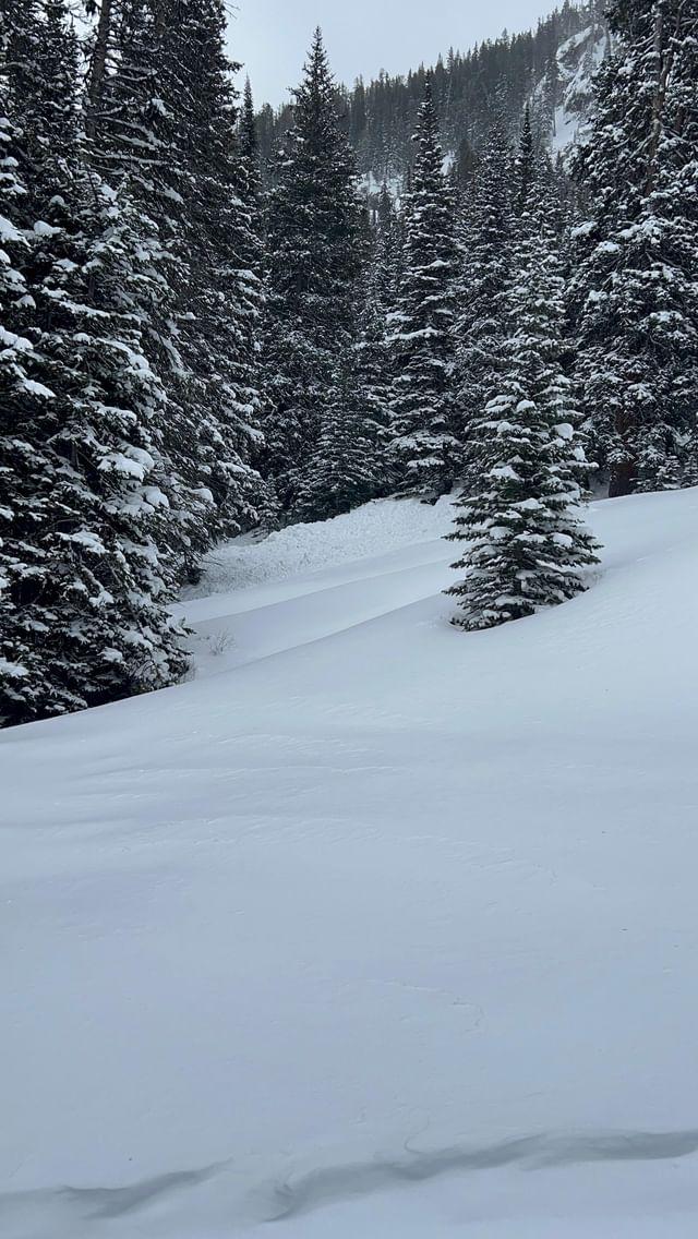

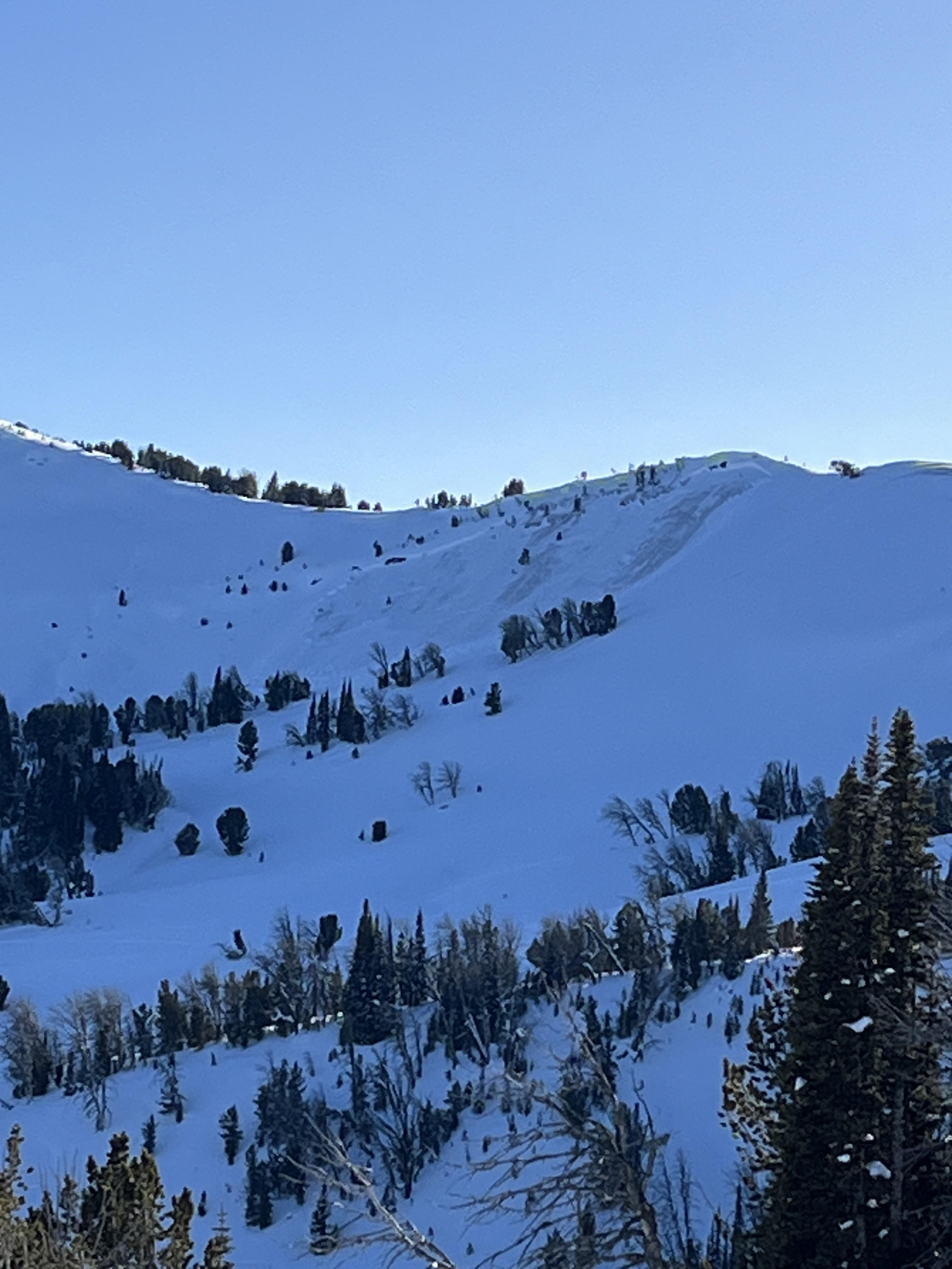
We exited Bridger Bowl ski area via the gate at the top of the Alpine Lift, ascended Bradley's Meadow and The Ramp and dug in one of the Refrigerator Chutes on a NE aspect at ~8000 ft. We found a snowpack that made us pretty hopeful about the direction things are headed in the Bridger Range. Snow depth was 160 cm and we got ECTX results. At least in this location, the weak layers are starting to heal. The early January weak layer was 1Finger hardness. We are not at all confident yet about how widespread this is, but nonetheless, it is nice to see things getting better somewhere.
Winds were calm below the ridgeline, but we could see big plumes transporting in Wolverine Bowl. Yesterday's skin track was completed drifted in in some places.
Around a foot of new snow from the last couple days made for good riding conditions.
Full Snow Observation ReportFelt MODERATE on non-windloaded slopes. CONSIDERABLE appropriate for the windload.

Touring from 6800' - 8800' breakable crust - both directions! Lots of whumphing down low but then none above 84-8600'.
Full Snow Observation ReportFrom email: "We didn't see any avalanches on E Henderson or E Sheep with decent vis on the ride in. One large avalanche on a heavily wind loaded slope below a huge cornice north of Scotch Bonnet. That one looked like it broke deeper/in the old snow, about 100' wide. Also saw one wind slab on a small slope north of Long Lake. 14-16" deep, 20' wide, and within the fresh wind slab. "
Full Snow Observation Report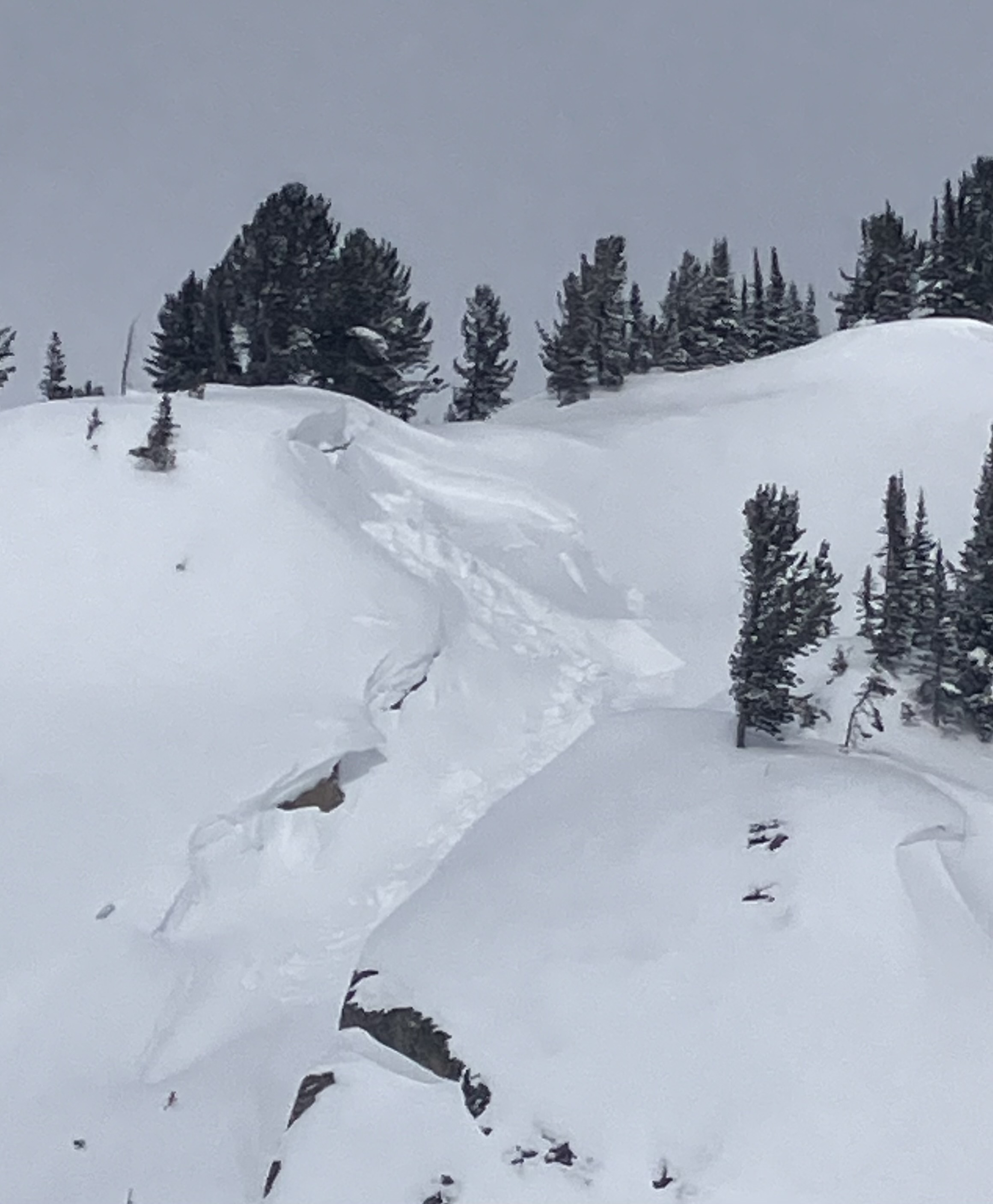
We rode up Taylor Fork around Skyline Ridge towards Cabin Creek. We found 12" of new snow had fallen over the last 24 hours. With poor visibility, we were unable to see any recent avalanche activity except for a small recent avalanche that happened near Beaver Slide. This was right next to a much larger slide that Doug and Ian had seen on 02/14/2024. While riding back we had a good view of the backside of Skyline Ridge above us and again saw no recent avalanche activity. However, many slopes had been stripped by recent winds. Strong winds and a foot of new snow that fell onto a weak snowpack kept us off of and out from underneath steep slopes, and recent snow made for pleasant riding conditions.
Full Snow Observation Report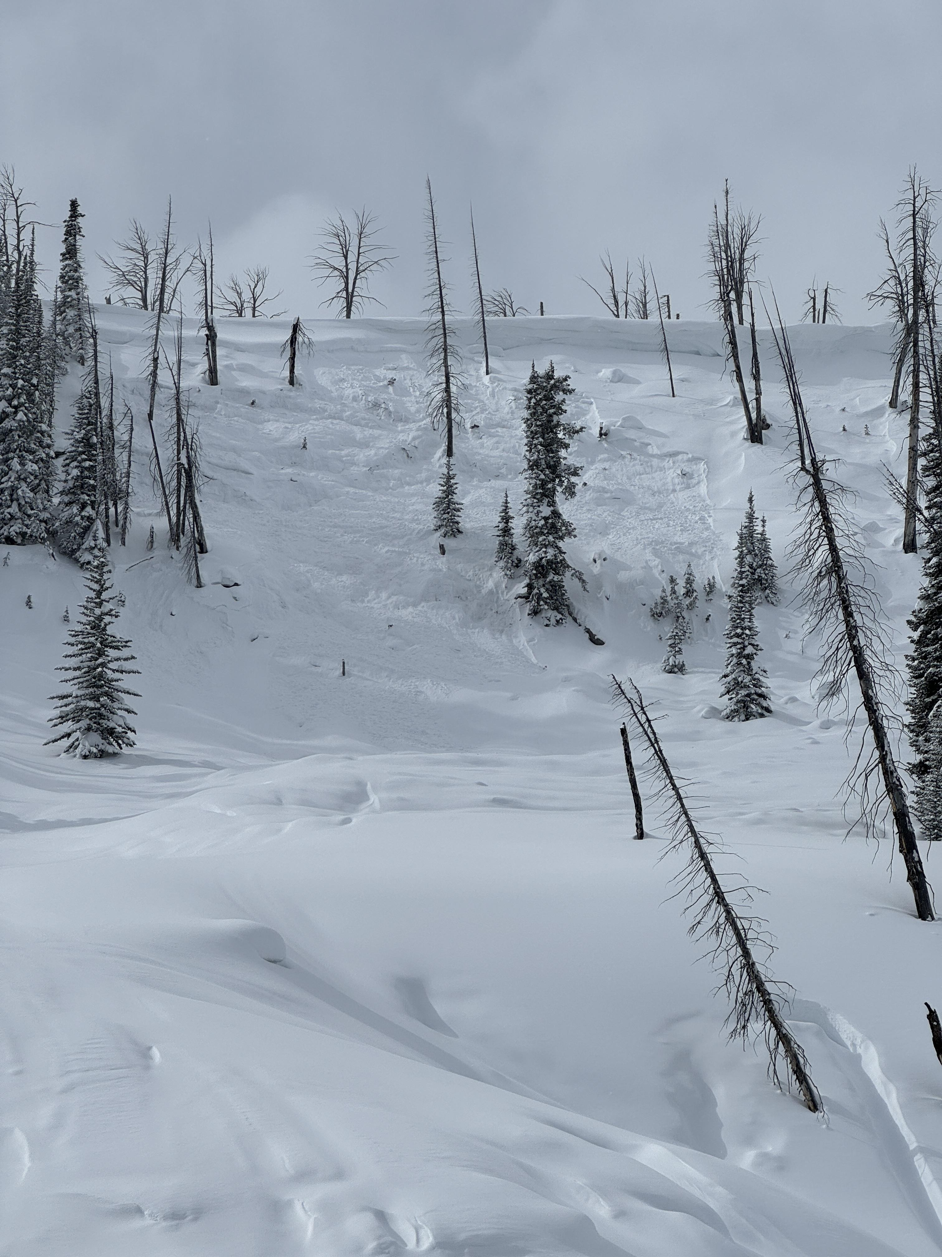

From IG message: “These are on the ridge between Miller Mtn and Sunset Peak on North aspect. All of the North facing ridge of Miller Creek up to Miller Mountain had similar slides too. The crowns filled back in overnight… The North facing ridge on Sheep Mtn slid as well, not sure on the trigger but a rider from another group send the following image of the Sheep slide“
Full Snow Observation Report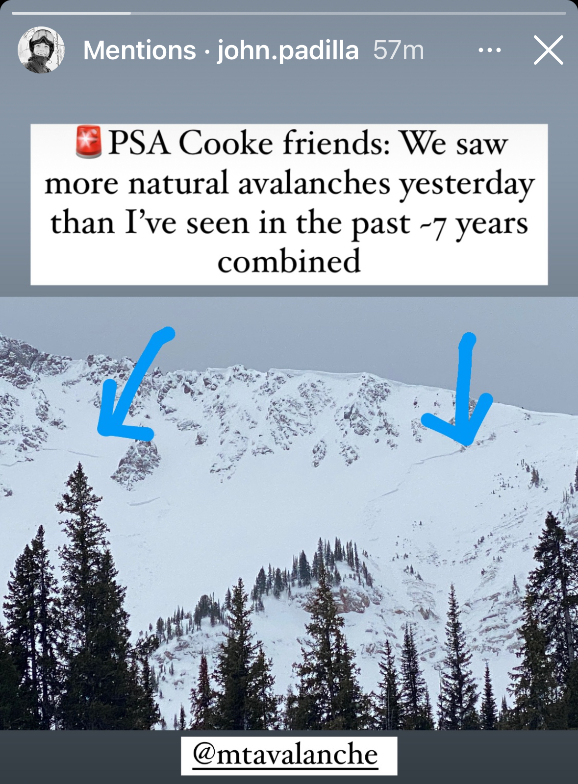
Toured up the west side of Woody via Central Park approach. Moderate to high wind gusts at the ridge line. Skied a couple laps in variable conditions on Sub bowl and then returned to the West aspect for a lap down South Central .
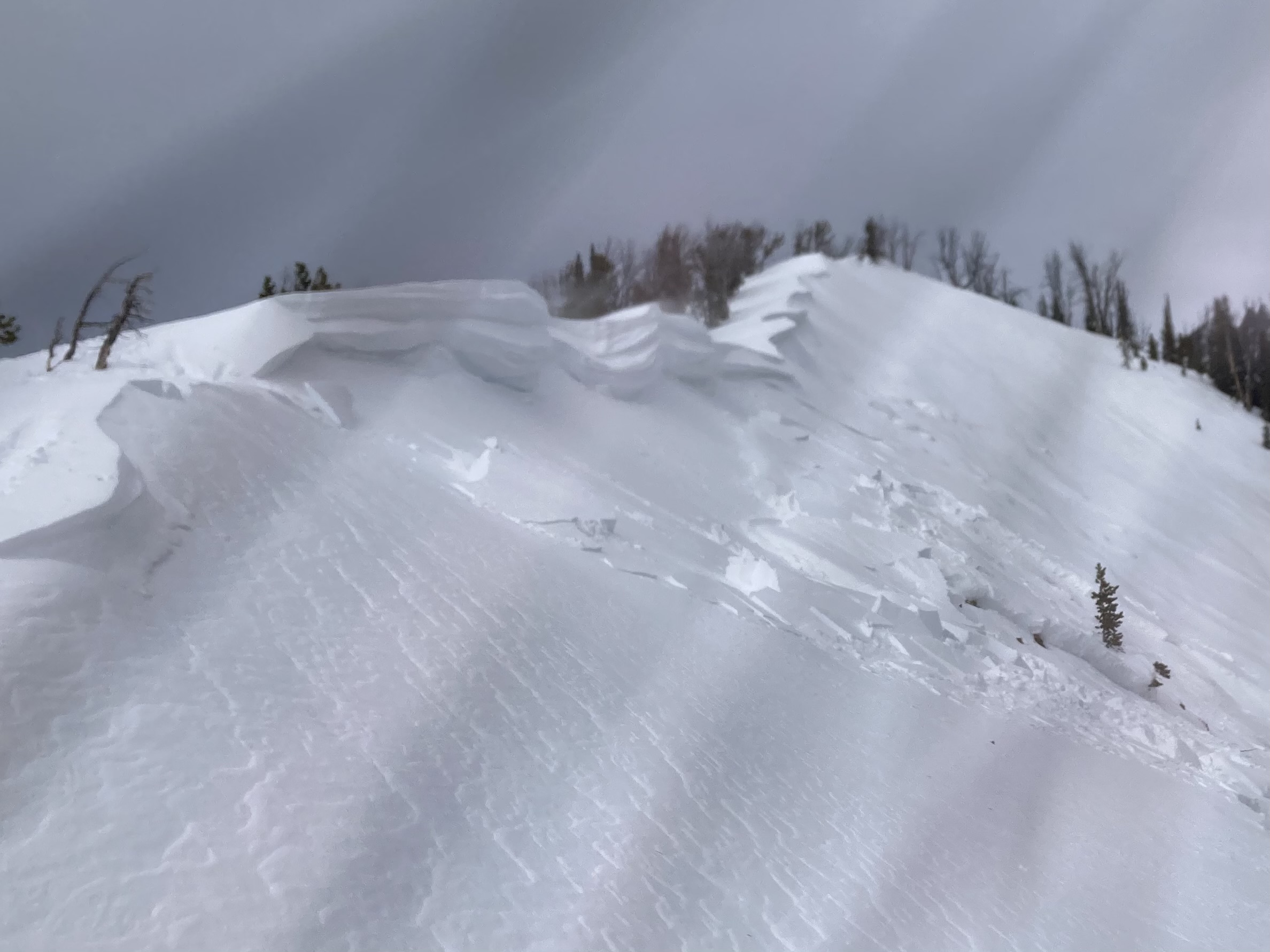
Traversed into the tube at tree-line roughly 9900’ and triggered a small wind slab. Crown was around ~1 foot deep and maybe 40 feet wide. Possibly stepped down a bit once in the tube and then ran for about 300 feet.
HS-AS-D1-R1
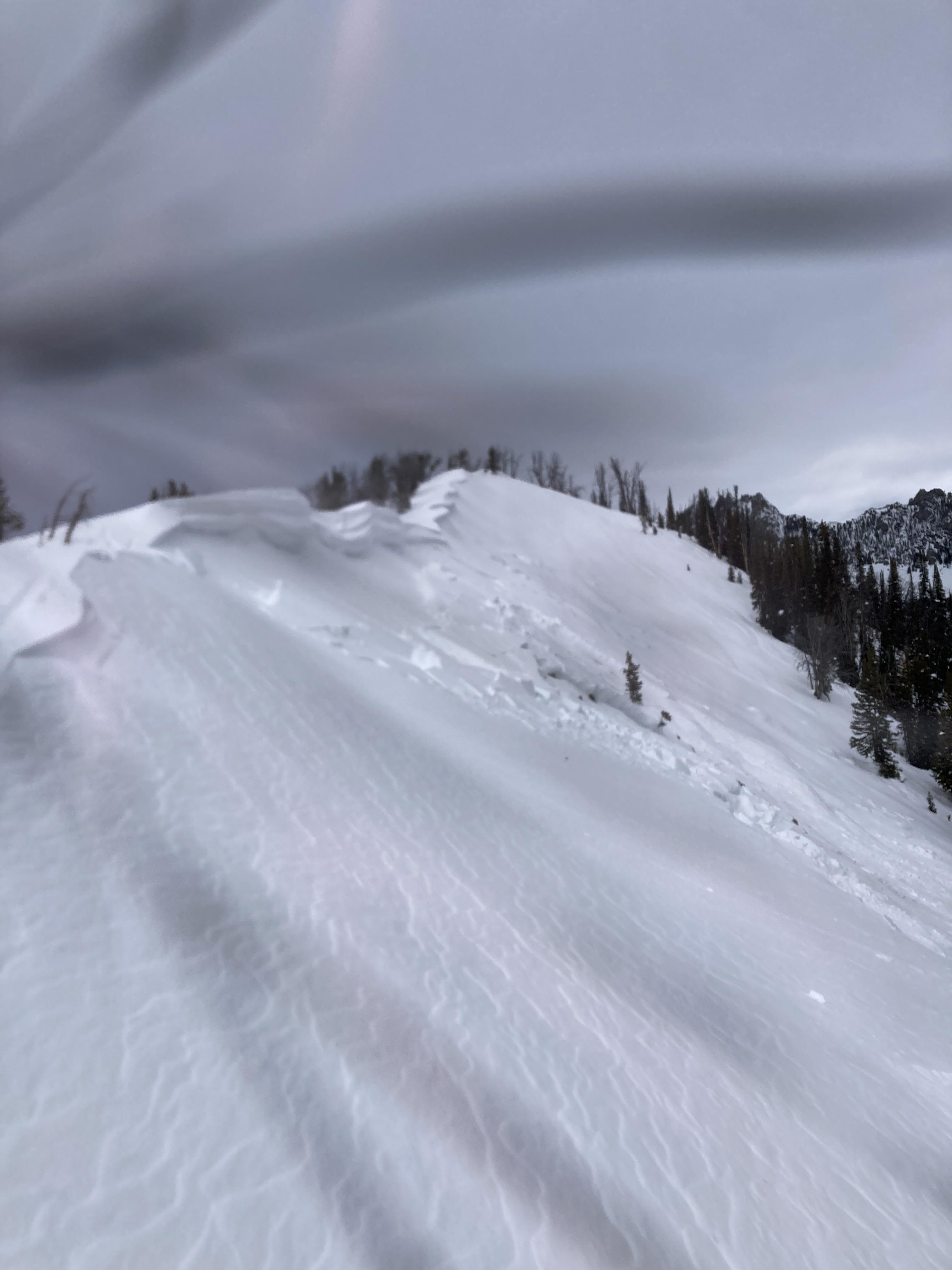
Went up to the prayer flags today. On the ridge about 100yards below the flags I went to the end of the cornice and gave it a stomp. Triggered a windslab that propagated about 50 to the left.
HS-ASc- D1-R1-I
The crown was roughly 1-1.5 ft deep in the most wind loaded area.
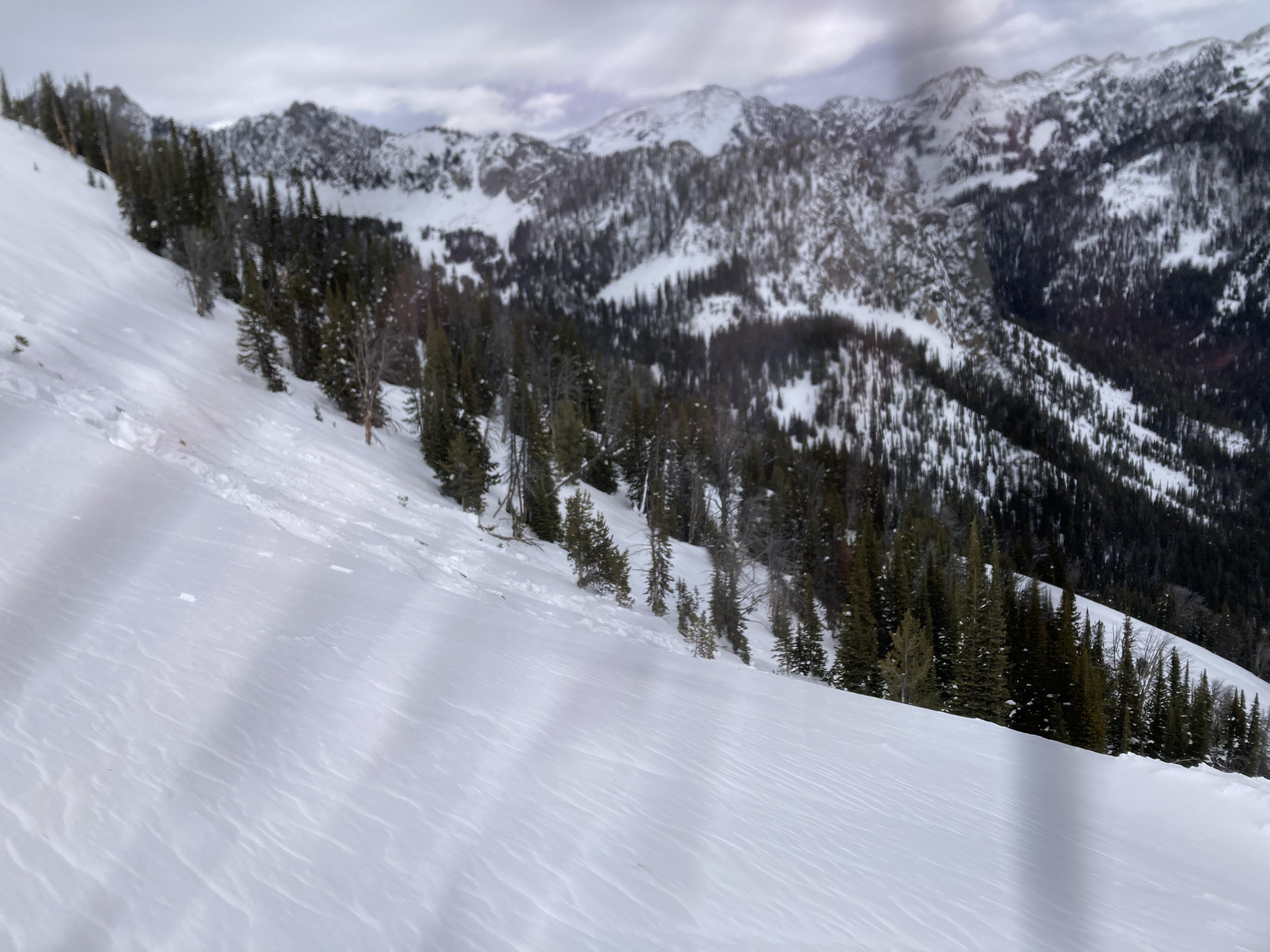
Multiple slides have went on this slope already this year, some running a good distance down through the trees.
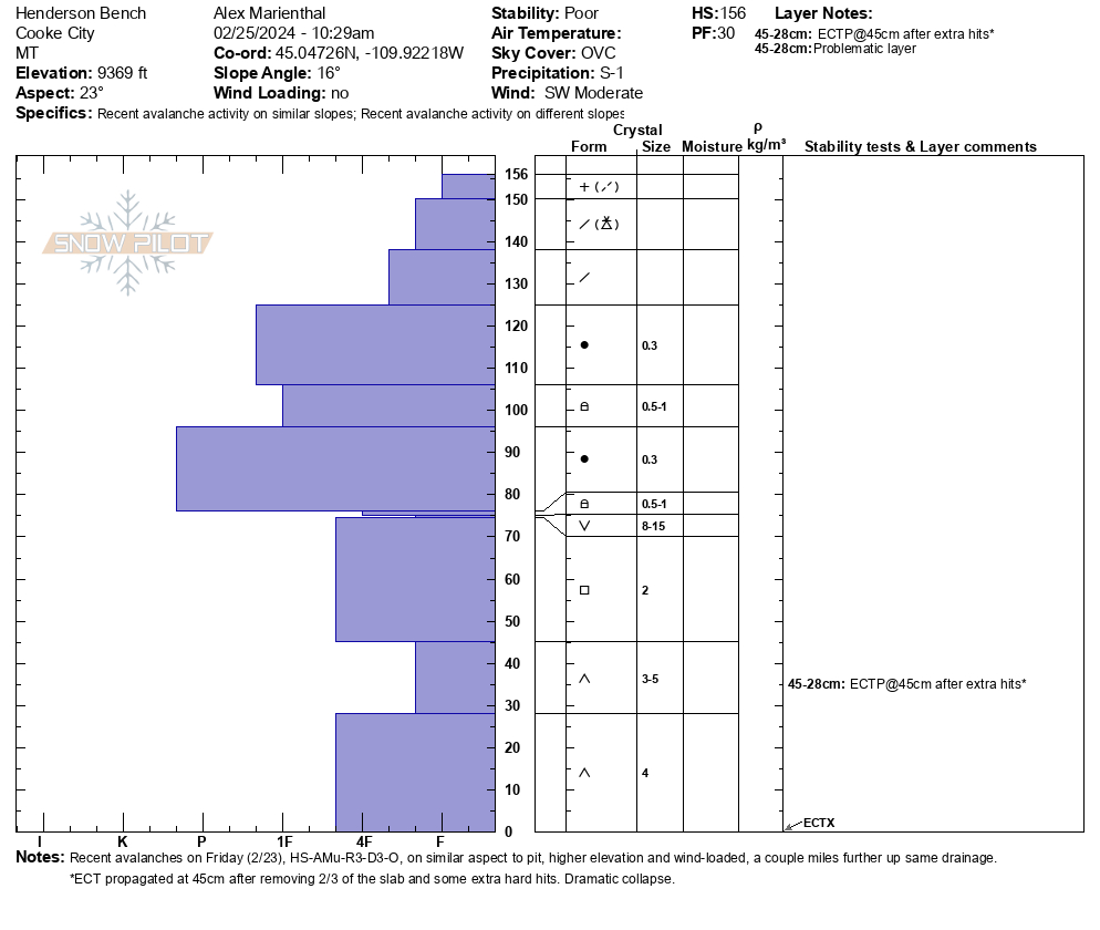
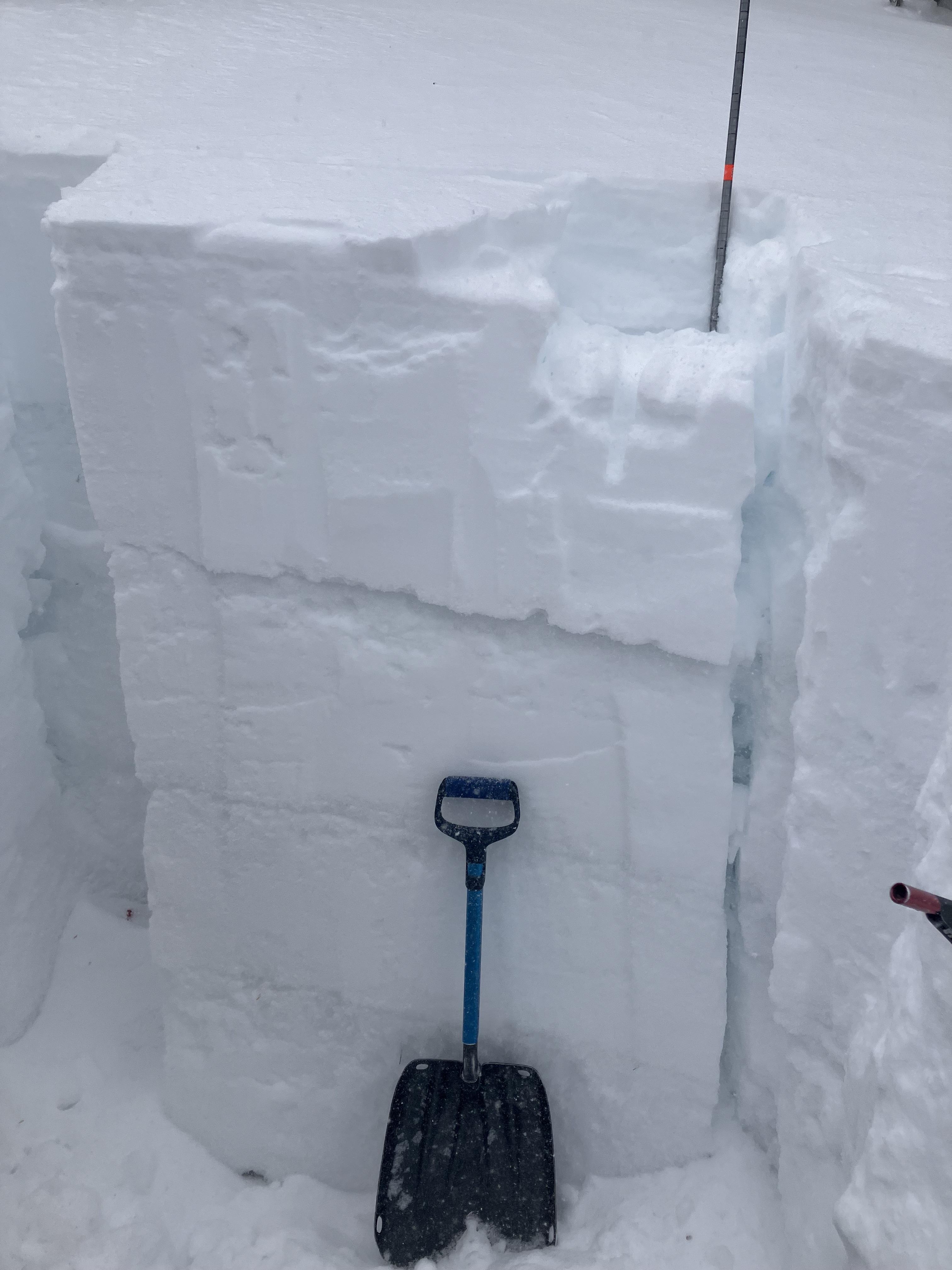
We rode up the road to Henderson Bench and dug on a northeast facing slope at 9,670'. While digging it was clear how poor the snowpack structure was. It was difficult to dig through a 2 foot thick hard slab, but once through the slab I sunk to the ground through 1.5 feet of weak sugary facets. We had an ECTX. After some extra hits, removing 2/3 of the slab, and a few more hard hits, we got a dramatic collapse and propagation. The facets were F+ in hardness below a P+ hard slab. Although the weak layer was difficult to affect in this spot, finding the right spot on a slope to collapse the weak layer would produce a big avalanche, as shown by a rider triggered slide two days ago on Fisher Mtn.
We also rode up to Daisy Pass. Visibility was good enough to see most slopes, but in flat light. We didn't notice any new avalanches.
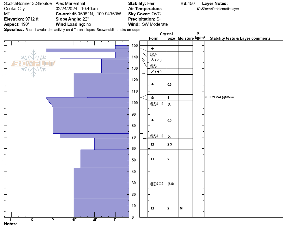
Snow was falling lightly (S -1). Overcast skies. Wind was moderate with frequent strong gusts out of the west-southwest, forming drifts along road cuts and convexities.
Full Snow Observation Report
Moving into a trickier snowpack. Tracks on many steep slopes, "stable" test scores, and less obvious signs, but the weak layer is still weak as ever. The snowpit today was a very similar structure to what I saw in the Bridgers the year of the wet slab cycle. A thick pile of depth hoar on the ground with a solid slab above... The depth hopar was worse in 2011-12, but not much. Oh yea, and the surface hoar is on top of the basal facets, just in case.
Despite a lack of activity, considerable feels right. It seems like a wind-loaded slope should break naturally even before this storm really gets going.

Saw multiple large slides around the McAtte drainage N/NE aspects. Some were larger than others but all ran on what looked like a persistent grain or even to the ground in some. Probably natural released over last few days.
During our time out the wind was hammering the ridge and clearing transporting and forming slabs.
Several small slabs pulled out above The Shimmy, left of Cleo's. Observed from across the valley while climbing the Dribbles. Did not observe them run, only saw the crowns. Unknown date of avalanches, but crowns were quite distinct from across the way.
Lots of wind transport all day.
Full Snow Observation Report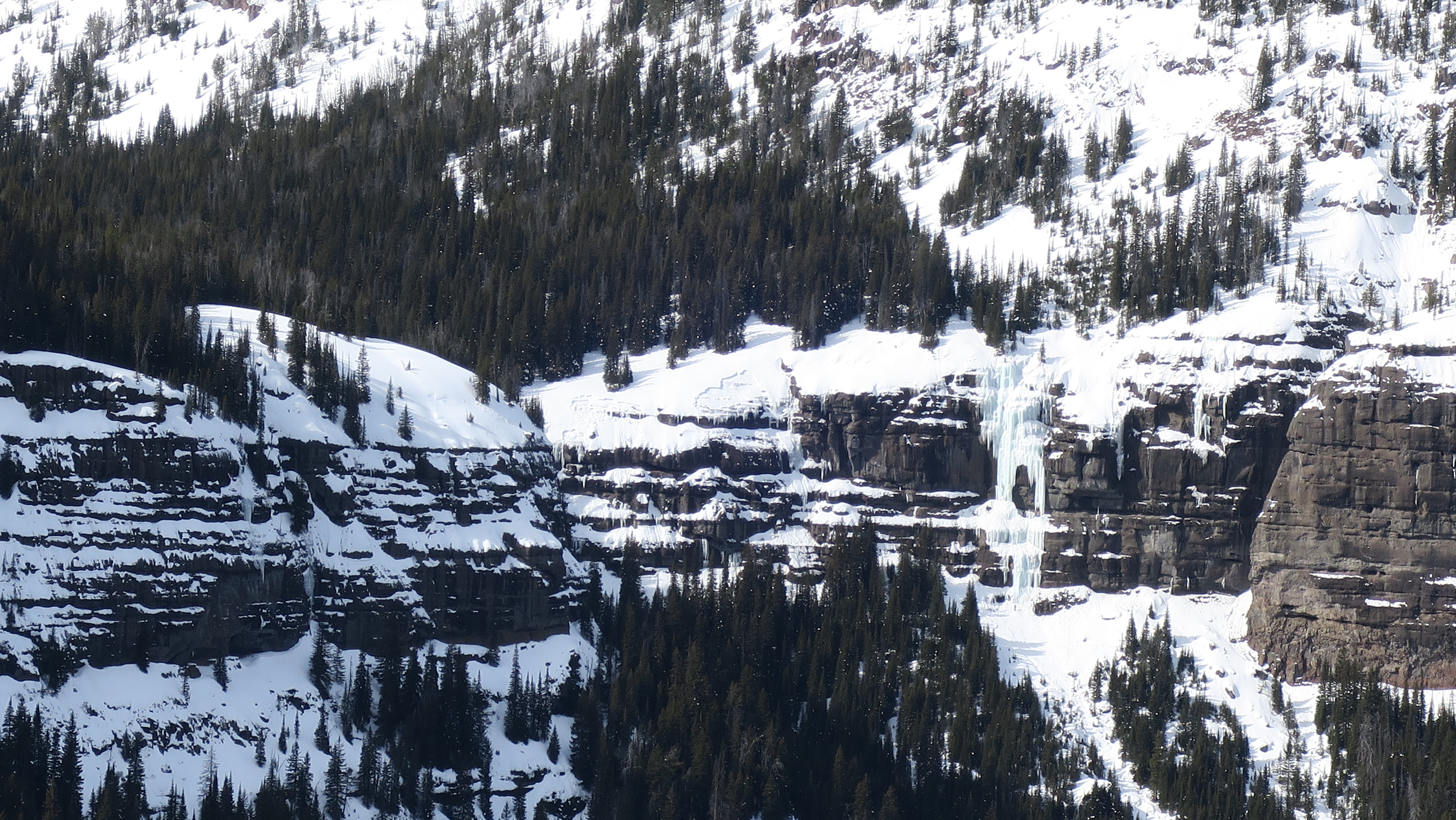
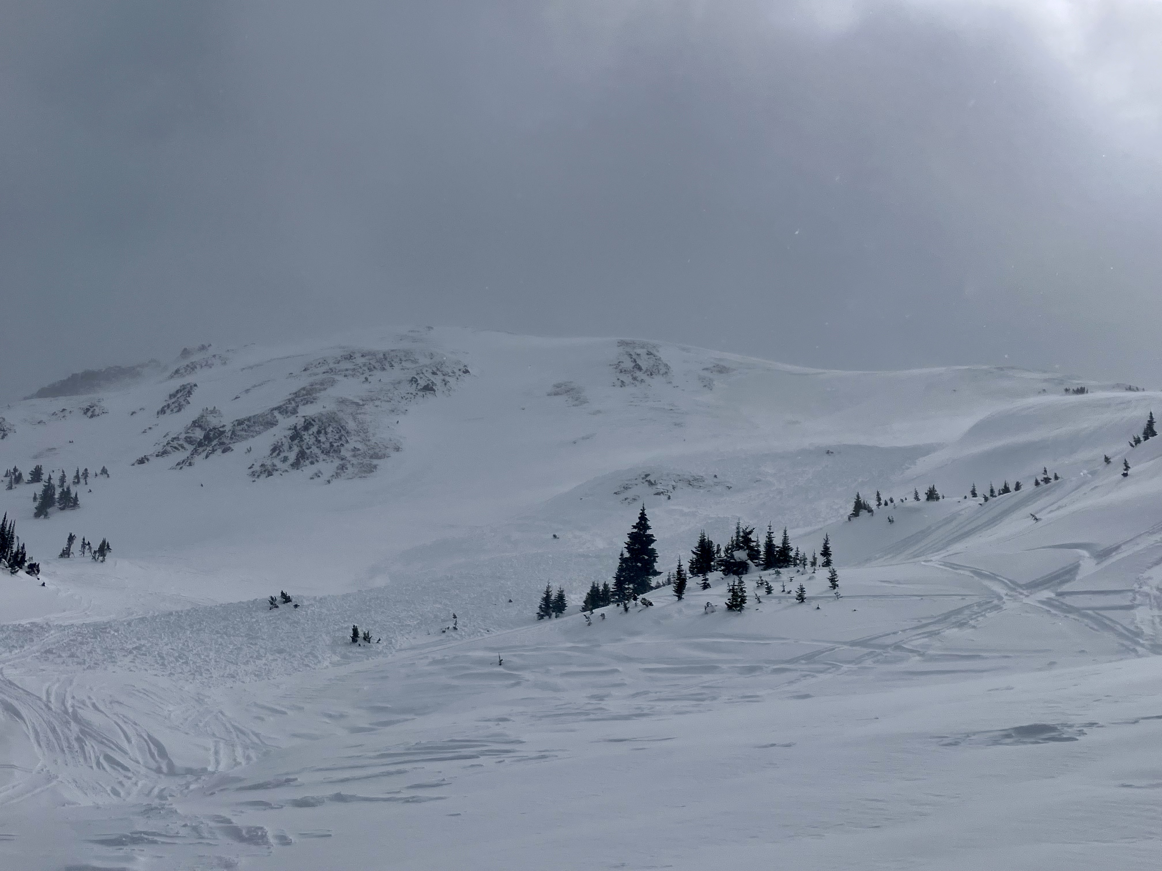
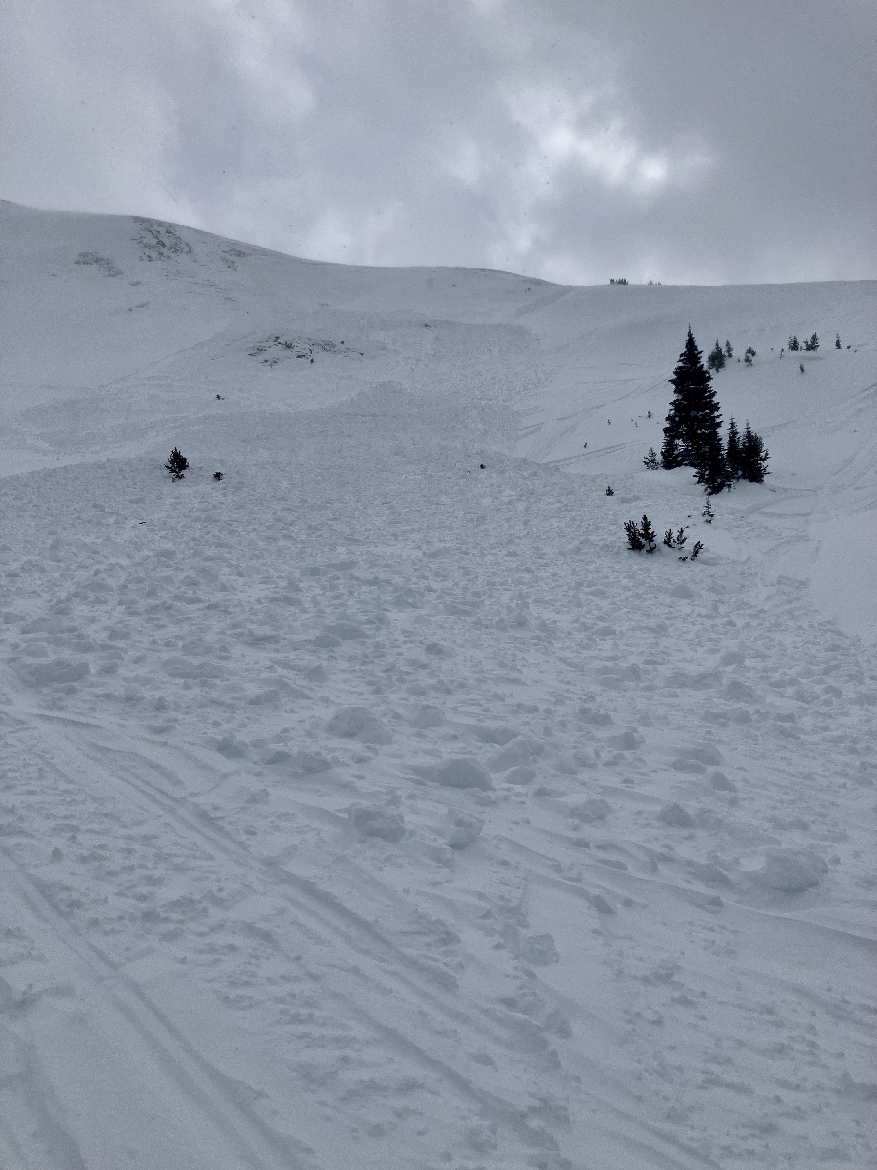
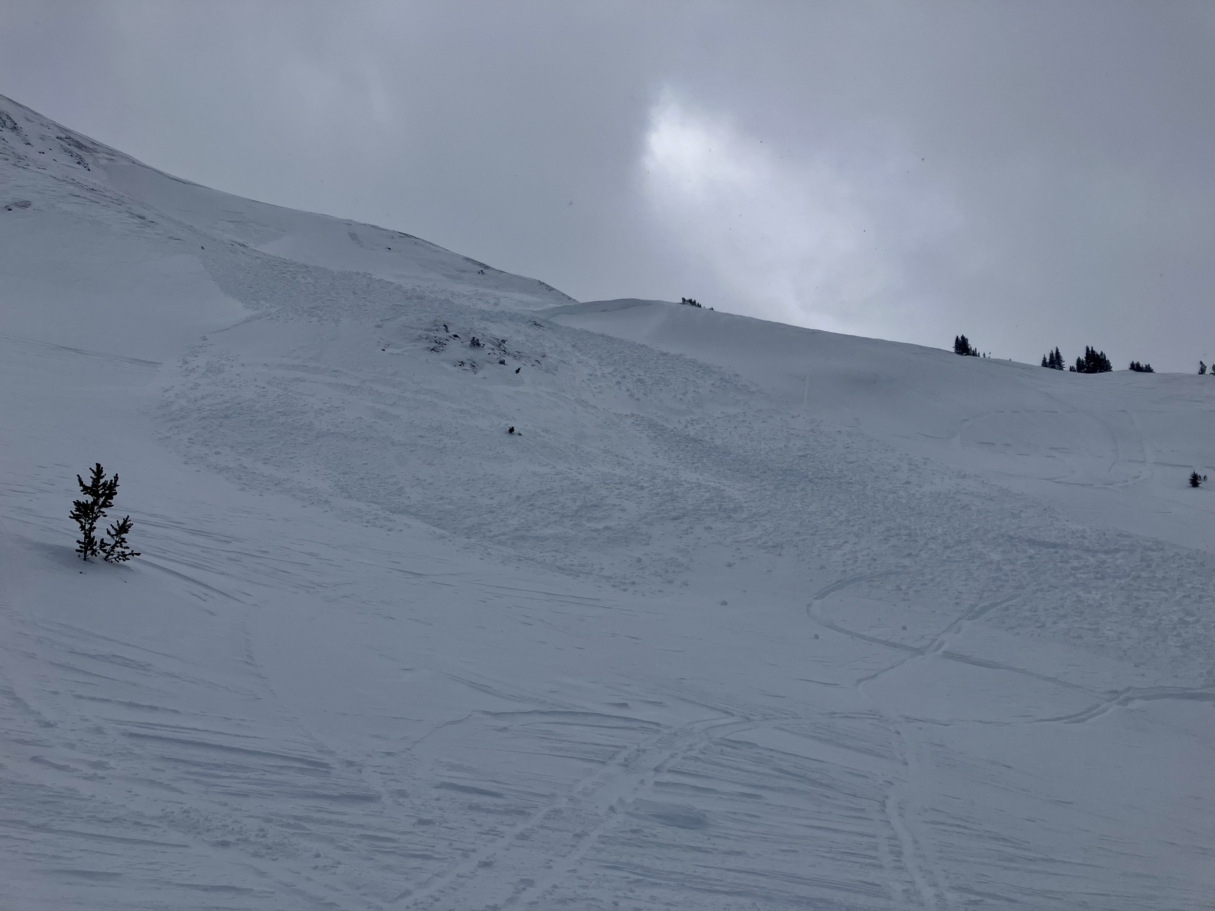
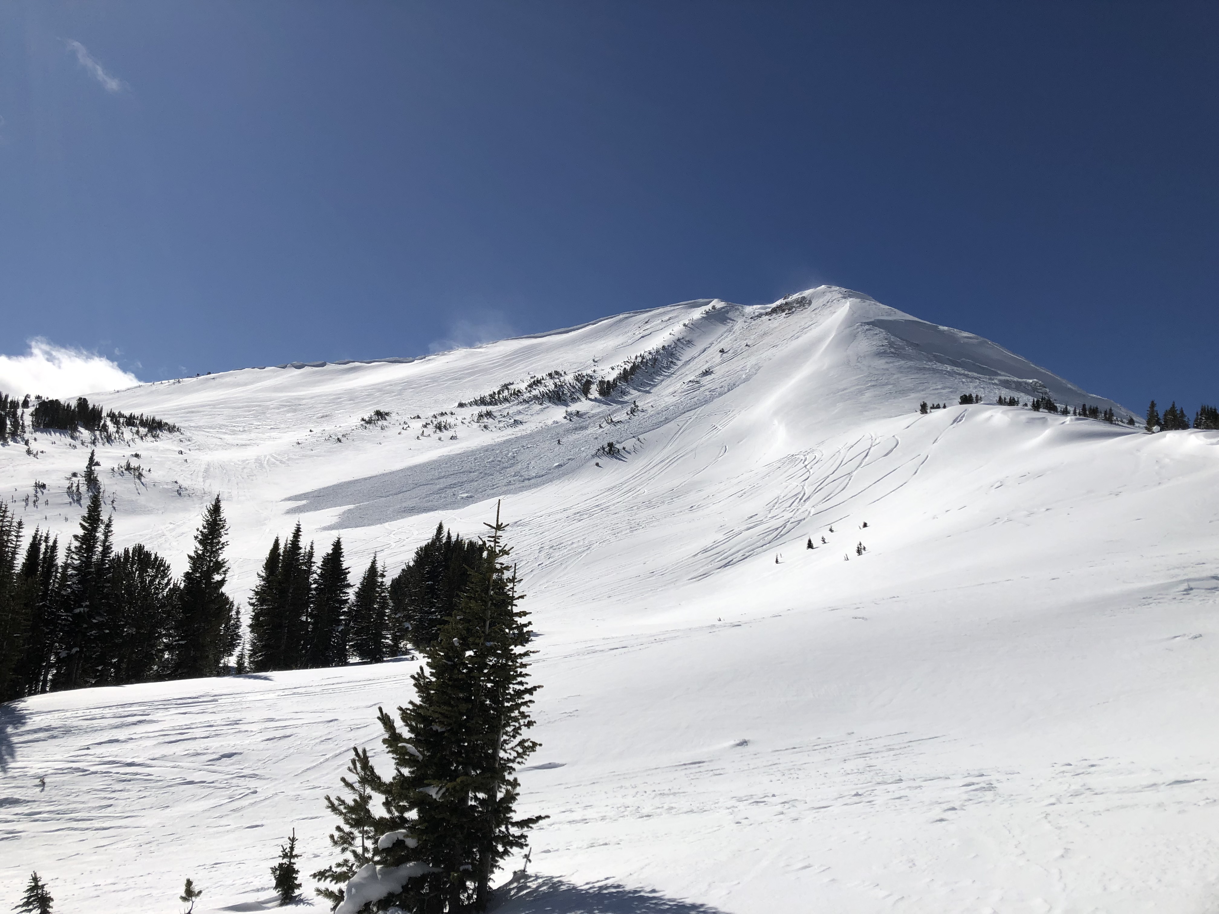
We rode to the south shoulder of Scotch Bonnet, then over Lulu Pass, towards Round Lake behind the north end of Sheep Mtn., and back to Lulu Pass. It was snowing very lightly and wind was blowing strong. Wind was blowing snow into drifts 6-8" thick on the leeward side of trees and convexities. We had intermittent ok visibility and could see old debris from last weekend on east Henderson, and we got a pretty good look at the slides on Fisher Mtn. that were triggered yesterday. They appeared 2-3 feet deep, and the debris was very hard. Crowns were already at least half drifted in.
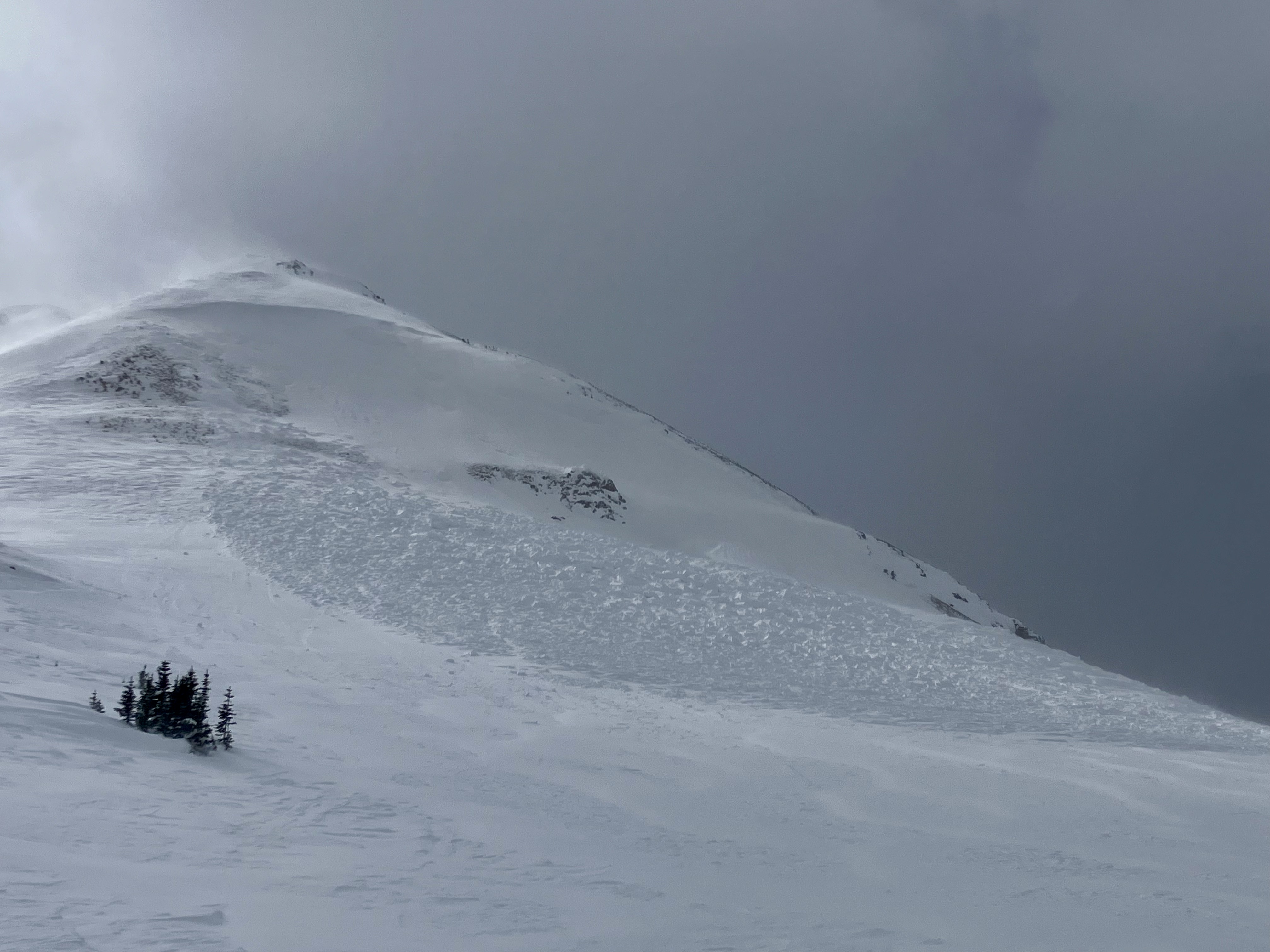
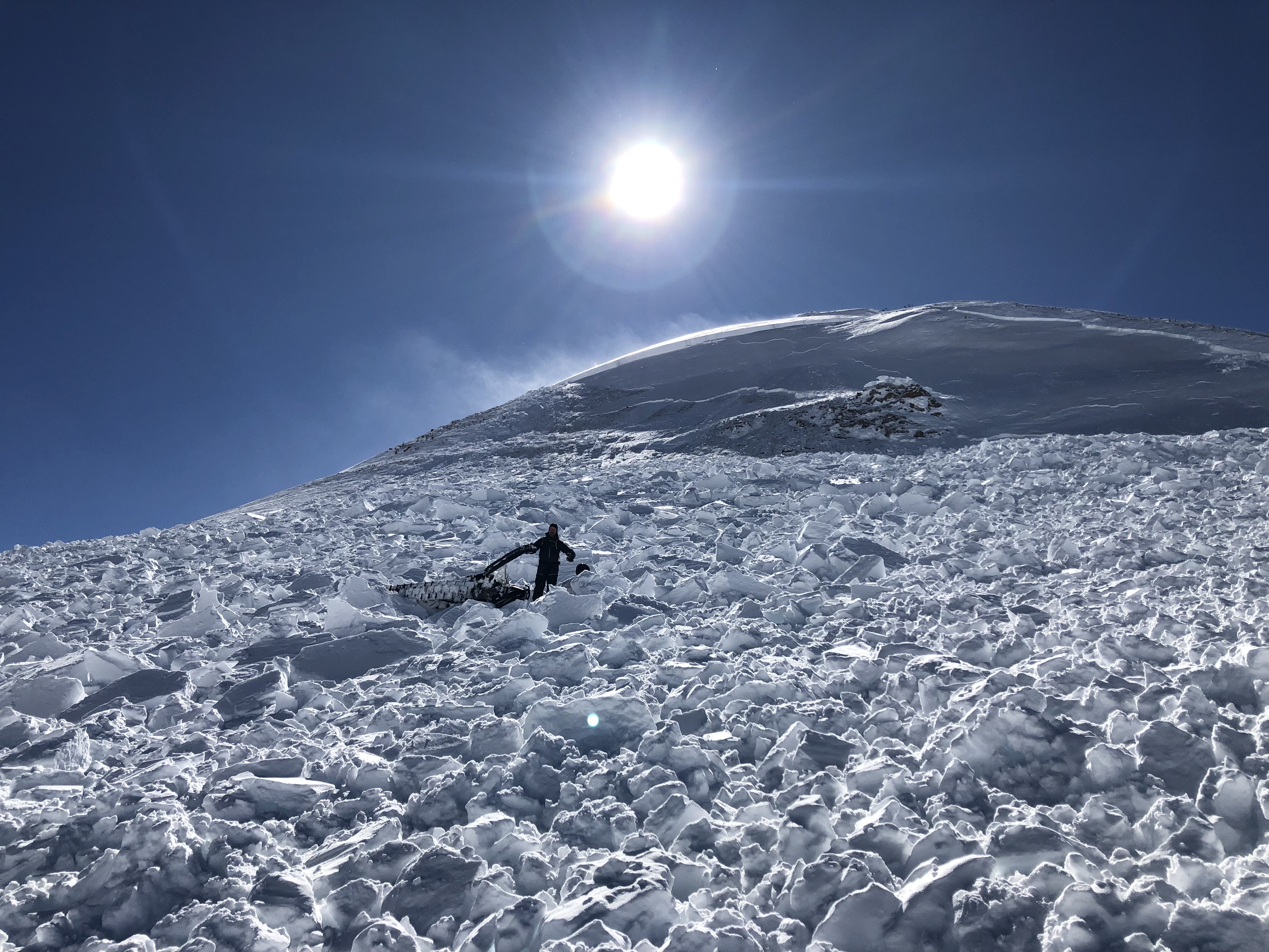
We saw another slide on the north end of Sheep Mtn. on a slope above the steep chute where people climb out of Goose Creek (photos attached). This slide had not been reported previously and looked similar in age to the two triggered yesterday, so maybe broke naturally or human-triggered in last 24 hours. It broke near a scoured north facing ridgeline, 1-1.5' deep, 175' wide. HS-R3-D2-O.
We dug a pit on the south facing shoulder of Scotch Bonnet and had an ECTP24, down 1.5 feet, not on the previous layers of concern which were lower down (pit attached).
Regardless of stability test results or which layer slides are breaking on, recent avalanche activity and more wind-loading is enough evidence to avoid avalanche terrain.
Full Snow Observation ReportDanger felt considerable with the stormy conditions and wind-loading. The place definitely got hammered by people last weekend. Many tracks in the Rastas and on the southeast bowl of Scotch Bonnet. Without the current loading it probably would have felt moderate, but we didn't quite make it there or missed it... I expect an easy HIGH on Monday or Tuesday if forecast snowfall plays out.

Large slide in the north basin of fan mountain. The flies is below the north, north east couloir and the crown runs all the way around the basin. It went to the ground below the couloir and a few other places. 10ft crown probably at the biggest point below the couloir.
no photos due to poor camera
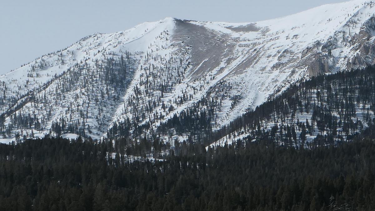
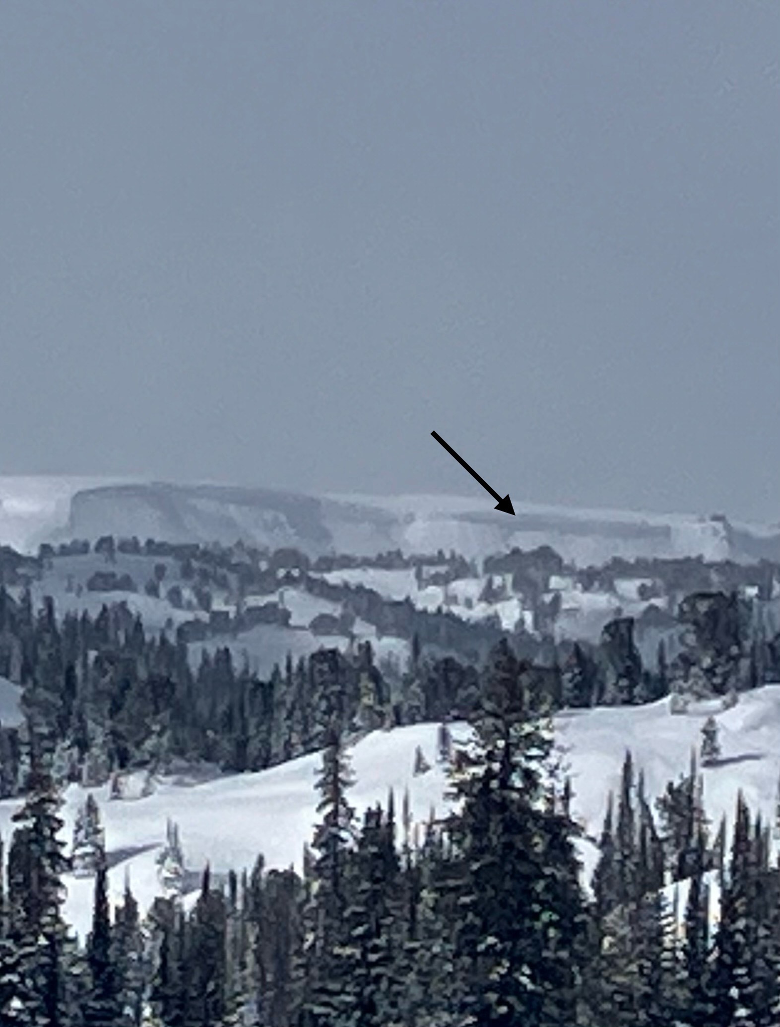
Full Snow Observation ReportObserved signs of a large avalanche along West aspect of Lionhead. I am not sure when it occured. At this distance and my experience level I can only estimate the crown at 3-4' and 1000'+ feet wide. It appears to have run about 650' vertical feet and the runout zone goes all the way to Targhee creek into several terrain traps.
Full Snow Observation Report
We noticed that a widespread crust had formed at lower elevations from the recent warm spell, especially in areas without consistent shade. The snow that remained available for transport was easily being picked up by moderate to strong SW winds at treeline. Many tracks had been filled in by the wind transported snow, and a dense, hollow windslab was found in isolated spots.
Full Snow Observation ReportThe snow ranger crew was out in the Bridgers today, mostly lower down in the Throne and Naya Nuki areas. The wind was very strong all day long and even in the woods our tracks were filling lightly from wind transported snow. We could see a fair amount of snow blowing over the ridge top and some very textured looking snow higher up. We did not see any recent avalanches.
Full Snow Observation Report
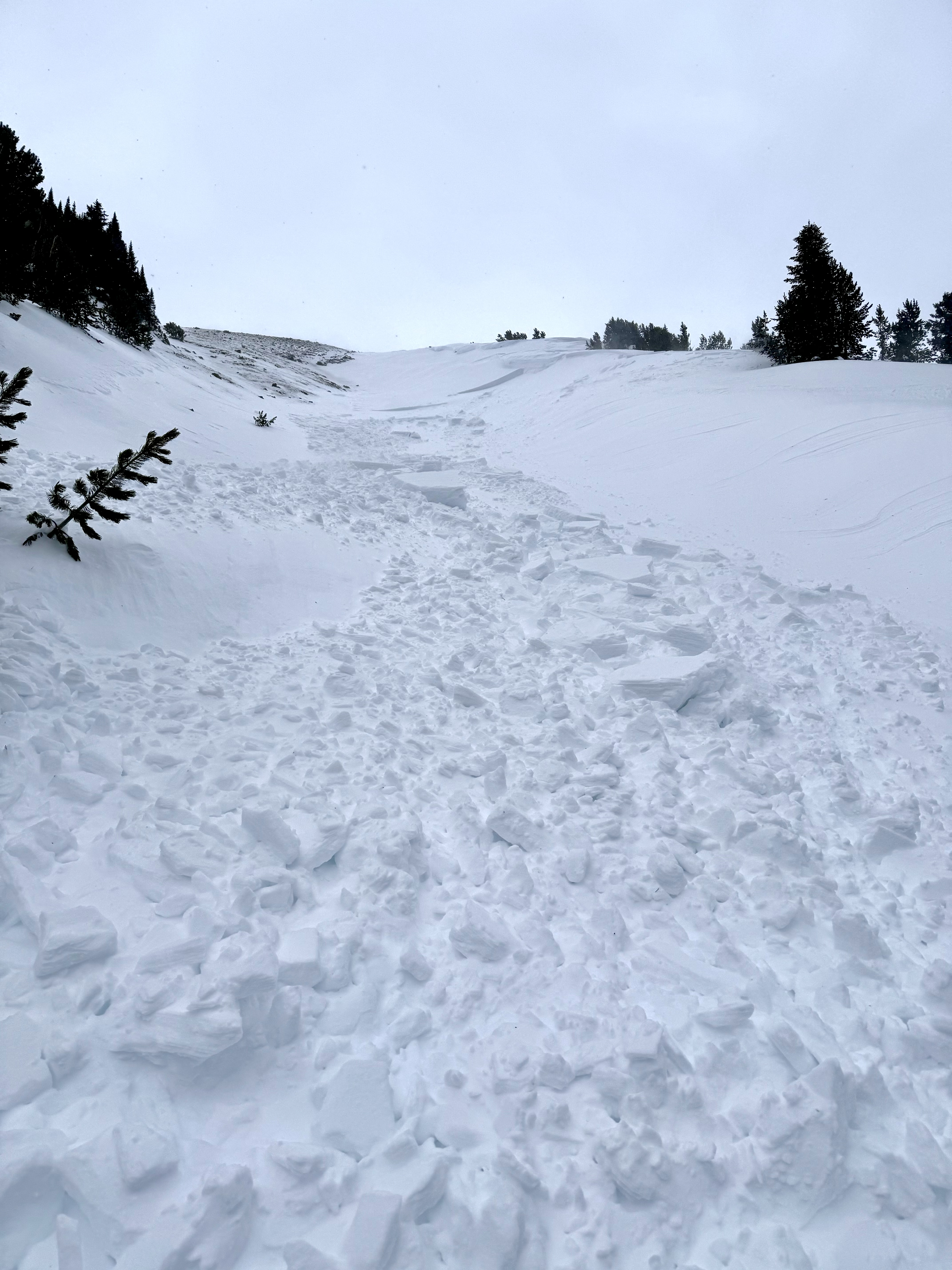
North facing aspect above McAtee creek. Triggered one remotely while traversing below, ~150 yards away, and likely triggered the second one from below as well but cannot confirm. 4-6 foot crowns, 50-100 yards wide, ran 75-100 yards
Full Snow Observation Report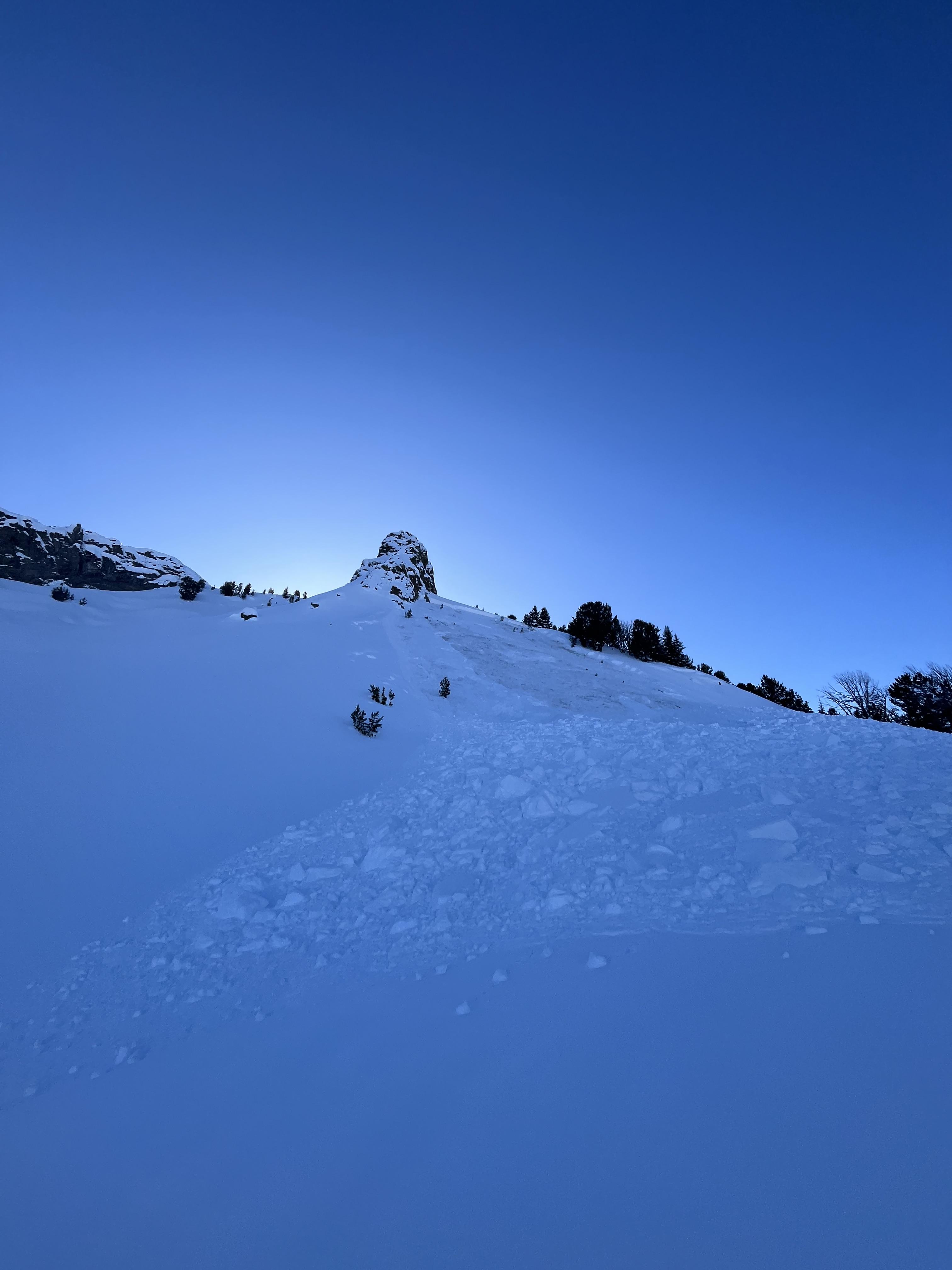
One slide seems to be natural.
just around the ridge, lookers right, a snowmobile triggered slide
rider in photo. Rider was carried downhill, not buried. Very very lucky
the two slide seem to have happened at the same time
Full Snow Observation Report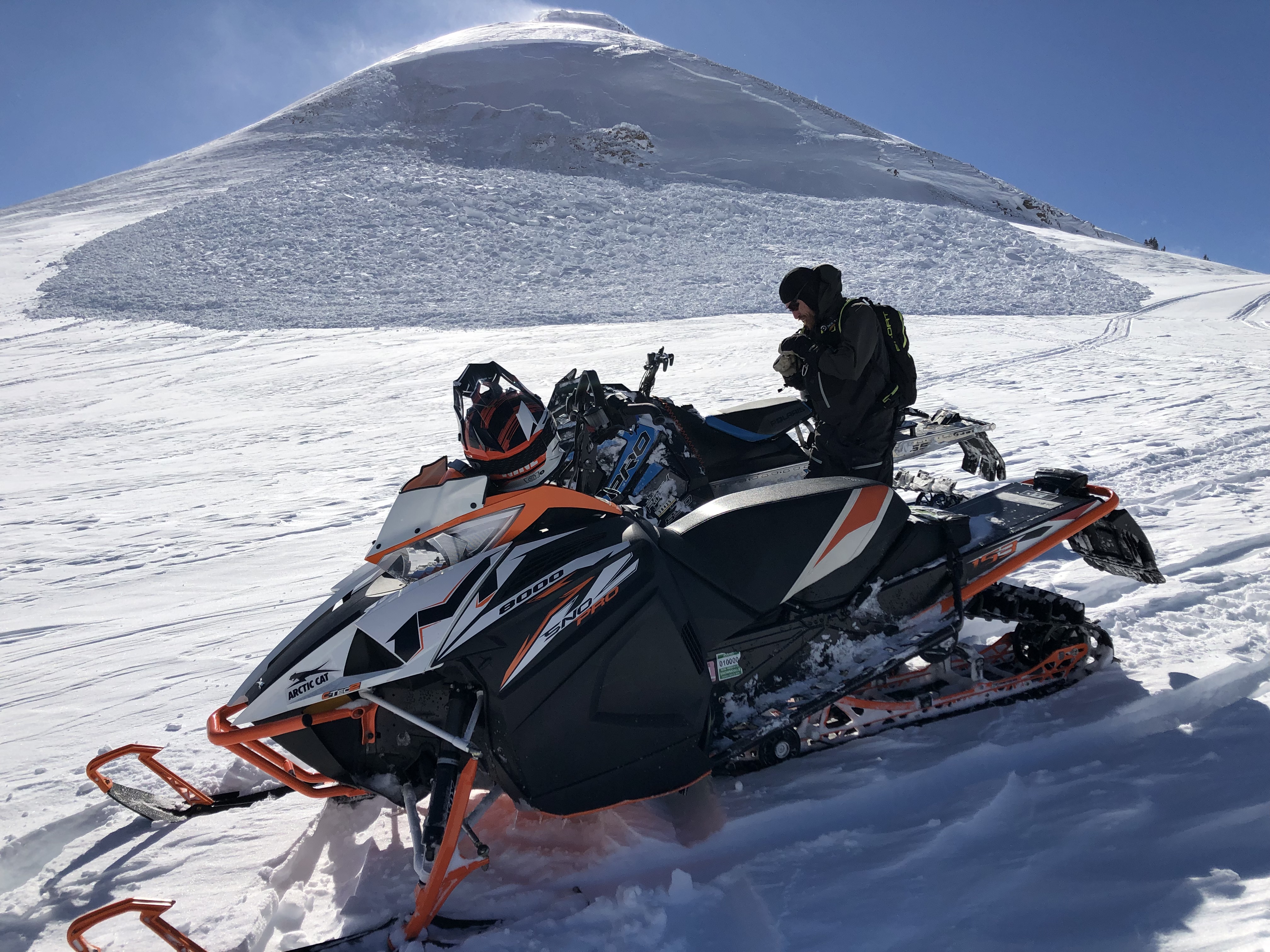
We skied Texas meadow this evening, and found relative stability. We tested a small hand out which did show the poor snow structures that the rest of the area with a very cohesive top on a sugary base, but we didn't find wumphing or other signs of instability in this zone. Southern aspects did have a strong sun crust on them, while others had great snow. There was also very gusty wind from the south which made temporary whiteouts and could be transporting snow.
Full Snow Observation Report