Snow Observations List
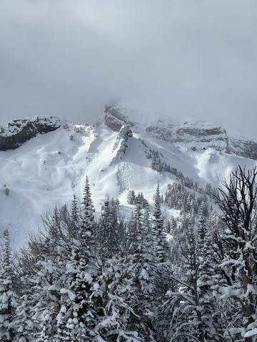
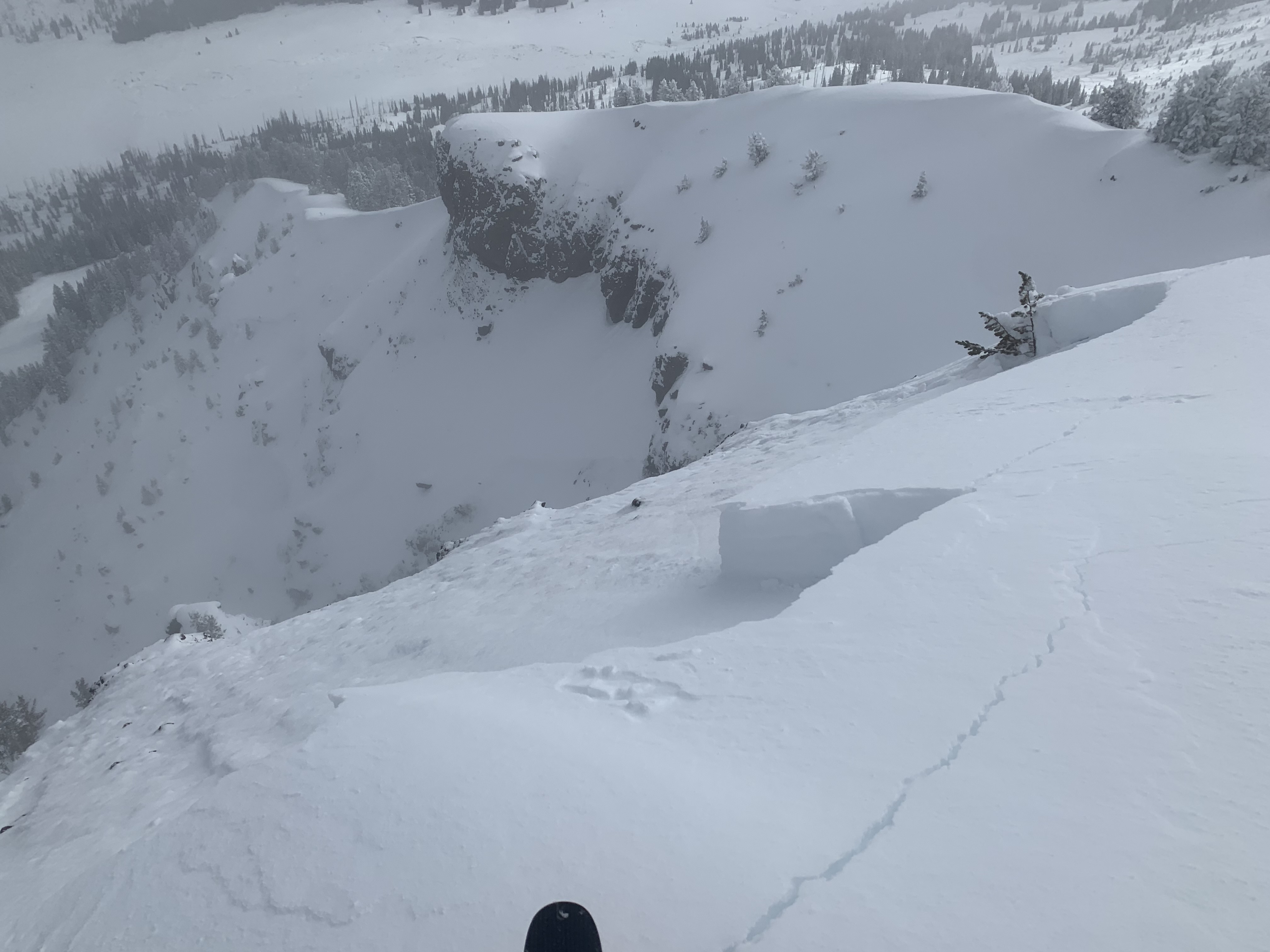
I skied above hebgen today, and was surprisingly the only one out there. The clouds opened up enough to see numerous 2-4’ deep slides that occurred over the past week, on slopes down to 29-30 degrees. Many started quite low on the mountain. There were several places where 27-28 degree slopes had shattered into cracks without sliding.
I dug a pit on an east aspect at about 8200’, and found 130 cm of snow. An ECT failed at ECTP 29 at the interface of the basal junk and newer snow, about 90 cm down. Normally I would see this as an encouraging sign, but my pit today was purely academic and I skied dad pow all day. I did not experience any collapsing today, in stark contrast to the 2-300 collapses I got Nordic skiing around the hebgen basin yesterday.
End of Forest Service Wall outside of Big Sky Resort boundary.
Full Snow Observation Report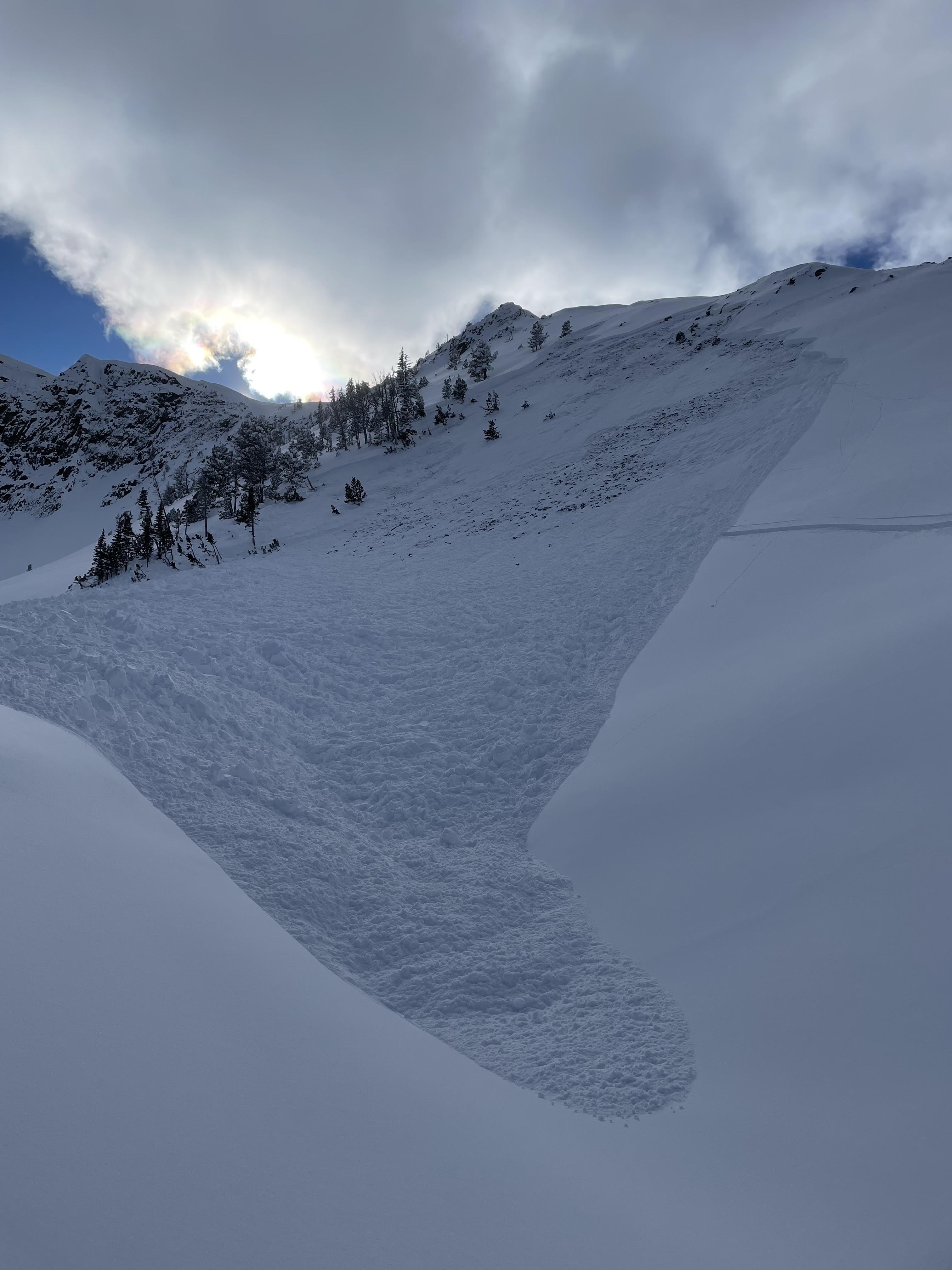
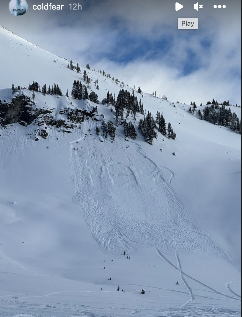
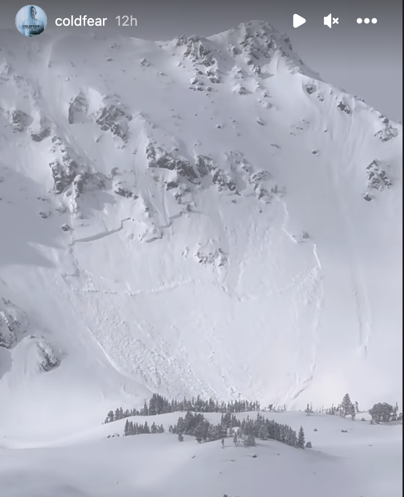
We rode into Buck Ridge today and in First Yellow Mule, we triggered an avalanche 100' away from a flat meadow below. This avalanche broke several hundred feet wide and 3' deep on weak faceted snow low in the snowpack. This was right next to a slope that we had remotely triggered weeks ago on January 22nd, observation here. We knew conditions were dangerous and chose not to travel on or near steep slopes, but triggering an avalanche in the first hour of riding didn't make us feel great. Similar to what Dave said in his video we left here feeling as though the danger was higher than we thought. From here we continued on towards Muddy Creek and along the way saw a few natural avalanches in McAtee Basin and a small recent rider triggered avalanche in Third Yellow Mule.
While signs of instability later in the afternoon were not obvious the glareing red flag from the morning had already set the tone for the day. Getting on or below terrain steeper than 30 degrees was not on the table and will remain off the table until conditions improve.
Full Snow Observation Report
In the crown, we got an ECTP 26 that broke below where the avalanche had broken.


Observed a recent avalanche on Henderson Mountain East aspect today.
Full Snow Observation Report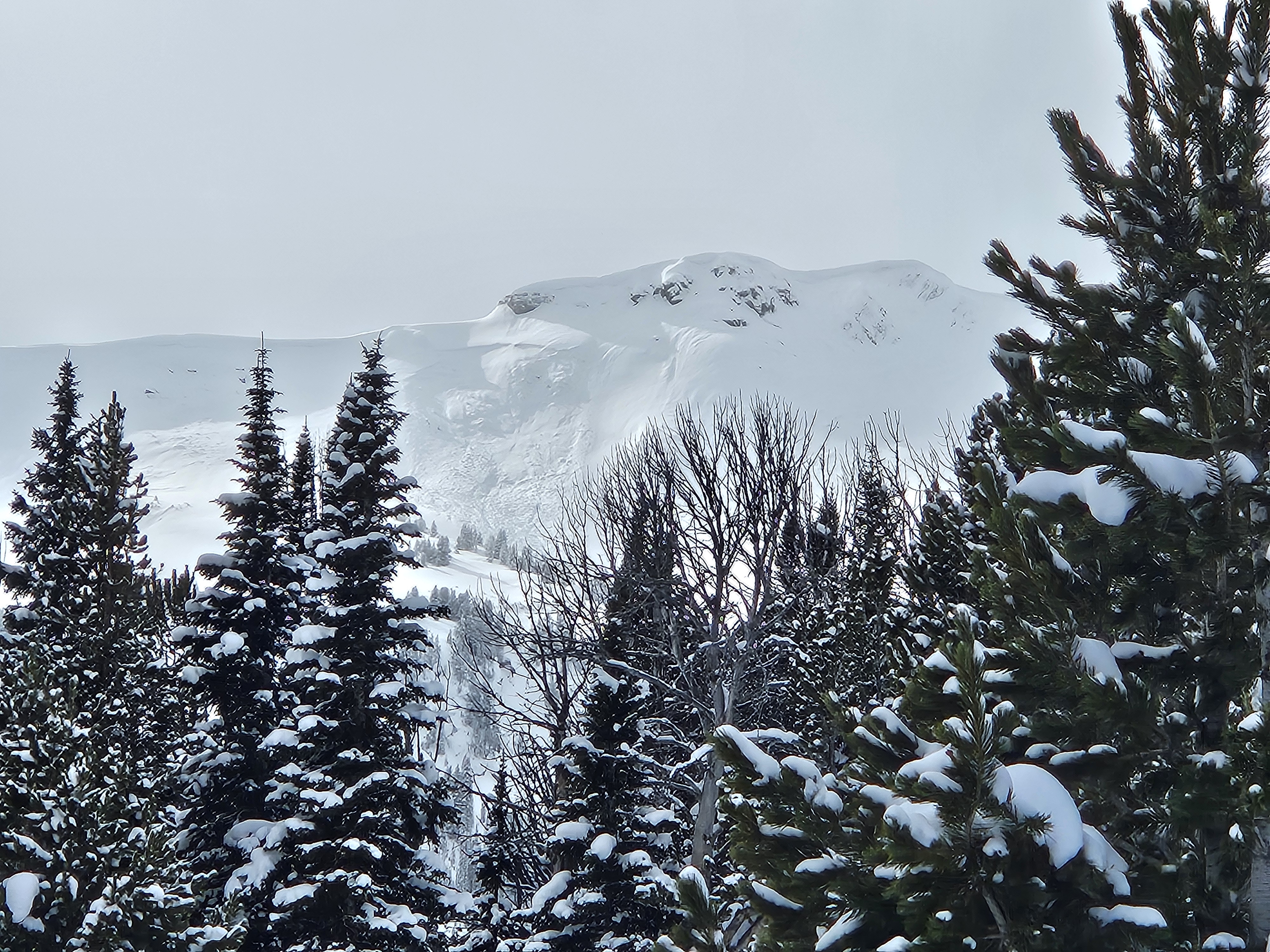
Pro 1 class pits and field observations:
Bottom Line: Still isn't looking good.
We toured out in Beehive Basin, conducted stability tests representative of of adjoining terrain. In 5/6 test pits we found the persistent weak layer is still problematic if you are going to get your skis or sled underneath the upper melt-freeze crust. There was also dramatic spacial variability of layers and reactivity even within a 50m x 50m area. This led us to believe that although there are tracks on the mountain, the button is still hiding waiting to be pushed.
The new storm layers have very poor bonding and are also capable of propagation.
We observed two natural (assumption) slides one ridgeline back on lower Beehive Peak, leading us to conclude there is a possibility of small to medium size avalanches within the new snow layers in addition to the massive sleeping dragon at the bottom of the pack.
Full Snow Observation Report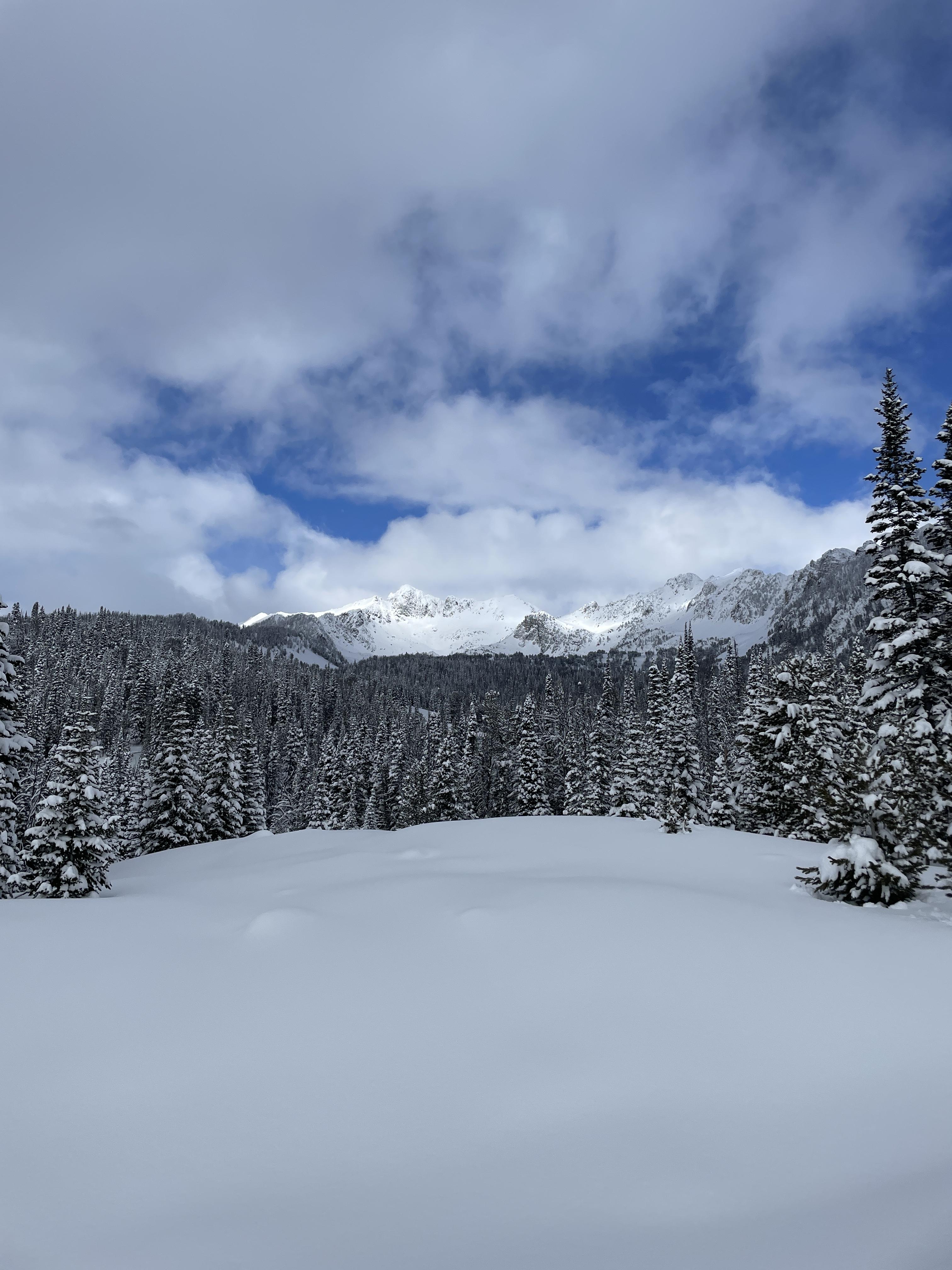

Got a whumph descending the ridge from little Ellis on the ENE facing slope just below the ridge around 7000'.
Saw some small cornices but snow was soft below the ridge. Hopped on the flat ridge top adjacent to a wind lip and got no result.
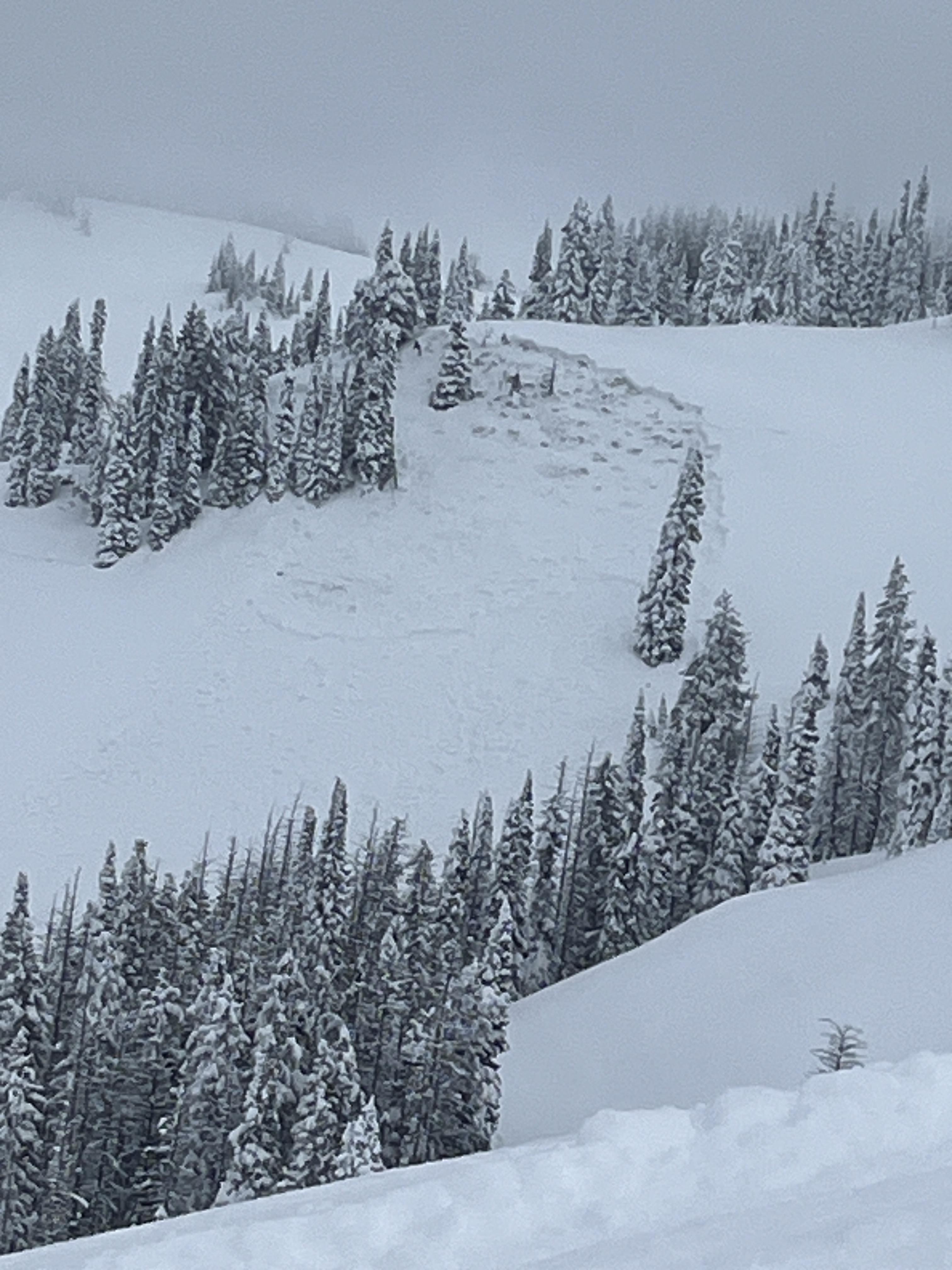
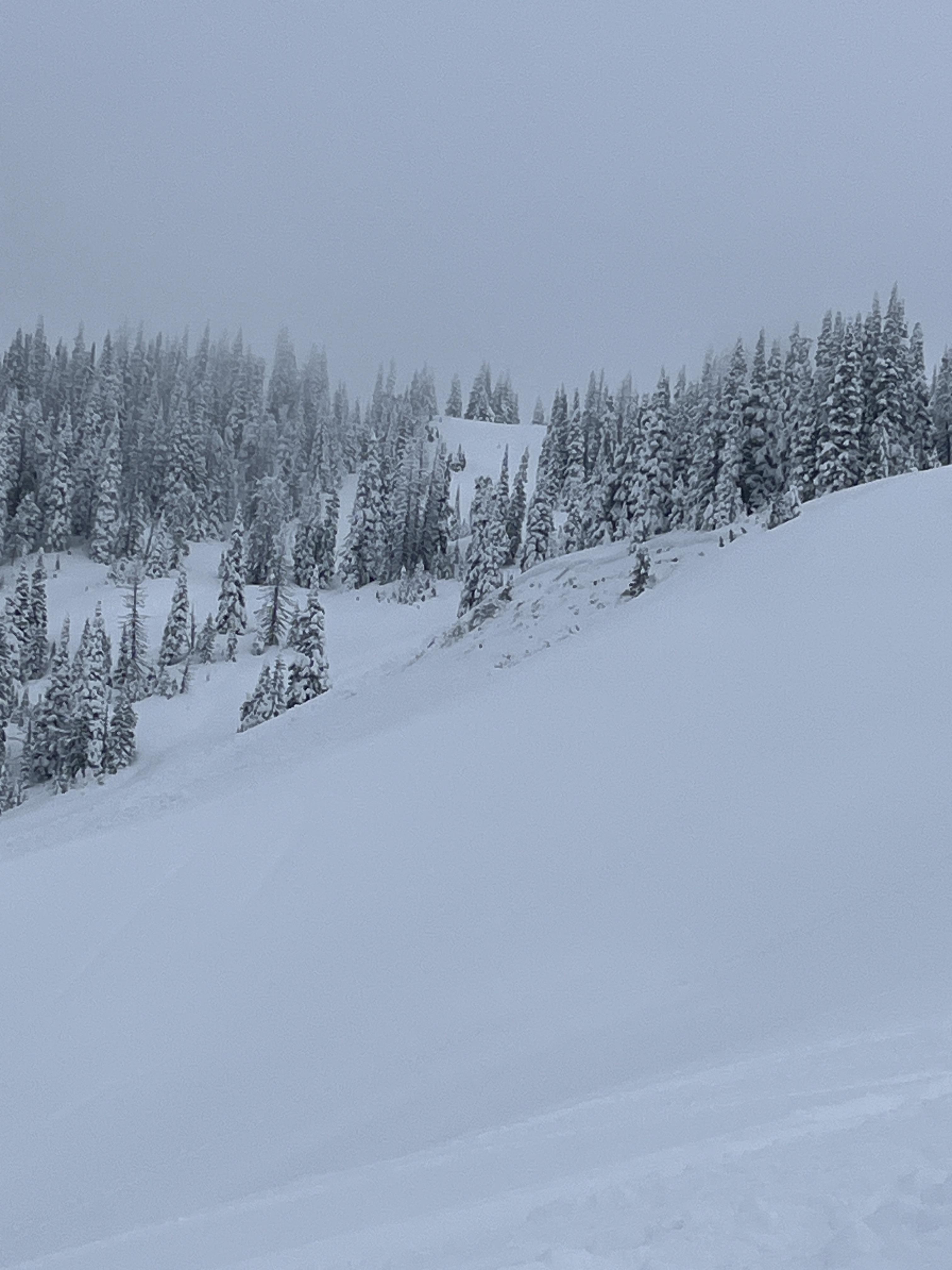
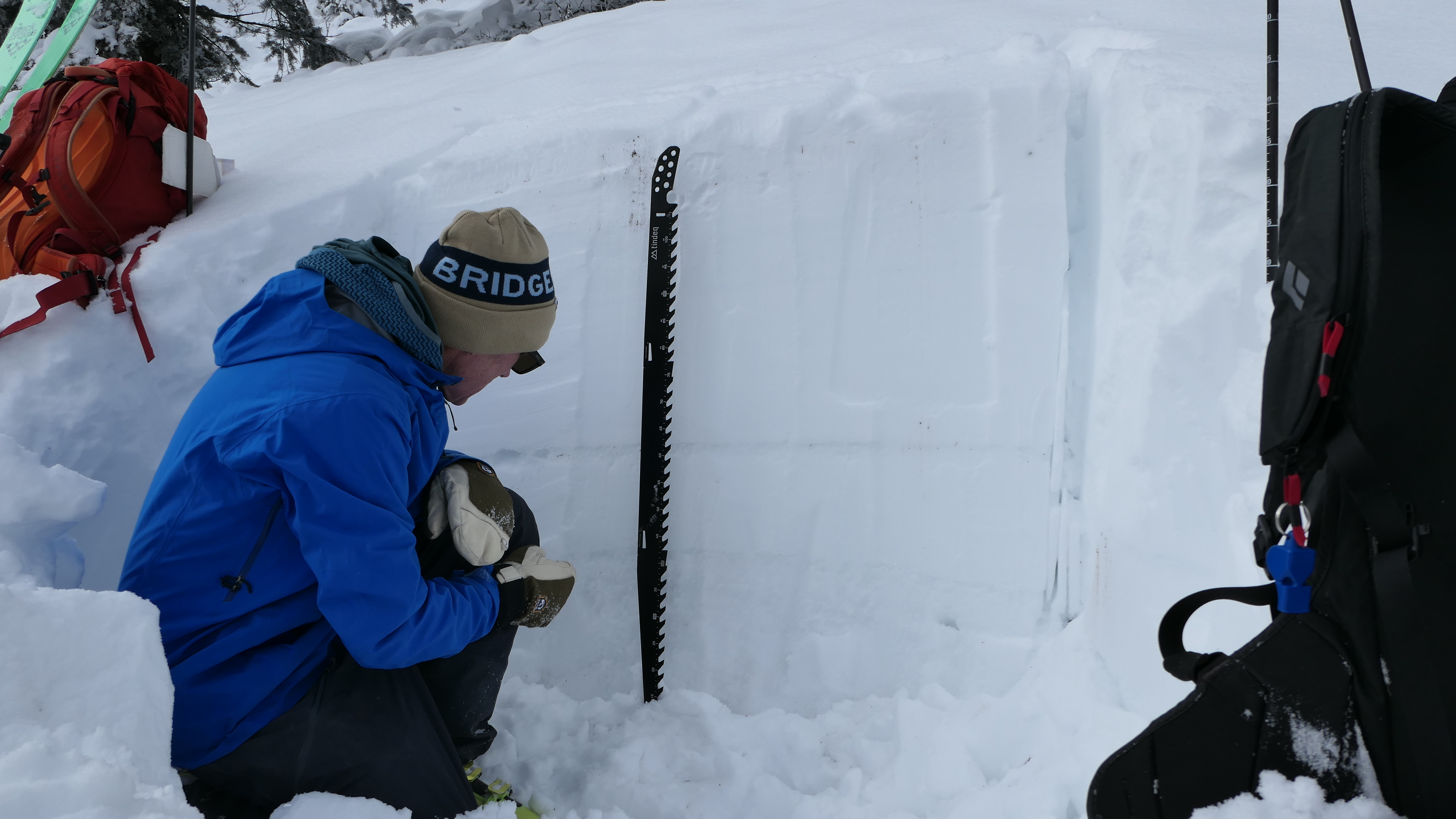
Full Snow Observation ReportWe rode into the Throne today in the Northern Bridgers. Our objective was to get to the top of the throne this time and to see what the warm-up in early February did. We felt that without signs of instability and good travel practices, this was an appropriate goal with wind-loaded terrain being off the table. At the bottom of the Throne, we discussed that if we saw signs of instability such as cracking and collapsing it was time to turn around. About halfway up on an east-facing slope at 8000' we dug a snowpit to test for instabilities. What we found is that the warm-up didn't change much, and found dry faceted snow below a stout crust that did form. Stability tests were reasonable with a score of ECTN 21 and we felt comfortable continuing to the ridgeline above. On the backside of the ridge, we were able to easily trigger small avalanches (1-2" deep) in the new snow. While walking on the ridge we felt a large collapse and saw shooting cracks behind, below, and above us. This made us both jump a bit and was an obvious sign that it was time to turn around. We pulled the plug once again and began skiing down, but not before kicking off a few more loose snow avalanches on the north side of the ridge.
Here's what we took away from this. First, the snowpack is still very weak and it will take more than just a short warm-up to improve stability. Second, areas where new snow has drifted into thicker slabs are concerning, and triggering an avalanche is likely. Third, new snow is bonding poorly to the old snow surface and as snow continues this new snow will be sensitive to human triggers.
Full Snow Observation Report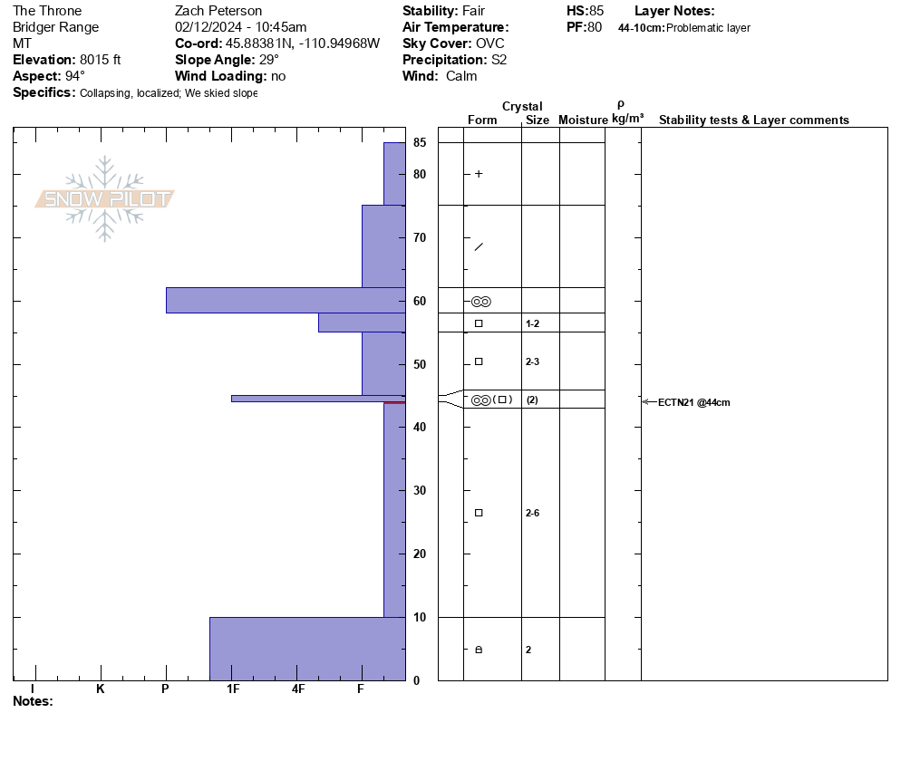

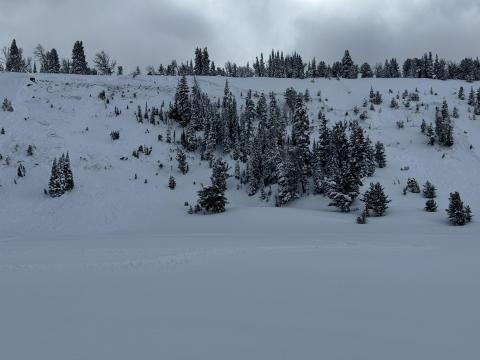
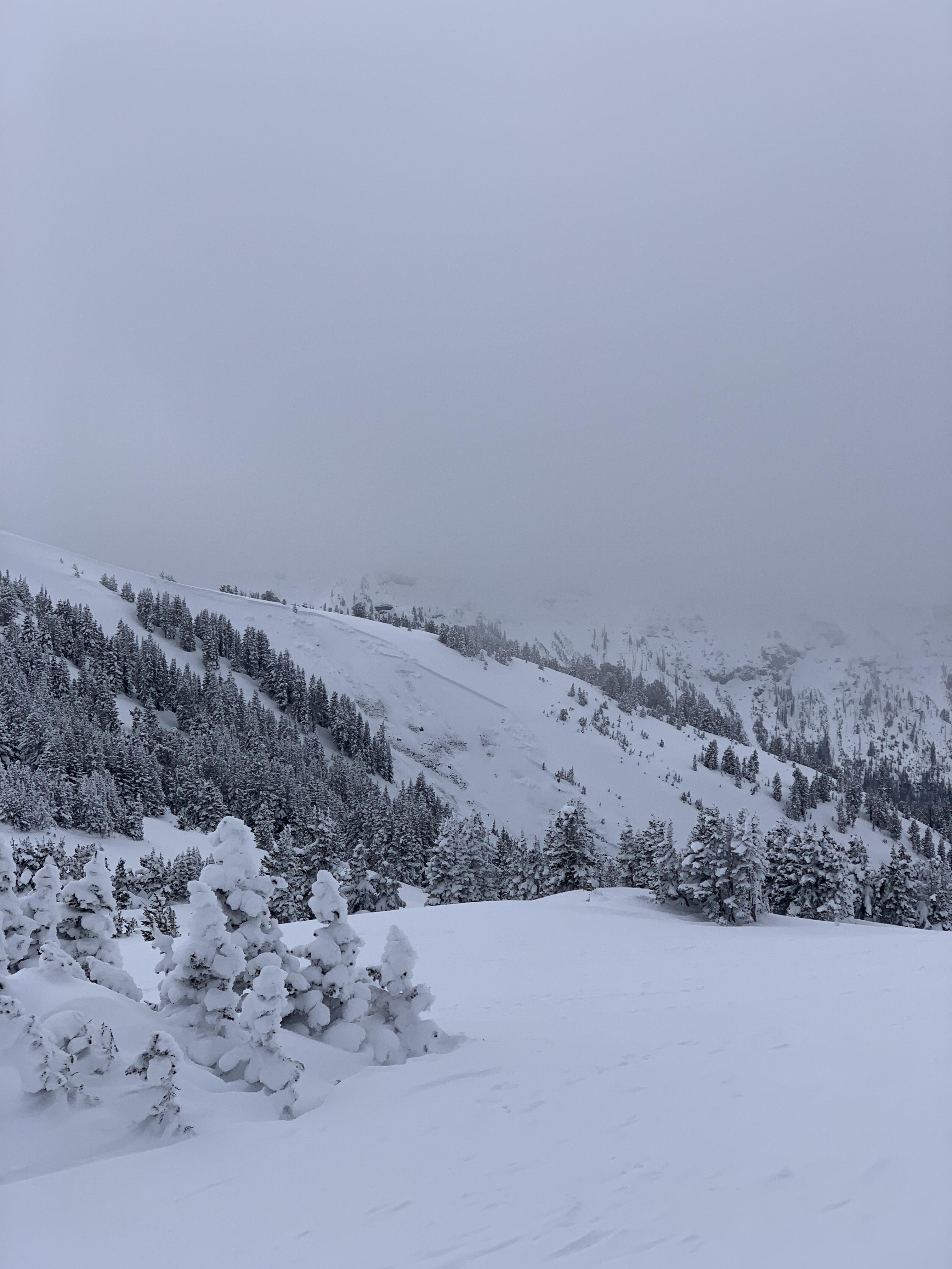
Skied the whitebark glade on Flanders and got several whumpfs at the mid and upper elevations. Light overnight and continued wind loading. There was a recent avalanche that appeared to be a wind slab with decent propogation on a north facing rocky slope. Visibility was too poor to get a good look or photo.
Full Snow Observation ReportNo details, came upon them while riding and making observations of the terrain. One was North-Northeast, the other was North-Northwest facing. Across the drainage from each other.
Also, notice three other small avalanches on a west facing slope, about two miles east of the first two. All five were on slopes well over 30. In the centennial mountains, close to the continental on the Idaho/Montana border.
No details, came upon them while riding and making observations of the terrain. One was North-Northeast, the other was North-Northwest facing. Across the drainage from each other.
Also, notice three other small avalanches on a west facing slope, about two miles east of the first two. All five were on slopes well over 30. In the centennial mountains, close to the continental on the Idaho/Montana border.
From email: "Natural avalanche from yesterday evening or last night.
North facing aspect, with an interesting 3 tiered crown beginning around 8900'."
Full Snow Observation Report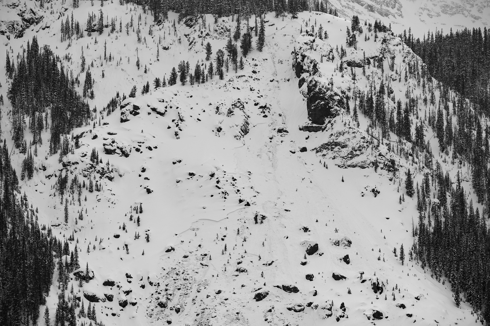
We took our level 1 course up to the ridge between Beehive and Bear Basin. Skies oscillated between overcast and broken as light snow fell throughout the day with little to no accumulation. Winds were generally light, and no snow was being actively transported.
We descended a low angle east aspect down to about 8500' and found quality surface conditions and fun turns. This week's snow comprised the upper 35 cm of the snowpack, was right side up, and generally well-bonded to the new/old interface below. Hand shears, up-track tests, and small test slopes were non-reactive. We avoided any sustained slopes over 30 degrees and we saw no obvious signs of instability during our tour.
We dug two quick pits and performed an ECT in each. We found very similar poor structure in both pits and both ECT's propagated across the column within a layer of soft facets about 18" below the surface.
East aspect @ 8500', 28 degree slope
HS 90 - ECTP24 @ 44 cm
90-55 F>4F>1F - This week's snow
55-50 - P - Rounded Grains - January snow
50-35 - F - Facets
35-33 - 4F - Decomposing Crust/Facets
33-20 - F - Facets
20-Gnd - 1F - DH/Facets
East aspect @ 9100', 12 degree slope
HS 88 - ECTP11 @ 43 cm within a layer of fist-hard facets
Very similar structure to above, except for a 2 cm pencil hard MFcr at the interface below this week's snow capping a few cm of pencil hard rounds from January.
Fist-hard facet layer began at 47 cm and transitioned to 4F DH at 20 cm, with large and striated crystals visible to the naked eye.
Full Snow Observation Report
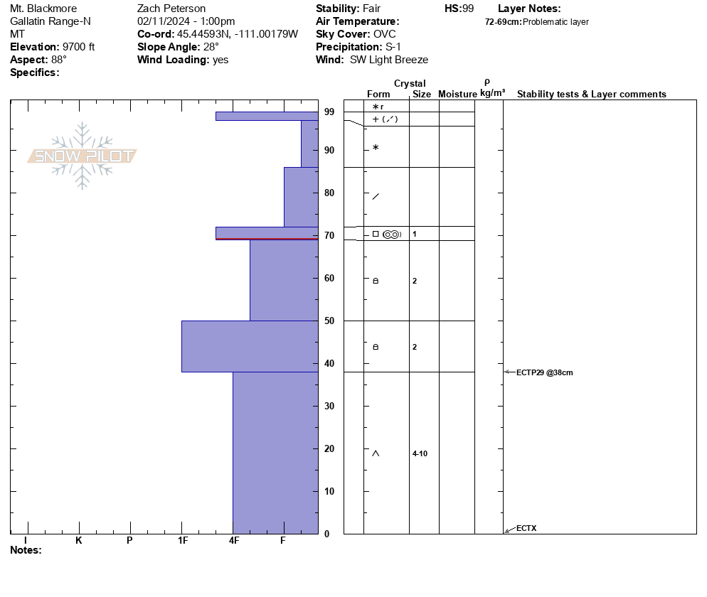
On Mt. Blackmore we dug a pit on the east face near the ridgeline. We measured 10-12" of new snow that fell over the last week, equalling 0.7" of snow water equivalent. In the trees and less wind affected areas there were 14-16" recent snow, but we did not measure SWE there. In our snowpit on an east-facing slope at 9700' we found this new snow sitting on 2' of faceted snow, showing us that the structure is there to create avalanches. While stability tests were not remarkable with scores of ECTX and ECTP29, we did not feel like stepping into avalanche terrain was an appropriate decision for two reasons. First, we know the snowpack setup is capable of creating large avalanches and new snow will increase the likelihood of this. Second, recent wind has drifted the new snow into thicker denser slabs that will add additional weight to already unstable slopes. We saw clear signs of wind loading with fresh cornices forming at ridgelines and pillows of wind-drifted snow forming at the top of rollovers. While skiing out my partner and I both noted that the snow felt unsupportable with our skis breaking through to the facets below. We also discussed that as more snow and wind come this week dangerous avalanche conditions will continue to exist.
Full Snow Observation ReportThe ski out had decent coverage and the core shot count is: Alex: 0 Zach: 1

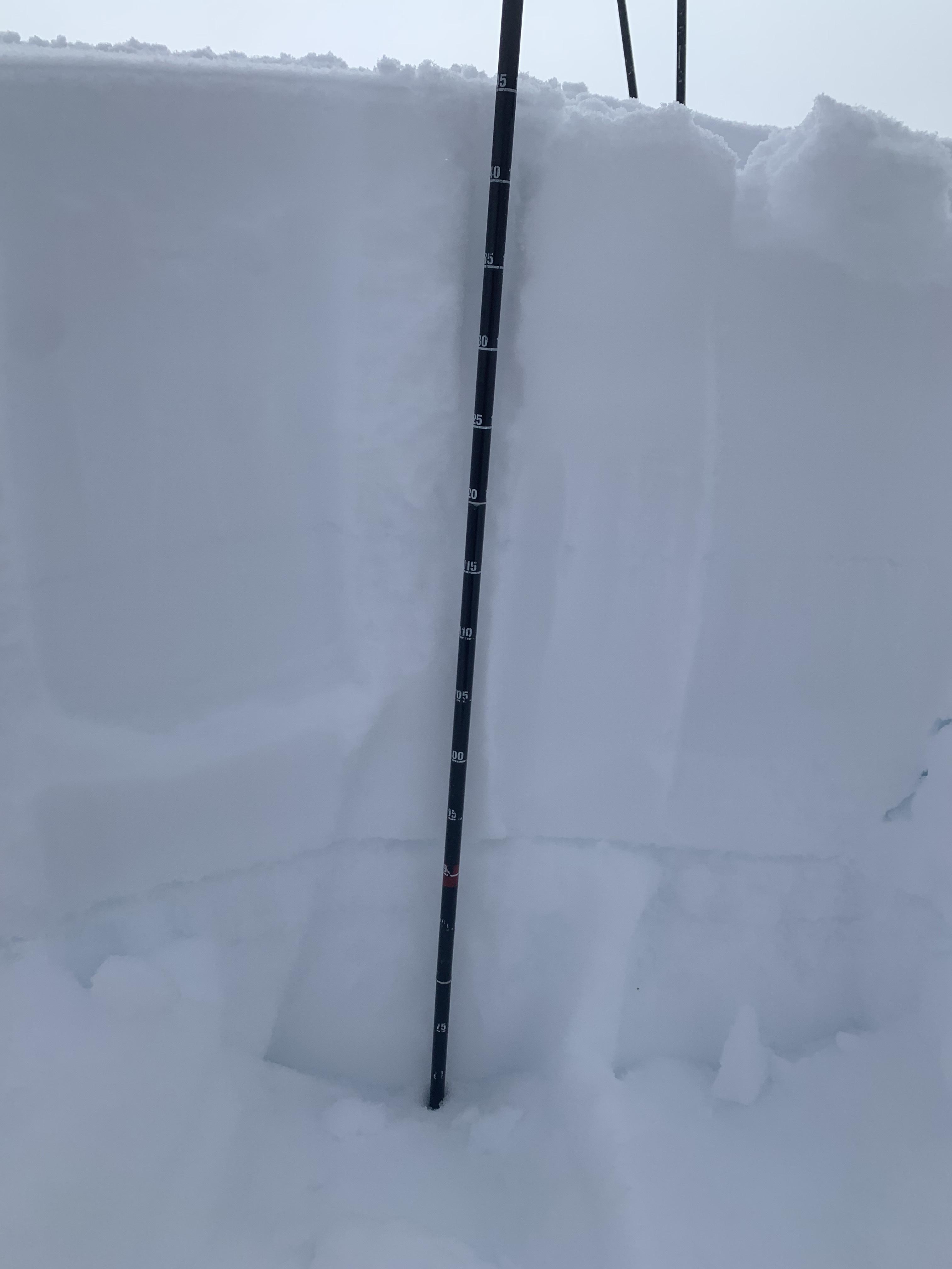
Wind was calm and there was no new snow overnight. A small whumpf in the skin track was followed by a massive one a few minutes later. I can count on one hand the number of times I got whumpfs in a skin track...rare indeed. The second one was so big it had us both deeply concerned. We peeled off the skin track after deciding to not cross a gully and soon found debris from a sizeable avalanche that released a couple days ago about 500' above us. We dug in the flank and had 100 cm of snow, 60 cm new from last week. The snowfall during the Avalanche Warning, doubled the depth and more than doubled the snow water equivalent of the snowpack. It was a large load and avalanches are breaking underneath the new snow.
Karl was using his 100 cm long Norwegian Battle Saw (pic)...a bit overkill.
Full Snow Observation ReportKarl and I were pretty spooked about the collapse in the skin track. The conditions there were the worst I've ever seen, so crossing the gully in the trees was not something we wanted to do. We cut back and within a 100' elevation gain we found an avalanche. It ran hundreds of feet below us. We also did a RB because Karl had his extra long Norwegian Battle Saw. RB4, not planar.

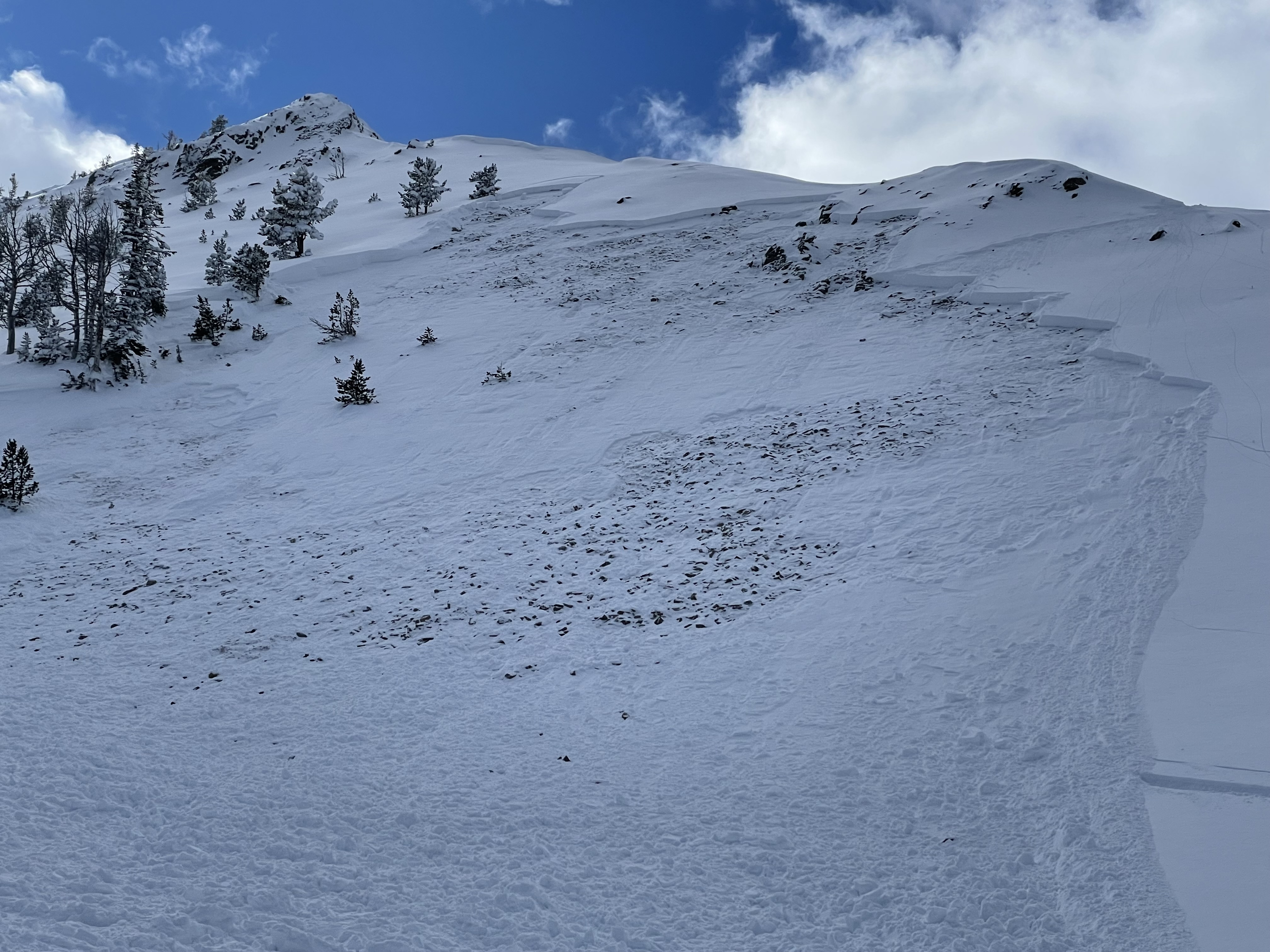
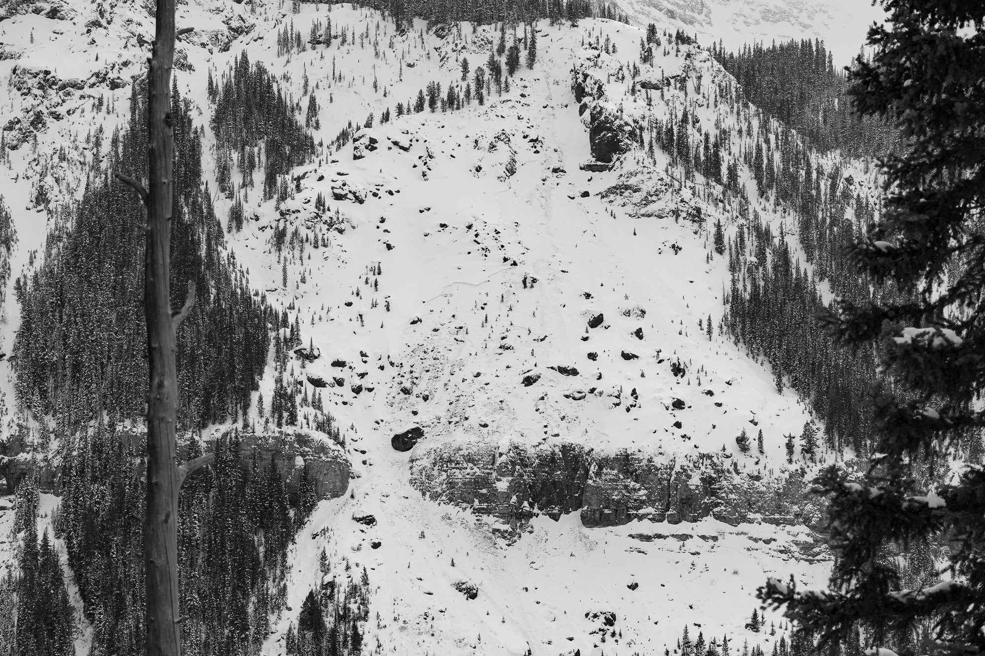
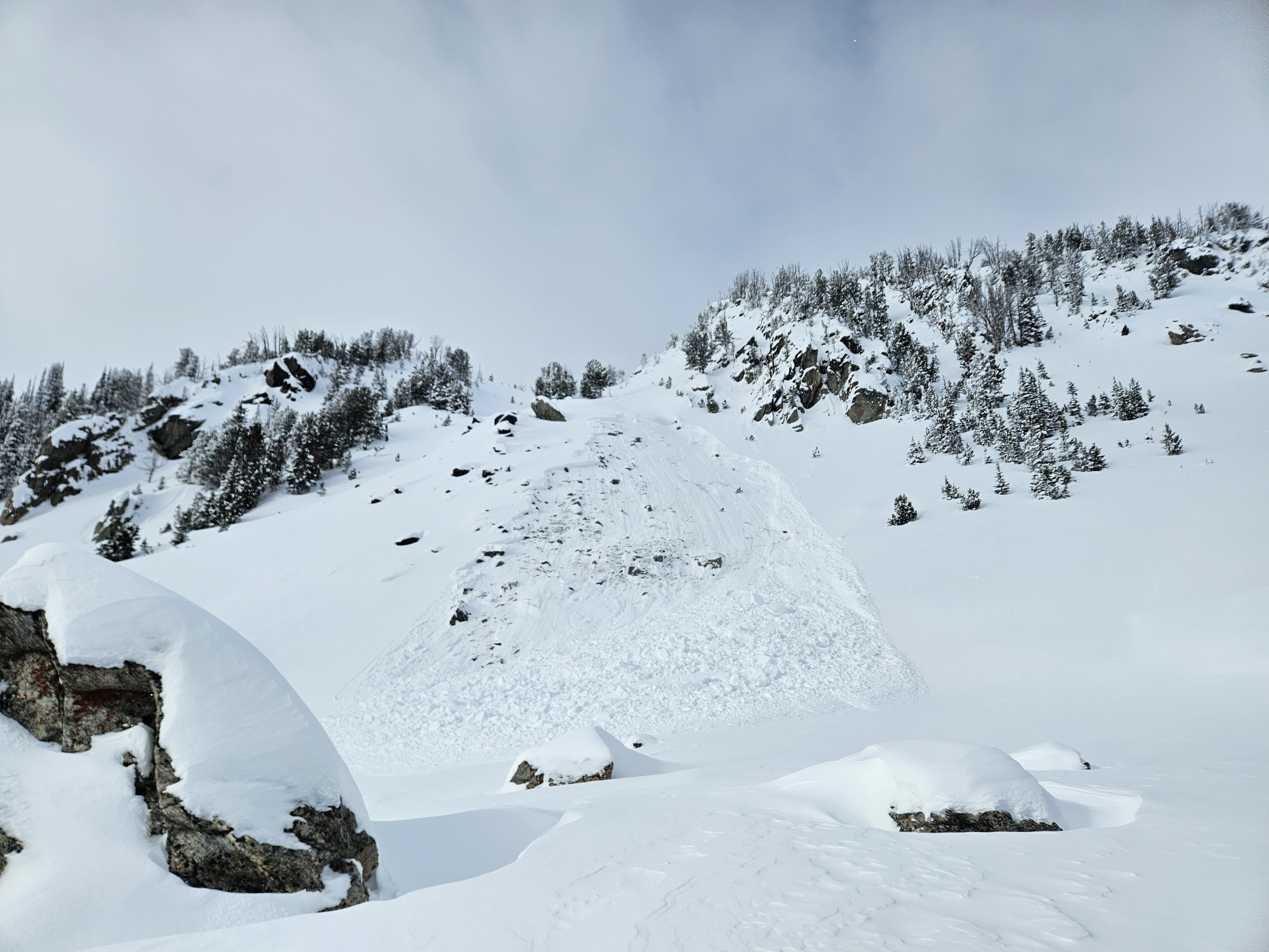
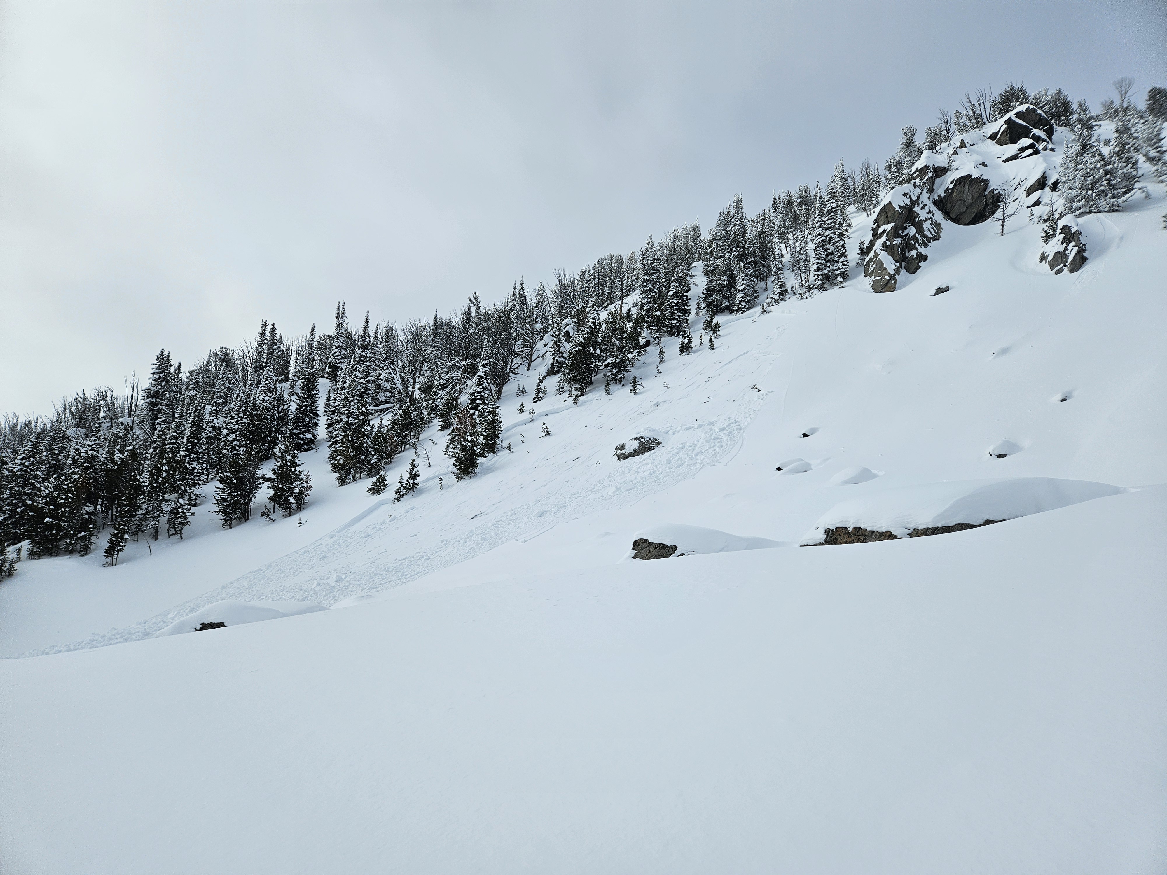
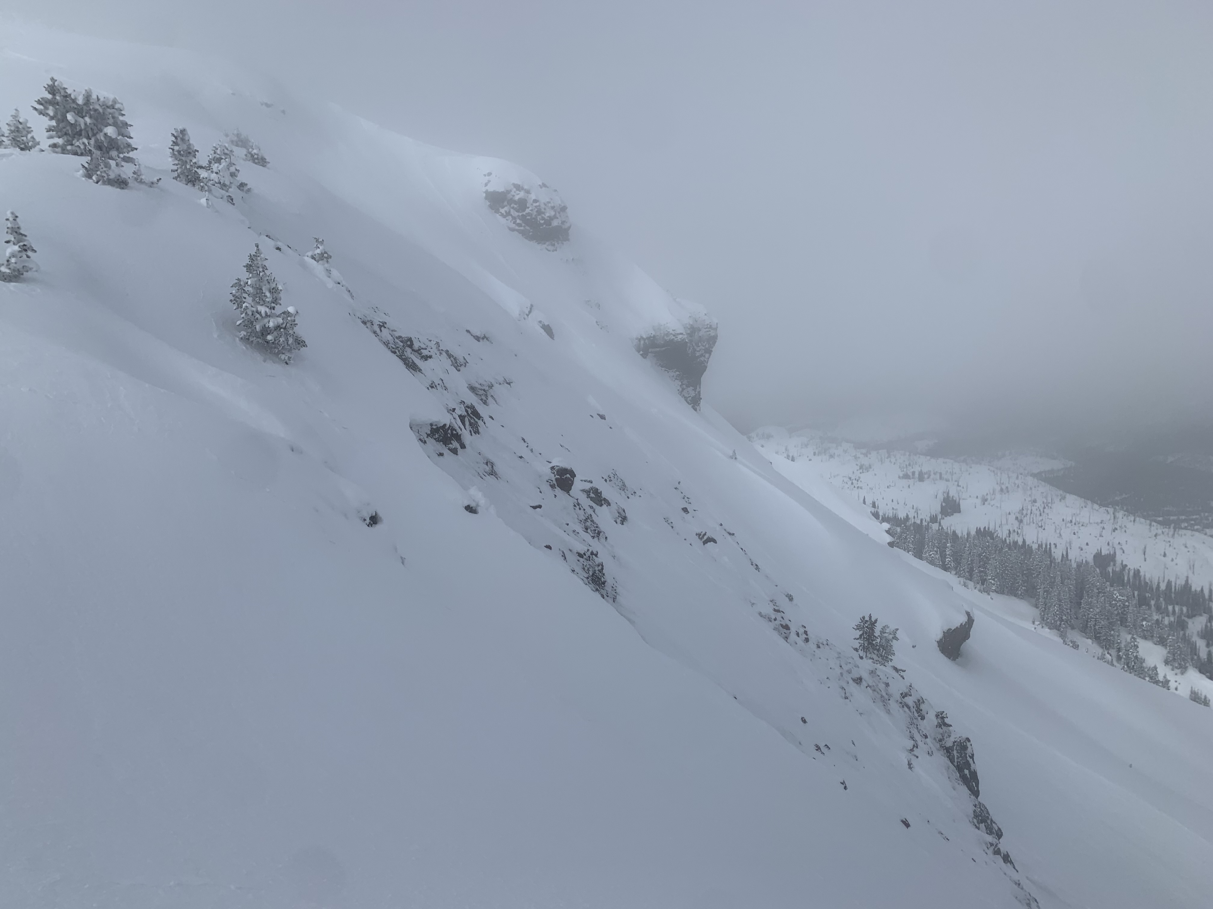
We observed three similar avalanches on Mt Abundance today (2/11). All were at about 9,900' and on NE-NW aspects. We were able to safely look at the crown of the first one, which was ~150' wide, 55cm deep, and with an HS of 145. It failed on 1-2 cm buried surface hoar. The other avalanches were on shallow unsupported rocky terrain. All were remote triggered from low angle terrain above, 20-50' away. One of the avalanches sympathetically released a gully and ran 800'.
Full Snow Observation Report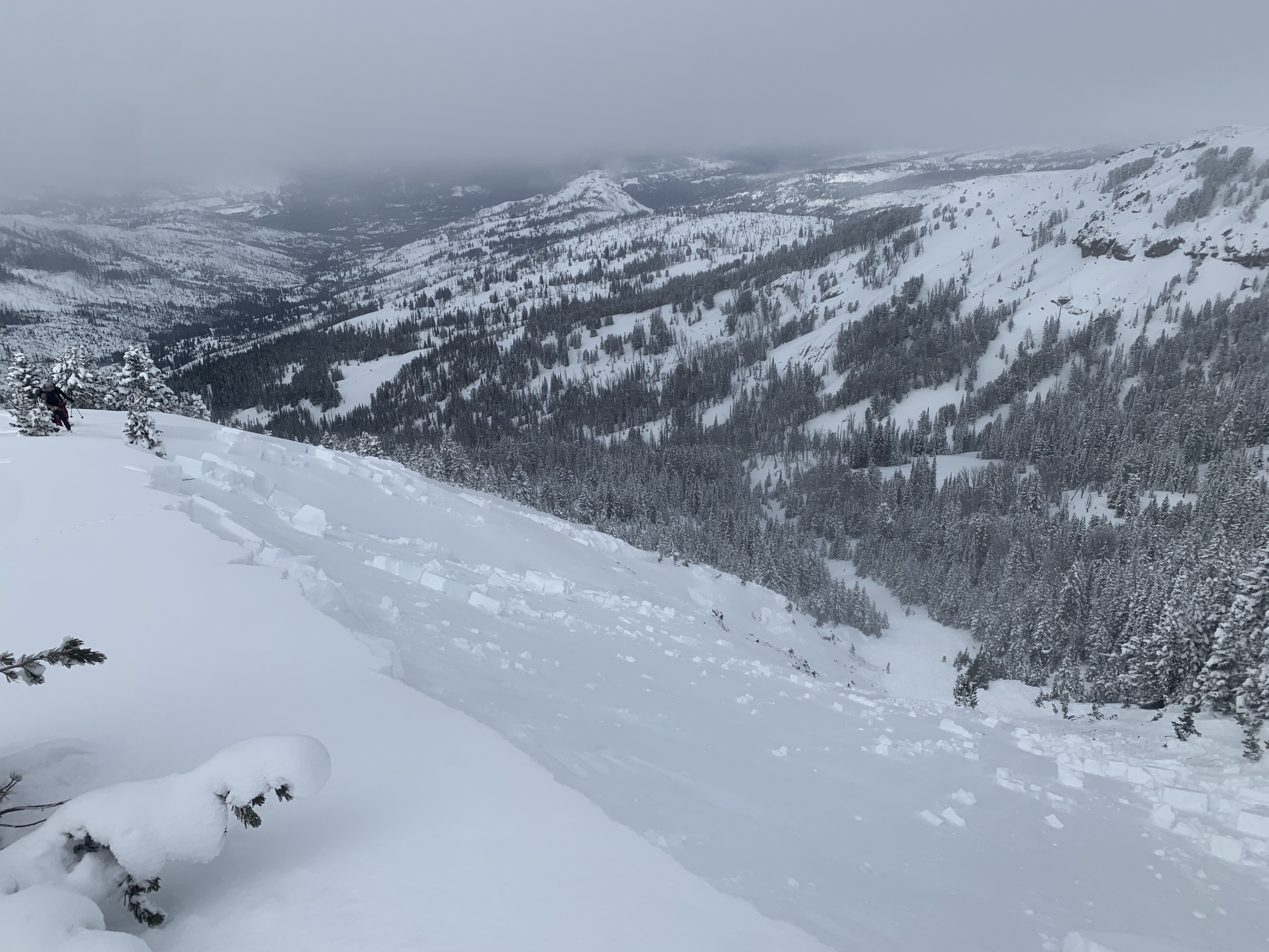
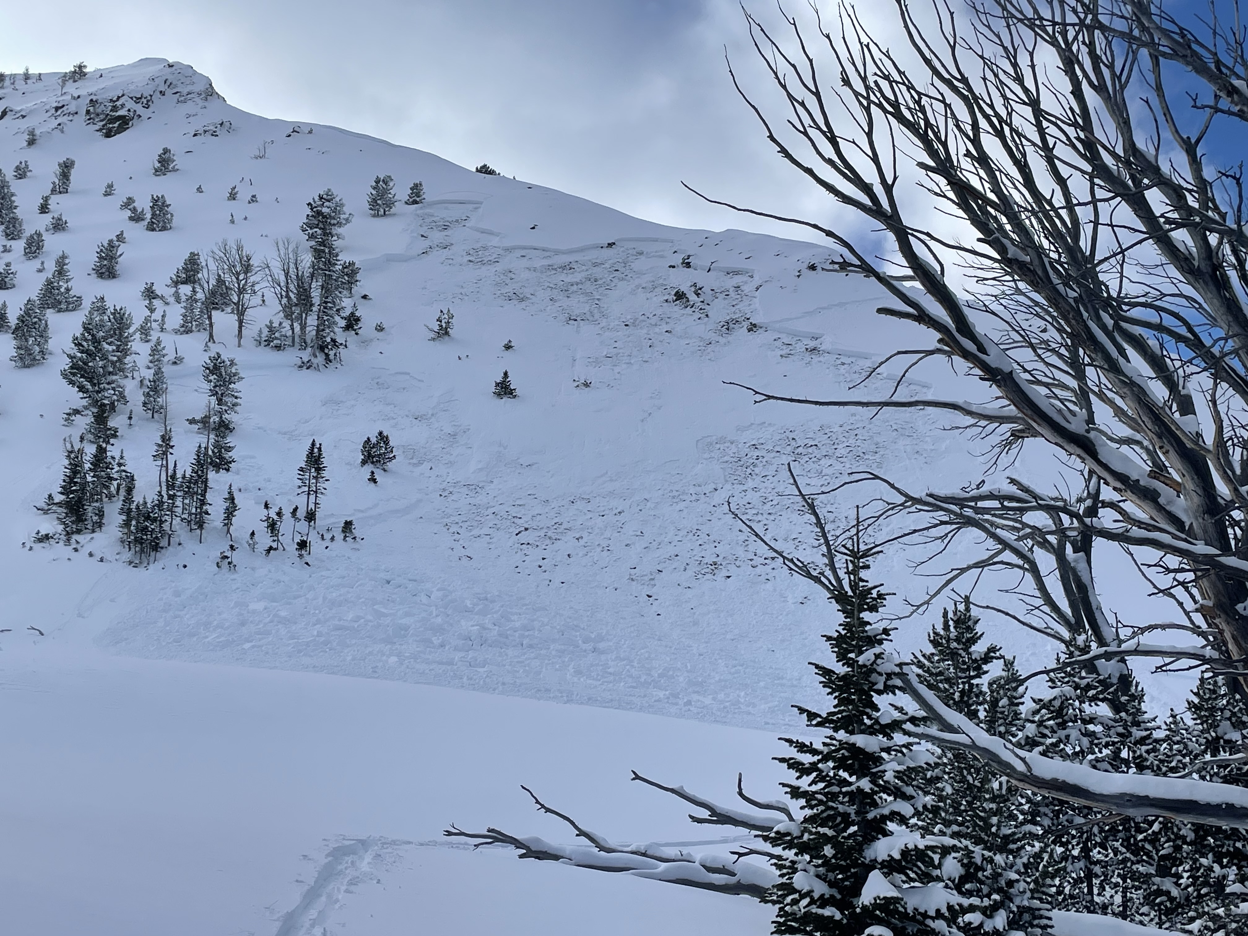
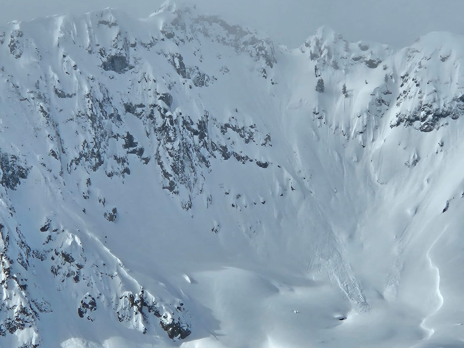
Natural avalanches observed on east facing aspect of Miller Ridge on 2/11. Larger avalanche propagated widely on the north end of the ridge around 10,000 ft. Smaller avalanche further south on the ridge as well.
Full Snow Observation Report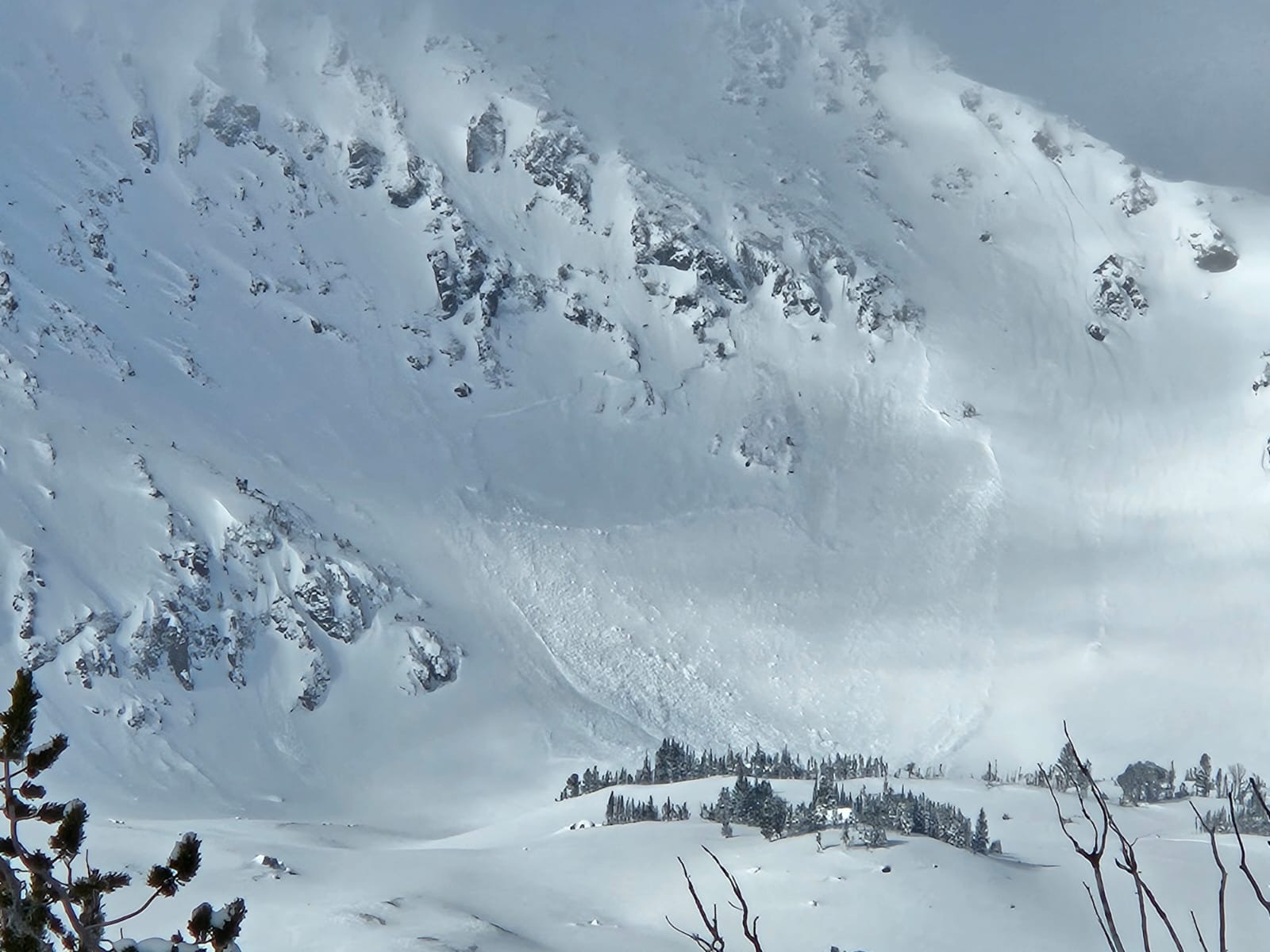
We got the same feedback that Dave and Doug did on 2/5/24 - collapsing every time we stepped out of the skin track or turned with any force, as well as a few sizable collapses triggered from inside the skin track. Very touchy, skied very well. Stayed well away from avy terrain.
Full Snow Observation ReportWe got the same feedback that Dave and Doug did on 2/5/24 - collapsing every time we stepped out of the skin track or turned with any force, as well as a few sizable collapses triggered from inside the skin track. Very touchy, skied very well. Stayed well away from avy terrain.
Full Snow Observation Report