Snow Observations List
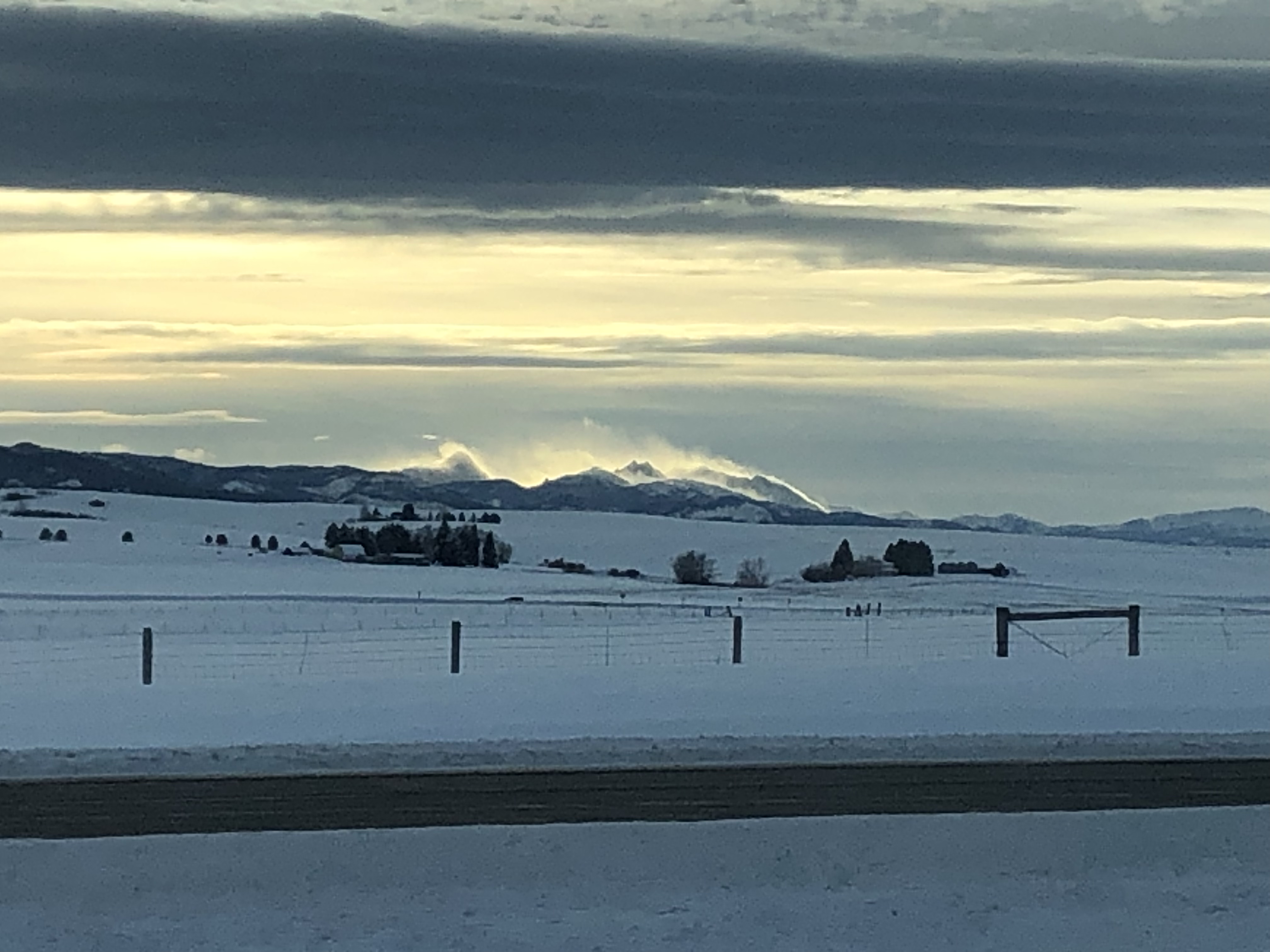
Our day started with Ian watching a natural avalanche coming down from Republic Mountain from the motel door. That, combined with nearly 2 feet of snow and strong winds meant our plan was to avoid avalanche terrain entirely today. The snow wrapped up as we headed out for the morning and the visibility improved. The wind did not calm with the end of the snowstorm, and there was snow blowing out of the trees and large plumes sweeping across the hillsides.
We did some out-and-back rides to Daisy Pass and the cabins at the bottom of the Rasta Chutes. We skied up west Henderson and to Marty’s slide. We had one collapse with shooting cracks at the new/ old snow interface while skinning up. There was a hardness change between the wind-drifted snow and the underlying powder that was detectable with skis and pole probing.
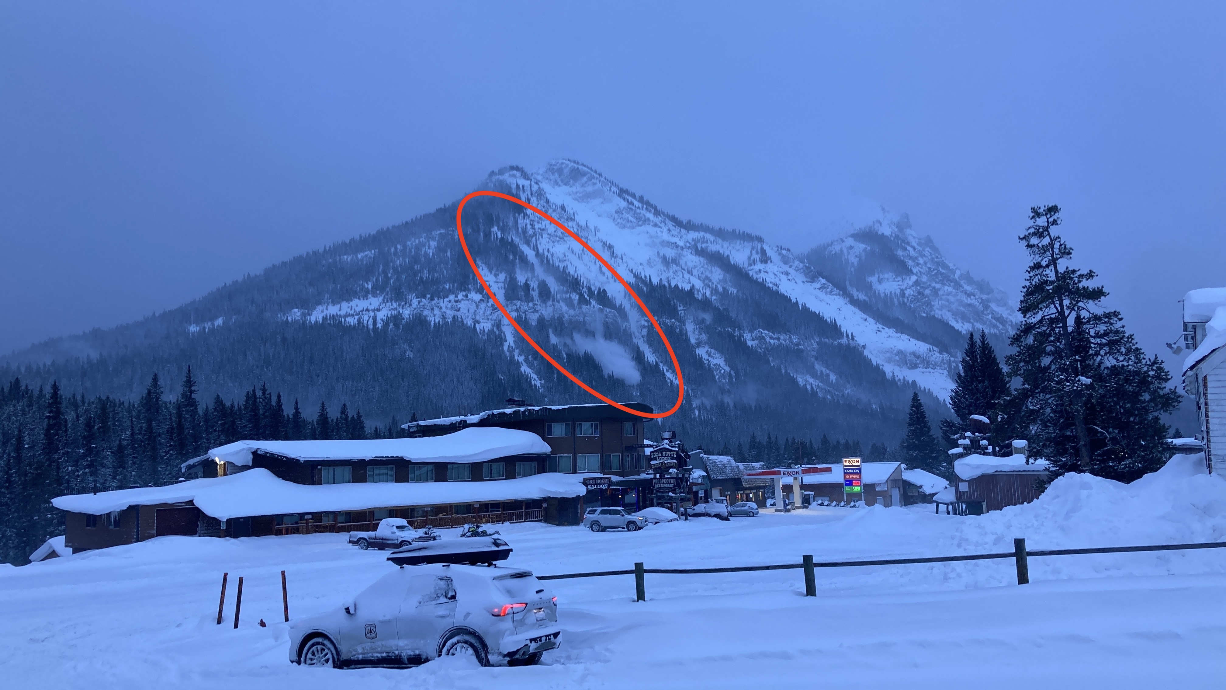
We rode on toward Daisy Pass as the temperature plummeted. Ian discovered that drifts up to 4 feet deep exist near the top of Daisy as he got stuck deeply a couple of times in the same drift. At the cabins below Lulu, we spotted the remnants of a small natural avalanche (probably failed last night) on Scotch Bonnett immediately to the north of the Rasta Chutes.
We were confident that human-triggered avalanches were likely today. They would be larger on wind-loaded slopes but dangerous to people in all steep terrain.
Full Snow Observation Report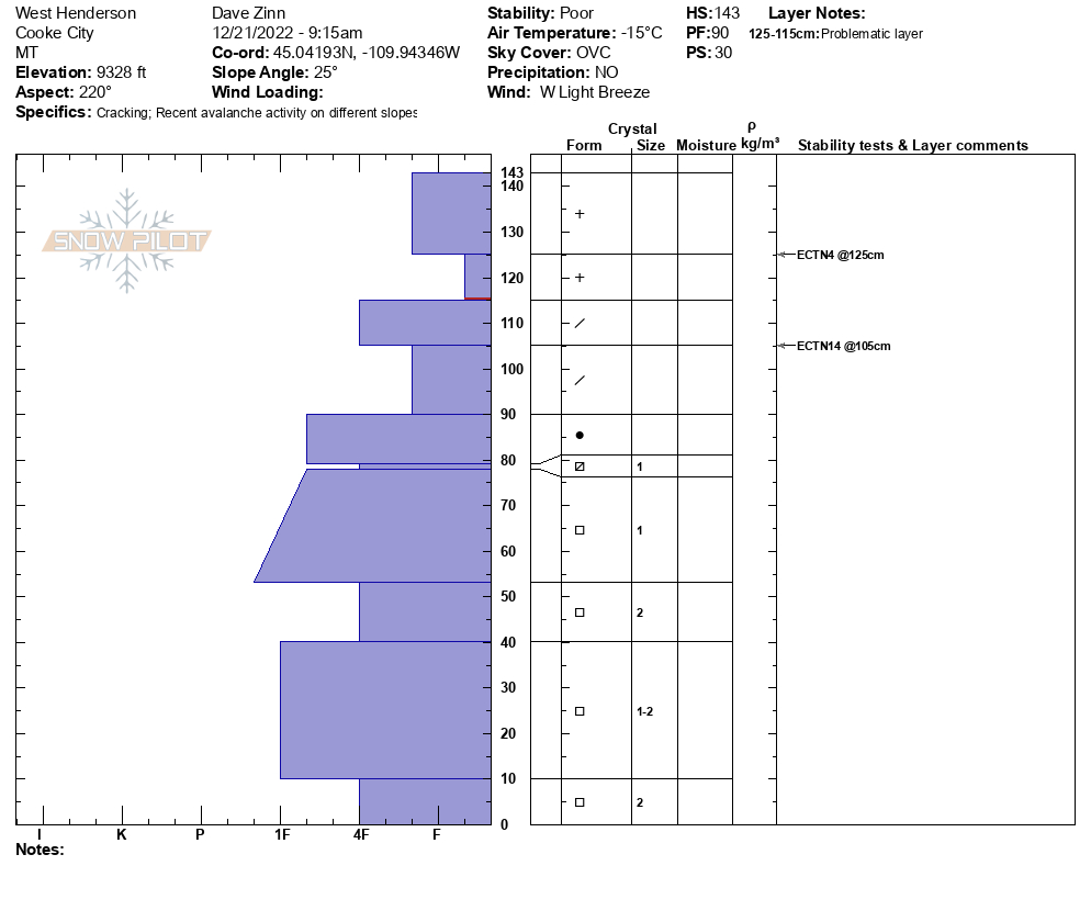


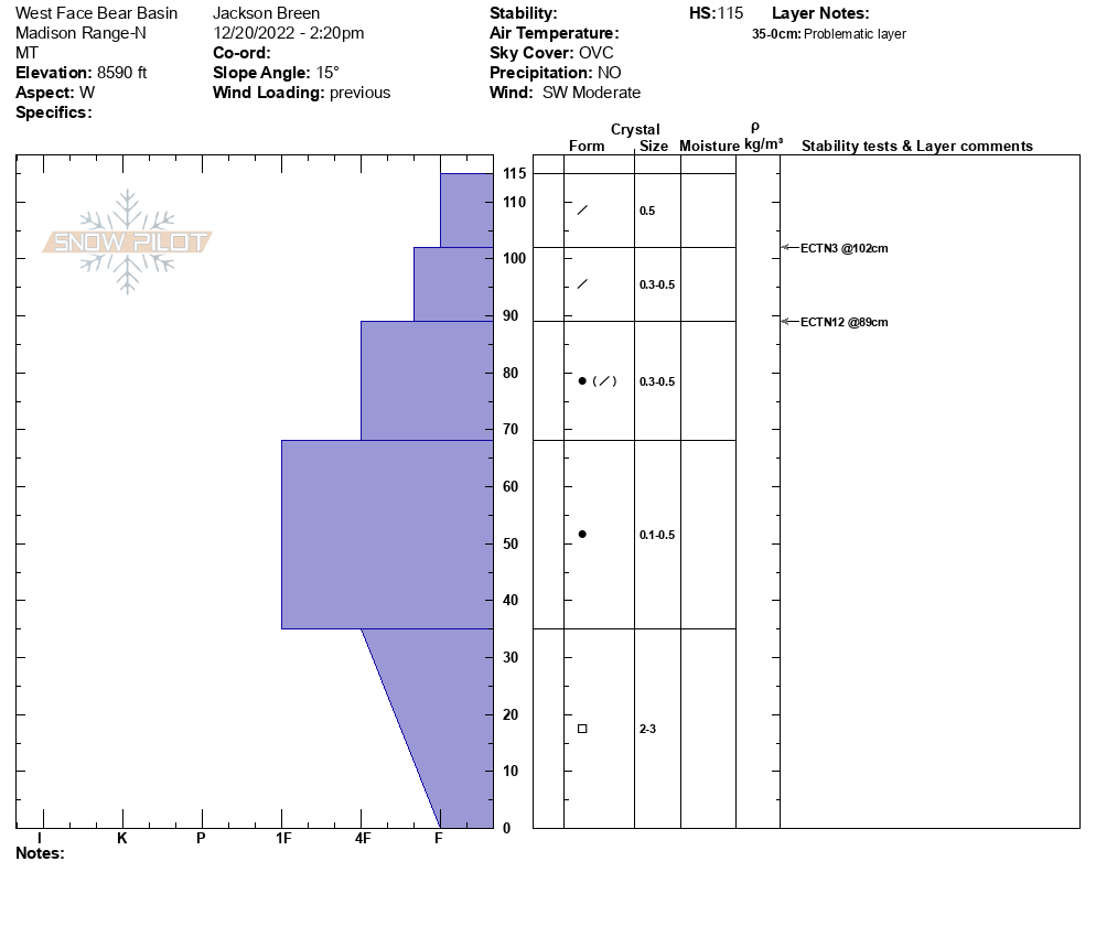
Today we toured up Beehive Basin to Prayer Flags and down into Bear Basin. We found moderate winds transporting snow at Prayer Flags. We also observed a recent small natural avalanche that broke just below the cornice at prayer flags (9200'). It was unclear if a cornice collapse triggered the avalanche. We did not go to the crown, but estimated it to be about 20-30 feet wide, 6-8 inches deep, and running less than 100 feet (Photo attached).
During our tour we saw lots of pillows of wind drifted snow and locations where slabs of wind drifted snow collapsed and cracked under our skis.
In Bear Basin we dug a pit and found weak faceted snow on the ground. We did not have any significant test results, but the structure along with the wind and recent avalanche activity was enough to keep us off steep slopes for the day.
The snow surface was powder in protected places, breakable wind crust in others, and either scoured or wind board at ridge lines. The skiing was best on low angle slopes protected from the wind.
Full Snow Observation Report
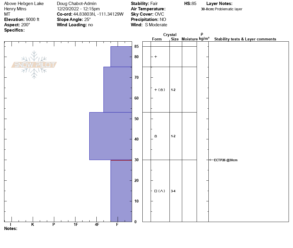
We dug a pit on a SE facing hill at 9,000 feet above Hebgen Lake. We had no signs of instability on the trip up. Near the ridgeline we dug and tested the 85cm snowpack and got an ECTP26 at the interface of the F- weak facets and slab of snow above. The structure was poor, but the snow was relatively stable. It would be possible to trigger a slide in an area where the snowpack is thinner and weaker, and I expect instability to increase with more snowfall.
Full Snow Observation Report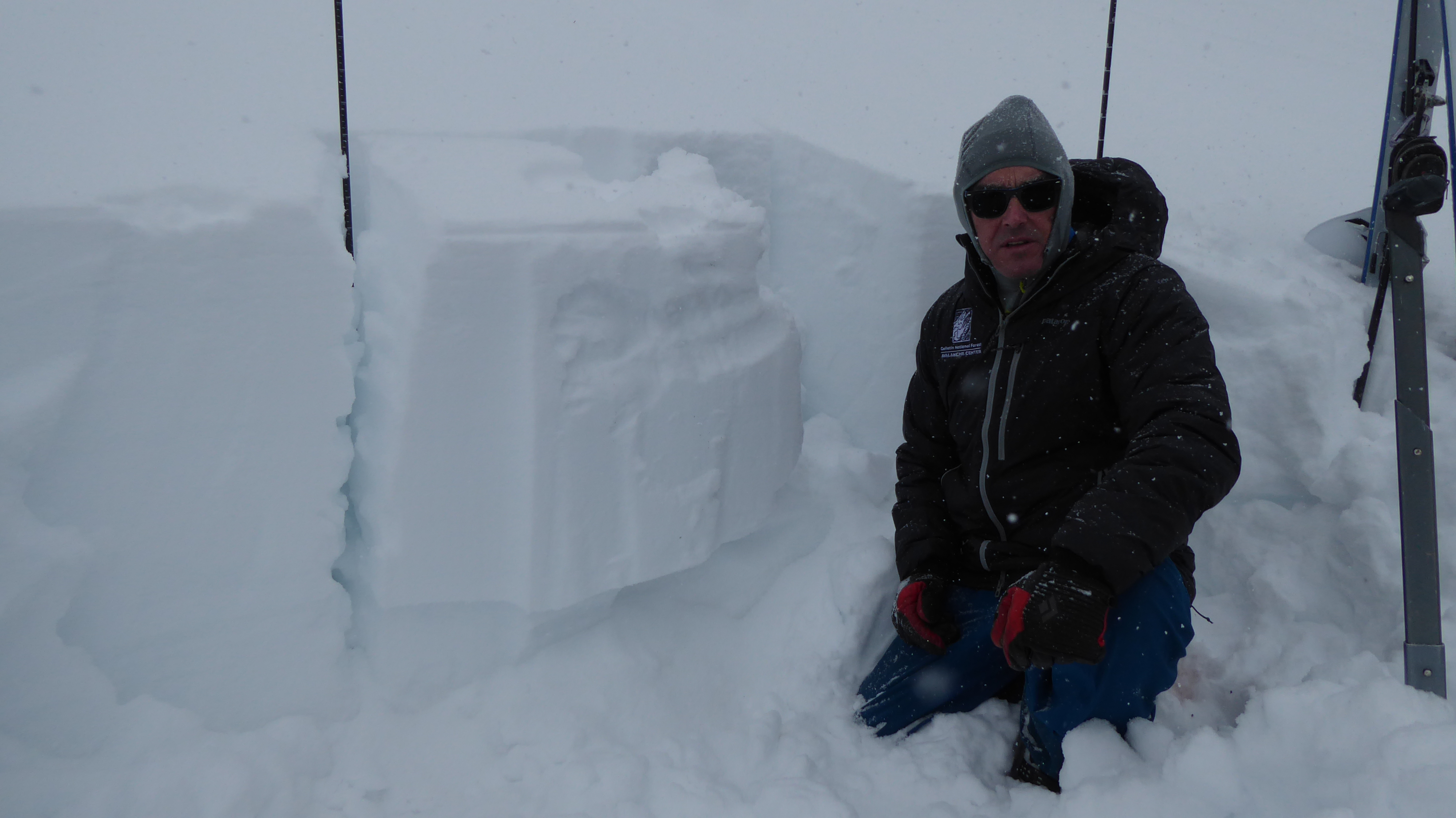

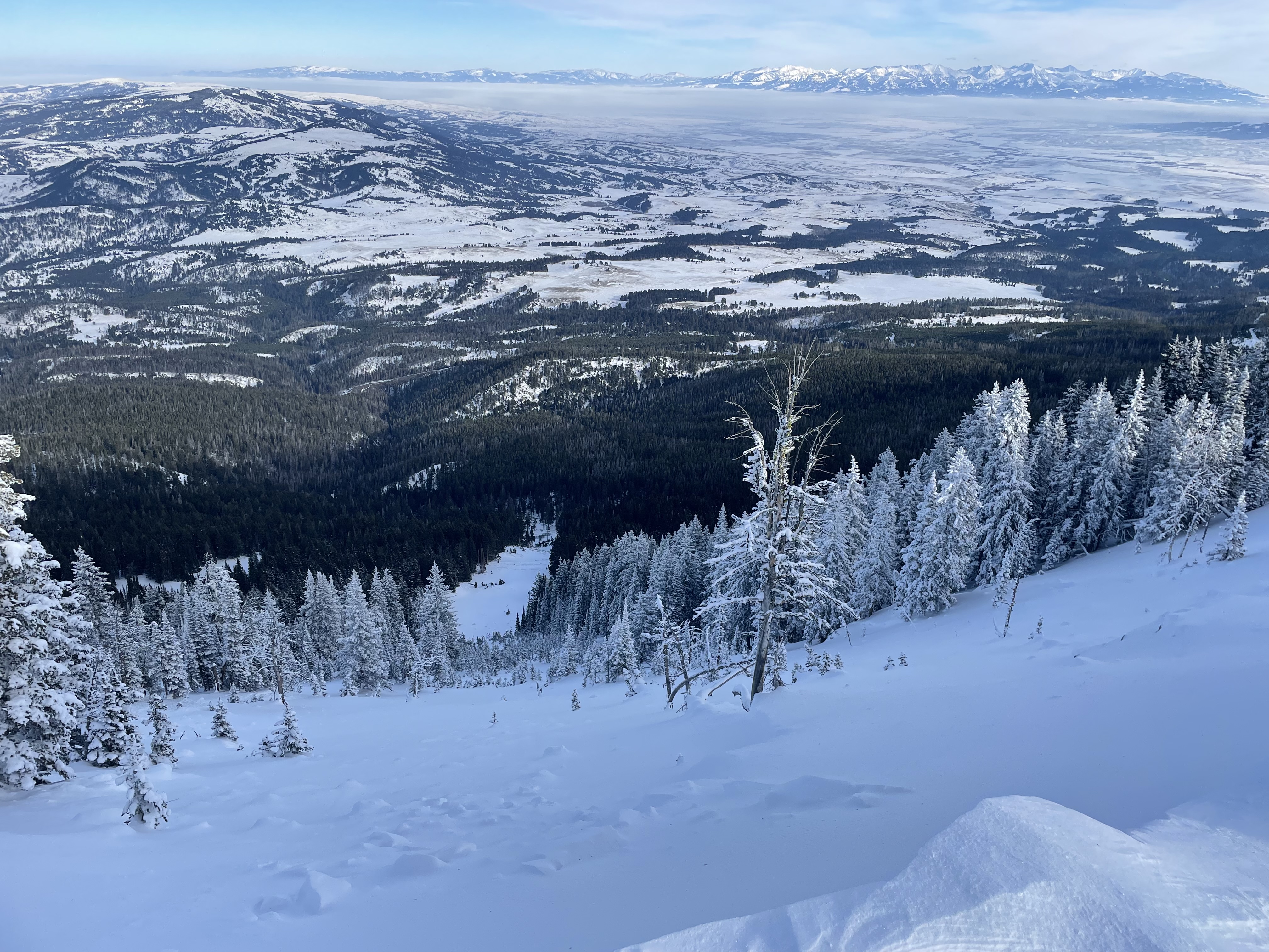
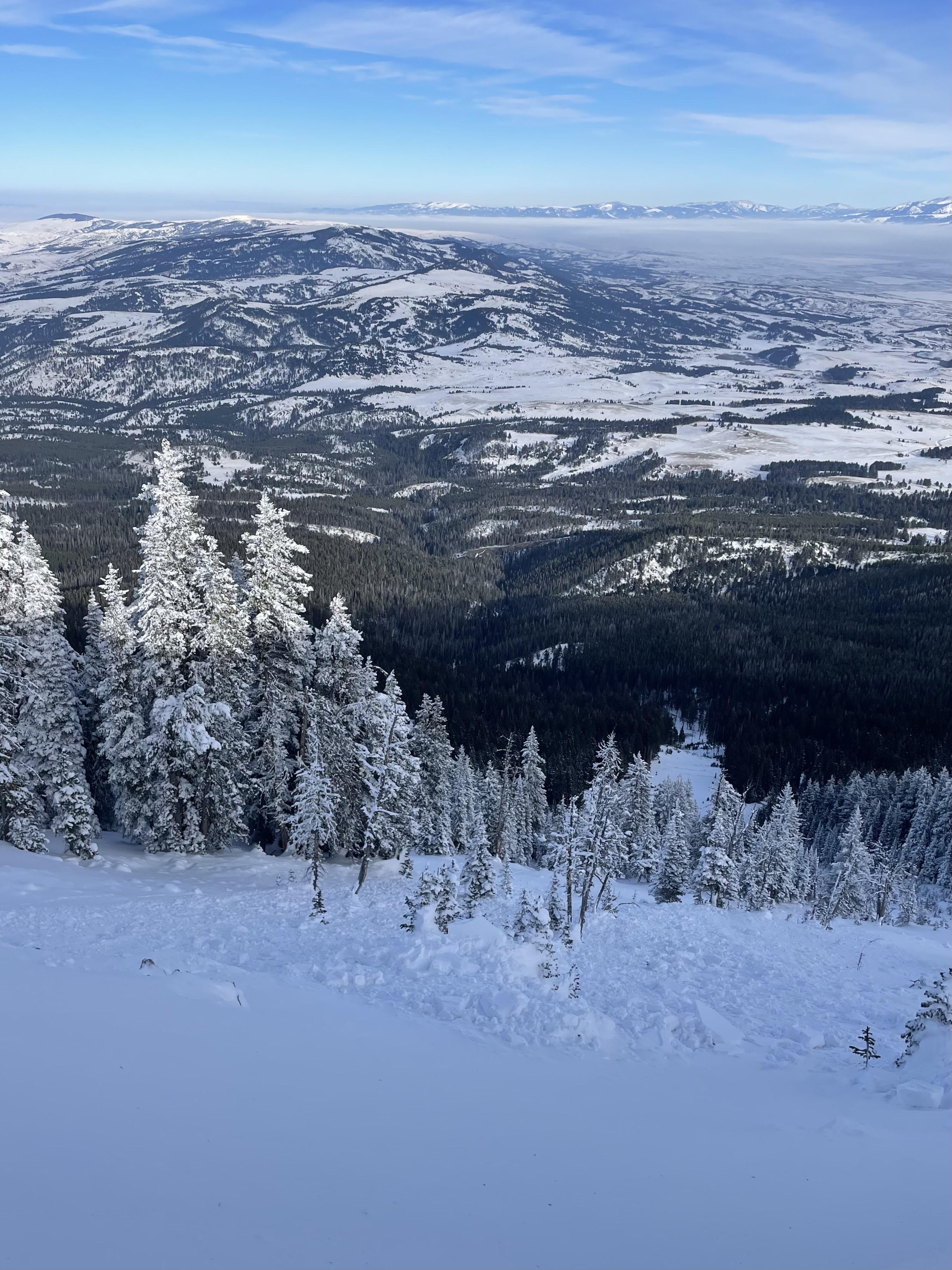
Rode to Daisy Pass, back around to Henderson Bench, out to the wilderness boundary past Round Lake, and then to the bowl between Scotch Bonnet and Sheep. Low visibility, but no signs of instability or avalanches observed. Close to a foot of new snow.
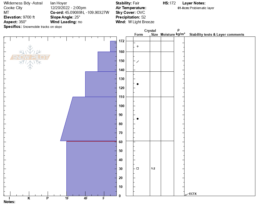
Dug on Henderson Bench on a NE aspect and a N aspect at the Wilderness boundary above Astral Creek. Facets were 4F+ to 1F hardness and didn't get any break at all in the facets. Did get an ECTP11 under the new snow on Henderson Bench. Dug low on the SE face of Scotch Bonnet. Facets were more pronounced and a little softer (4F). Got an *unofficial* ECTP with extra hard taps past the prescribed 30.
New snow and wind were the primary concern. Isolated areas where you might get a slide to break deep on the facets are a less likely, but more consequential concern.
Full Snow Observation Report
ECTP17 below wind slab on weak facets approximately 3/4mm in size. Propagation about 80cm below surface.
Full Snow Observation ReportWe found lots of weak snow waiting for a load on NE aspects up Dudley Creek. There was surprisingly little wind effect.
Full Snow Observation Report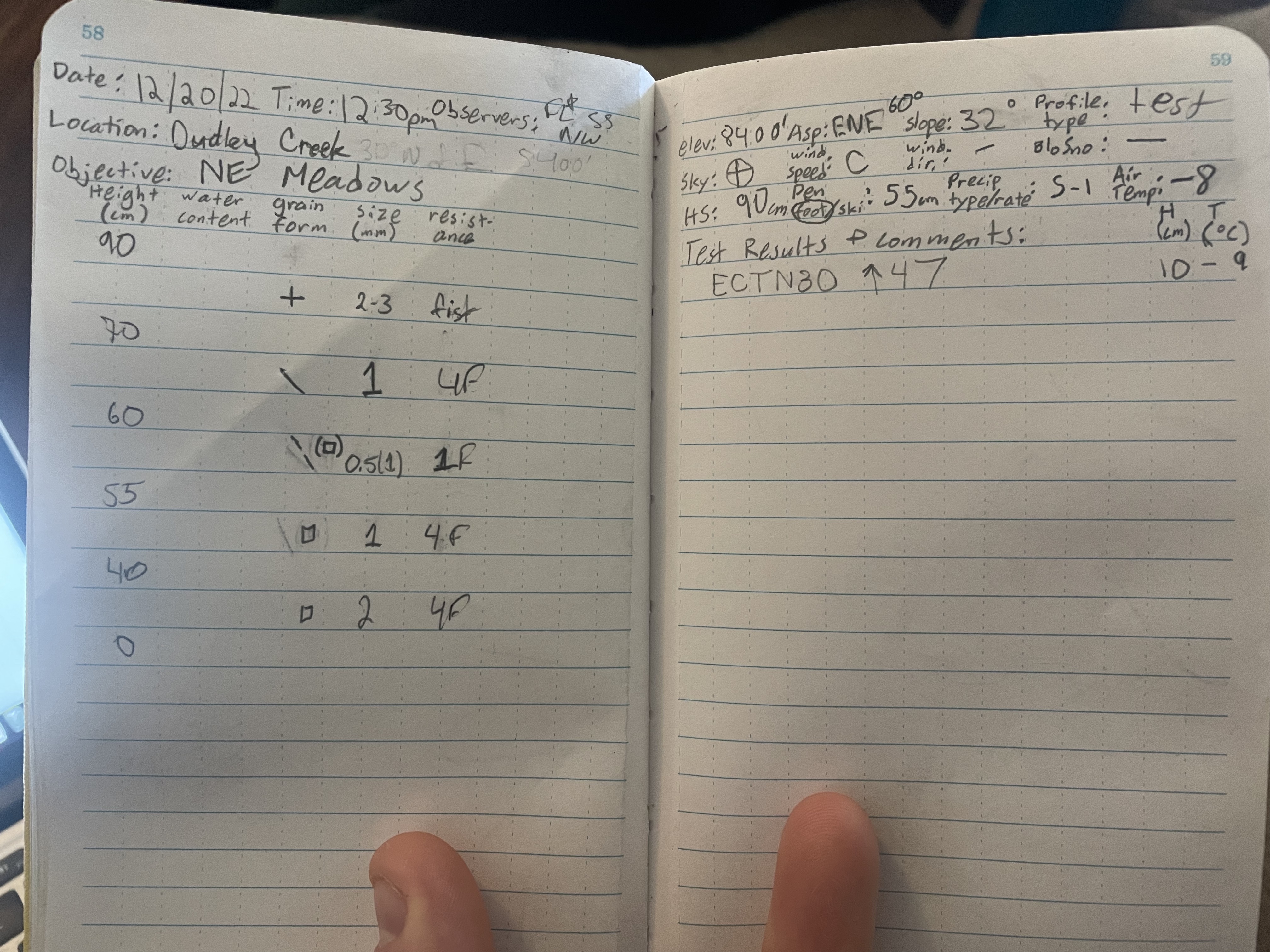
Today we went up Divide Peak. It was much warmer up at the trailhead than in town, with a temp of 17 degrees at about 10:30 am. Went up to Divide Basin and then to the bottom of that southerly-facing slope that you ascend on your way to the top. It was a bit windy and some snow was moving, but not a lot. There were small plumes off some of the higher peaks, but I’m guessing a lot of the snow had already been transported by earlier stronger winds.
About 3/4ths of the way up to the ridge we dug a quick pit. This was in a wind protected area with soft surface snow and no obvious prior wind loading. By this time it had gotten considerably colder and so we did not spend much time there. Total snow depth was about 115 cm, and the faceted layer went from 50 cm to the ground. ECTP23, and broke clean and smooth. There were also a couple of ECTNs in the upper snowpack above the ECTP.
Full Snow Observation Report
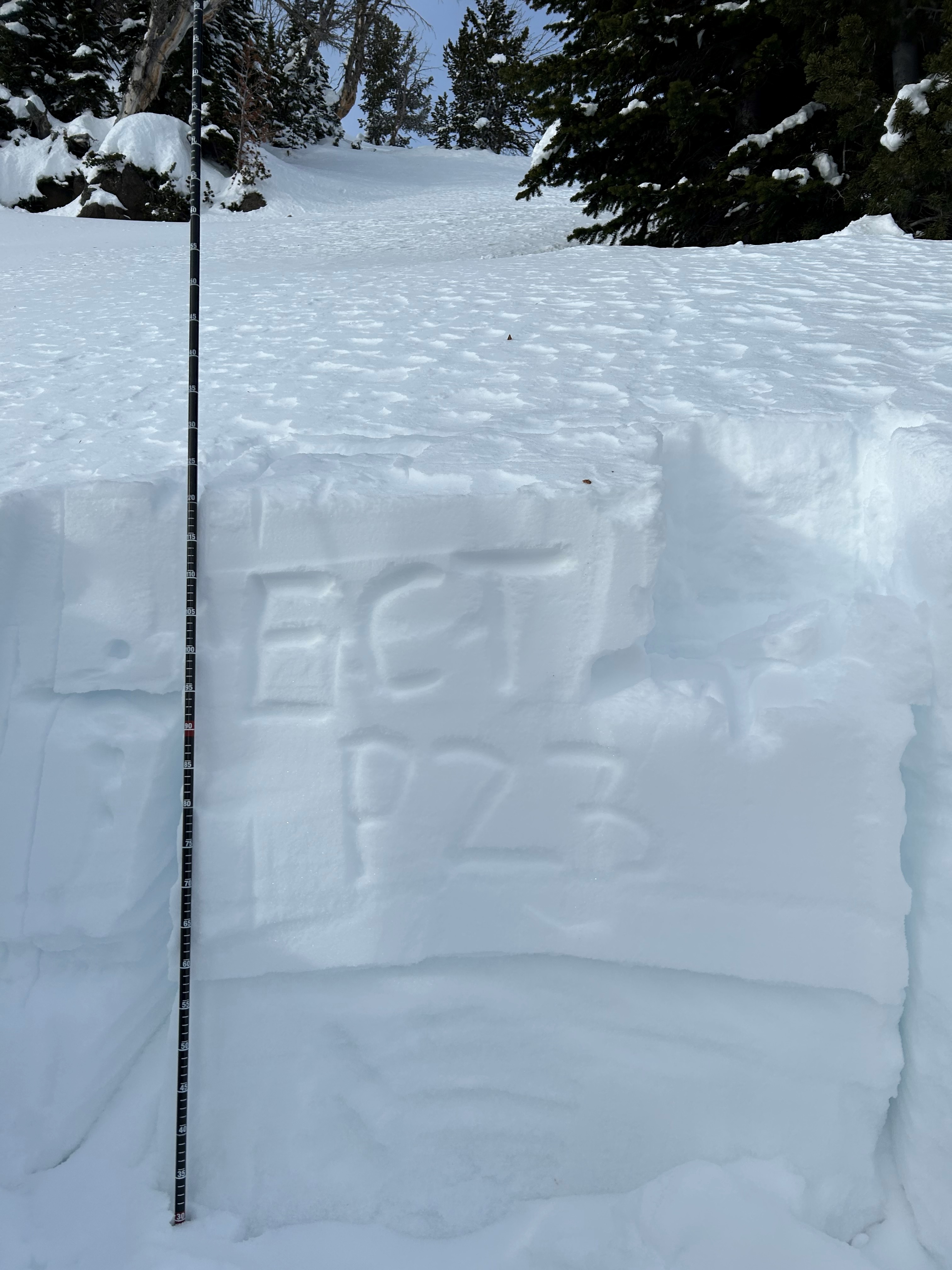
Dig into snow at 73400 in Wolverine Basin just south of Texas Meadows. Got several ECT x and then one ECT n 23 at 40 cm below the surface. See attached photo of hardness graph.
Full Snow Observation Report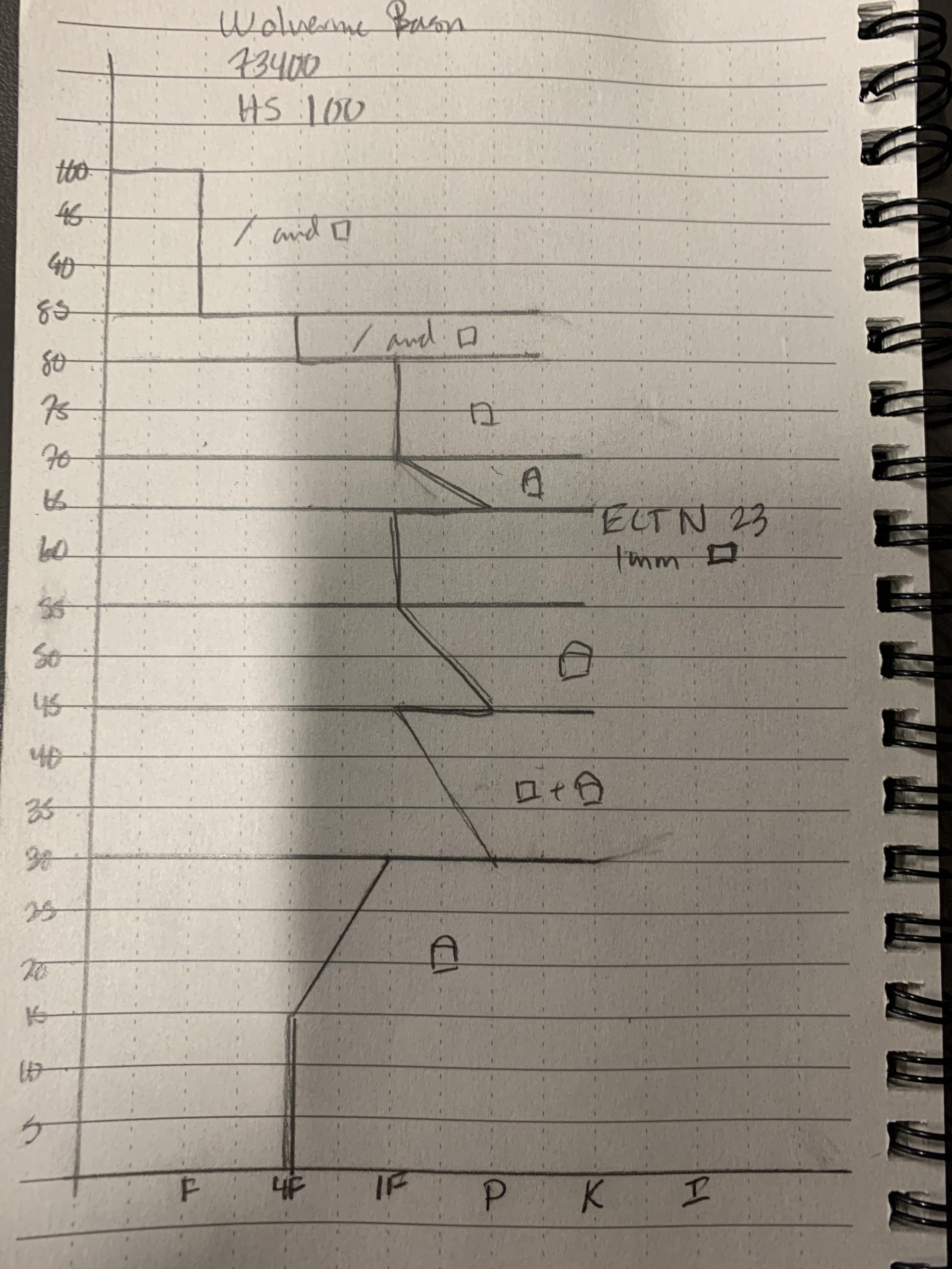
Ellis has seen alot of skier traffic since my last submission for Ellis on December 15, 2022. A quick pit was dug on a south east facing slope at 7936 feet. Height of snow = 90 cm. Bottom faceted layer was 25 cm thick. The top 65 cm of snow is beginning to consolidate into a slab. We did not experience any signs of snow instabilty. My previous submitted observation for Ellis noted surface sluffs, yesterday we had none. I believe there was a slight temperature inversion as we all remained comfortable.
Full Snow Observation ReportI skied on the east side of the Bridgers south of the ski area today. We dug a pit on an east aspect around 7300' and found 80 cm of snow with a similar structure to the more southerly parts of the advisory area. Well developed 2mm FC with a few DH cups sprinkled in made up the lower 40 cm or so of the snowpack (ECTP 21 on this layer) with the remainder consisting of 4F to F+ DFs. There was a razor thin "wind skin" I felt while skiing in more open areas below treeline but no major wind loading was present until at or near the ridgeline (pretty robust cornice development already for this time of year though). On our way back up just below the ridge around 7700' I felt a very large collapse that radiated out from my skis and shook some snow off of nearby branches.
Full Snow Observation ReportWe skinned up Tylers and ran into a group of 4 who just wrapped up digging a pit. They had ECTP18 on the facets at 50 cm (HS 90 cm). We skied into Bear Basin in the Spanky’s area. We dug a pit that also had HS 90 cm. A few ECTNs but nothing concerning other than the thick layer of facets near the ground. Weak but not unstable…yet. The snowpack story seems more similar than not from West Yell to the Bridgers and Cooke. This layer of 2-4mm facets will be an issue with the next decent load, but until then the weakening continues.
Full Snow Observation Report
Natural wind slab, likely triggered by cornice fall in the last day or two, on a NE aspect at 8500’. Propagated ~150’ wide and ran probably 300’. Slab thickness seemed to be 18-24” at the thickest. No sign of stepping down deeper into facets in the snowpack, although adjacent to this slide there was evidence of an older slide (previous to recent storm cycle) that failed deeper in the snowpack.
Full Snow Observation Report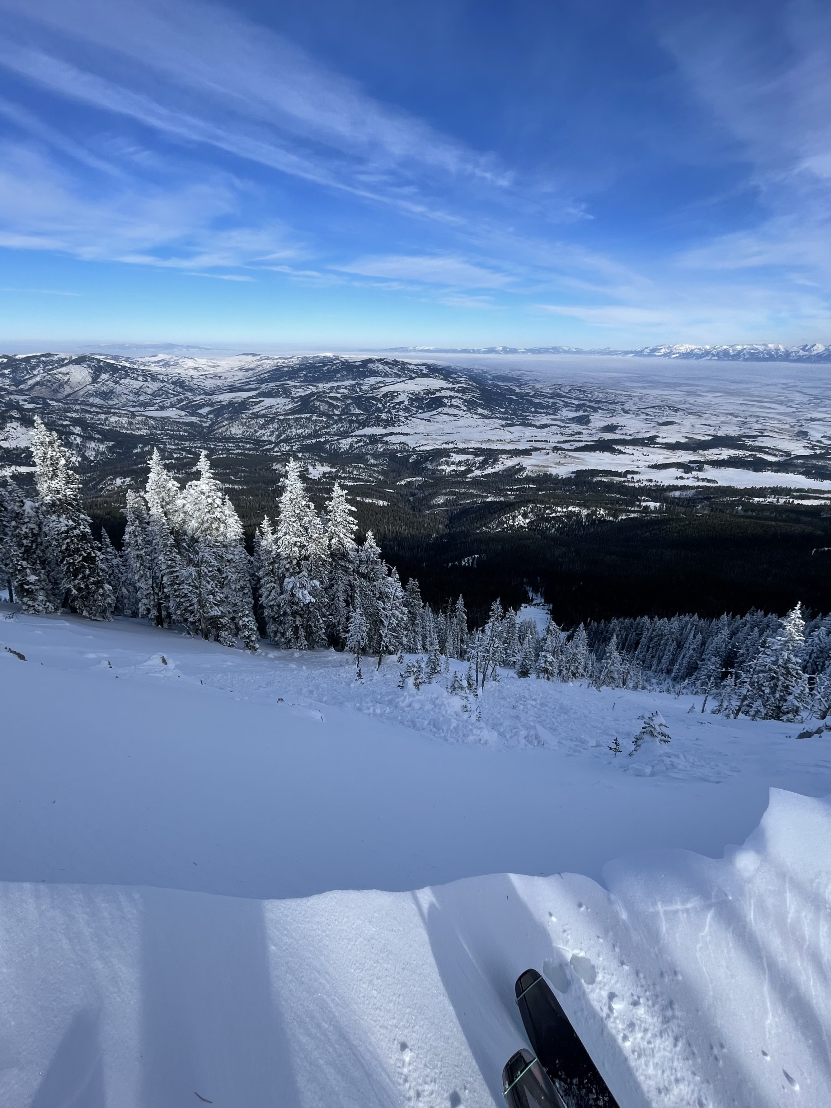
White Elephant drainage above White Elephant snotel @ 8,170'.
Full Snow Observation Report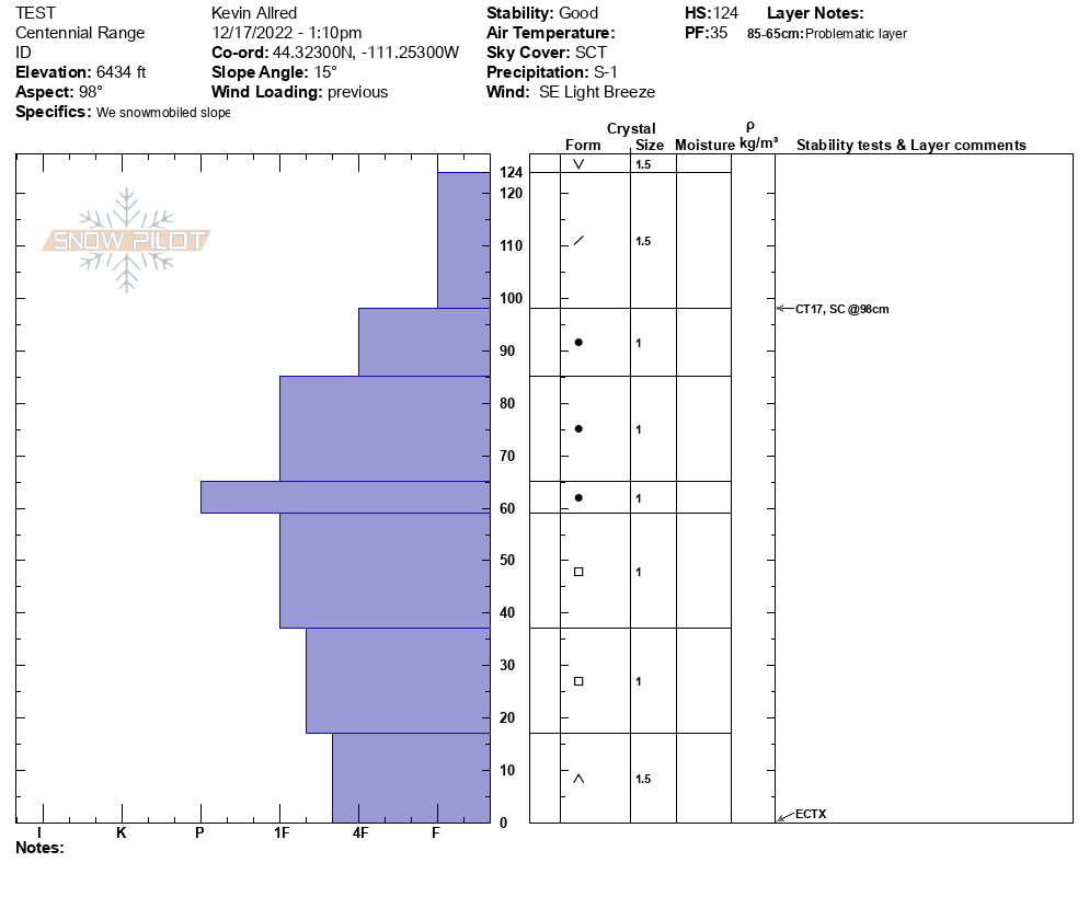
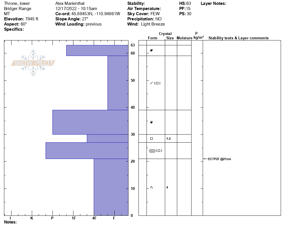
We rode in and toured up the Throne. We dug a pit low, on a northeast aspect at 7,850' and the snow depth was 63cm (2 feet). We had an ECTP27 break on 2-4mm facets at the bottom of the snowpack.
We dug a second pit on the north-norheast facing slope above The Throne at 8,400'. Snow depth here was 95cm (3 feet). We found similar 2-4mm facets making up the bottom 45cm of the snowpack, but we had ECTX 3 times. We were surprised it didn't break or propagate. Despite these test scores, we figured recent snow, wind and a large skier triggered avalanche yesterday were signs to avoid steep slopes, especially if they are wind-loaded.
The sugary, weak facets we found may not yet be showing signs of widespread instability, but combined with more new or wind-drifted snow they could create larger avalanches.
Full Snow Observation Report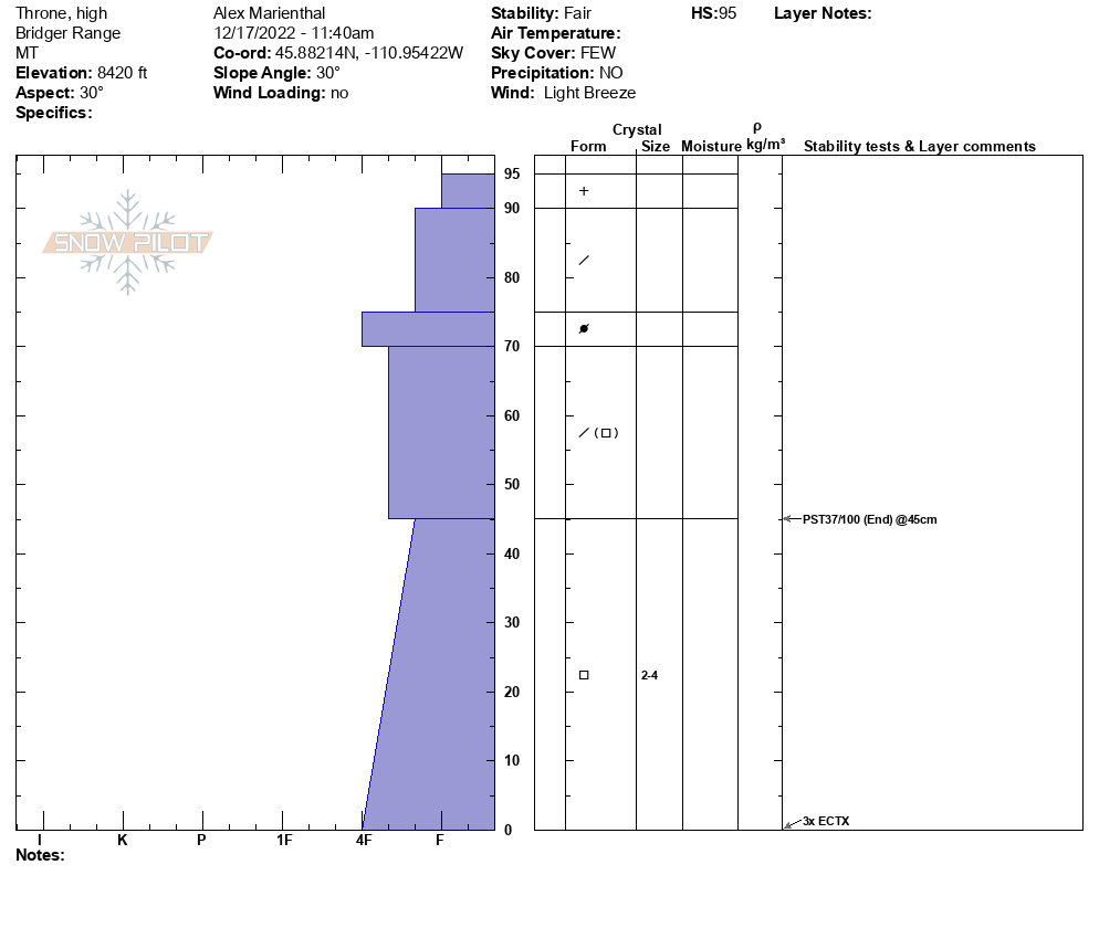

Went into Beehive basin today with a group of people. We dug a pit on a south west aspect just above Beehive meadows at 8384ft to see what was going on in the snow. We got an ECTX for our results.
Full Snow Observation ReportWent on a tour today with a buddy and traveled through twin falls basin as well as the maid. We skied a NW slope off of Palace Butte and found touchy conditions below the ridge line, but great skiing in the trees. We also skied the bowl of Arden peak. We observed numerous recent wind slabs that released naturally in the past 24 hours on NE and E aspects with some crowns starting to get covered up throughout the day. Judging from afar, I would estimate these crowns to be 6 inches to 1.5 feet deep.
Full Snow Observation Report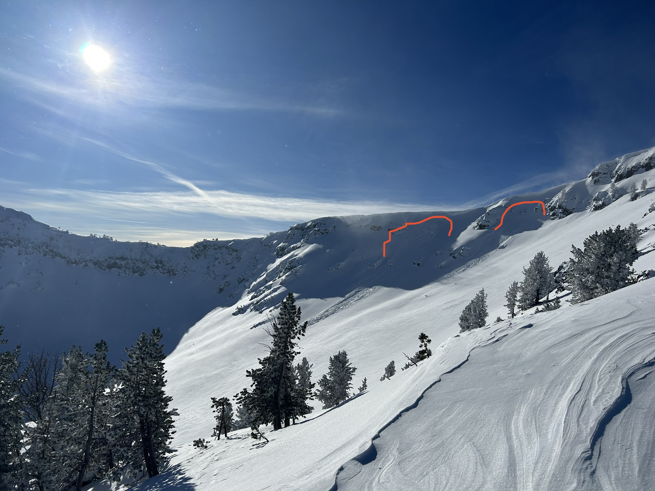
Saturday afternoon on the way back into town snow was moving in the Spanish peaks. Nice light
Full Snow Observation Report
Skied a few laps on Ellis today, E through NE aspects
No slab avalanche activity was observed (minor sluffing on steep, cold slopes)
Got off the skin track in a few places and no whumphing or cracking
Light to moderate ridgetop winds from W and SW
Trees holding snow; no drifting/ blowing snow on Ellis
Saw A LOT of blowing/ drifting snow toward Hyalite and the Spanish Peaks at elevations above 8000'
Average HS on Ellis summit ridge 100 cm; average ski penetration 35 cm
Dug a quick test pit on a NE aspect at ~7800' (30 deg slope)
Pit results: HS 130 cm; CT 21 BRK at 85 cm; ECTX
No signs of instability; great skiing. Yay!
Full Snow Observation Report
Thin and variable snow pack in the N Fork (?) Specimen creek drainage. Max depth less than 100cm, min depth bare ground. Active wind loading on exposed ridges, multiple whumphs when skinning over wind loaded, low angle slopes. Decent skiing, albeit thin, on low angle W aspects from 8200’ down.
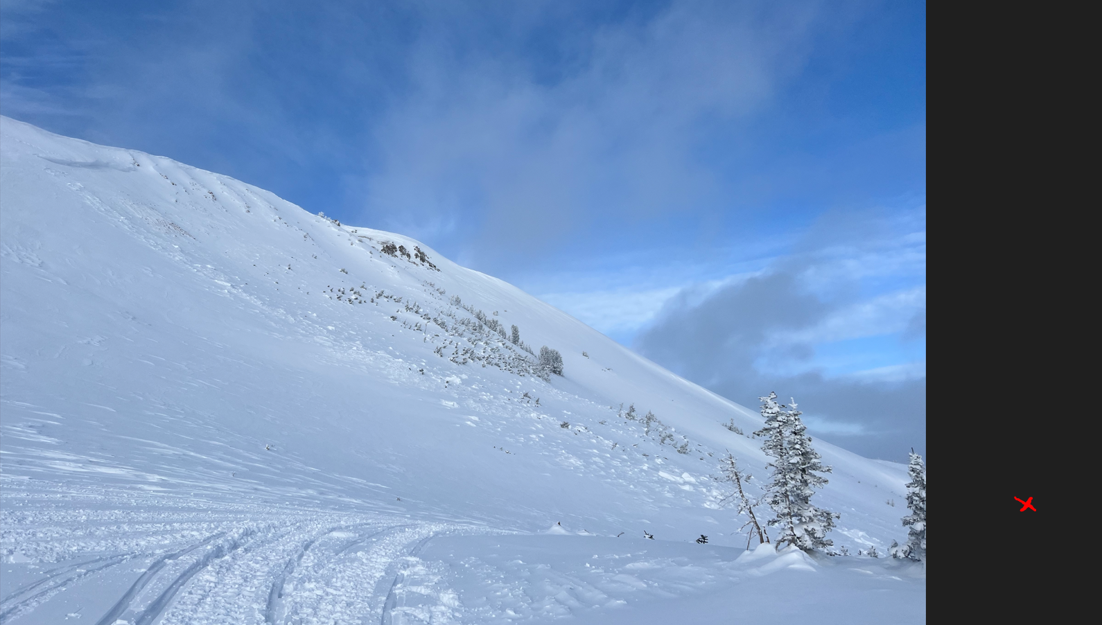
Full Snow Observation ReportWe skied on the knob Saturday and Sunday. Dug a pit on the east facing slope just above the steeper roll over. ECTX. No result. Minimal wind loading next to the tree bands. We skied the slope 20+ times (between 4 skiers).
We took the sled up track around the north side of the knob and below the avy debris from the slide triggered a last week. Only sign of avalanche activity (other then the obvious one) was a small wind slab release on a south facing slope near the top of the pass. Marked on the map below. Photo attached is of the previous slide but the wind slab release would be where the red X is if the photo continued. Looked to be 30ft across, ran for 15-20ft and about 6inches deep.
Full Snow Observation Report